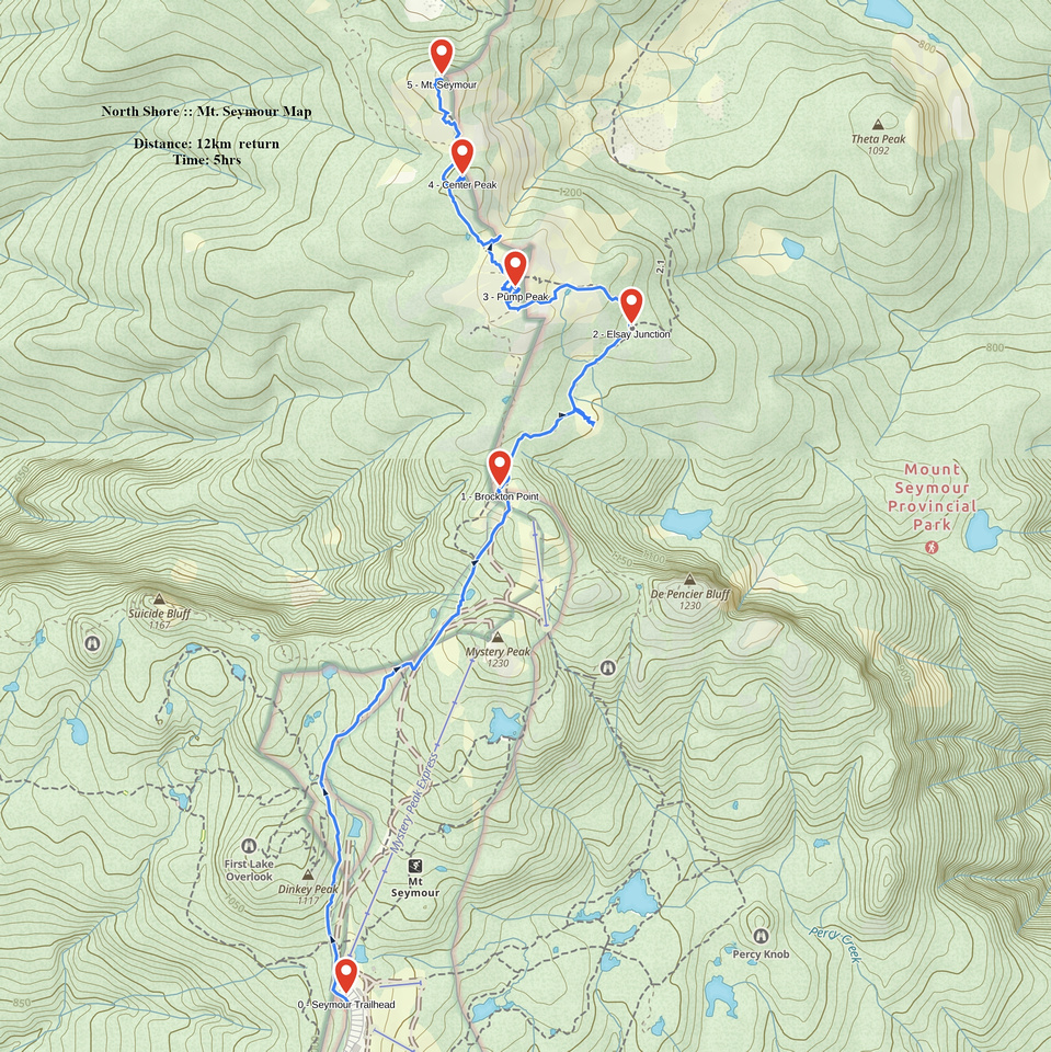
Google Map |
BC Coast :: North Shore :: Mt. Seymour |
GPS Track |
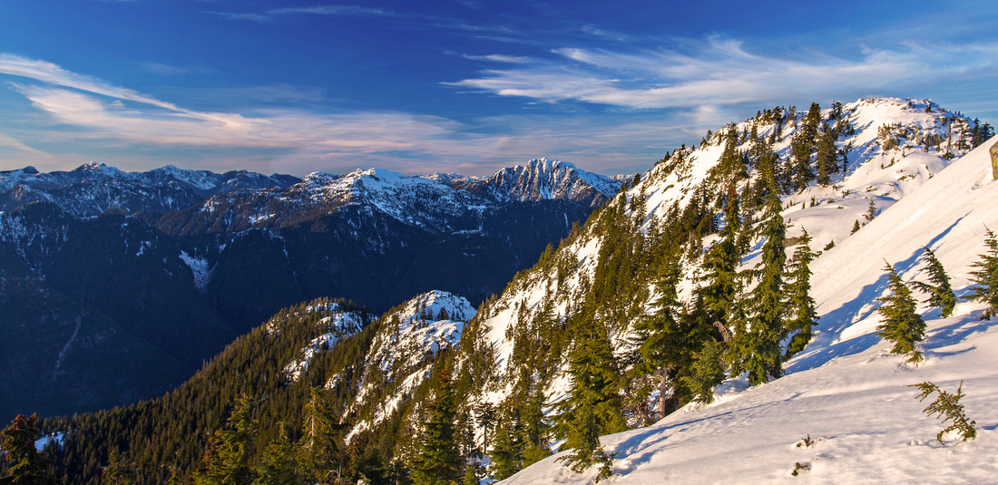 
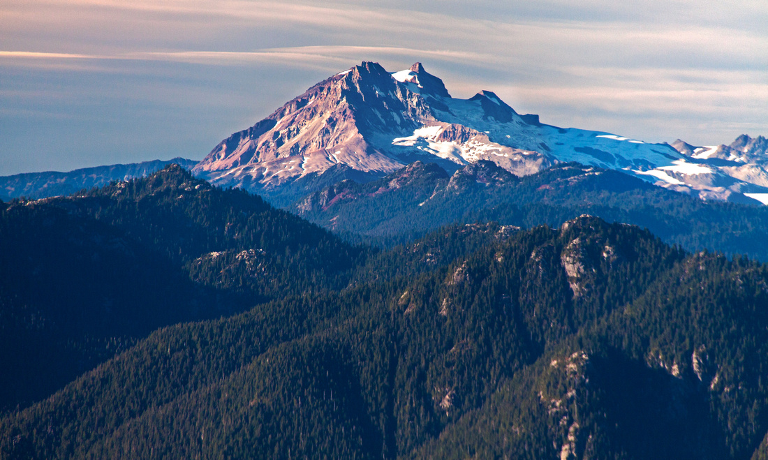
Main summit of Mt. Seymour (right) from the col below center peak. Cathedral, Coliseum/Burwell to the left |
|||
| Trip Summary | |||
Multiple Dates, last Oct 11, 2012
Seymour is unique. But it might take time to develop full appreciation. I hiked first time in October 2008 - fresh Rockies transplant eager to explore North Shore Mountains and Mt. Seymour I heard so much about. I could not figure out what in the world was so special about it --- roots, bone jarring rocks that give you sore feet with main prize 3 rocky bumps that someone decided to call peaks?? Then it started growing on me, pretty much to the point now that I would miss something in my life if I could not visit in the fall when colors are changing and fog due to temperature inversion laying over Burrard strait causes almost sublime effect. Add unique North Shore terrain, grippy rock with fissures filled with water, far reaching views that include ocean, snow-capped peaks of Garibaldi or peaks across the border. Most of all it is promise of wonders that wait behind every corner to be (re)discovered over and over again. Seymour can be enjoyed year-round. Winter snowshoe trips are very attractive - although caution is required because of avalanche danger (several accidents have occurred in the past). Many possibilities for further exploration exist - three peaks of Mt. Seymour are merely "front-country" for seasoned north shore explorer. To visit all three peaks follow main Seymour trail starting from kiosk at north end of parking lot (fills very fast, specially on sunny winter weekend -- you might have to leave your vehicle couple of kilometers lower on the side of the road!). Initially trail runs parallel to Brockton chair ski out, passing turn off for Dog Mountain and First lake in short succession. About 15-20 minutes in there is Tim Jones memorial - so pay your respects to legendary north shore S&R veteran; Center peak is now officially known as "Tim Jones Peak". Brockton point is reached about 40 minutes in, and this is usual end of maintained winter showshoe track. From here two options exist for scramble to First (Pump) peak. Main trail continues around to junction with Elsay lake trail, then scrambles up on the east side. Pleasant option is to take "Old Seymour trail" that climbs directly up. In summer it is great scramble, never too hard and just challenging enough to make it interesting. Watch for flags and side trail on left (west) side about 5 minutes past Brockton point. In winter this "shortcut" might not be feasible, depending on snow conditions and avalanche danger as it is considerably steep. Past Pump peak trail descends a bit, then climbs wide gully to the saddle just below center peak. Turn right and reach second summit in couple of minutes. Continuing to the main summit (Mt. Seymour) is more difficult, as steep slopes west of center peak must be descended. In dry conditions it is just class 2 scramble, with one semi-exposed traverse. In winter it is considerably more challenging and even dangerous - borders mountaineering. At the col is famous "root belay" as you must descend 4-5 meters down exposed root of giant tree - great fun! Mt. Elsay trail splits from here, while main trail continues across glades and platforms, then briefly up another gully to the summit. Fissure filled with water with great backdrop of Cathedral, Colliseum and Burwell is something I can never have enough -- trademark North Shore. There are views all around - distant Garibaldi and Mamquam north, Lions group west, metro Vancouver and Burrard strait south, and Golden Ears group to the east. Close by is Runner peak; masochist class 3-4 scramble to diminutive bump in ridge leading from Seymour to Elsay. Long curving Vicar - Rector - Curate ridge leading from Elsay to Mt. Bishop looks super inviting, but is not really feasible as day trip (it has been done). |
|
Gallery |
|||
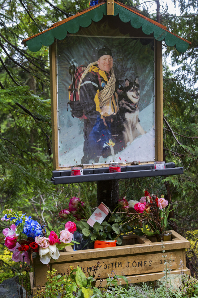 Tim Jones memorial 10-15 min past trailhead
 |
|||
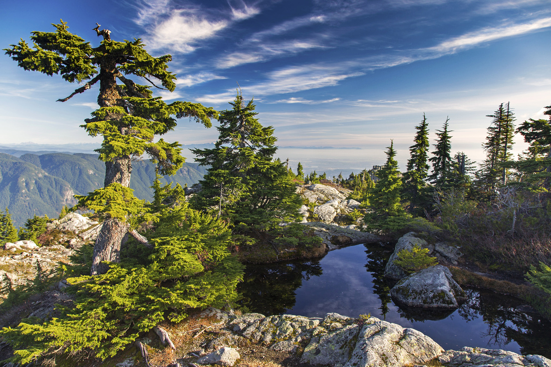
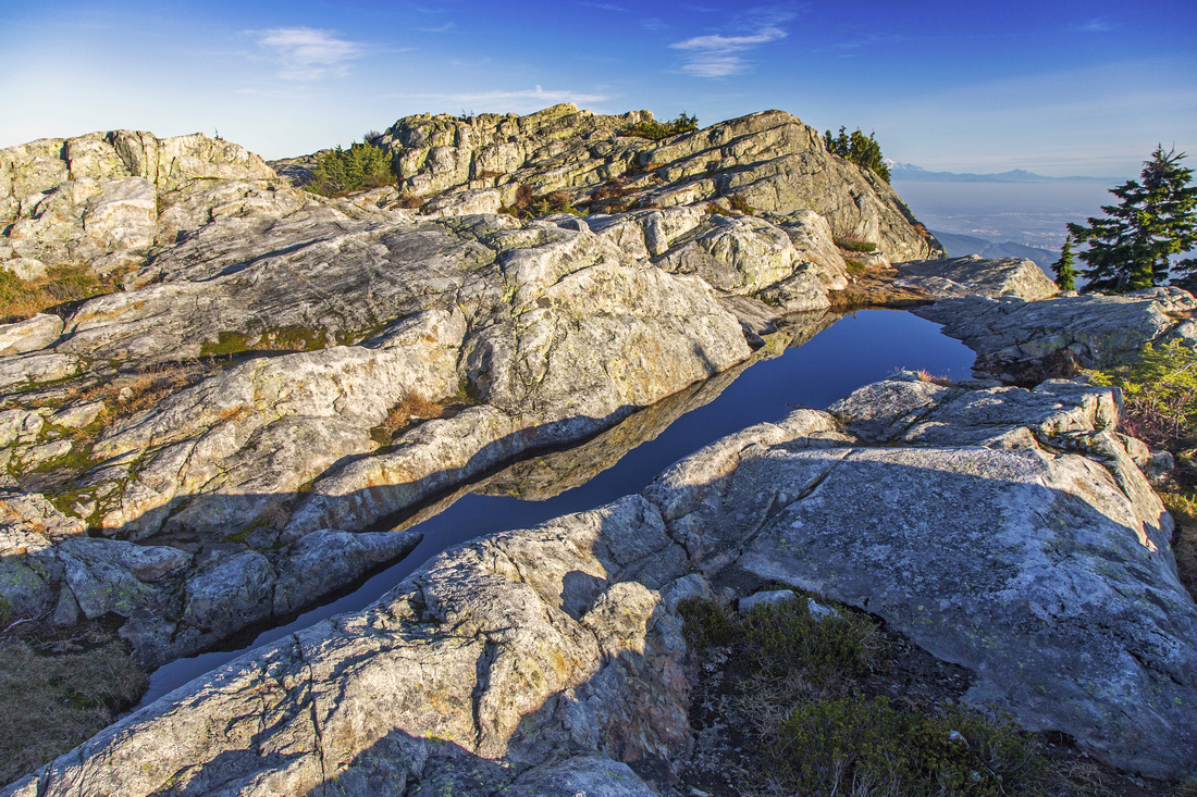
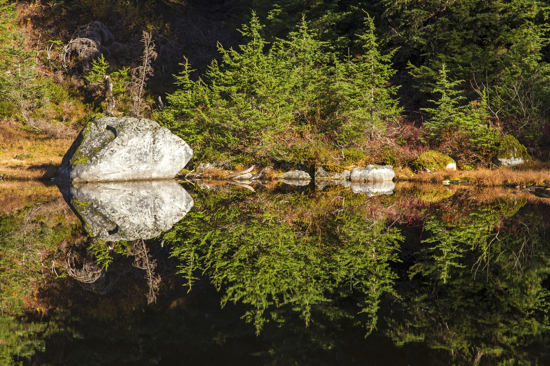 Lovely tarn near Brockton point
 |
|||
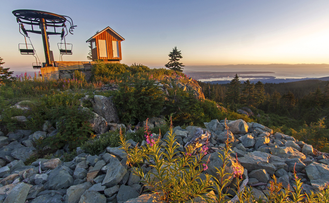 Sunset at Brockton chairlift
 |
|||
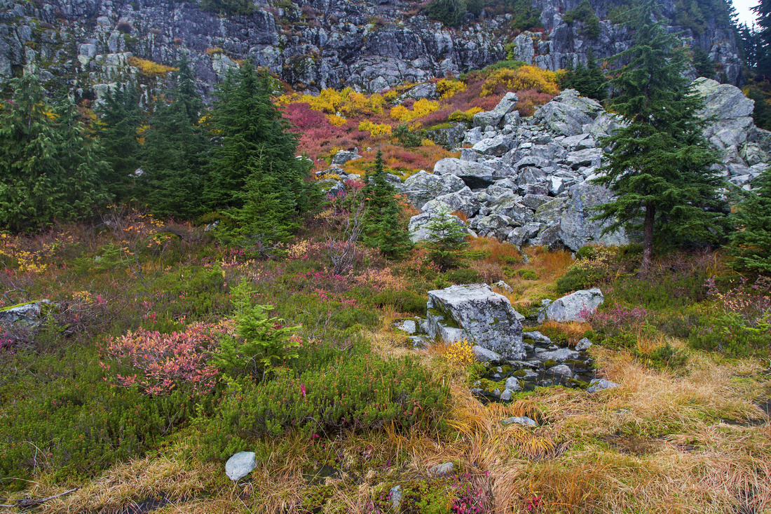 Fall colors below Pump peak
 |
|||
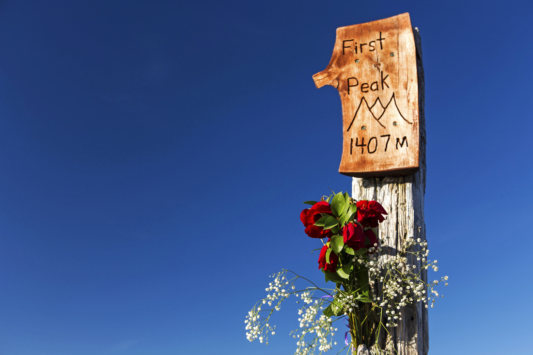 Iconic post at 1407 m First (Pump) peak
 |
|||
 Trademark views on Center (Tim Jones) peak
 |
|||
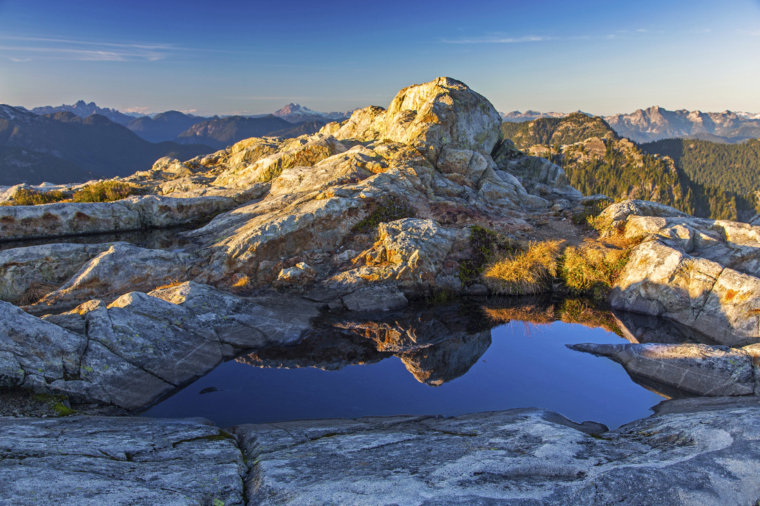
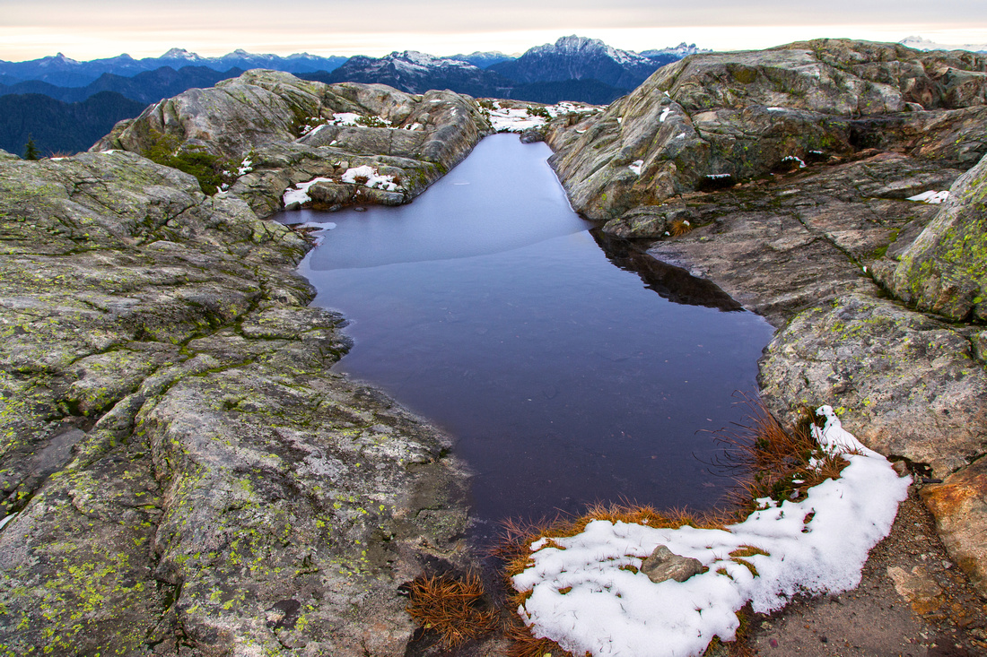 Picture perfect tarn on main summit
 |
|||
 Zoom on Mt. Garibaldi from main summit
 |
|||
 Northerly views from tarn at main summit
 |
|||
 Runner peak lit by late afternoon sunshine
 |
|||
 View back to Tim Jones peak from Mt. Seymour
 |
|||
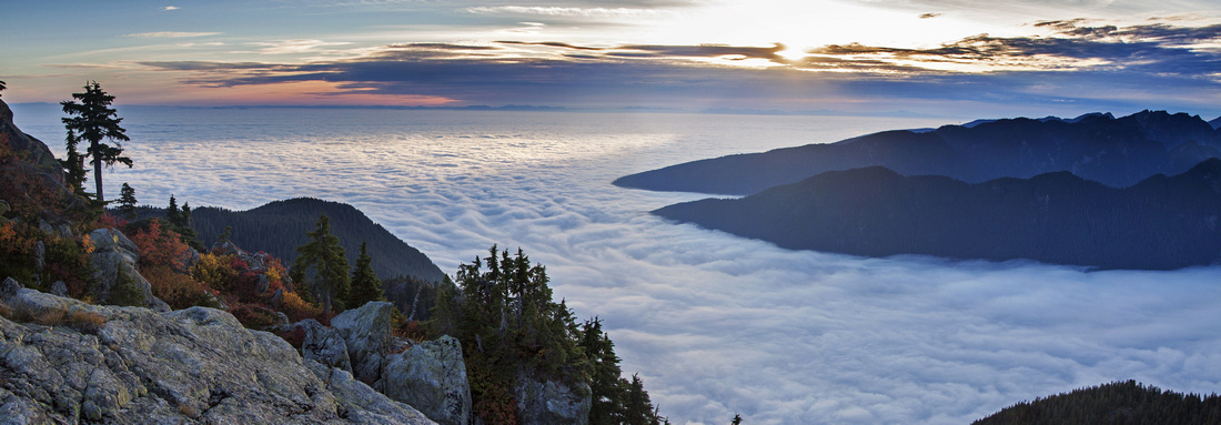 Thick layer of fog over Burrard strait viewed from main summit
 |
|||
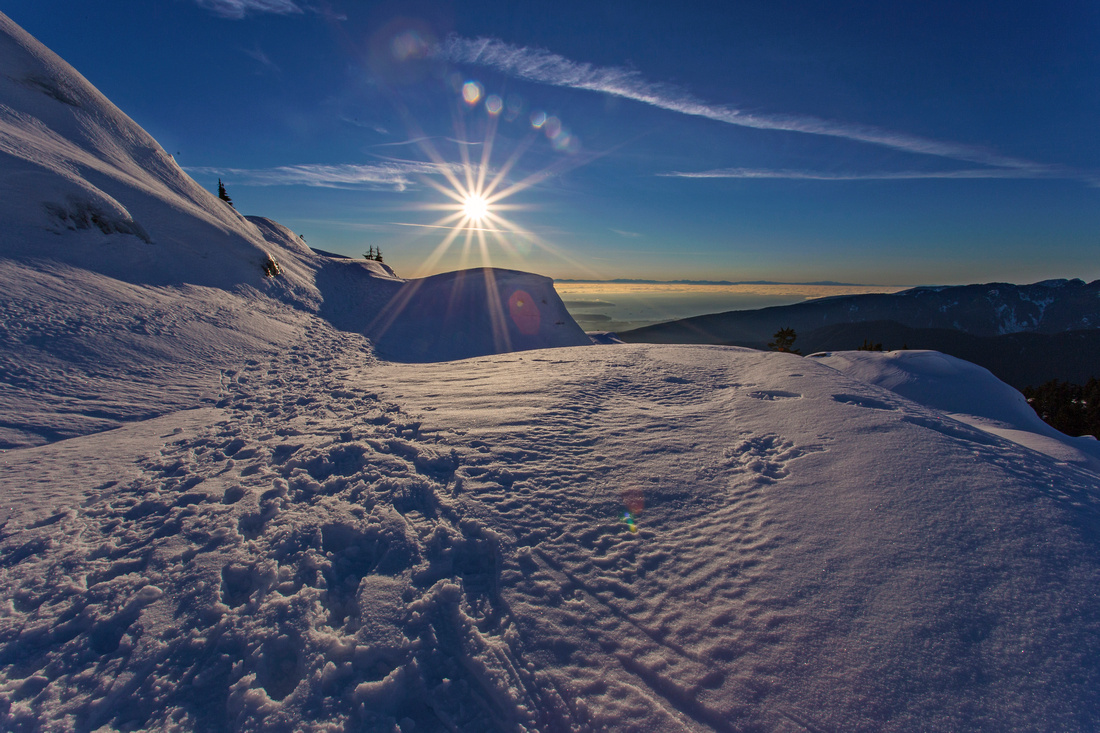 Sunny winter skies below Pump peak
 |
|||
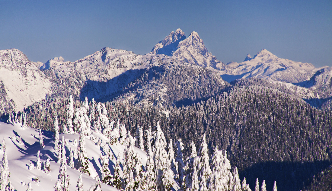 Zoom on Judge Howay from slopes below Pump peak
 |
|||
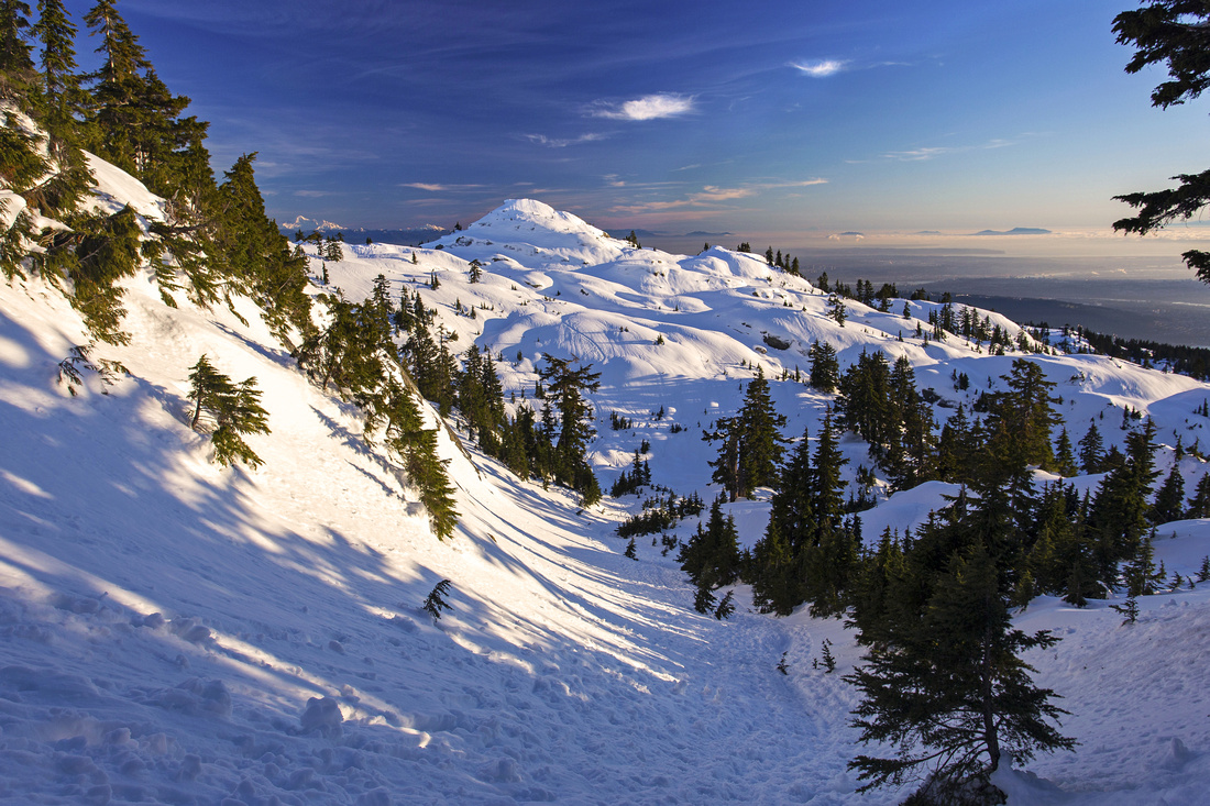 Pump peak from ascent gully of Center peak
 |
|||
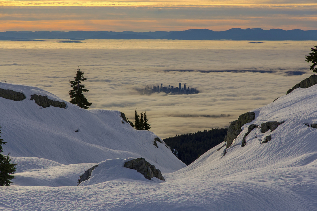 Vancouver downtown rising above thick fog layer
 |
Abstract
| Overall Difficulty | D4 | Typical north-shore terrain with roots, rocks and small bluffs. Steep slope west of center peak with light exposure | |||
| Snow Factor | S2(4) | Snowshoe trail to Brockton point - easy (S2). Harder to Pump and Center peak; difficult for main summit | |||
| Scenery | Pen-ultimate North shore. Bluffs, tarns and far reaching views in all directions. Unique! | ||||
| Trail/Marking | Very good | Main trail is well marked and easy to follow. Flagged shortcut via old Seymour trail | |||
| Suggested Time | ~5-6 hrs | Return time for all three summits; less if going only for center or Pump peak | |||
| Elevation | Start: 980m Max: 1460m Total: ~1000m (return) | Round Trip: ~12 km | |||
| Gear | Day hikers or full boots and poles. Icers/snowshoes mandatory in winter. Ice-axe suggested for main summit | ||||
| Water | Small ponds and seasonal creeks but no reliable source of water. Recommended: Carry ~1-2L | ||||
| Dog Friendly | Yes | Environs of Pump peak are frequented by black-bears; keep dog under control | |||
 Mt. Seymour GAIA Map
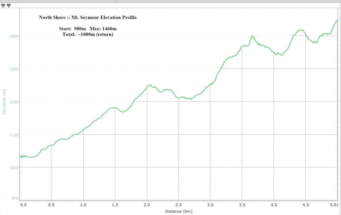 Mt. Seymour Elevation Profile