Google Map |
USA :: Sedona :: Munds Wagon - Hangover Trail |
GPS Track |
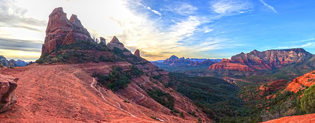 
Teapot and Pointed Dome from Cowpies Saddle. Mt. Wilson center right, distant Capitol Butte group in the Background |
|||
| Trip Summary | |||
Dec 4, 2023
Overall probably the most advanced Trip I've done in Sedona area, until now at least. Portions of Hangover trail traversing north side of Mitten Rock are not for faint of heart; I still have problems believing some people tackle it on Mountain Bikes (no wonder many end in Hospital). There are also significant route-finding problems, specially if you are just getting used to concept of following white paint blazes on Slickrock. But overall reward far overweights the effort, both in terms of Adventure/Accomplishment and superb Scenic Views.
Hangover Trail loops around Mitten Rock Formation, starting/ending at Munds Wagon. Access is via Schnebly Hill Road, branching off Hwy179 at Traffic Circle across Tlaquepaque Arts & Crafts Village. It is possible to drive to Hangover Trailhead, but this road becomes really bad past end of pavement at Huckaby Parking Lot and is not recommended - even with 4x4. It is far better to approach by hiking Munds Wagon which is also quite scenic reaching Hangover west end in 45-50min (Waypoint "1 - Hangover Junction", GPS Download Top of Page). After finishing Hangover Loop below Cowpies (Waypoint "6 - Munds Wagon"), this trail is then descended back to Parking. Loop can be done in either direction; I did CW and this is how Gallery Photos are organized, but if first time here CCW is probably easier from routefinding point of view.
Shorter Option is hike to Mitten Rock west end (Waypoint "2 - Mitten Saddle"), then return the same way. This saddle is phenomenal viewpoint with in-your-face view of Mt. Wilson area, while iconic Midgley Bridge on 89A is directly below. If continuing on Mitten backside, the most confusing part comes shortly after. Trail follows some slickrock then disappears. Which way? Confused I continued mostly level for 10-15 minutes until I got into some bad bushwhack and cliffs. Retreating, I saw mad mountain biker descending slickrock, and after brief conversation he directed me in correct direction. Main lesson is: Watch for White Paint Blazes. They are not always readily apparent, but if you don't see any for awhile you are heading in wrong direction - backtrack. From Waypoint "3 - Mitten Slickrock" I headed directly up the rock. There was some light scrambling, but nothing overly difficult. Eventually I intercepted reasonably well defined trail hugging north side of Mitten Rock. Ensuing section to Waypoint "4 - Cowpies Saddle" is out-of-this world, culminating with fantastic panorama on the other side. Trail then disappears again switchbacking the south side Slickrock, but white paint blazes are somewhat more abundant and I had no further problems reaching signed Cowpies Junction and further down to Munds Wagon. Entire time accompanied with jaw dropping scenery.
For experienced hiker equiped with GPS and comfortable with routefinding / light scrambling this is very rewarding Sedona trip I am likely to repeat at some point. Highly Recommended! |
|
Gallery |
|||
 Munds Trailhead Munds Trailhead Munds Wagon Trail starts top of Parking Lot at end of Paved Portion of Schnebly Hill Road
 |
|||
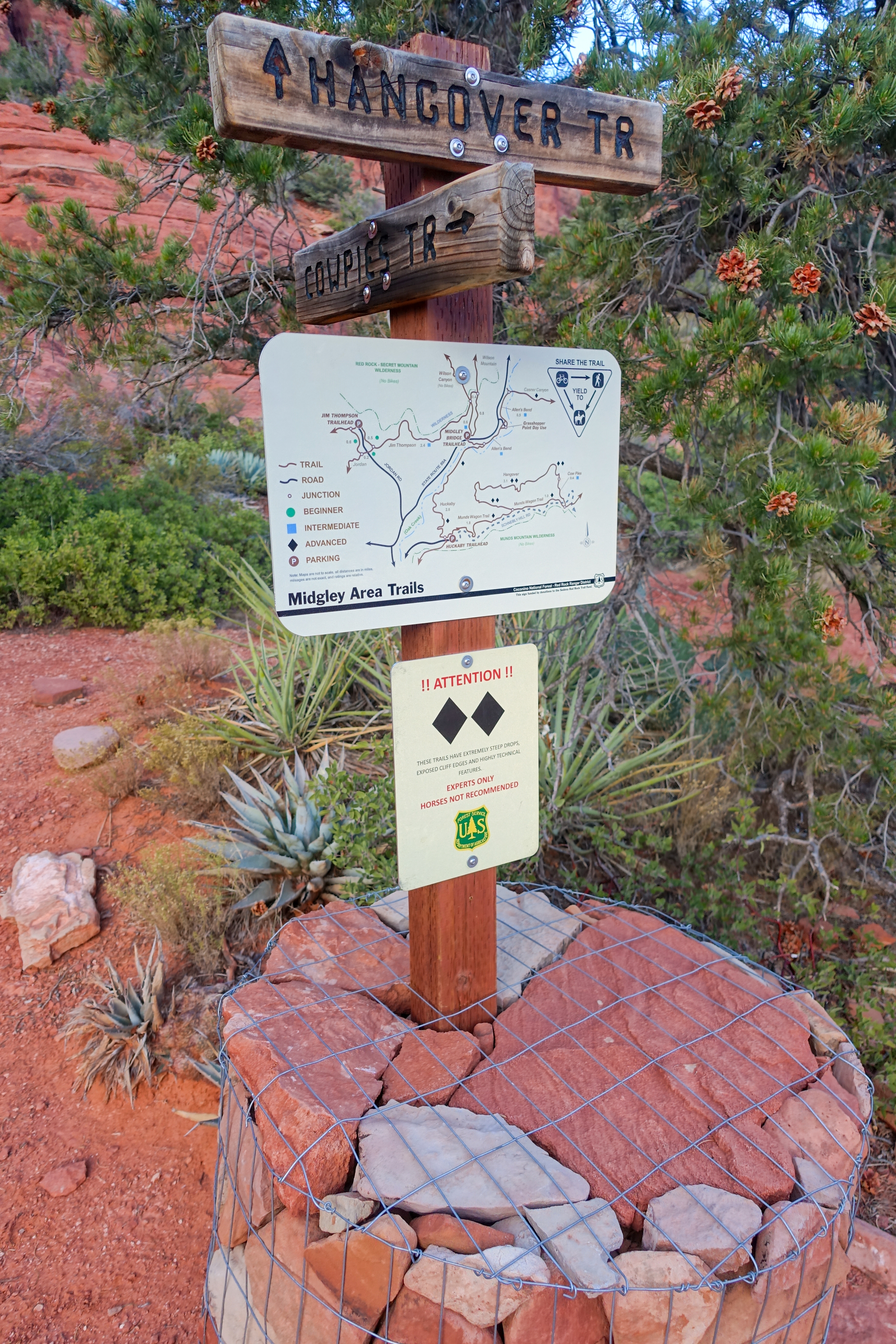
 Munds Table Munds Table Customary Table indicating Trail number #78
 |
|||
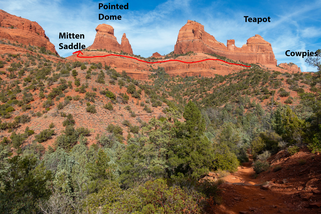 Mitten Ridge Mitten Ridge View of Mitten Ridge from Munds Wagon Trail. Red Line indicates approximate direction of 1st part of Hangover Trail
 |
|||
|
|
|||
 Picnic Area Picnic Area Picnic Area shortly before Hangover Junction
 |
|||
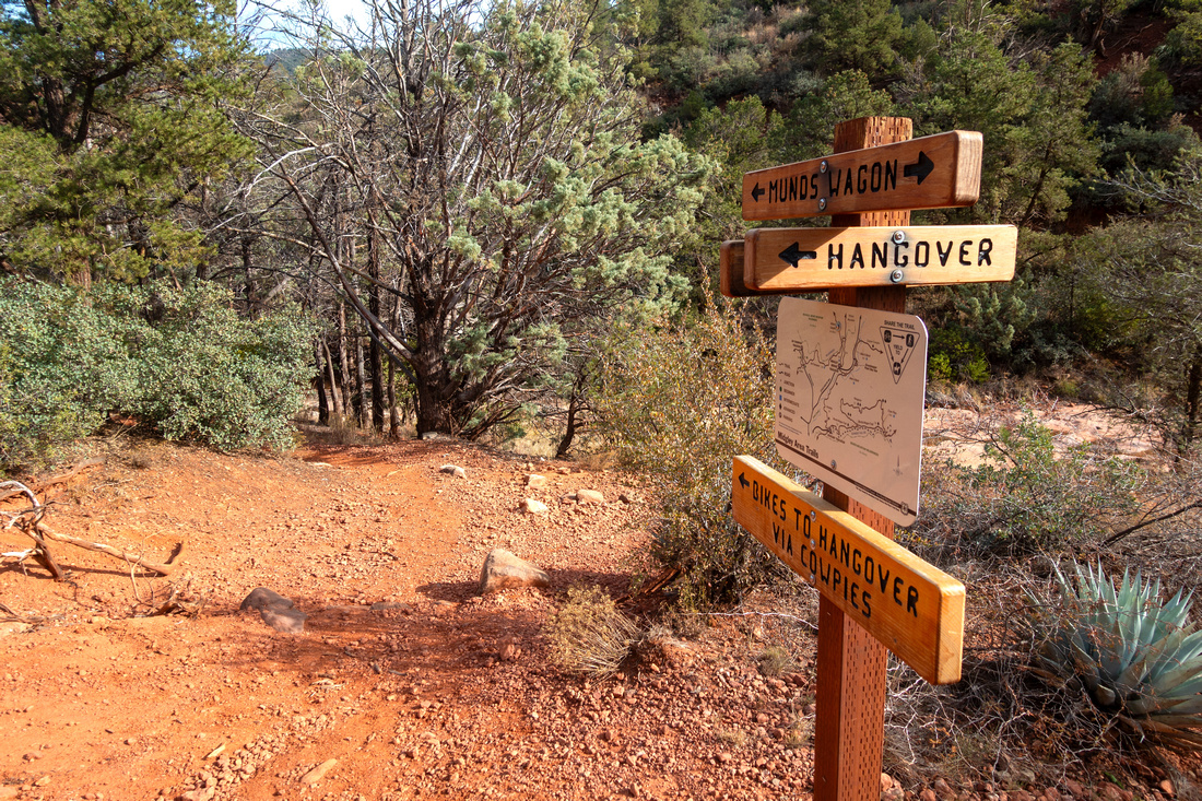 Hangover Junction Hangover Junction Signed Hangover Trail junction 45-50min from Parking. For CW loop turn left
 |
|||
|
|
|||
 Mitten Slickrock Mitten Slickrock First indication of things to come: Narrow sloped Slickrock ledge, just below Mitten Saddle looking back
 |
|||
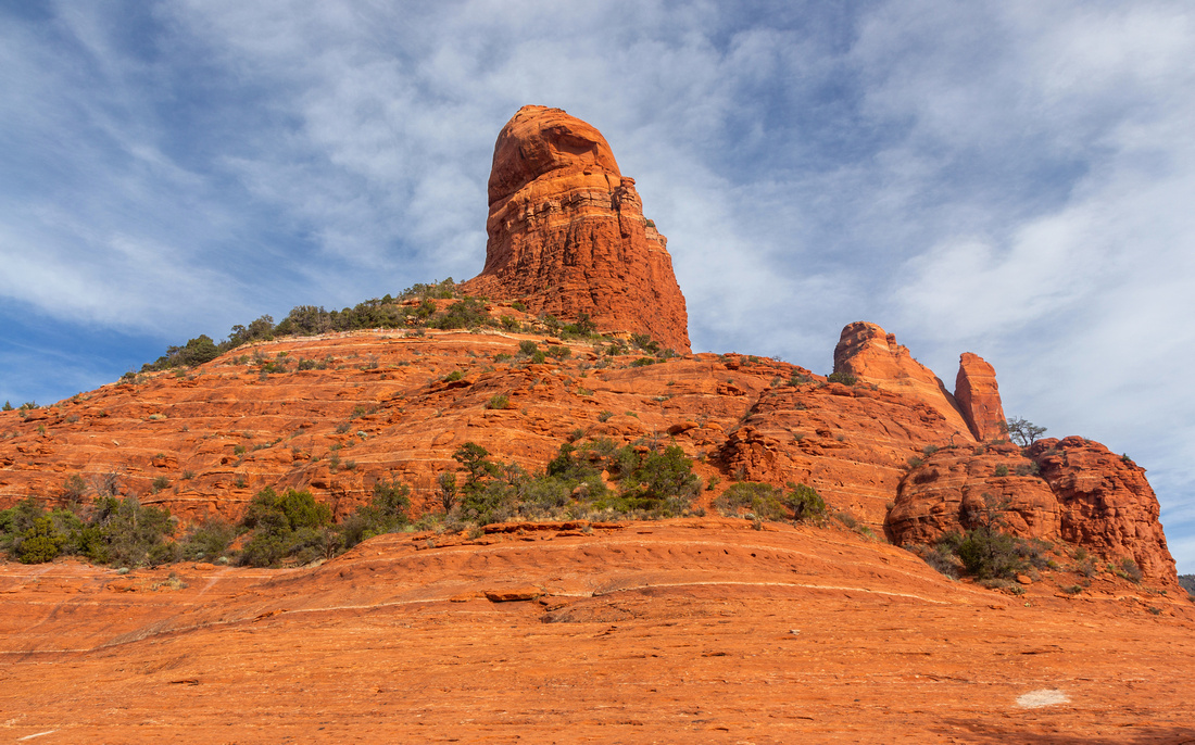 Pointed Dome Pointed Dome Pointed Dome at West end of Mitten Ridge
 |
|||
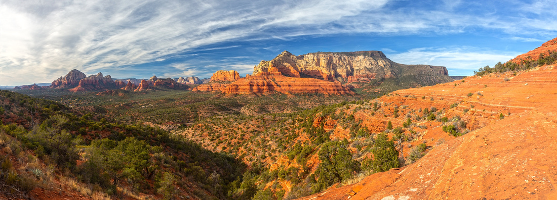 Mitten Saddle Mitten Saddle Mitten Saddle, a fantastic viewpoint and optional turning point for shorter trip or if you don't feel up to challenging part. Tricky routefinding ahead: After crossing initial part of Slickrock turn right and scramble up following white paint blazes
 |
|||
 Midgley Bridge Midgley Bridge Iconic Midgley Bridge on Hwy 89A Telephoto. Right side is also alternate trailhead for Mt. Wilson and north end of Jim Thompson Trail
 |
|||
 Mitten Slickrock Mitten Slickrock Looking back at Mitten Saddle. About here leave the ledge and scramble up
 |
|||
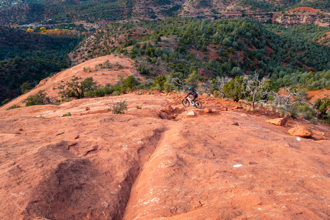 Mad Biker Mad Biker Mad Mountain Biker descends Crux on Hangover Slickrock
 |
|||
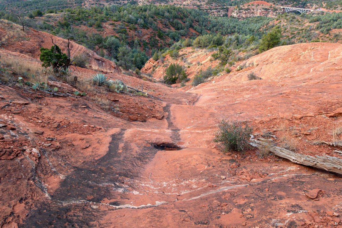 Steep Slickrock Steep Slickrock Looking down steep drainage just before reaching upper Hangover Trail. Midgley Bridge upper Right corner
 |
|||
 Hangover Trail Hangover Trail Typical Section of Hangover Trail at Mitten Ridge Backside
 |
|||
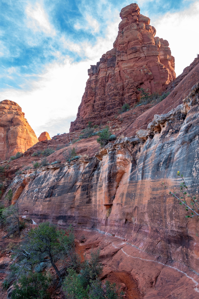 Hangover Trail Hangover Trail Wild section of Hangover "Trail" below Mitten Ridge, approaching Cowpies Saddle. Yes, people cycle here
 |
|||
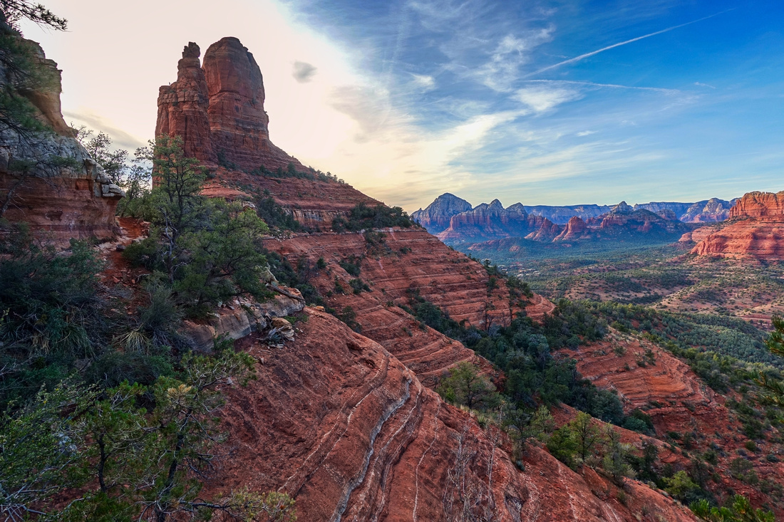 Hangover Ledges Hangover Ledges Looking back Mitten Backside near Cowpies saddle. This is the meat of Hangover Trail. Pointed Dome upper left
 |
|||
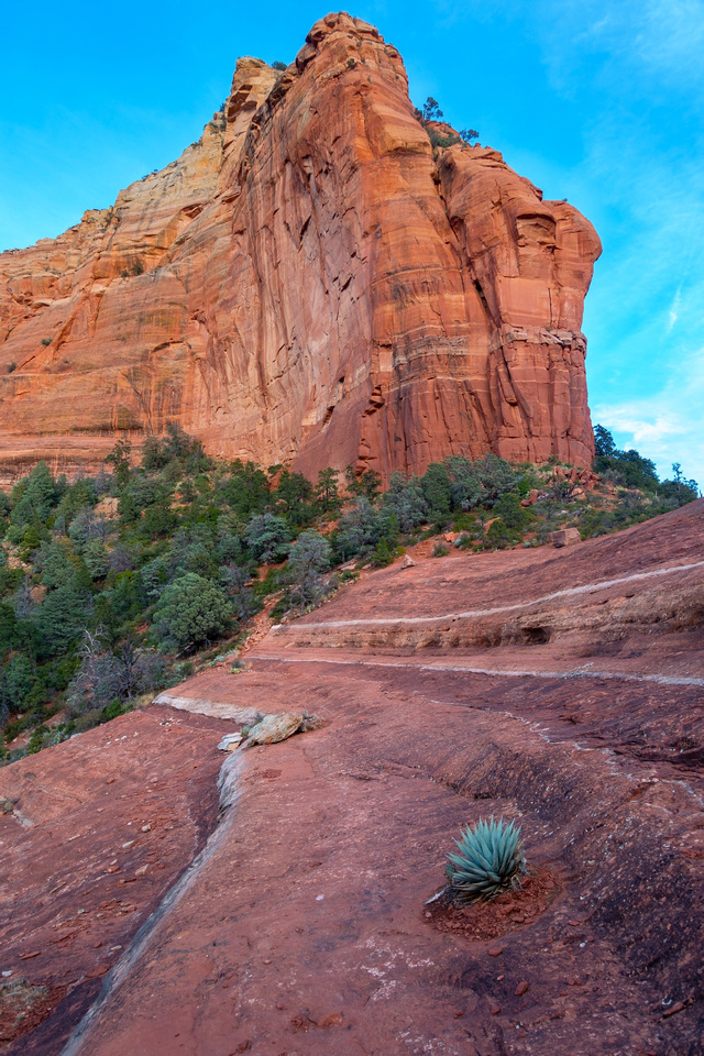 Cowpies Saddle Cowpies Saddle Final Slickrock Ledge Traverse. Trail then climbs forested patch to Cowpies Saddle right
 |
|||
 Cowpies Saddle Cowpies Saddle View south from Cowpies saddle. Upper part of Schnebly Hill Road in valley below. Hangover zig-zags slickrock towards Cowpies Mesa center left
 |
|||
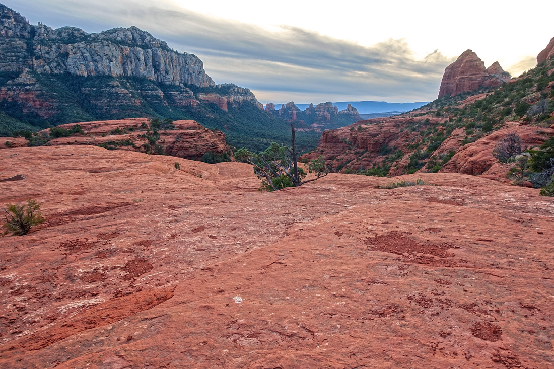 Cowpies Mesa Cowpies Mesa Flat Cowpies Mesa Plateau. Routefinding becomes tricky here again; follow white paint blazes angling left. Cowpies Saddle from previous photo upper right corner
 |
|||
 |
|||
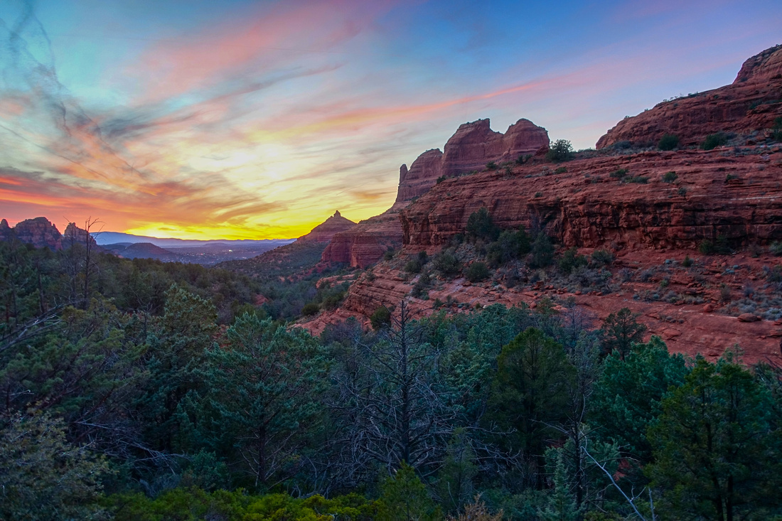 Mitten Sunset Mitten Sunset Vibrant Sunset Sky on Munds Wagon Descent back to Parking
 |
Abstract
| Overall Difficulty | D5 | Stiff class 2 / low class 3 rock scramble above Mitten Saddle. Steep and rocky sections of Trail | |||
| Scenery | Spectacular Mitten Ridge (Pointed Dome, Teapot). Aerial panorama of Oak Creek north / Midgley Bridge Area with distant Mt. Wilson. Very scenic Cowpies Slickrock in upper part of Schnebly Road | ||||
| Trail/Marking | Excellent / Poor | Munds Wagon easy to follow with marked junctions. Sections of tricky Routefinding on Hangover Trail | |||
| Suggested Time | 5hrs | Full loop, allowing time for photo breaks. 3hrs only for Mitten Saddle OnB | |||
| Elevation | Start: 1370m Max: 1605m Total: ~620m | Round Trip: 14km | |||
| Gear | Full hiking boots preferred. Hiking Pole for stability. GPS helpful | ||||
| Water | Occasional shallow Munds Creek Pools (must filter). No water source on Hangover. Carry 1.5-2L, depending on season | ||||
| Dog Friendly | Yes | Frequented by Mountain Bikers - keep control of your pet | |||
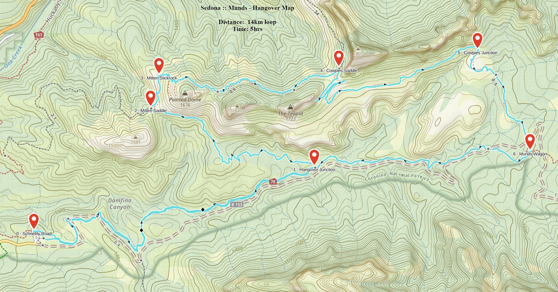 Munds - Hangover GAIA Map
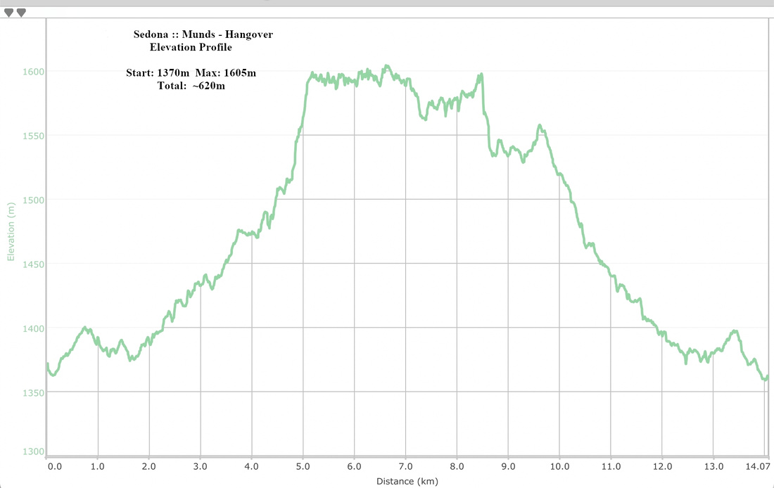 Munds - Hangover Elevation Profile
