Google Map |
USA :: Sedona :: Jim Thompson |
GPS Track |
 
Midgley Bridge across Wilson Creek Canyon at end of Jim Thompson Trail 4 couple of miles north of Sedona |
|||
| Trip Summary | |||
Dec 14, 2023
Jim Thompson (Trail #124) connects top of Jordan Road and Midgley Bridge on Hwy 89A. Undemanding and very scenic it follows old roadbed rounding east slopes of Steamboat Rock. There are several highlights but main one is probably famous Midgley Steel Truss bridge, very photogenic from west side most tourists don't see. Trail can be cycled or hiked. Jordan trailhead is much better start as Midgley side parking is super busy and space is almost impossible to find. Compared with some other easy Sedona trails, Jim Thompson still doesn't see much traffic - on my trip I had it to myself. After ~1.5hr of casual pace and lunch break at Picnic area I hiked briefly lower ridge of Mt. Wilson before descending to Wilson Canyon and reconnecting with Jim Thompson - see Gallery.
Extensions include exploration of Wilson Canyon (add ~1hr) or scramble to plateau below Steamboat Rock (class 3; top is technical). Steamboat junction is not marked; use GPS Track (Waypoint "1 - Steamboat Junction"), download Top of Page. Add min 2 hrs for Steamboat. Jim Thompson can also be used as alternate Mt. Wilson approach because of busy Midgley trailhead parking area. This would be quite a long day; my suggestion is to climb Wilson from north side, and simply enjoy Jim Thompson on its own with relaxed pace. Very satisfying option is return via Huckaby (Trail #161) following east side of Oak Creek to Schnebly Hill Road, but this requires 2 vehicles. |
|
Gallery |
|||
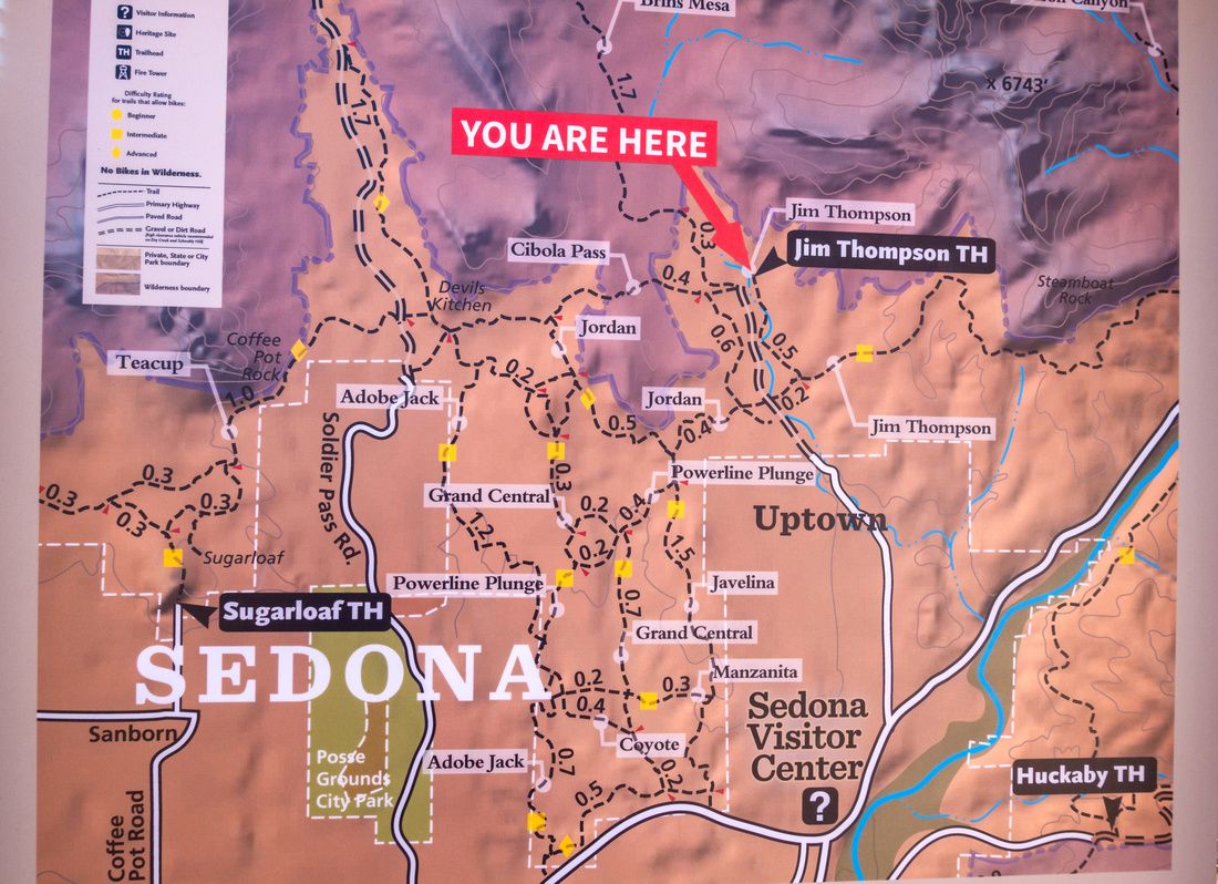 Jim Thompson Trailhead
Trailhead Map at end of Jordan Road Jim Thompson Trailhead
Trailhead Map at end of Jordan Road |
|||
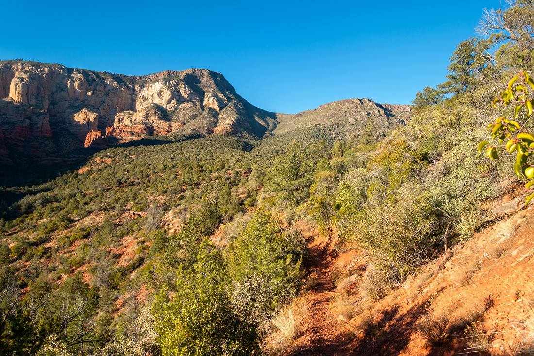
 Jim Thompson Trail
Typical section of Jim Thompson as trail starts circling around Steamboat Rock (R). Tisha Spire / Acropolis left Jim Thompson Trail
Typical section of Jim Thompson as trail starts circling around Steamboat Rock (R). Tisha Spire / Acropolis left |
|||
|
|
|||
 Wilson Rige
View of Mt. Wilson (center left) as Jim Thompson starts descent to Midgley bridge area Wilson Rige
View of Mt. Wilson (center left) as Jim Thompson starts descent to Midgley bridge area |
|||
 |
|||
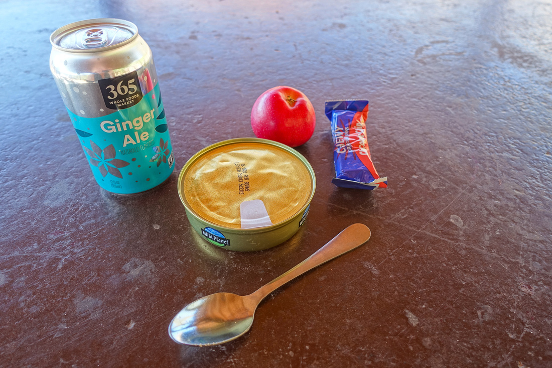 Midgley Lunch
Enjoying mid-afternoon lunch at Midgley Picnic area which was deserted on this day because of temporary Hwy 89A closure Midgley Lunch
Enjoying mid-afternoon lunch at Midgley Picnic area which was deserted on this day because of temporary Hwy 89A closure |
|||
|
|
|||
 |
|||
 Wilson Trail
Lower part of Mt. Wilson trail above MIdgley Bridge Wilson Trail
Lower part of Mt. Wilson trail above MIdgley Bridge |
|||
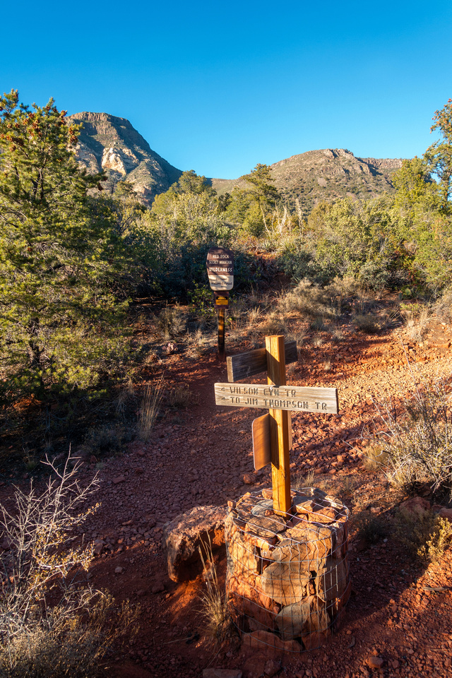 Wilson Junction
Wilson Canyon connector. Mt. Wilson trail continues straight; turn left and descend to Jim Thompson Wilson Junction
Wilson Canyon connector. Mt. Wilson trail continues straight; turn left and descend to Jim Thompson |
|||
 Steamboat Rock
 lite by late afternoon sunshine on return. Scrambling route exists but upper part is strictly technical Steamboat Rock
Steamboat Rock lite by late afternoon sunshine on return. Scrambling route exists but upper part is strictly technical |
|||
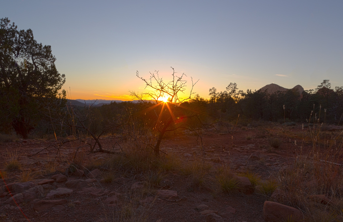 Sedona Sunset
Taking a break some 30min before Jordan trailhead to enjoy terrific Sedona Sunset Sedona Sunset
Taking a break some 30min before Jordan trailhead to enjoy terrific Sedona Sunset |


Abstract
| Overall Difficulty | D2 | Mostly easy walk on old road with some rocky part. Moderately steep, but short bit above Wilson Canyon | |||
| Scenery | Steamboat Rock, Tisha Spire and Acropolis. Picturesque Midgley Bride and Wilson Canyon. Mitten Ridge / Munds Wilderness | ||||
| Trail/Marking | Very Good | Official Sedona Trail with marked junction and trail maps | |||
| Suggested Time | 4 hrs | Casual pace including short Mt. Wilson trail loop. Add an hour if planning to explore Wilson Canyon. Mt. Wilson summit extension would be a very long day | |||
| Elevation | Start: 1390m Max: 1450m Total: +190m -215m | Round Trip: 11km | |||
| Gear | Light hikers are sufficient | ||||
| Water | No reliable source. 1-2L, depending on season | ||||
| Dog Friendly | Yes | Frequented by Mountain Bikers - keep control of your pet | |||
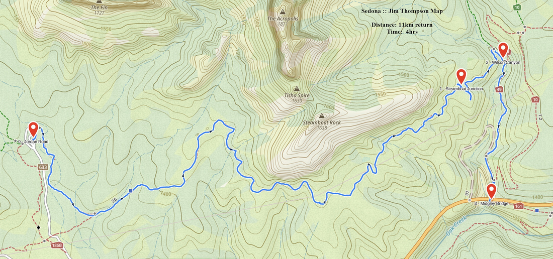 Jim Thompson GAIA Map
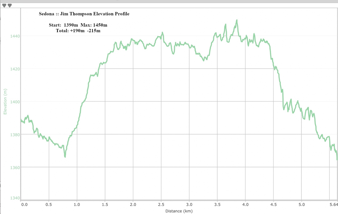 Jim Thompson Elevation Profile