Google Map |
USA :: Sedona :: Chapel Loop |
GPS Track |
|
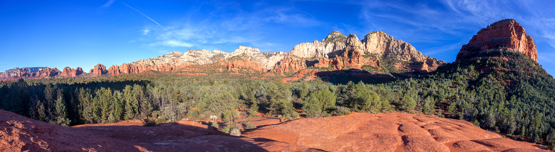
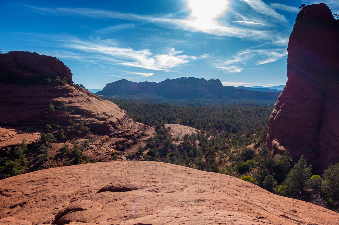
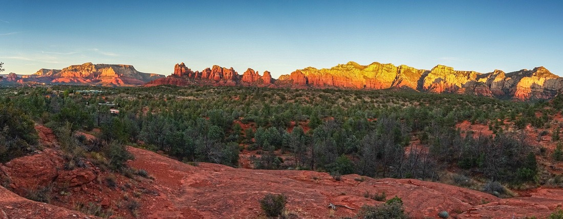
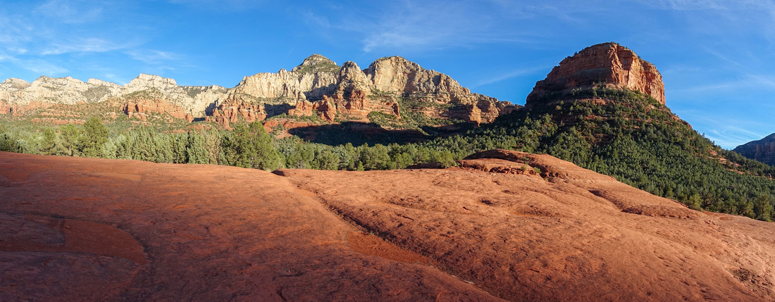
Panoramic view east to Munds Wilderness Peaks from Submarine Rock |
|||
| Trip Summary | |||
Multiple Dates, last Nov 22, 2023
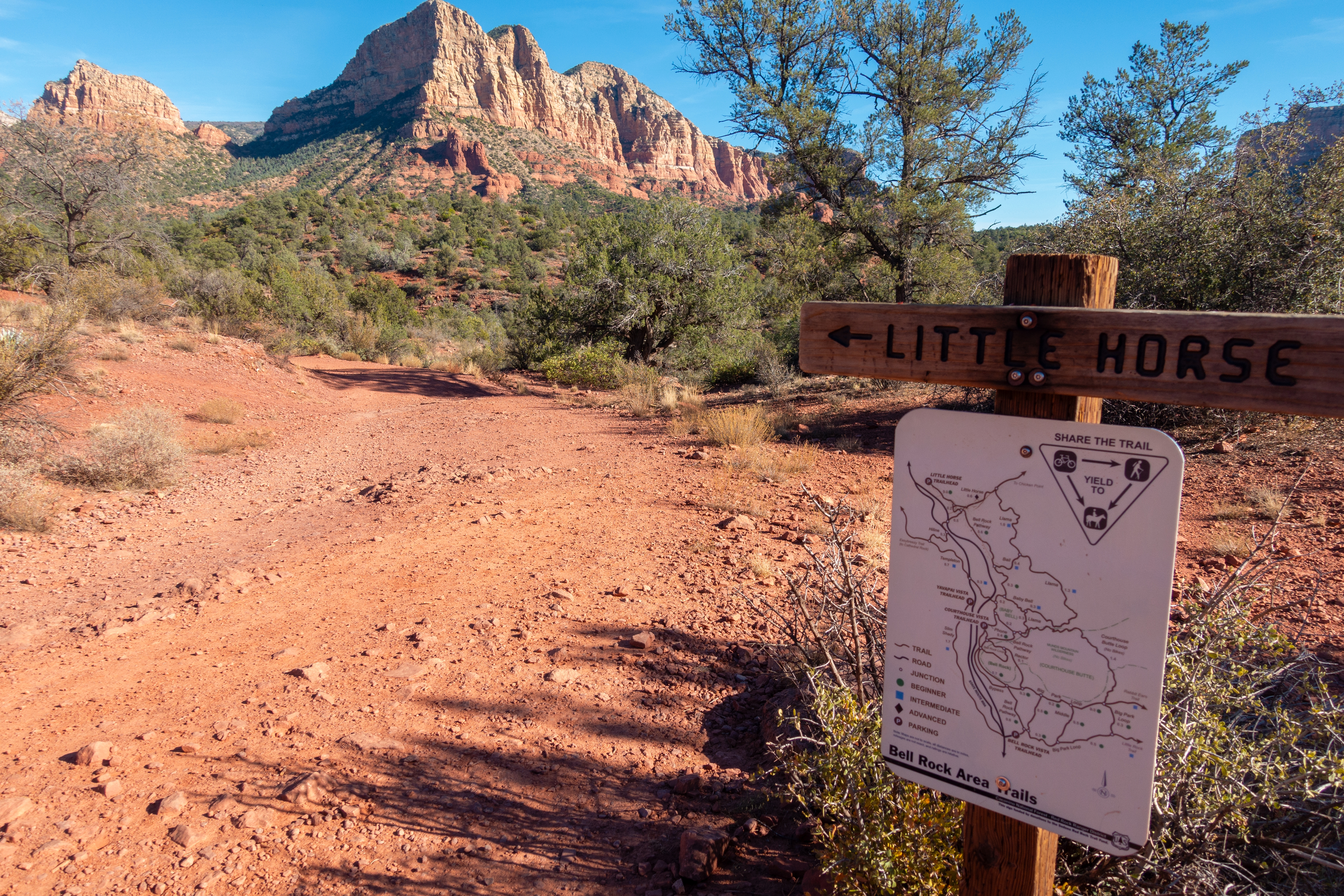
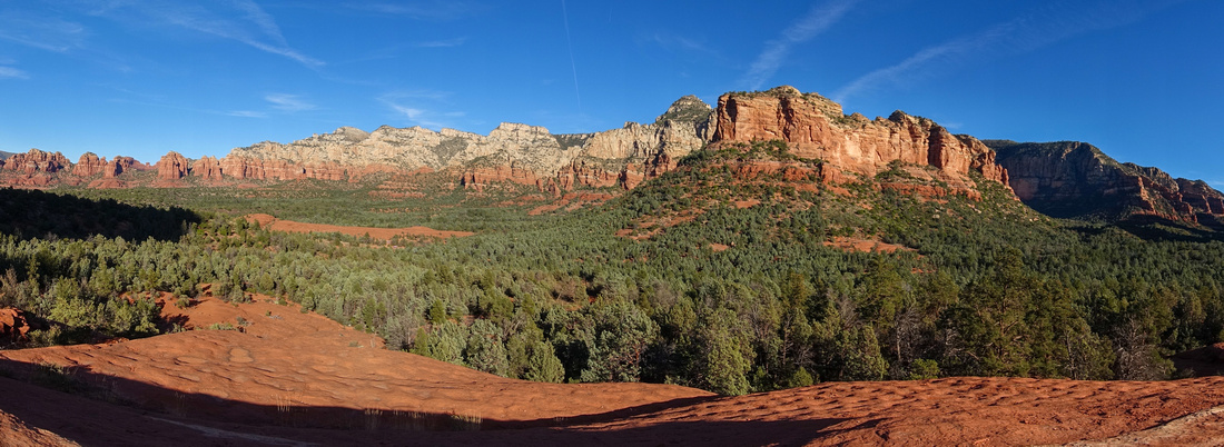
Great loop hike behind Sedona Chapel utilizing variety of hiking/biking/4x4 trails, giving the most complete overview of the area. Different options exist. In the past I used to start from Sedona chapel road where hike ends, but on Nov '23 trip approached via Little Horse trail and found that alternative more scenic. All junctions are as usual well marked with Trail Maps. In 30-40 minutes from Parking, Little Horse joins Chapel trail then climbs briefly up slickrock to Chicken Point. This is fantastic viewpoint (see Gallery), but also frequent gathering place of 4x4 tours so solitude will be hard to find. Following meandering on network of 4x4 roads can be both entertaining and annoying, depending on your perspective. This section can be avoided by following "High on the Hog" to Broken Arrow. Upon reaching marked Submarine Rock junction just past "Devil's Staircase" 4x4 section, turn right and hike to Submarine. This is probably highlight of the day as views on large polished platform are superb (lead photo on this page). Tours also stop here and depending on your timing you might have it to yourself, or share with large groups.
From Submarine Rock one can return the same way, but better is to continue north on Broken Arrow trail (shared with mountain bikers) to Twin Buttes / Hog Wash junction. Along the way there was interesting Sinkhole on my '23 trip, along with unusual Bat Roost Monitor. Loop closure can be either via Twin Buttes (longer, bit more rough) or Hog Wash. I've done both and found Hog Wash more scenic. There are several more junctions but all are signed - stay on Hog Wash and hike back to Chapel Road. If you left car at Little Horse parking there will be ~20min walk back (Chapel Road to Hwy179, then turn left - sidewalks entire way). |
|
Gallery |
|||
 |
|||
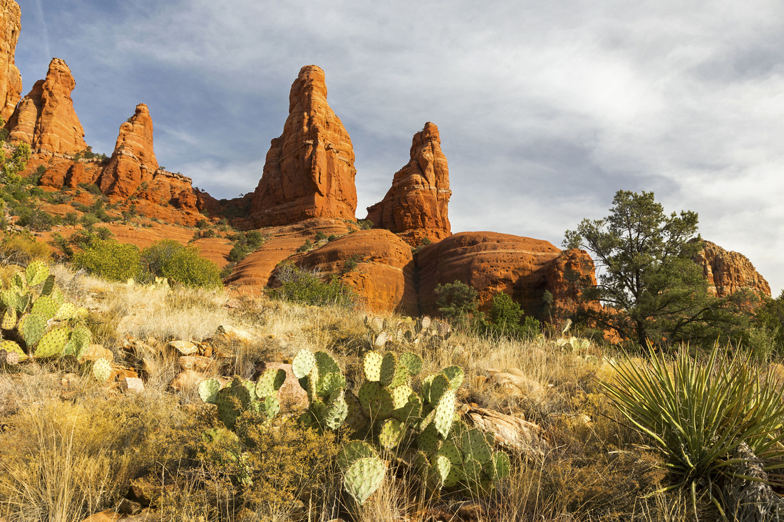
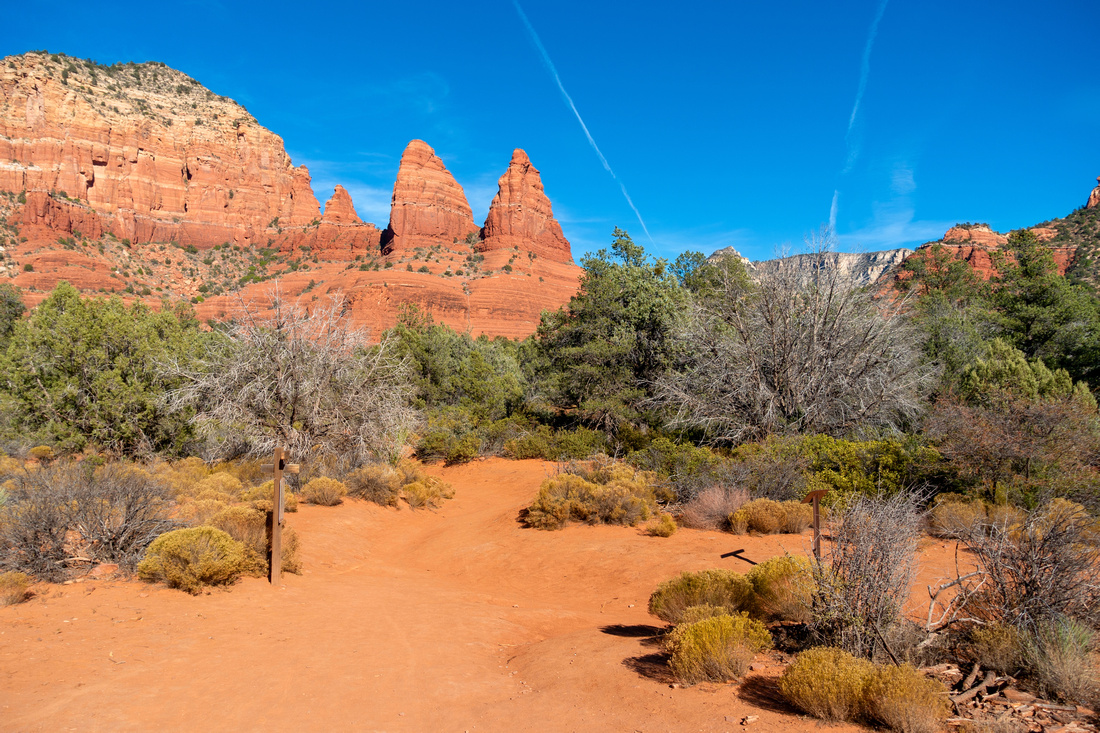 Christianity Peaks Christianity Peaks View of Rock Spires called "Christianity Peaks" near Little Horse / Chicken Point junction
 |
|||
|
|
|||
 Chicken Point
Rock Dome behind Christianity Peaks called Chicken Point, also popular 4x4 gathering point Chicken Point
Rock Dome behind Christianity Peaks called Chicken Point, also popular 4x4 gathering point |
|||
 Chicken Point
View SW from Chicken Point looking back to Hwy179 corridor Chicken Point
View SW from Chicken Point looking back to Hwy179 corridor |
|||
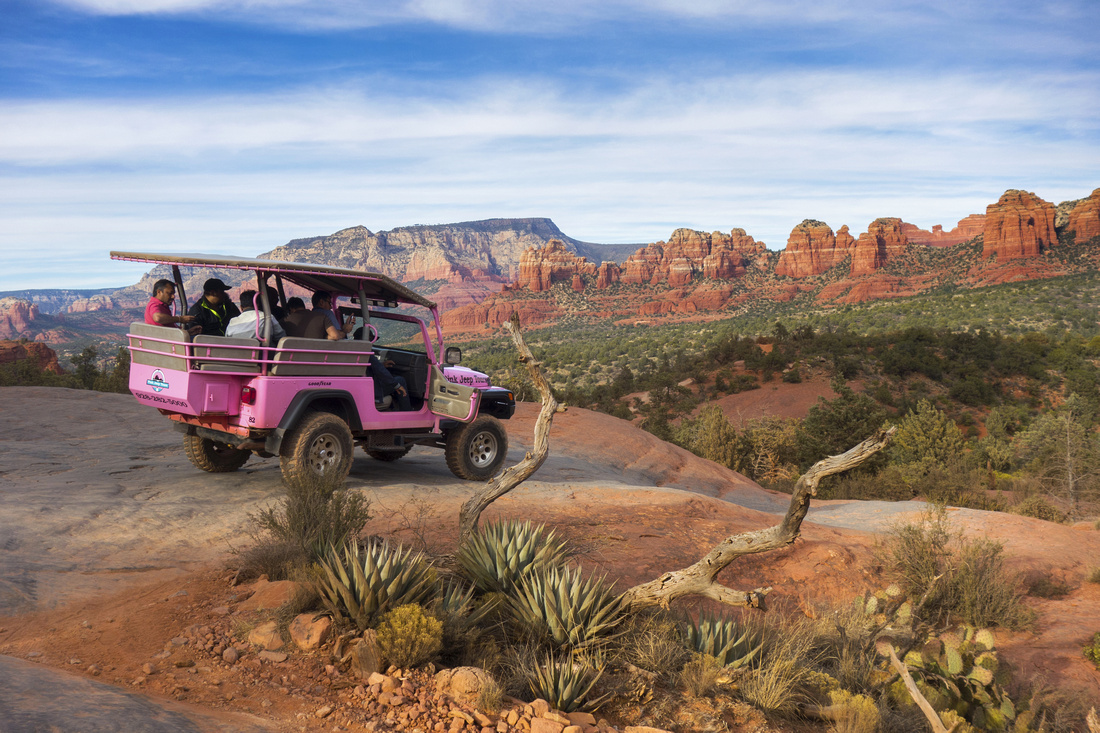 Pink Jeeps
Pink Jeep Tours with Tourists onboard on Slickrock near Chicken Point. This is love-hate section; while it is quite entertaining watching what terrain these vehicles are capable of handling, motorized noise is super annoying Pink Jeeps
Pink Jeep Tours with Tourists onboard on Slickrock near Chicken Point. This is love-hate section; while it is quite entertaining watching what terrain these vehicles are capable of handling, motorized noise is super annoying |
|||
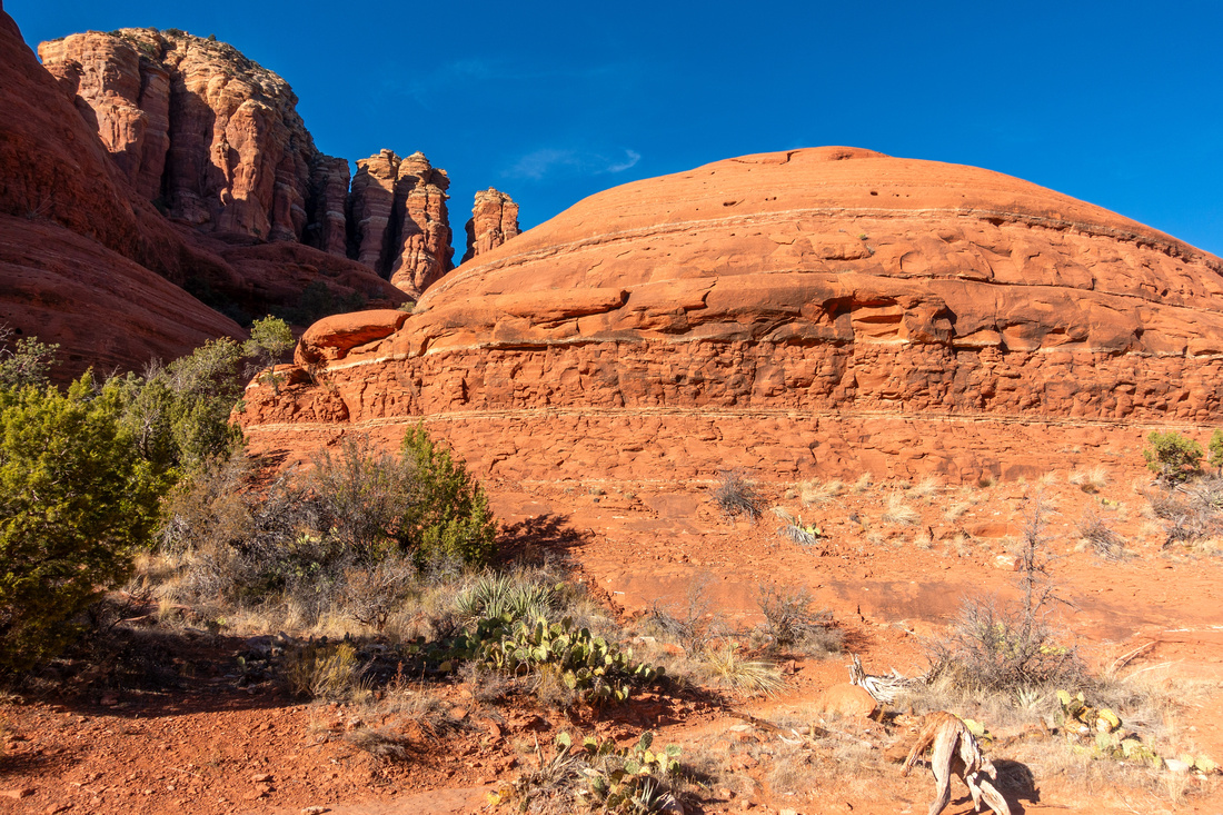
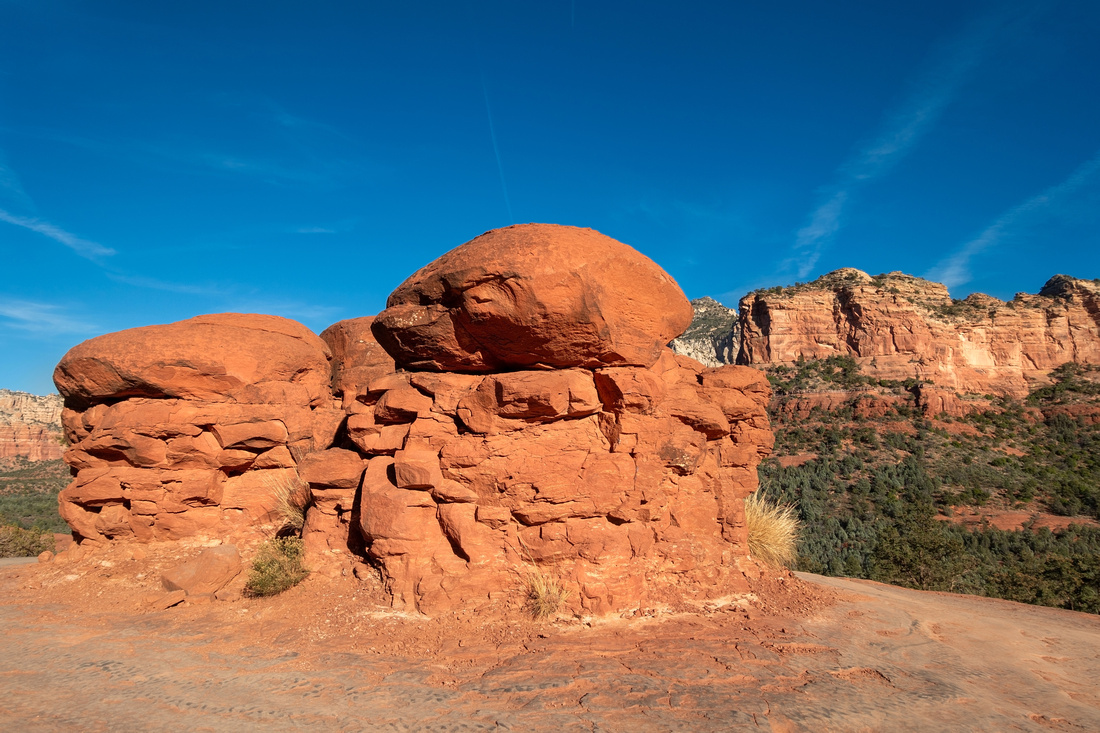 Rock Dome
Interesting Rock Dome on Plateau in middle of 4x4 section, well worth a visit Rock Dome
Interesting Rock Dome on Plateau in middle of 4x4 section, well worth a visit |
|||
|
|
|||
|
|
|||
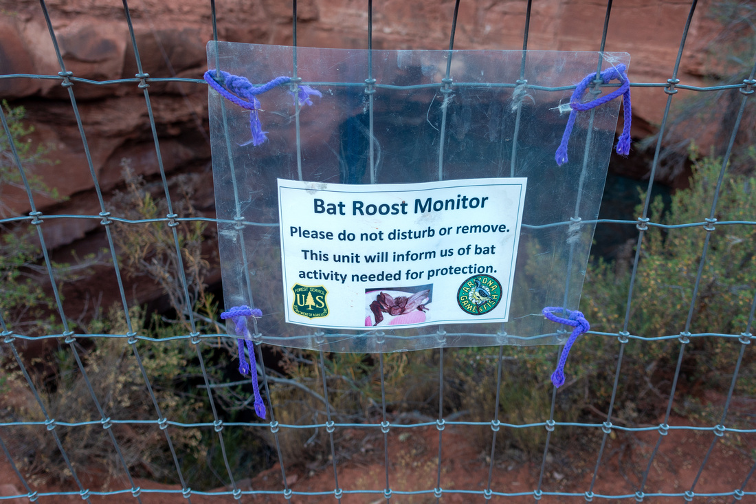 Bat Monitor
Fenced Sinkhole on Broken Arrow with Bat Roost Monitor near Twin Butte / Hog Wash Junction Bat Monitor
Fenced Sinkhole on Broken Arrow with Bat Roost Monitor near Twin Butte / Hog Wash Junction |
|||
 Sedona Sunset
Great Sunset Light Conditions on Hog Wash Trail looping back to Chapel Road Sedona Sunset
Great Sunset Light Conditions on Hog Wash Trail looping back to Chapel Road |
|||
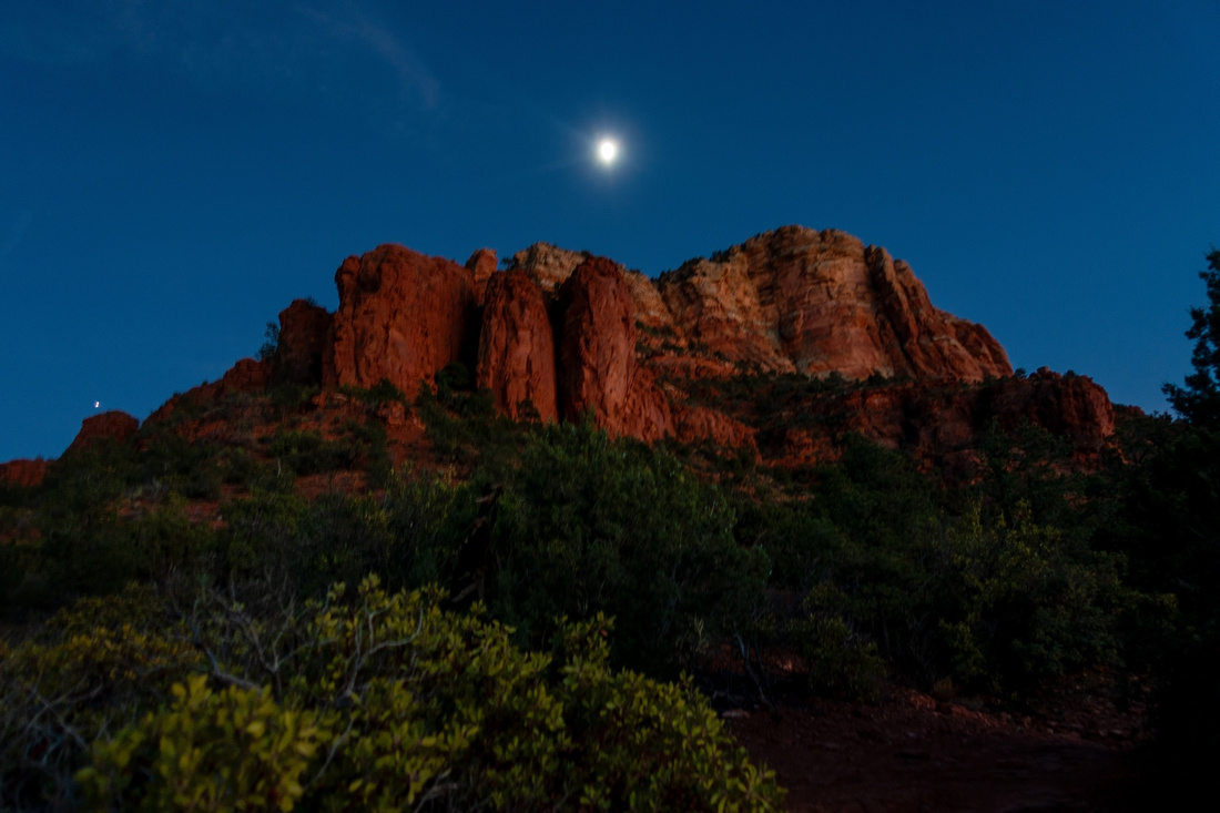 Mammoth Moon
Moonrise behind Mammoth Peak at Twin Buttes / Hog Wash Junction Mammoth Moon
Moonrise behind Mammoth Peak at Twin Buttes / Hog Wash Junction |
Abstract
| Overall Difficulty | D3 | Some (optional) easy slickrock scrambling. Minor moderately steep parts. Annoying 4x4 stretch | |||
| Scenery | Christianity Peaks and Wilderness Valley with Munds Wilderness Panorama. Submarine Rock. Very scenic meandering How Wash trail | ||||
| Trail/Marking | Excellent | Well defined trail with marked junction and trail maps | |||
| Suggested Time | 4 hrs | Loop starting at Little Horse trailhead and ending at Sedona Chapel Road, not including transfer time between trailheads. Several options exist to make day longer or shorter as desired | |||
| Elevation | Start: 1305m Max: 1405m Min: 1290m Total: ~320m | Round Trip: 11km loop | |||
| Gear | Light hikers are sufficient. Hiking pole recommended | ||||
| Water | No reliable source. Carry 1L or more, depending on season | ||||
| Dog Friendly | Yes | Take good care at 4x4 stretch between Chicken Point and Submarine Rock. Broken Arrow and Hog Wash trials shared with Mountain bikers | |||
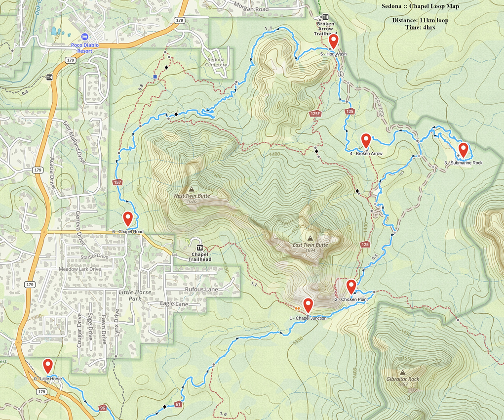 Chapel Loop GAIA Map
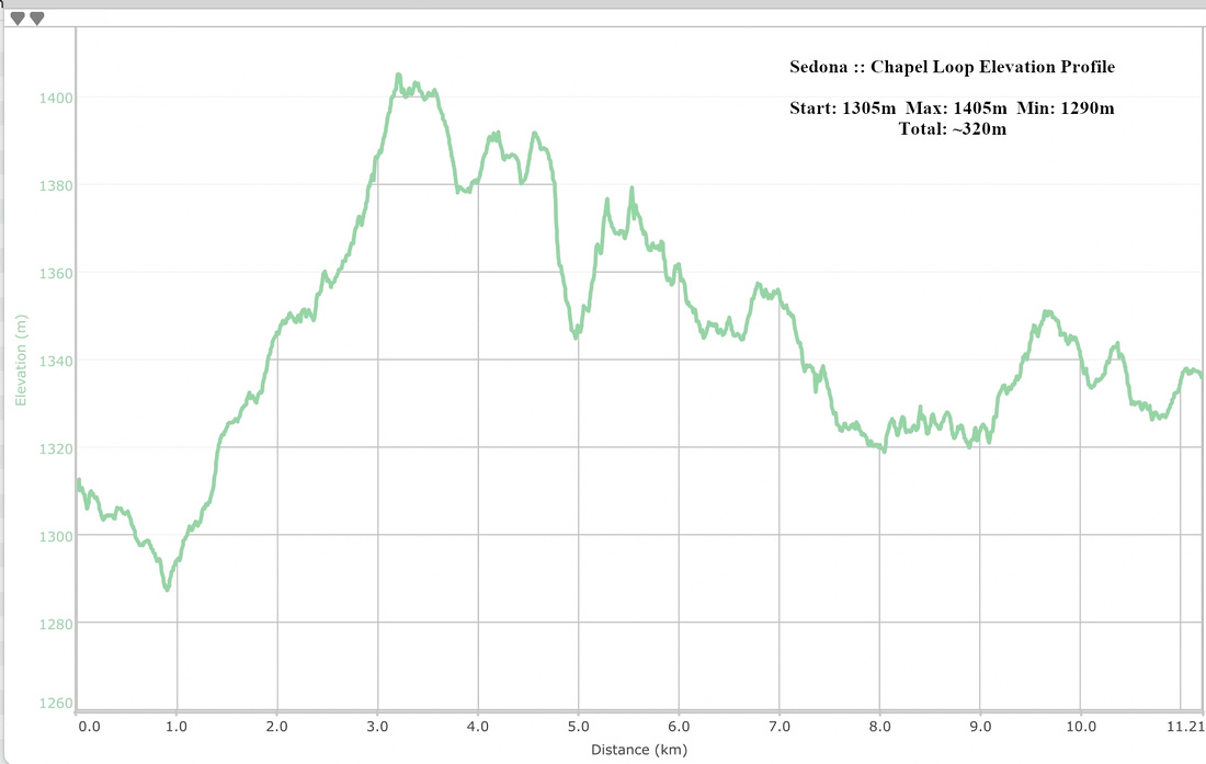 Chapel Loop Elevation Profile