Google Map |
USA :: Sedona :: Brins Mesa - Soldier Pass |
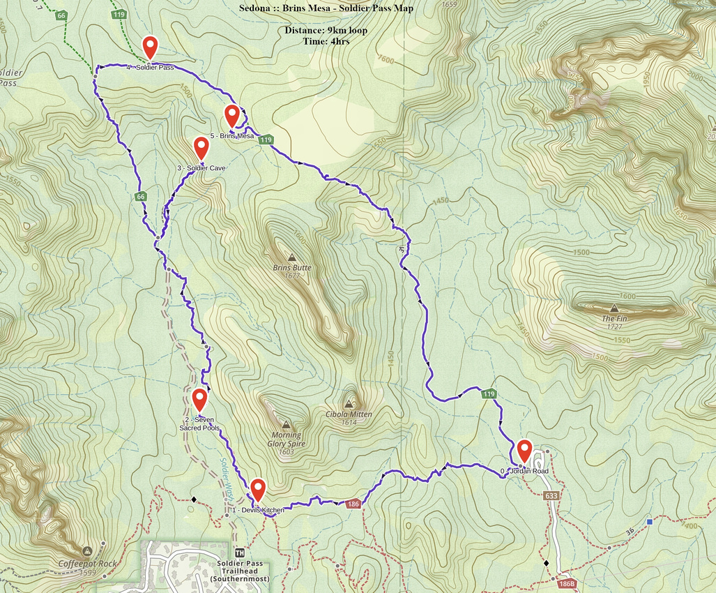
GPS Track |
|
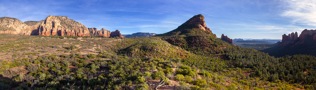
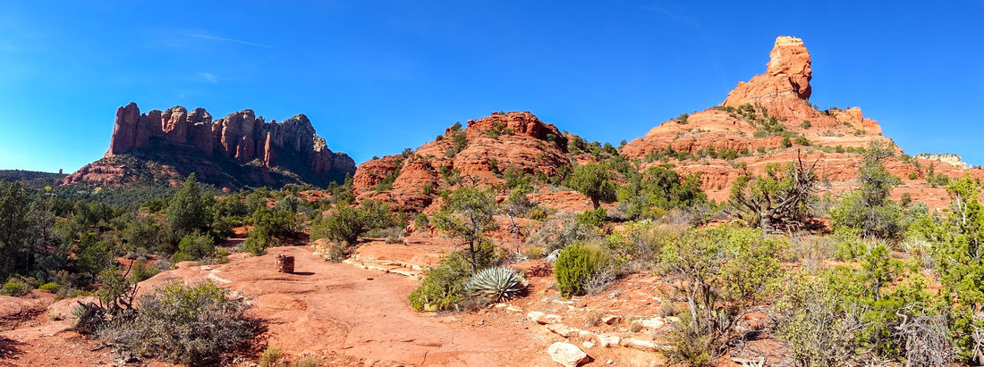
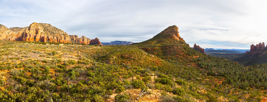
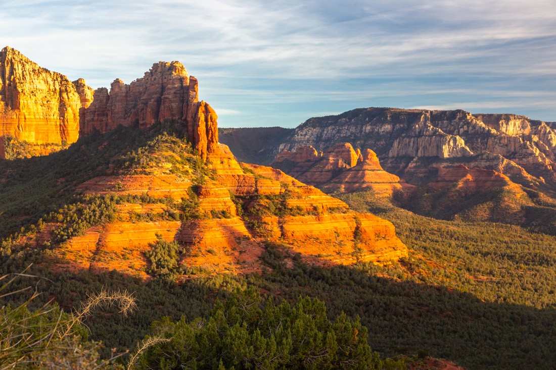
Panoramic View from Brins Mesa Rock Outcrop. Brins Butte just right of center, Soldier Pass extreme right |
|||
| Trip Summary | |||
Multiple Dates, last Dec 10, 2023
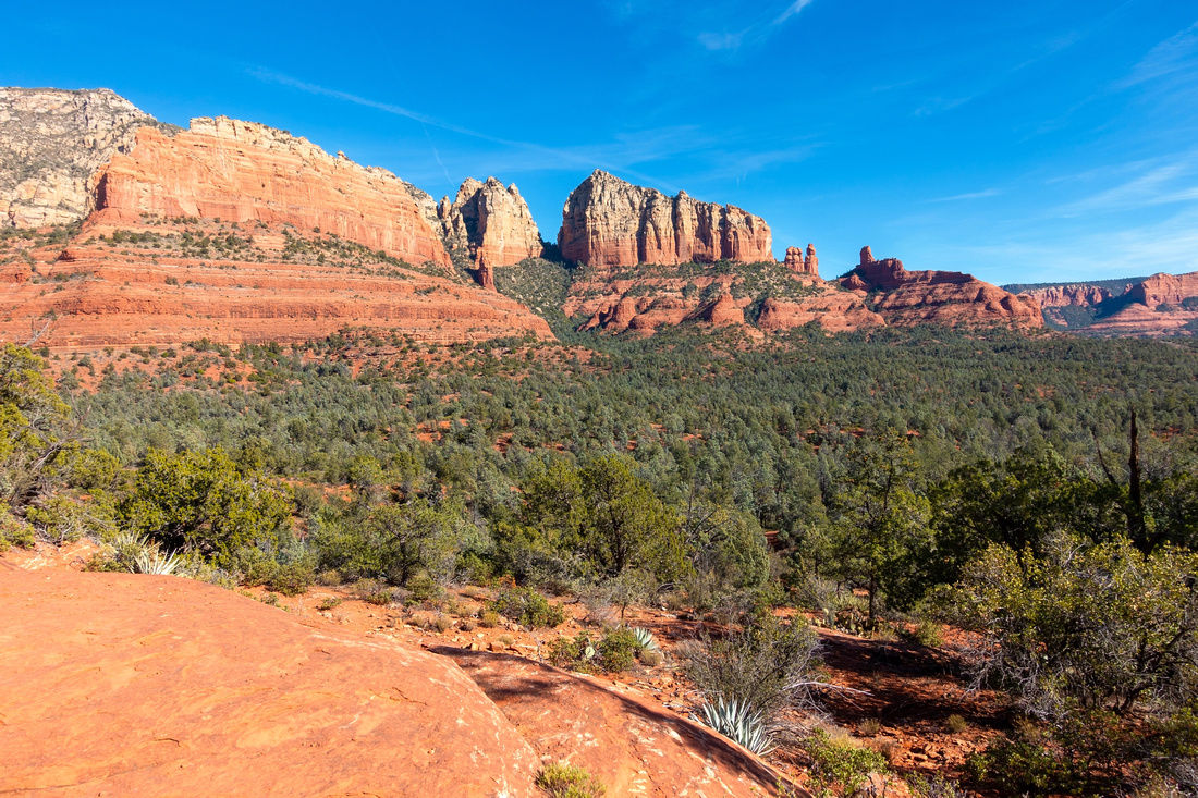
Probably the most complete moderate hike in Sedona with several scenic interests that leads itself naturally to the loop. Usual start is Brins Mesa Trailhead - take Jordan Drive from the Uptown, then go left at junction with Park Ridge Drive and drive to the End. Last km or so is unpaved with one very rough section; most low clearance cars can make it with due diligence (go slow!). Loop can be done CW or CCW; I've done both ways and there is no clear advantage either way. If you go CW, Devil's Kitchen Sinkhole and Soldier Arch will have more sunlight for photos. If you go CCW there will be less crowds later in the day at all scenic Soldier Pass Trail highlights. Photos in Gallery and brief write-up are for CW direction.
From parking take signed Cibola trail branching to the left (Jordan Trail can be also used, but is longer; it will join below Cibola Pass). Some scenic Slickrock traverse brings you to first major highlight: "Devil's Kitchen", natural sinkhole that is as awesome as it's name suggests. This area is quite busy with 4x4 jeep tours and late afternoon usually grants more solitude. Second highlight is "Seven Sacred Pools" - shallow slickrock fissures filled with water and considered Holy by Indigenous People. Trail then starts gradual ascent to Soldier Pass. Third highlight - "Soldier Cave"- is reached by steep trail that forks off to the right ~20 min past Sacred Pools. Junction is not marked, but it is obvious. Area is usually quite busy so if in doubt just follow the crowds! It is short but steep ascent to the cave(s) with last part even a bit scrambly. Return back to main trail the same way.
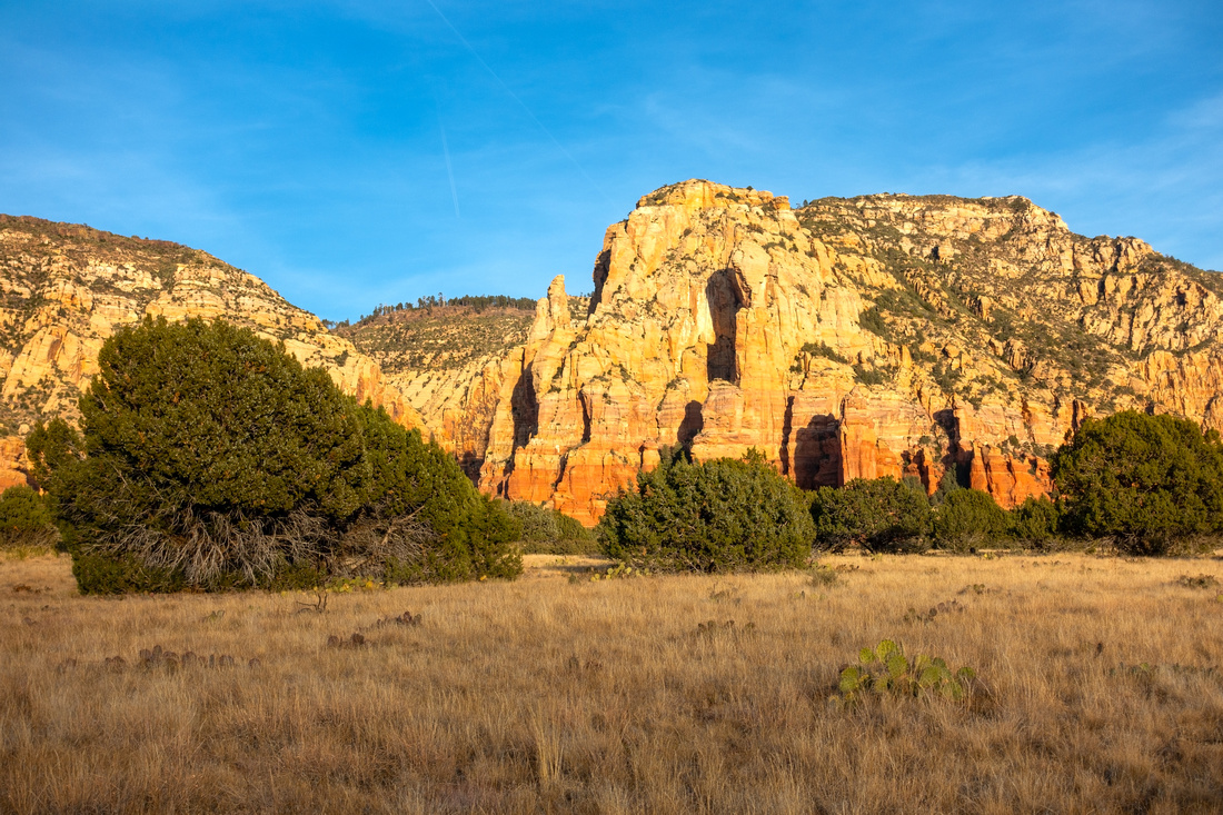
Crowds diminish past Cave junction and ensuing Soldier Pass ascent again feels like wilderness hiking. At marked Brins Mesa trail junction go right and traverse expansive plateau to its east edge, where trail dips down to Jordan Trailhead. Each time I hiked this trail (regardless of direction) I made brief detour to clamber up Rock Outcrop in middle of plateau; it's an excellent spot for the break, and chances are you can have it to yourself too. |
|
Gallery |
|||
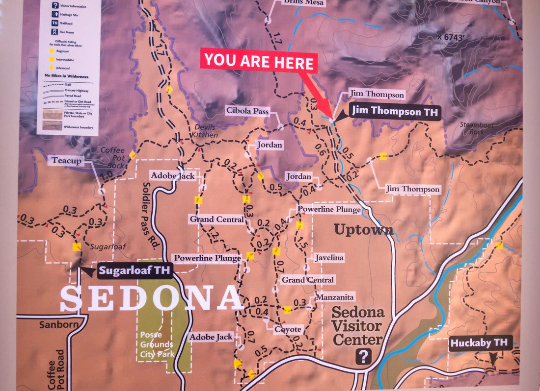 Jordan Trailhead Jordan Trailhead Trailhead Map at end of Jordan Road
 |
|||
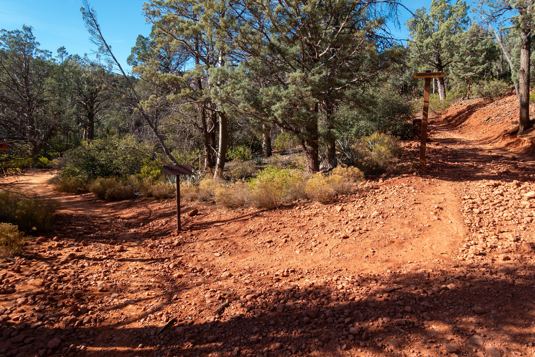
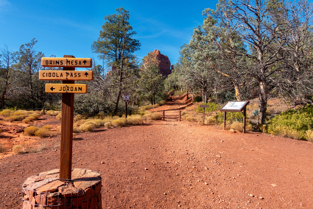 Trailhead Sign
Sign near Trailhead Parking. Jordan trail branches left and could also be used for slightly longer loop Trailhead Sign
Sign near Trailhead Parking. Jordan trail branches left and could also be used for slightly longer loop |
|||
|
|
|||
 Cibola Pass
View back from Cibola Pass. The Fin left, Acropolis, Tisha Spire and Steamboat Rock to the right Cibola Pass
View back from Cibola Pass. The Fin left, Acropolis, Tisha Spire and Steamboat Rock to the right |
|||
 Jordan Pano
Panoramic view south below Cibola Pass as Jordan Trail rejoins from the left. Coffeepot Rock left, Morning Glory Spire upper right Jordan Pano
Panoramic view south below Cibola Pass as Jordan Trail rejoins from the left. Coffeepot Rock left, Morning Glory Spire upper right |
|||
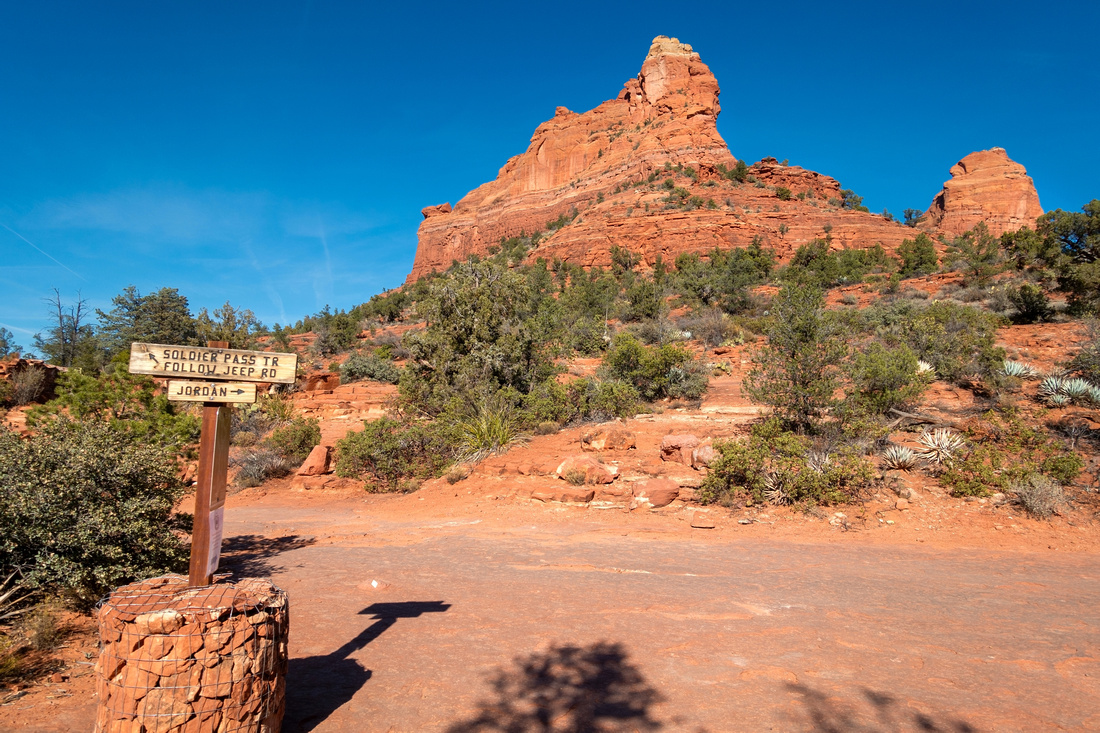 Soldier Pass Trailhead
Signed Soldier Pass Trailhead at end of Jordan Trail near Devil's Kitchen Sinkhole. This area is fairly popular with tourist 4x4 tours Soldier Pass Trailhead
Signed Soldier Pass Trailhead at end of Jordan Trail near Devil's Kitchen Sinkhole. This area is fairly popular with tourist 4x4 tours |
|||
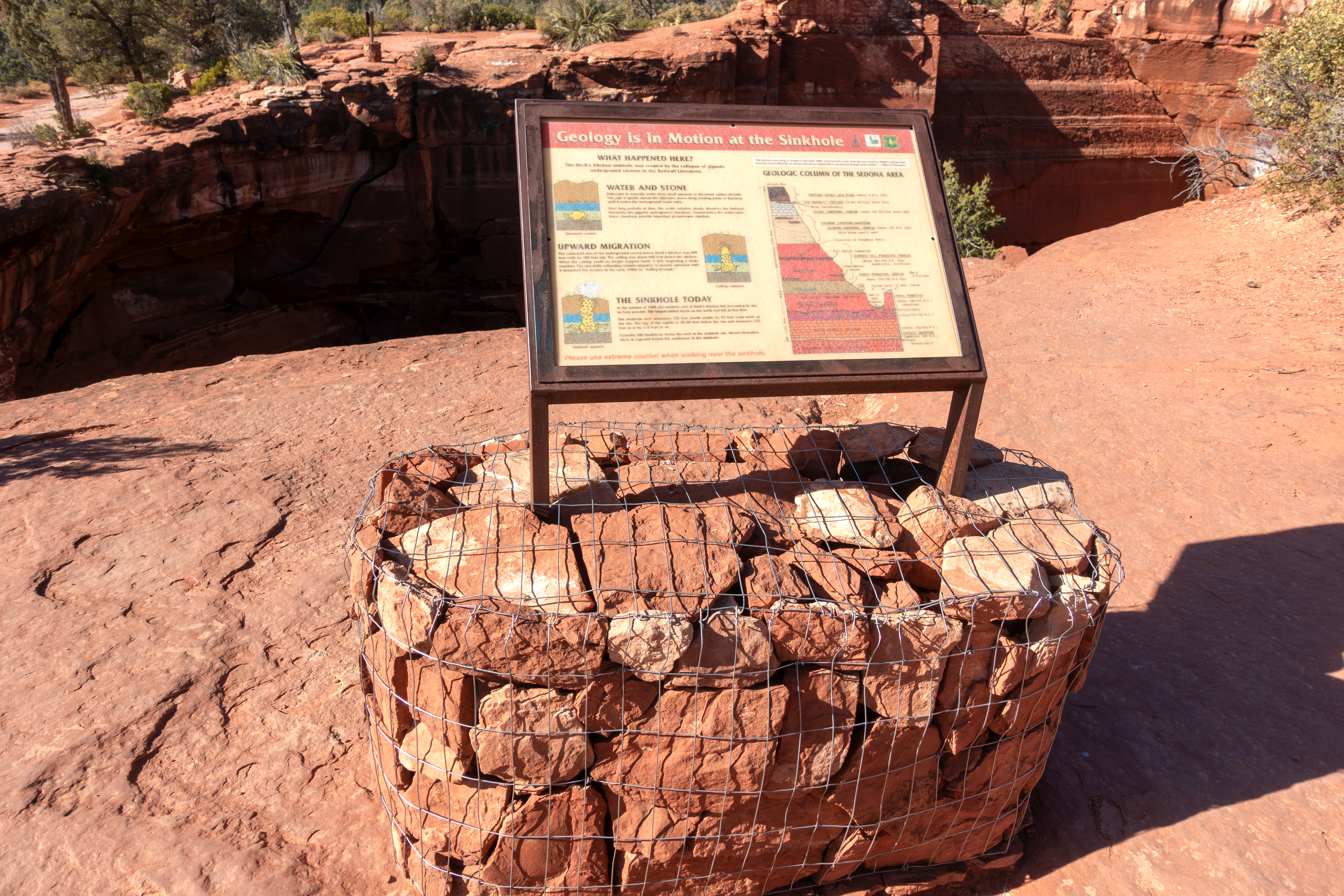
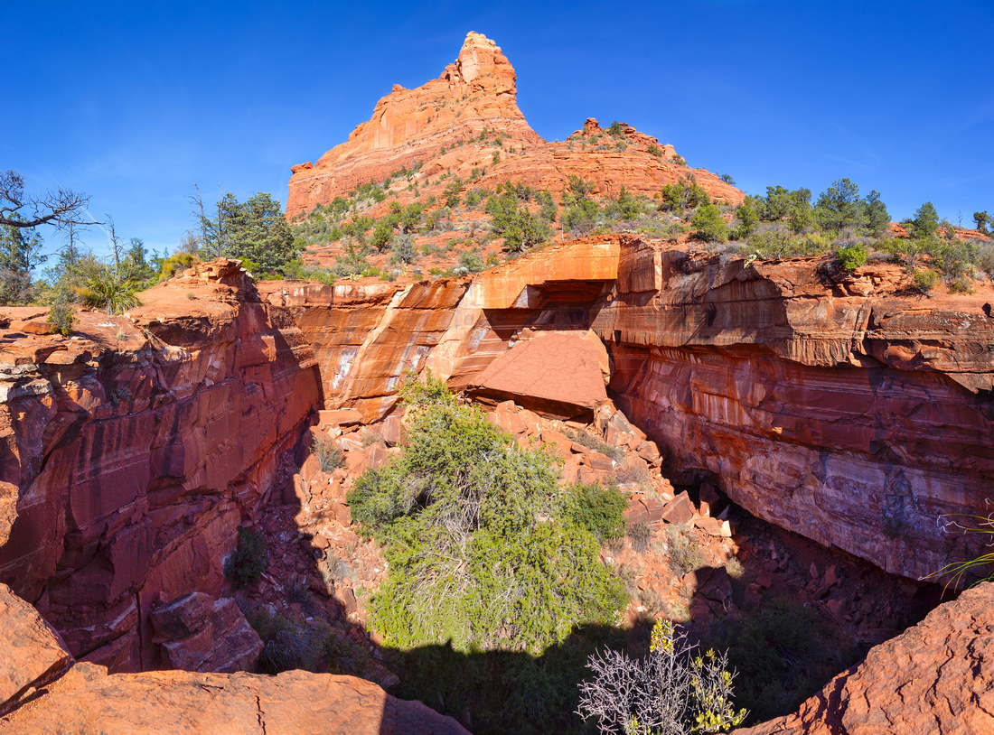 Devil's Kitchen
"Devil's Kitchen" natural Sinkhole, originally caved in 1880's with second collapse in 1989. Stay off the edge as fall would likely kill Devil's Kitchen
"Devil's Kitchen" natural Sinkhole, originally caved in 1880's with second collapse in 1989. Stay off the edge as fall would likely kill |
|||
 |
|||
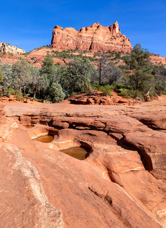
|
Seven Sacred Pools - shallow fissures filled with water considered Holy Place by Natives. Morning Glory Spire behind |
|||
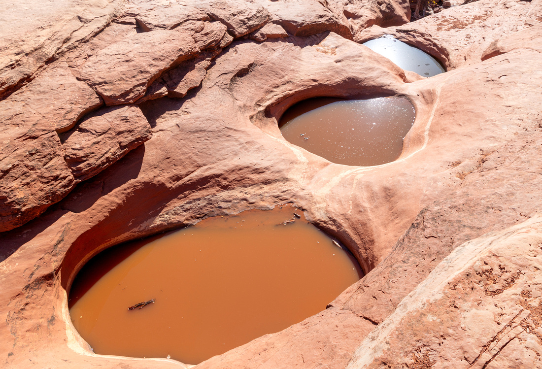 Seven Sacred Pools
 close-up, early December shot. Optimal time is in Spring when water is usually blue and higher Seven Sacred Pools
Seven Sacred Pools close-up, early December shot. Optimal time is in Spring when water is usually blue and higher |
|||
 Soldier Cave
, Natural Sandstone Rock Formation - optional side trip from Soldier Pass trail. Soldier Cave
Soldier Cave, Natural Sandstone Rock Formation - optional side trip from Soldier Pass trail. |
|||
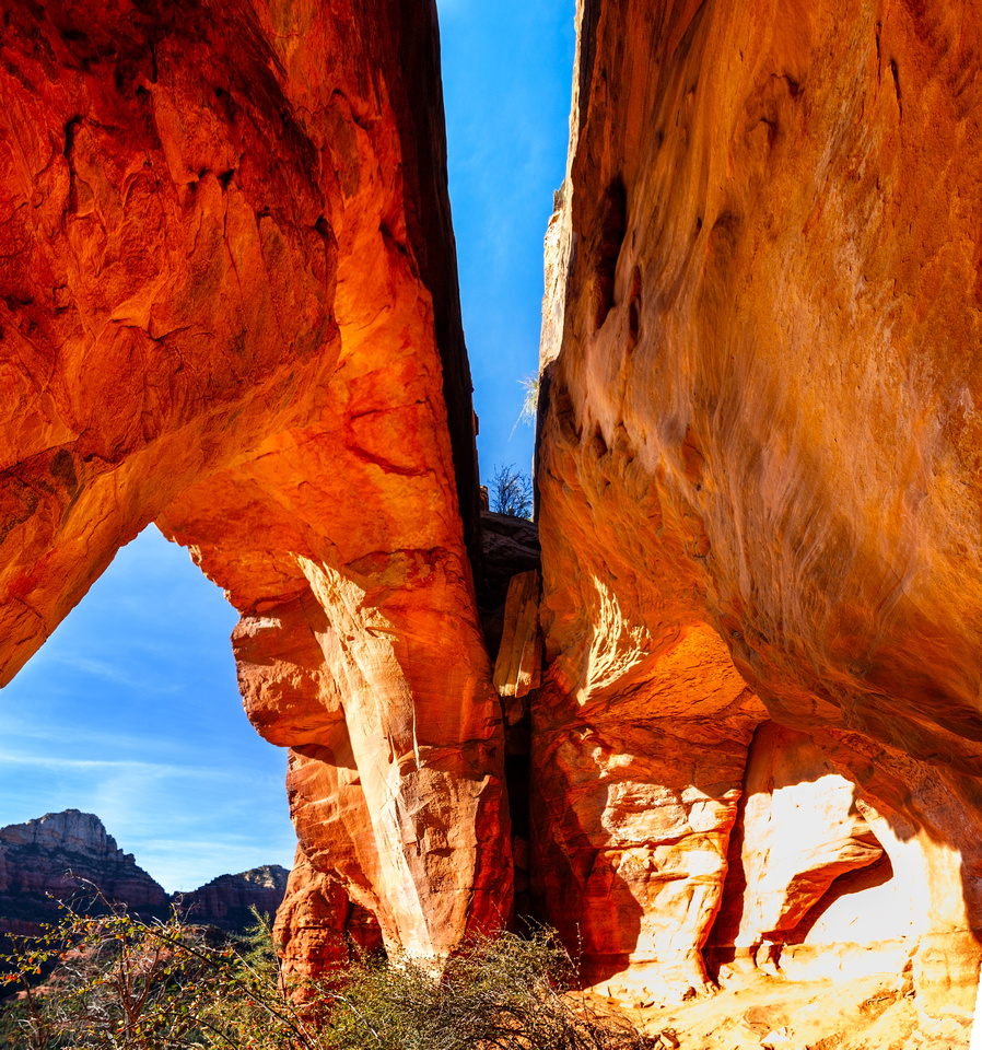
 Soldier Cave
Inside Soldier Cave. Please treat this fragile place with respect and do not clamber up ledges or scar with graffiti Soldier Cave
Inside Soldier Cave. Please treat this fragile place with respect and do not clamber up ledges or scar with graffiti |
|||
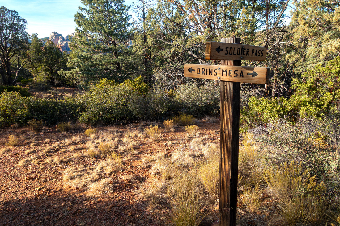 Soldier Pass Junction
Soldier Pass - Brins Mesa trail junction on Brins Plateau. West side of Brins Trail ends at Dry Creek Road Soldier Pass Junction
Soldier Pass - Brins Mesa trail junction on Brins Plateau. West side of Brins Trail ends at Dry Creek Road |
|||
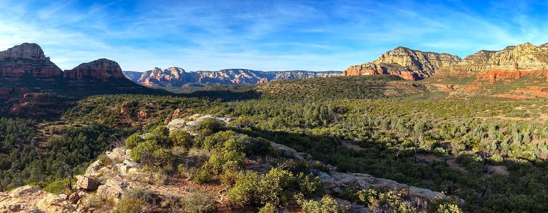
 Brins Pano
Brins Mesa pano from rock outcrop in middle of Plateau. Similar to lead photo but taken at different time Brins Pano
Brins Mesa pano from rock outcrop in middle of Plateau. Similar to lead photo but taken at different time |
|||
 Brins Pano
Westerly Panorama from Brins Mesa Rock Outcrop. Soldier Pass in shade center left Brins Pano
Westerly Panorama from Brins Mesa Rock Outcrop. Soldier Pass in shade center left |
|||
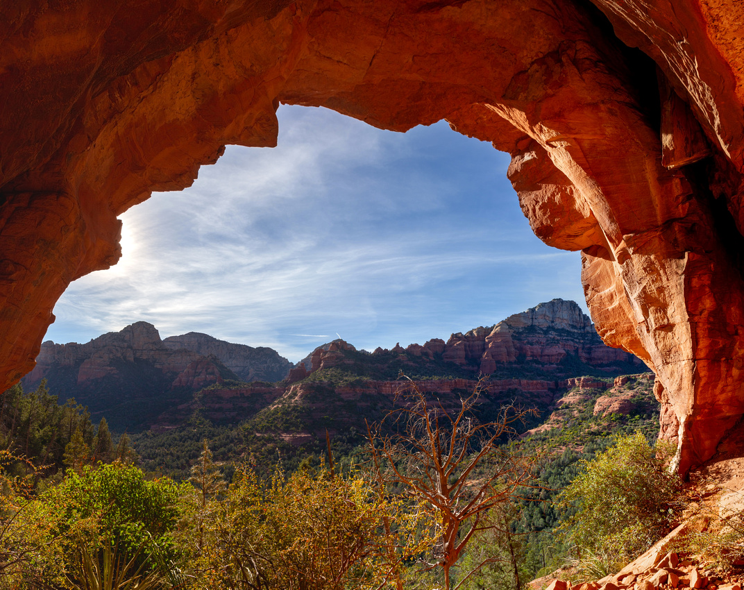
 Brins Caves
Interesting Caves in Rock wall at north side of Brins Mesa. Mt. Wilson Plateau in the background upper center left Brins Caves
Interesting Caves in Rock wall at north side of Brins Mesa. Mt. Wilson Plateau in the background upper center left |
|||
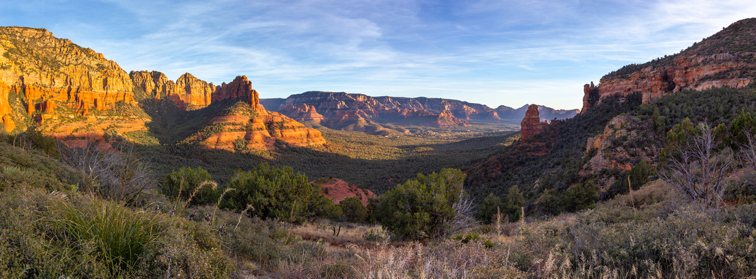 Brins Col Panorama
Panorama East from East end of Brins Plateau. Trail drops losing ~200m vertical back to Jordan Parking Brins Col Panorama
Panorama East from East end of Brins Plateau. Trail drops losing ~200m vertical back to Jordan Parking |
|||
 The Fin
Stunning Rock Formation called "The Fin" lit by late afternoon sun from Brins East end. The Mitten center behind The Fin
Stunning Rock Formation called "The Fin" lit by late afternoon sun from Brins East end. The Mitten center behind |
Abstract
| Overall Difficulty | D3 | Some moderate steep and rocky sections. Easy scrambling on final Soldier Cave approach (optional) | |||
| Scenery | Sedona Red Rocks, Devil's Kitchen Sinkhole, Seven Sacred Pools, Soldier Cave and vast Brins Mesa Plateau | ||||
| Trail/Marking | Excellent | Well defined trail with marked junction and trail maps | |||
| Suggested Time | 5 hrs | Easy to moderate pace, Including Soldier Cave side trip | |||
| Elevation | Start: 1385m Max: 1550m Total: ~420m | Round Trip: 9km (incl. Soldier Cave) | |||
| Gear | Full Hikers or Day Hikers. Hiking Pole Helpful | ||||
| Water | No reliable source. Carry 1L or more, depending on season | ||||
| Dog Friendly | Yes | Busy area - keep control of the pet for courtesy to other hikers | |||
 Brins Mesa - Solder Pass GAIA Map
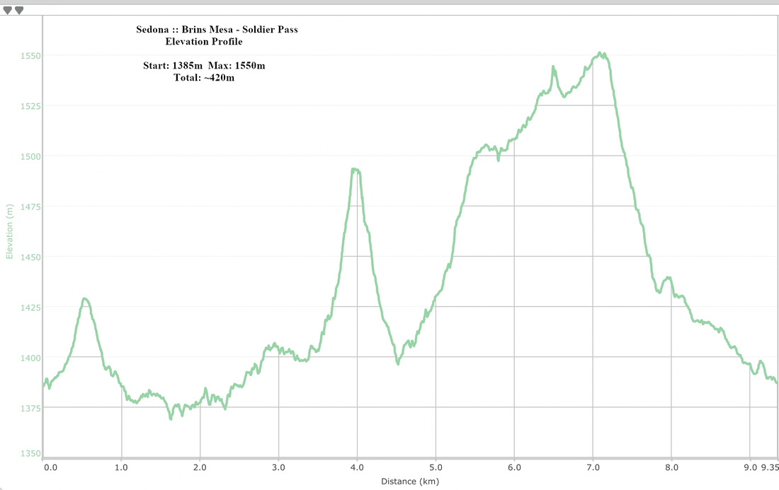 Brins Mesa - Solder Pass Elevation Profile