Google Map |
USA :: Sedona :: Airport Loop |
GPS Track |
|
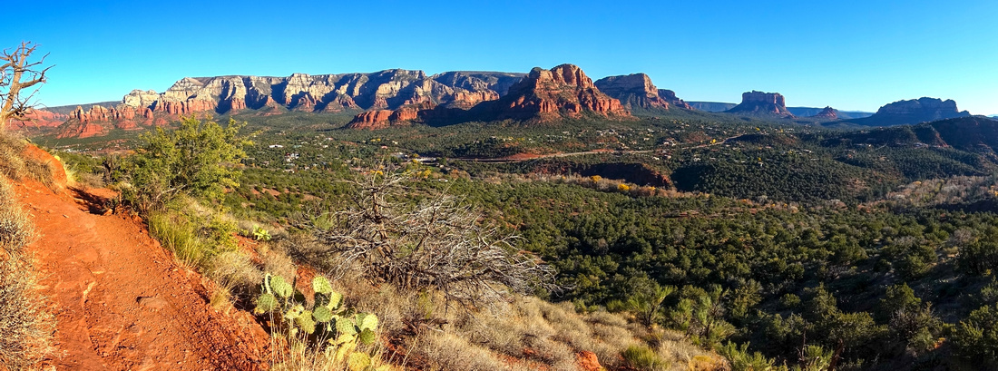
Table Top Panorama at Sunset. L-R: Lee Mountain, Courthouse Butte, Bell Rock, Seven Warriors and Cathedral Rock |
|||
| Trip Summary | |||
Dec 6, 2023
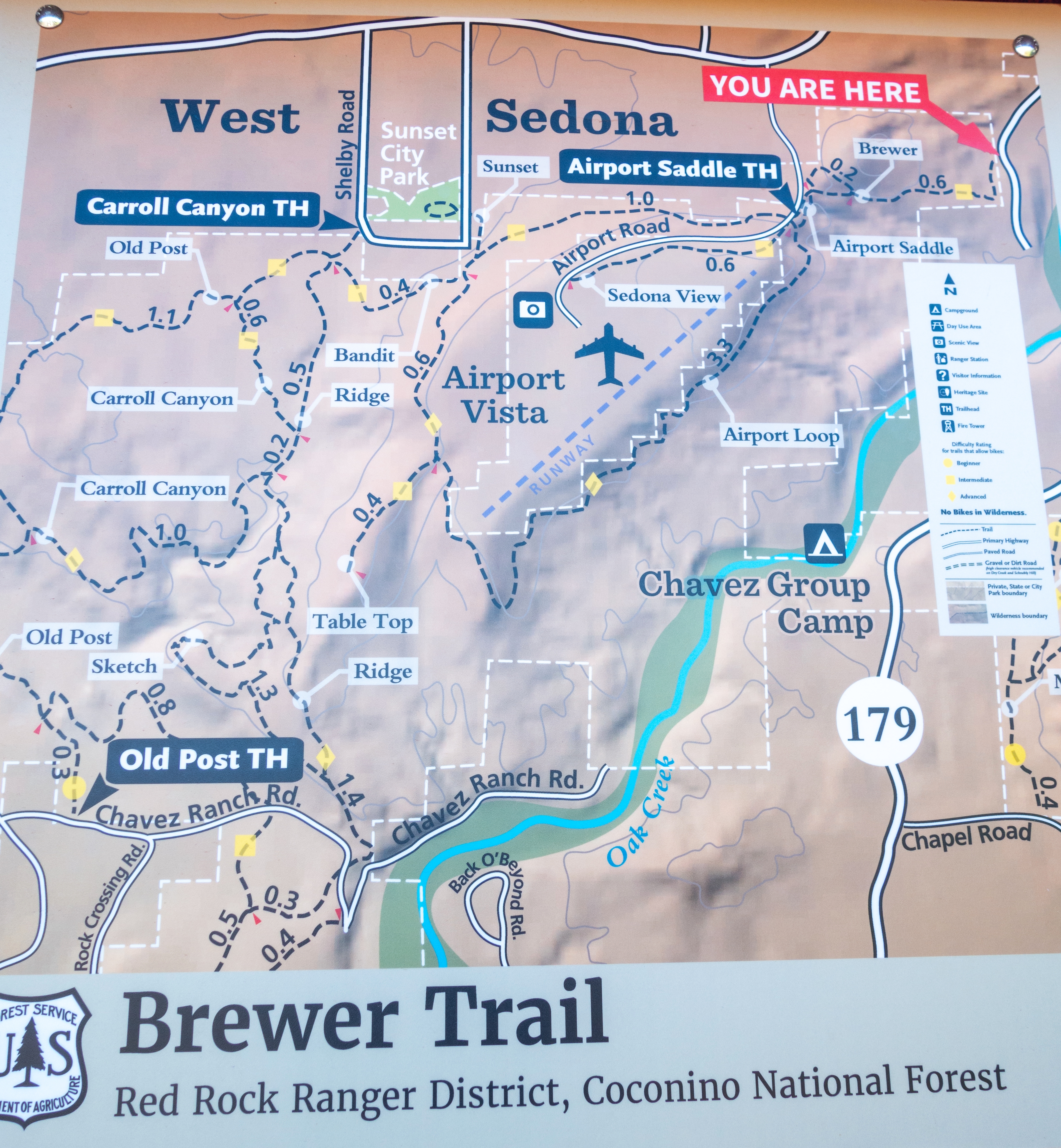
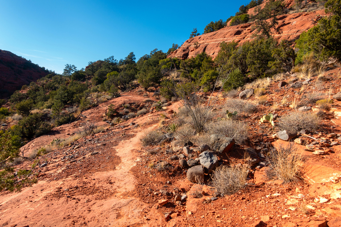
Airport Loop is one of best known Sedona Trails. Trail circling around Airport Mesa offers 360 Panoramic views of entire Valley and is suitable for most people fitness levels. Main problem is skimpy Airport Road Parking which is almost always full. Alternative -as presented on this page- is start from Brewer Road with plenty of space at Wesleyan Church, or even at Brewer Trailhead pullout. Brewer Trail is about 1km long rising somewhat steeply then levels out and traverses some open slickrock with great easterly panoramic views. There is option to do quick Coconino Butte loop just before the End.
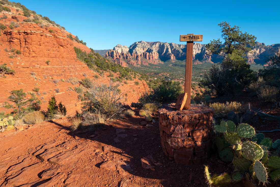
Loop trail starts just below "Sedona View" - open rock butte directly above Airport Road - and can be done in either CW or CCW direction. East side falls in shade earlier in the day, but otherwise there is no special advantage either way. You are likely to lose crowds soon after starting up the trail. Regardless, I recommend "Table Top" extension on south side, specially if you time to be there around Sunset. Junction is marked and it will take ~10min 1-way to fabulous viewpoint (lead photo on this page, also see Gallery). Stats in Abstract are given for both Brewer/Table Top extensions. |
|
Gallery |
|||
 |
|||
|
|
|||
|
|
|||
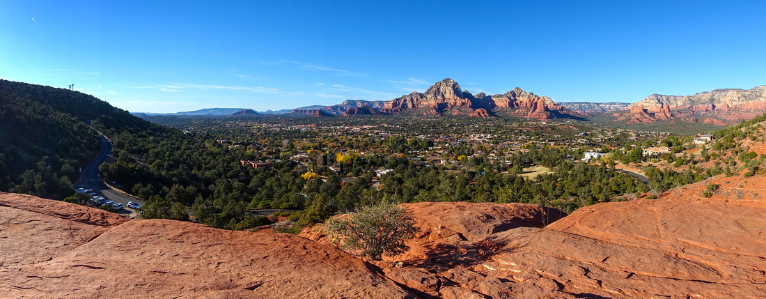 Sedona View Sedona View Westerly Panorama from "Sedona View" - Slickrock Butte directly above Airport Road. Almost always full skimpy parking lower center left
 |
|||
|
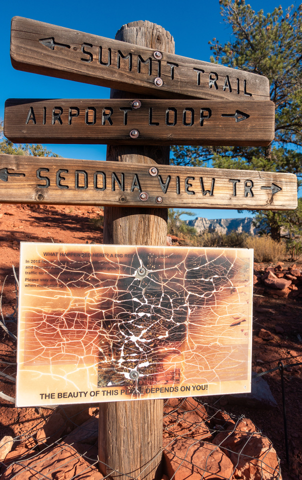
Vandalized Trail Sign just below Sedona View |
|||
 |
|||
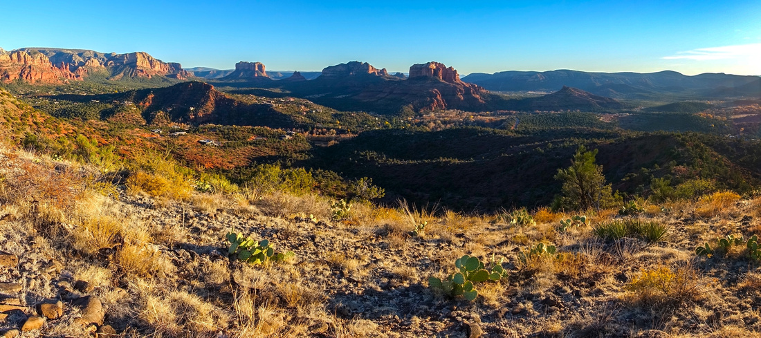
 East Side Panorama
Munds Wilderness Peaks above Hwy 179 corridor from Airport Loop East Side East Side Panorama
Munds Wilderness Peaks above Hwy 179 corridor from Airport Loop East Side |
|||
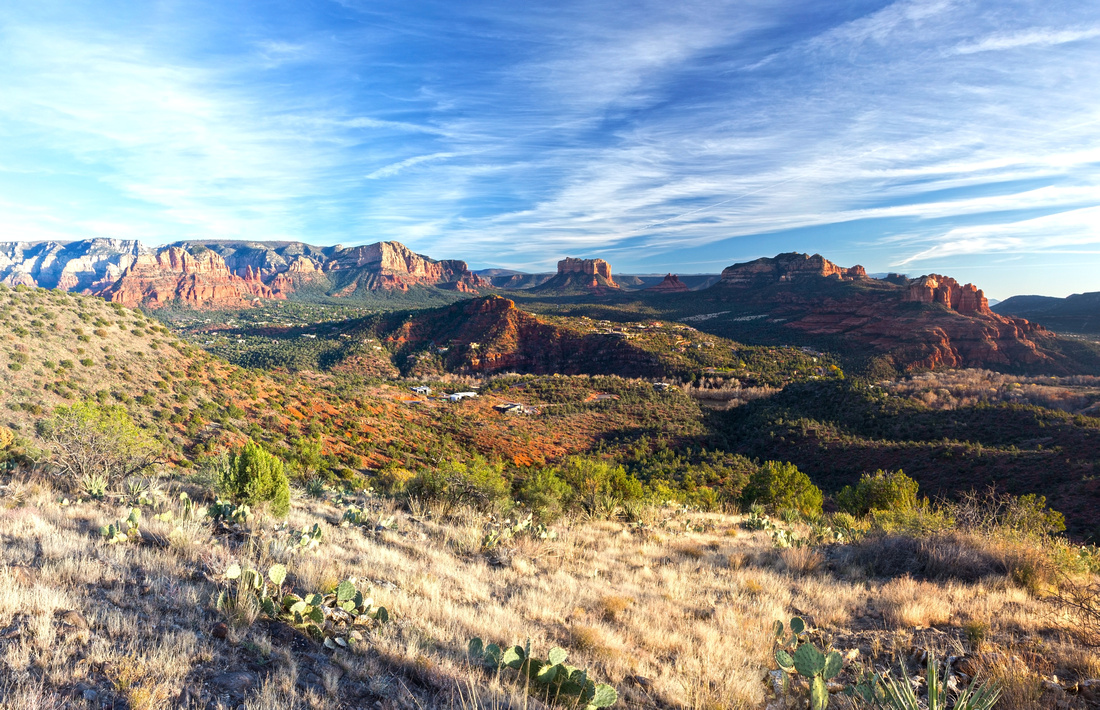 Table Top Panorama
Panoramic view south from Table Top extension. Courthouse Butte and Bell Rock distant center Table Top Panorama
Panoramic view south from Table Top extension. Courthouse Butte and Bell Rock distant center |
|||
 West Side View
Closing the loop on west side with view towards Chimney Rock/Sugarloaf/Brins Mesa - Soldier Pass area West Side View
Closing the loop on west side with view towards Chimney Rock/Sugarloaf/Brins Mesa - Soldier Pass area |
Abstract
| Overall Difficulty | D2 | Some rocky trail sections and open slickrock | |||
| Scenery | 360 Panorama of Sedona Valley | ||||
| Trail/Marking | Excellent | Well defined trail Maps and Signposts | |||
| Suggested Time | 4 hrs | Brewer Road start with Table Top extension. Less than 3 hours for the loop only | |||
| Elevation | Start: 1290m Max: 1455m Total: ~220m | Round Trip: 10km (Brewer Road + Table Top) | |||
| Gear | Light hikers are sufficient | ||||
| Water | No water source. Carry 1L or more depending on season | ||||
| Dog Friendly | Yes | Must be on leash. Please keep control of the pet for courtesy to other hikers | |||
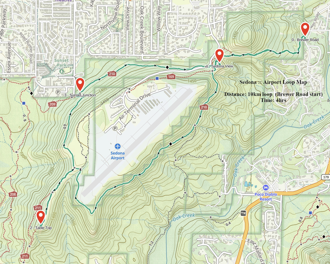 Airport Loop GAIA Map
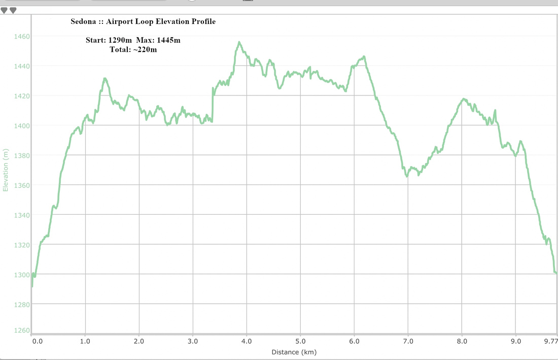 Airport Loop Elevation Profile