Google Map |
USA :: San Diego :: Mount Woodson |
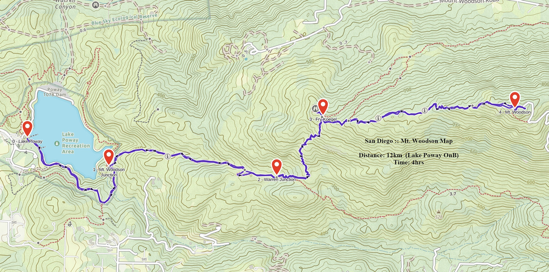
GPS Track |
|
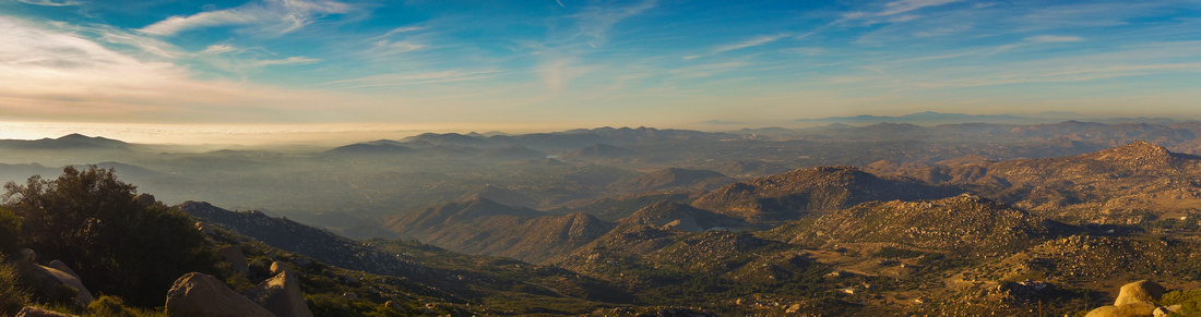
Panoramic View west across San Diego County near Woodson summit with coastal layer advancing over Pacific Ocean |
| Trip Summary | |||
Multiple Dates, last January 11, 2022
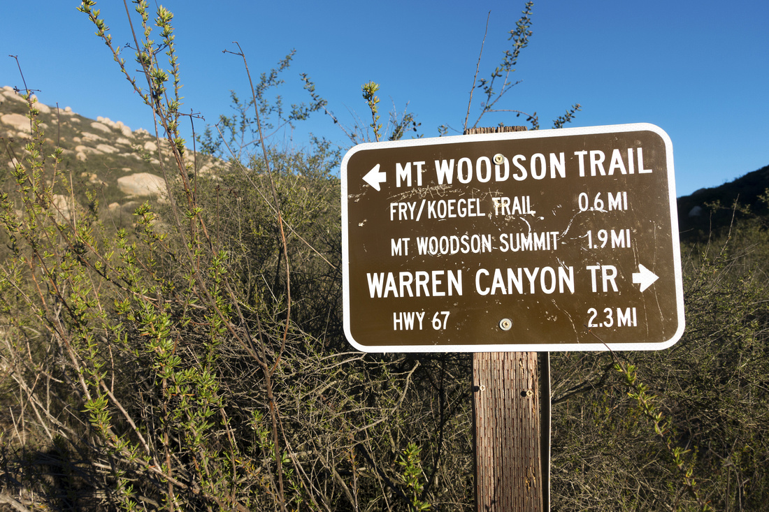
Mt. Woodson is probably most demanding Poway hike. 875m summit with forest of Telecom towers can be seen from many different points across North San Diego County. While living in San Diego and lacking Rockies fitness, I'd usually train on Woodson before Banff/Jasper summer sabbaticals. Well defined trail with marked junctions presents no routefinding problems, but has moderately steep sections and overall elevation gain that exceeds other nearby hikes. Usual start is from Lake Poway, but urban hikers - and trail runners - sometime ascend paved road from SR67 (Ramona Highway). My preference is longer, but more scenic approach starting from Blue Sky Preserve; it adds 3-4km (return) compared to Lake Poway start, but is way more scenic and less busy. Other access is via Fry Koegel trail starting from Mt. Woodson Golf Club right next to Archie Moore Road; this trail intercepts standard trail at summit ridge 1.5km before top (junction waypoint on GPS track).
Woodson summit trail splits off Lake Poway shoreline trail on east side; junction is marked, 25-30min from Lake parking lot or 45min to an hour from Blue Sky Preserve. Moderately steep but wide trail ascends south side of wide gully to plateau above where Warren Canyon trail splits to the right. There are trail markers every 0.5mile (~800m). From Warren junction trail switchbacks up stone staircase to ridge above and Fry Koegel Junction; this is the most demanding part of the ascent. Grade then moderates and sweeping views open up. Trail undulates up bolder strewn summit ridge for another 25-30min to the summit. Mt. Woodson trail is also sometimes called "Potato Chip Rock Trail" thanks to rather unusual broken rock feature at the top. Hordes of Urban Hikers litter this spot for Instagram shots which makes this otherwise fascinating spot rather comical. Solitude with sweeping views can be found at rock outcrops behind Telecom towers or by straying off the ridge below the summit.
Note that Lake Poway gate gets locked after hours; in winter this is 5pm. Blue Sky Preserve trailhead on Espola Road also gets locked. This rather unnecessary practice complicates matter if you'd like to enjoy sunset. In that case parking possibilities exist along Espola road residential; exact situation changes with time and I can't post any specifics - be prepared for some creativity. Also note that City of Poway charges $10 USD non-resident fee for entering/ parking at the Lake; Blue Sky parking lot is still free as of January `22.
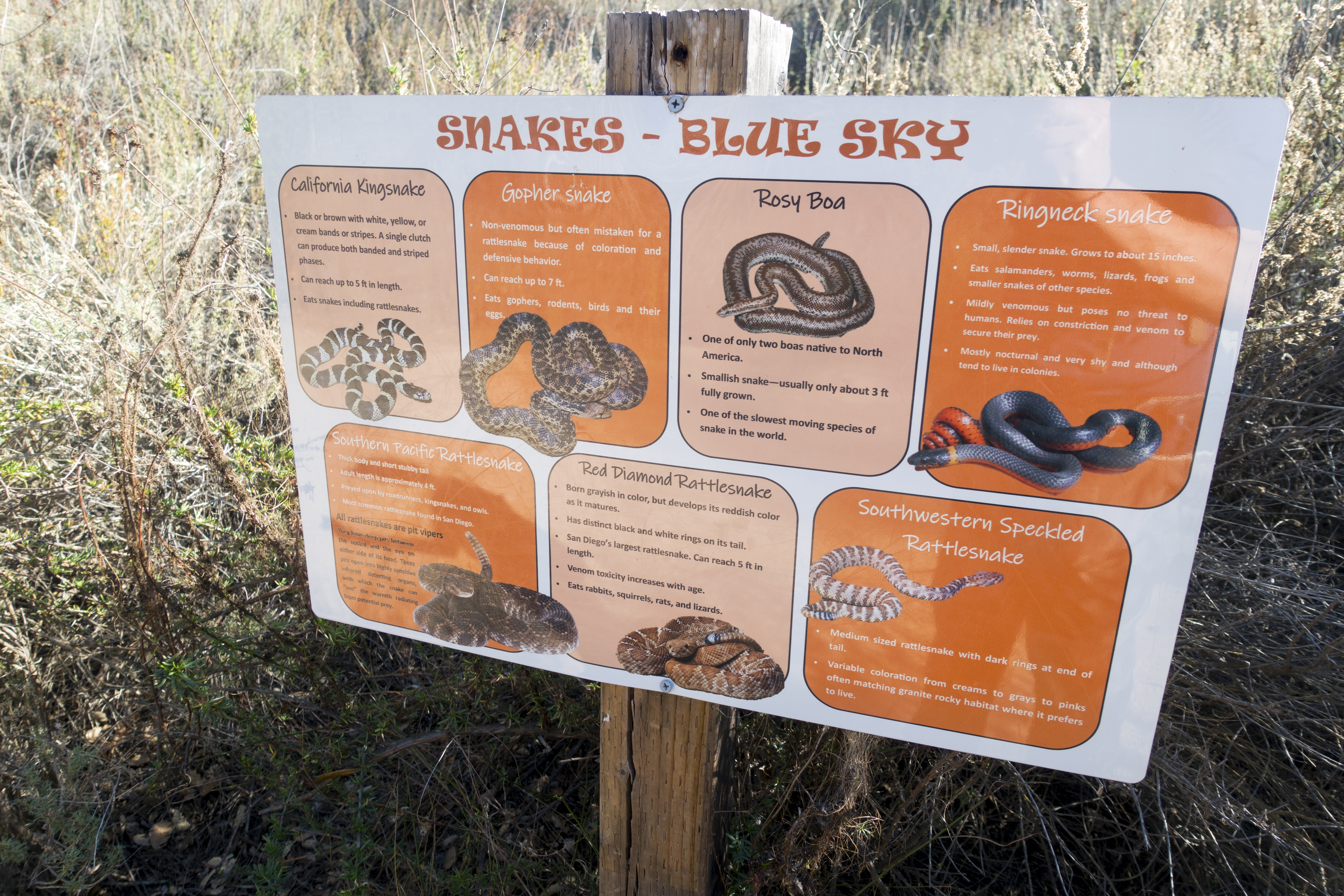
Caution: On my hike in January '22, some 15 min below the summit I ran across large orange wasp crawling across the trail. I am still not sure what it was; it looked exactly like giant orange Asian hornet, but Internet research later on revealed that many hikers confused Cicada Killer Wasps for Hornets in previous year. I don't have a photo as I got freaked out thinking about possible nest - but it looked much more like a Hornet than Cicada! Beast stopped alerted by my presence. I stepped back and after few minutes it continued its path eventually freeing the trail. Whatever it was - be careful, regardless where you hike and be aware of your surroundings.
|
|
Gallery |
|||
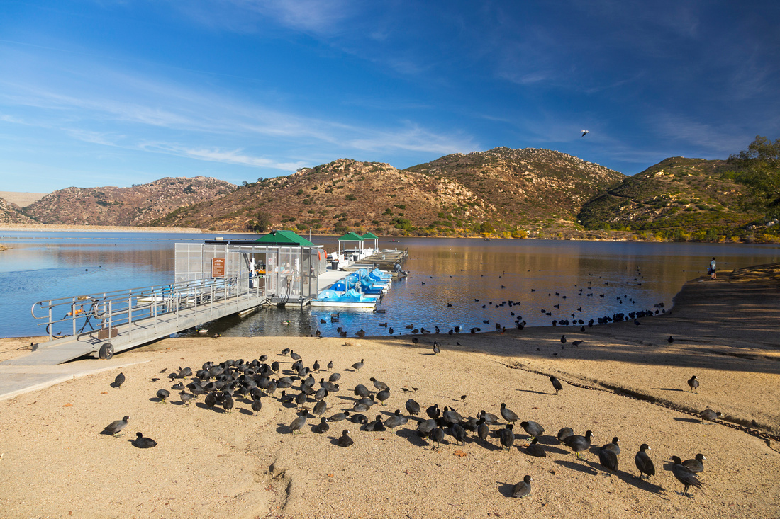 Lake Poway Lake Poway Colony of American Coot Black Ducks at Beach by Lake Poway boat launch. This is the usual trailhead
 |
|||
 Save the Environment
If only more hikers would follow these instructions. Table at alternate approach via Blue Sky Preserve Save the Environment
If only more hikers would follow these instructions. Table at alternate approach via Blue Sky Preserve |
|||
 |
|||
 Poway Dam Panorama
Panoramic view west from Lake Poway Trail with Dam on left side (alternate Blue Sky approach) Poway Dam Panorama
Panoramic view west from Lake Poway Trail with Dam on left side (alternate Blue Sky approach) |
|||
 Poway Gazebo
Lovely Viewpoint / Picnic area along Lake Poway trail near Mt. Woodson junction Poway Gazebo
Lovely Viewpoint / Picnic area along Lake Poway trail near Mt. Woodson junction |
|||
 Warren Junction
Warren Canyon Junction Table ~1.5km from Lake Poway trail and start of steep ascent up stone staircase to Mt. Woodson Ridge Warren Junction
Warren Canyon Junction Table ~1.5km from Lake Poway trail and start of steep ascent up stone staircase to Mt. Woodson Ridge |
|||
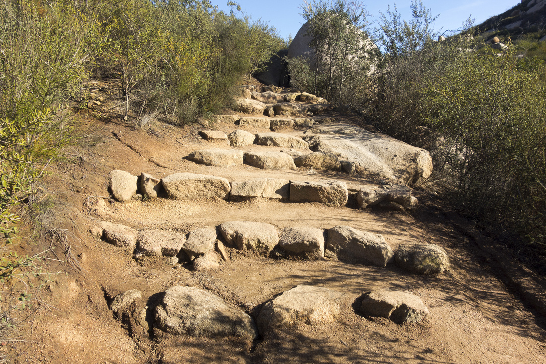 Stone Staircase
Typical section up Stone Staircase between Warren and Fry Koegel junctions Stone Staircase
Typical section up Stone Staircase between Warren and Fry Koegel junctions |
|||
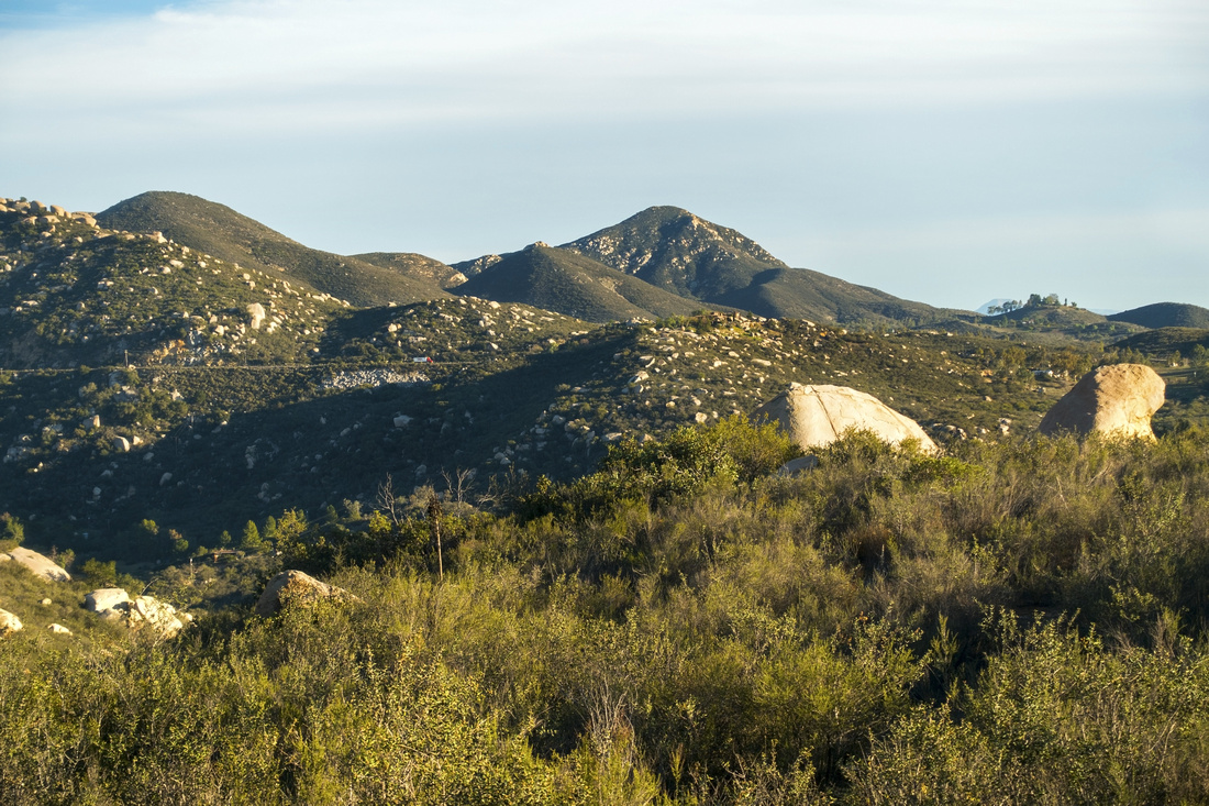 Iron Mountain
Southerly views towards Iron Mountain (center). Ramona Highway SR67 center left Iron Mountain
Southerly views towards Iron Mountain (center). Ramona Highway SR67 center left |
|||
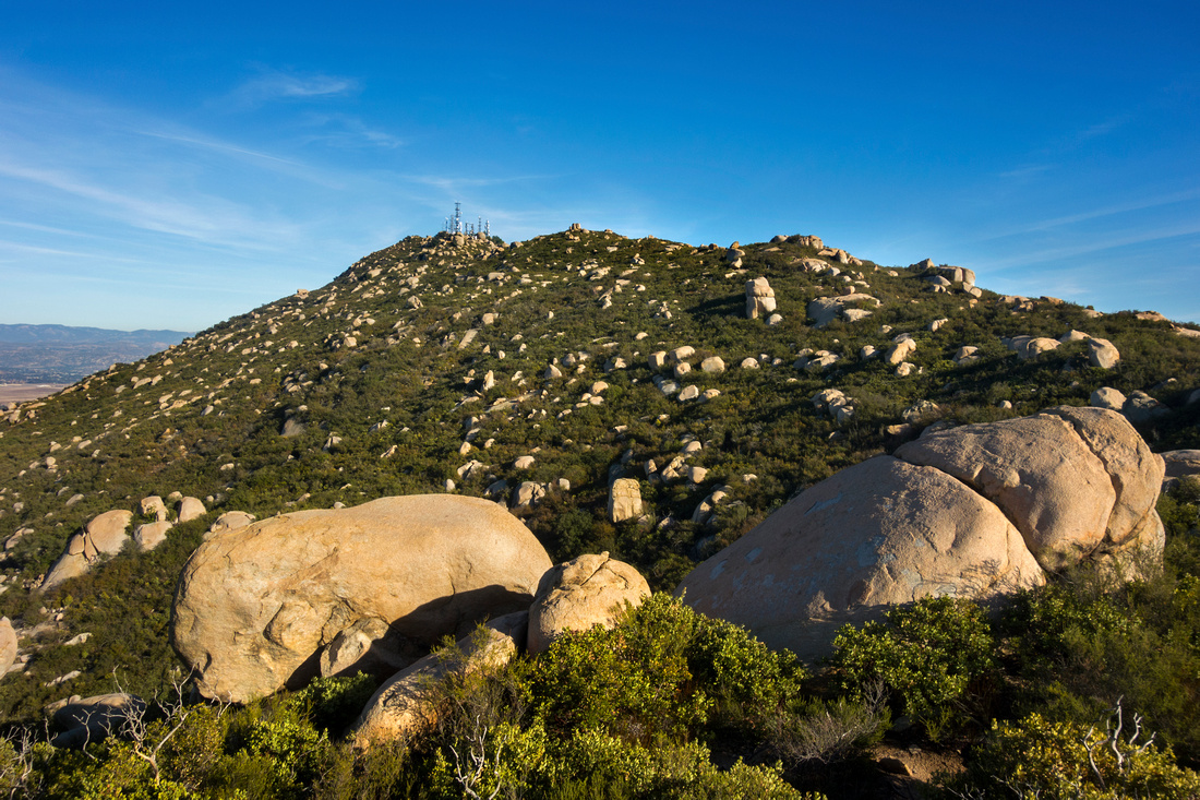 Woodson Ridge
Final part of ascent above Fry Koegel junction follows skyline ridge through rock outcrops to Telecom towers ~30min away Woodson Ridge
Final part of ascent above Fry Koegel junction follows skyline ridge through rock outcrops to Telecom towers ~30min away |
|||
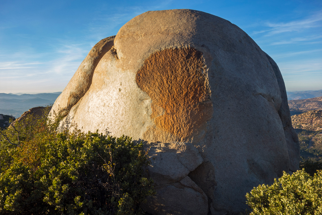 Painted Rock
One of several impressive Rock Boulders along the way on upper Ridge Painted Rock
One of several impressive Rock Boulders along the way on upper Ridge |
|||
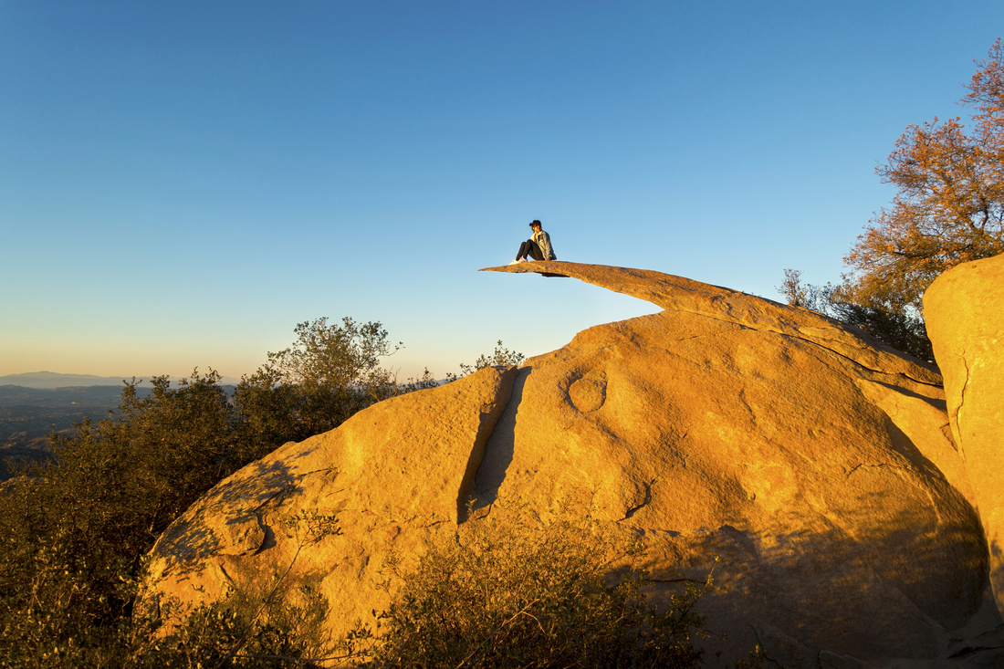 Instagram Crazy
Urban Hikers, usually coming via paved road from SR67 on east side, clamber Potato Chip Rock posing for Instagram shots Instagram Crazy
Urban Hikers, usually coming via paved road from SR67 on east side, clamber Potato Chip Rock posing for Instagram shots |
|||
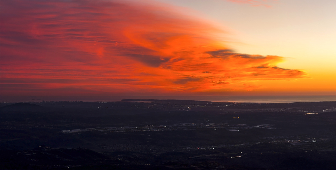 Pacific Sunset
Dramatic Orange Colored Sunset Sky over Pacific Skyline from Woodson Summit Pacific Sunset
Dramatic Orange Colored Sunset Sky over Pacific Skyline from Woodson Summit |
Abstract
| Overall Difficulty | D3 | Moderately steep sections with rocky steps. Cumulative distance and elevation exceed average Poway area hikes | |||
| Scenery | Sweeping Panorama of San Diego County and distant Pacific Ocean. Scenic Lake Hodges. Instagram crazy Potato Chip Rock | ||||
| Trail/Marking | Excellent | Well defined trail maintained by City of Poway with marked junctions | |||
| Suggested Time | 4-5 hrs | Start/end at Lake Poway. Add an hour for Blue Sky Preserve approach | |||
| Elevation | Start: 290m End: 875m Total: ~680m (Lake Poway OnB) | Round Trip: ~12km (Lake Poway OnB) | |||
| Gear | Day Hikers or Full Hiking Boots. Hiking pole helpful for stability descending steep bit below the ridge | ||||
| Water | Dry hike. Carry min 2L, more in summer heat (1 gallon recommended by Lake Poway Park) | ||||
| Dog Friendly | Yes | Dogs should be leashed as this is popular trail. Beware of rattlesnakes in season and keep control | |||
 Mt. Woodson GAIA Map
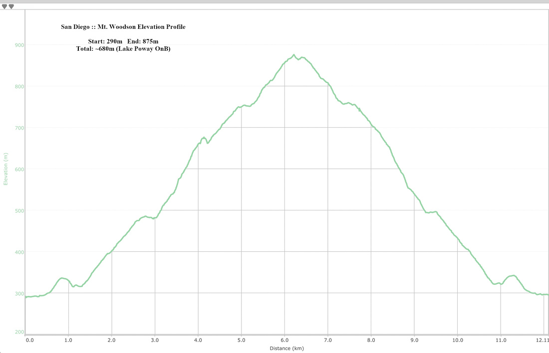 Mt. Woodson Elevation Profile