Google Map |
USA :: San Diego :: Iron Mountain |
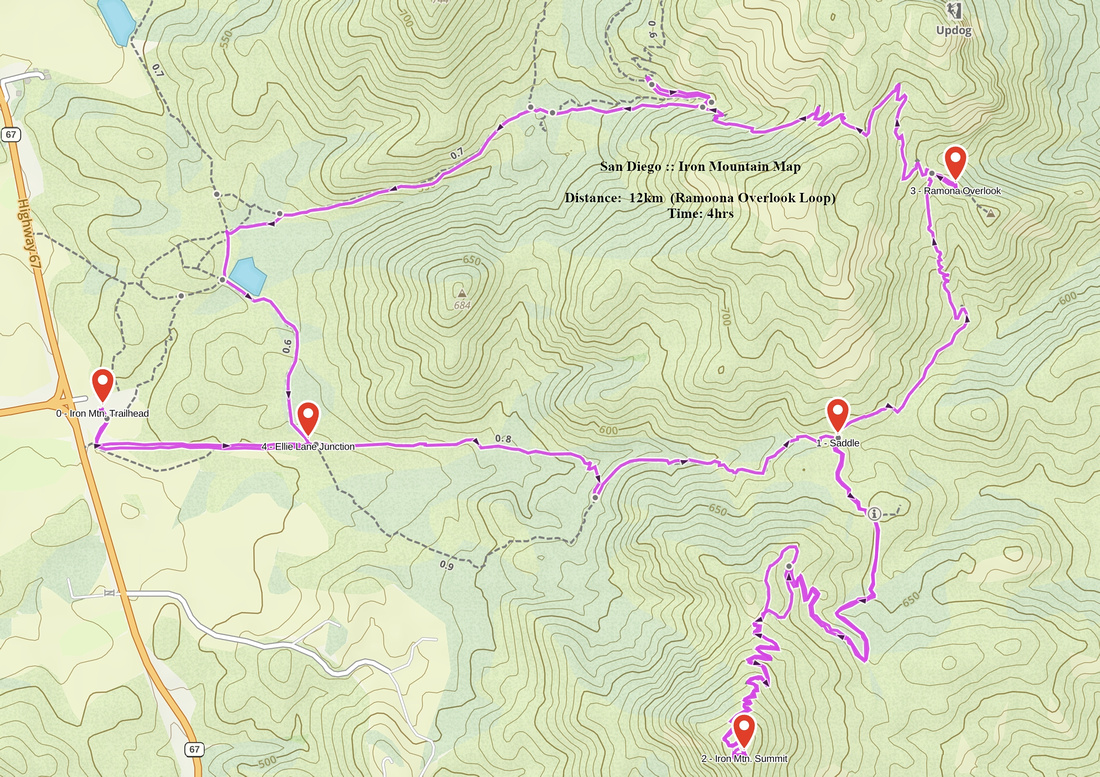
GPS Track |
|
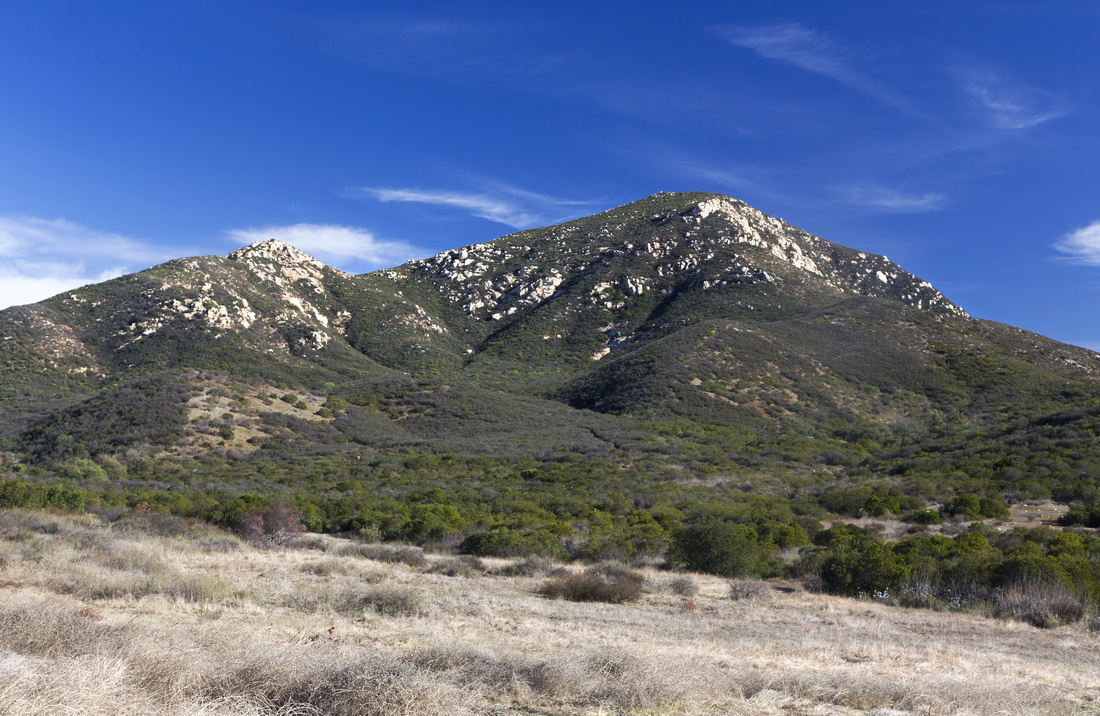
Classic View of Iron Mountain near the trailhead. Ascent follows Skyline ridge in upper part |
|||
| Trip Summary | |||
Multiple Dates, last January 4 2024
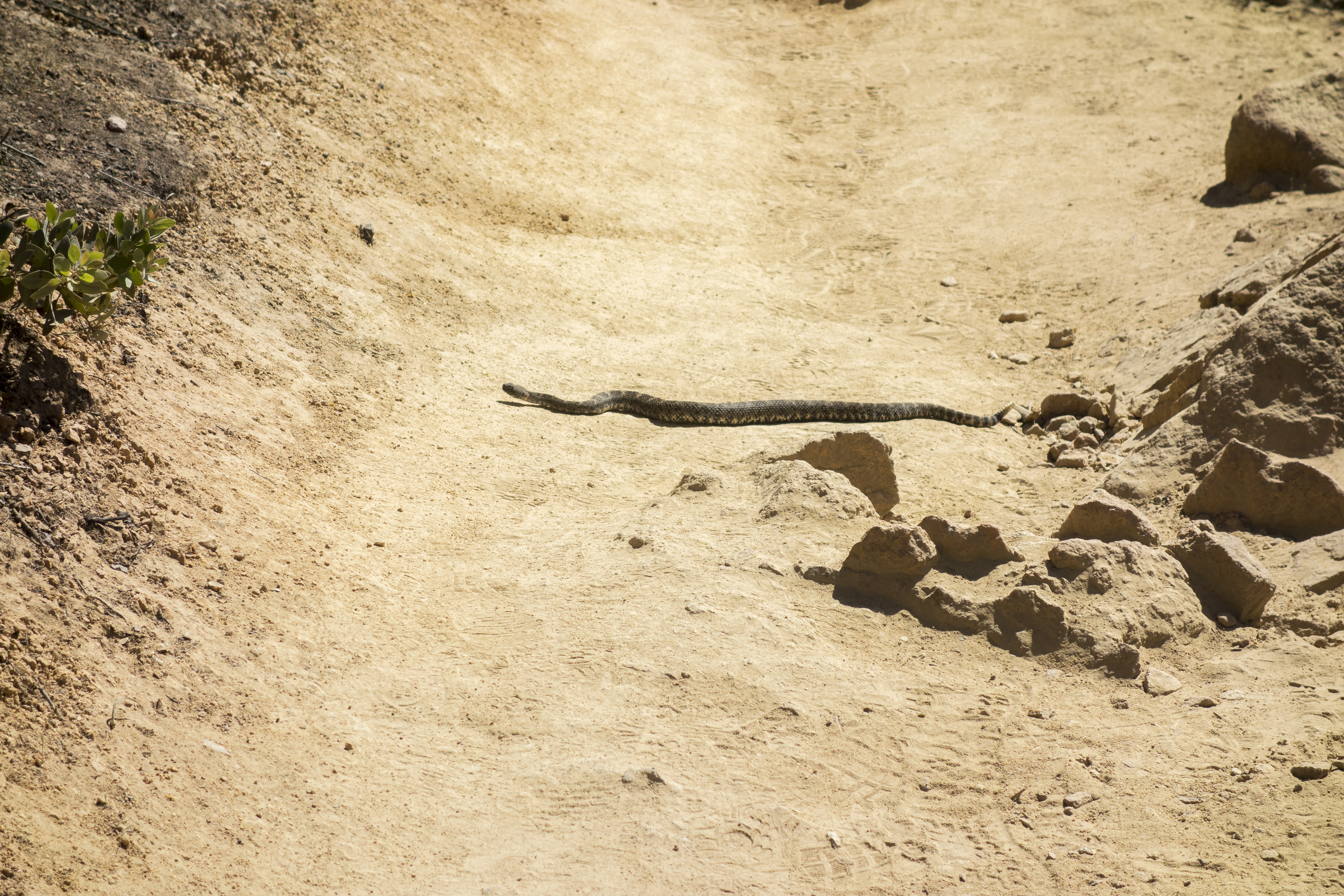
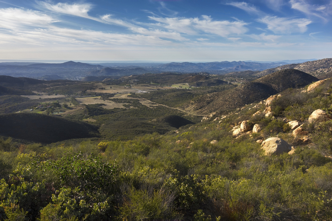
Iron Mountain is favorite Poway hike. I used to do it around the clock for US Thanksgiving when I lived in San Diego; it was tradition. It is not challenging by any stretch of imagination, but it does provide bit of different feel compared to 'beach hikes' or walks around Poway Lake or Lake Hodges. Optimal time is November - April, as temps can get quite high rest of the year. Views are simply fantastic and include sweeping panorama of Poway, distant Pacific Coastline and Cuyamaca Rancho Mountains to the east. There is no water source anywhere on trail, so take plenty specially in warmer months. Only objective hazard are rattlesnakes, but they tend to mind their own business unless provoked. Hike can be extended for loop return via Ramona Overlook and Ellie Lane staging area. Highly Recommended!
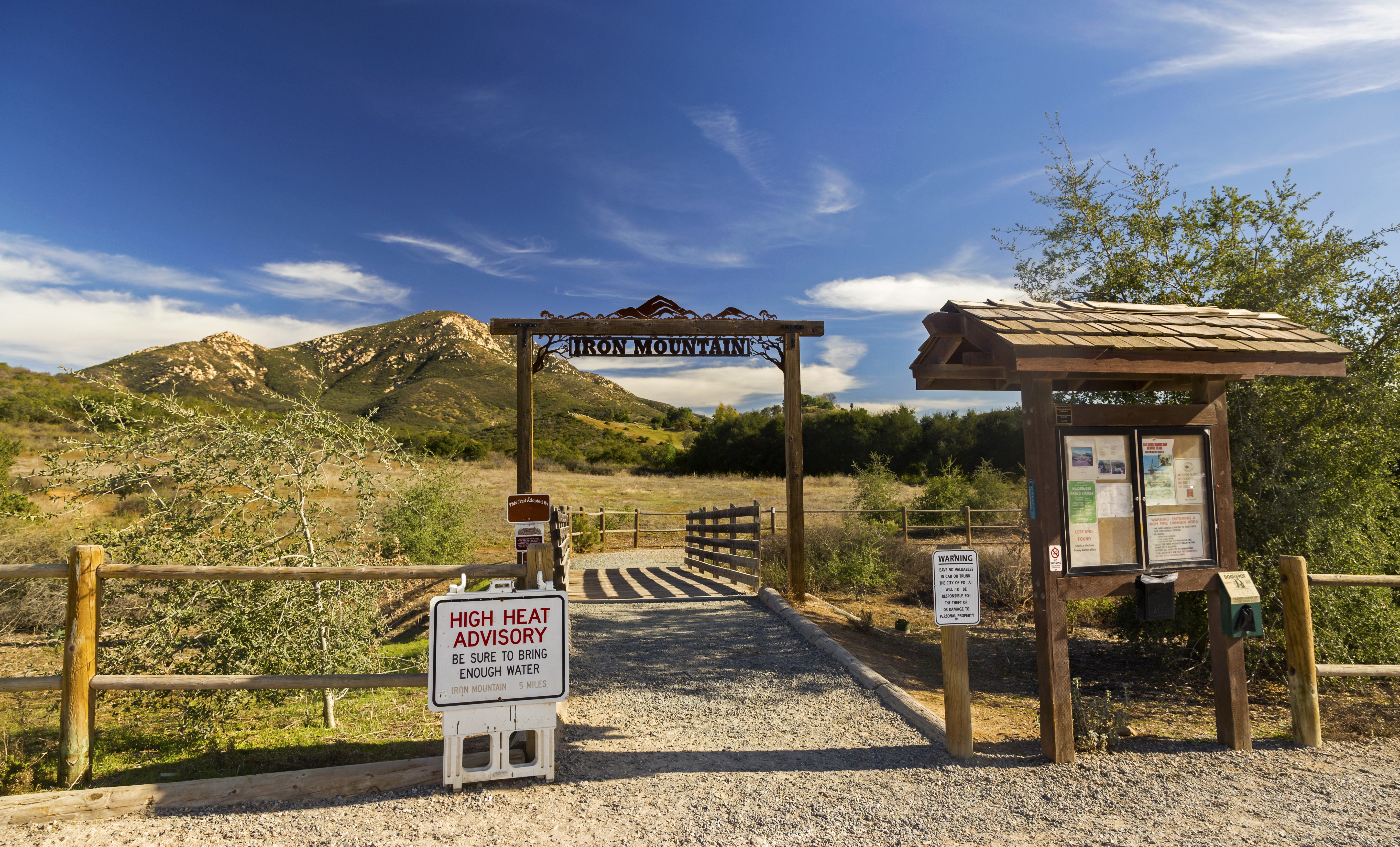
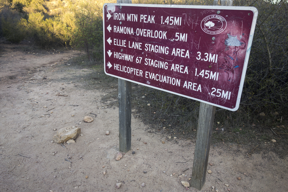
Parking lot is at junction of Poway Road and Highway 67 (Ramona Road). From trailhead kiosk wide and sometimes dusty trail heads east, flat for ~15 min, then ascends to obvious saddle and junction sometimes called 'Iron Mountain Base Camp'. Turn right and continue past the helipad up some unnecessarily wide switchbacks then intercept summit ridge visible from Highway and continue to the top - roughly 1:15 of moderate pace from parking. Picnic bench is usually busy, but solitude can be found by trashing a bit couple of boulders on south side. On descent back to 'base camp' junction, optional return is continuing north to Ramona Lookout then looping across Poway Crags down to Ellie Lane staging area. This extension is more rough with steeper trail and added elevation gain, but will provide additional viewpoints. Potentially confusing part is unmarked junction on descent from Poway Crags - see GPS Map (no waypoint, sorry) and correct way is left, not right. Eventually turn south by small lake and intersect main Iron Mtn. trail near the parking.
Update January 2022: I hiked up via Ellie Lane/Poway Crags/Ramona Lookout, and if you have enough time this longer alternative will provide great views and solitude. There is seasonal raptor breeding closure sign at Poway Crags (Dec 1 - July 31), but I believe it relates to side trails exploring nearby ridge. Main Iron summit now has "Peak Dial" - see gallery. |
|
Gallery |
|||
 |
|||
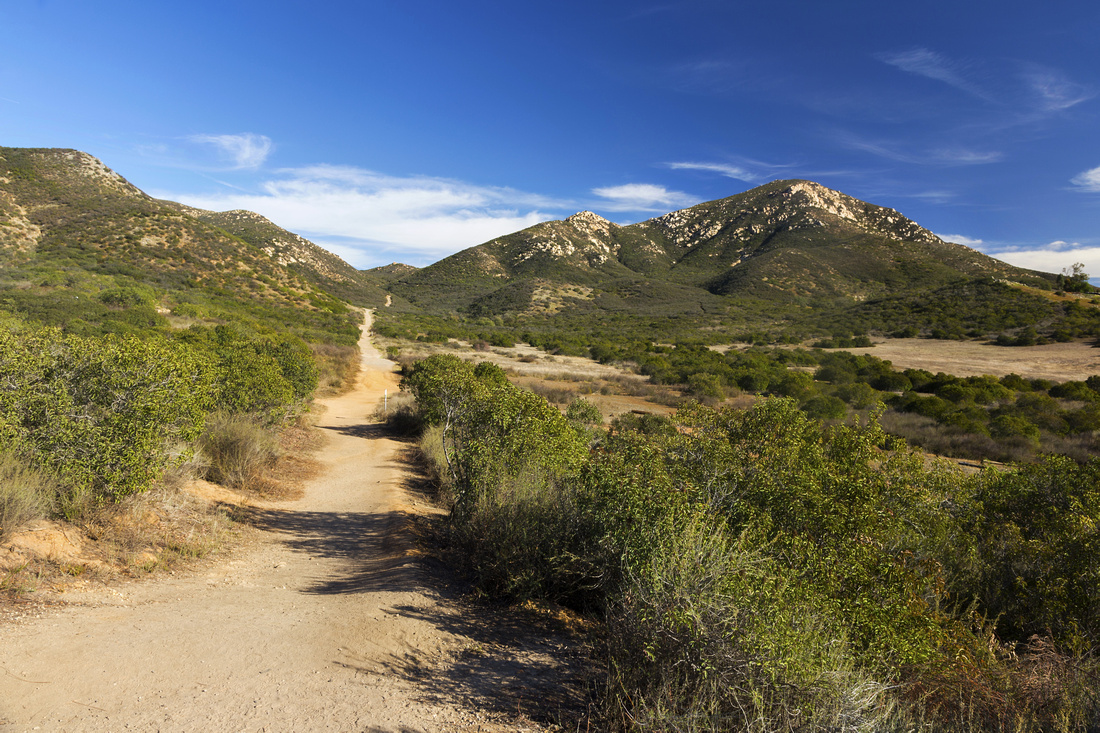 Iron Mountain Trail Iron Mountain Trail Initial flat section heading towards low saddle on horizon. Ellie Lane trail comes in here from left side (loop return via Ramona overlook)
 |
|||
 |
|||
 Ramona Overlook Junction
Ramona Overlook junction, 35-40min from parking. Keep right for Iron Mountain summit Ramona Overlook Junction
Ramona Overlook junction, 35-40min from parking. Keep right for Iron Mountain summit |
|||
 Distant Cuyamaca Mountains
Great views east towards Rancho Cuyamaca State Park as trail switchbacks towards summit ridge Distant Cuyamaca Mountains
Great views east towards Rancho Cuyamaca State Park as trail switchbacks towards summit ridge |
|||
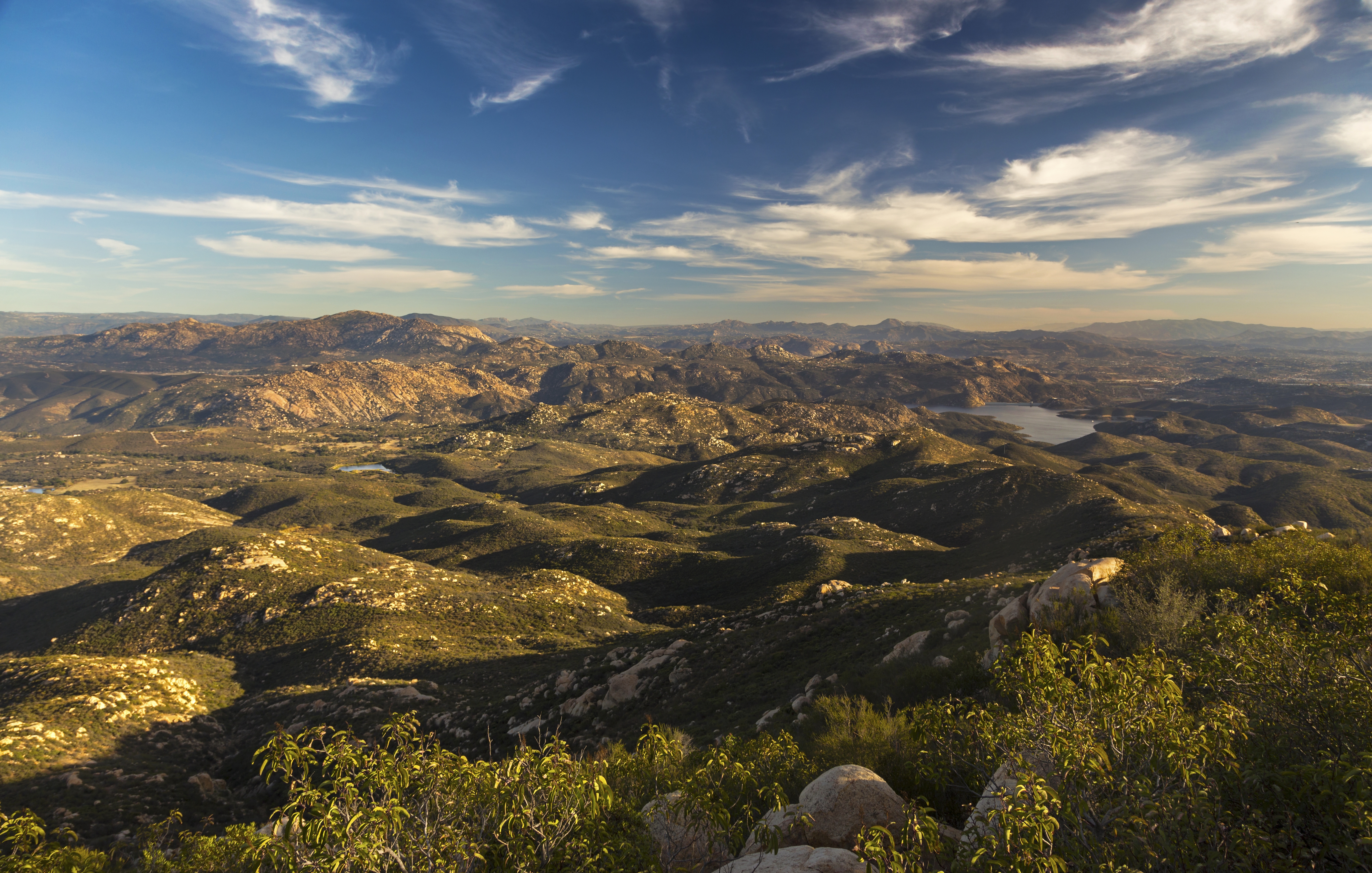
 San Diego County
Rolling Poway Hills with distant Pacific ocean on Horizon as trail starts final switchbacks. This is the best part and summit is 15-20 away San Diego County
Rolling Poway Hills with distant Pacific ocean on Horizon as trail starts final switchbacks. This is the best part and summit is 15-20 away |
|||
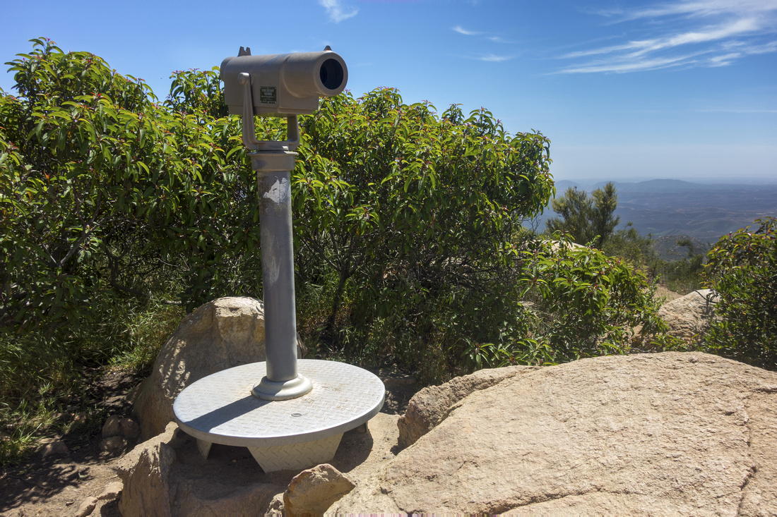 Summit Telescope
Iron Mountain Summit with Telescope that used to be free Summit Telescope
Iron Mountain Summit with Telescope that used to be free |
|||
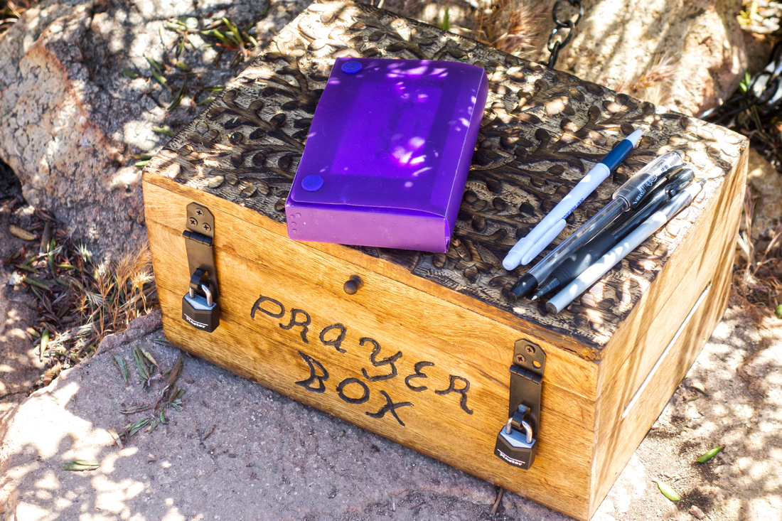 Summit Prayer Box
Southern California version of Summit Register Summit Prayer Box
Southern California version of Summit Register |
|||
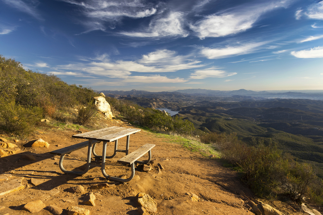 Summit Picnic Table
Picnic Table just below the summit looking south towards Mexico and Baja California Summit Picnic Table
Picnic Table just below the summit looking south towards Mexico and Baja California |
|||
 |
|||
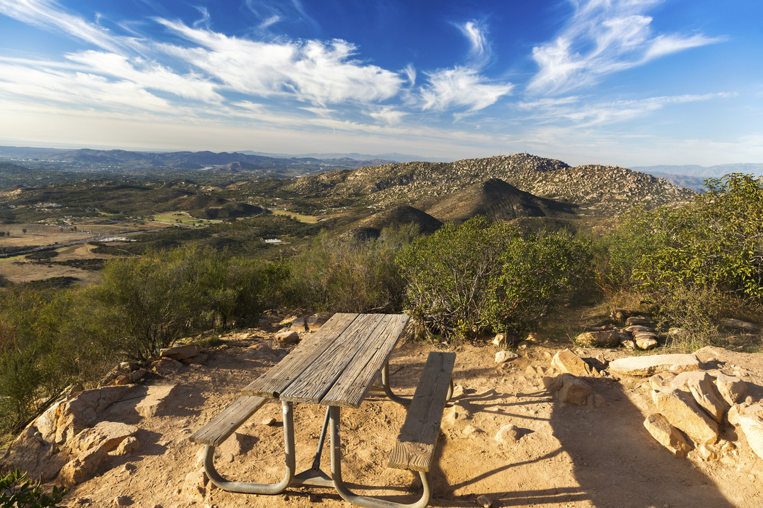 Summit Picnic Bench
View north towards Mount Woodson from Iron Summit. Distant Lake Hodges upper center left Summit Picnic Bench
View north towards Mount Woodson from Iron Summit. Distant Lake Hodges upper center left |
|||
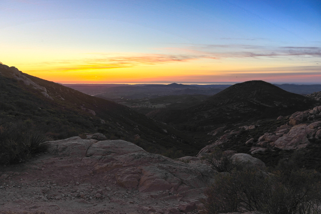 Pacific Sunset
Sunset Sky from loop descent via Ramona Overlook and Poway Crags. Keep left at unmarked junction lower down Pacific Sunset
Sunset Sky from loop descent via Ramona Overlook and Poway Crags. Keep left at unmarked junction lower down |
|||
 Ellie Tarn
Jan '22 Trip: Lake at Ellie Lane/Wild Horse trail junction. Poway Crags trail can be seen mid-center right Ellie Tarn
Jan '22 Trip: Lake at Ellie Lane/Wild Horse trail junction. Poway Crags trail can be seen mid-center right |
|||
 Canyon Views
Jan '22 Trip: View down to Ellie Lane from top of ascent canyon near Poway Crags Canyon Views
Jan '22 Trip: View down to Ellie Lane from top of ascent canyon near Poway Crags |
|||
 Raptor Closure Sign
Jan '22 Trip: Seasonal Raptor Breeding Closure Sign at Poway Crags Raptor Closure Sign
Jan '22 Trip: Seasonal Raptor Breeding Closure Sign at Poway Crags |
|||
 |
|||
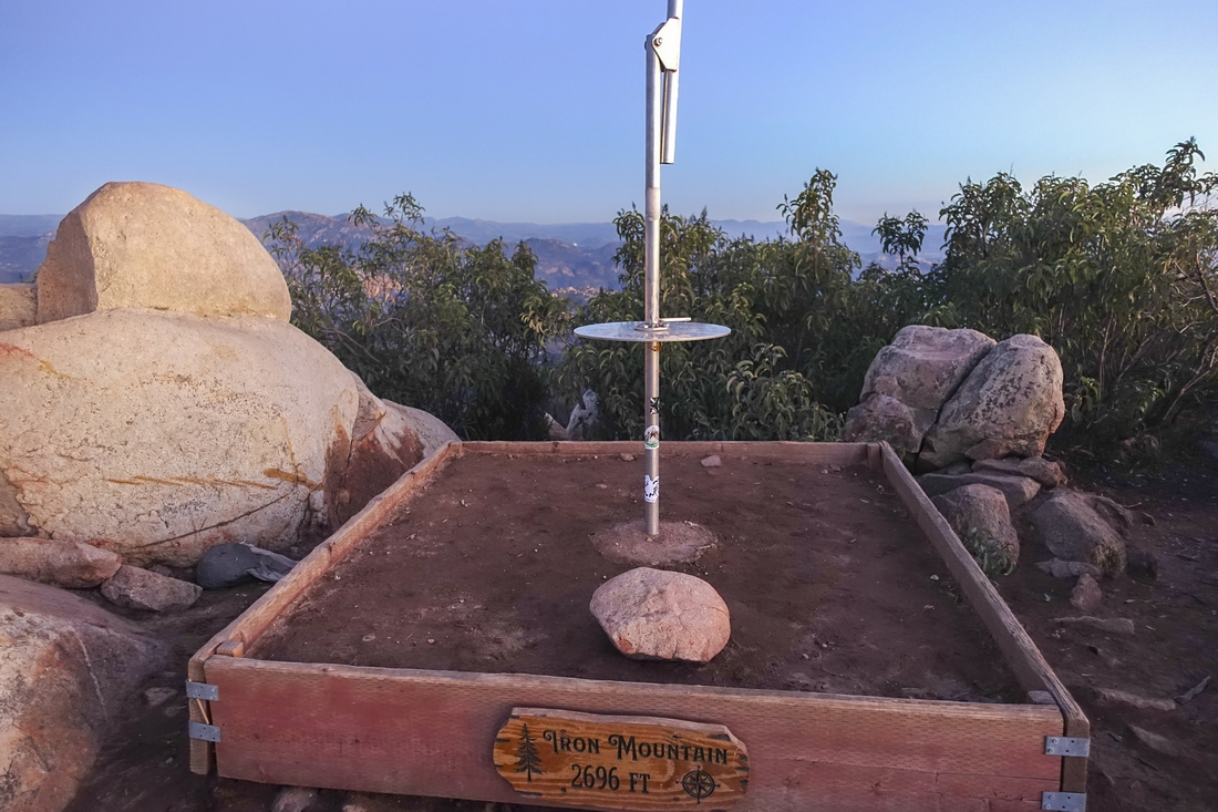 Peak Dial
Jan '22 Trip: "Peak Dial" at Iron Mtn. Summit Peak Dial
Jan '22 Trip: "Peak Dial" at Iron Mtn. Summit |
Abstract
| Overall Difficulty | D2 | Half-day hike on well established trail with some rocky parts and couple of steeper sections. In summer rattlesnakes are biggest objective hazard. More involved (D3) in case of loop return via Ramona Overlook | |||
| Scenery | Sweeping Panorama of San Diego County North Inland and distant Cuyamaca Mountains to the east | ||||
| Trail/Marking | Very Good | Main Trail is wide and well defined. Unmarked junctions for loop return via Ramona overlook | |||
| Suggested Time | 2-3 hrs | Add 1 - 1.5 hrs for loop return via Ramona Overlook | |||
| Elevation | Start: 495m Max: 815m Total: ~320m (550m Ramona loop) | Round Trip: ~8km (12.5 km Ramona Overlook loop) | |||
| Gear | Day Hikers are optimal (Runners not recommended). Hiking pole helpful for stability on some rocky sections, but not required | ||||
| Water | Dry hike. Carry 1 - 1.5L | ||||
| Dog Friendly | Yes | Please keep dog on leash for courtesy to other hikers as this is very popular trail | |||
 Iron Mountain GAIA Map
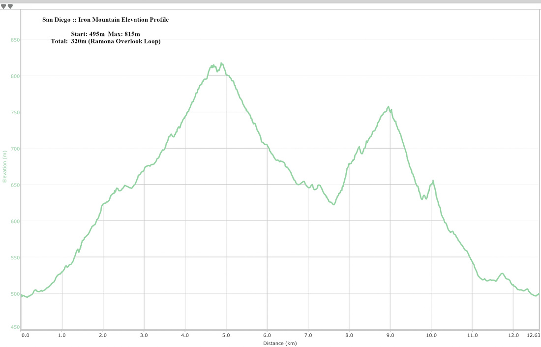 Iron Mountain Elevation Profile