Google Map |
USA :: San Diego :: Coast To Crest |
GPS Track |
|
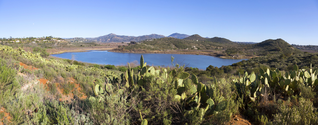
Panoramic view east across Bernardo Bay towards rolling Poway Hills; Mt. Woodson just right of distant center |
| Trip Summary | |||
Multiple Dates, last Feb 4, 2024
Full Coast to Creast Trail is a multi-use trail that passes through the San Diequito River watershed from its source on Volcan Mountain near Julian to the Pacific Ocean at Del Mar's Dog Beach. Entire Trail is ~70mile long and sections are still work in progress -- this page is fairly good resource. San Dieguito River Park section traversing north side of Lake Hodges is described here. It is primarily used for mountain biking, but I find it quite suitable for hiking too as scenery is exceptional. Usual trailhead is at bottom of Sunset Drive just south of Westfield Shopping Center in Escondido. First part is same as Bernardo Mountain summit approach - about 45min to the Junction. Ensuing part is the most beautiful - level traverse with great Lake Hodges Bernardo Bay and distant Poway Panoramas. Trail then turns west and begins gradual descent to Hodges Bay Marina. Going in I recommend taking High branch at obvious junction; it is a bit longer but has far better views than lower branch that can be hiked on return. Watch for rattlesnakes in season. Both trails join just before large parking lot and Hodges Bay Visitor Center.
From Marina Coast to Crest continues along paved Lake Hodges Way to Recreation center below Del Dios Highway. This was my usual turnaround point in the past, but on subsequent visits I discovered Trail that continues past Boat Launch to Hodges Bay Viewpoint - obvious hill above. It is bit more rough and there is some bushwhack near the end, but views from the top are exceptional - see Gallery. One can then backtrack the same way to Marina, but there is also shortcut on North side. You might have to jump the fence before re-joining San Dieguito River Park Trail few 100's meters past the Parking lot. |
|
Gallery |
|||
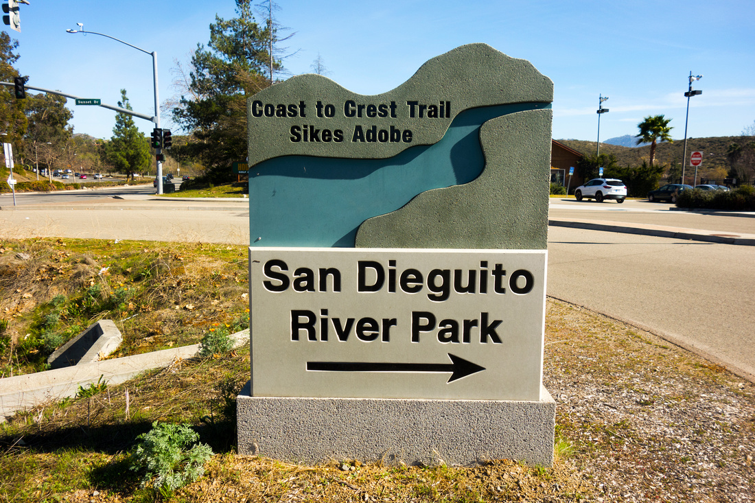 San Dieguito Park Table San Dieguito Park Table Table with Sign pointing down Sunset Drive towards Coast to Crest trailhead at junction with East Via Rancho Parkway
 |
|||
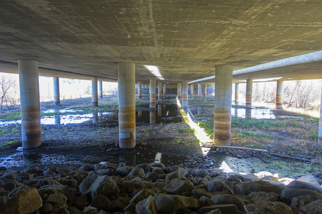 I-15 underpass
Trail crossing under Interstate 15 from east to west side I-15 underpass
Trail crossing under Interstate 15 from east to west side |
|||
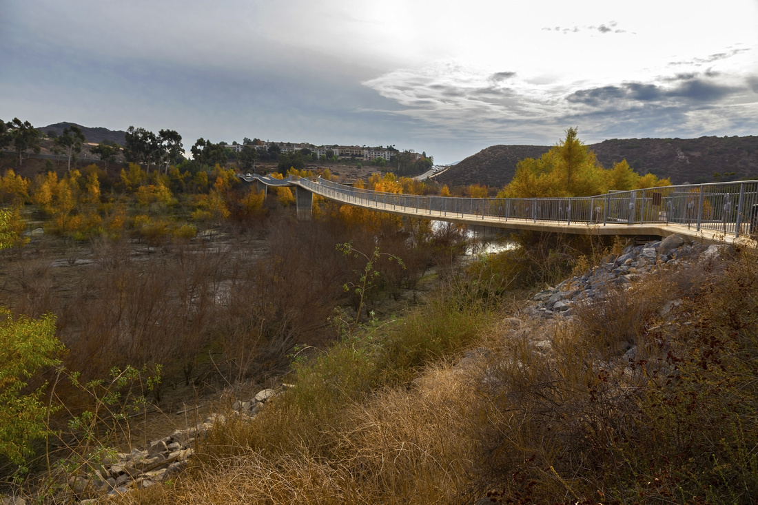 Lake Hodges Bridge
David Kreitzer Bicycle Pedestrian Bridge, the world's longest stress ribbon bridge, was opened to the public in May 2009 Lake Hodges Bridge
David Kreitzer Bicycle Pedestrian Bridge, the world's longest stress ribbon bridge, was opened to the public in May 2009 |
|||
 Hodges marshland from David Kreitzer bridge. San Dieguito River trail traverses lower slopes of Bernardo Mountain, center right
 |
|||
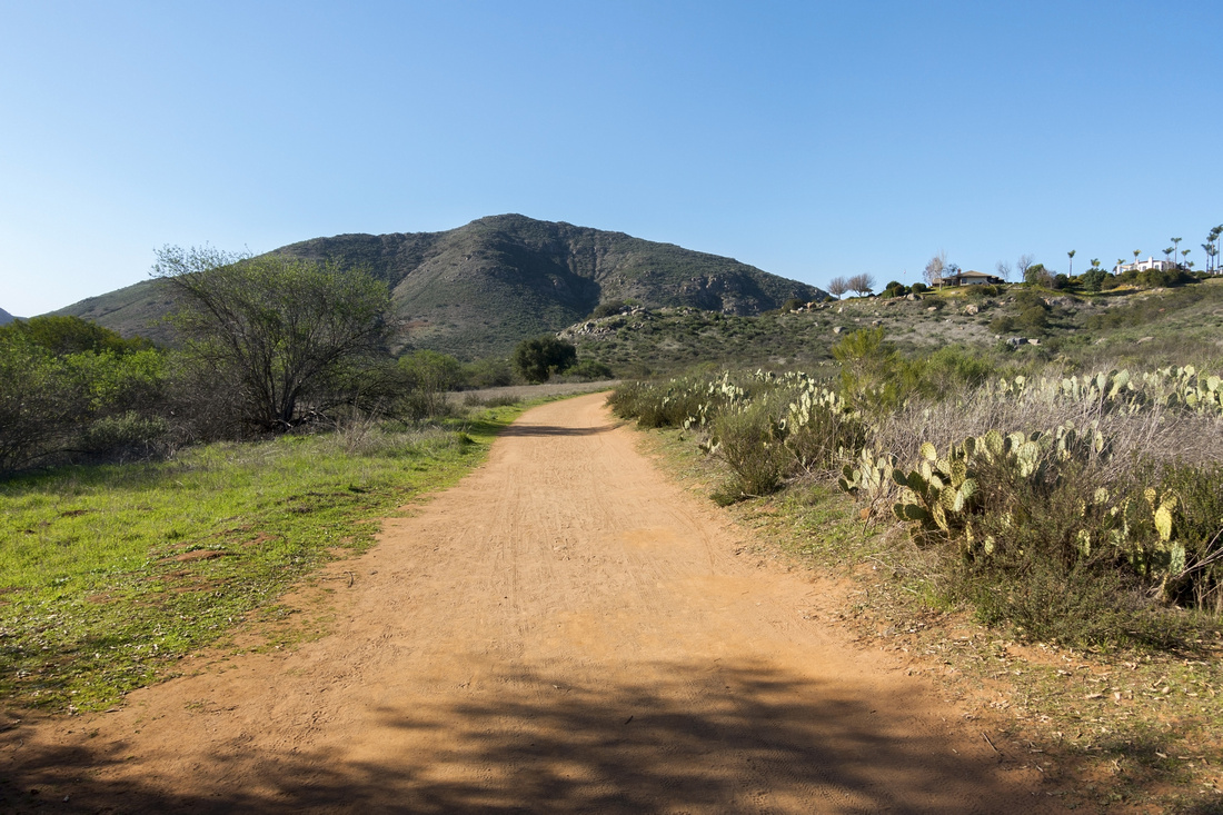 Coast to Crest
San Dieguito River Trail, frequently used by cyclists, heading towards Bernardo Mountain Coast to Crest
San Dieguito River Trail, frequently used by cyclists, heading towards Bernardo Mountain |
|||
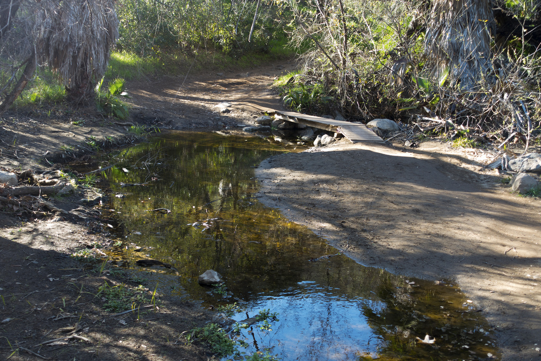 Felicita Creek
Crossing of Felicita Creek just before Bernardo Summit Trail junction Felicita Creek
Crossing of Felicita Creek just before Bernardo Summit Trail junction |
|||
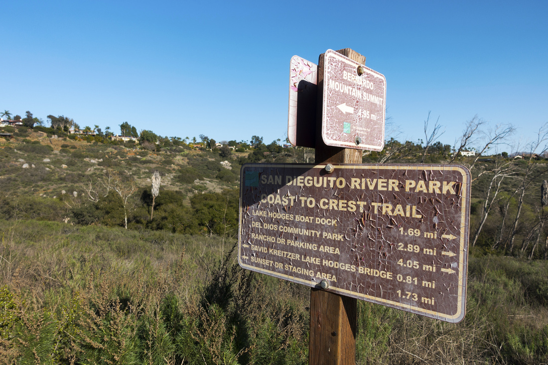 Trail Junction
Weathered Table at Junction of San Dieguito River Park and Bernardo Summit trails junction Trail Junction
Weathered Table at Junction of San Dieguito River Park and Bernardo Summit trails junction |
|||
 Bernardo Bay
Very scenic section of San Dieguito River Park trail traversing east slopes of Bernardo Mountain. Same spot as lead photo on the page, but different season and personal favorite Bernardo Bay
Very scenic section of San Dieguito River Park trail traversing east slopes of Bernardo Mountain. Same spot as lead photo on the page, but different season and personal favorite |
|||
 San Dieguito River Trail
Looking back as upper branch of San Dieguito River Park Trail traverses west slopes of Bernardo Mountain San Dieguito River Trail
Looking back as upper branch of San Dieguito River Park Trail traverses west slopes of Bernardo Mountain |
|||
 San Dieguito River Park Trail
Looking west from same spot as on previous photo. Hodges Bay Viewpoint is Hill center left San Dieguito River Park Trail
Looking west from same spot as on previous photo. Hodges Bay Viewpoint is Hill center left |
|||
 Hodges Bay Marina
West Hodges Bay below Visitor Center. San Dieguito River Park Trail continues on paved Lake Hodges Way to Recreation center on west side of the Lake below Del Dios Highway. Continue left to Marina and pick up trail heading up to the viewpoint Hodges Bay Marina
West Hodges Bay below Visitor Center. San Dieguito River Park Trail continues on paved Lake Hodges Way to Recreation center on west side of the Lake below Del Dios Highway. Continue left to Marina and pick up trail heading up to the viewpoint |
|||
 Hodges Bay
Early evening view across tranquil Hodges Bay Hodges Bay
Early evening view across tranquil Hodges Bay |
|||
 Hodges Bay Marina Sign
Boat Launching Facility Sign Hodges Bay Marina Sign
Boat Launching Facility Sign |
|||
 Hodges Bay
Waterfowl colony that makes Hodges Bay permanent home Hodges Bay
Waterfowl colony that makes Hodges Bay permanent home |
|||
 WTF Moment
Old Rusted car wreck along Viewpoint Trail - how did it get here, and why is nobody removing it? WTF Moment
Old Rusted car wreck along Viewpoint Trail - how did it get here, and why is nobody removing it? |
|||
 Hodges Bay Viewpoint
 looking east in Feb '24; note exceptionally low water level Hodges Bay Viewpoint
Hodges Bay Viewpoint looking east in Feb '24; note exceptionally low water level |
|||
 Hodges Bay Viewpoint Hodges Bay Viewpoint
Hodges Bay Viewpoint Panorama in Feb '22; water level was much higher |
|||
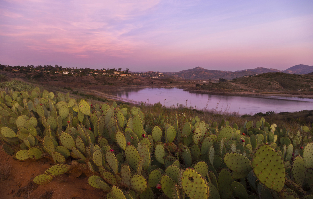 Cactus Sunset
Cactus field and Crimson Sunset Sky on return Cactus Sunset
Cactus field and Crimson Sunset Sky on return |
Abstract
| Overall Difficulty | D2 | Gentle walk with couple of minor ups/downs. Optional Upper Trail below Bernardo Mountain is bit more rough. Some chaparral bushwhack on Bernardo Bay Viewpoint | |||
| Scenery | Various vantage points of beautiful Lake Hodges. East slopes of Bernardo Mountain. Terrific Hodges Bay Viewpoint | ||||
| Trail/Marking | Excellent | Official San Dieguito River Park trail with signed junctions. | |||
| Suggested Time | 4hrs | Return time, including Hodges Bay viewpoint extension | |||
| Elevation | Start: 100m Max: 160m Total: +150m -90m | Round Trip: ~16km | |||
| Gear | Day Hikers | ||||
| Water | Felicita creek, but water must be treated. Carry at least 2L in summer | ||||
| Dog Friendly | Yes | Dogs must be kept on leash throughout San Dieguito River Park. Be on lookout for rattlesnakes - dogs have been bitten on nose in Lake Hodges area | |||
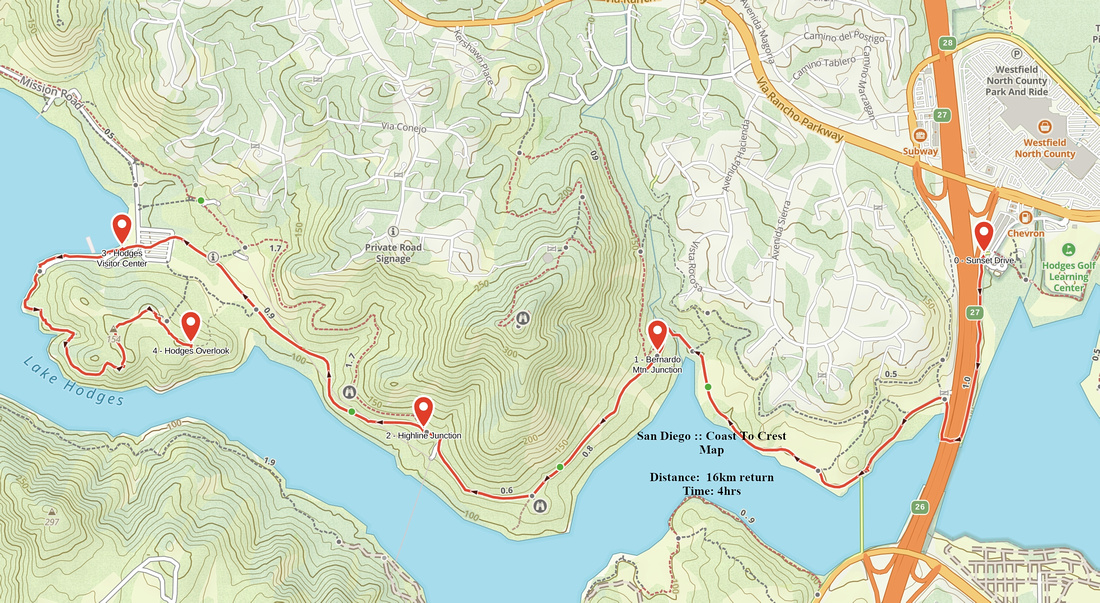 Coast To Crest GAIA Map
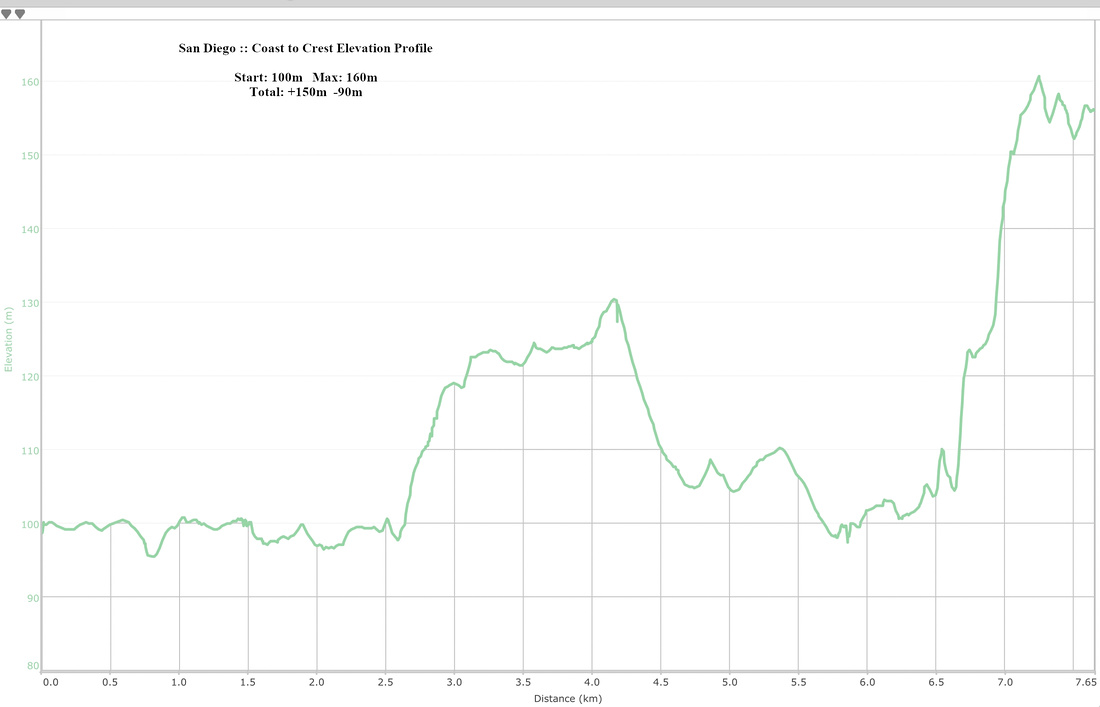 Coast To Crest Elevation Profile