Google Map |
USA :: San Diego :: Bernardo Mountain |
GPS Track |
|
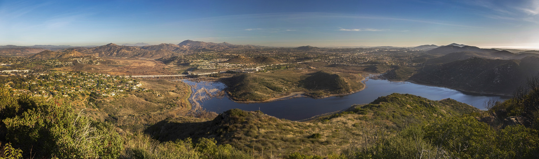
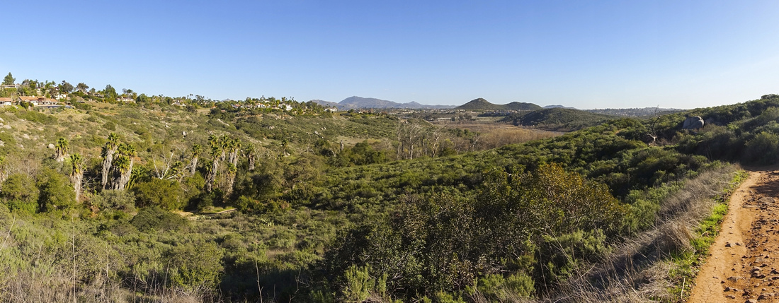
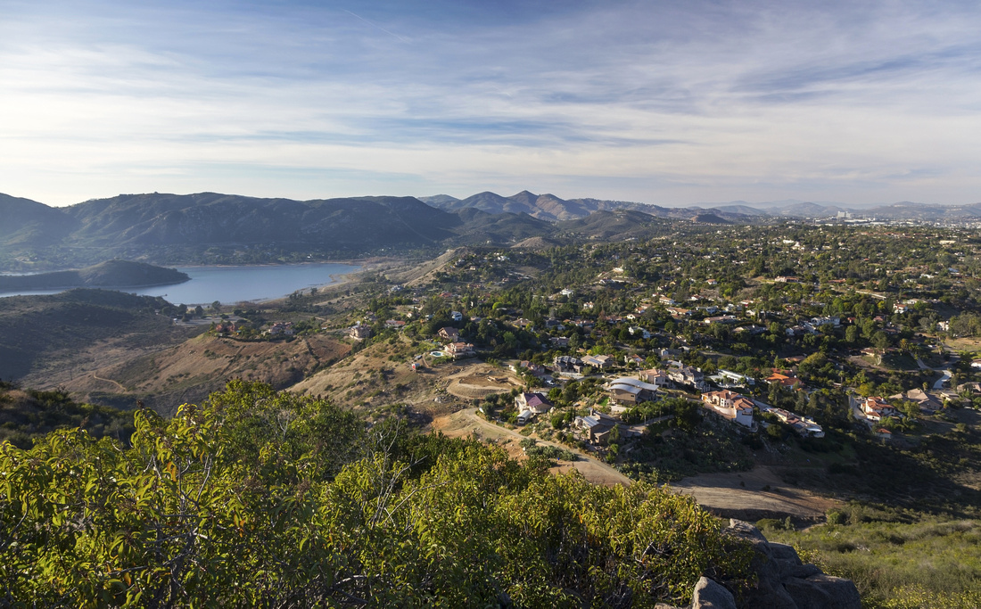
Panoramic view SE across Lake Hodges and San Dieguito River Park from summit of Bernardo Mountain |
| Trip Summary | |||
Multiple Dates, last Feb 2, 2022
Aerial Panorama of San Diego County and Lake Hodges from summit of Bernardo Mountain is true classic. On a clear day far reaching views extend all the way to Cyamaca Rancho State Park and Laguna Mountains to the East while distant San Jacinto Range can be spotted to the North. Lead image on this page has more than 100 downloads across various stock agencies, as well as individual sales through this site (If you'd like high-res copy for your project, contact me directly). Contrary to other Lake Hodges area hikes that are mostly level, Bernardo Summit trail gains about 350m elevation thus providing for bit of workout too.
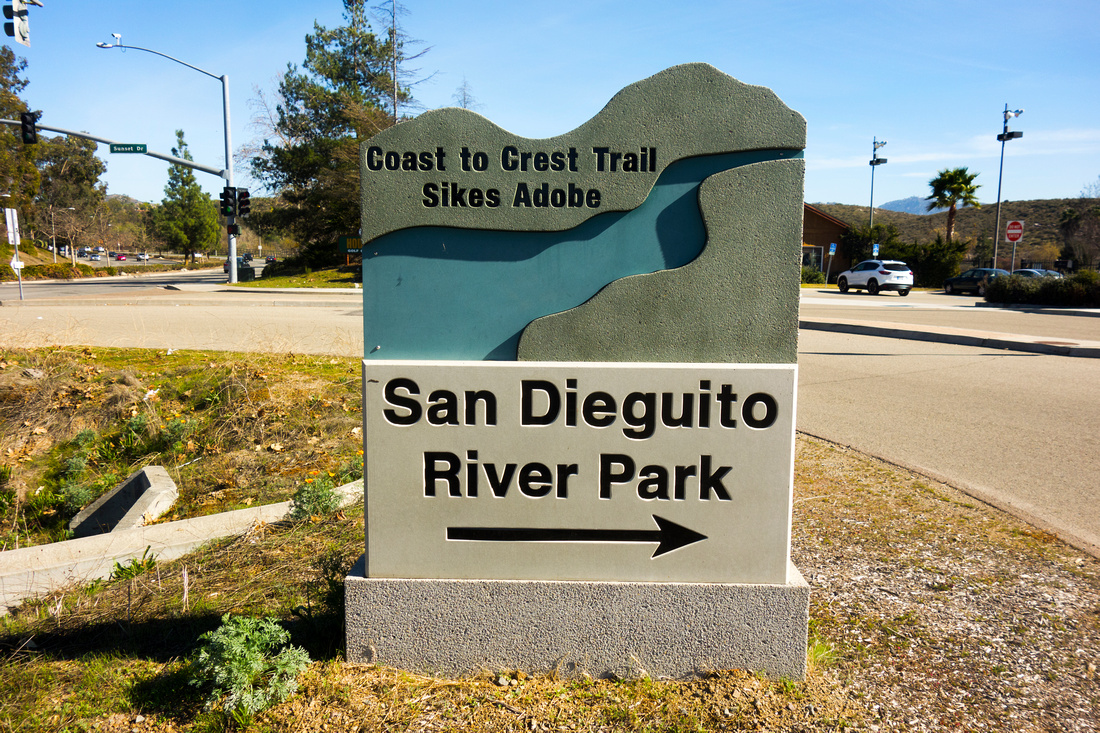
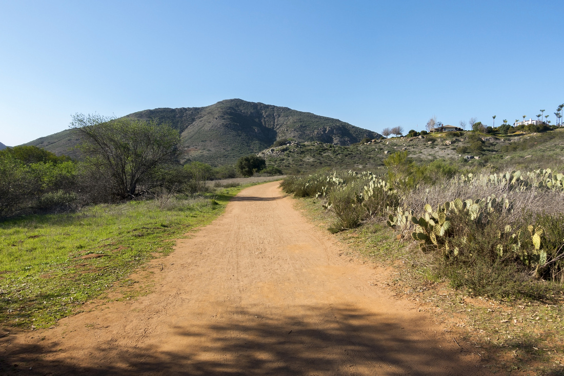
First part of the hike is approach on iconic "Coast to Crest" trail running through San Dieguito River Park all the way west to Pacific Coast. Trailhead is at end of Sunset Drive (exit 26 of I-15, turn into East Rancho Parkway and right on Sunset drive by gas station). Parking lot is small and will fill up on weekends, but there is street parking along both sides of Sunset drive). First part is about 1km walk paralleling I-15, crossing under the overpass to west side, then turning onto what was once 395 California Highway. Parts of pavement are still visible. David Kreitzer Suspension bridge across Lake Hodges flats is worth the effort by itself; elegant engineering structure and world longest stress ribbon bridge at time of its construction. Wide trail, popular with cyclists, then leads towards Bernardo Mountain and after crossing Felicita Creek is marked junction: Coast to Crest continues straight, Bernardo Summit right. It will take 45 min to an hour up to here. Going is now bit more rough, but still not challenging. Be on lookout for rattlers as trail is more narrow - I've seen young rattler curled up in the middle of trailbed in early February, when I believed they were still asleep. After contouring to north side, trail switchbacks lazily towards the summit, passing above large Water tank. Upon reaching the summit note that obvious open rocky knoll is NOT the best viewpoint. Find path to the right (south) and descend for about a minute to much better views; this is where title panorama was taken.
Return is the same way. It might appear tempting to trash down south facing slopes. Out of curiosity on my Feb '22 trip I took closer look. There is no trail but vegetation is not too dense and I was quite sure I could pick my way down navigating cacti fields scattered around obvious drainage. I gave up mainly because of footwear; old day hikers with worn sole that would not provide enough traction. If you decide to try, wear real hiking boots and carry hiking pole. This off-trail adventure is for winter trips only; rest of the year rattlesnakes that could not be seen in bush and rocks would be real hazard. |
|
Gallery |
|||
 San Dieguito Park Table San Dieguito Park Table Table with Sign pointing down Sunset Drive towards Bernardo Mountain trailhead at junction with East Via Rancho Parkway
 |
|||
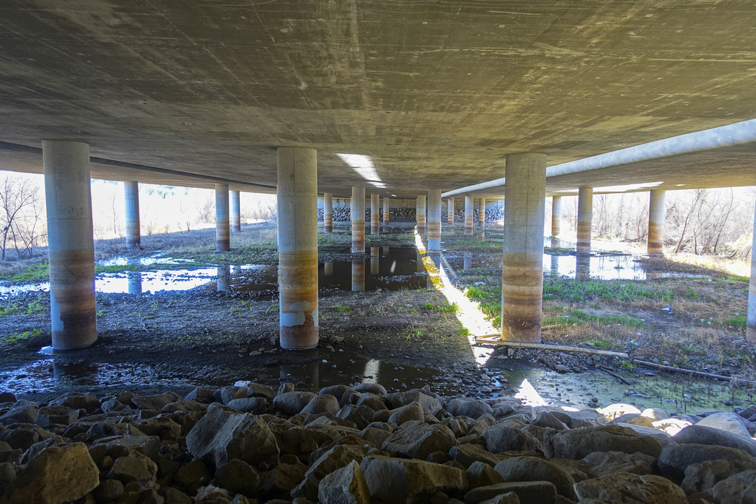 I-15 underpass
Trail crossing under Interstate 15 from east to west side I-15 underpass
Trail crossing under Interstate 15 from east to west side |
|||
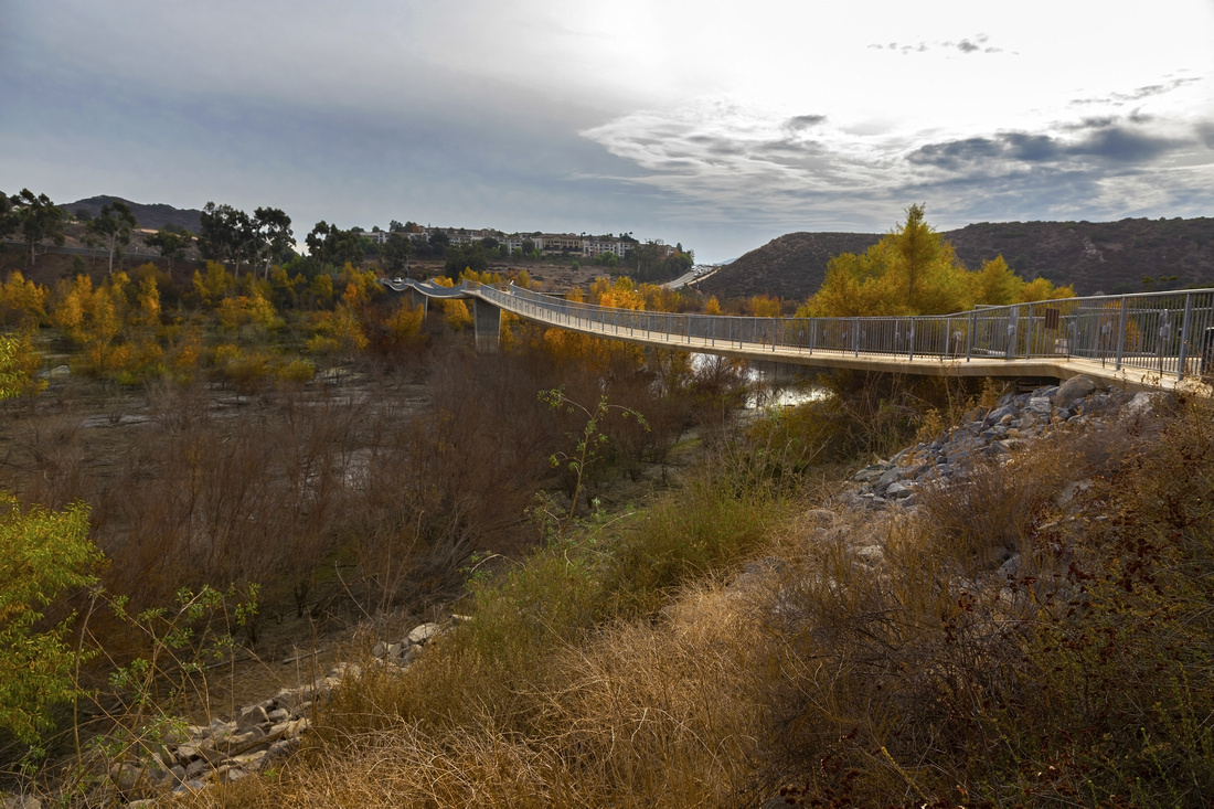 Lake Hodges Bridge
David Kreitzer Bicycle Pedestrian Bridge, the world's longest stress ribbon bridge, was opened to the public in May 2009 Lake Hodges Bridge
David Kreitzer Bicycle Pedestrian Bridge, the world's longest stress ribbon bridge, was opened to the public in May 2009 |
|||
 Coast to Crest
San Dieguito River Trail, frequently used by cyclists, heading towards Bernardo Mountain Coast to Crest
San Dieguito River Trail, frequently used by cyclists, heading towards Bernardo Mountain |
|||
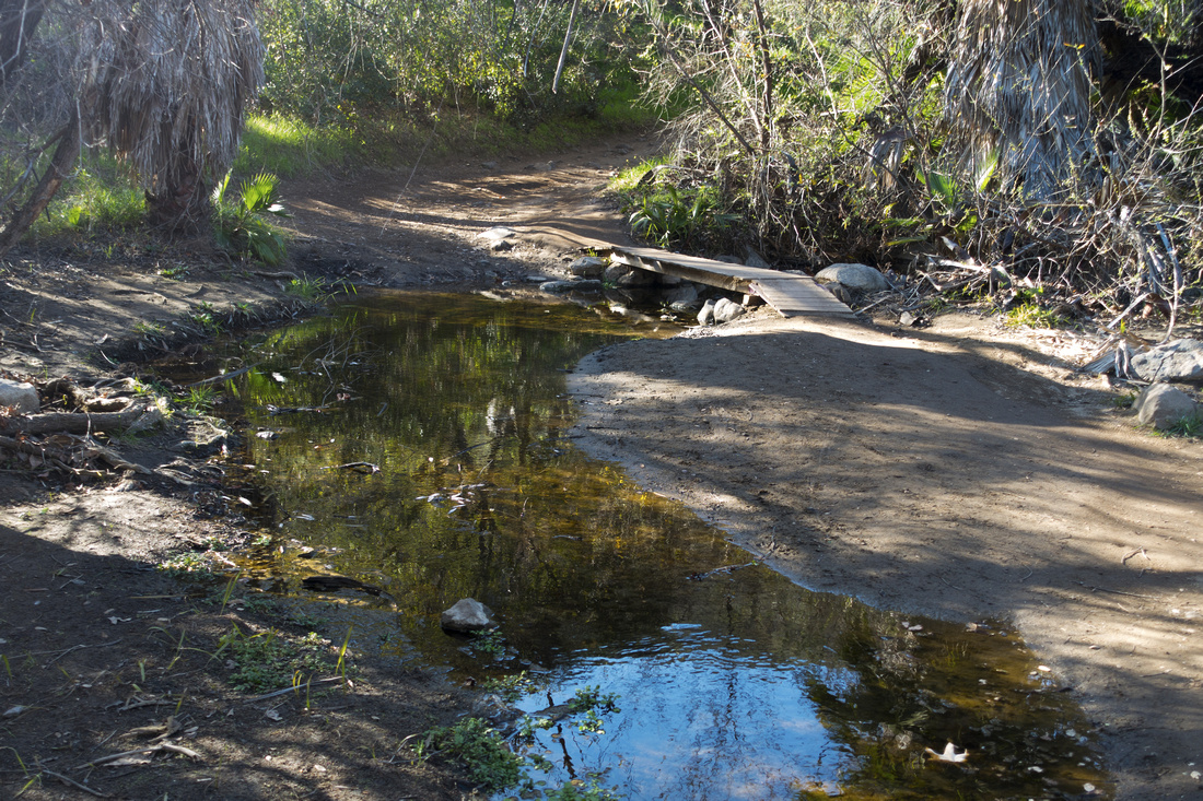 Felicita Creek
Crossing of Felicita Creek just before Bernardo Summit Trail junction Felicita Creek
Crossing of Felicita Creek just before Bernardo Summit Trail junction |
|||
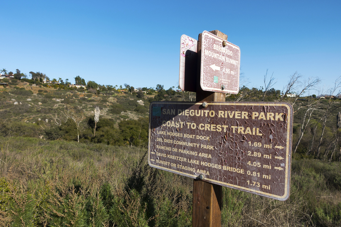 Trail Junction
Weathered Table at Junction of San Dieguito River Park and Bernardo Summit trails junction Trail Junction
Weathered Table at Junction of San Dieguito River Park and Bernardo Summit trails junction |
|||
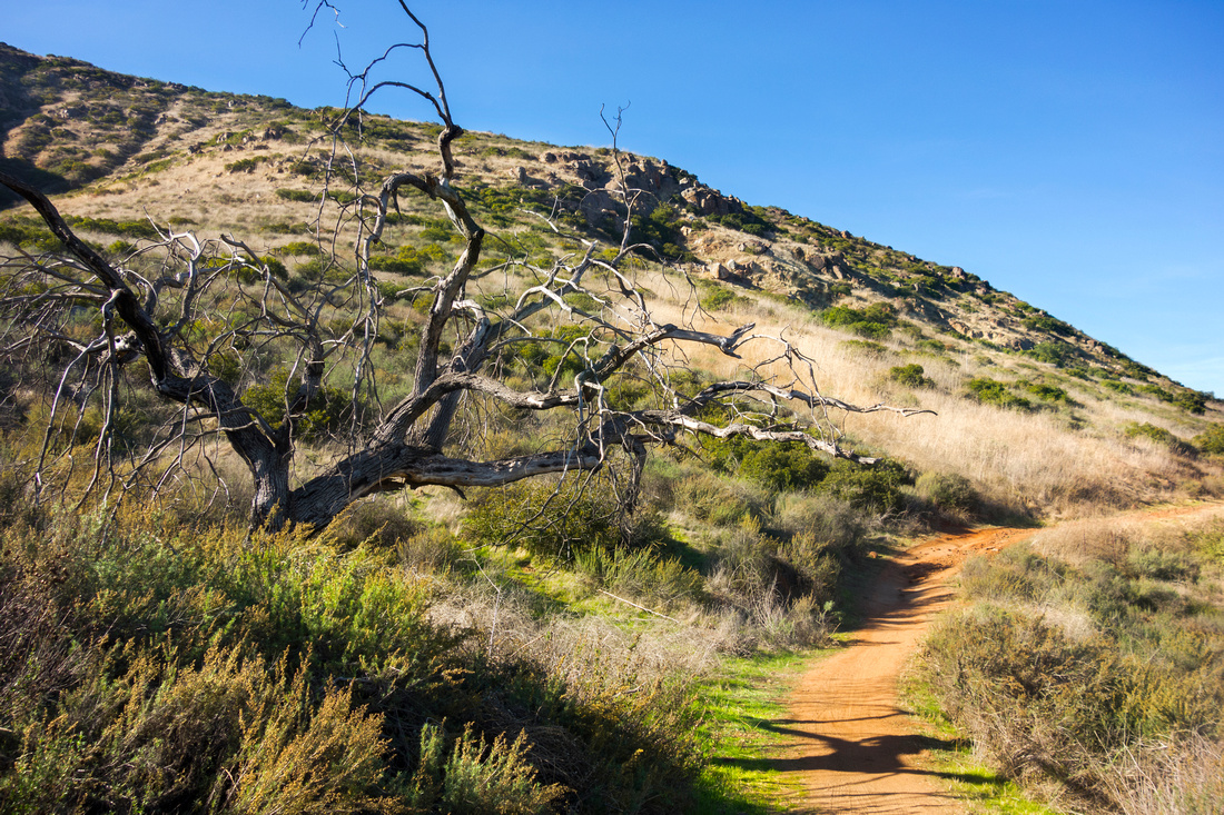 Bernardo Summit Trail
 contouring east slopes of Bernardo Mountain Bernardo Summit Trail
Bernardo Summit Trail contouring east slopes of Bernardo Mountain |
|||
 |
|||
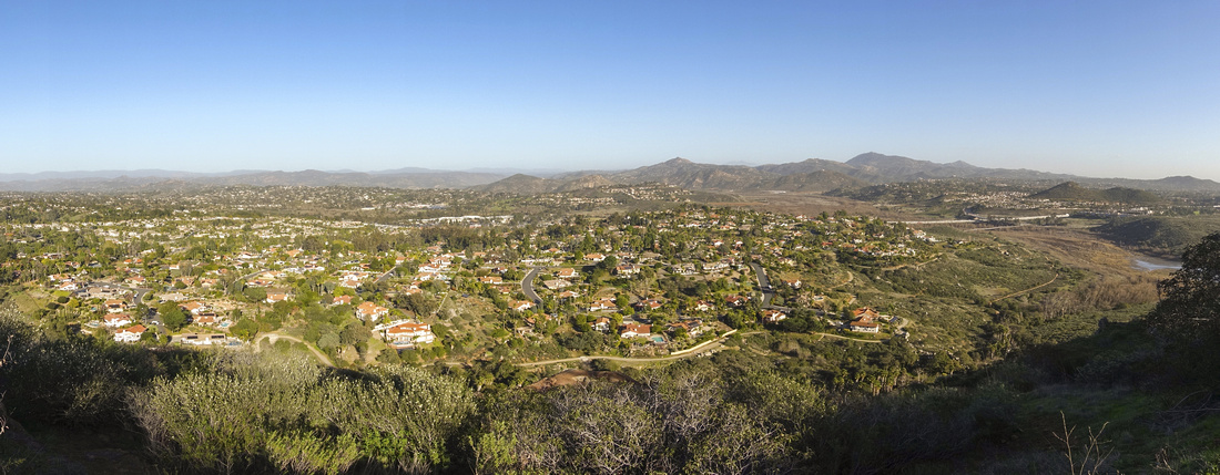
 San Dieguito Panorama
Panoramic View back towards Lake Hodges area and Rancho Bernardo San Dieguito Panorama
Panoramic View back towards Lake Hodges area and Rancho Bernardo |
|||
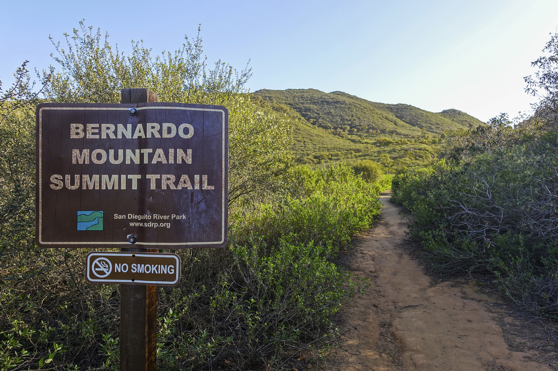 Summit Trail Table
Sign as trail starts switchbacking backside ascent towards Bernardo Mountain Summit Trail Table
Sign as trail starts switchbacking backside ascent towards Bernardo Mountain |
|||
 Escondido Panorama
Fabulous Panoramic views NE across Escondido Valley from shoulder some 15min below Bernardo Mountain Summit Escondido Panorama
Fabulous Panoramic views NE across Escondido Valley from shoulder some 15min below Bernardo Mountain Summit |
|||
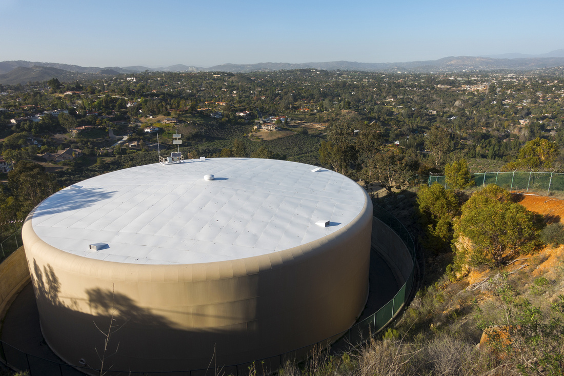 Water Tank
Trail skirts above Water Tank supply, guarded by fence and security cameras - no trespassing Water Tank
Trail skirts above Water Tank supply, guarded by fence and security cameras - no trespassing |
|||
 West Lake Hodges
Looking west across Residential Houses towards Del Dios Gorge and Fletcher Point just below Bernardo Summit West Lake Hodges
Looking west across Residential Houses towards Del Dios Gorge and Fletcher Point just below Bernardo Summit |
|||
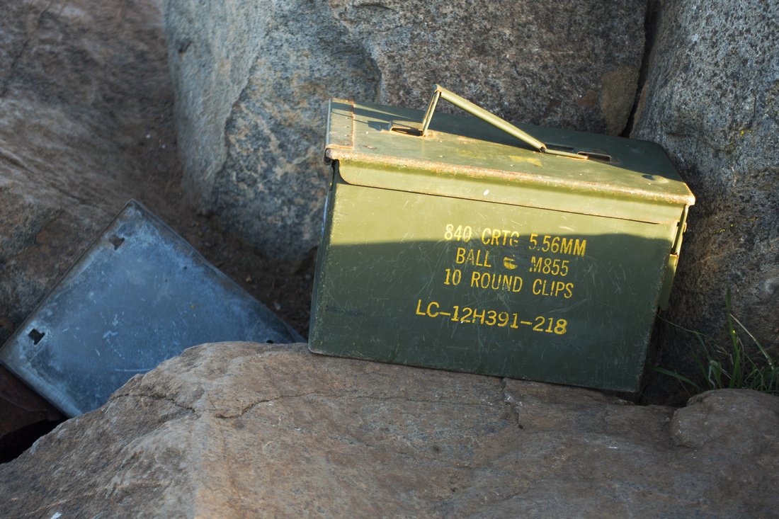 Ammo Register
Old Military Ammo box serving as Summit Register at 350m High Bernardo Mountain Summit Ammo Register
Old Military Ammo box serving as Summit Register at 350m High Bernardo Mountain Summit |
|||
 |
|||
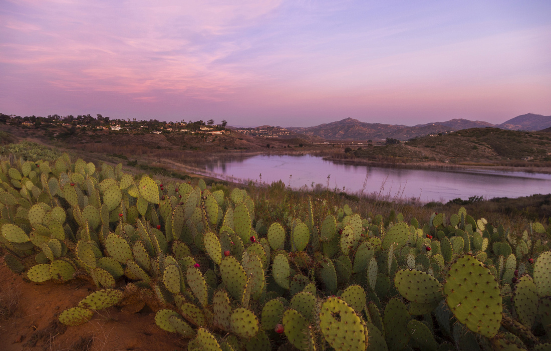 Cactus Sunset
Cactus field and Crimson Sunset Sky from San Dieguito River Trail on return Cactus Sunset
Cactus field and Crimson Sunset Sky from San Dieguito River Trail on return |
Abstract
| Overall Difficulty | D3 | Some rocky sections past Coast to Crest junction. Moderately steep ascent | |||
| Scenery | Fabulous 360 panorama of San Diego County. Aerial view of Lake Hodges and San Dieguito River Park | ||||
| Trail/Marking | Excellent | Official Coast to Crest Trail followed by wide and well defined Bernardo Mountain Summit. Couple of junctions in upper part coming from residential are not marked, but direction is obvious | |||
| Suggested Time | 4hrs | Allowing enough summit time for photos, coming back same way. | |||
| Elevation | Start: 100m Max: 350m Total: ~350m | Round Trip: ~12km | |||
| Gear | Day Hikers. Hiking pole helpful for stability on rocky upper part of the trail | ||||
| Water | Felicita creek, but water must be treated. Carry at least 2L in summer | ||||
| Dog Friendly | Yes | Dogs must be kept on leash throughout San Dieguito River Park. Be on lookout for rattlesnakes - dogs have been bitten on nose in Lake Hodges area | |||
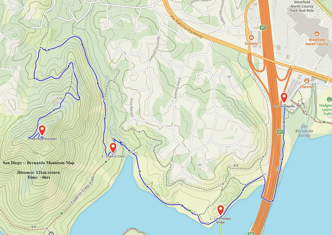 Bernardo Mountain GAIA Map
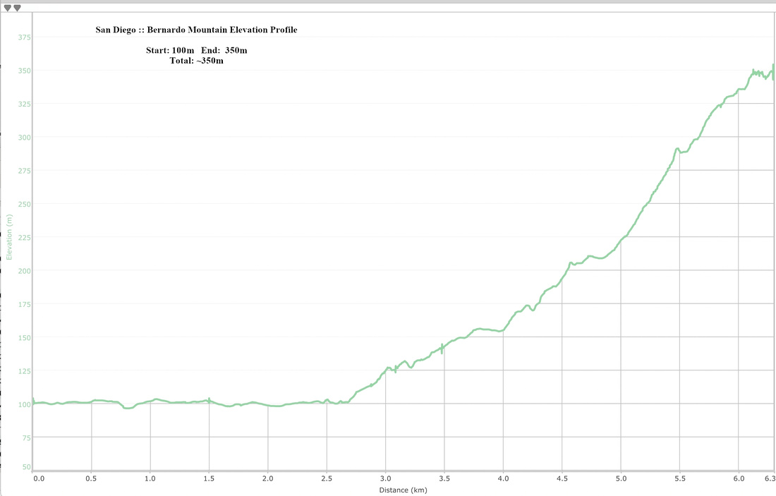 Bernardo Mountain Elevation Profile