Google Map |
USA :: San Diego :: Fletcher Point |
GPS Track |
|
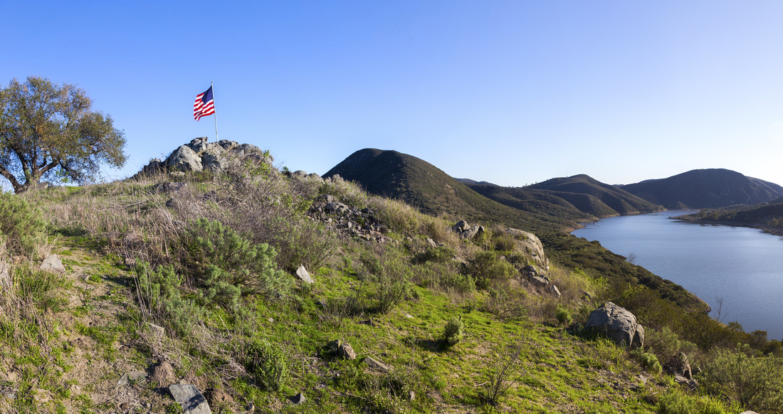
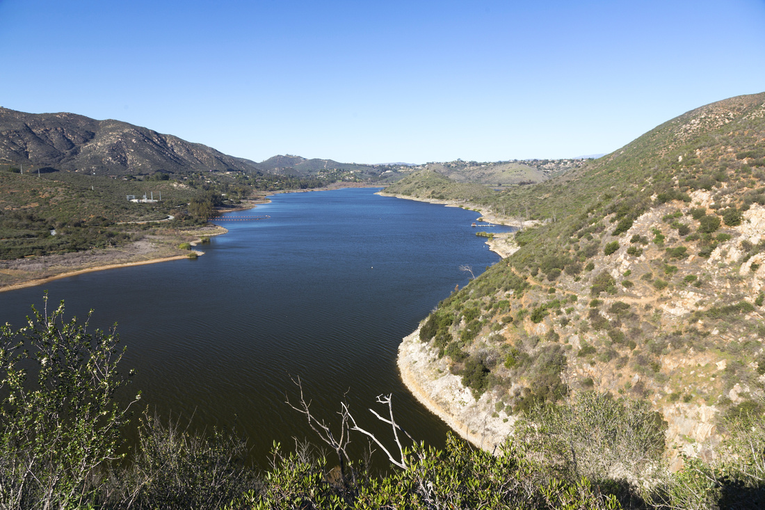
Fletcher Point with American Flag and Panoramic View down Del Dios Gorge. Rough trail from S4 follows length of lake shore center right |
| Trip Summary | |||
Multiple Dates, last January 12, 2024
Fletcher Point is peninsula feature at west end of Lake Hodges where lake makes 90 degree turn south towards Hodges Dam and Del Dios Gorge. It is named after Ed Fletcher, one of creators of Hodges Dam and Reservoir. It the least traveled part of the lake, but in many aspects the most beautiful. There are two possible ways in: Longer follows South Lake Hodges past Piedras Pintadas ; newer "direct" trail, described here, starts from top of Alva Road in 4S farm.
Follow Rancho Bernardo Road east (exit 24 from I-15), then turn into Alva Road and drive to top where Alva loops back around the residential. There is no official parking, so just park anywhere on street. Trailhead is little picnic area - see first photo in gallery - where wide trail known as "Lake Hodges from 4S" descends gradually in less than half-an hour to Del Dios Gorge. At first junction keep contouring the lake; left branch descends to the lake, optional short trip on return. Trail now becomes much more rough and after contouring the hill and crossing the drainage is the confusing part. Trail splits and it is unclear where to go. Correct way is left; scramble down short bluff (class 2 at most), then resume on rocky path that gradually improves the further you go. On my trip I took the upper branch and dearly regretted. It was better defined and had footprints, but soon deteriorates and stops completely in the bush. I continued bushwhaching which was in hindsight completely unnecessary. In summer it could also be dangerous because of rattlesnakes you could not see as you can on defined trail. Correct trail rounds one more hill and completely mellows after crossing next drainage. There is one re-routed section here because of poison oak. Unsigned junction / trail to the right up the hillside leads to "Ralph Ranch" (Ralphs grocery chain owner lives there) - do not use for return, as it crosses private property. Very enjoyable section of flat hiking now leads quickly to junction with South Lake Hodges trail and finally up to Fletcher Point, usually with US Flag. This is such a wonderful viewpoint, easily the best in entire San Dieguito River Park. On my visit there was even a swing under oak tree, just behind the Flag.
Return is the same way, with optional visit to the Lake via final part of "Lake Hodges from 4S" trail. With two cars loop return via South Lake Hodges is fantastic option (leave other car either at Poblado Road, or in RB Community Park). Highly recommended outing in San Dieguito River Park.
Update January '24: There is now "Turtle Head" sign at first junction pointing to upper trail; trail also appears regularly brushed off
|
|
Gallery |
|||
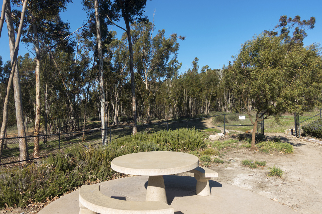 Alva Trailhead Alva Trailhead 4S Trailhead by Picnic area at top of Alva Road - note trail at other side of open gate
 |
|||
 Del Dios Gorge
"Lake Hodges from 4S" trail emerging to Del Dios gorge after 20-25min of gradual descent from Alva trailhead. Hodges Dam extreme center left Del Dios Gorge
"Lake Hodges from 4S" trail emerging to Del Dios gorge after 20-25min of gradual descent from Alva trailhead. Hodges Dam extreme center left |
|||
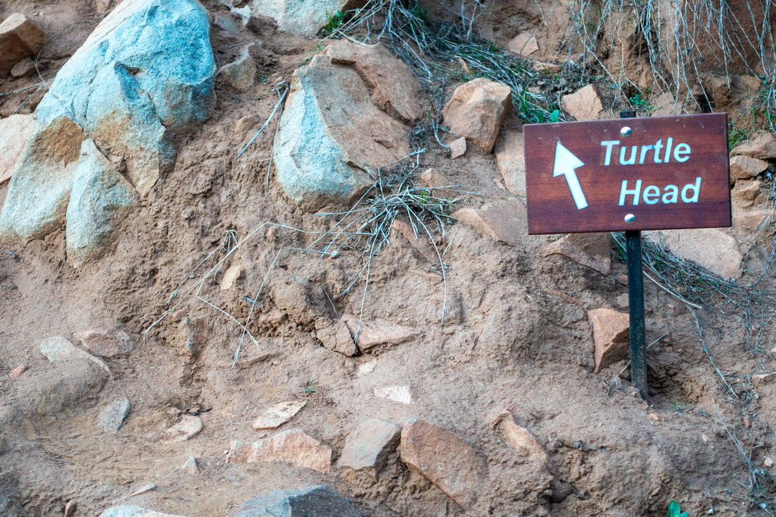 Turtle Head Junction
Marked first junction ~35min in Jan '24; Fletcher Point is apparently also called "Turtle Head" Turtle Head Junction
Marked first junction ~35min in Jan '24; Fletcher Point is apparently also called "Turtle Head" |
|||
 Gorge Trail
Rough trail hugging east side of Del Dios Gorge after Lake Trail splits to the left. Fletcher Point Peninsula just right of distant center Gorge Trail
Rough trail hugging east side of Del Dios Gorge after Lake Trail splits to the left. Fletcher Point Peninsula just right of distant center |
|||
 Routefinding Problem
Routefinding problem: Better defined trail right and up is wrong; it ends in horrible bushwhack. Correct way is to take the left fork Routefinding Problem
Routefinding problem: Better defined trail right and up is wrong; it ends in horrible bushwhack. Correct way is to take the left fork |
|||
 Correct Way
Top of rock bluff past confusing junction and correct way to go Correct Way
Top of rock bluff past confusing junction and correct way to go |
|||
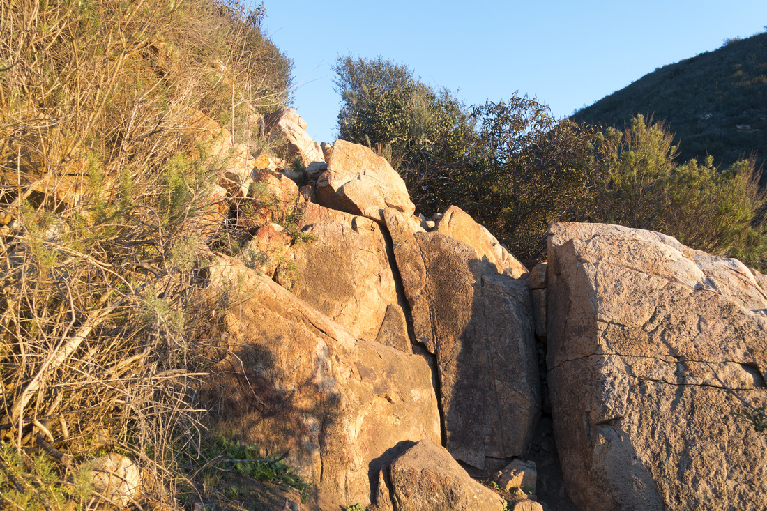 Rock Step
Class 2 Rock step, looking back up. Trail becomes evident again Rock Step
Class 2 Rock step, looking back up. Trail becomes evident again |
|||
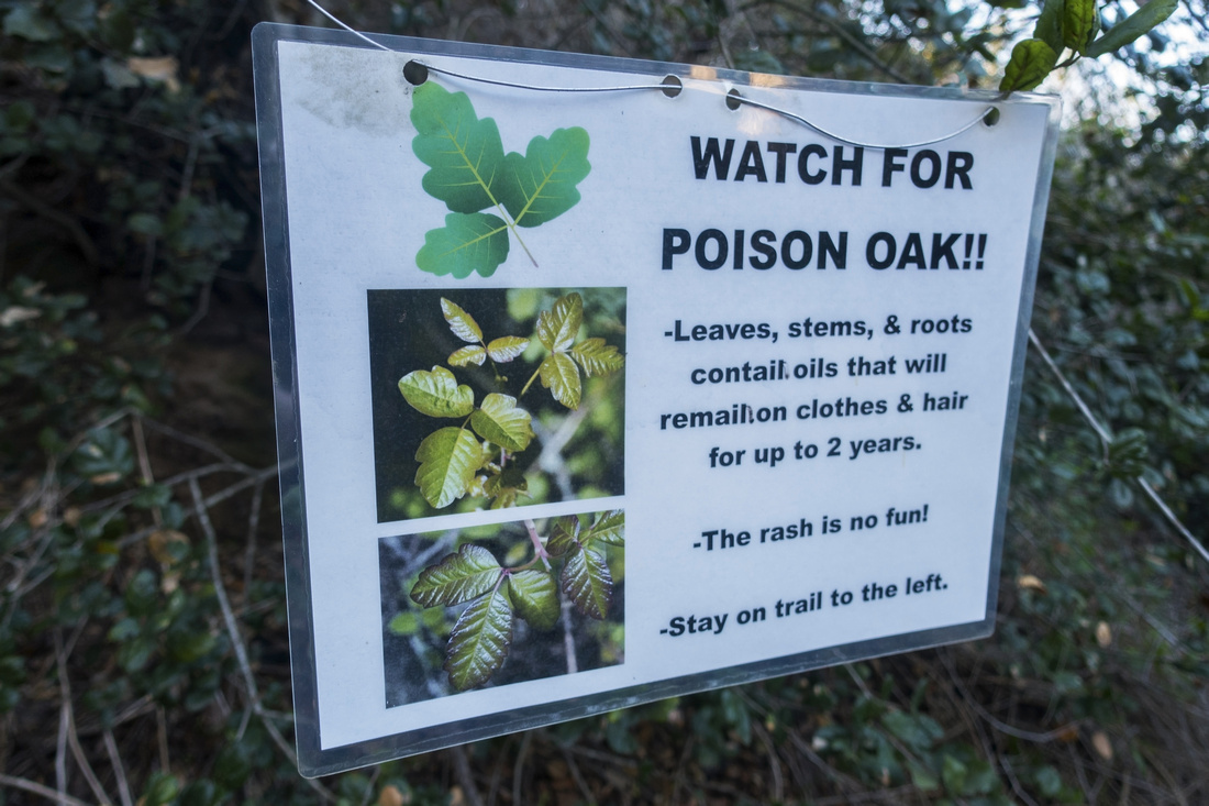 Poison Oak Warning
Part of Trail is rerouted because of Poison Oak Poison Oak Warning
Part of Trail is rerouted because of Poison Oak |
|||
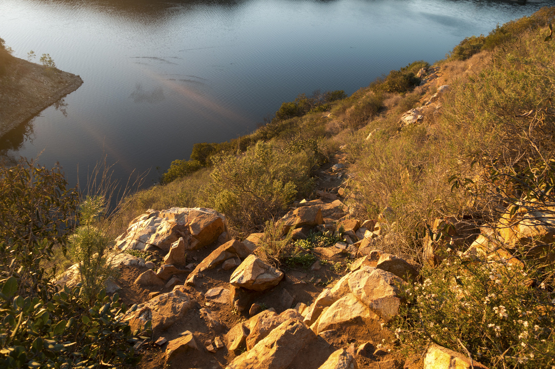
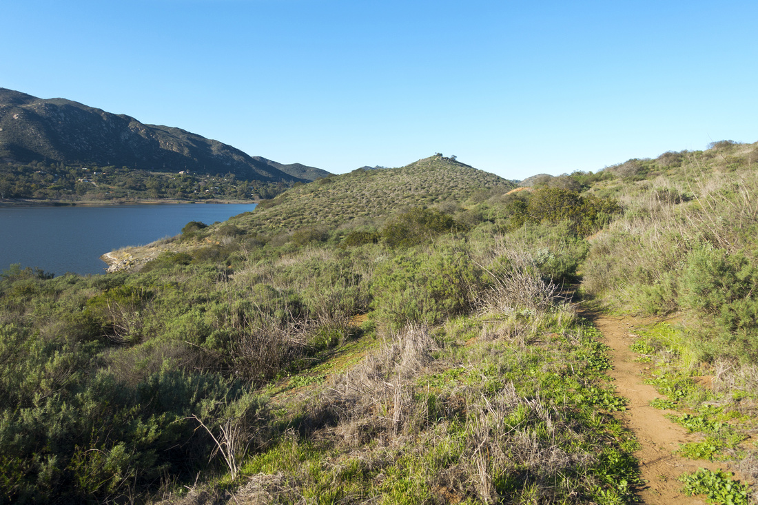 Gorge Trail
Delightful hiking past all difficulties among sage and chaparral approaching South Lake Hodges junction; Fletcher Point just right of center Gorge Trail
Delightful hiking past all difficulties among sage and chaparral approaching South Lake Hodges junction; Fletcher Point just right of center |
|||
 |
|||
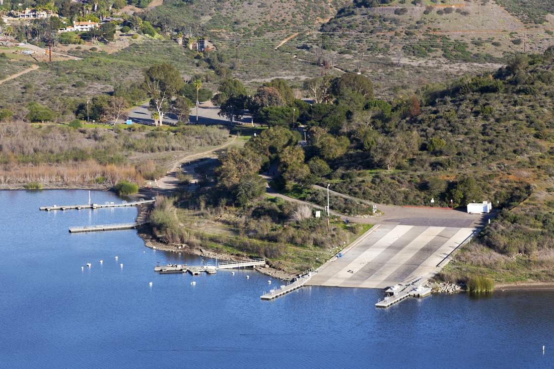 Boat Launch Marina
 Telephoto Boat Launch Marina
Boat Launch Marina Telephoto |
|||
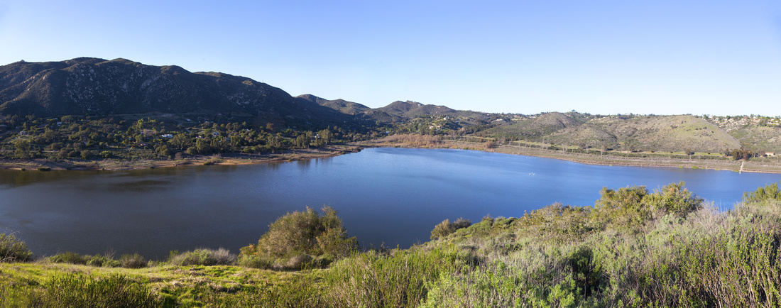 North Panorama
Panoramic view north as Lake Hodges bends 90 degrees North Panorama
Panoramic view north as Lake Hodges bends 90 degrees |
|||
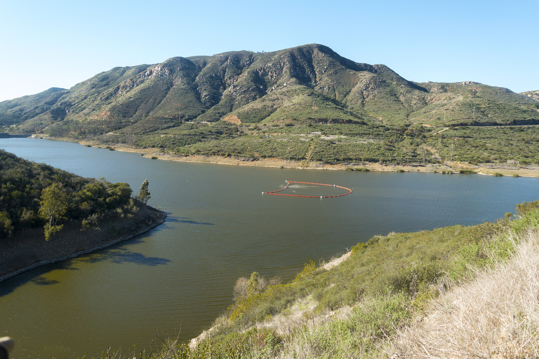
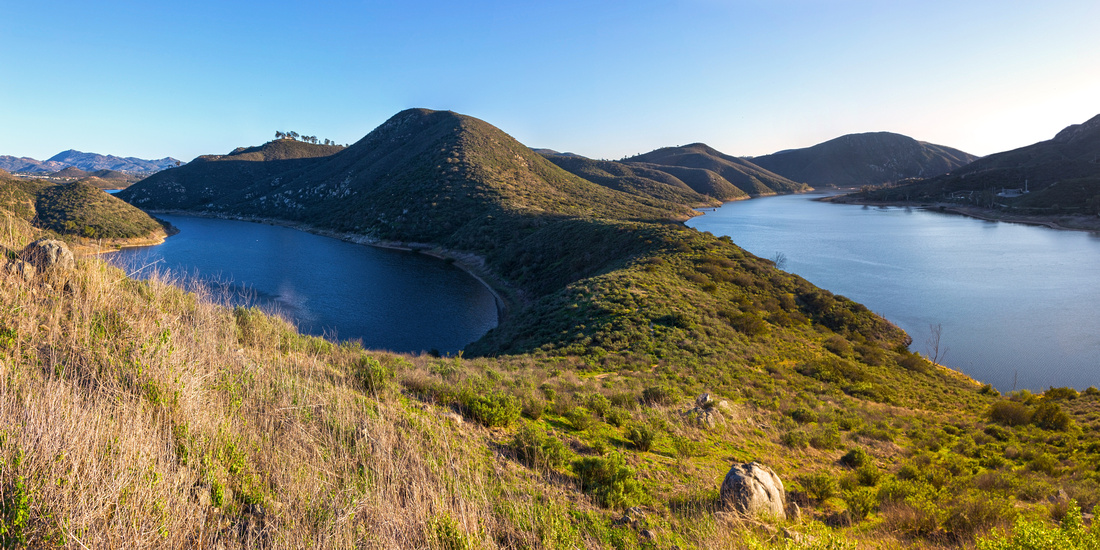 The Interlakes
Beautiful Vista south looking at both Arms of Lake Hodges The Interlakes
Beautiful Vista south looking at both Arms of Lake Hodges |
|||
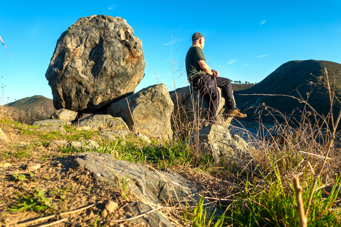 Fletcher Selfie
Rare "Selfie" at rock outcropping just below US Flag on Fletcher Point; Jan '24 Trip Fletcher Selfie
Rare "Selfie" at rock outcropping just below US Flag on Fletcher Point; Jan '24 Trip |
|||
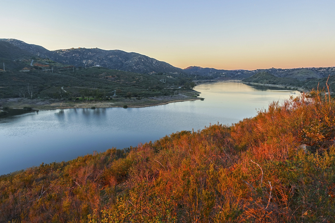 Sunset Colors
Great Sunset Colors reflected from low bush on return Sunset Colors
Great Sunset Colors reflected from low bush on return |
|||
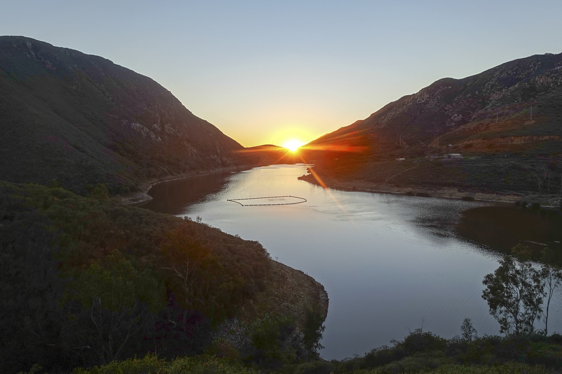 Del Dios Sunset
Sun setting behind Del Dios gorge on return, already back to "Lake Hodges from 4S" trail Del Dios Sunset
Sun setting behind Del Dios gorge on return, already back to "Lake Hodges from 4S" trail |
Abstract
| Overall Difficulty | D3 | Rough section with steep up/down and rocky trailbed. Brief class 2 rock step. Serious bushwhack when off-route | |||
| Scenery | Fantastic views of Lake Hodges from different angles. Distant Poway area peaks | ||||
| Trail/Marking | Good/None | Initial descent to Lake Hodges wide and well defined. One confusing section after with route-finding. No marking | |||
| Suggested Time | 3-4hrs | Allowing plenty of time for break / photos on Fletcher Point and optional visit to Lake Hodges shore | |||
| Elevation | Start: 190m End: 165m Total: ~340m (+160, -180) | Round Trip: ~8km | |||
| Gear | Day Hikers. Hiking pole helpful for stability on rough parts | ||||
| Water | In emergency one could descend and use lake water (must be treated). Carry 1-2L depending on season | ||||
| Dog Friendly | Yes | Dogs must be kept on leash throughout San Dieguito River Park. Be on lookout for rattlesnakes - dogs have been bitten on nose in Lake Hodges area | |||
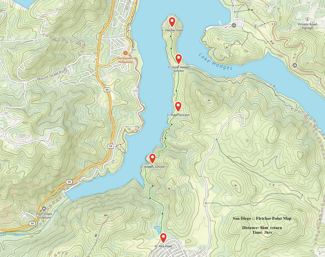 Fletcher Point GAIA Map
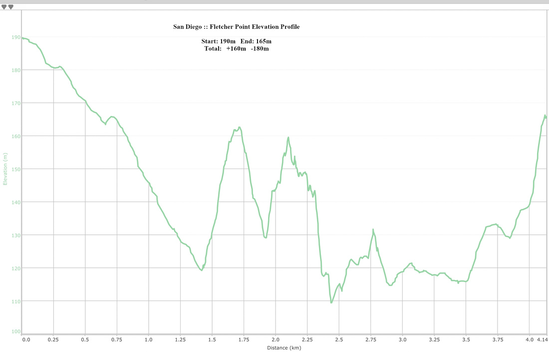 Fletcher Point Elevation Profile