Google Map |
Rockies :: Yoho :: Wapta Falls |
GPS Track |
 Wapta FallsWapta Falls on Kicking Horse River, an easy walk from Trans-Canada Highway. More info Wapta FallsWapta Falls on Kicking Horse River, an easy walk from Trans-Canada Highway. More infoHigh Res: 5472 x 3648, 11.5 MB Price: 14 USD 
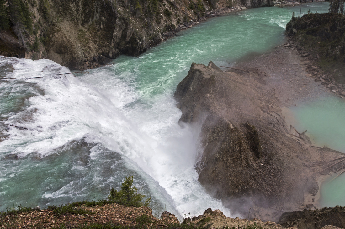
View from the lookout on top of Wapta Falls. Trail descends on the right side to Kicking Horse level |
|||
| Trip Summary | |||
July 11, 2016A short touristy walk (5km return, ~100m elevation, D1) leading to impressive drop of Kicking Horse River. Access is just before Trans-Canada makes 90 degree turn below Chancellor Peak about 20 minutes before Field (driving from Golden). Turn right (south) into gravel access road and drive for ~2km to the parking lot. There are some potholes but road is not overly rough. From the parking wide track leads through forest cover for about 2km to fenced lookout and view of the falls. Trail is generally flat, with some rooty and muddy sections in second part. From the lookout trail drops steeply to Kicking Horse river level. There is junction just below the lookout; shorter, but steeper branch drops directly down, while gentler and wider branch switchbacks and emerges about 50 meters downstream. Shale hill partially shields the falls from river level but you can walk a bit on left side for better view. You can also walk a bit downstream on a nice beach just before river curls right for bit more solitude. Return the same way; whole thing can be done comfortably in about an hour + time you spend at the falls |
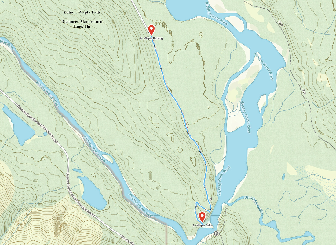 Wapta Falls GAIA Map
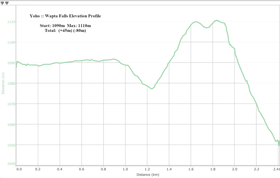 Wapta Falls Elevation Profile
© Autumn Sky Photography