Google Map |
Rockies :: Kananaskis :: The Windtower |
GPS Track |
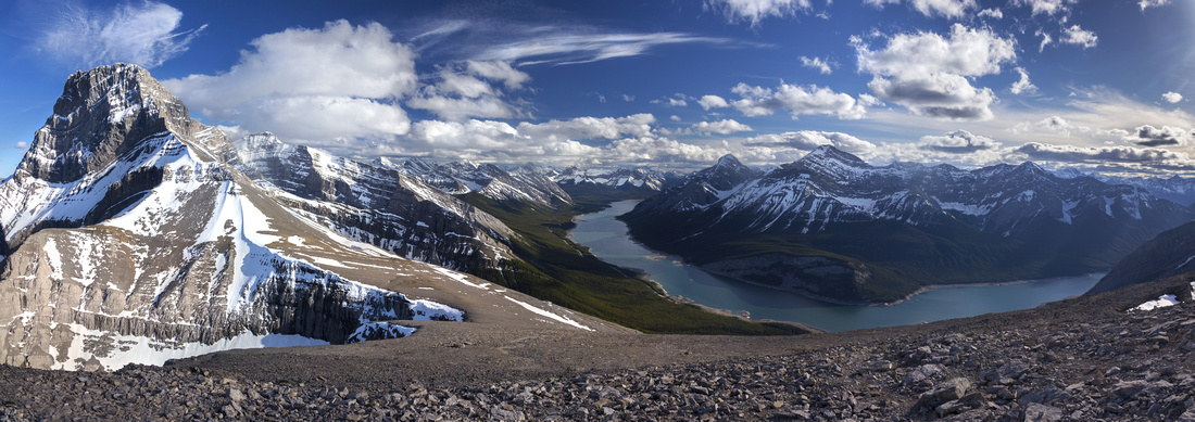 
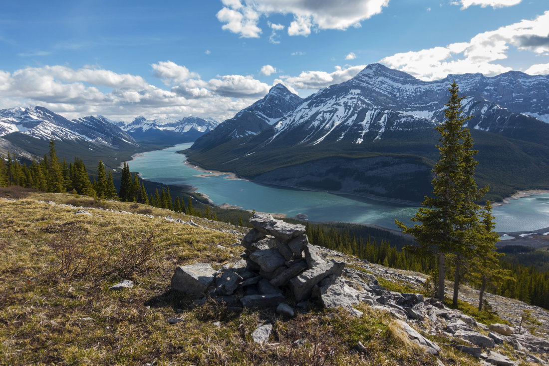
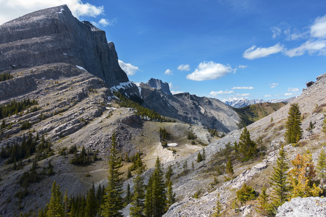
Panoramic Views South from Windtower Summit. Spray Lakes below, Lougheed Tower upper left |
|||
| Trip Summary | |||
Multiple Dates, last June 10 2020Almost bulletproof ascent in dry conditions with very high reward::effort ratio. When seen from Trans-Canada Highway driving past Dead Man Flats, Windtower appears impregnable; this view doesn't indicate any of gentle south side talus slopes. Views of Spray corridor any many distant Kananaskis peaks is fantastic. Only difficulty is slope traverse past West Wind Pass and this bit should be dry. Hike is worth repeating over and over. Peak did not get its name for no reason -- calm conditions don't happen very often (did you remember to bring the windbreaker?) For photographers, sunset in right conditions can be formidable.
Drive Spray Road for ~20km (25min) south of Whiteman Gap above Canmore and park on either side of the road below obvious drainage between Rimwall and Windtower; this is just as speed signs have been reverted back to 80kph and unobstructed view of Spray Lakes appears on west side. Use GPS track, available for download on top of the page, if necessary. Trail dips in the forest and is for short distance shared with TCT - Trans Canada Trail. At second junction (marked) turn sharp right and up -- this is West Wind Pass trail. Trail rises above the drainage with several clearings offering good view of Windtower gentle upper slopes. It takes ~45min to West Wind Pass where you will likely leave most of the hordes behind. Windtower is directly above, but sheer cliffs above the pass require traversing in south direction for ~30min until they have eroded and only thing that remains is gentle talus. This traverse is potentially the only tricky bit; several small rock steps are not an issue when dry, but in spring conditions soft snow lingers long and creates dangerous moats that can cause ankle sprain or worse. Several cairns indicate spot when you should stop traversing and angle left. Good talus trail appears but this is better used on descent as it is fairly lose going up. Instead traverse on heather for another 5-10 minutes then easily hike up to broad Lougheed - Windtower saddle above. This saddle is simply wild and fantastic viewpoint, in many aspects better than the summit above!
From the saddle final push is as easy as it looks. Spray Lakes Panorama behind constantly improves as you follow beaten path in scree gently switchbacking to several wind corrals on the top. Other side drops pretty much vertical so stay away -- fall would be fatal. Lower Tower directly east does not offer better view although scrambling is sometimes attempted by irresponsible people trying to impress their friends - stay at main summit and enjoy views instead! Return is the same way and depending on your timing light for panoramic photography of Spray corridor can be phenomenal. Highly recommended.
|
|
Gallery |
|||
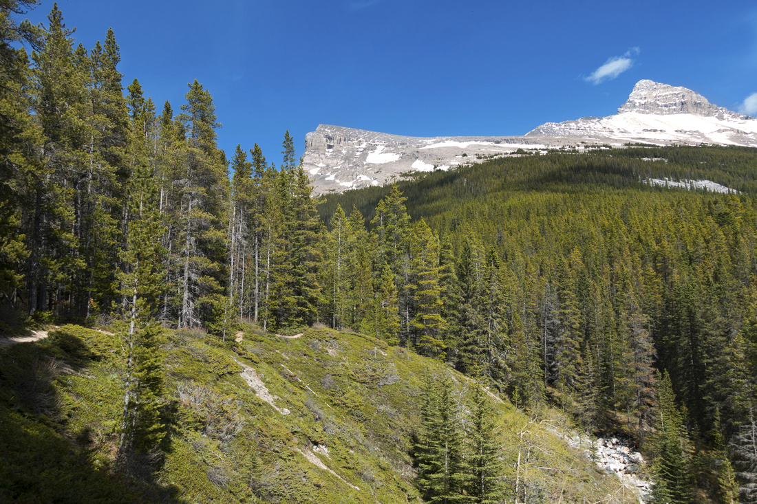 Hiking West Wind Pass trail. Windtower just left of center above showing easy upper ascent slopes
 |
|||
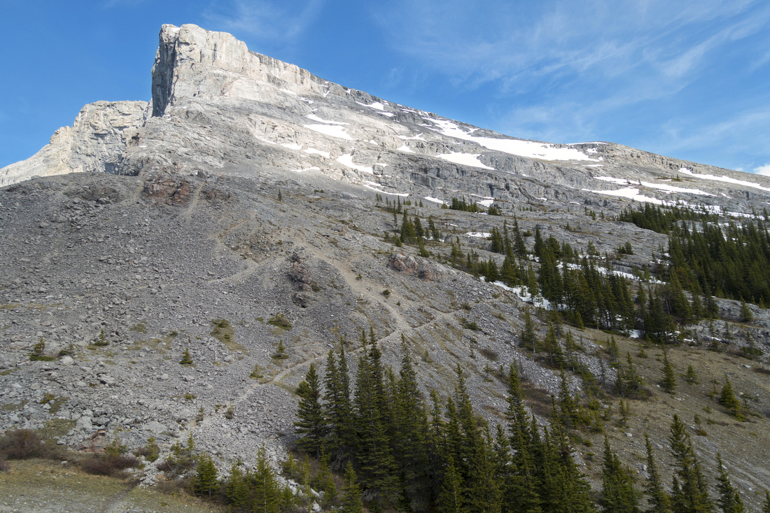 Arriving to West Wind Pass ~45min from the parking lot; Windtower directly above. Follow obvious talus trail in lower part of the photo
 |
|||
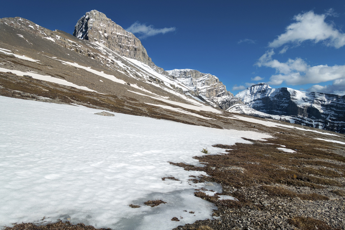
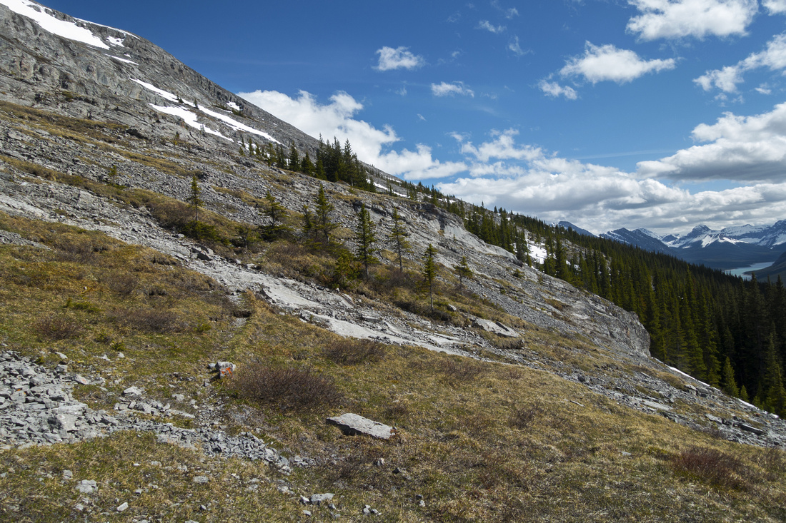 Traversing alpine slopes above West Wind Pass with minor cliffbands along the way
 |
|||
|
|
|||
 Expansive Views of Spray Lakes along the way. Trail starts angling up last bits of forest and up rubble slopes beyond this cairn
 |
|||
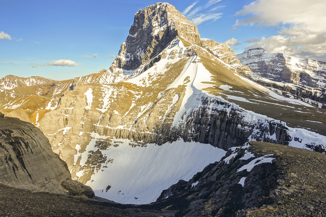
 Looking back to imposing Lougheed Tower from upper talus slopes with minor springtime snow patches
 |
|||
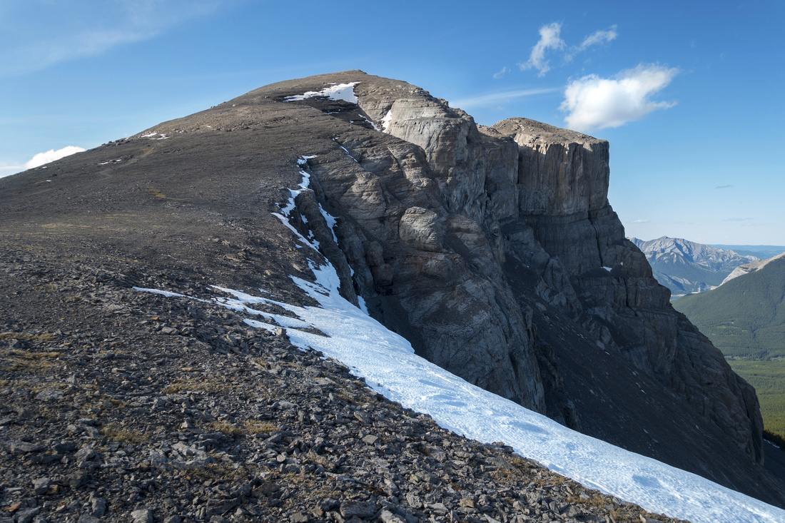 Final summit block - as easy as it looks. Stay well away from cornice on right side of the photo
 |
|||
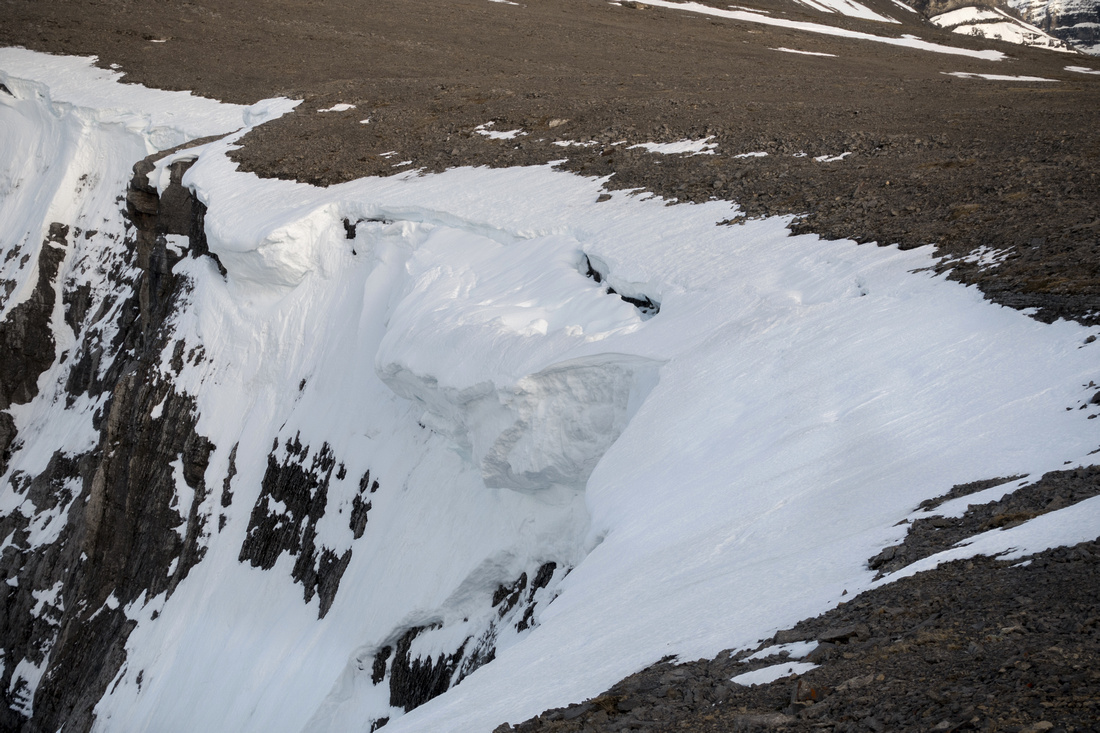 Illustration why venturing on that cornice would be deadly
 |
|||
 Stunning Lougheed Tower is reason to frequently stop and look behind
 |
|||
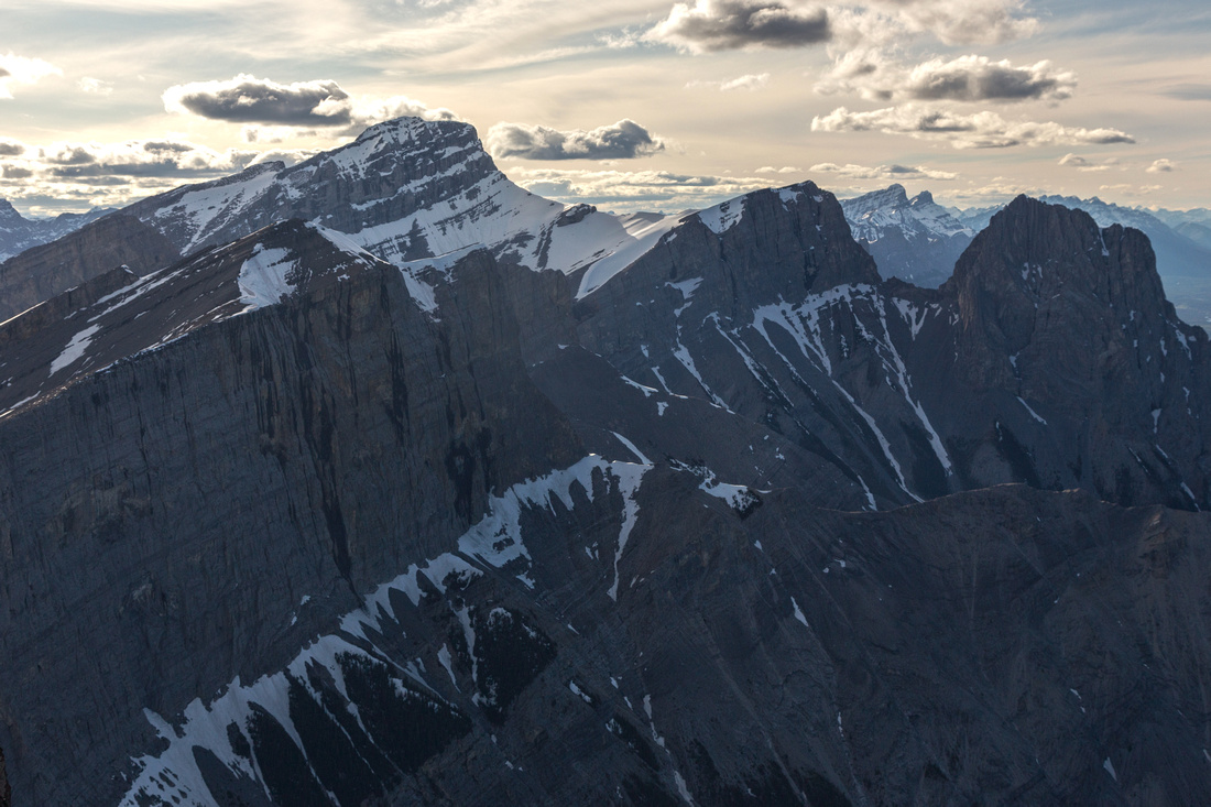 Three Sisters from Windtower. Rimwall upper left foreground
 |
|||
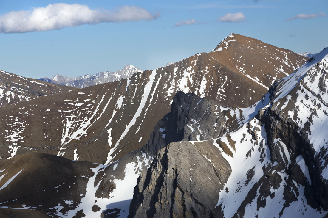 Mt. Allan Centennial Ridge - a classic front ranges ridgewalk. Saddle leading to rarely visited Connolly lake lower left
 |
|||
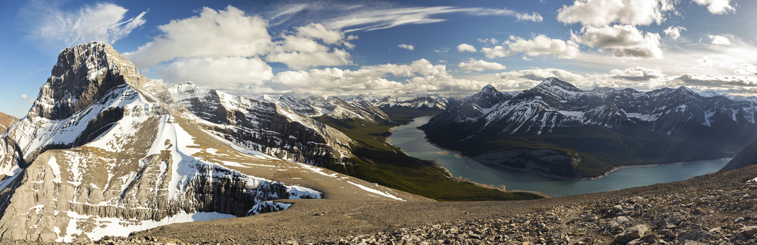 One more pano from the summit, similar to lead photo but with different color lighting
 |
Abstract
| Overall Difficulty | D5 | Mostly hiking with couple of minor rock bands above West Wind Pass. Moderately steep talus slopes. No exposure | |||
| Snow Factor | S4 | Traverse of Slopes south of West Wind Pass could be avalanche trap. Deep unsupportive snow and moats on early springtime ascents, | |||
| Scenery | Exceptional views towards Spray Lakes, and many peaks of Smith-Dorrien corridor. Stunning Lougheed Tower. Panoramic view of Canmore and Bow Valley from the summit | ||||
| Trail/Marking | Very Good | Well defined and popular hiking trail to West Wind Pass. Scree trails and cairns beyond that disappear in upper talus slopes but way is obvious | |||
| Suggested Time | 5-6hr | Could easily be done in under 5 hours, but why hurry with such exceptional scenery | |||
| Elevation | Start: 1655 m Max: 2680 m Total: ~1100 m | Round Trip: ~12 km | |||
| Gear | Full hiking boots, poles and gaitors | ||||
| Water | Seasonal spring snowmelt, but no reliable water source year-round. Carry 2-3L in summer | ||||
| Dog Friendly | Yes | Standard back-country travel precautions | |||
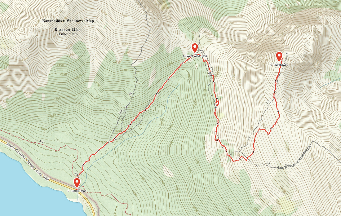 Windtower GAIA Map
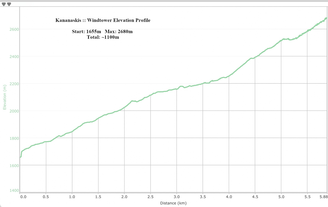 Windtower Elevation Profile