Google Map |
Rockies :: Kananaskis :: Tent Ridge |
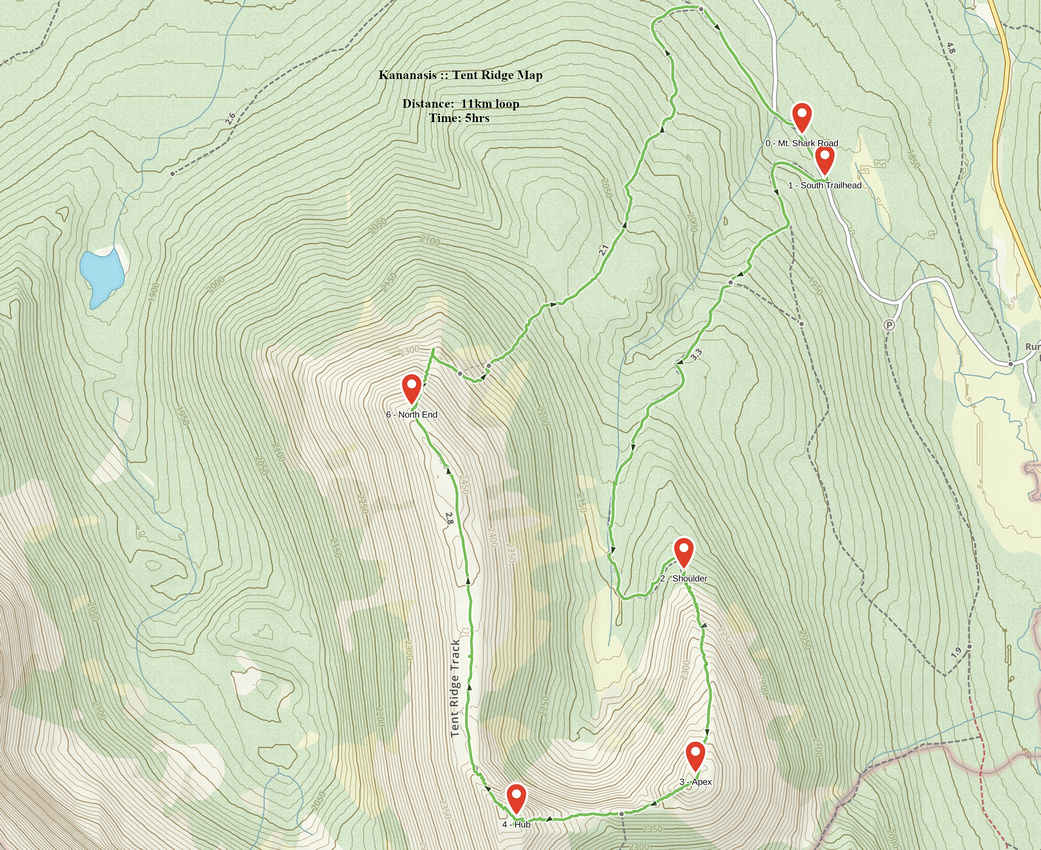
GPS Track |
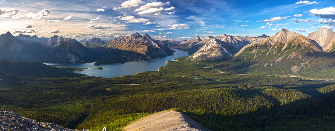 
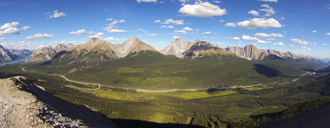
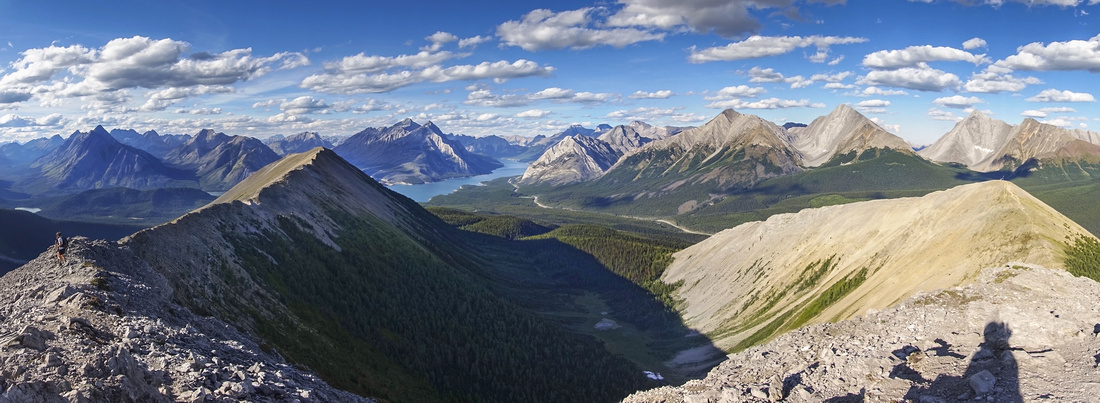
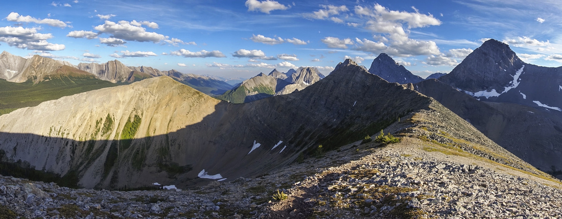
Magnificent Panorama from North End Viewpoint looking to Spray Lakes spreading like shining jewels surrounded by Smith-Dorrien corridor peaks |
|||
| Trip Summary | |||
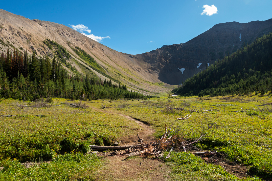
August 26, 2020Tent ridge is fantastic half-day hike on west side of Smith-Dorrien corridor, offering one of best viewpoints in K-country. There are several options ranging from full horseshoe traverse to few hours stroll up North end viewpoint. Clockwise direction is preferred. Tryst lake, seen below south side can also be visited by dropping steep talus / forest below south saddle. Trip is best done in 2nd half of September as abundant golden larches turning colors put area on fire.
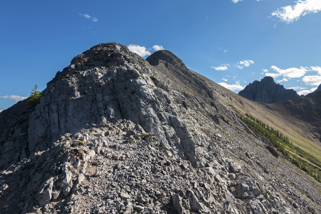
Parking is at shoulder of Mt. Shark road, ~2km from Spray road junction. Large pull-out area on the right (north) side is just before road starts descending from top of the hill. It is obvious and there will probably be cars as this is popular hike, but if in doubt use GPS track from top of the page. First thing is to decide on direction; described here is clockwise, and for that you need to hike back along the road you just drove in for couple of minutes watching for trail on right (south) side (Waypoint "1 - South Trailhead"). If doing CCW loop, or if hiking just to North viewpoint trailhead is ~100m further up the road; this will be where you will return after completing clockwise loop. From south trailhead good trail rises through semi-open forest and in about 15 minutes reaches the junction. Branches are laid across trail continuing straight; turn right instead and hike more steeply along occasionally rooty terrain to head of "Monica Basin" - meadow filled amphitheater encircled by Tent Ridge Horseshoe. Seasonal creek flowing here is the only source of water for the day. Trail soon turns left and ascends through larch forest to shoulder below east leg of the Horseshoe. Scree trail switchbacks up; there are some minor cliffbands along the way, but they don't present serious challenge (class 2, head on). Terrain then mellows and eventually reaches first bump with weather station -- "The Apex", then descends to low saddle below "The Hub" -- highest point of the Horseshoe. Tryst lake is revealed in cirque on south side. Upcoming ascent looks steep but is shorter than expected and before long you reach 2540m highpoint of the day and logical spot for lunch break. Surrounding views are fantastic. Venture a bit along rugged ridge north towards the Fist for unique perspective of this difficult-rated Kane scramble; it might be possible to trash this way to ridge between The Fist and Smuts, but I have not tried it.
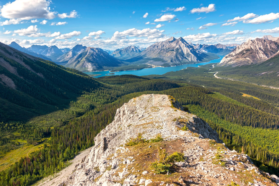
Drop from "The Hub" is initially straightforward, but soon becomes a bit rough. Trail on skier left bypasses couple of narrow parts and after 25-30 minutes you are past all difficulties. Upcoming finale is easily best part of the day, rounded ridgewalk with spectacular 360 views culminating with that fabled North End viewpoint. Even if everything so far was boring, this view would more than justify whole effort! My photos don't do justice as air was fairly hazy from BC Wildfires smoke. On a clear crisp fall day it is simply jaw dropping. Best lighting is late afternoon / early evening as sun is to the left (west), optimal angle for circular polarizers, and lights beautiful colors on Spray Lakes spreading like shining jewel on horizon. Last part is descent back to Monica basin; trail descends north ridge for 10 min or so, then swings east to the face. Be alert for bears lower down; on my trip in 2012 I've seen large grizzly here! From Monica basin trail follows shallow drainage back to Mt. Shark road; this part will probably feel considerably longer than expected. Eventually it exits to old forest road; turn right and walk back to the parking.
If hiking in CCW direction and wanting alternate exit from the ridge that avoids elevation gain to "The Apex" and rough east side descent, suggested option is to drop to Tryst Lake from low saddle below "The Hub". There is no trail, but going is fairly easy; initially talus, then semi open low forest. Upon reaching valley floor, circle the lake on south side then pick up trail at far end. It descends through forest then after joining old fire-road leads back to Mt. Shark road ~1km from the parking. |
|
Gallery |
|||
 Hiking through Monica basin, ~30-40 min from parking. Trail swings left and ascends larch forest to shoulder below Horseshoe east side
 |
|||
 Climbing rugged east side with couple of class 2 rock steps
 |
|||
 Looking back to Spray lakes as ridge mellows above the rugged initial part
 |
|||
 Nice panorama of Chester group east of Smith-Dorrien road; Spray lakes extreme left
 |
|||
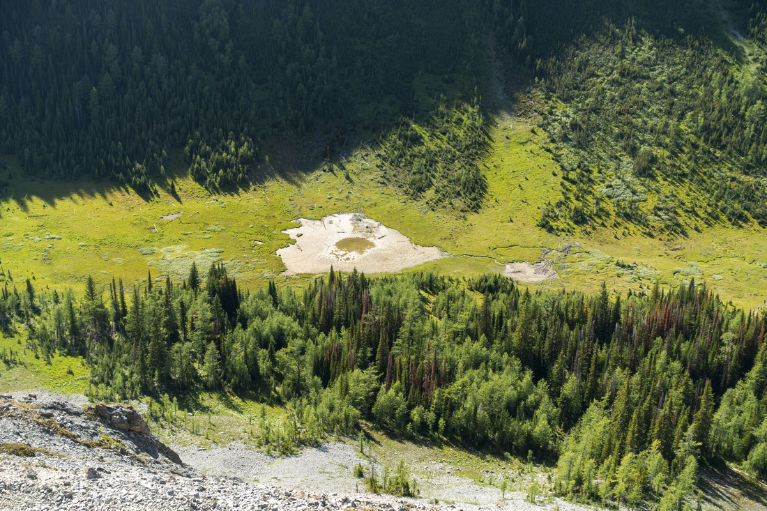 Aerial view of dried tarn in Monica basin below in heart of Horseshoe. This valley is grizzly bear haven
 |
|||
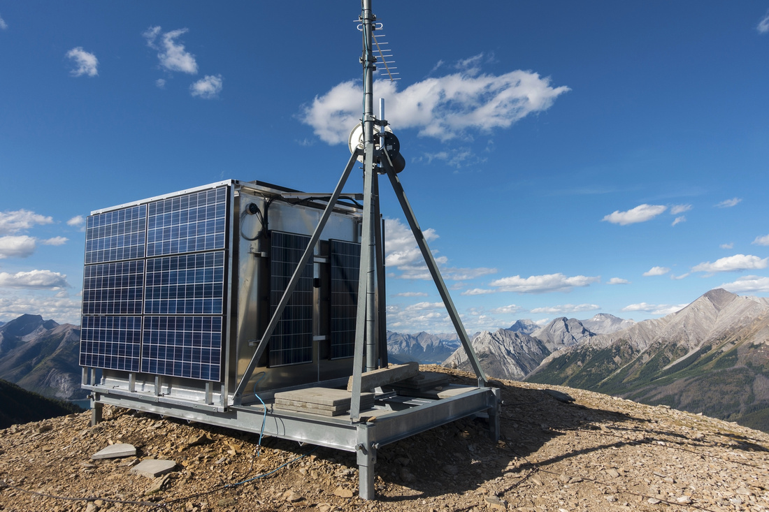 Weather station with solar panels at South Apex
 |
|||
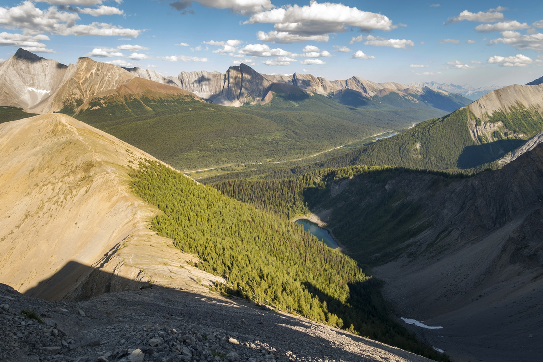 Tryst Lake in deep cirque below saddle between Apex and the Hub. It is possible to descend steep rubble/forest slopes then pick up trail at far end of the lake and return to Mt. Shark road that way
 |
|||
 North panorama from "The Hub" - highest point of the horseshoe. Apex right, west side extending to north viewpoint left. Monica basin below
 |
|||
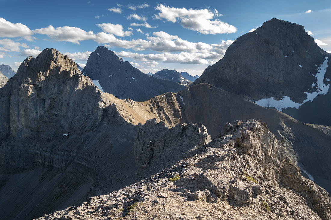 Rough ridge with rocky pinnacles south of the Hub; it might be possible to scramble this way and interesect normal route up the Fist (upper left foreground). Mt. Smuts upper right, Mt. Birdwood behind center left background
 |
|||
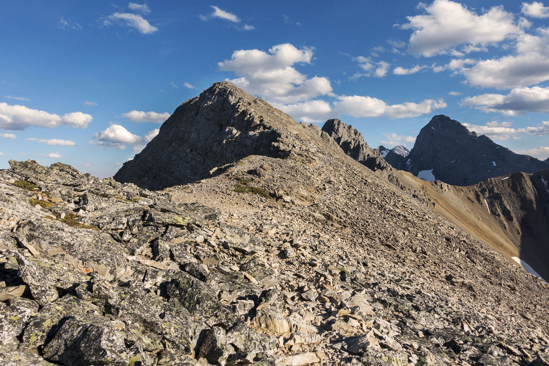 View back to the Hub after descending rough and mildly exposed section
 |
|||
|
|||
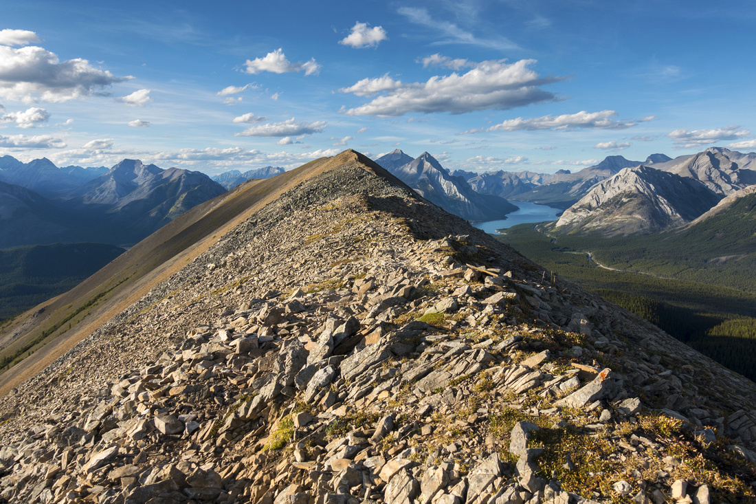
| Hiking towards north end viewpoint. This part with far reaching views is very enjoyable | |||
 Panoramic view back to entire Tent Horseshoe from north end
 |
|||
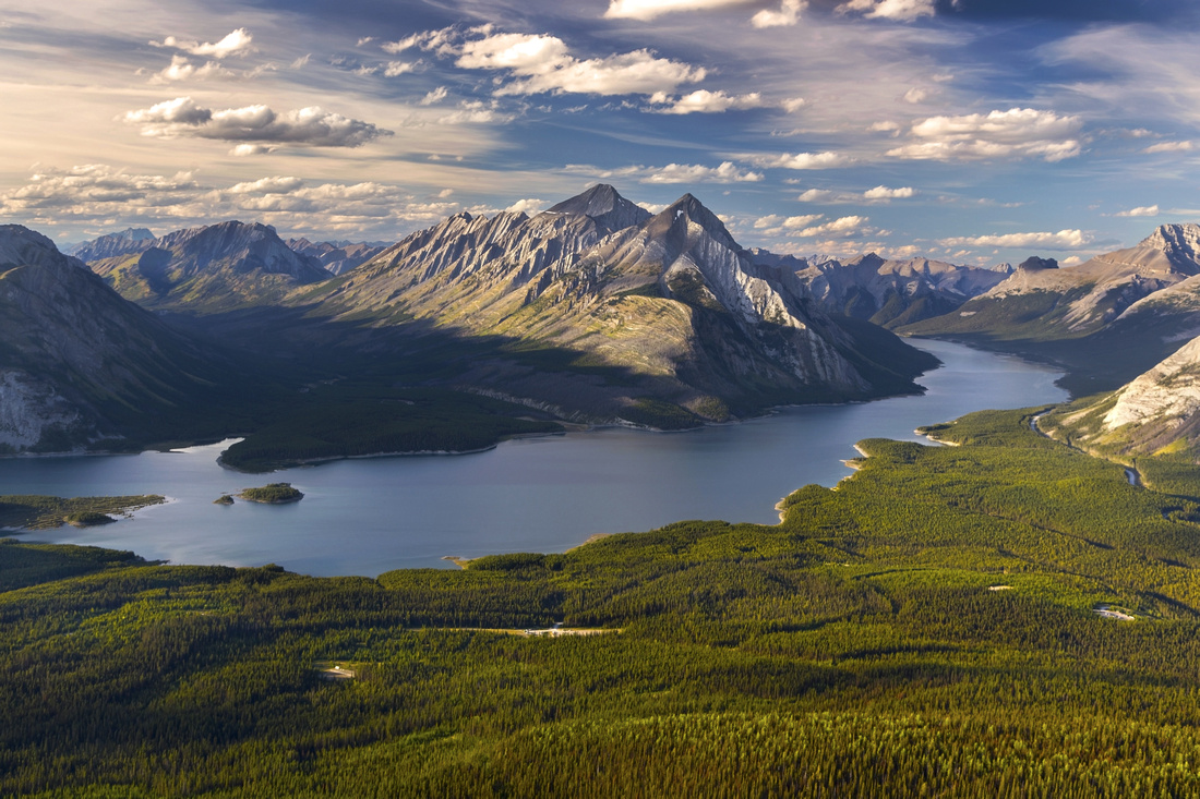 Fantastic north end viewpoint, one of best in K-Country. This photo doesn't even do justice as air was quite hazy from BC wildfires. For photographers it is worth coming here with tripod ~1hr before sunset; with right light conditions scenics will be amazing!
 |
|||
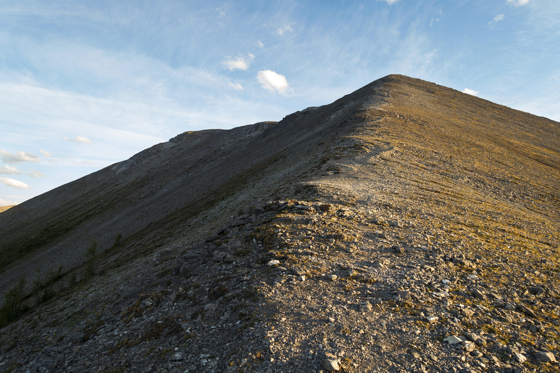 Descending rubbly north end; note scree trails above. Trail turns east here and drops steeply back to Monica basin
 |
|||
Abstract
| Overall Difficulty | D4 | Some class 2 rock scrambling with mildly exposed parts. Steep talus slope on descent into Monica bowl from west end | |||
| Snow Factor | S5 | Severe avalanche danger on steep west slopes; deaths have occurred there in the past. Not feasible for winter trip | |||
| Scenery | Amazing view of Spray lakes from west end - one of best in K-country (lead photo on this page). Many rugged Rockies peaks, including distant Mt. Assiniboine | ||||
| Trail/Marking | Good / None | Fairly distinct trails below treeline to / from Monica basin, but trailhead and junctions are not marked. Way on the ridge is obvious | |||
| Suggested Time | 5 hr | Full Horseshoe (regardless of direction). Less if going just to west Spray lakes viewpoint | |||
| Elevation | Start: 1880m Max: 2540m Total: ~850m | Round Trip: 11 km (horseshoe loop) | |||
| Gear | Full Hiking boots and poles. Gaiters helpful for steep talus slopes. | ||||
| Water | Creek draining seasonal tarn in Monica basin. Ridge is dry. Carry 1-2L | ||||
| Dog Friendly | Yes | Grizzly bears frequent Monica basin and accidents have occurred. Take necessary precautions | |||
 Tent Ridge GAIA Map
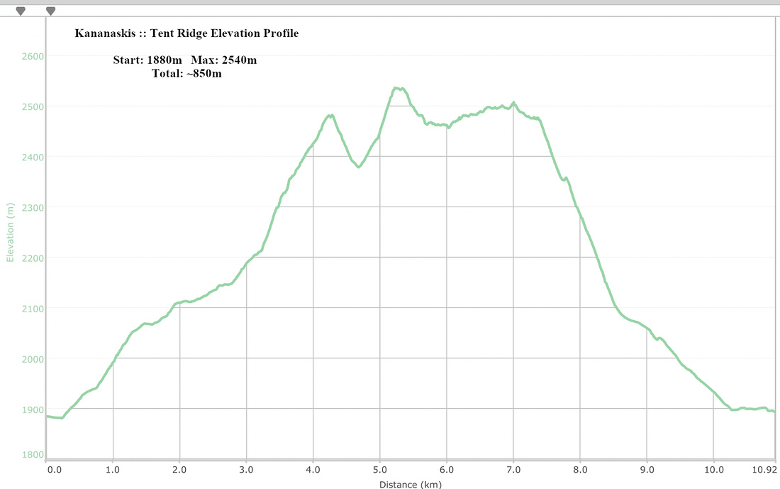 Tent Ridge Elevation Profile