Google Map |
Rockies :: Kananaskis :: Smutwood Peak |
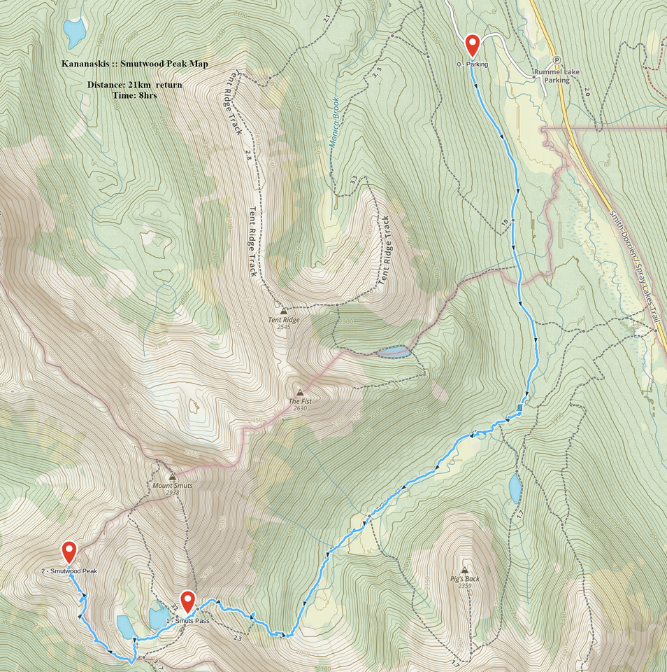
GPS Track |
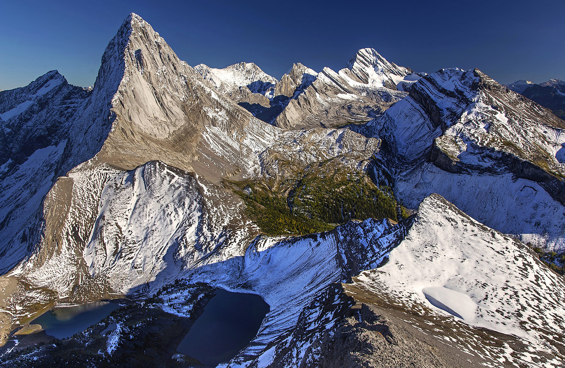 
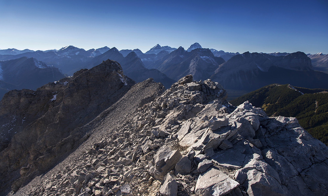
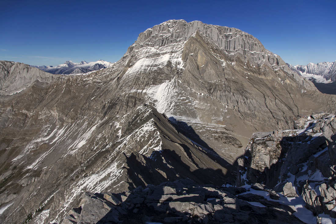
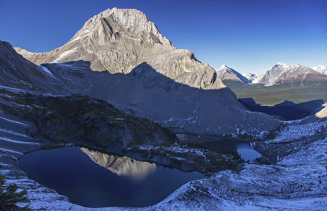
"Million dollar view" from summit of Smutwood Peak. Striking NW ridge of Mt. Birdwood upper left, Birdwood Tarns below. Smuts Pass far bottom left. Sir Douglas just right of upper center in the distance, Snow peak to its right |
|||
| Trip Summary | |||
September 13, 2016Mt. Smutwood is unofficially named high point of long ridge just west of Smuts Pass. It is very scenic easy ascent in beautiful Smuts Pass environs. Summit view is simply breathtaking and easily one of the best in K-country. With 2 vehicles it is possible to extend the day and do a loop return via Birdwood/Burstall Pass. For less energetic, even just the hike to Smuts Pass is well worth the effort. Highly recommended!
Follow Mt. Shark access road past Mt. Engadine lodge turnoff across the bridge, then at first switchback turn left into logging road - parking area is few meters away. Hike this logging road passing Tryst Lake turnoff in about 20 minutes, then when the road splits take right branch heading towards Commonwealth creek. Road soon turns into trail and descends to the creek. First highlight is here -- twin falls (did you bring the tripod?). Past the falls rooty and occasionally muddy trail hikes on right side of the creek to head of long valley sandwiched between Fist/Smuts to the right and Commonwealth Peak/Pigs Tail/Mt. Birdwood to the left. Smuts pass is the notch on the horizon and appears far away at this point. Good trail continues on the right side of the valley and reaches base of headwall below the pass in 45 mins to an hour. Ascent to the pass is steep and lower part of the trail is a bit eroded - caution needed on descent. Trail splits on the bench dotted with larches halfway up; going left across the scree is faster, but if you continue straight it is actually more beautiful - make your pick. Both routes converge just below Smuts Pass. This is where scramblers heading for Mt. Smuts would leave the trail and ascend scree cone to the right. It looks quite scary just looking from below, and hard to believe it is a scramble. Most parties that ascended Mt. Smuts over the years agree it is low class 5 and really a technical climb - I strongly advise against. There are much better ways to spend days in the mountains.
Lovely panorama unfolds at the pass, with Smutwood ascent ridge directly across. Lower Birdwood tarn is below and it is worth losing a bit of elevation to visit it. Hike up to upper tarn noting lovely waterfall separating the two, then up grassy slope to start of the ascent ridge. Alternatively scree trail on the left side bypasses the tarns and is more direct; leave it for the return perhaps. The ridge is as easy as it appears and faint trail can be found most of the way. There are couple of rock bands but all are very easy and barely call for use of hands (class 2). False summit is usually bypassed on the left side, but you can also go directly over. Final part of the ridge is a bit loose; as usual, it is best to stay as close to the crest as possible, and leave scree trails for descent. It takes about an hour from upper tarn to the summit. |
|
Gallery |
|||
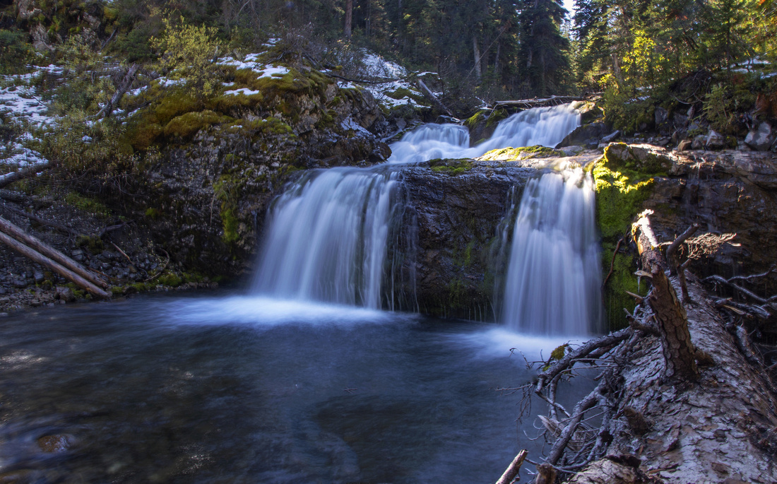 Commonwealth Creek Falls. Trail continues on the right side
 |
|||
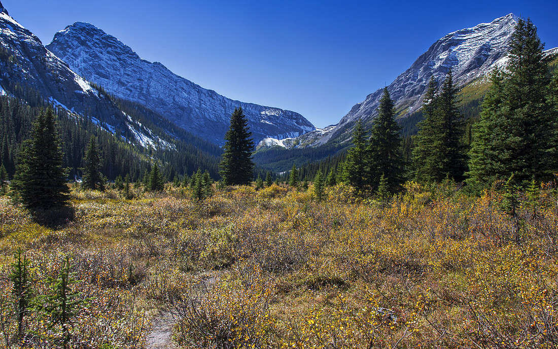 Entering Commonwealth Creek valley 15 min past the waterfall. Smuts Pass in the distance
 |
|||
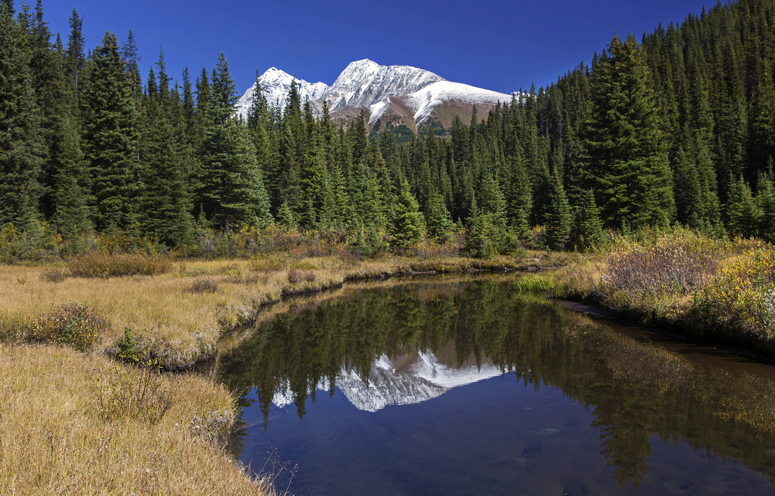 Views back to Mt. Chester
 |
|||
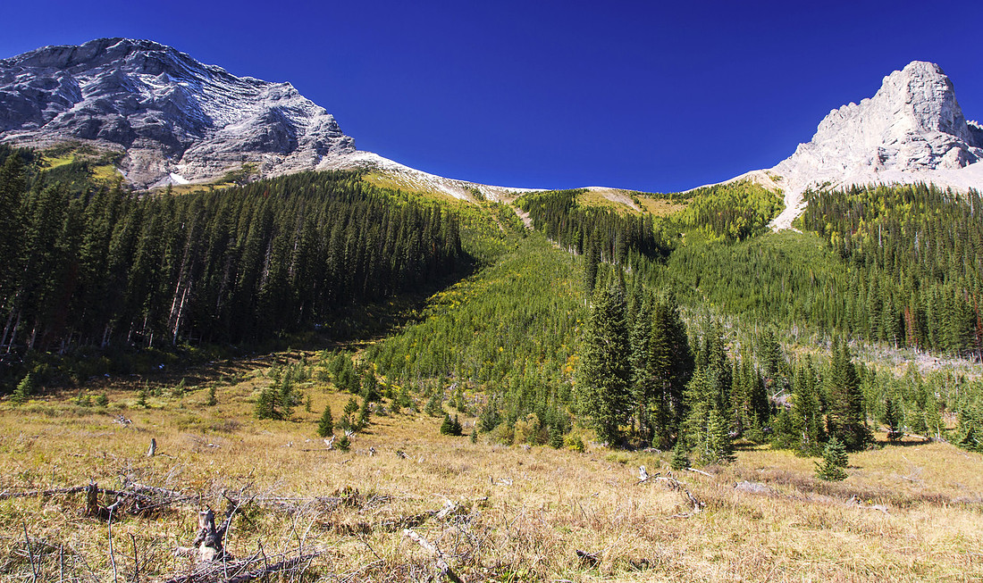 Avalanche slope in mid valley. Smuts left, Fist right
 |
|||
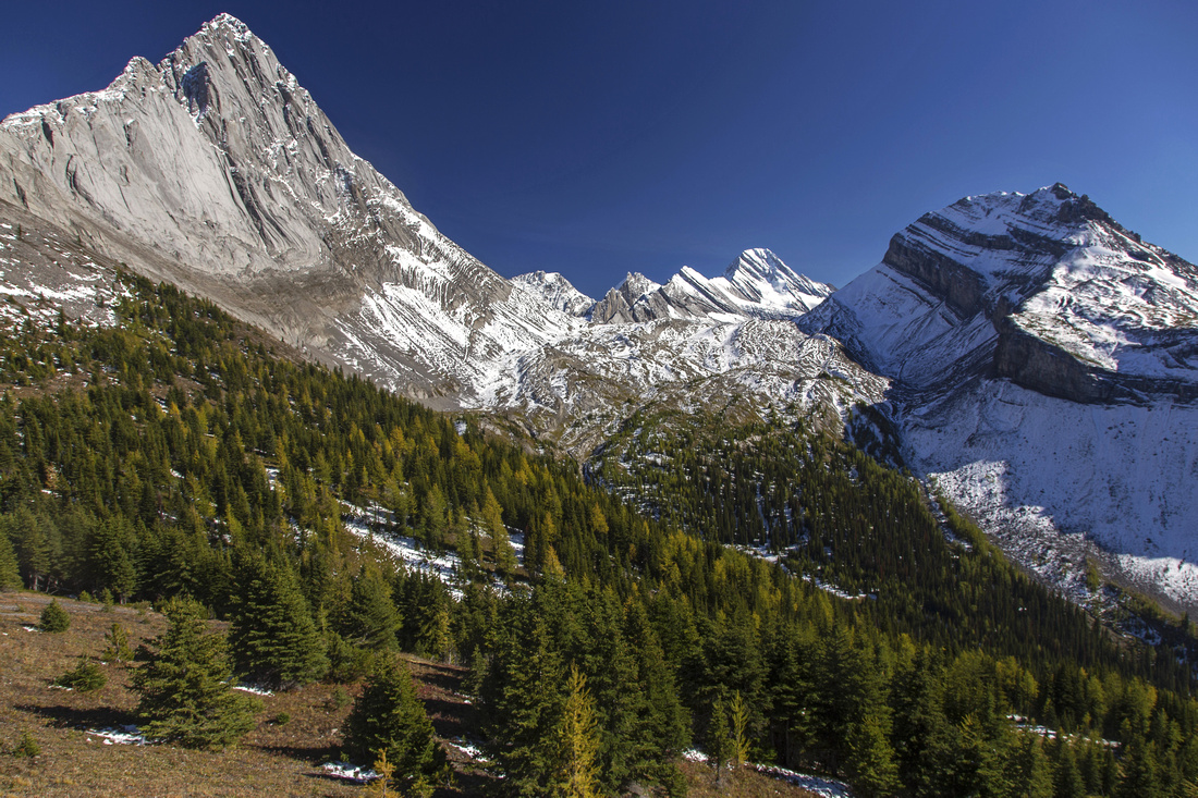
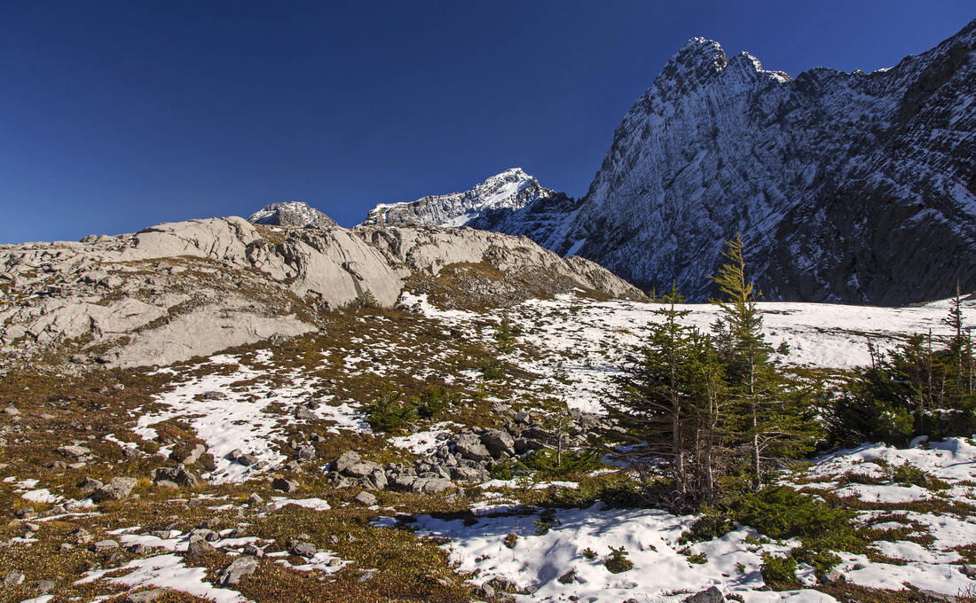 Smuts Pass alpine environs. Birdwood NW ridge upper right
 |
|||
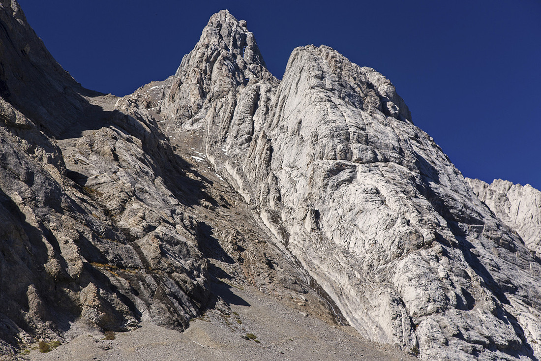 Mt. Smuts normal ascent route - do yourself a favour and go somewhere else
 |
|||
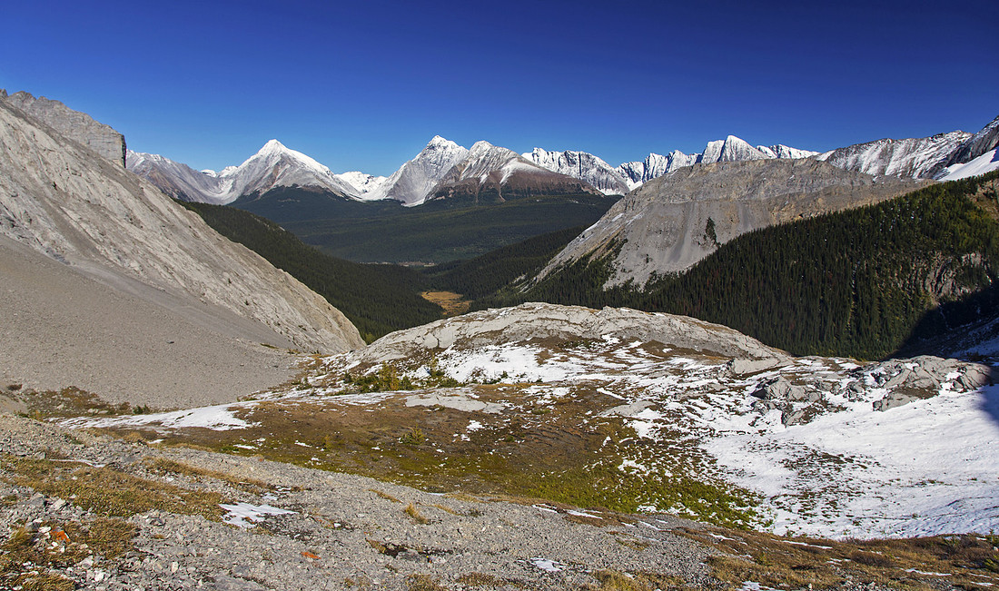 Length of Commonwealth creek valley from Smuts Pass
 |
|||
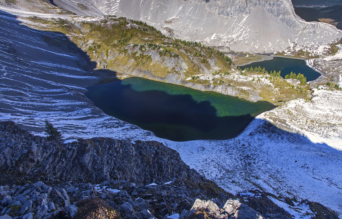
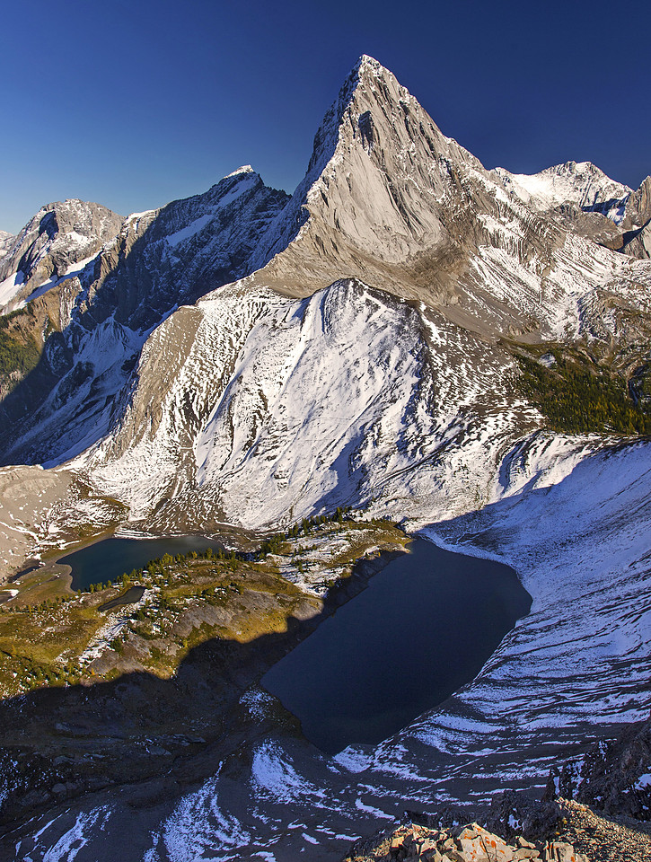
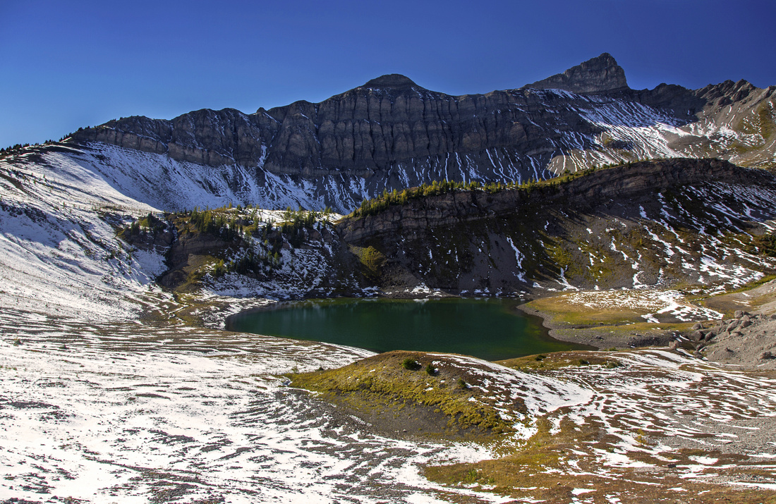 Smutwood ridge and lower Birdwood Tarn from Smuts Pass
 |
|||
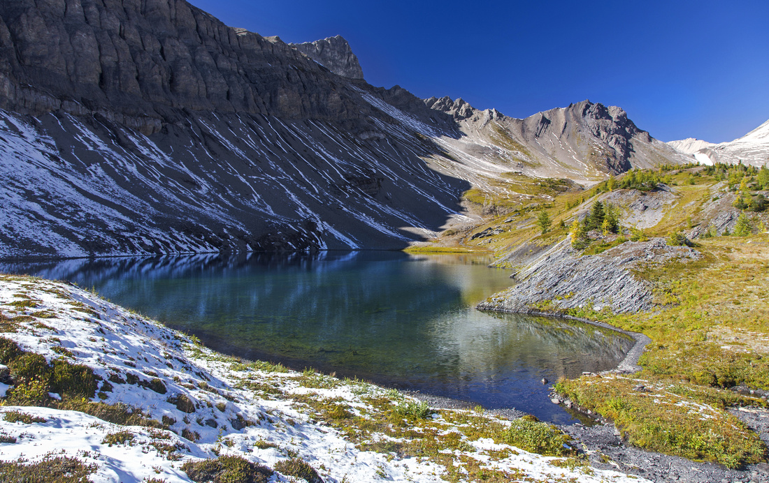
 Hiking by Birdwood Tarn. Mt. Smutwood upper left
 |
|||
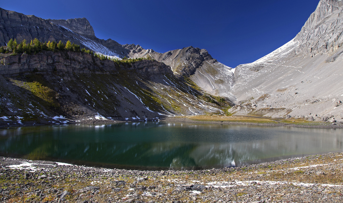
 Upper Birdwood Tarn - fantastic photo op in mid-afternoon
 |
|||
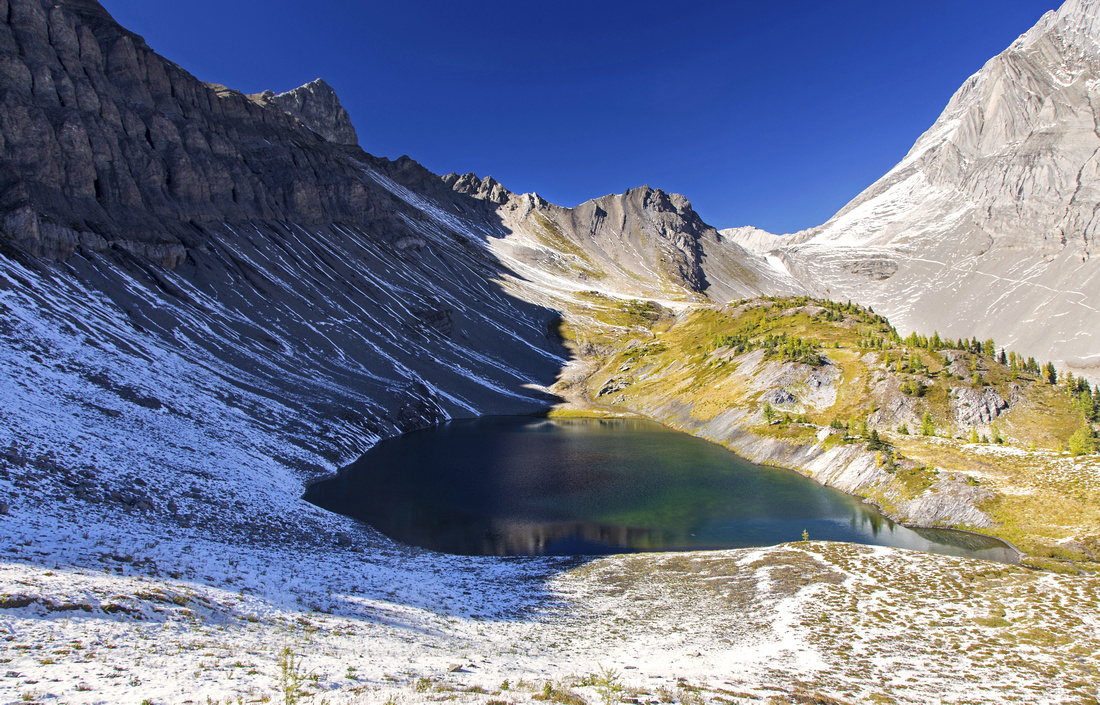 One more shot of upper Birdwood Tarn
 |
|||
 Birdwood/Burstall Pass area from start of Smutwood Ridge
 |
|||
 View down to Birdwood Tarns from start of Smutwood ridge
 |
|||
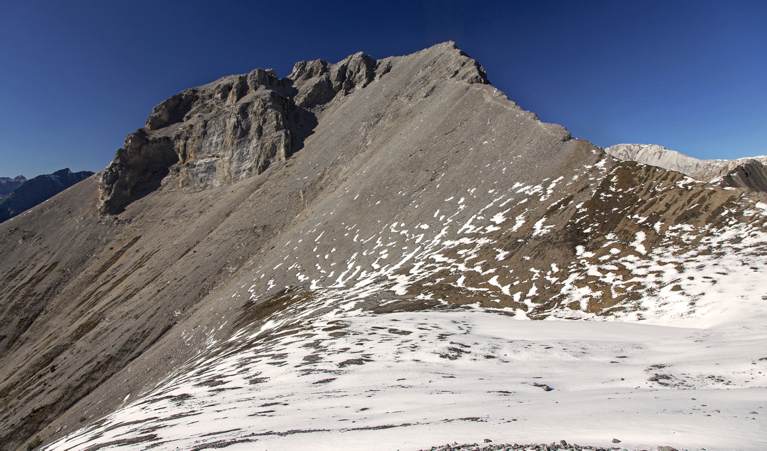 Final part of the ridge just past the lower sub-summit
 |
|||
 Views west from the summit. Nub center left is lower
 |
|||
 View to alternate Mt. Smuts descent route
 |
|||
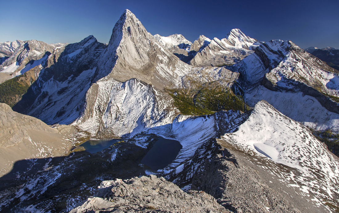
 Mt. Birdwood from the summit. Smuts Pass far center left
 |
|||
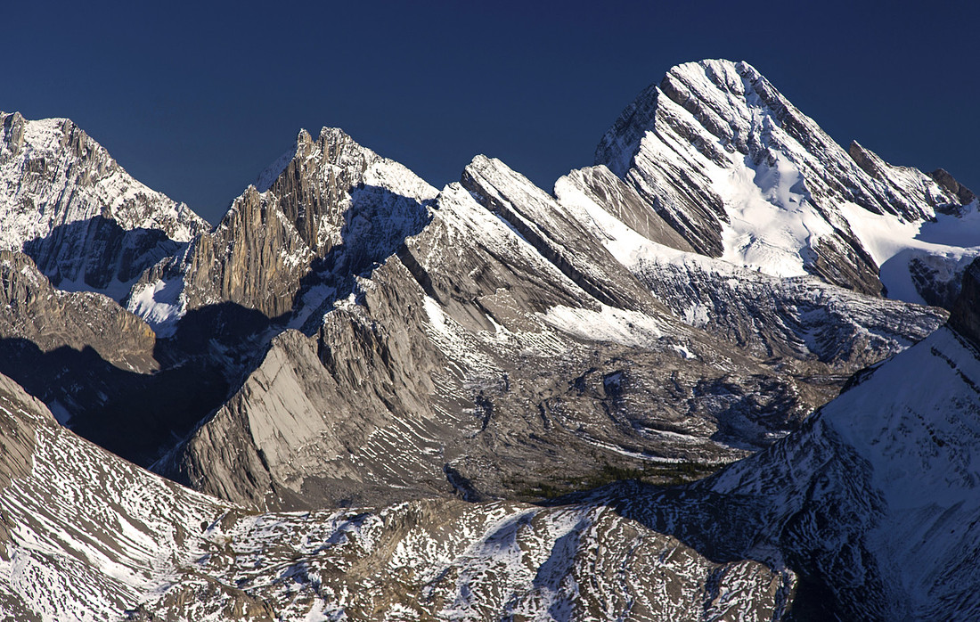 Zoom on Sir Douglas and Burstall pass environs
 |
|||
 Entire length of ascent ridge from Smutwood summit
 |
|||
 Mt. Smuts reflected in upper Birdwood Tarn on descent
 |
Abstract
| Overall Difficulty | D5 | Trail hiking in Commonwealth creek valley with some muddy and rooty/bushy parts. Steep ascent to Smuts Pass. Easy scramble on Smutwood south ridge with few minor rock steps. Lose talus slope just before the summit. | |||
| Snow Factor | S3/4 | Avalanche danger on Smuts Pass approach. Trip is likely too long for snowshoes, but fantastic as ski ascent | |||
| Scenery | Except for initial logging road walk, this is exceptionally scenic trip throughout! Commonwealth creek waterfall, meadows below Fist/Smuts, Birdwood Tarns at Smuts Pass are some of highlights on approach. Summit view is easily one the best in K-country | ||||
| Trail/Marking | Good | Unofficial, but easy to follow trail to Smuts Pass with one confusing part. Off-trail Smutwood ridge alpine ascent | |||
| Suggested Time | 8 hrs | Round trip returning the same way. Add 1-2 hours for alternate loop return via Burstall pass | |||
| Elevation | Start: 1870m Max: 2690m Total: ~1000m | Round Trip: ~21km | |||
| Gear | Full hiking boots preferred. Ski poles very helpful on lose parts of final lose parts. | ||||
| Water | Commonwealth creek and Birdwood Tarns. Ridge is dry. Carry ~ 1.5 - 2L | ||||
| Dog Friendly | Yes | Standard back-country travel precautions. Grizzly bears sometimes frequent Commonwealth creek valley | |||
 Smutwood Peak GAIA Map
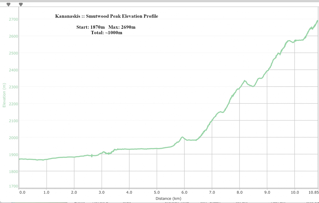 Smutwood Peak Elevation Profile