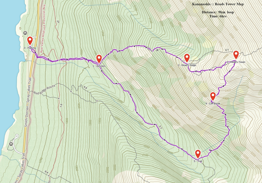
Google Map |
Rockies :: Kananaskis :: Read's Tower |
GPS Track |
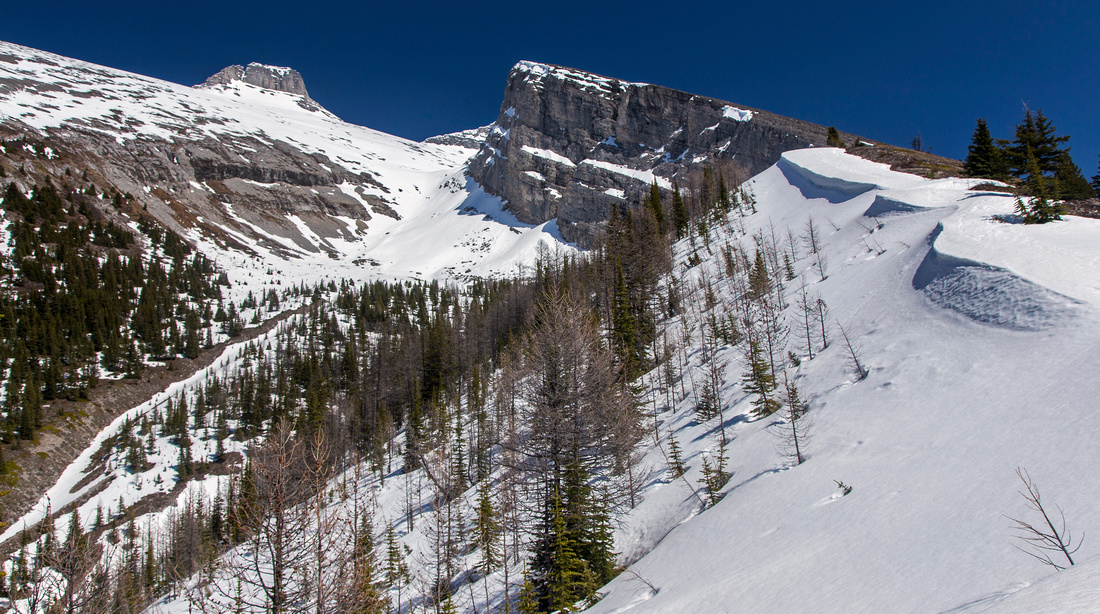 
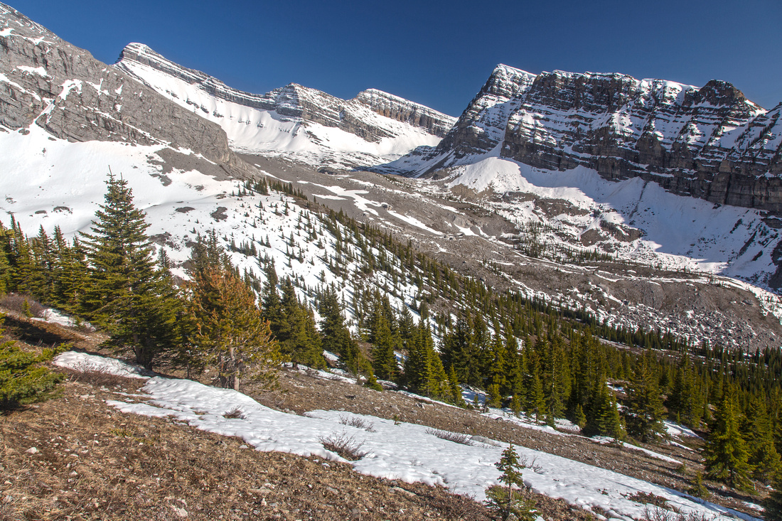
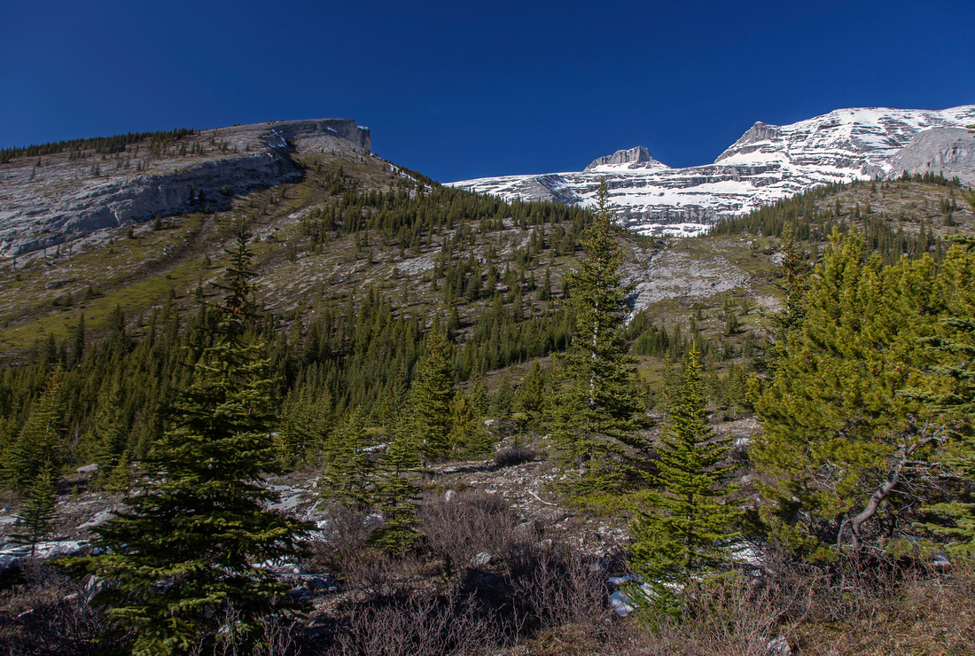
Ascending Read's Ridge. Read's Tower in upper center, Mt. Sparrowhawk rocky nub in the distance upper left |
|||
| Trip Summary | |||
May 19, 2015Steep ascent from Smith-Dorrien road to top of rock buttress at east end of Read' ridge. It is a short outing, and what you see is what you get - straight up to the top! Ascent route is well described in Daffern K-country trail guide (Book 3 new edition - orange). First part is also normal access route for easy rated Kane scramble to Mt. Sparrowhawk. Loop return is possible by descending south side to valley below Red ridge then hiking out via Sparrowhawk tarns trail. This alternate off-trail descent has one tricky step in lower part as you must transfer from rubbly slopes through the cliff band on the left side and involves non-trivial route-finding. Views are fantastic throughout and include possibly the best vantage point of Spray reservoir as well as peaks in Mt. Bogart area. There are many other alternatives: from including scramble of Mt. Sparrowhawk (and visiting Read' Tower on return perhaps, for a very long day) to continuing to the tarns upon connecting with hiking trail on alternate descent. Drive Spray trail 25km south from Canmore and park at Sparrowhawk day-use area on right (west) side of the road. Hiking trail is visible across the road directly across the parking. It rises moderately for about 1/2 hour on the left side of Sparrowhawk creek to the junction; go left for Read ridge/Tower/Mt. Sparrowhawk, right for Sparrowhawk tarns. If doing a loop, this is where you will eventually connect on return. Next part is the steepest bit of the day -- up much eroded slopes, which will not be very pleasant on the knees if descending this way. It all pays off upon reaching low end of Read ridge -- fabulous views of Spray reservoir unfold behind you. Next bit is pleasant hiking along the grassy ridge for about 15-20 minutes; snow drifts possible in early season. Large cairn at end of this section indicates where scramblers going for Mt. Sparrowhawk should turn left and drop down to scree basin on the left of Read' Tower. (Note that Tower drops steeply on the east side and is not feasible for access to Sparrowhawk.) It takes about an hour and ~300m vertical to the top of Read' Tower from the cairn. Lower down in is best to stay on the left side as close as possible to the edge of drop-off, then halfway up transfer horizontally to the right side where patches of grass and bits of trail provide better footing. Beware of cornice on the summit in early season and don't venture out as there is large drop off & fall through the snow would likely kill you. For alternate descent drop down gently angled slopes on south side. Fantastic view of Red ridge, Mt. Bogart and valley hosting Sparrowhawk tarns is reason for frequent stops. Stay close to the edge; the idea is to find suitable spot to break through the cliffs and transfer to grassy draw below on left side. Note that staying on the ridge all the way is not feasible as there are cliff bands lower down. Best spot is probably about 2/3 of the way (waypoint "Cliff Break" on GPS track) where cliffs have eroded sufficiently to provide relatively easy spot to scramble down. From here side-slope towards far end of the draw, then descend right; bits of trail can be be found. Eventually pick up Sparrowhawk tarns hiking trail then turn right and hike out. Mt. Sparrowhawk itself is easy rated scramble - it is less technical than break through cliff band on alternate descent from Read' Tower. From cairn at Read ridge descend into scree basin and climb scree to gap on other side of Read Tower. (Note that turning right here it would be all descent on grass to the tarns trail; Daffern describes this as "Tower Gap" loop). Much rubble leads to weather station; turn left and ascent more scree to the summit. Staying closer left in final bit is easier on ascent. Views of Memorial lakes valley from the summit of Mt. Sparrowhawk are fantastic! |
|
Gallery |
|||
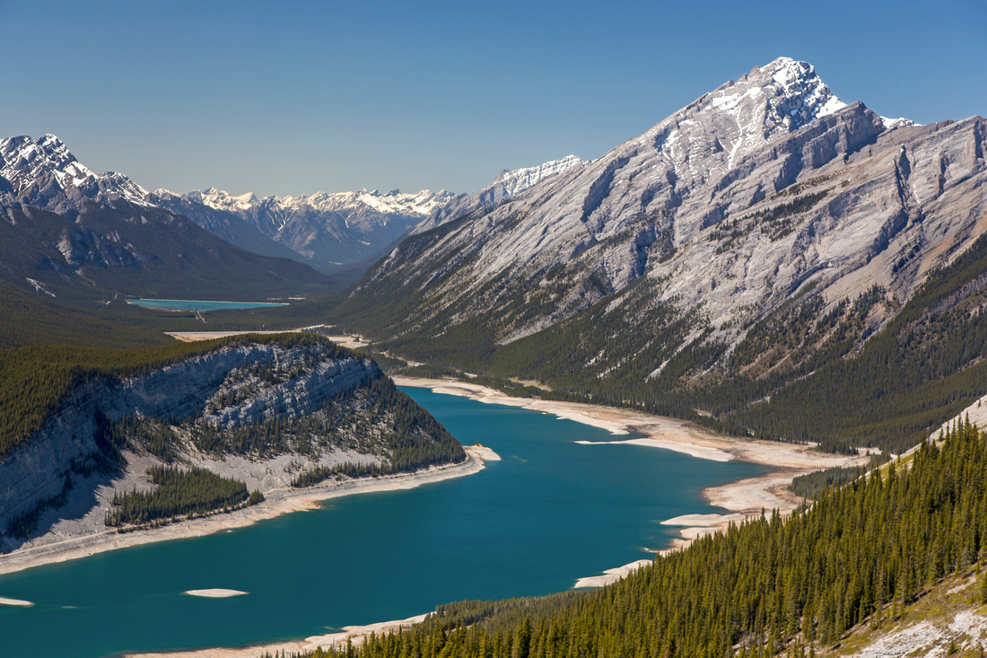 View of Spray Lakes and Big Sister while ascending lower part of Read's Ridge
 |
|||
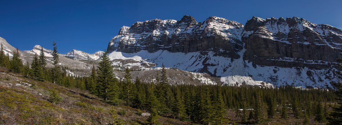
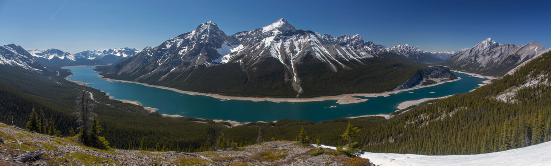 Panoramic view of Spray Lakes from Read's Ridge
 |
|||
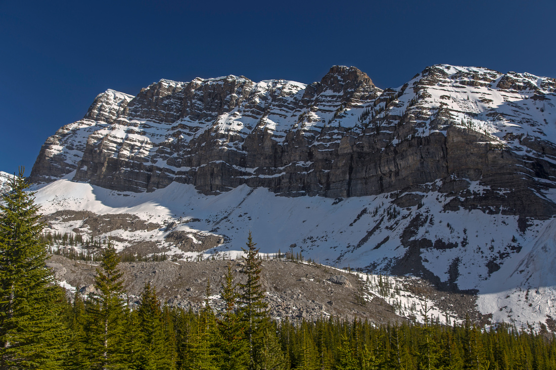
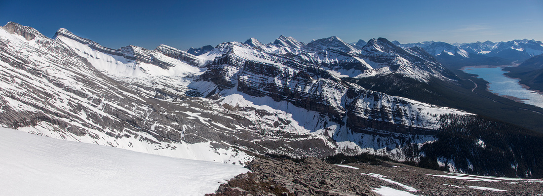 Panoramic view south from Read's Tower
 |
|||
 Descending to valley between Mt. Sparrowhawk and Red Ridge. Mt. Bogart upper left
 |
|||
 Meadows below Red Ridge just before intersecting Sparrowhawk Tarns trail
 |
|||
 View back at scramble descent from Read's Tower; snowpatch in center is easiest spot
 |
|||
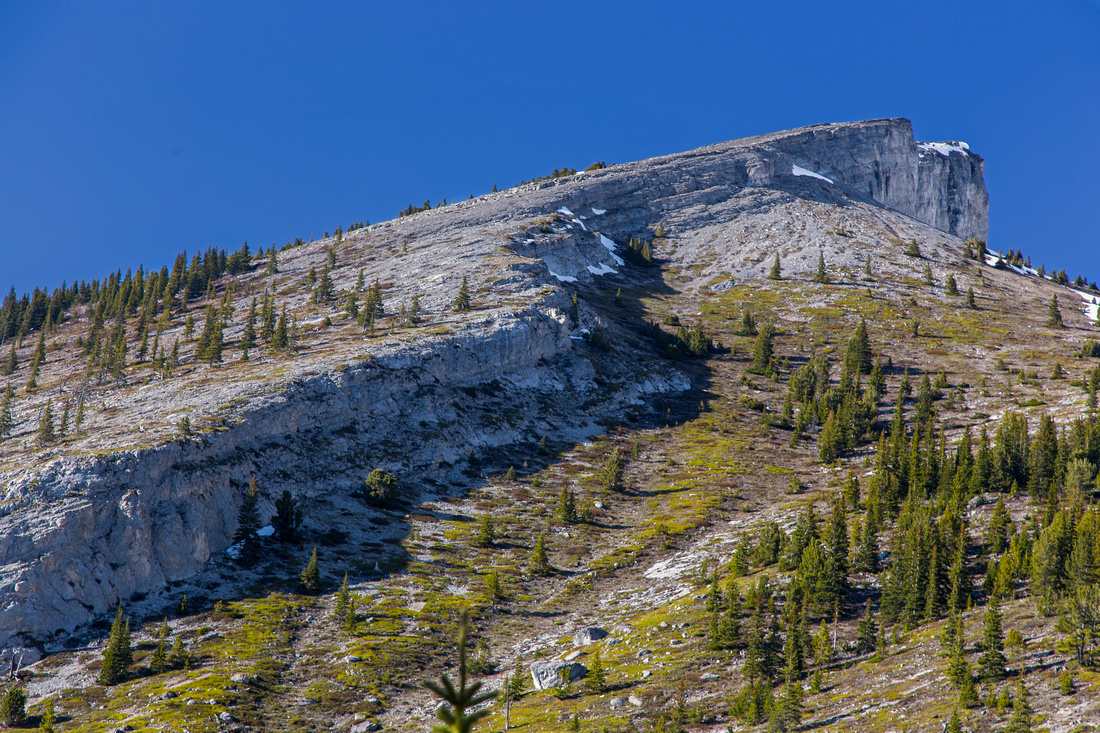
 One more look at Red Ridge
 |
|||
 View back to off-trail descent from Read' Tower
 |
Abstract
| Overall Difficulty | D5 | Steep and eroded trail to start of the ridge, followed to loose scree slopes to Read's Tower. Alternate descent on south side has one class 2 / class 3 step through the cliff band. Route-finding. | |||
| Snow Factor | S3 | Frequently done on snowshoes in winter. Open slopes above treeline require proper assessment of avalanche conditions. | |||
| Scenery | Panoramic views of Spray Lakes and Smith-Dorrien corridor. Great view of valley beneath Red's ridge leading to Sparrowhawk tarns on alternate descent. | ||||
| Trail/Marking | Good / none | Good trail to base of Read' Tower west side, none after. Route-finding skills essential for alternate descent on south side. | |||
| Suggested Time | 5-6 hr | Return time for full loop via Sparrowhawk Tarns trail. If descending the same way via west side ~4 hr. | |||
| Elevation | Start: 1730m Max: 2650m Total: ~950m (loop) | Round Trip: 9km (loop) | |||
| Gear | Hiking boots and poles. Gaiters helpful on scree slopes. In winter ice-axe might be an asset for self-arrest | ||||
| Water | None on west slopes. If descending on south side Sparrowhawk creek. Carry 2-3 L | ||||
| Dog Friendly | Yes | Most dogs should be ok with alternate scramble descent on south side | |||
 Reads Tower GAIA Map
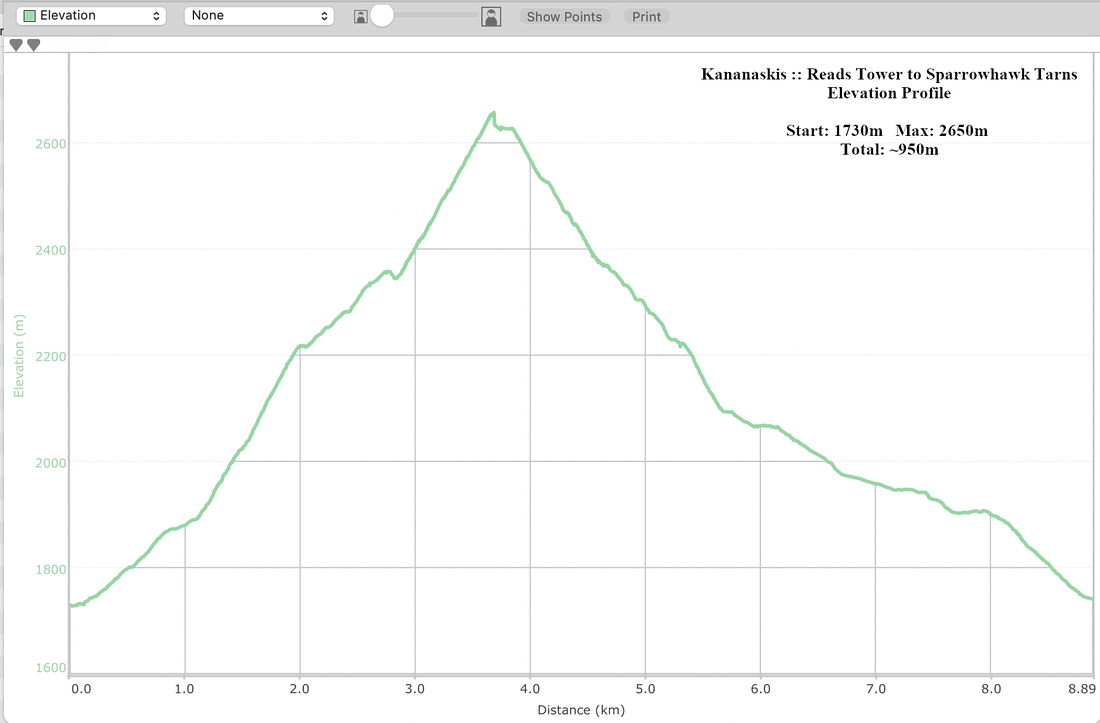 Reads Tower Elevation Profile