Google Map |
Rockies :: Kananaskis :: Piper Pass |
GPS Track |
|
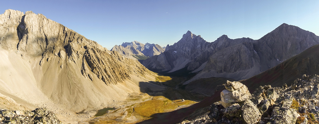
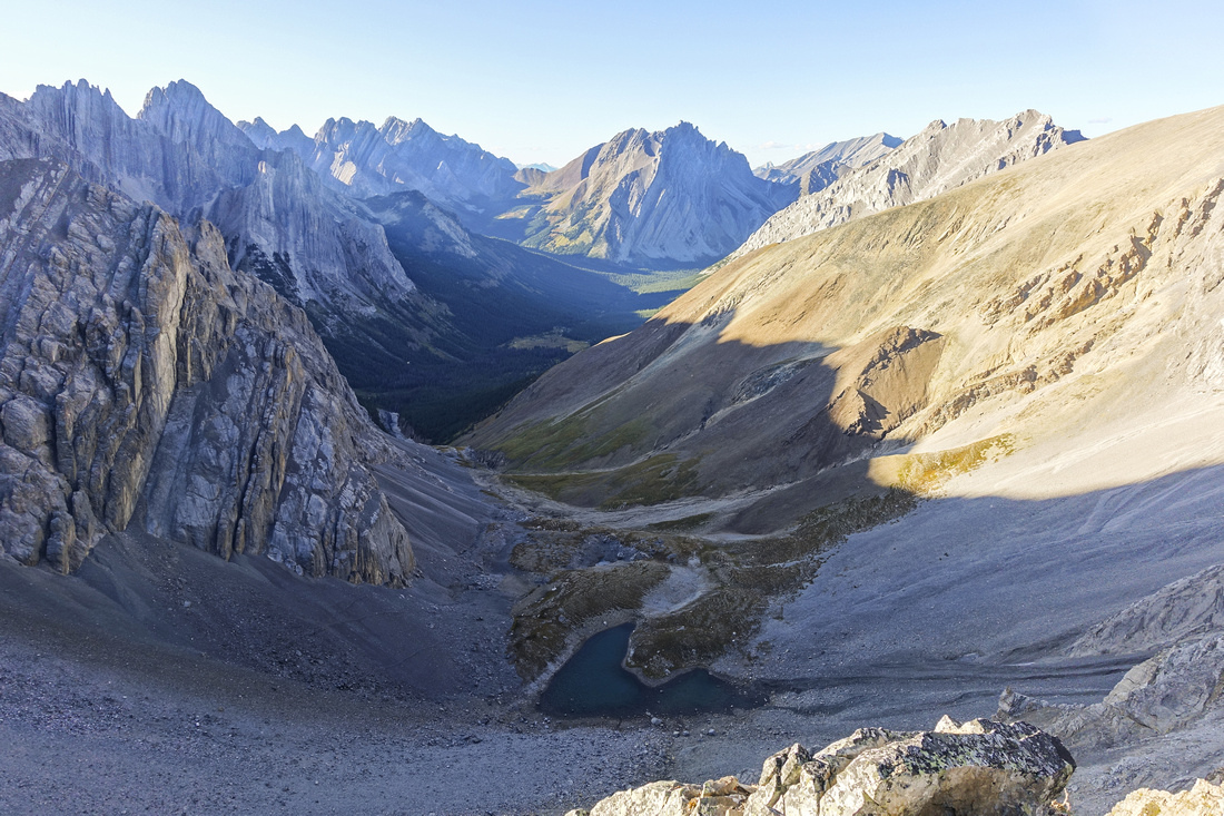
Panoramic View from Ridge above the Pass down Piper Creek Valley; Mt. Elpoca just right of center, Mt. Rae behind to the left |
|||
| Trip Summary | |||
September 3, 2021Piper Pass is rewarding day hike in scenic Elbow/Tombstone area. Often overlooked in favor of more popular destinations like Rae Glacier, Tombstone Lakes, Rae Lake, etc. but it offers similar if not better scenery. Access is via ever popular Elbow Lake trail, but crowds thin out past the campground and after leaving Elbow Trail below Tombstone Pass you are likely to have it all to yourself! Main deterrent is unavoidable ford of -very young- Elbow River; this is why hike is better done later in season after water level have subsided. Forest travel contouring west slopes of South Tombstone Peak is longer than expected, but once trail breaks treeline you are rewarded with trademark Kananaskis alpine. For better views Bumps either side of the pass can be scrambled easily, while Peakbaggers will utilize Piper Creek for approach to rarely ascended Mt. Schlee (not a Kane peak). Rough trail continues on north side of the Pass and drops into West Fork of Little Elbow continuing over Paradise Pass into Evan Thomas area. This extension requires several nights backpack and is attempted very rarely.
From Elbow Lake Parking (note seasonal closure of Hwy 40 past Kananaskis Lakes turnoff Dec 1 - June 15), hike to Elbow Lake on a wide track. Trail, road in fact, continues on left (north) side of the lake then after crossing lake outlet on log bridge continues for couple of km to Tombstone Pass. Views really open up here and it is worth taking a break. Piper Valley is to the left and in the distance Cats Ears / Mt. Schlee can be spotted. Normal access is roughly 10 minutes below Tombstone Pass. It will be the second trail to the left (first being brief side trip to Edworthy Falls, well worth if you have never seen it). Except for cairn -- that might or might not be there next time -- this junction is not marked; if not sure use GPS track (download link on top of page, Waypoint 2 - Elbow Trail). Rough trail drops steeply to Elbow River; easiest place to cross is right where the trail brings you; it is not worth looking upstream or downstream. Gaiters will be of big help here if you don't want to take your boots off, but watch for slip on slimy river rocks. On the other side trail climbs across some meadows then settles for long forested haul crossing several drainages along the way. Piper Creek is on the left side and higher up there are some neat waterfalls well worth a glance. After breaking up treeline ~1hr from Elbow Trail, fantastic alpine opens up and this is logical spot for a break. Mt. Schlee access is on the left side; while Piper Trail continues into upper valley. Further up in the meadows trail fades away but direction is obvious - aim for large rock boulder directly below the pass, crossing Piper Creek along the way (good water!). Final rise to the Pass is steep and bit loose, but not problematic. On my hike I scrambled "Piper Ridge" on east side and it offered very nice viewpoint. More popular is apparently higher orange cone on the other (west) side, but it offers no scenic advantage.
Return is the same way. Instead of going all the way to Elbow Trail it is possible to take shortcut via Tombstone Meadows. Watch for side trail (on my trip there was branch lying across this path) ~20 min from Elbow ford; Waypoint 3 - Shortcut on GPS Track). Trail drops to Piper Creek; ford and find bits of trail on other side leading to Tombstone Meadows where trail fades away. Aim for general direction of Tombstone Pass and after crossing several benches ford Elbow River back to Elbow Trail. Main reason this shortcut is not recommended going in is that direction will be not obvious and you might end up doing more rough bushwhack than necessary. |
|
Gallery |
|||
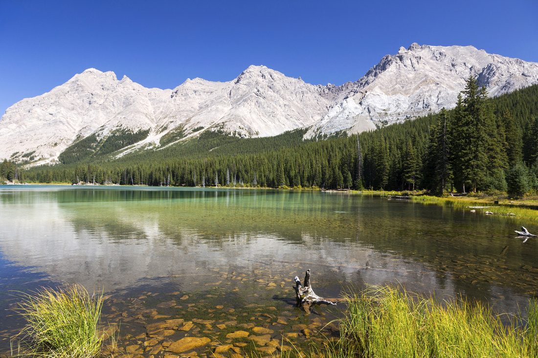 Elbow Lake Elbow Lake Elbow Lake 1.2 km and ~20min from the Parking; Backcountry campground is on the right side
 |
|||
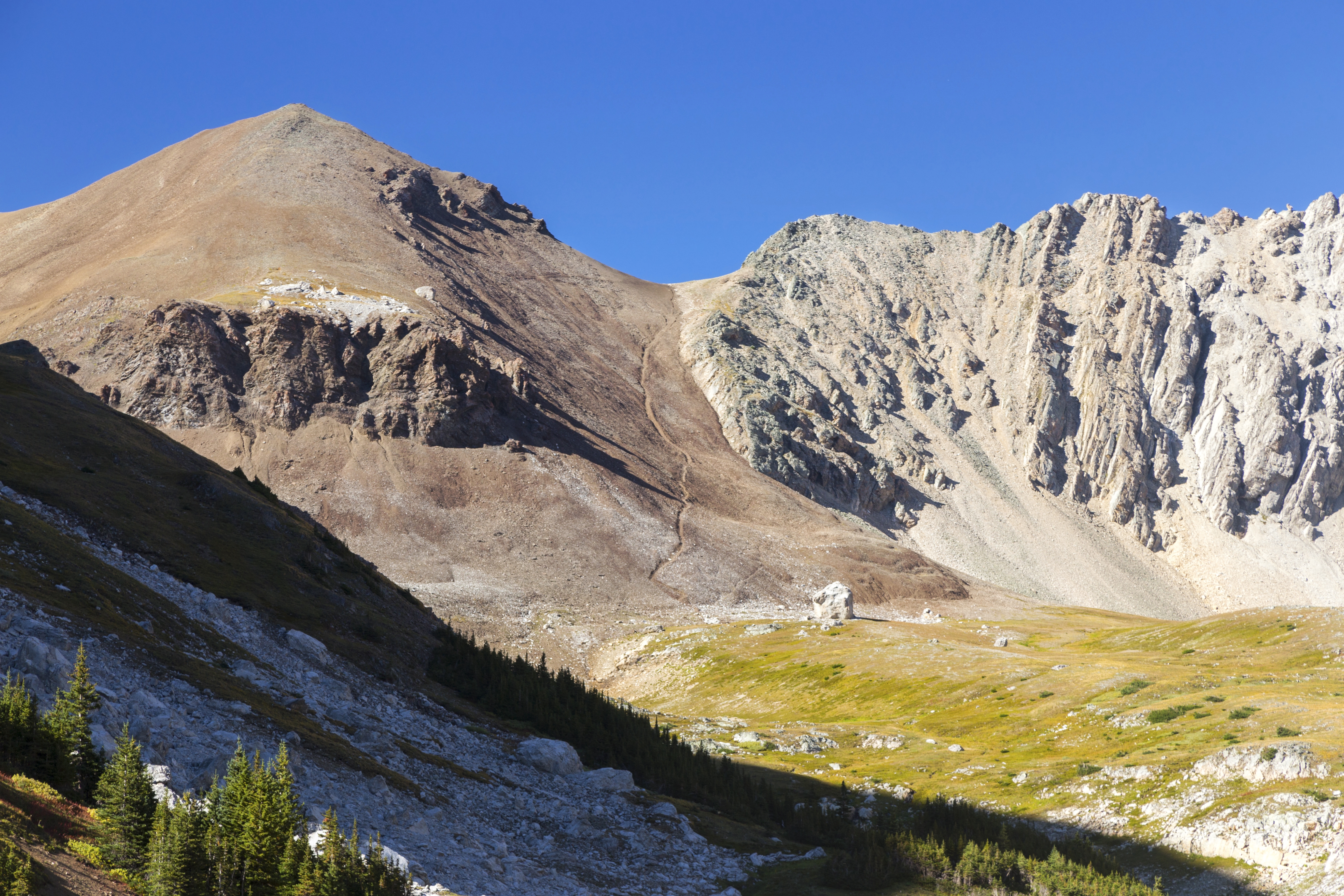
 Tombstone Pass
 Panorama with South Tombstone Mtn in center. Piper Creek valley is to the left, with Cats Ears and Mt. Schlee in the distance. Normal access is from Elbow Trail ~10min from here, but it is possible to shortcut via meadows center left with some bushwhacking and Elbow / Piper creek fords Tombstone Pass
Tombstone Pass Panorama with South Tombstone Mtn in center. Piper Creek valley is to the left, with Cats Ears and Mt. Schlee in the distance. Normal access is from Elbow Trail ~10min from here, but it is possible to shortcut via meadows center left with some bushwhacking and Elbow / Piper creek fords |
|||
 Elbow / Piper Junction
Piper Valley Junction; note cairn. It is easy to miss as it is not marked and cairn might not be there always, so use GPS track from top of page Elbow / Piper Junction
Piper Valley Junction; note cairn. It is easy to miss as it is not marked and cairn might not be there always, so use GPS track from top of page |
|||
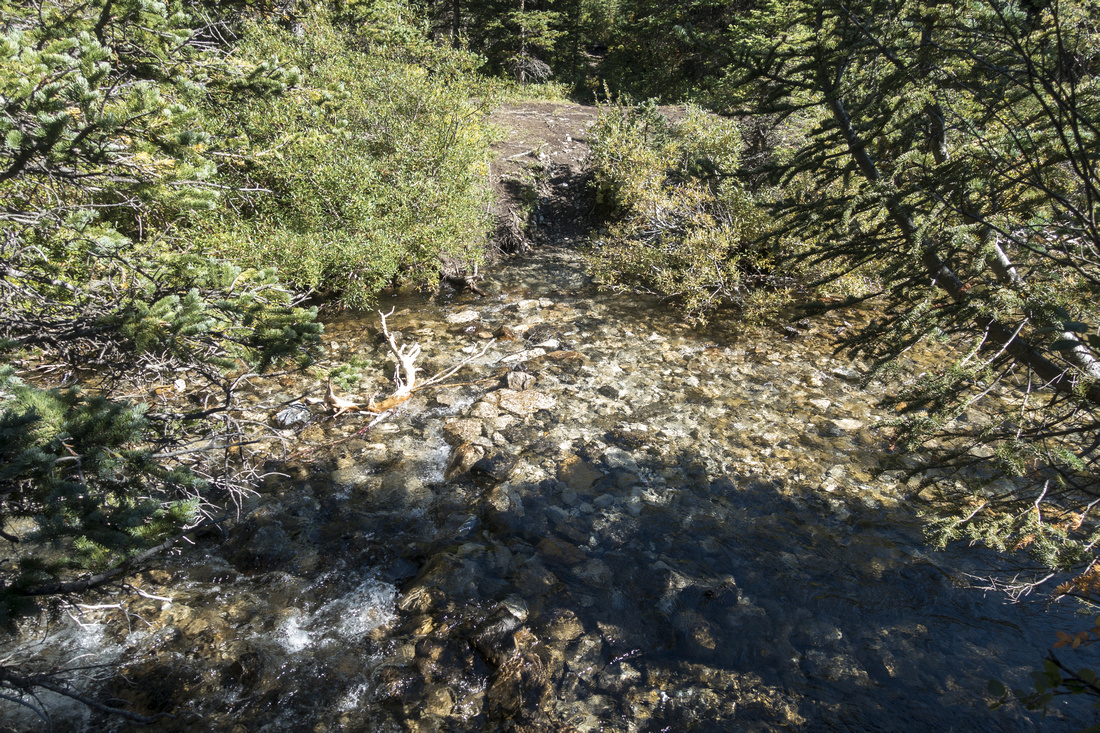 Elbow Ford
Unavoidable ford of very young Elbow River & main reason why hike is best done late(r) in season Elbow Ford
Unavoidable ford of very young Elbow River & main reason why hike is best done late(r) in season |
|||
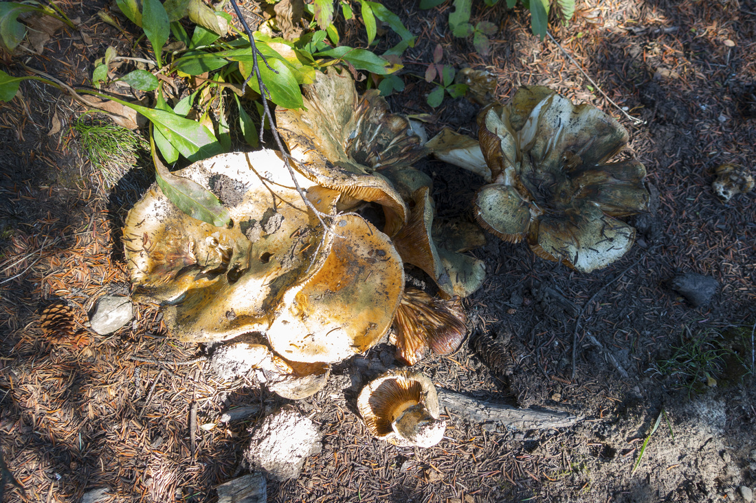 Mushrooms
Plenty of wild mushrooms litter Piper trail later in season Mushrooms
Plenty of wild mushrooms litter Piper trail later in season |
|||
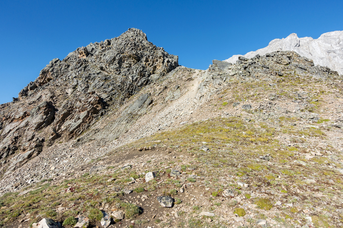
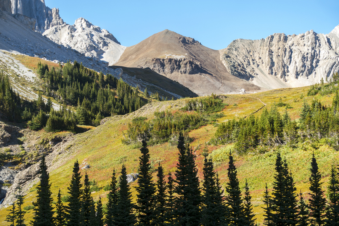 Piper Alpine
Piper Pass as trail finally reaches the alpine ~1hr from Elbow junction Piper Alpine
Piper Pass as trail finally reaches the alpine ~1hr from Elbow junction |
|||
 |
|||
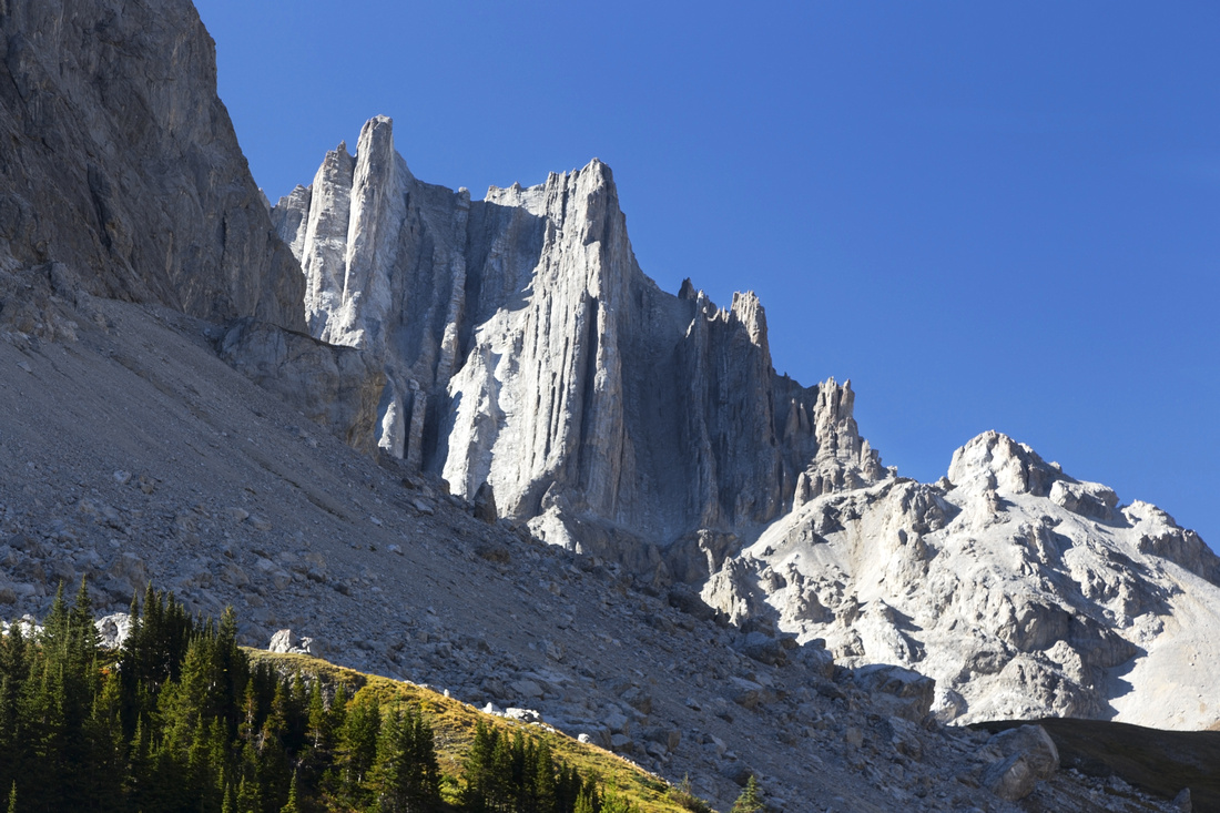 Cats Ears
Dual Rock Spire called "Cats Ears" behind Mt. Schlee Cats Ears
Dual Rock Spire called "Cats Ears" behind Mt. Schlee |
|||
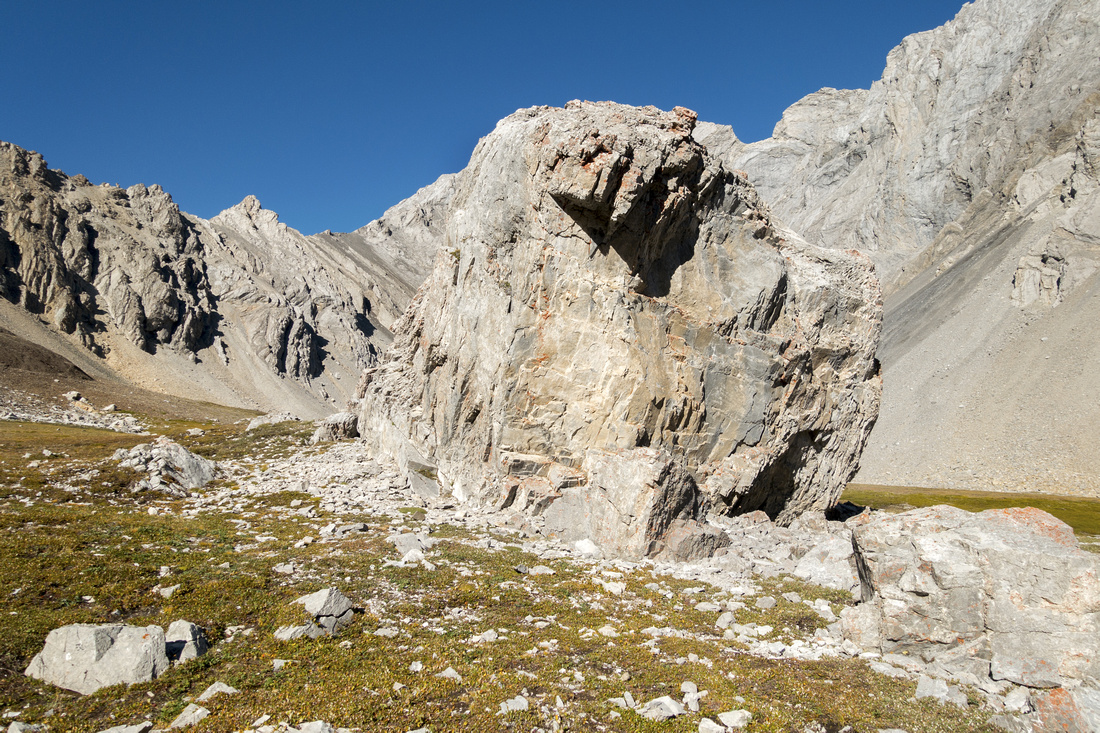
 Alpine Obelisk
Rock obelisk; note cairn. Trail vanishes here, so use this landmark on descent Alpine Obelisk
Rock obelisk; note cairn. Trail vanishes here, so use this landmark on descent |
|||
 |
|||
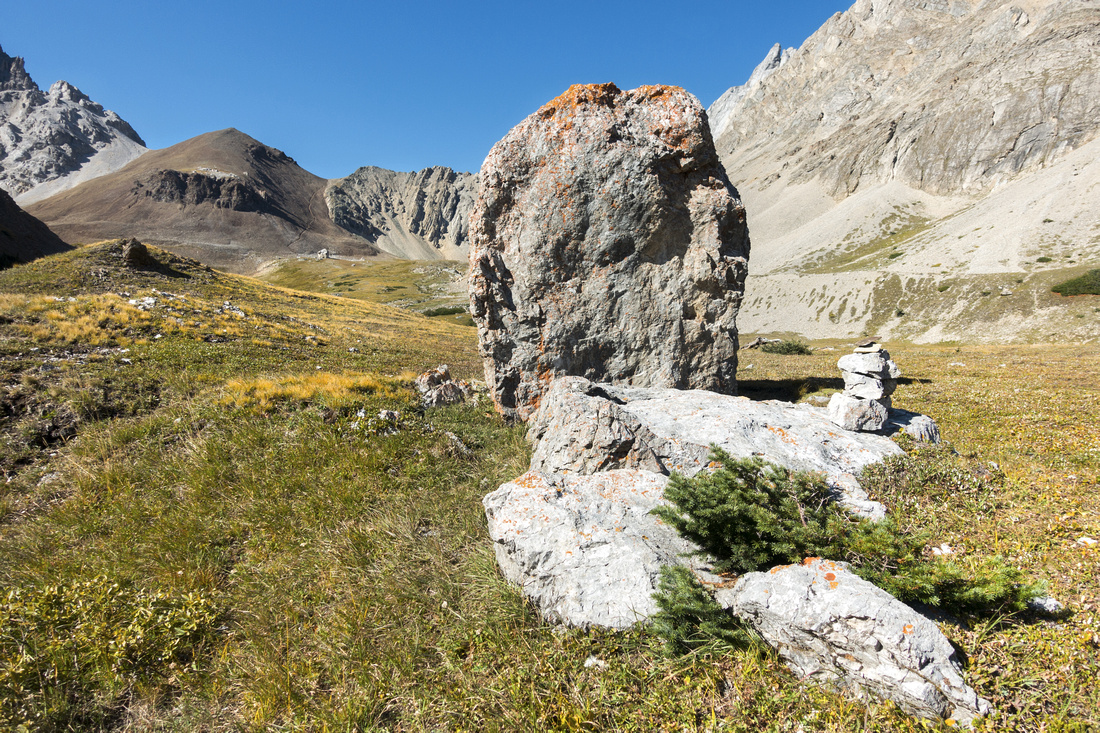
 Rock Boulder
Huge Rock Boulder that tumbled off the mountain long time ago just before start of Piper Pass ascent and good place for quick break Rock Boulder
Huge Rock Boulder that tumbled off the mountain long time ago just before start of Piper Pass ascent and good place for quick break |
|||
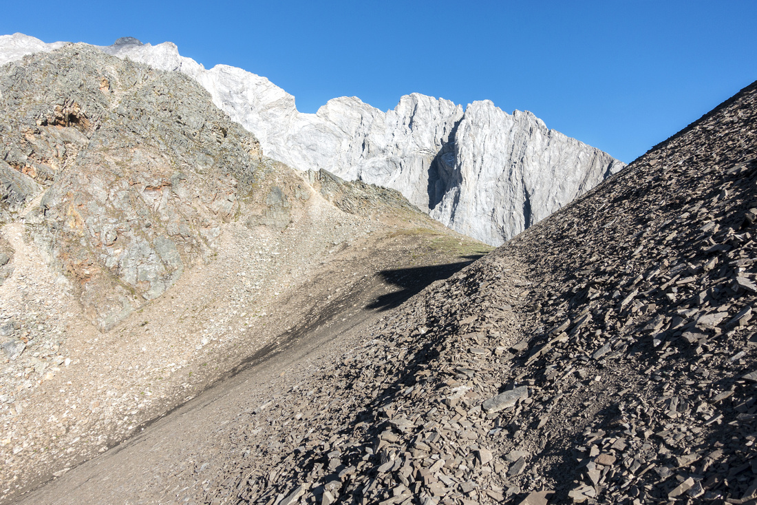 Piper Pass
North side of Piper Pass looking back as trail begins switchback descent to Little Elbow west fork valley. Piper Ridge upper left Piper Pass
North side of Piper Pass looking back as trail begins switchback descent to Little Elbow west fork valley. Piper Ridge upper left |
|||
 Piper Ridge
Closer look at Piper Ridge scramble access from the Pass; class 2 to first highpoint Piper Ridge
Closer look at Piper Ridge scramble access from the Pass; class 2 to first highpoint |
|||
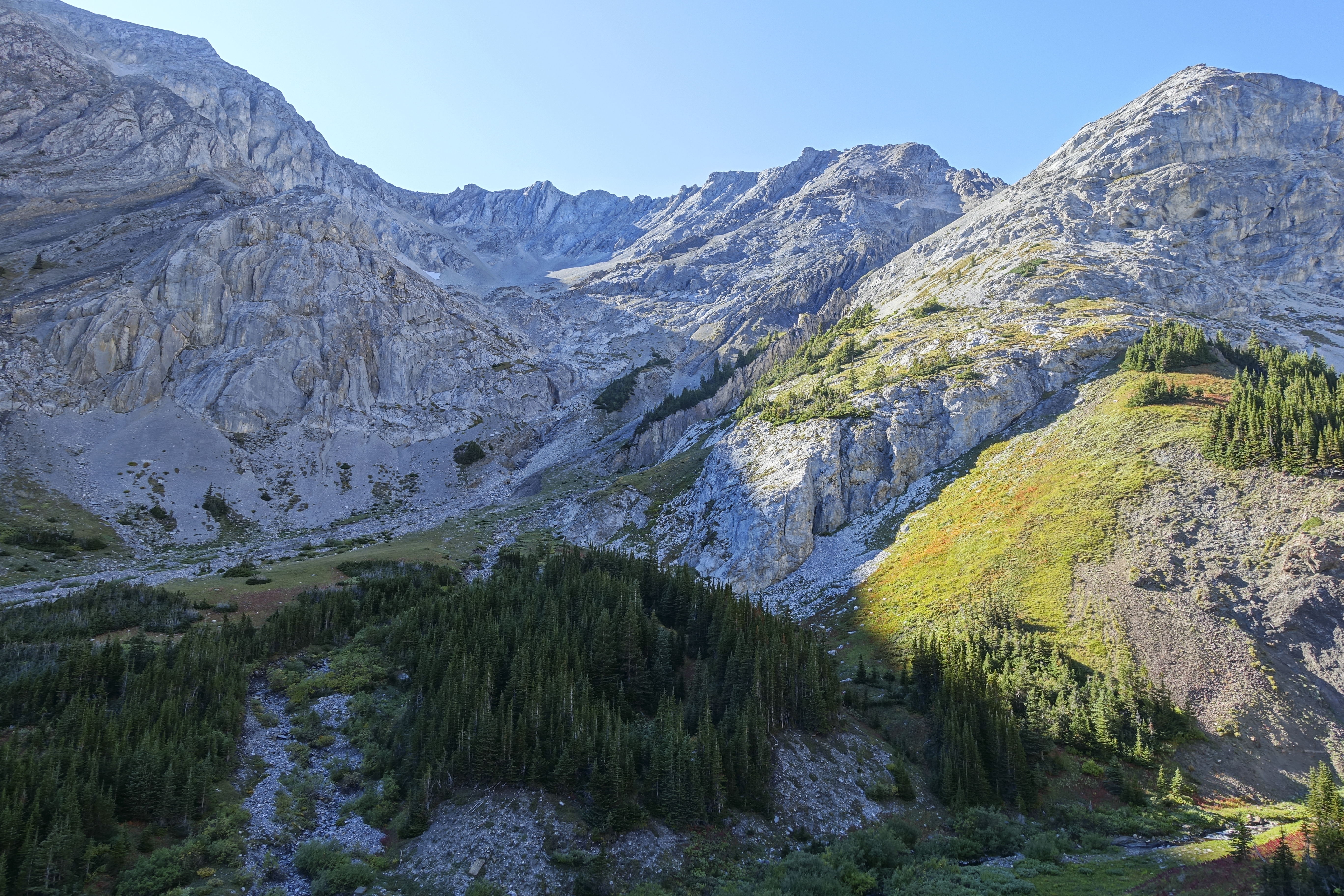
 Little Elbow West Fork
View north from Piper Ridge with trail continuing over Paradise Pass into Evan Thomas area Little Elbow West Fork
View north from Piper Ridge with trail continuing over Paradise Pass into Evan Thomas area |
|||
 |
|||
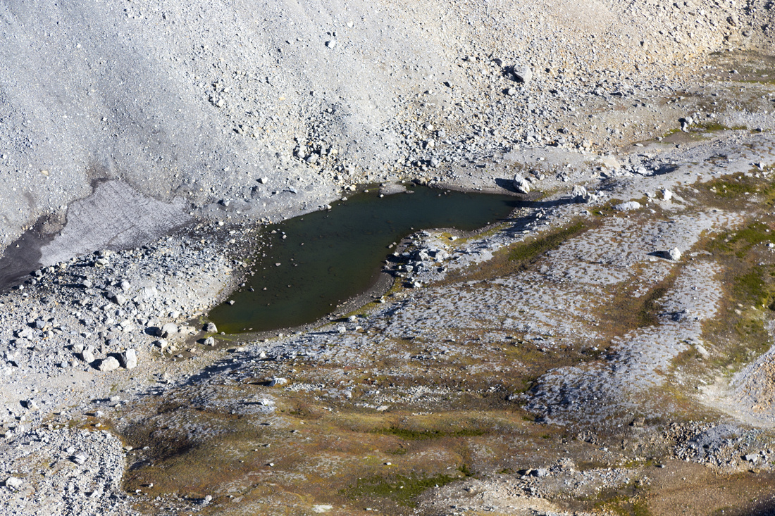 Piper Tarn
Small Tarn below Piper Ridge and ultimate source of Piper Creek could be a nice bivi spot Piper Tarn
Small Tarn below Piper Ridge and ultimate source of Piper Creek could be a nice bivi spot |
|||
 Tombstone Meadows
Crossing Tombstone Meadows on shortcut return, with Elbow Trail on left side. Mt. Rae / Glacier center Tombstone Meadows
Crossing Tombstone Meadows on shortcut return, with Elbow Trail on left side. Mt. Rae / Glacier center |
|||
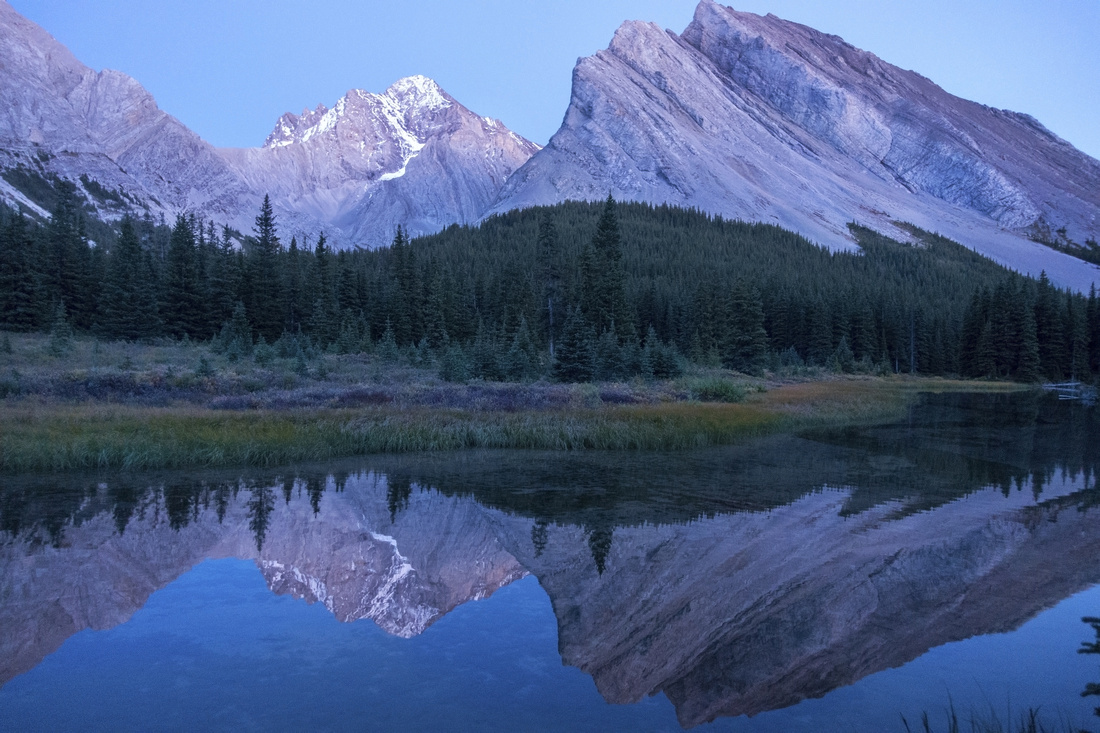 Rae Reflections
Mt. Rae reflected in Elbow Lake on return Rae Reflections
Mt. Rae reflected in Elbow Lake on return |
Abstract
| Overall Difficulty | D4 | Unbridged creek ford(s), potentially problematic early in season. Steep and loose talus slope below the Pass, class scramble to ridge (optional) | |||
| Snow Factor | S4 | Unlikely candidate for winter tip (Hwy 40 closed past K-lakes turnoff). Tombstone South Slope significant avalanche trap | |||
| Scenery | Elbow Lake, Tombstone Pass/Meadows and great Alpine below the Pass. Far reaching views from the Ridge | ||||
| Trail/Marking | Good | Elbow Trail to Tombstone Pass and Junction; single, but well defined track up Piper Creek. Trail vanishes in alpine but direction is obvious. Elbow / Piper junction not marked (cairn only) | |||
| Suggested Time | 7-8hrs | Add 2 hrs minimum - very long day - if including Mt. Schlee | |||
| Elevation | Start: 1965m Max: 2615 m Total: ~970m (+810 -170) | Distance: ~24km | |||
| Gear | Full hiking boots. Poles essential for Talus slope below the Pass. Gaiters for Elbow / Piper creeks ford. | ||||
| Water | Elbow / Piper creeks and several smaller drainages off Tombstone Mountain. No need to carry more than 1L | ||||
| Dog Friendly | Yes | Standard back-country travel precautions. Grizzly bears frequent the area | |||
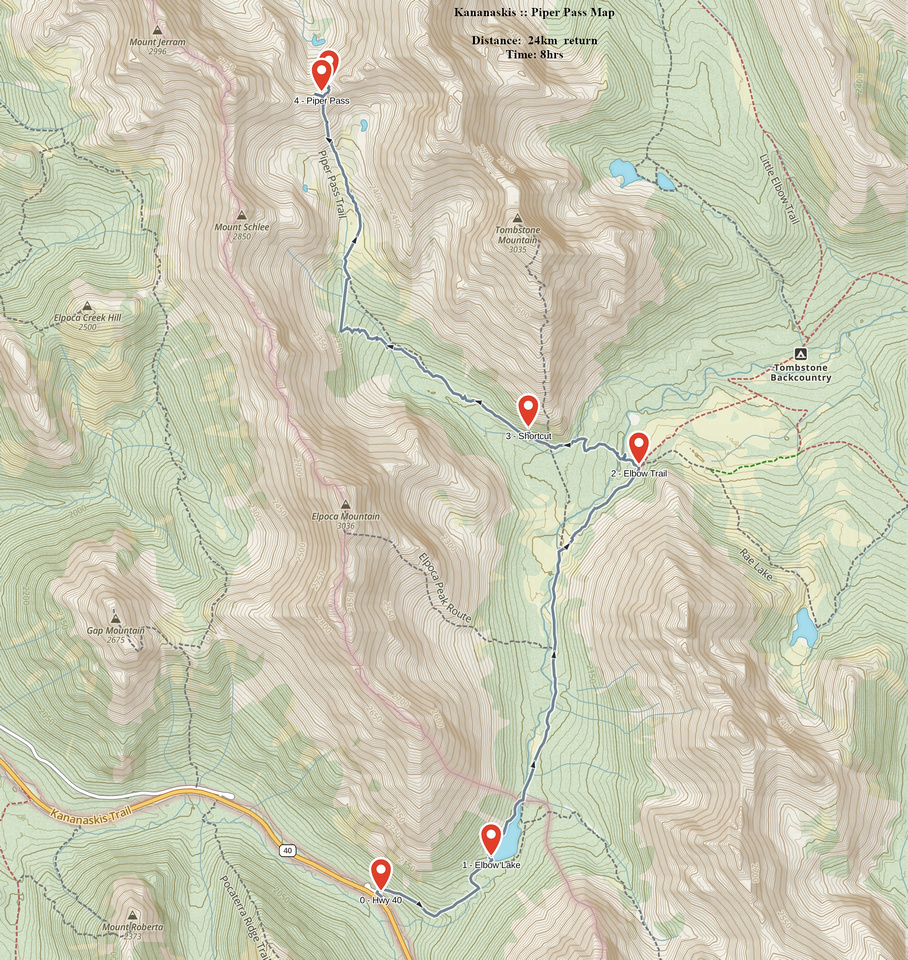 Piper Pass GAIA Map
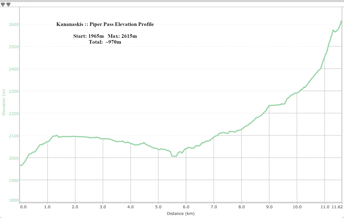 Piper Pass Elevation Profile