Google Map |
Rockies :: Kananaskis :: Kidd Creek |
GPS Track |
 
Panoramic view down Kidd Creek Drainage to Kananaskis Trail corridor; Spoon Needle center right, Opal North and Wedge to its left. Good Animal trail far center right of the photo leads to a nice viewpoint 10-15 min away |
|||
| Trip Summary | |||
August 4, 2023Drainage branching off Terrace Trail used in winter by Ice climbers leading to "Kidd Creek Waterfall", breaking east cliffs of Mt. Kidd with surprisingly good views and thoroughly enjoyable half-day hiking trip. Solitude is almost guaranteed. Optimal time is mid-May when drainage is flowing from snow melts with plenty of small cascades. My original trip was in August and everything was almost dry, but I will revisit in Spring and update Gallery.
From Galatea Parking follow popular Lilian Lake trail ~10 min to Terrace Trail junction, just past second bridge and turn right. Kidd Creek is the first drainage less than 5min along Terrace; it is not marked but trail soon develops on climber right side becoming well defined and easy to follow. There is one fairly steep bit where poles will be great asset on descent. Less than 30 min from Terrace trail exits to treeline, bypasses short cliff on climber left, then continues in moderate grade up grassy right bank. Great views develop and whole experience becomes much more enjoyable than perhaps expected. Approaching the cliffs trail slowly disintegrates, but it is possible to reach the waterfall by following rocky drainage to its base marked by end of long black rock (see Gallery). On my trip I spotted good animal trail on grassy hillside to the left (south) and decided to investigate. It does not lead far, 10-15min max past the drainage to promontory with excellent viewpoint of Spoon Needle and Kananaskis Valley; I built small cairn here.
Return is the same way and will be considerably faster. Do not try to descend directly to Lilian trail on south side as there are cliffs lower down. |
|
Gallery |
|||
 Upper Drainage Upper Drainage Upper half of the drainage above minor cliffband. Kidd Creek Waterfall is black rock streak roughly center of the photo
 |
|||
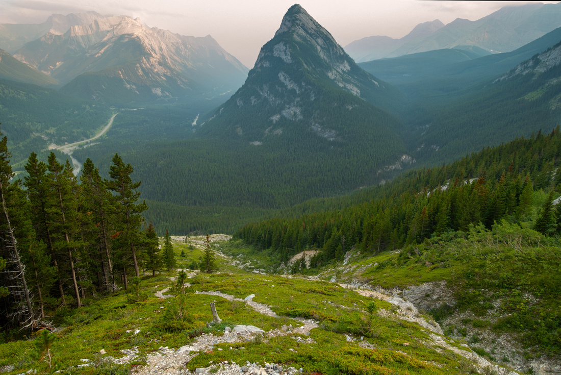 Looking back Looking back View down the ascent slope to wildfire smoke covered valley. Spoon Needle center, Opal north upper left. Note well defined trail
 |
|||
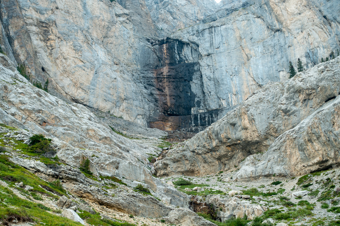 Kidd Creek Waterfall Kidd Creek Waterfall Trail disintegrates as it approaches Kidd Creek Waterfall, apparently popular ice climb in winter, but just a trickle in summer
 |
|||
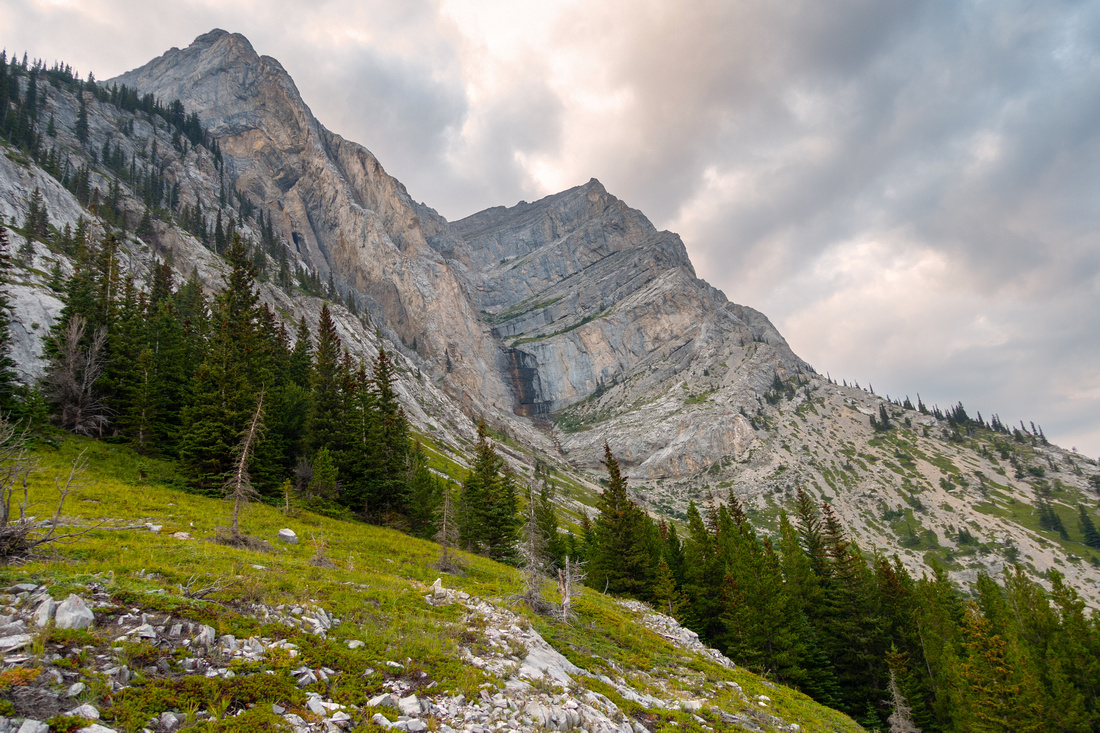 Sheep Trail Sheep Trail Exploring sheep trail on green hillside just south of Kidd Creek Waterfall
 |
|||
 Spoon Needle Viewpoint Spoon Needle Viewpoint Nice viewpoint at grassy promontory ~15min from Kidd Creek Waterfall with just built small cairn. Further progress is not feasible
 |
Abstract
| Overall Difficulty | D3 | Moderately steep slopes with one short cliff band, easily bypassed | |||
| Snow Factor | S3 | Moderate steep slope might be avalanche prone in unstable spring snow conditions | |||
| Scenery | Mt. Kidd towering cliffs. Waterfalls and cascades, depending on season. Aerial view of Kananaskis Valley and surrounding peaks | ||||
| Trail/Marking | Good | Official Lilian and Terrace Trails, followed by unsigned but reasonably well defined trail up Kidd Creek | |||
| Suggested Time | 3 hr | Return trip time, including side trip to Spoon Needle viewpoint | |||
| Elevation | Start: 1550 m Max: 1930 m Total: ~520m | Round Trip: ~5 km | |||
| Gear | Full hiking boots preferred. Hiking poles recommended; spikes might be necessary in shoulder season | ||||
| Water | Kidd Creek; mostly dries out late in summer. Carry 1L | ||||
| Dog Friendly | Yes | Standard back-country precautions | |||
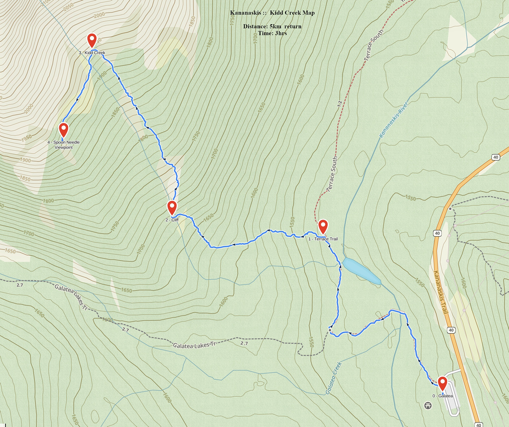 Kidd Creek GAIA Map
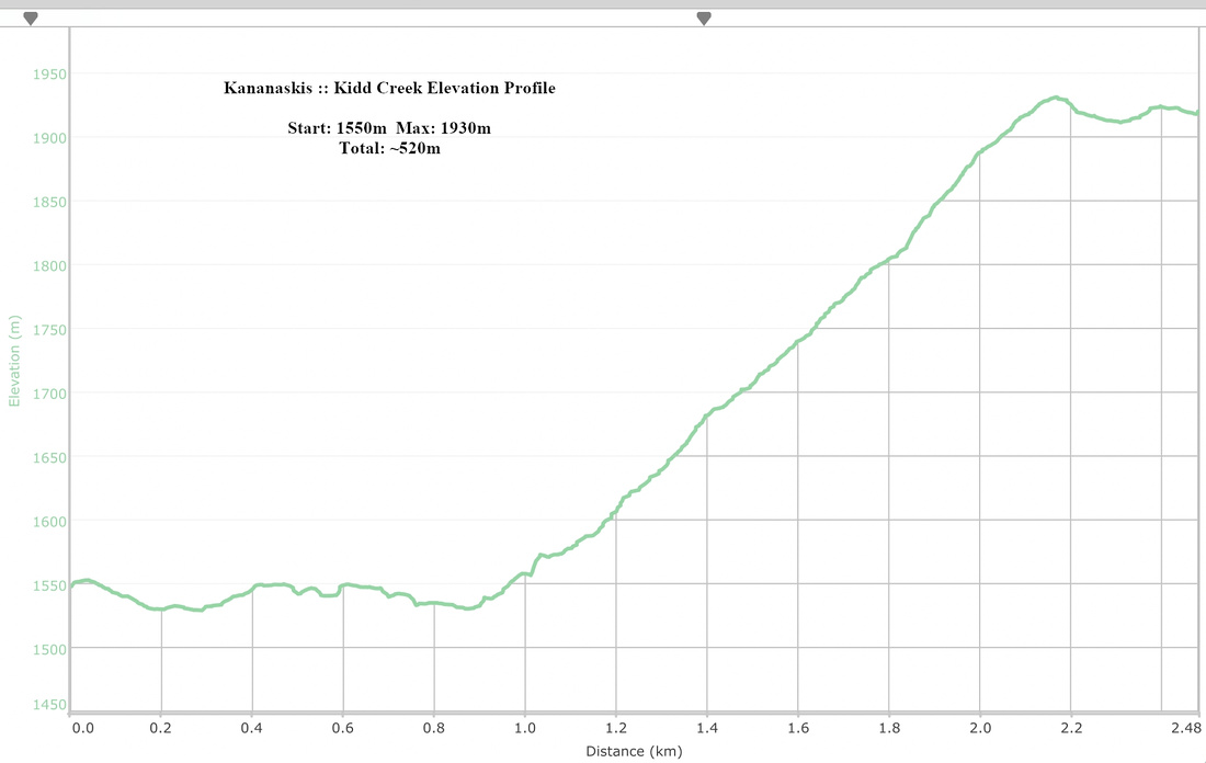 Kidd Creek Elevation Profile