Rockies :: Kananaskis :: Kananaskis Lookout |
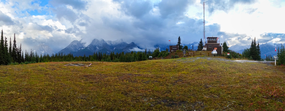 
Kananaskis Lookout Panorama looking west towards clouds obscured peaks on AB/BC Provincial Border |
|||
| Trip Summary | |||
August 23, 2023Forest road walk to manned Fire Lookout above Kananaskis Lakes, frequently done on bicycle or cross-country skis in winter. There are 2 starts, longer from Boulton Trading Post and shorter from Hwy40, which is presented here. Trailhead is unmarked pullout on right (west) side of the road, some 5km past seasonal gate at Kananaskis Lakes turnoff - see gallery. After crossing Pocaterra Creek on solid wood bridge it meanders lazily through the forest for several kilometers without much change in scenery. There are 3 junctions, first 2 you go left and last one right. Second junction is also where Boulton trail merges from the right. Beyond last junction road climbs up moderately to the lookout, if cycling there might be some pushing here. Lookout structure is off-limits, so please respect the privacy, but there is nice viewpoint with wooden bench for hikers as well as visitor guest book inside Mailbox. Several variations for extending the day exist utilizing variety of XC Ski network of trails. |
|
Gallery |
|||
 Hwy40 Trailhead
Trailhead pullout as Hwy40 swings between Gap Peak (L, out of photo) and Mt. Roberta upper center right. Do not block the gate as service vehicles occasionally need to pass Hwy40 Trailhead
Trailhead pullout as Hwy40 swings between Gap Peak (L, out of photo) and Mt. Roberta upper center right. Do not block the gate as service vehicles occasionally need to pass |
|||
 Pocaterra Creek
 bridge immediately below the gate Pocaterra Creek
Pocaterra Creek bridge immediately below the gate |
|||
 First Junction
Pocaterra Trail coming in from the right ~15 min in; keep left First Junction
Pocaterra Trail coming in from the right ~15 min in; keep left |
|||
 Ptarmigan Bird
Flock of Ptarmigans breaking forest road walk monotony Ptarmigan Bird
Flock of Ptarmigans breaking forest road walk monotony |
|||
 Second Junction
 ~40min in; Boulton trail comes in from the right; keep left again (note signs). There is also picnic bench in the woods to the right Second Junction
Second Junction ~40min in; Boulton trail comes in from the right; keep left again (note signs). There is also picnic bench in the woods to the right |
|||
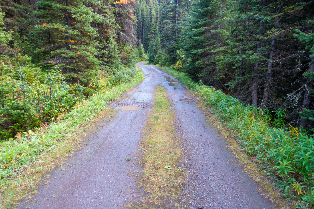 Forest Trail
Typical section of the road with little variety remains mostly flat till last junction Forest Trail
Typical section of the road with little variety remains mostly flat till last junction |
|||
 Third Junction
Third and Final junction; go right. Road now switchbacks moderately steeply for last ~2km to the lookout Third Junction
Third and Final junction; go right. Road now switchbacks moderately steeply for last ~2km to the lookout |
|||
 Kananaskis Lookout
Arriving just below the lookout with posted current Fire Danger Rating, just under 5km from Hwy 40 Kananaskis Lookout
Arriving just below the lookout with posted current Fire Danger Rating, just under 5km from Hwy 40 |
|||
 Viewpoint Bench
Lovely Viewpoint with bench by road end Viewpoint Bench
Lovely Viewpoint with bench by road end |
|||
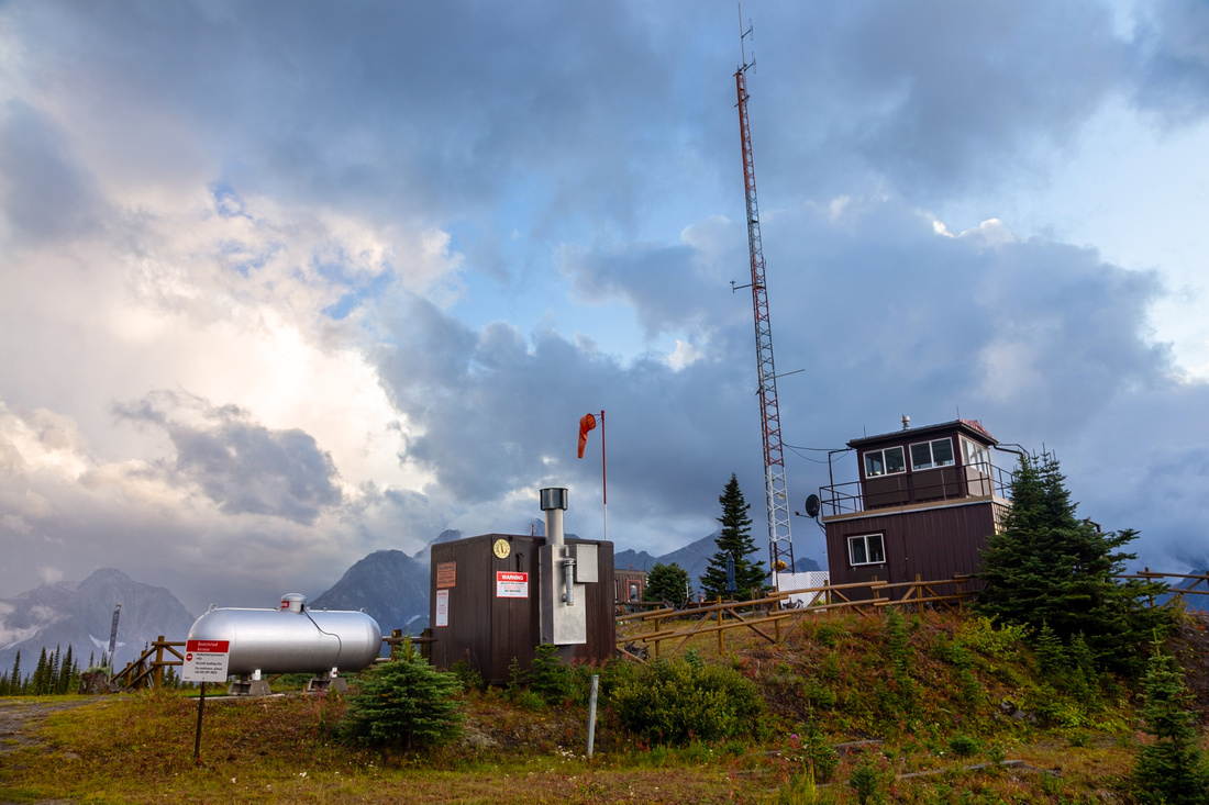
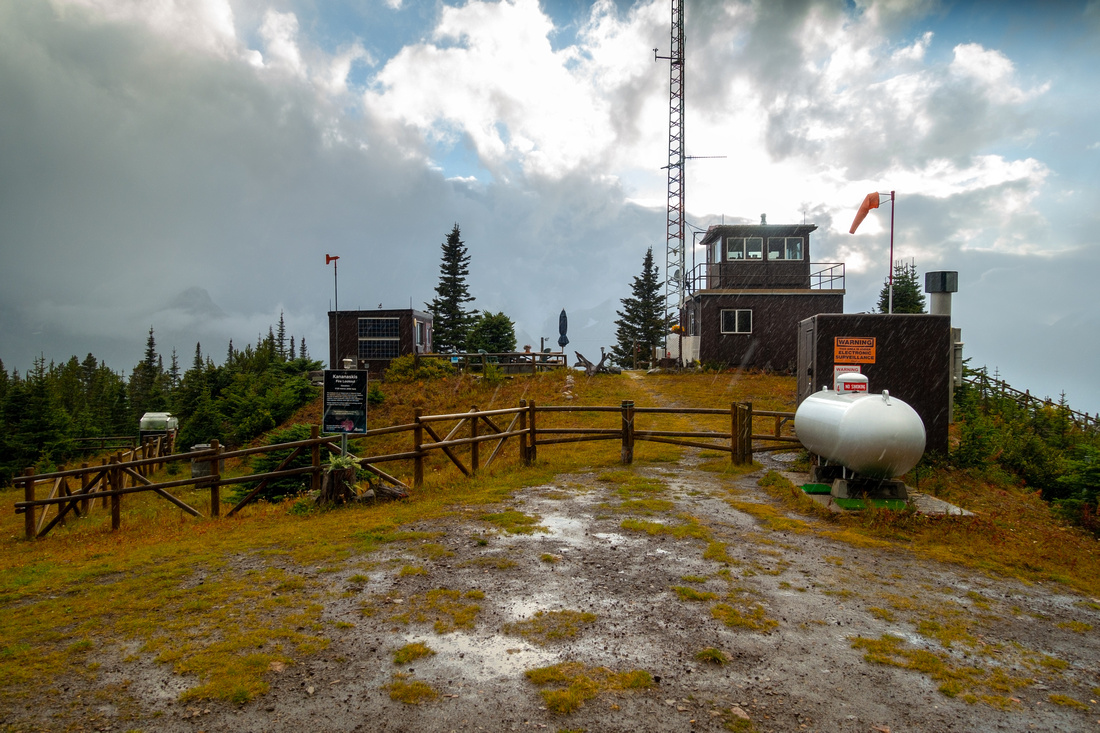 Kananaskis Lookout
Lookout Structure is manned and off limits; please respect the privacy Kananaskis Lookout
Lookout Structure is manned and off limits; please respect the privacy |
|||
 Lookout Table
Information Table at Gated Entrance to Lookout Structure Lookout Table
Information Table at Gated Entrance to Lookout Structure |
|||
 Mailbox Register
Visitor Guestbook is usually found inside this mailbox Mailbox Register
Visitor Guestbook is usually found inside this mailbox |
|||
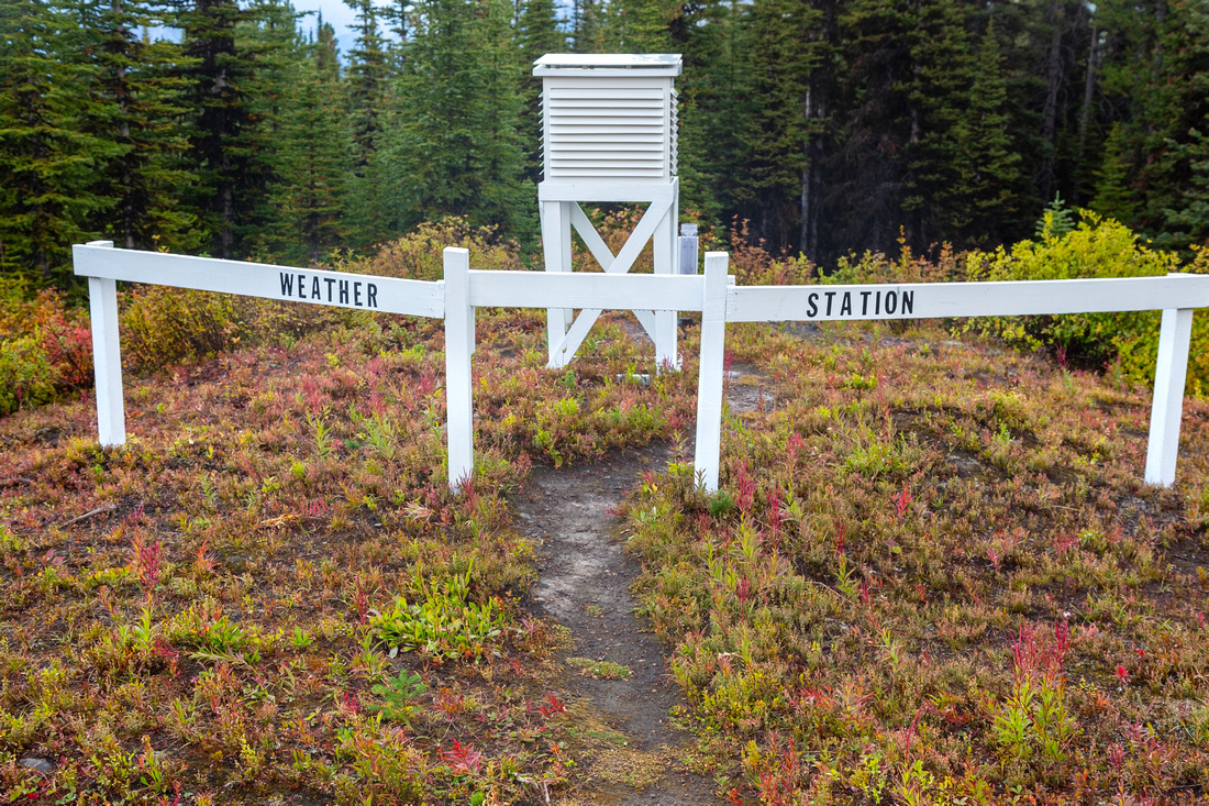 Weather Station
Meteorological Measurement Station is near the Mailbox Weather Station
Meteorological Measurement Station is near the Mailbox |
|||

|
|||
 XC-Ski Trail
Road continues in meadow at far side of lookout; it eventually connects with Elk Pass Trail. Best done on skis, as sign indicates XC-Ski Trail
Road continues in meadow at far side of lookout; it eventually connects with Elk Pass Trail. Best done on skis, as sign indicates |
|||
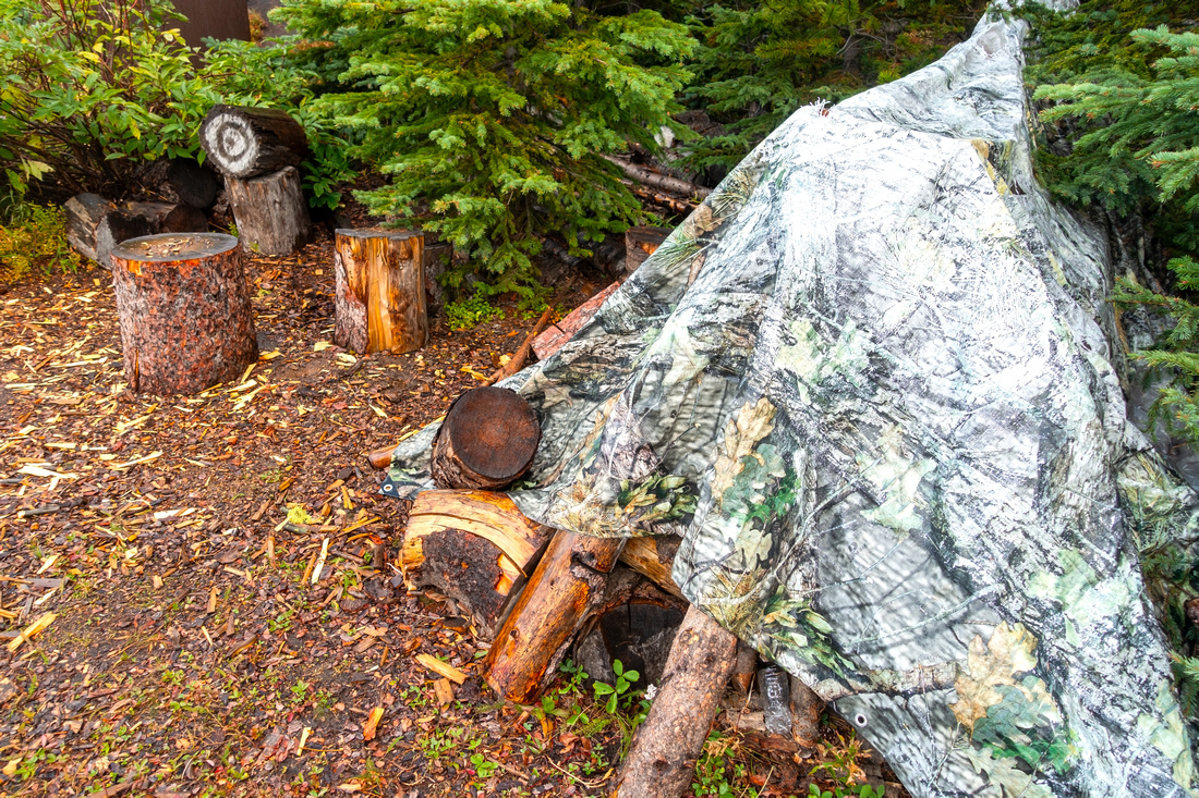 Woodshed
Firewood stash below the Lookout structure Woodshed
Firewood stash below the Lookout structure |
|||
 Tree Broomstick
Lots of Character near the Woodshed Tree Broomstick
Lots of Character near the Woodshed |
|||

|
|||
 Stormy Lookout
Another look at Kananaskis Fire Lookout with rather dramatic stormy sky above Stormy Lookout
Another look at Kananaskis Fire Lookout with rather dramatic stormy sky above |
|||
 Kananaskis Viewpoint
Kananaskis Lakes through treetops from the Viewpoint; Road just below Kananaskis Viewpoint
Kananaskis Lakes through treetops from the Viewpoint; Road just below |
|||
Abstract
| Overall Difficulty | D2 | Gentle forest road walk with final moderately steep rise to the lookout | |||
| Snow Factor | S1 | Frequently done as XC-Ski trip; trails are groomed | |||
| Scenery | Kananaskis Lakes Valley and surrounding peaks. Interesting lookout site | ||||
| Trail/Marking | Excellent | Wide forest road with marked junctions | |||
| Suggested Time | 3 hr | Return trip time on foot; less on bike or skis. Add several hours if exploring network of surrounding XC-Ski trails | |||
| Elevation | Start: 1860 m Max: 2130 m Total: ~300m | Round Trip: ~9.5 km | |||
| Gear | Day hikers sufficient; mtn. bike or XC-Skis | ||||
| Water | Pocaterra Creek at start, no reliable source after. Carry 0.5-1L | ||||
| Dog Friendly | Yes | Standard back-country precautions. Area frequented by grizzly bears | |||