Google Map |
Rockies :: Kananaskis :: Gypsum Ridge |
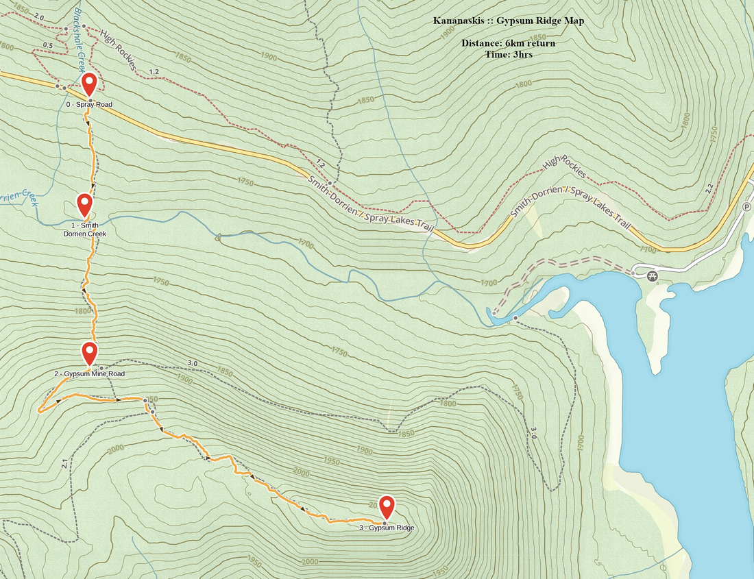
GPS Track |
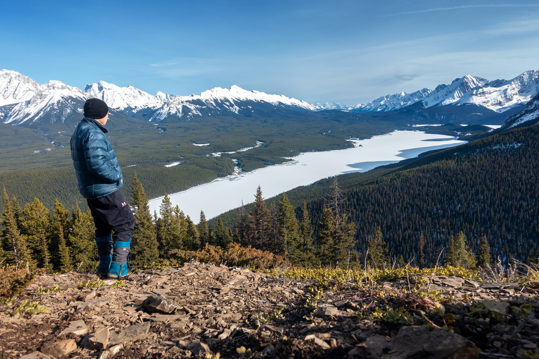 
Author enjoying early spring K-Lakes panorama from Gypsum Ridge endpoint |
|||
| Trip Summary | |||
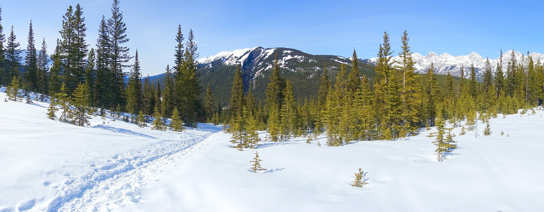
April 10, 2024Short outing leading to fantastic K-Lakes viewpoint, mainly done as winter / early spring snowshoe trip. Forested north slopes pose little avalanche danger. Mostly a route and there is no official trailhead or parking area; use GPS track (top of page download): Waypoint "0 - Spray Road". Alternatively pull over at Blackshale Creek crossing ~1.5km from Peninsula Picnic area on Spray Road, then walk back ~100m watching for boot prints heading down to Smith-Dorrien creek. On sunny weekends some cars are likely to be on the shoulder. There is ~70m vertical loss to the creek, which must be regained on return. Solid snow bridge in winter conditions makes creek crossing trivial, but be alert for springtime warming induced collapse. Above the creek is the crux - climb to junction with Gypsum Mine Road (200+m vertical, 0.6km) which is also sometime used by back-country skiers. Going then becomes comparatively easy. Broken trail usually follows Mine Road for ~15min then after wide 180 turn heads up forested slopes to the Ridge. Ridge crest is densely forested with no views, until last part which is super enjoyable if short. Highest point of the Ridge is just as you exit the Forest, but continuing for ~5min leads to much better viewpoint. Intervening Dip can be tricky if icy or covered by hard-packed snow. When windy shelter can be found by descending briefly on east side towards treeline with arguably even better view; I built small cairn here. Return the same way will be twice faster than ascent, but be cautious on steep slopes below Mine Road; on my Spring '24 trip I felt necessary to put spikes despite well broken trail with no ice. |
|
Gallery |
|||
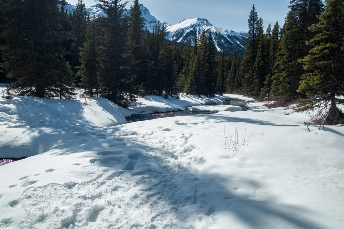 The Snow Bridge
Crossing of Smith-Dorrien Creek on Snow Bridge after descending ~0.5km and 70m vertical from Spray Road The Snow Bridge
Crossing of Smith-Dorrien Creek on Snow Bridge after descending ~0.5km and 70m vertical from Spray Road |
|||
 Gypsum Mine Road
 junction after brutally steep ascent (200+m vertical, 0.6km) above Smith-Dorrien Creek; Note Flag Gypsum Mine Road
Gypsum Mine Road junction after brutally steep ascent (200+m vertical, 0.6km) above Smith-Dorrien Creek; Note Flag |
|||
|
|
|||
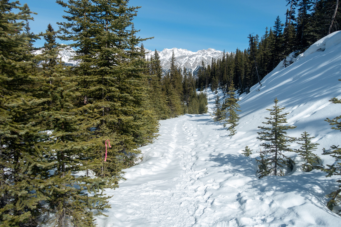
 Kent Ridge
View back to Kent Ridge as broken trail leaves Gypsum Mine Road and heads up forested slopes below the Ridge. Reverse View from Kent South Kent Ridge
View back to Kent Ridge as broken trail leaves Gypsum Mine Road and heads up forested slopes below the Ridge. Reverse View from Kent South |
|||
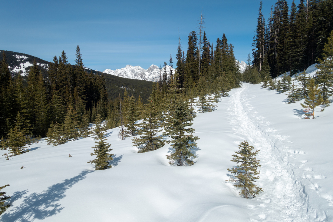
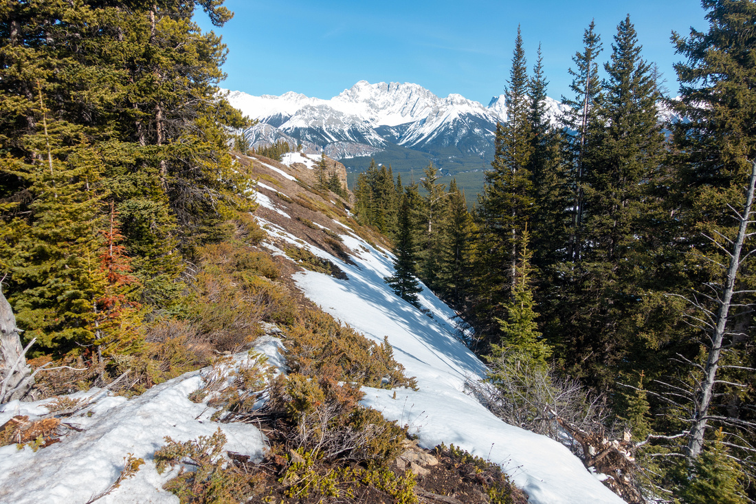 Gypsum Ridge
Final open part of Ridgewalk leading to viewpoint is very enjoyable but short Gypsum Ridge
Final open part of Ridgewalk leading to viewpoint is very enjoyable but short |
|||
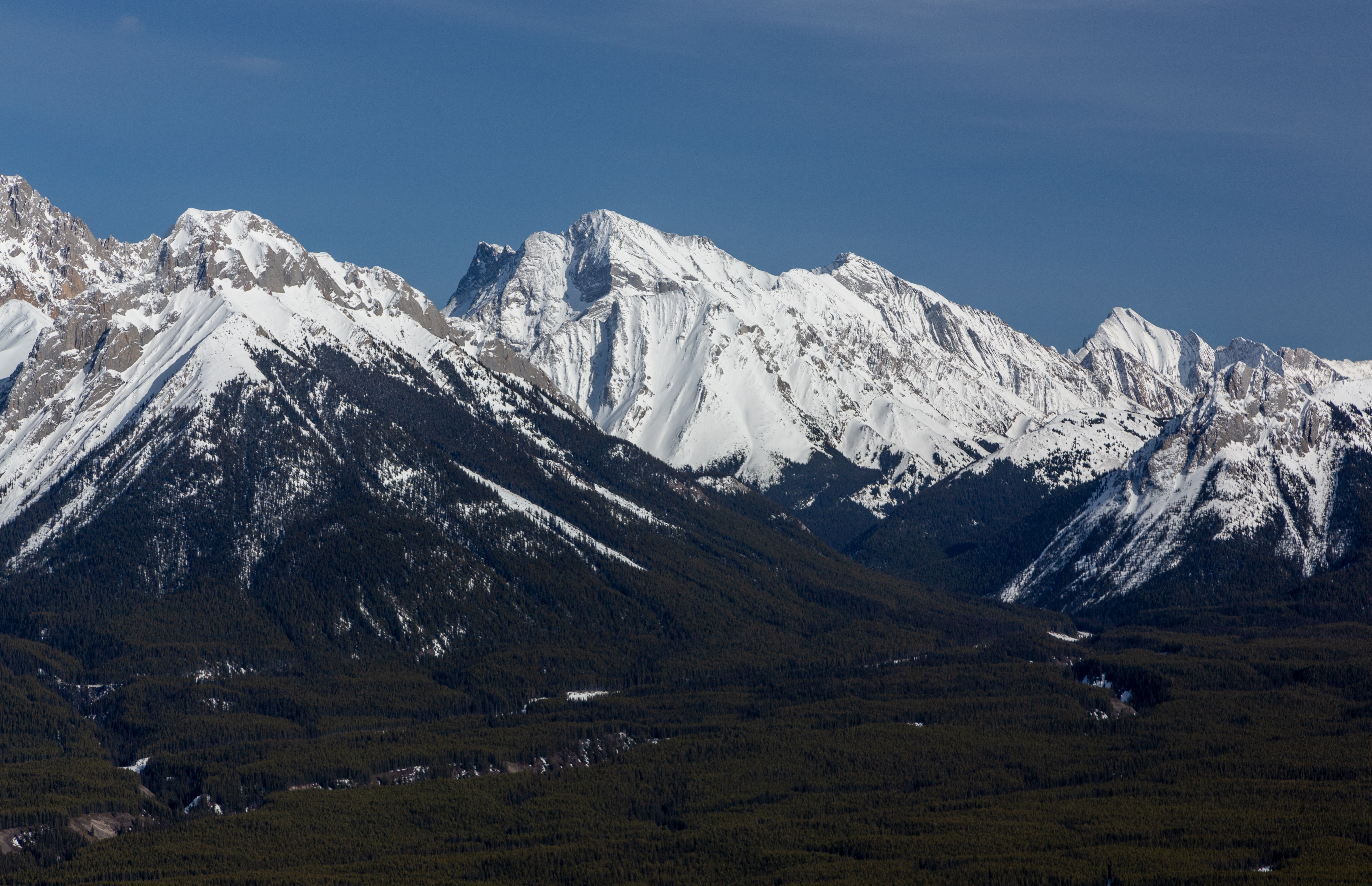
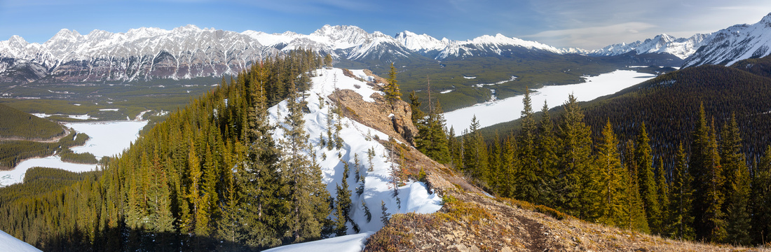 K-Lakes Panorama
Super Scenic early Spring Panorama of K-Lakes area from Gypsum Ridge highpoint; Opal Range behind K-Lakes Panorama
Super Scenic early Spring Panorama of K-Lakes area from Gypsum Ridge highpoint; Opal Range behind |
|||
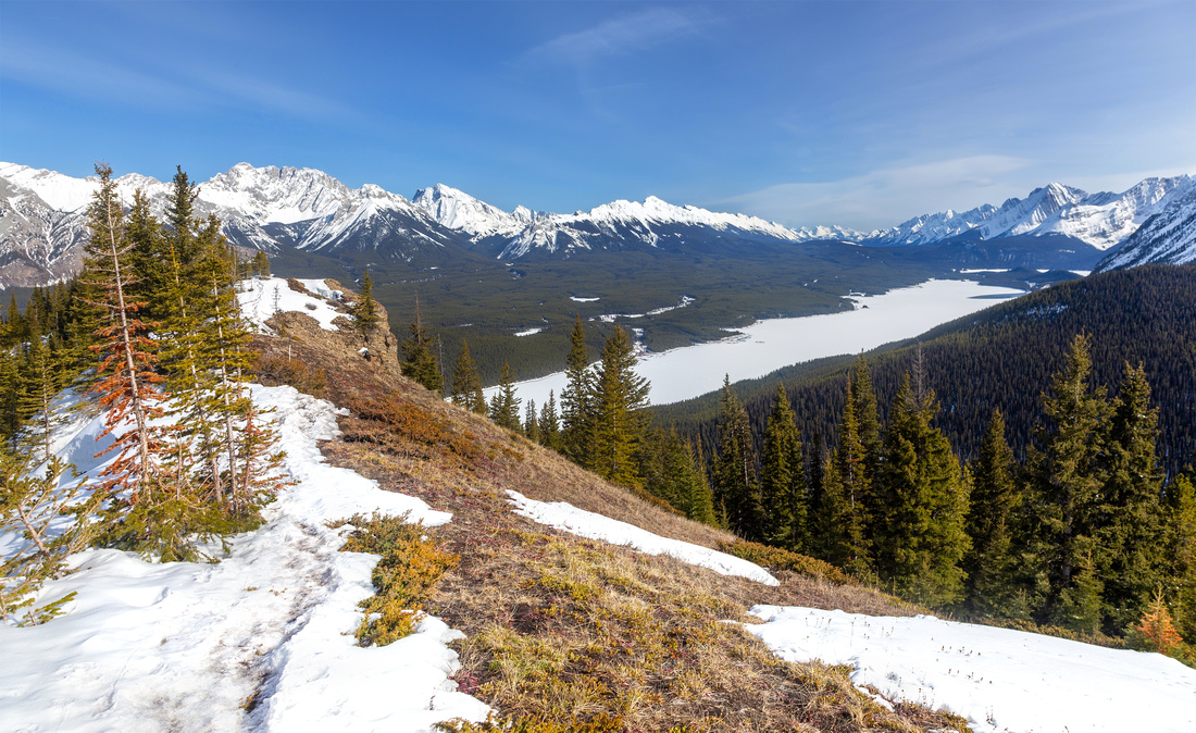 Gypsum Ridge
Ridge endpoint is marginally lower but offers better viewpoint Gypsum Ridge
Ridge endpoint is marginally lower but offers better viewpoint |
|||
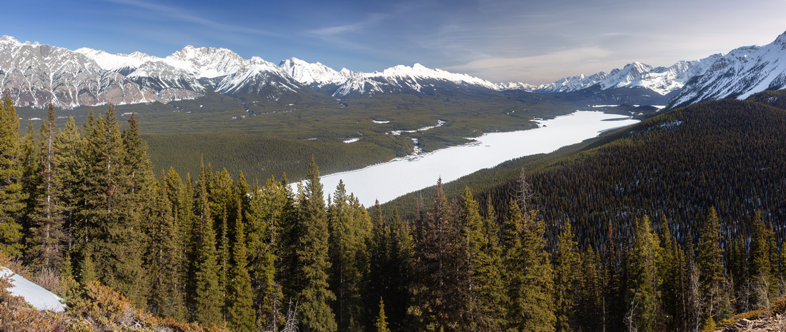 Upper Kananaskis Lake
 view from sheltered spot ~1min under the Endpoint Upper Kananaskis Lake
Upper Kananaskis Lake view from sheltered spot ~1min under the Endpoint |
|||
|
Abstract
| Overall Difficulty | D4 | Unbridged creek crossing. Very steep section above Smith-Dorrien Creek. Final Ridge dip before Endpoint can be tricky when Snow Covered and/or Icy | |||
| Snow Factor | S2 | Low avalanche danger on Forested north slopes | |||
| Scenery | Jaw dropping postcard Kananaskis Lakes and Opal Range panorama. "Military" group (Warspite, Invincible, Indefatiguable) to the west. Great view of Kent Ridge between Smith-Dorrien and Kananaskis Trail corridors | ||||
| Trail/Marking | None | Route with sporadic flags | |||
| Suggested Time | 3-4 hrs | Moderate pace, 2hrs up 1hr down + time on summit | |||
| Elevation | Start: 1790m Max: 2125m Total: +400m -70m | Round Trip: 6km | |||
| Gear | Winter trip: Full hiking boots, Gaiters, Snowshoes / Spikes. | ||||
| Water | Smith Dorrien Creek, none after. 0.5-1L is sufficient | ||||
| Dog Friendly | Yes | Standard back-country Travel precautions | |||
 Gypsum Ridge GAIA Map
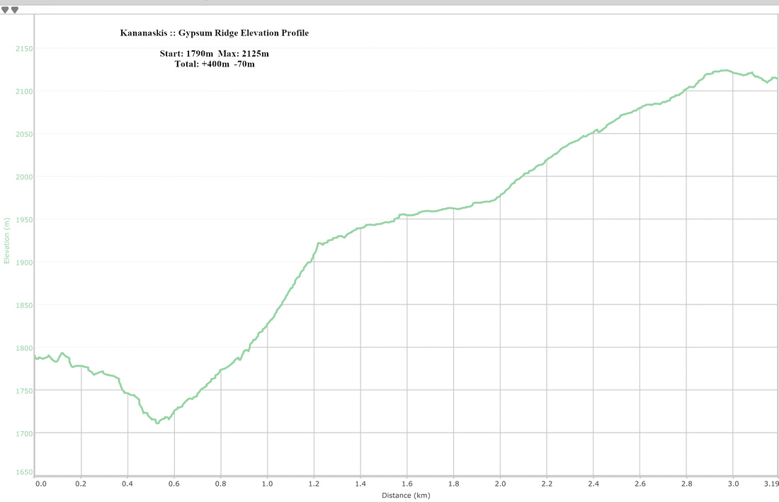 Gypsum Ridge Elevation Profile