Google Map |
Rockies :: Kananaskis :: Fortress South Outlier |
GPS Track |
|
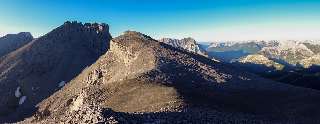
Fortress South Outlier Ridge Panorama. Highest Point directly across, main Peak behind to the left. Hwy40 corridor right |
|||
| Trip Summary | |||
Sep 16, 2024Compact alpine valley tucked between Mt. Chester and Headwall Peak is usually used as (one of two possible) approach for Kane Fortress Mountain scramble. Beautiful Headwall Lakes along the way, as described in Daffern K-Country Guide, are worthy day-hike destination on their own. Totally off radar is ridge rising above upper Headwall Lake ending in 2850m highpoint, also known as "Fortress South Outlier". Despite being obvious, route is not documented in any hiking guidebook I know off and there are just a handful of personal websites, with no mention on zombie social media groups either. There are no technical and views from summit ridge are fantastic. Stellar approach hike adds to overall appeal; I expect this route to become more popular in the future.
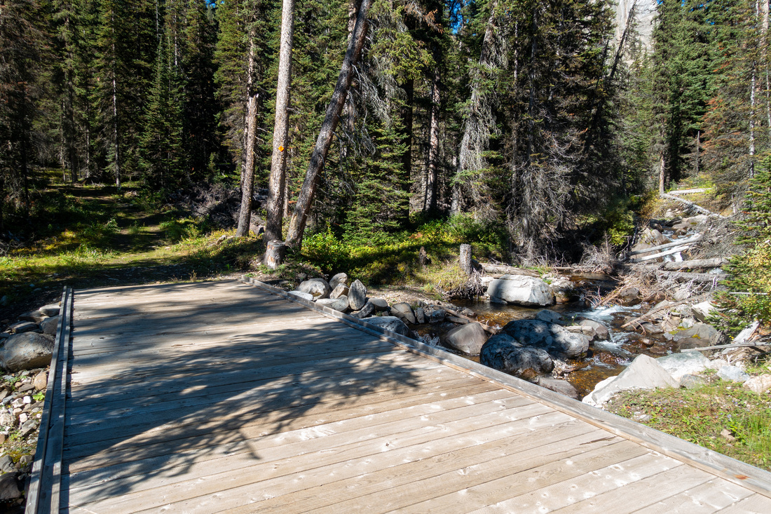
Crux of the day is navigation of ultra confusing XC Ski road Network, starting from south corner of Chester Lake parking lot. There are several junctions along the way but despite having signposts they all look alike - easiest is to simply use GPS (download Top of the Page). Shortly after crossing wide wood bridge over Headwall Creek ~45min in, watch for trail on the left (east) side. Third photo in the Gallery, Waypoint "1 - Headwall Junction". Trail is narrow with some deadfall but overall easy to follow. After passing some washed out parts at creek level and contouring huge boulder field below Headwall Peak (cairns), it starts steep and rough climb to lower Headwall Lake - about 2 hrs from the Parking. Scree path circumvents lower lake at right side, then ascends grassy bench by "Headwall Cascades" to the lip of Upper Lake. This is usual day-hiker turnaround point and trail now vanishes.
For Fortress South (or main Peak) continue around upper lake, then after hiking delightful karst valley angle up obvious Talus slope on right side. It is less steep and more solid from what you might expect. Best line ascends diagonally aiming to intercept goat trails above cliff band halfway, then easily hikes up stable terrain to low saddle - about an hour from valley floor. Turning left hike over lower bump and after brief descent ridgewalk to South Outlier, that to my surprise even had summit register. Views are superb and in my opinion even better from Fortress Main summit.
Return is the same way and will be considerably faster - at least quick run to Headwall valley floor. Be mindful not to follow goat trails all the way down as they end on cliffs of which goats don't care much about, but humans do.
|
|
Gallery |
|||
 Ski Trail Junction Ski Trail Junction One of several confusing XC-ski trail network junctions. Despite various instructions both printed and online, GPS is easiest way to navigate
 |
|||
|
|
|||
 Headwall Junction Headwall Junction Headwall Valley "Trailhead" couple of minutes from the Bridge, marked by stone arrow and tree flags
 |
|||
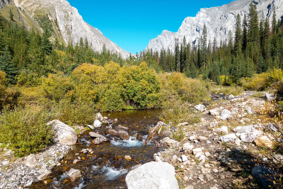 Headwall Creek Headwall Creek Washed out section of trail by Headwall Creek
 |
|||
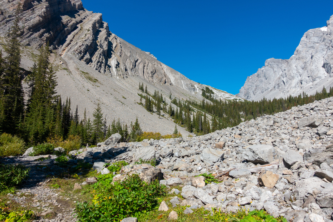 Boulder Field Boulder Field Trail circling large boulder field below Headwall Peak - watch for cairns
 |
|||
 Headwall Plateau Headwall Plateau Topping up at large open area just before lower Headwall Lake. Fortress Main Peak in the distance
 |
|||
 Lower Headwall Lake Lower Headwall Lake Beautiful lower Headwall Lake, ~2hrs of moderate pace from Chester Parking
 |
|||
 Headwall Cascades Headwall Cascades Cascading creek between lower and upper Headwall Lakes
 |
|||
 Lower Headwall Lake Lower Headwall Lake Looking back at lower Headwall Lake near the point where creek draining upper lake emerges from underground. Note trail on left side
 |
|||
 Upper Headwall Lake Upper Headwall Lake West end of upper Headwall lake - worthy destination on its own even if not planning on going further. Fortress South Outlier right, Main Peak center
 |
|||
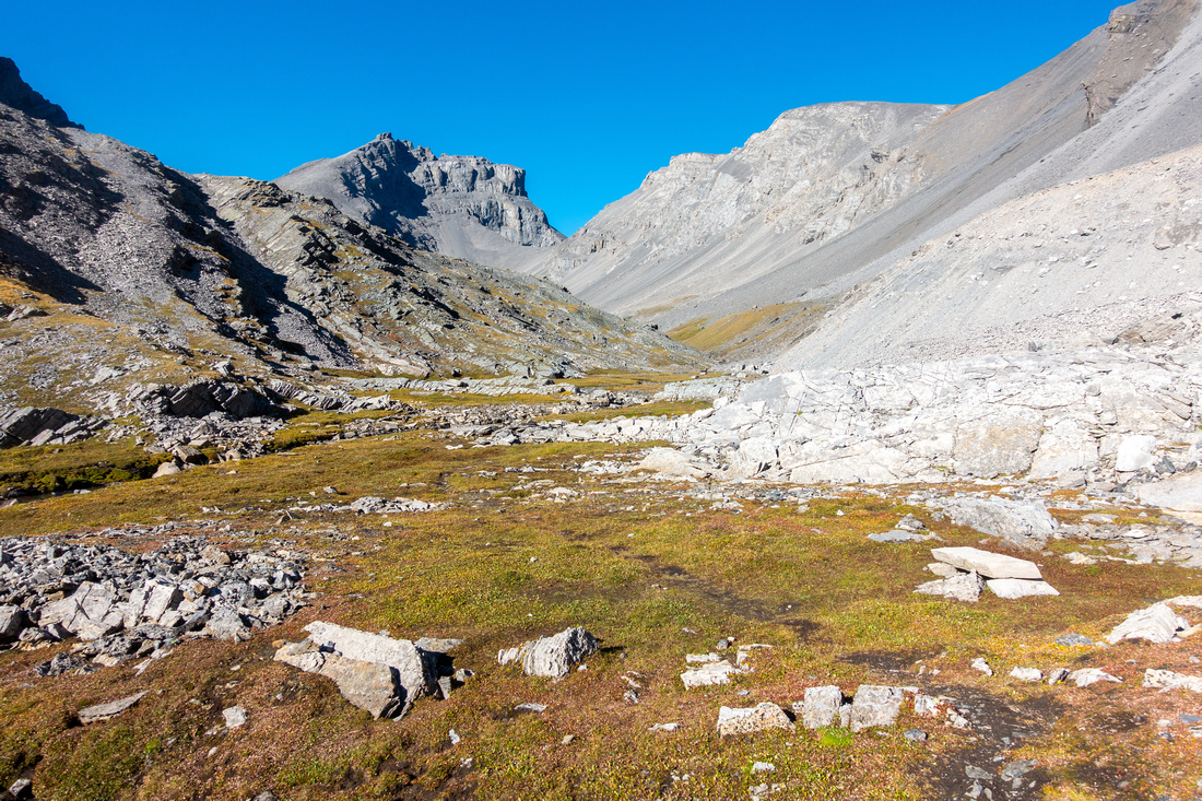 Karst Valley Karst Valley Great hiking past upper Headwall Lake. Talus slope upper right providing straightforward Fortress South ascent line is less steep from what this photo suggests
 |
|||
 Talus Grind Talus Grind Grinding up Talus Slope. Best line ascends diagonally aiming to intercept goat trail above the cliffs visible from valley bottom
 |
|||
 Col Hike Col Hike Hiking up stable terrain to low saddle below Headwall Peak (right)
 |
|||
 Fortress Resort Fortress Resort View east from the saddle. Abandoned Fortress Ski Resort in valley below
 |
|||
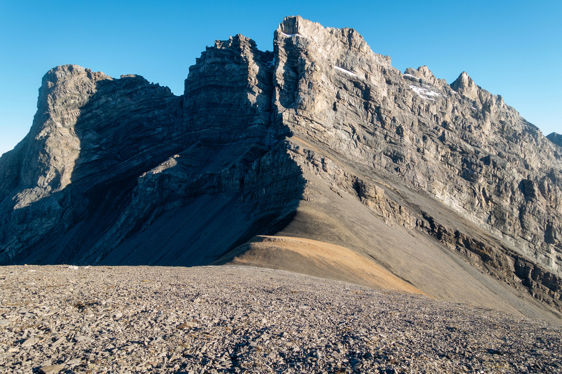 Headwall Peak Headwall Peak Hiking up gentle talus above the saddle with towering cliffs of Headwall Peak behind
 |
|||
 Outlier Ridgewalk Outlier Ridgewalk Final hands-in-your-pockets ridgewalk to 2850m Fortress South. Main Peak behind with normal ascent route upper left
 |
|||
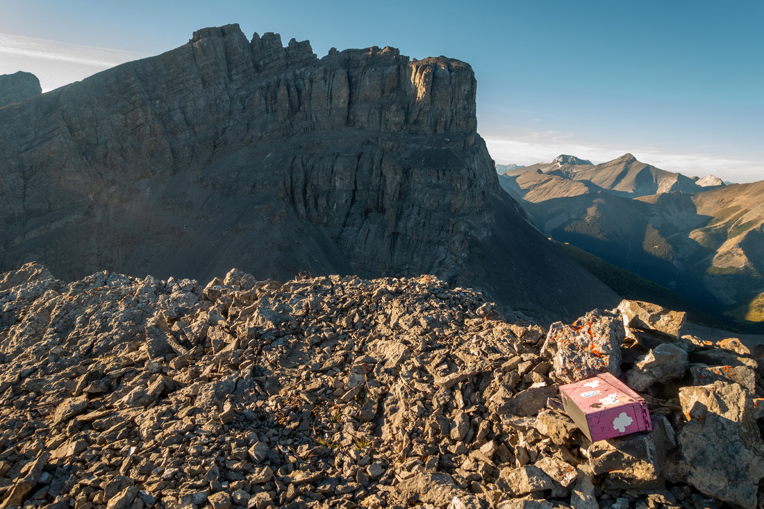 Summit Register Summit Register Pink summit register at Fortress South has very few entries
 |
|||
 Headwall Valley Headwall Valley Late afternoon sun reflecting of Outlier Ridge with Headwall Valley already in shade
 |
Abstract
| Overall Difficulty | D5 | Rough section of Headwall Trail below first Lake. Moderately steep but straightforward Talus slope for South Outlier. | |||
| Snow Factor | S3 | Avalanche prone steep slope above upper Lake. Summit register revealed successful ascent in snow conditions | |||
| Scenery | Scenic Headwall Lakes and Valley. Imposing Fortress cliffs. Aerial Panorama of Kananaskis Trail (Hwy40) corridor from the summit | ||||
| Trail/Marking | Good / None | Signed but confusing network of XC-Ski trails. Headwall trail with blowdown areas and washed out sections. Route with some goat trails beyond upper Lake | |||
| Suggested Time | 8hrs | Return time via Headwall Lakes Valley | |||
| Elevation | Start: 1930m Max: 2850 m Total: ~1000m | Distance: 20km return | |||
| Gear | Full hiking boots and poles, Gaiters. Climbing helmet recommended in group. GPS helpful navigating XC Ski Trail network | ||||
| Water | Headwall Creek, none beyond upper Lake. Carry 1-1.5L | ||||
| Dog Friendly | Yes | Standard back-country travel precautions | |||
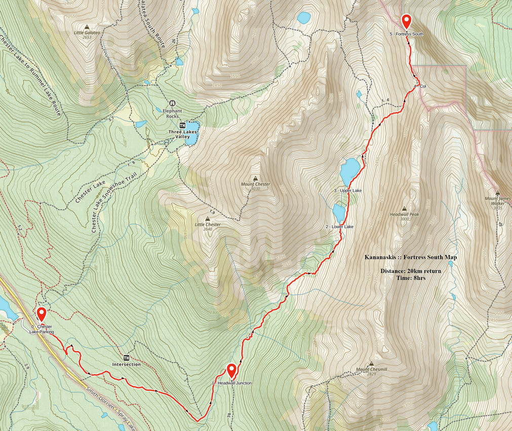 Fortress South GAIA Map
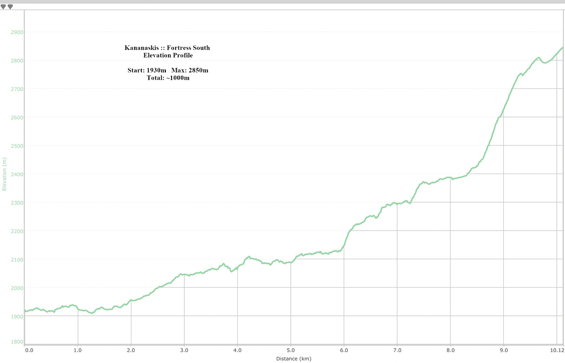 Fortress South Elevation Profile
