Google Map |
Rockies :: Kananaskis :: Elk Lakes - Petain Falls |
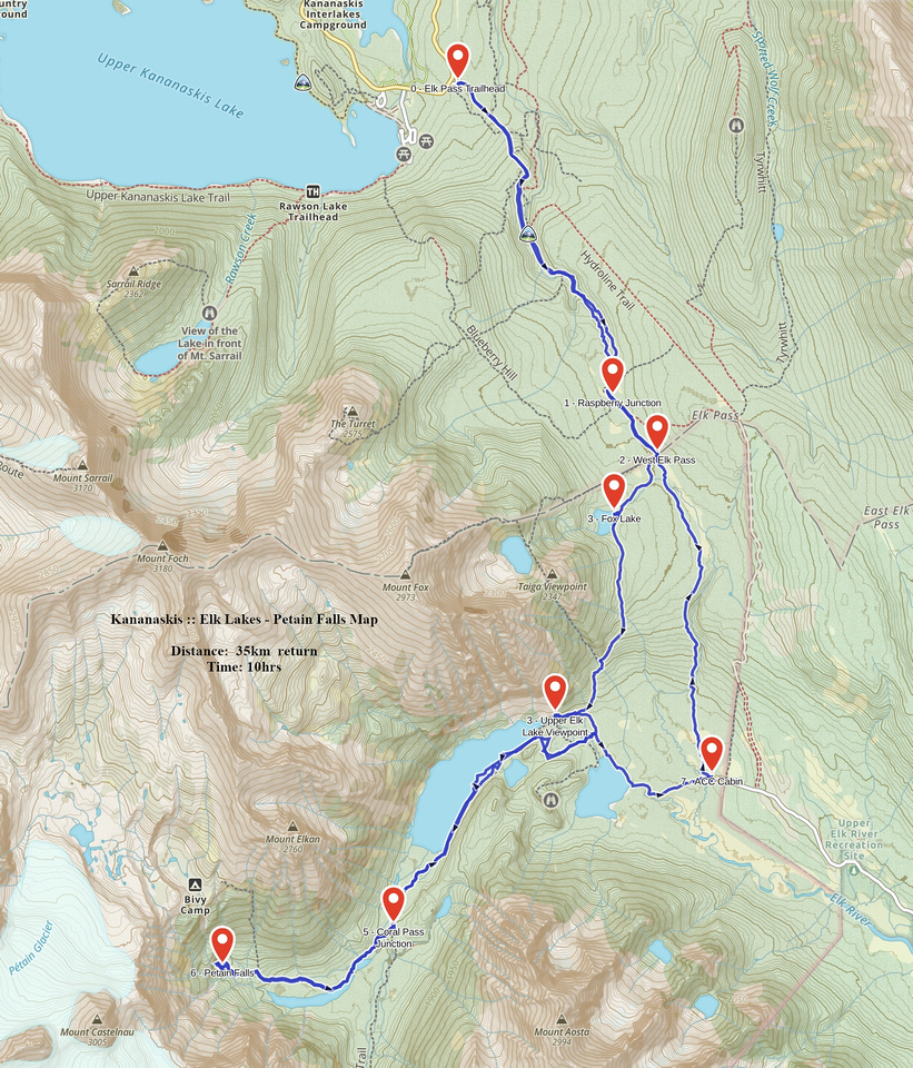
GPS Track |
Water collecting in shallow pool at Base of Petain Waterfall |
|||
| Trip Summary | |||
August 10, 2020There are 2 approaches to Elk Lakes Provincial Park -- driving from Sparwood, BC on a network of forestry gravel roads, or hiking from Peter Lougheed Provincial Park on Alberta side. Unless visiting from out of Alberta or living in Crowsnest area driving in is much more time consuming. Hiking approach is via Elk Pass trail starting from Kananaskis Lakes road, also popular winter cross-country skiing trip, and takes only ~2hours of moderate pace via shorter Fox Lake approach. Elk Lakes Trail system has been severely damaged during historic 2013 spring floods, including total washout of bridge spanning upper Elk Lake outlet. BC Parks "refurbished trail system" now includes re-routed upper Elk Lake trail and brand new bridge -- see gallery. Core area includes Alpine Club of Canada Hut and back-country campground - both mere minutes from parking lot at end of Elkford gravel forestry road. Both Elk lakes are quite scenic, but real reward is continuing to Petain Waterfall -- see this World Waterfall Database entry. Although long (perhaps too long!) for day hike from AB side, it is still feasible due to undemanding nature of established hiking trails. Back-country campground at gravel flats above upper Elk Lake has been decommissioned but wild camping without facilities is still allowed. It is logical overnight base for visit to Petain alpine basin, or Coral Pass, both not possible anymore as day-hikes.
Park at signed Elk Pass trailhead on Kananaskis Lakes road in Peter Lougheed Provincial Park, ~15 min from Hwy 40 junction and ~5min past Boulton Creek Trading Post. First part is forest road walk that can be cycled. Past picnic bench at Raspberry Junction (used for Turret scramble approach), trail forks right and reaches West Elk Pass around 5km mark, 1hr of moderate-fast pace on foot from parking. Turn right into Fox Lake trail while direct ACC cabin trail via Elkan creek continues straight. Trail is bit rocky and rooty now, but still easy going. Fox Lake sits in pretty alpine meadow below Mt. Fox and is well worth a breather; flock of Canadian Wild Geese can often be seen here. Continuing around south shoulder of Mt Fox trail descends crossing wide avalanche slope below "Taiga Viewpoint" -- great extension of Frozen Lake hike. Approaching upper Elk Lake trail swings left; old trail before floods used to continue straight but has been abandoned since outlet bridge has been washed out. It is still worthy diversion to a viewpoint, only 5min from main trail. All junctions are now signed and undemanding walk on wheelchair accessible wide trail leads in some 15-20 minutes to south side of the lake. This spot, complete with picnic bench, would be logical turnaround point if hiking only to Elk Lakes.
For Petain Falls continue along single track around upper Elk Lake; takes ~35-40min to reach west end. Following gravel flats past decommissioned back-country campground, trail crosses Petain Creek couple of times on new Park bridges passing signed Coral Pass junction along the way. Final approach to the falls rises a bit more steeply and is forest enclosed, then turning left at signed Petain Basin junction reaches glacial moraine below Petain Falls in another 5 minutes. It is possible to hike all the way to base of Waterfall & it would be worth spending several hours here for that perfect shot (for which day hiking is not feasible option anymore!). Return the same way, noting alternate Elkan creek loop option after reaching junction above upper Elk Lake. This is longer way and probably won't sit well as legs are getting tired by now, but it does allow for nice evening views of lower Elk Lake. |
|
Gallery |
|||
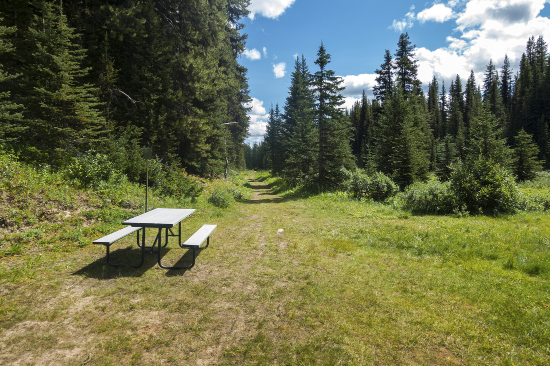 Picnic bench at Raspberry Junction ~4km along Elk Pass trail
 |
|||
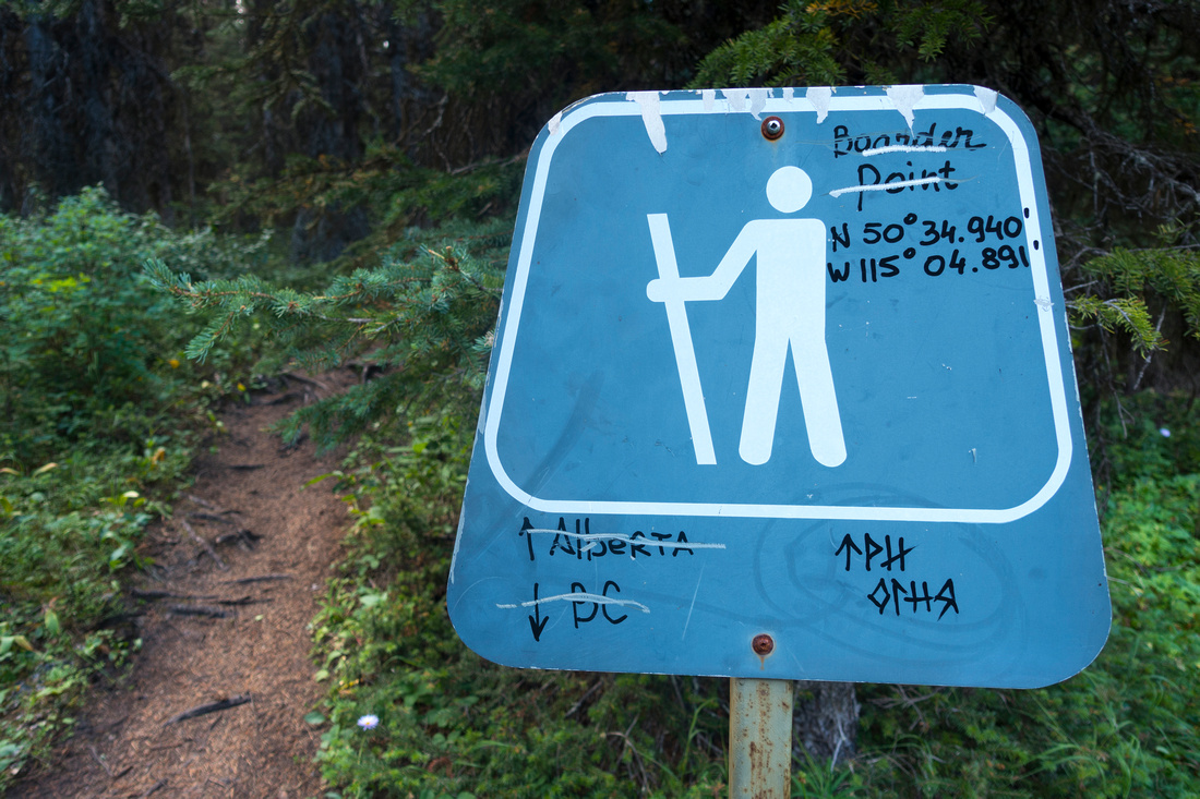 Crossing Alberta / BC Provincial Border on West Elk Pass Trail
 |
|||
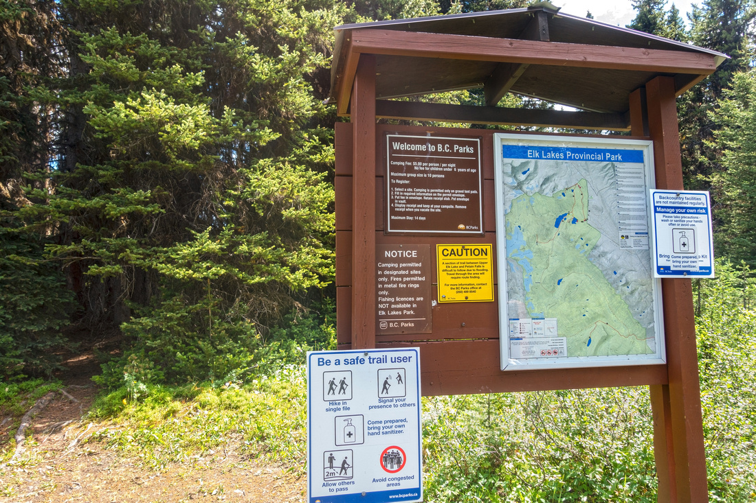 BC Parks Info table at West Elk Pass, ~5km from Kananaskis Lakes parking. Fox Lake approach to upper Elk Lake branches to the right, direct trail to ACC Hut continues straight
 |
|||
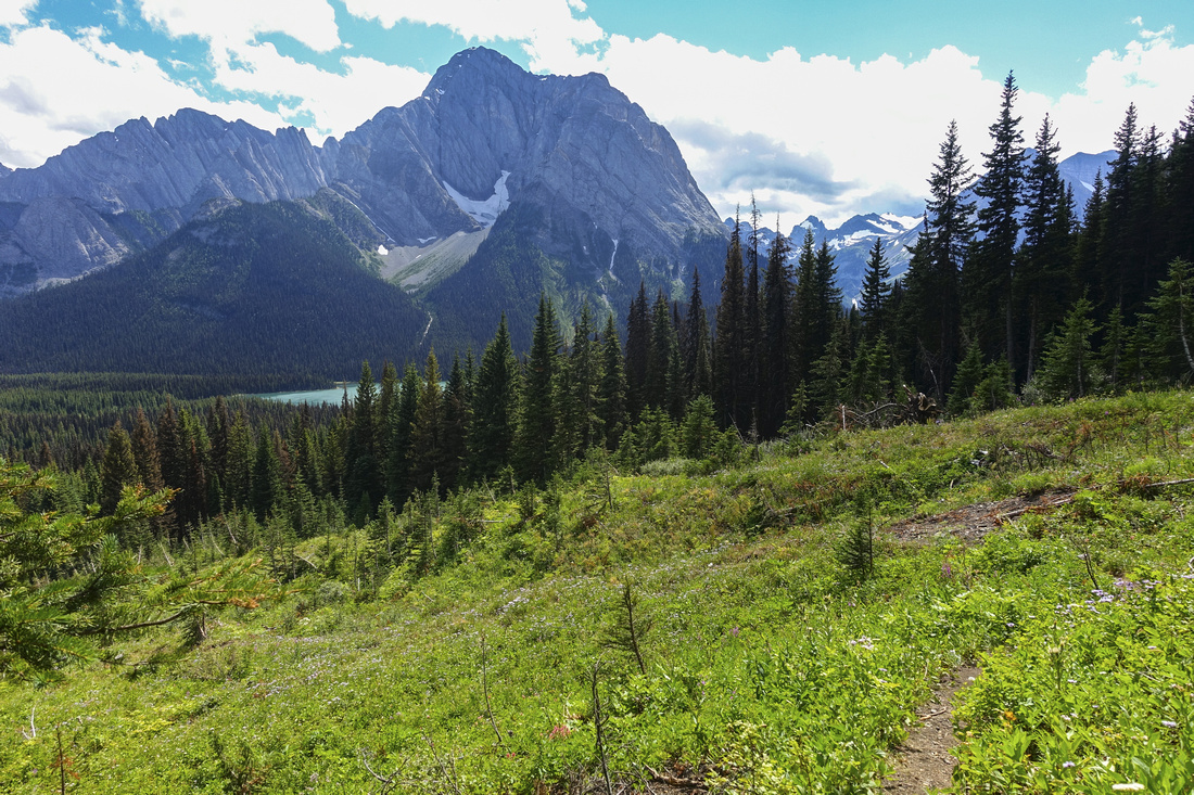
 Fox Lake in beautiful alpine meadow below Mt. Fox (Kane difficult, upper right)
 |
|||
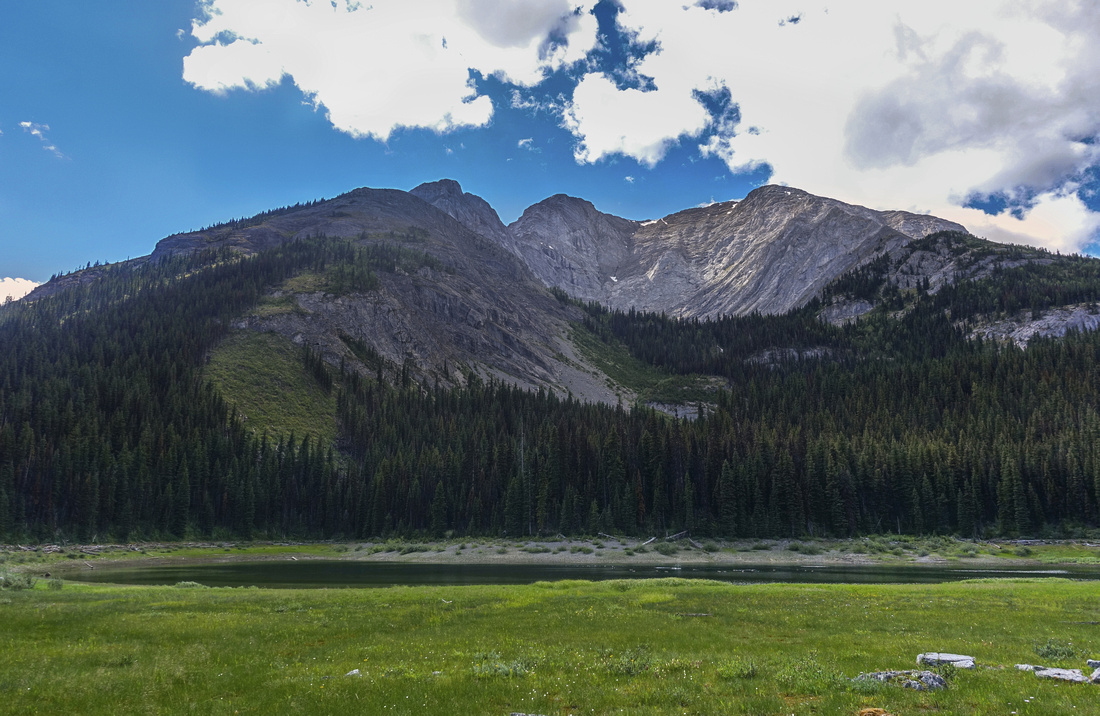
 Fox Lake approach crossing avalanche slope with view of lower Elk Lake center left
 |
|||
 Upper Elk Lake viewpoint on obsolete old trail that is getting overgrown. Bridge spanning lake outlet lower left has been washed out in 2013 floods. It is still worth 5min detour.
 |
|||
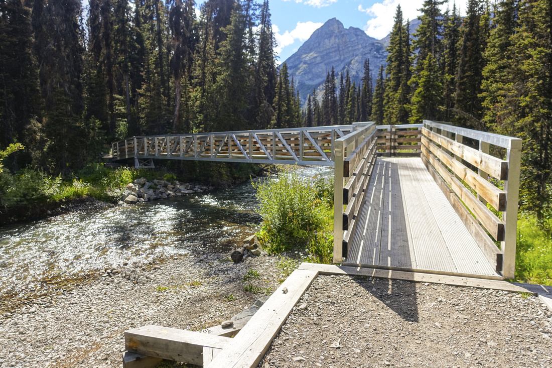 New bridge on "refurbished trail system" crossing upper Elk Lake outlet
 |
|||
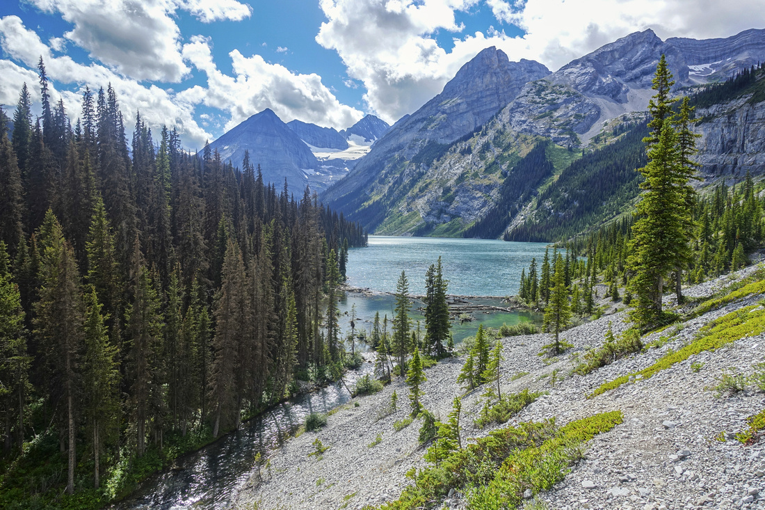
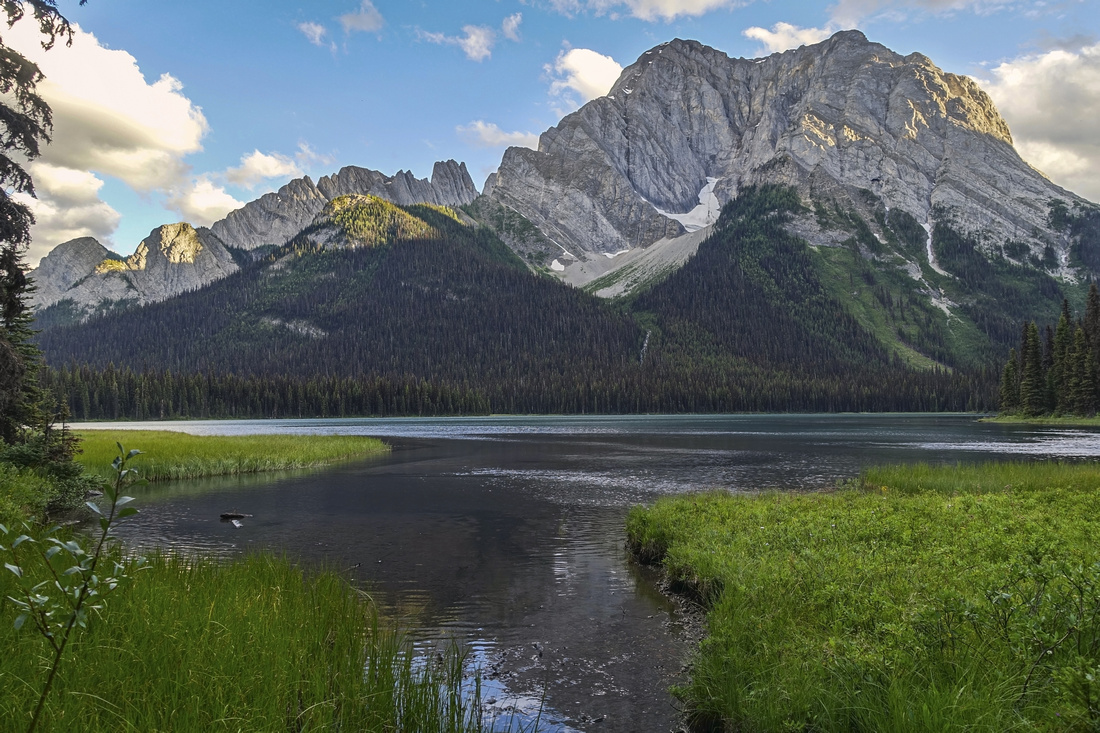
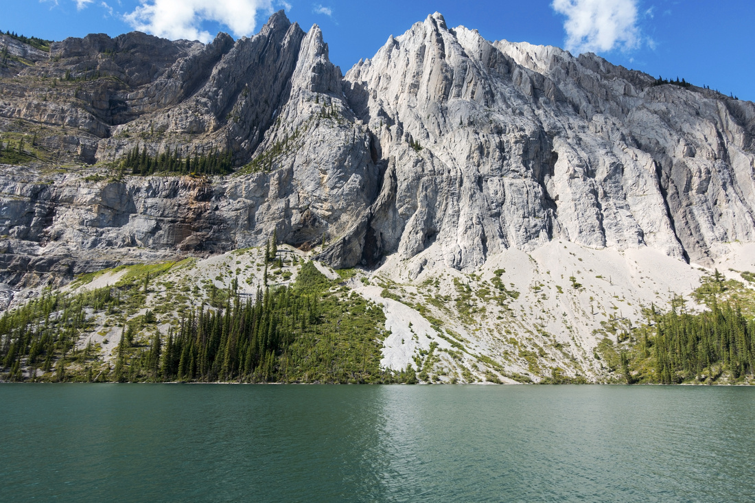 Beautiful upper Elk Lake just past end of wheelchair accessible trail portion, looking across to southern outlier of Mt. Fox
 |
|||
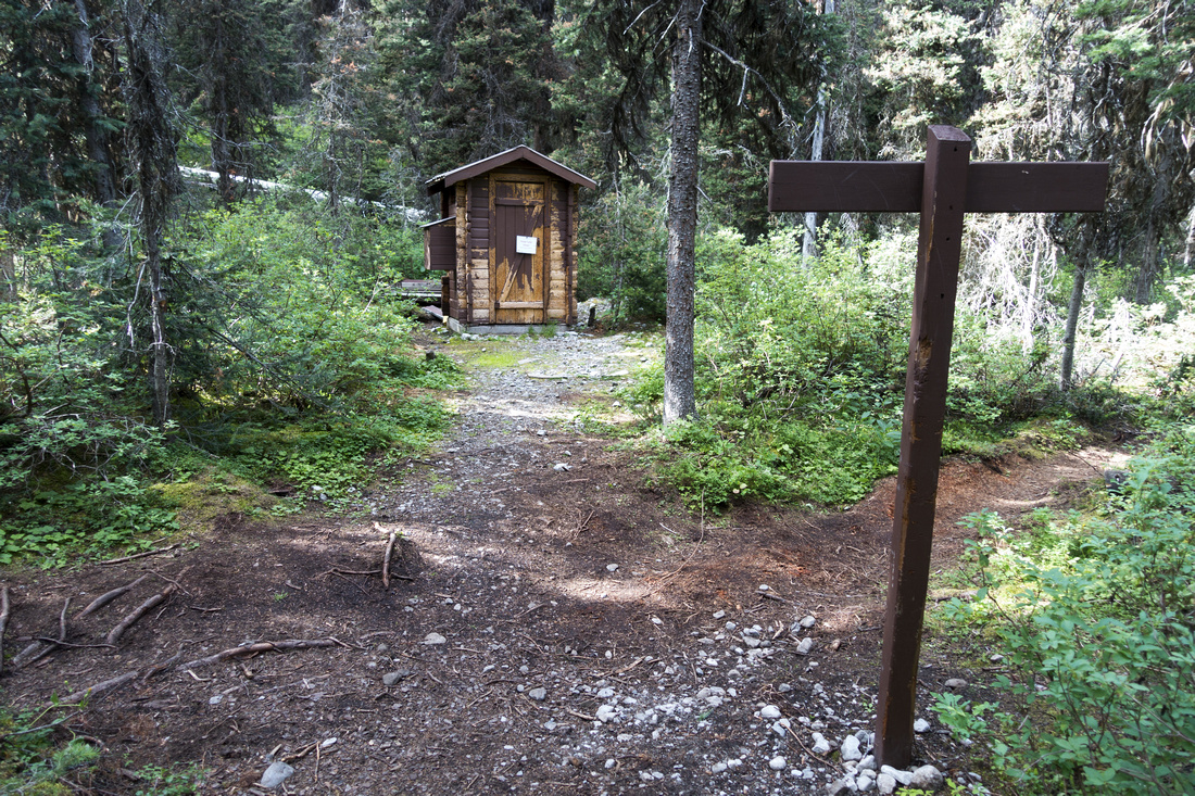 "Petain Washroom" now closed some 40min before Petain Falls
 |
|||
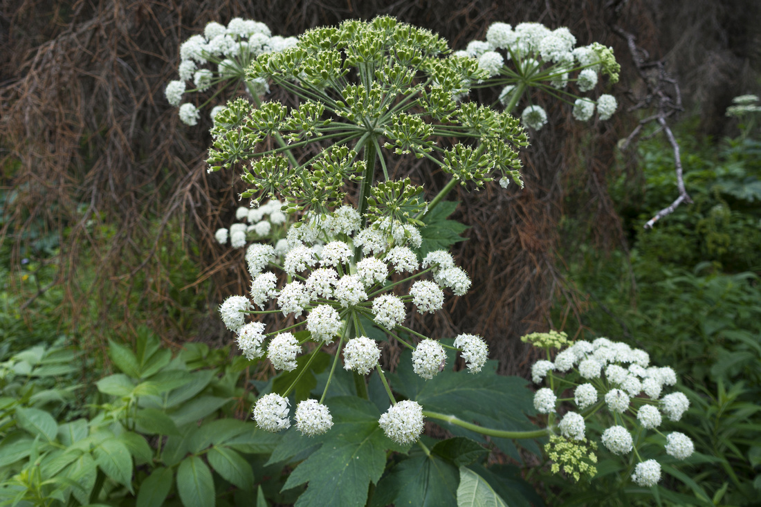 Common White Milkweed on forest enclosed approach to Petain Falls
 |
|||
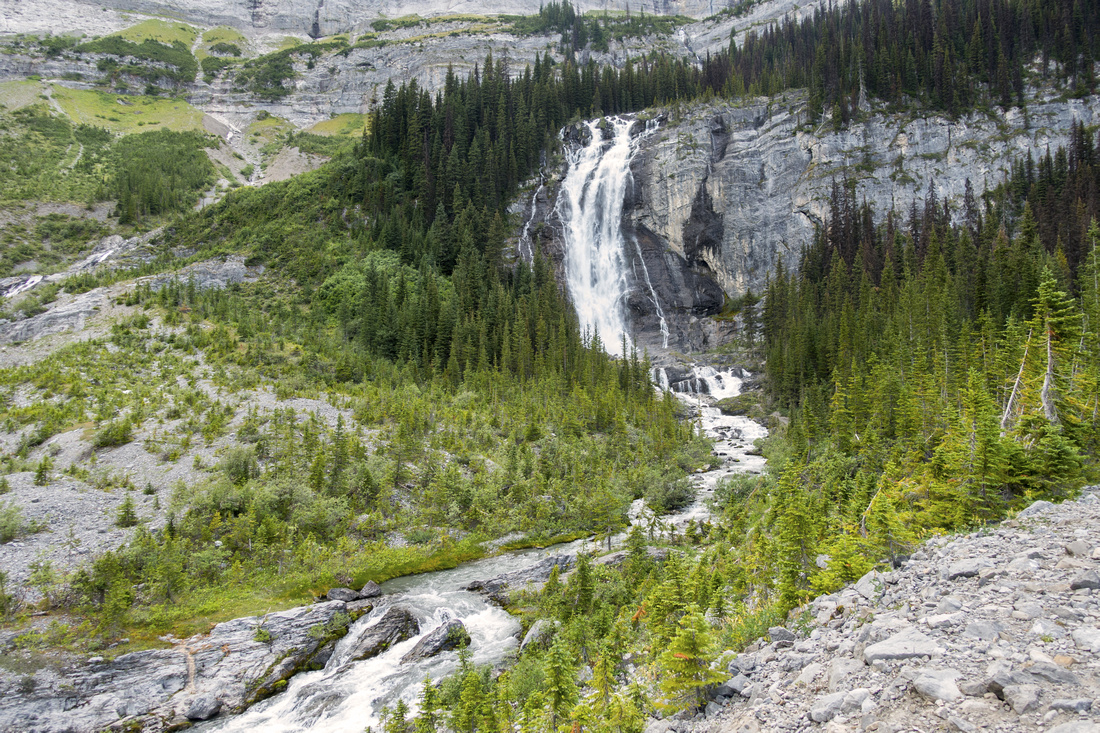 Petain Falls as trail exits to Glacial Moraine ~5min past Petain Basin junction. It is possible to continue to waterfall base
 |
|||
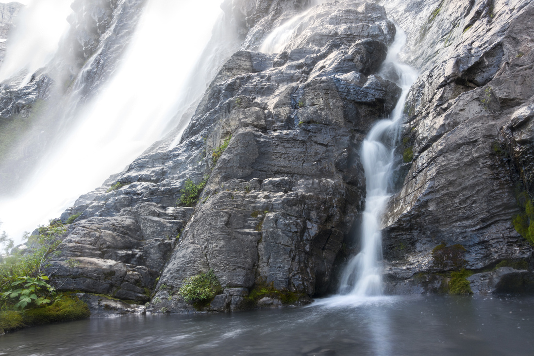
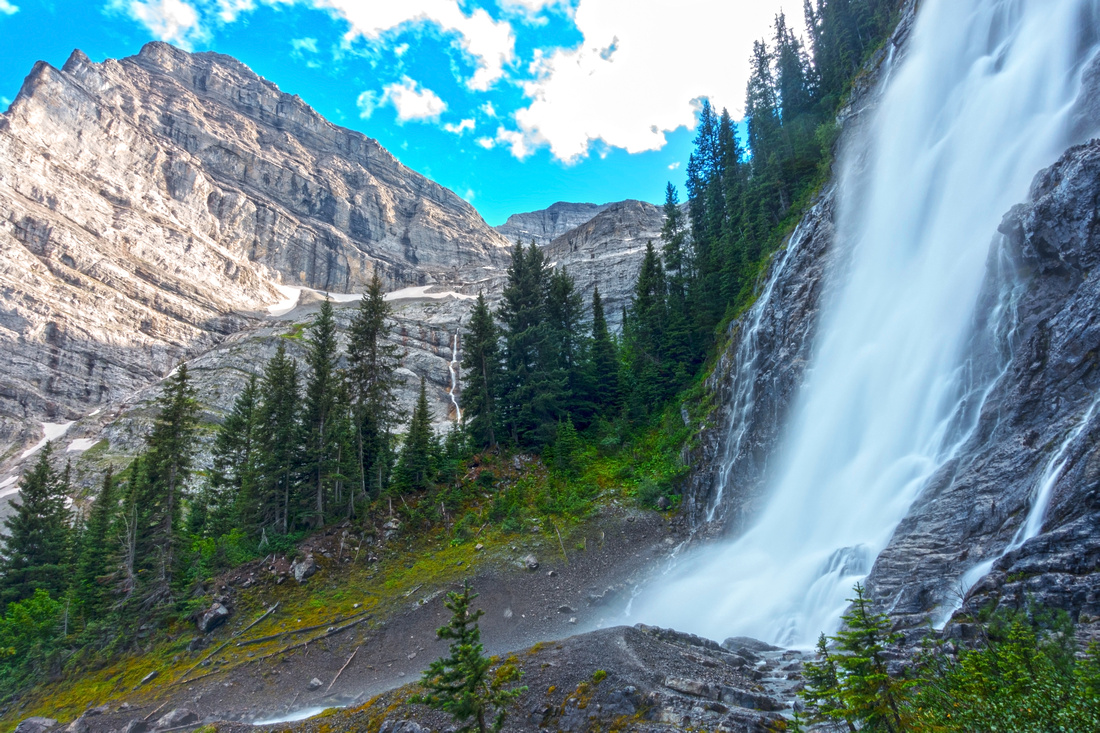 Petain Falls base. The falls plunge approximately 1230 feet in three major steps (approximately 350, 375 and 275 feet respectively) with interstitial cascades in between. For more details see here
 |
|||
 Lower Elk lake near back-country campground on alternate (but longer) loop return via ACC Hut / Elkan Creek
 |
|||
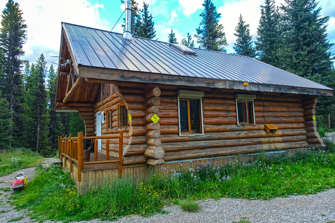 Alpine Club of Canada Hut, a family friendly overnight base for visit to Elk Lakes Provincial Park
 |
Abstract
| Overall Difficulty | D3/4 | Established trail hiking with some rooty / rocky parts. Bridged creek crossings. Seasonally washed out flats above upper Elk Lake. Significant total distance - very long day for day hike | |||
| Snow Factor | S2 | Elk lakes frequently visited by cross-country skiers in winter. Low avalanche danger | |||
| Scenery | Alpine meadows at West Elk Pass, Fox Lake, Elk Lakes and spectacular Petain Falls | ||||
| Trail/Marking | Excellent | Official maintained AB/BC parks trail with signposts. One indistinct section above upper Elk Lake is marked with cairns | |||
| Suggested Time | 10 hr | Return time to Petain Falls (6 hrs for Elk Lakes only), if dayhiking from Peter Lougheed Provincial Park in Alberta; much shorter if driving in from BC side. | |||
| Elevation | Start: 1740m Max: 1950 m Total: ~850 m (AB approach) | Round Trip: ~35km (AB approach) | |||
| Gear | Day Hikers with good ankle coverage in summer. Poles helpful but not really required. Camping gear for overnight trips. Cross-country skis preferable to snowshoes in winter | ||||
| Water | Plenty of water sources including Fox and Petain creeks. No need to carry more than 0.5L at any time | ||||
| Dog Friendly | Yes | Standard back-country travel precautions | |||
 Elk Lakes - Petain Falls GAIA Map
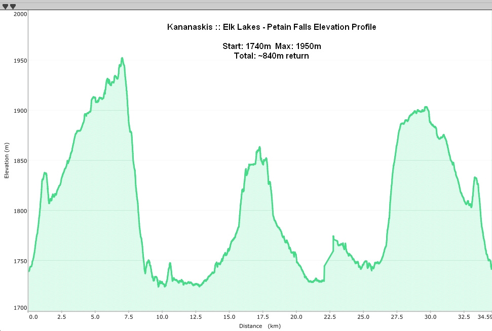 Elk Lakes - Petain Falls Elevation Profile