Google Map |
Rockies :: Kananaskis :: Black Prince Lakes |
GPS Track |
 
Black Prince Lakes just starting to melt in early July. By September usually only small puddle remains |
|||
| Trip Summary | |||
Multiple Dates, last July 8 '24Delightful high Alpine Bowl flanked by Mt. Warspite and Mt. Black Prince at Spray Road west side. First part is Black Prince Cirque Family Friendly Trail with old interpretive signs. Adventure begins after leaving crowds at Warspite Lake north side, where Cirque trail ends. In late summer easiest way across is simple walk on dried lake bed, as reflected on GPS Track (download Top of Page). On my second trip in early summer I bushwhacked around left side following bits of trail and old flags, then after crossing lake inlet intercepted good trail that leads into Warspite alpine bowl - but apparently there is also trail circling west side of the lake; suit yourself. Only other potential route-finding problem comes soonafter: Trail disappears crossing large scree plateau; watch for cairns in order to pick it up on the other side. Rest is relatively straightforward; be ware of resident bear that frequents the area, but appears to mind its business and not bother anyone. After entering the Bowl above the Cascades (~1hr from Warspite Lake) Black Prince Ridge is reached by scrambling obvious Talus slope on west (climber right) side. Any line works, but there is also faint trail branching off main trail near the lip of the Bowl. Ridge traverse is highly recommended, specially if you arrive early enough when sun has not yet dropped below Mt. Black Prince. From the low col at Ridge North side one can also climb another ~100m vertical for high-angle view till cliffs bar further progress.
Despite abundance of golden larches on Black Prince Ridge I believe Autumn is not optimal time for this hike; as all main highlights (Warspite Lake and Cascades, Black Prince Lakes) will be dry. Try to come in early summer instead or as soon as snow has melted. Going FurtherThere are 3 options I know all radiating from Warspite Alpine Bowl:
|
|
Gallery |
|||
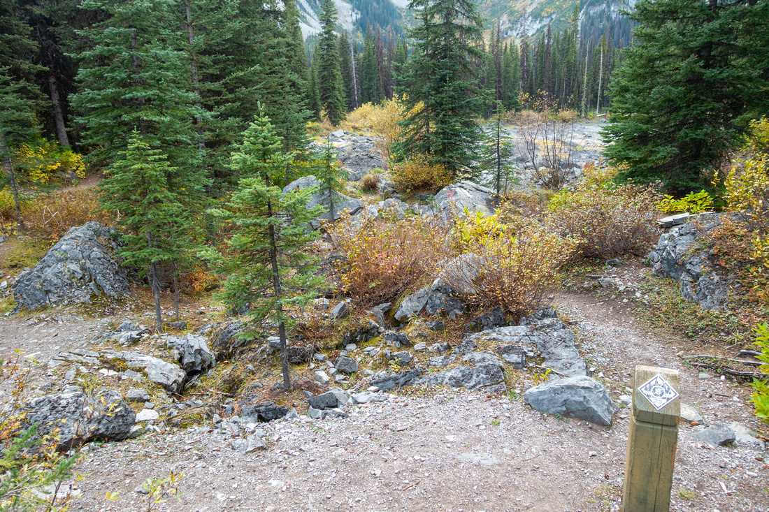
 Black Prince Trailhead
Black Prince Cirque Trailhead just below Parking Lot on Spray Road West Side Black Prince Trailhead
Black Prince Cirque Trailhead just below Parking Lot on Spray Road West Side |
|||
|
|
|||
 Warspite Lake
 at end of Cirque Interpretive Trail, full of water in early July - first reason why early summer is optimal timing for this hike. Mt. Black Prince behind Warspite Lake
Warspite Lake at end of Cirque Interpretive Trail, full of water in early July - first reason why early summer is optimal timing for this hike. Mt. Black Prince behind |
|||
 Interpretive Post
 #8 is good spot to leave Cirque Trail and start circling Warspite Lake. In late summer one can simply walk across dried out lake bed Interpretive Post
Interpretive Post #8 is good spot to leave Cirque Trail and start circling Warspite Lake. In late summer one can simply walk across dried out lake bed |
|||
 Warspite Lake
 in early September, looking back - almost completely dry. Kent Ridge in the Background Warspite Lake
Warspite Lake in early September, looking back - almost completely dry. Kent Ridge in the Background |
|||
 Log Jam Crossing
Log Jam crossing of Warspite Lake Inlet in early July; by September this is usually completely dry Log Jam Crossing
Log Jam crossing of Warspite Lake Inlet in early July; by September this is usually completely dry |
|||
|
|
|||
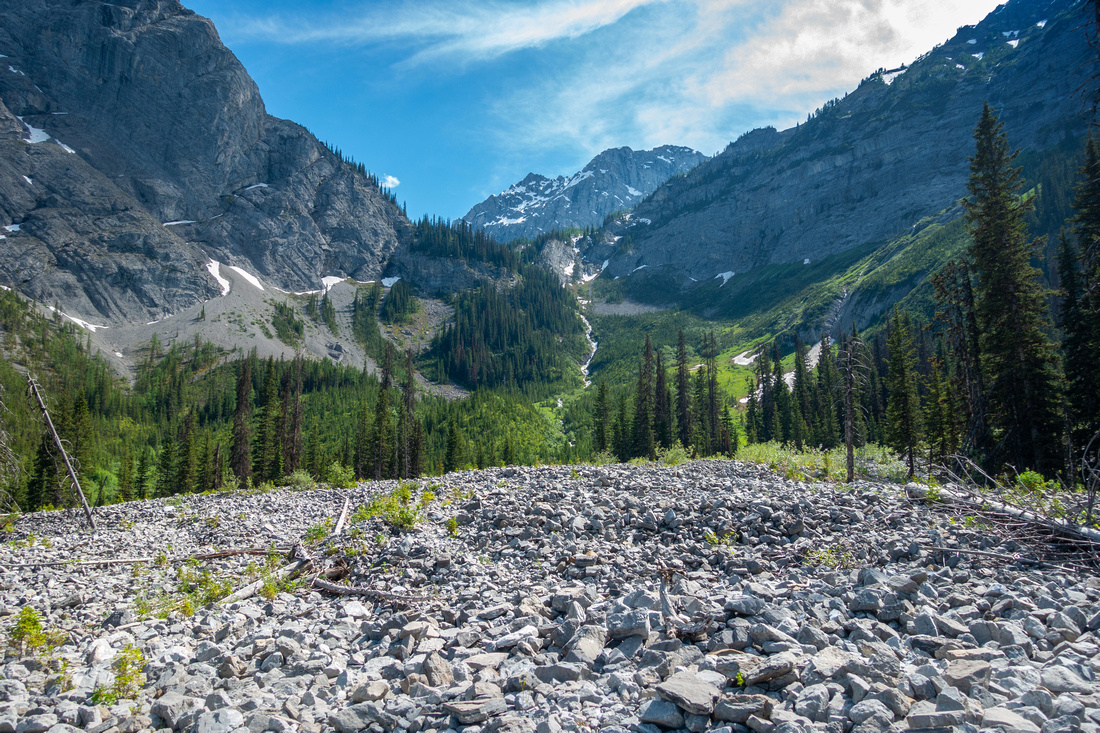
 Black Prince Cirque
View back Black Prince Cirque as trail climbs towards Warspite Bowl. Kent Ridge center Black Prince Cirque
View back Black Prince Cirque as trail climbs towards Warspite Bowl. Kent Ridge center |
|||
 Warspite Cascades
Trail levelling off briefly crossing just below boulder field on approach to Warspite Cascades Warspite Cascades
Trail levelling off briefly crossing just below boulder field on approach to Warspite Cascades |
|||
 Warspite Cascades
 fully flowing in early July. Second reason why early summer is optimal timing for this hike Warspite Cascades
Warspite Cascades fully flowing in early July. Second reason why early summer is optimal timing for this hike |
|||
 Warspite Cascades
 in early September - barely a trickle to fill water bottle. Compare to earlier photo Warspite Cascades
Warspite Cascades in early September - barely a trickle to fill water bottle. Compare to earlier photo |
|||
 Warspite Cascades
View down Warspite Cascades in early July - great spot to fill the water bottle Warspite Cascades
View down Warspite Cascades in early July - great spot to fill the water bottle |
|||
 Warspite Meadows
Lip of Warspite Cirque, looking back with scattered snow patches in early Summer Warspite Meadows
Lip of Warspite Cirque, looking back with scattered snow patches in early Summer |
|||
 Warspite Bowl
Warspite Cirque - One of nicest high alpine bowls in K-country. Mt. Warspite behind Warspite Bowl
Warspite Cirque - One of nicest high alpine bowls in K-country. Mt. Warspite behind |
|||
 |
|||
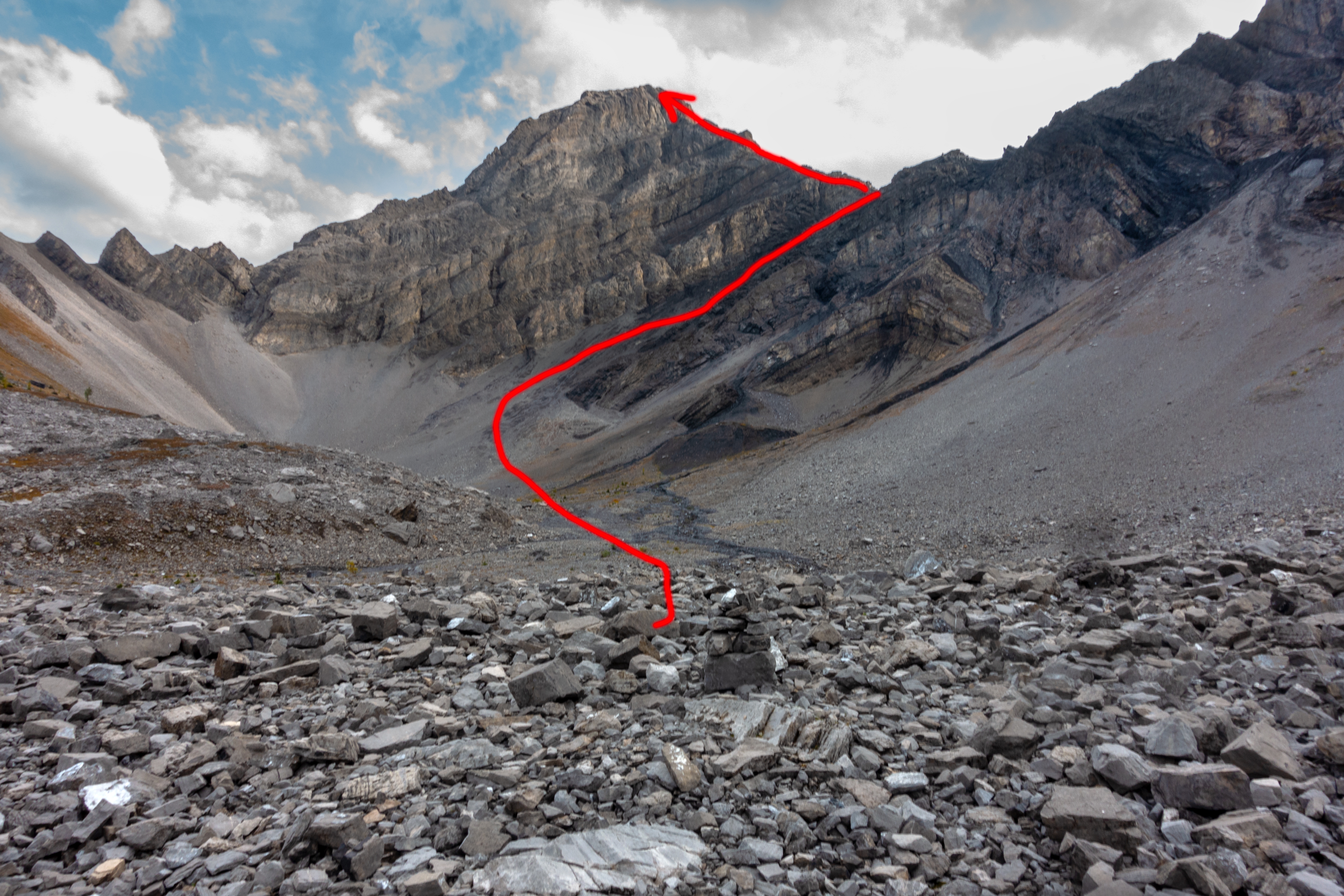
 Black Prince Ridge
Foreshortened view up Black Prince Ridge scramble route - any line will work, but there is also rough trail extreme right. Early September photo when everything was dry; in early July '24 I found firm snow patches helpful Black Prince Ridge
Foreshortened view up Black Prince Ridge scramble route - any line will work, but there is also rough trail extreme right. Early September photo when everything was dry; in early July '24 I found firm snow patches helpful |
|||
 Warspite Cirque
Snowbound top of Warspite Cirque from Black Prince Lakes Ridge after scrambling Talus field roughly center Warspite Cirque
Snowbound top of Warspite Cirque from Black Prince Lakes Ridge after scrambling Talus field roughly center |
|||
 Black Prince Ridge
Panoramic view NE from start of Black Prince Ridge. Wide gully on the other side of Warspite Bowl can be scrambled to Ridge center right for great views of Spray Corridor. Kent Ridge left background Black Prince Ridge
Panoramic view NE from start of Black Prince Ridge. Wide gully on the other side of Warspite Bowl can be scrambled to Ridge center right for great views of Spray Corridor. Kent Ridge left background |
|||
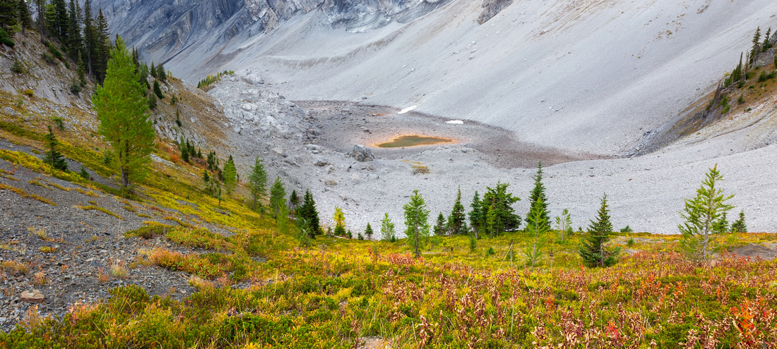
 Black Prince Lakes
Terrific Hiking on Black Prince Ridge with Lake just beginning to melt in early July Black Prince Lakes
Terrific Hiking on Black Prince Ridge with Lake just beginning to melt in early July |
|||
 Dry Black Prince
Same spot as on previous photo, but in early September - what a difference! Just small puddle remains. Mt. Black Prince above Dry Black Prince
Same spot as on previous photo, but in early September - what a difference! Just small puddle remains. Mt. Black Prince above |
|||
 Closer look at Black Prince Puddle further up the ridge
 |
|||
 North Caiirn
Cairn at North End of Black Prince Ridge. This is logical turnaround Point, but one can also continue by scrambling down to col below then ascending opposite side for another 15 min or so for different perspective North Caiirn
Cairn at North End of Black Prince Ridge. This is logical turnaround Point, but one can also continue by scrambling down to col below then ascending opposite side for another 15 min or so for different perspective |
|||
 Black Prince Col
View back to Black Prince Puddle from North side Col. Return back via the Ridge or by sidehilling grassy bench mid-center left Black Prince Col
View back to Black Prince Puddle from North side Col. Return back via the Ridge or by sidehilling grassy bench mid-center left |

Abstract
| Overall Difficulty | D3/4 | Possible bushwhack and non-bridged stream crossings in early season. Steep Trail Sections below Warspite Cirque. Off Trail Talus scramble to Black Prince Ridge. | |||
| Snow Factor | S4 | Bowl above Warspite Lake would be dangerous avalanche trap. Wait till snow has melted | |||
| Scenery | Warspite Lake and Cirque. Warspite Cascades, Mt. Warspite and Black Prince Lakes | ||||
| Trail/Marking | Excellent / Poor | Wide family friendly trail with old Interpretive Signs to Black Prince Cirque. Some bushwhack / routefinding around Warspite Lake, depending on season. Trail disappears in Warspite Bowl. Occasional Cairns | |||
| Suggested Time | 5-6 hrs | North end of Black Prince Lakes ridge return time | |||
| Elevation | Start: 1740m Max: 2370m Total: ~800m | Round Trip: 12km | |||
| Gear | Full hiking boots much preferred for ankle support. Poles recommended. Gaiters helpful | ||||
| Water | Warspite Lake inlet and Warspite Cascades; dries out by late summer. Carry 1-2L, depending on season | ||||
| Dog Friendly | Yes | Resident bear around Warspite Lake. Standard back-country precautions | |||
 Black Prince Lakes GAIA Map
 Black Prince Lakes Elevation Profile