Google Map |
Rockies :: Jasper :: Tonquin Valley |
GPS Track |
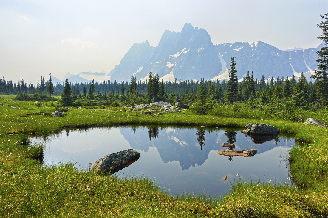 
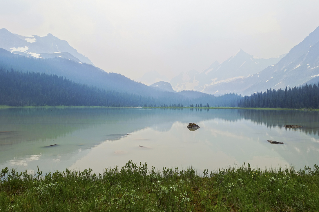
Ramparts reflected through summer wildfire haze in shallow pond on Moat Lake/Tonquin Pass trail |
|||
| Trip Summary | |||
July 13-16, 2021
Tonquin Valley is essential Jasper and one of best known Rockies backpacks. Iconic view of Amethyst Lakes with backdrop of Ramparts cliffs have been captured in many guidebooks, maps and calendars. Over the years area has commercialized quite a bit and there are 2 lodges that cater to wealthy clientele. Horse traffic that churn trails into mud and swarming bugs are main reason why summer, normally the busiest, is also the least preferred time for visit. As someone I know said "You have to hit Tonquin right" - and that "right" usually means crisp fall days, when bugs are gone and views are nothing short of spectacular. It is possible to dayhike Tonquin, and I have done so in the past in early 2000s - it was out-and-back Astoria trip. Jasper trail runners also frequently run entire loop in a day. But this is inferior way to experience Tonquin: You have to backpack. There are several strategically placed and maintained campgrounds that include food lockers and picnic tables. Reservations in summer are hard to come by as season gets booked solid throughout summer on Parks Canada reservation site. But if your timing is flexible it is worth to keep checking as people often cancel in the last minute. Strong backpackers can easily reach Tonquin valley in a day, but there are also 'transit' campgrounds on both sides - Astoria River when starting from Cavell road and Portal Creek when starting from Marmot Basin road. In the valley most popular campground is Amethyst Lakes, but in my opinion Surprise Point is by far the best -- extremely scenic, only 4 tent pads (!) and along trail that leads to Chrome and Outpost Lakes / Eremite Valley, prime back-country alpine destinations. Other option if you have deep pocket is stay at lodges that offer full board. Popular is also Wates-Gibson Alpine Club of Canada Hut at shore of Outpost Lake; it is usually approached from Astoria side & used as mountaineering base camp.
My backpack in summer of 2021 was 4 days, 3 night trip: Hike in via Portal Creek to Maccarib campground on day 1, explore Moat Lake/Maccarib meadows on day 2, move camp to Clitheroe on day 3 with afternoon dayhike to Chrome and Outpost Lakes, and finally finishing with Astoria River hike out on day 4. Unfortunately smoke from BC wildfires rolled in on day 1 and remained throughout the trip (and summer season for that matter). So initial version of photo story is quite mediocre; I plan autumn visit for pure photography reasons, and will update the gallery then.
Final word on often debated through hike logistics regarding shuttle between Astoria and Portal trailheads. Without 2 cars on their disposal people usually revert to either taxi or hitch-hiking. If you are planning on calling Jasper taxi, note that Marmot road has cell reception, but Cavell trailhead does not. However there is third option completely self-reliant, which is always personal preference: cycling. You do not want to cycle Cavell road uphill, but Marmot road is manageable for string cyclist. Unknown to many, there is also very good hiking trail starting from Wabasso road that emerges ~1km from Portal trailhead. On my trip, after leaving the car at Astoria trailhead, I cycled down Cavell road, continued for 3km along Wabasso to Marmot junction, stashed the bike in the forest and easily hiked up to Portal trailhead; entire thing took under 1.5 hrs, and saved me at least $100 CAD which seems to be ongoing rate for Jasper cabbies. Contact me directly if you want more details about location of that Marmot hiking trail. |
|
Gallery |
|||
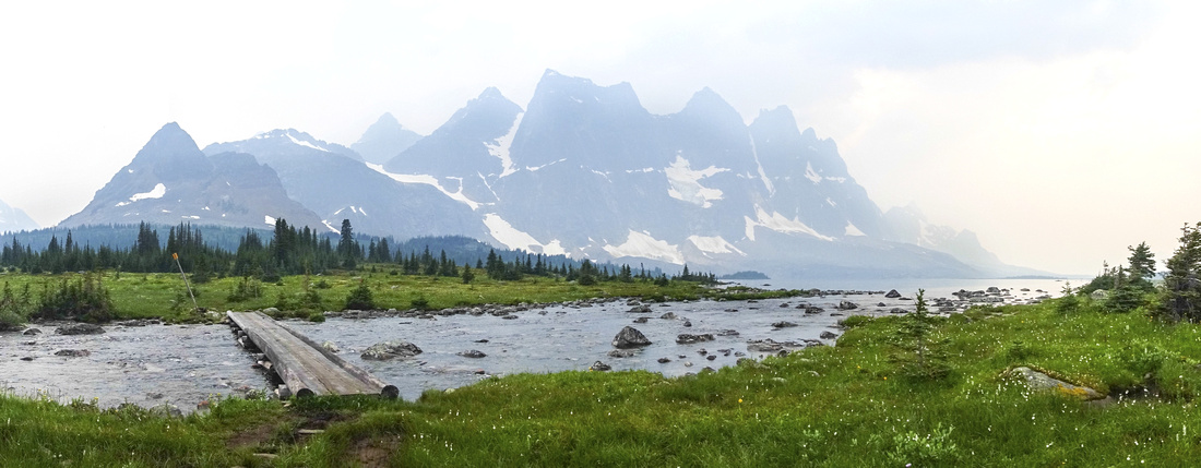
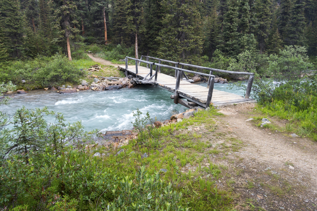
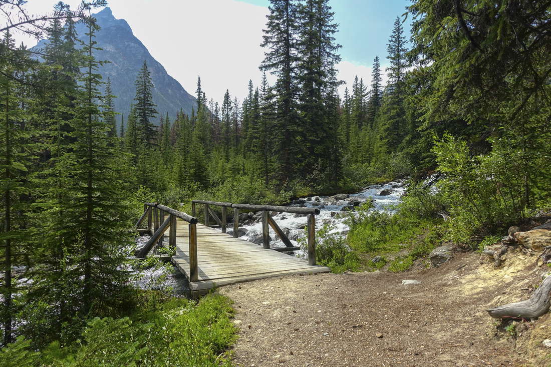 Circus Creek Bridge
 ~4.2 mark from Portal Trailhead with Peveril Mtn upper left Circus Creek Bridge
Circus Creek Bridge ~4.2 mark from Portal Trailhead with Peveril Mtn upper left |
|||
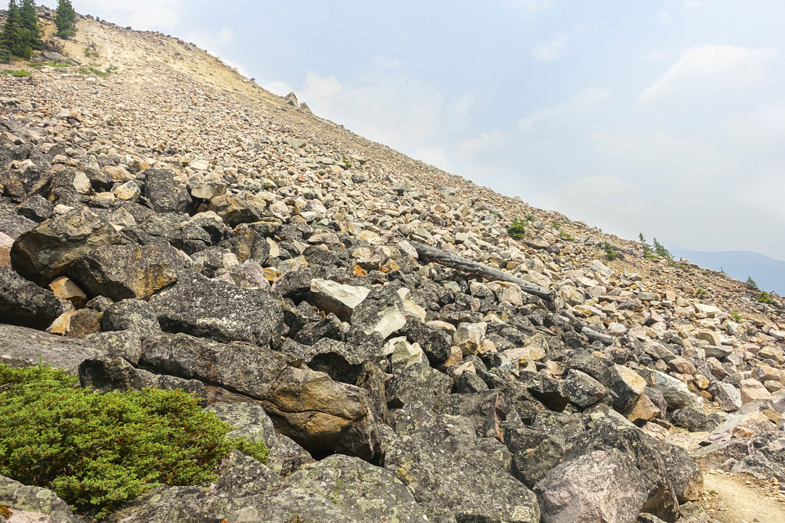
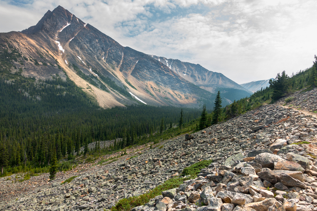 Peveril Rock Slide
Portal Trail contouring Peveril Mountain with great views of Aquila Peak Peveril Rock Slide
Portal Trail contouring Peveril Mountain with great views of Aquila Peak |
|||
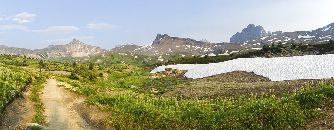 Maccarib Pass Panorama
Looking back as Portal Trail crests 2210m High Maccarib Pass. Old Horn Mountain upper right Maccarib Pass Panorama
Looking back as Portal Trail crests 2210m High Maccarib Pass. Old Horn Mountain upper right |
|||
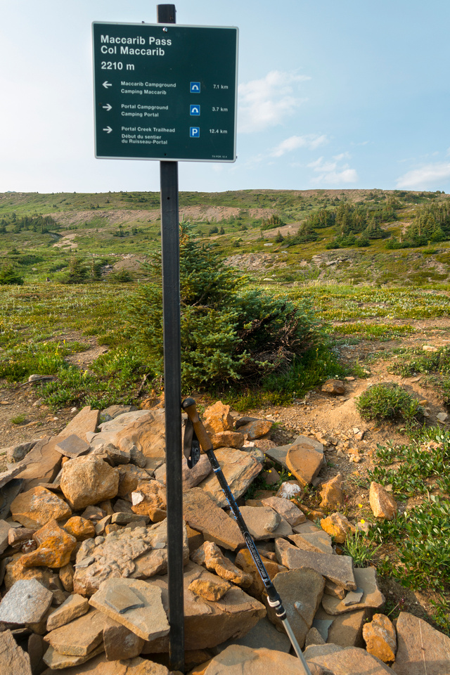 Maccarib Pass
 Sign Post. Following section of ~7km down rolling alpine meadows to Maccarib campground is one of Tonquin highlights Maccarib Pass
Maccarib Pass Sign Post. Following section of ~7km down rolling alpine meadows to Maccarib campground is one of Tonquin highlights |
|||
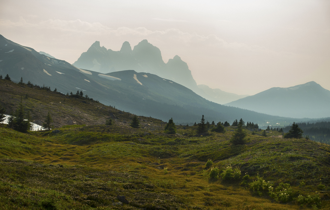 Hazy Ramparts
Descending from Maccarib Pass towards Tonquin Valley with ever improving view of iconic Ramparts, despite increasing haze Hazy Ramparts
Descending from Maccarib Pass towards Tonquin Valley with ever improving view of iconic Ramparts, despite increasing haze |
|||
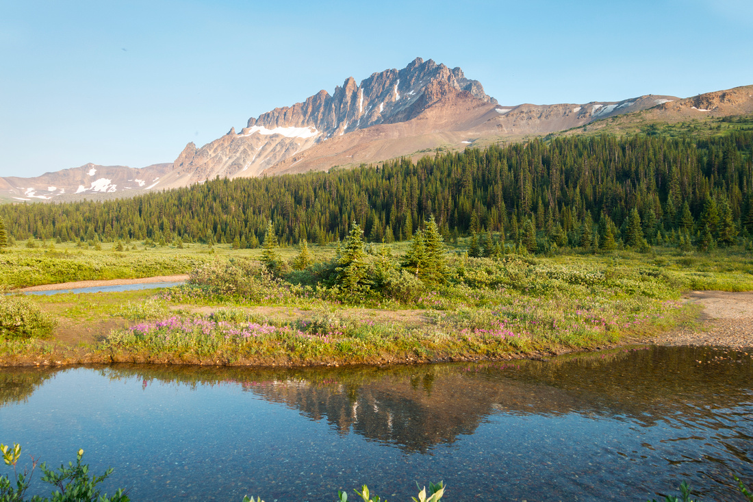 Maccarib Peak
Side view of Maccarib Peak, feasible ascent for competent scrambler. It is possible to shortcut to Astoria trail by hiking up talus upper center right, then following drainage on the other side emerging near Clitheroe campground Maccarib Peak
Side view of Maccarib Peak, feasible ascent for competent scrambler. It is possible to shortcut to Astoria trail by hiking up talus upper center right, then following drainage on the other side emerging near Clitheroe campground |
|||
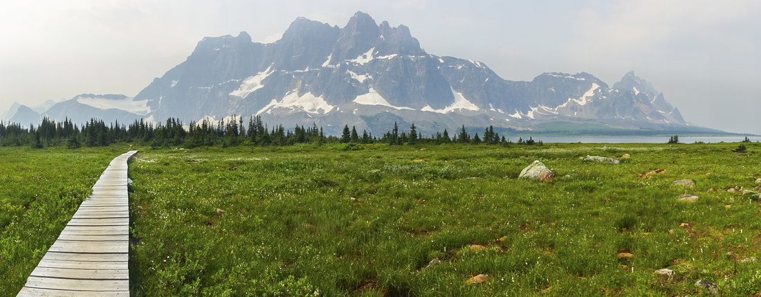
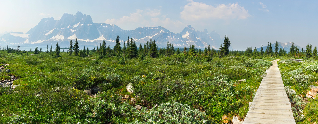 Boardwalk Meadows
Side trail to Tonquin Lodge / Moat Lake crossing expansive alpine meadow on wooden boardwalk Boardwalk Meadows
Side trail to Tonquin Lodge / Moat Lake crossing expansive alpine meadow on wooden boardwalk |
|||
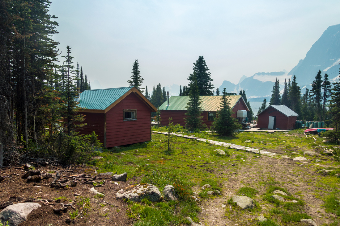 Tonquin Lodge
 (~km from main valley trail). Full board cost $330 CAD/night (summer 2021) - and you still have to hike or horseback ride in on your own Tonquin Lodge
Tonquin Lodge (~km from main valley trail). Full board cost $330 CAD/night (summer 2021) - and you still have to hike or horseback ride in on your own |
|||
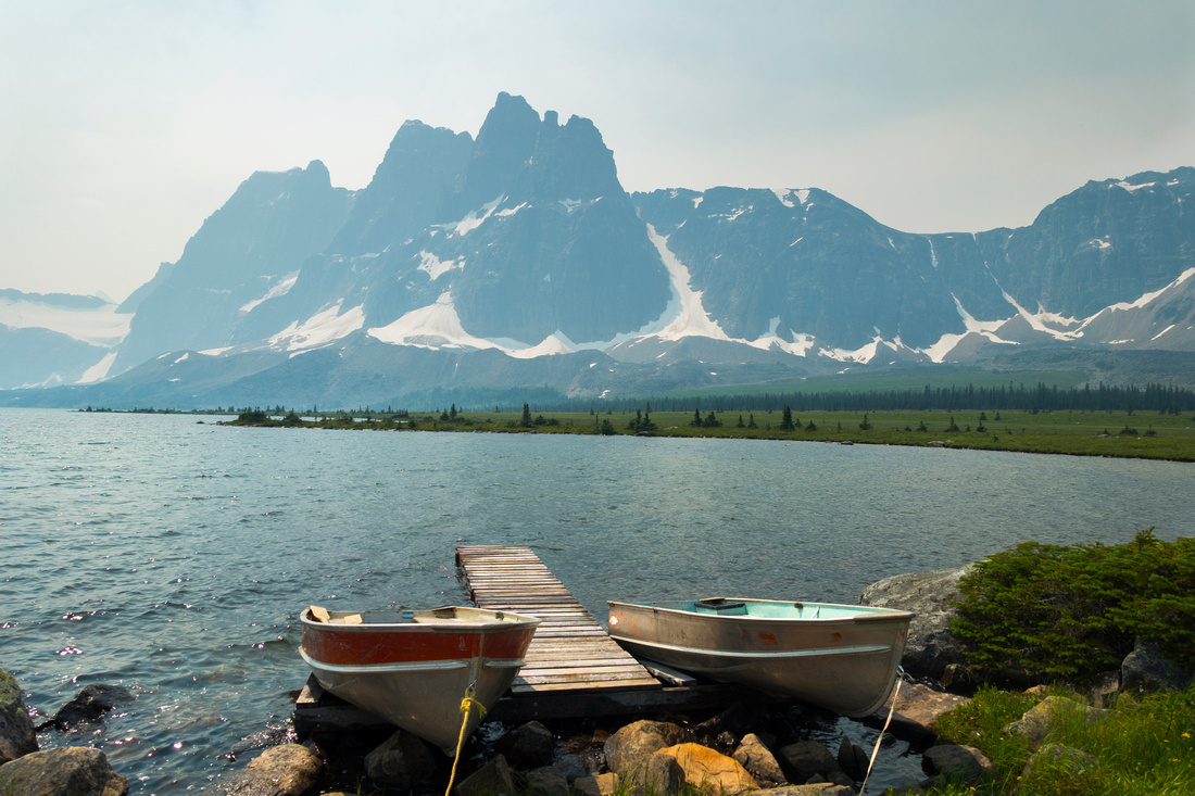 Amethyst Boat Dock
Boat Dock below Tonquin Lodge Amethyst Boat Dock
Boat Dock below Tonquin Lodge |
|||
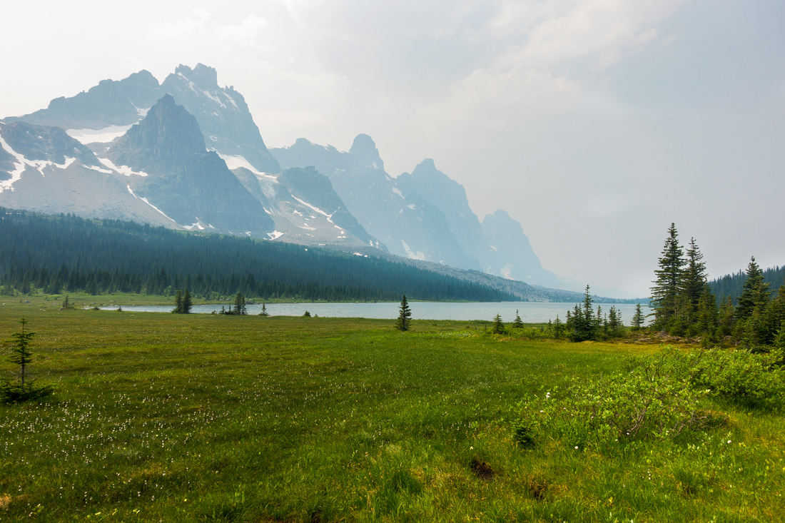 Moat Lake
Alpine Meadow at east side of Moat Lake. Tonquin Pass distance center right can be reached by following faint trail on right side Moat Lake
Alpine Meadow at east side of Moat Lake. Tonquin Pass distance center right can be reached by following faint trail on right side |
|||
 Amethyst Boardwalk
Classic view of Ramparts crossing Alpine Meadow just past Amethyst Campground Amethyst Boardwalk
Classic view of Ramparts crossing Alpine Meadow just past Amethyst Campground |
|||
 Surprise Outlet
Amethyst Lake Outlet on Chrome / Outpost trail. Surprise Point campground is ~500m away on the other side Surprise Outlet
Amethyst Lake Outlet on Chrome / Outpost trail. Surprise Point campground is ~500m away on the other side |
|||
 Chrome Lake
Beautiful Chrome Lake, short side trip from standard Outpost Lake / Eremite Valley trail Chrome Lake
Beautiful Chrome Lake, short side trip from standard Outpost Lake / Eremite Valley trail |
|||
 Astoria Rock Slide
Crossing the Rock slide below switchbacks on Astoria Trail Astoria Rock Slide
Crossing the Rock slide below switchbacks on Astoria Trail |
|||
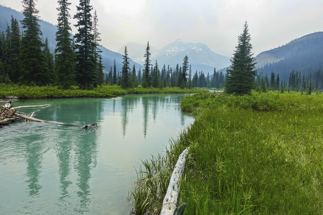 Astoria River
Calm Astoria River at Horse Campground ~8km mark from Cavell Road Astoria River
Calm Astoria River at Horse Campground ~8km mark from Cavell Road |
|||
 Astoria Bridge
Bridge over Astoria River ~5km from Cavell trailhead Astoria Bridge
Bridge over Astoria River ~5km from Cavell trailhead |
|||
Abstract
|
Overall Difficulty |
Straightforward trail hiking with some moderately steep and rocky parts. Rock slide below Old Horn Mountain and some easy rock-hopping over shallow streams below Maccarib Pass |
||||
|
Snow Factor |
Frequently visited in winter on skis; through day-hike likely not feasible due to short days |
||||
|
Scenery |
Iconic view of Ramparts and Amethyst Lakes. Expansive alpine meadows below Maccarib Pass are among the best Rockies have to offer |
||||
|
Trail/Marking |
Excellent |
Official Parks Canada trail with signposts and marked junctions. Bridged creek crossings. Muddy parts in high summer |
|||
|
Suggested Time |
3-4 days |
Through backpack, allowing at least one full day to explore the valley. Dayhike is feasible for super fit and trail runners on occasion run the full loop |
|||
|
Elevation |
Start: 1710m Max: 2340m Total: ~700m |
Round Trip: 16km | |||
|
Gear |
Full hiking boots, poles and gaiters; overnight gear. Mosquito net and bug spray essential in summer |
||||
|
Water |
Plenty of water throughout; no need to carry more than 1L at any time |
||||
|
Dog Friendly |
No |
Parks Canada prohibits dogs in Tonquin area trails as it is primary caribou habitat |
|||
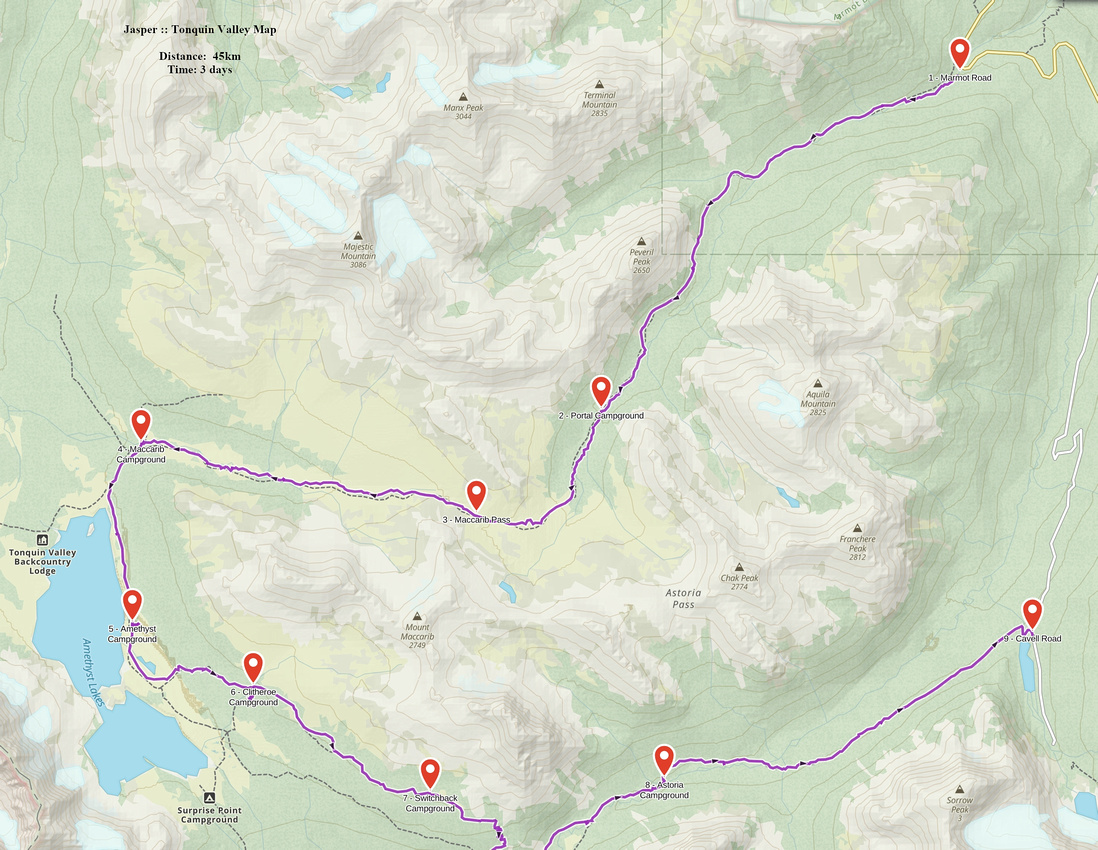 Tonquin Valley GAIA Map
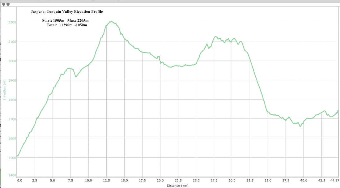 Tonquin Valley Elevation Profile