|
|
Rockies :: Jasper :: Maligne Pass |
|
|
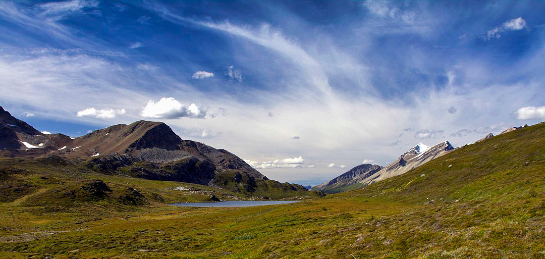
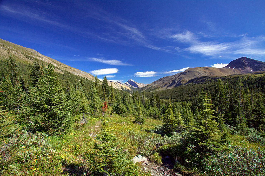
Lovely tarn at apex of Maligne Pass with trademark Alberta chinook skies above |
|||
| Trip Summary | |||
August 2012Trail of historical significance (used by Mary Schaffer and her party when they discovered Maligne Lake) and one of most scenic trips in Jasper National Park. 1-way crossing from Icefields parkway to Maligne Lake is about 46 km and requires backpack, but hiking to Maligne Pass and back in a day is feasible as long-day hike. Like many others, this once official parks trail has been decommissioned and is slowly deteriorating. Going is still easy and route obvious. Reward is one of most amazing alpine areas I have witnessed in the Rockies - pictures in the gallery don't do justice. Many further options are possible from the pass, including scramble of Replica peak and exploring of Endless chain ridge. For that reason backpack is recommended option, even if not doing entire traverse to Maligne Lake. Avalanche campground about 11-12 km from Poboktan trailhead is good base for further exploration, although Parks are now limiting its use. Expect solitude.
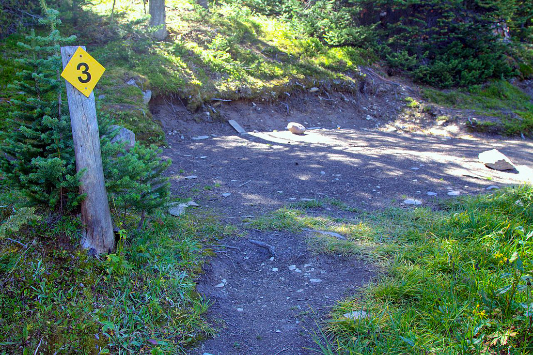
Drive Icefields Parkway 70km south from Jasper townsite to Sunwapta warden station on east side of the road. Parking is south of bridge over Poboktan creek; after you have geared up, walk back across the bridge and find trailhead next to warden building. Initial part is 6km flat hike on north side of Poboktan creek. Occasionally trail descends to creek level and grants some view, otherwise it is rather dull and completely foreshadows glory that is to come. Turn left at signed Jonas Pass junction and hike up Poligne creek valley. Creek must be crossed couple of times, and bridges are not maintained anymore - but rock-hop should not be too difficult. From Avalanche campground at top it is about 4km meandering hike to the apex of the pass where you are guaranteed to hike with camera around your neck. From the pass trail drops on the other side; turn left (west) and ascend grassy bench where several beautiful tarns await. This would be an excellent, although illegal, bivy site. Continuing north for full traverse to Maligne Lake is not as pretty; below the pass trail crosses swampy areas and soon descends below treeline. |
|
Gallery |
|||
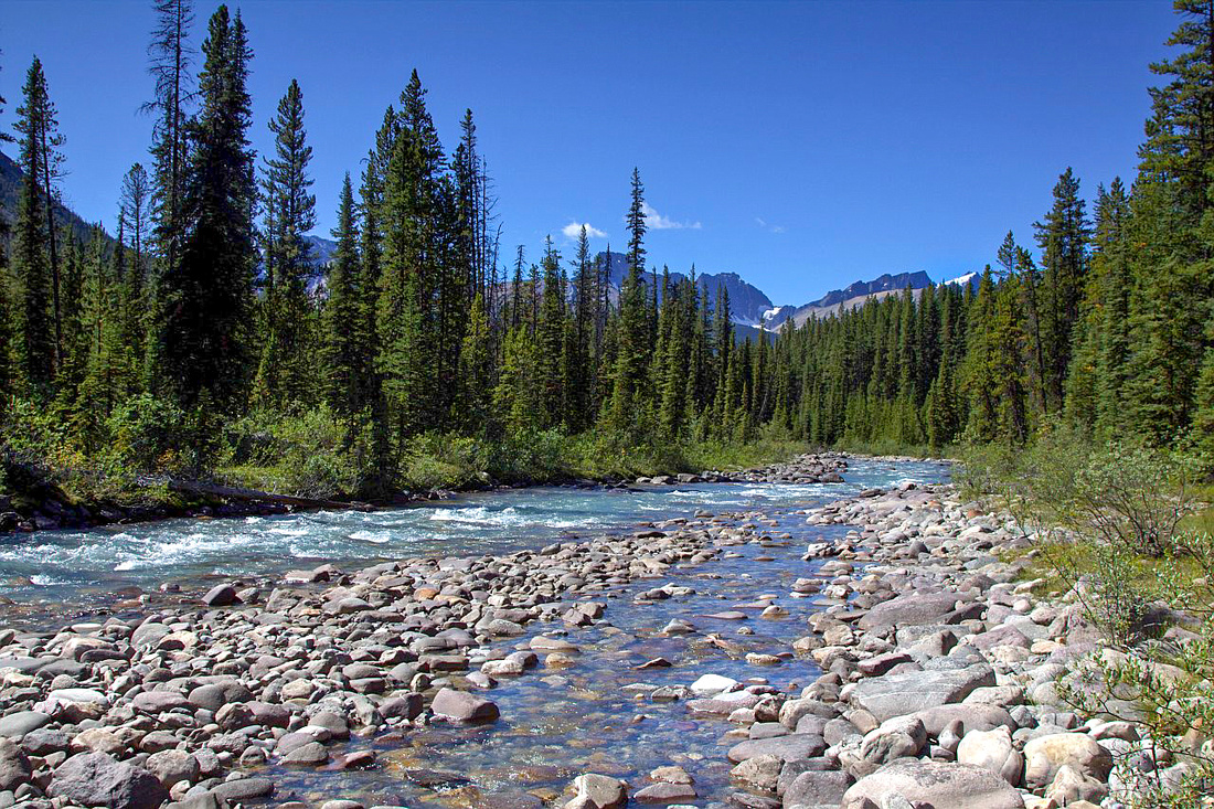 Poboktan Creek Poboktan Creek Views back from Poboktan creek around 5km mark
 |
|||
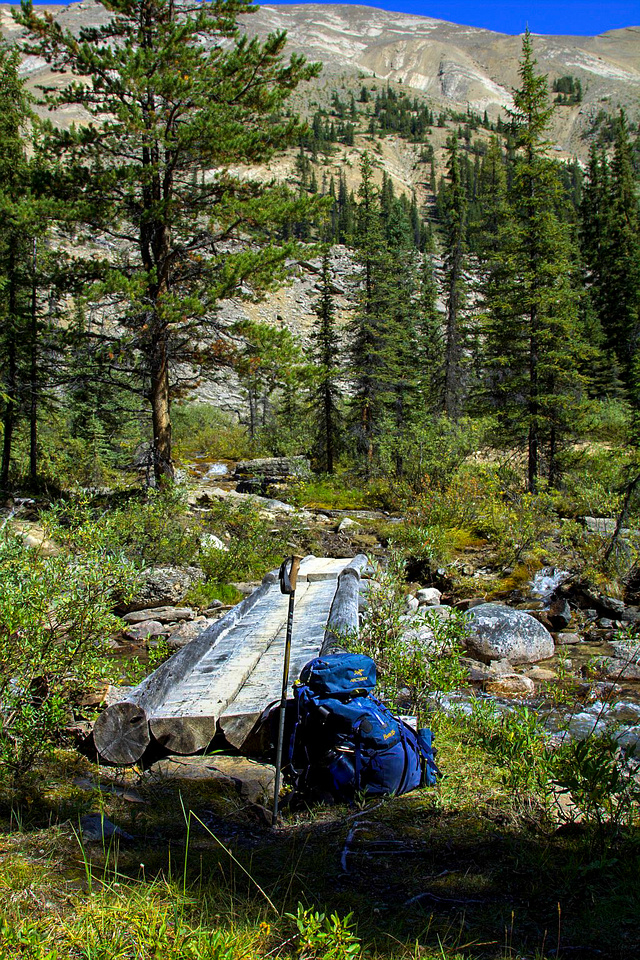 Poligne Creek Crossing
Bridged crossing of Poligne creek Poligne Creek Crossing
Bridged crossing of Poligne creek |
|||
 Avalanche Campground
Tent site at Avalanche campground Avalanche Campground
Tent site at Avalanche campground |
|||
 View back at Treeline
View back towards Poboktan area from meadows at treeline. Poboktan Peak center distance View back at Treeline
View back towards Poboktan area from meadows at treeline. Poboktan Peak center distance |
|||
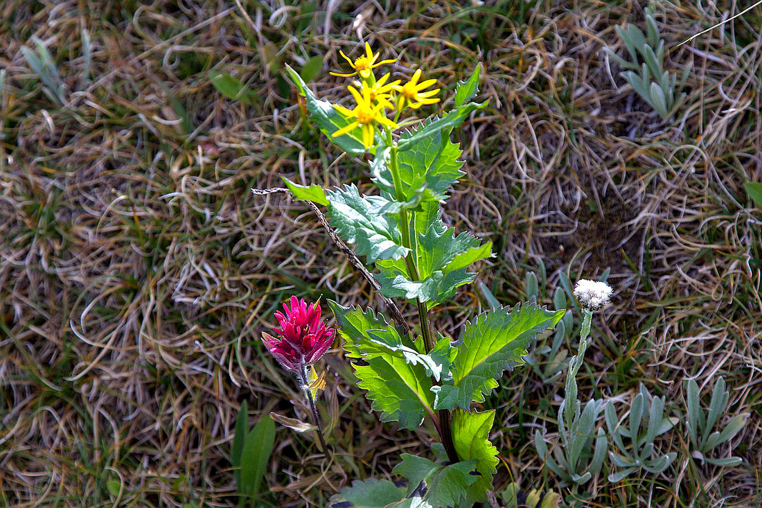 Summer Wildflowers
Wildflowers in meadows; everything is so beautiful and pristine! Summer Wildflowers
Wildflowers in meadows; everything is so beautiful and pristine! |
|||
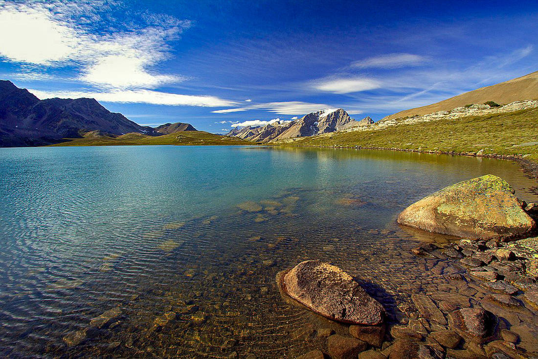 Endless Chain
Largest lake on large bench west of Maligne Pass. Elusive Pass upper center left, Mt. Mary Vaux right. Endless Chain
Largest lake on large bench west of Maligne Pass. Elusive Pass upper center left, Mt. Mary Vaux right. |
|||
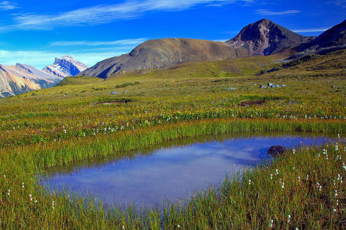 Maligne Meadows
Fantastic hiking from the bench back to Maligne Pass trail. Poboktan Peak upper center left Maligne Meadows
Fantastic hiking from the bench back to Maligne Pass trail. Poboktan Peak upper center left |
|||
 |
Abstract
|
Overall Difficulty |
Long day hike, or easy backpack. Steady but moderate ascent of Poligne valley. Expect collapsed bridges for creek crossings. |
||||
|
Snow Factor |
Wide valleys with no significant avalanche danger. Not practical as snowshoe trip, but sometimes done on skis. |
||||
|
Scenery |
Amazing alpine, one of best I've experienced. Meadows, tarns and snowcaped peaks |
||||
|
Trail/Marking |
Good |
Trail not maintained by Parks Canada is slowly deteriorating. Marked junctions. Way is obvious in the meadows |
|||
|
Suggested Time |
10-12 hr |
Day hike return time from Icefields Parkway. 3-4hrs to Avalanche Campground if backpacking |
|||
|
Elevation |
Start: 1540m Max: 2380m Total: ~900m |
Round Trip: 30km | |||
|
Gear |
Hiking boots and poles; snowshoes in winter. |
||||
|
Water |
Poboktan and Poligne creeks, several tarns in upper bench west of Maligne Pass. Carry 1-2 L |
||||
|
Dog Friendly |
Yes |
No on-leash restrictions. Standard griz-country travel precautions |
|||