Google Map |
Rockies :: Jasper :: Bald Hills |
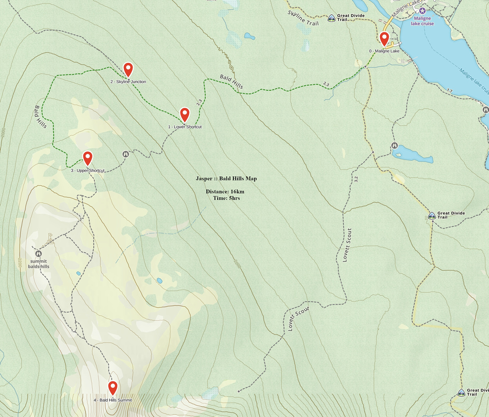
GPS Track(waypoints only) |
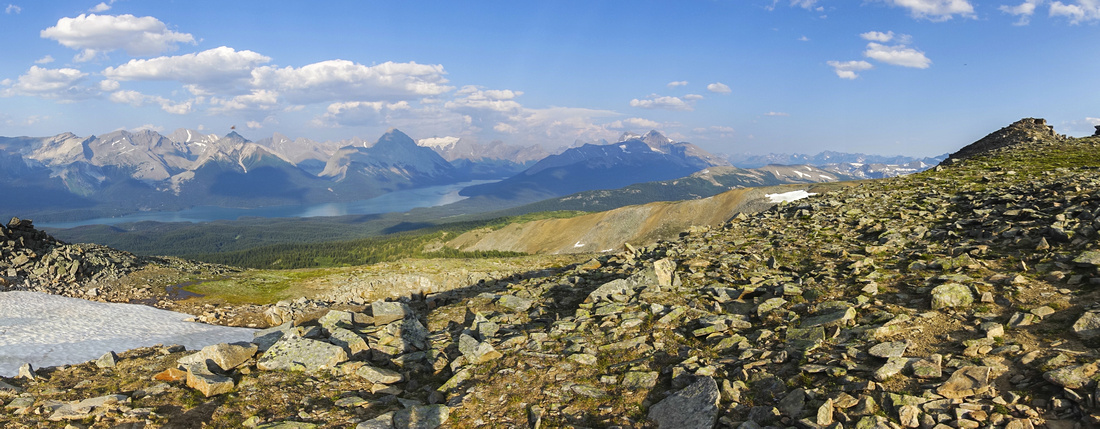 
Panoramic view across Maligne Lake basin from ridge leading to Bald Hills highpoint |
|||
| Trip Summary | |||
July 12, 2021
Bald Hills is fantastic viewpoint of Maligne Lake and best day-hike in the area. Old forest road effortlessly brings you to expansive alpine where many hours can be spent wondering aimlessly and enjoying the scenery. For shorter few hours outing one can visit first bump only, but it is far better if time allows to continue at least on main trail to "Bald Highpoint". Afternoon lighting is preferred as sun will cast 45 degree angle over Maligne Basin. On my visit in summer of '21 haze from BC Wildfires has already obscured the area resulting in mediocre photography. On a crisp autumn day Bald Hills are easily landscape photographer paradise.
Trailhead is at end of Maligne Lake road, ~1km past main tourist parking lot above boat launch dock. Fabled Skyline trail splits to the right, while Bald Hills trail starts up old forest road past official Parks Trail Kiosk. (Note that dogs are NOT allowed, due to sensitive caribou habitat). This road rises first gently then a bit more steeply through semi-open forest. Roughly 40min in there is signed junction -- shortcut splits to the left, while road contours to the right. On my trip I ascended via the road and used shortcut for descent, but although on trail entirely this shortcut is very rooty and rocky - it is better to stay on road. Continuing past Skyline junction road contours to the left with first bump on the sight, then switchbacks to horse corral at the end; trail continues and shortly reaches the upper shortcut junction. You can now continue on main trail contouring below first bump across delightful alpine meadows reaching the highpoint in another 45min or so, or take the highline route across all bumps - your choice. Good trail exists for both alternatives. Highpoint has large cairn (but no register) and offers fabulous views of Maligne basin and what seems like never ending lake. With full day on disposal it is possible to wonder for many more hours across rolling alpine terrain and easy ridges. When you are done exploring, return the same way -- although it might be possible to trash down wooded slopes and intercept Maligne Pass trail, then hike back that way. |
|
Gallery |
|||
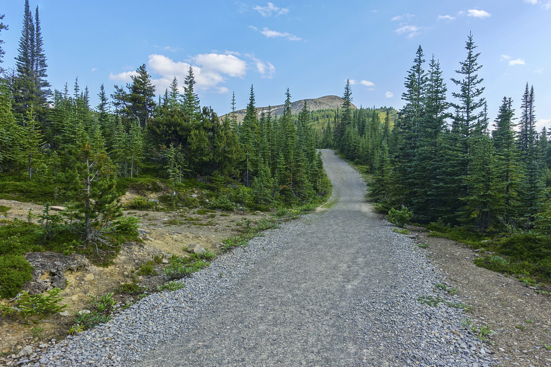 Bald Treeline
Forest Road passing through subalpine area with first Bald Hills bump on horizon Bald Treeline
Forest Road passing through subalpine area with first Bald Hills bump on horizon |
|||
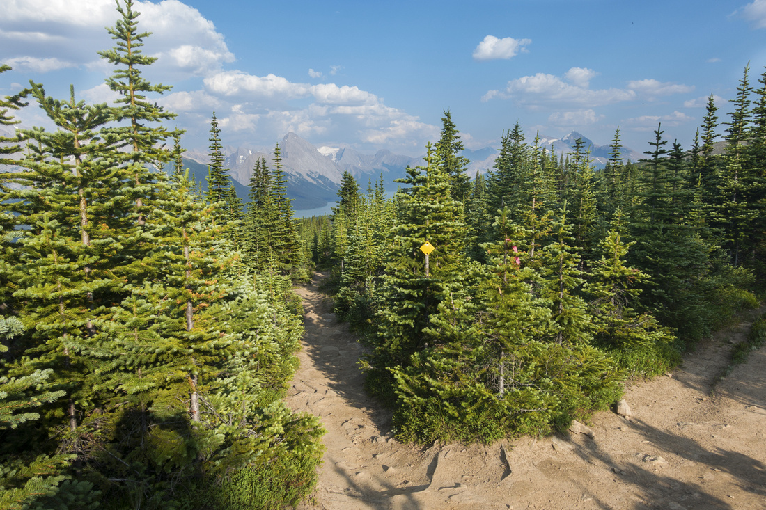 Shortcut Junction
Marked junction for alternate shortcut - note yellow square. Although entirely on trail, large sections are rocky and rooty - road, despite being longer, is much better option Shortcut Junction
Marked junction for alternate shortcut - note yellow square. Although entirely on trail, large sections are rocky and rooty - road, despite being longer, is much better option |
|||
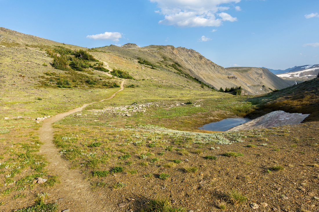
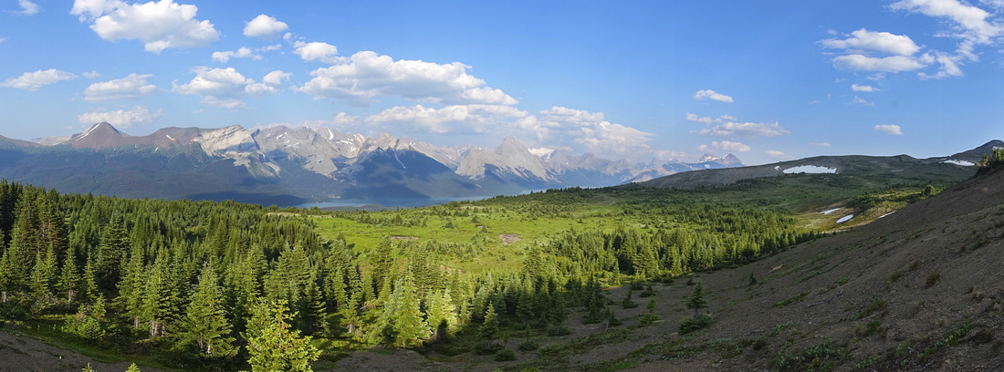 Alpine Meadowland
Vast alpine meadow with view of Maligne Basin on horizon as main trail contours below first Bald Hills bump Alpine Meadowland
Vast alpine meadow with view of Maligne Basin on horizon as main trail contours below first Bald Hills bump |
|||
 Beautiful Trail
Trail meandering across broad saddle leading to gentle ridge rising to Bald Hills highpoint, just left of upper center Beautiful Trail
Trail meandering across broad saddle leading to gentle ridge rising to Bald Hills highpoint, just left of upper center |
|||
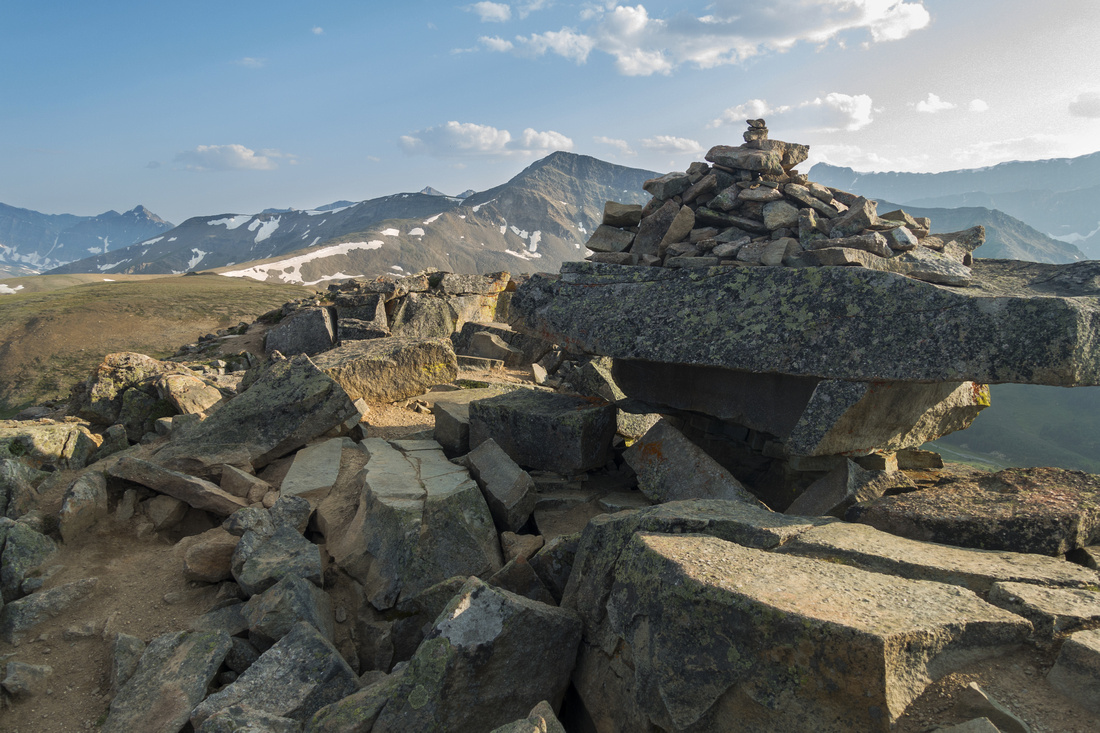 Summit Cairn
Large Rock Cairn at Bald Hills Highpoint. It is possible to drop on the other side and explore vast ridge system on horizon Summit Cairn
Large Rock Cairn at Bald Hills Highpoint. It is possible to drop on the other side and explore vast ridge system on horizon |
|||
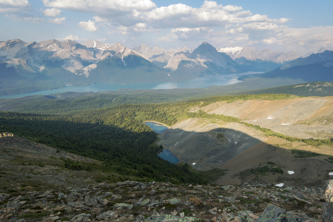 Maligne Tarns
Pair of delightful alpine tarns below Bald Hills Higpoint; length of Maligne Lake below Maligne Tarns
Pair of delightful alpine tarns below Bald Hills Higpoint; length of Maligne Lake below |
|||
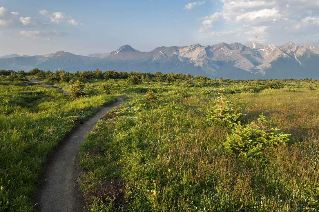 Alpine Meadows
Hiking back across great alpine meadows with view of Opal Cone on the other side Alpine Meadows
Hiking back across great alpine meadows with view of Opal Cone on the other side |
Abstract
|
Overall Difficulty |
Straightforward hike up old forest road and across rolling alpine meadows with some moderately steep parts |
||||
|
Snow Factor |
Very low avalanche danger. Frequently ascended on skis or snowshoes in winter. |
||||
|
Scenery |
Fantastic view of Maligne Basin and Peaks on east side of the lake. Exquisite alpine meadows dotted with wildflowers in summer |
||||
|
Trail/Marking |
Excellent |
Official Parks Canada trail with signposts and marked junctions. Old forest road to alpine |
|||
|
Suggested Time |
5 hrs |
Return time for main Highpoint, less if going just to first bump. Add several hrs if exploring further |
|||
|
Elevation |
Start: 1710m Max: 2340m Total: ~700m |
Round Trip: 16km | |||
|
Gear |
Day hikers sufficient in dry conditions, snowshoes/skis in winter |
||||
|
Water |
Creek following road for ~15min past the trailhead, but no reliable source of water after. Carry 1L minimum |
||||
|
Dog Friendly |
No |
Parks Canada prohibits dogs on Maligne Lake area trails as it is primary caribou habitat |
|||
 Bald Hills GAIA Map