Google Map |
Rockies :: Icefields :: Crowfoot Tarn |
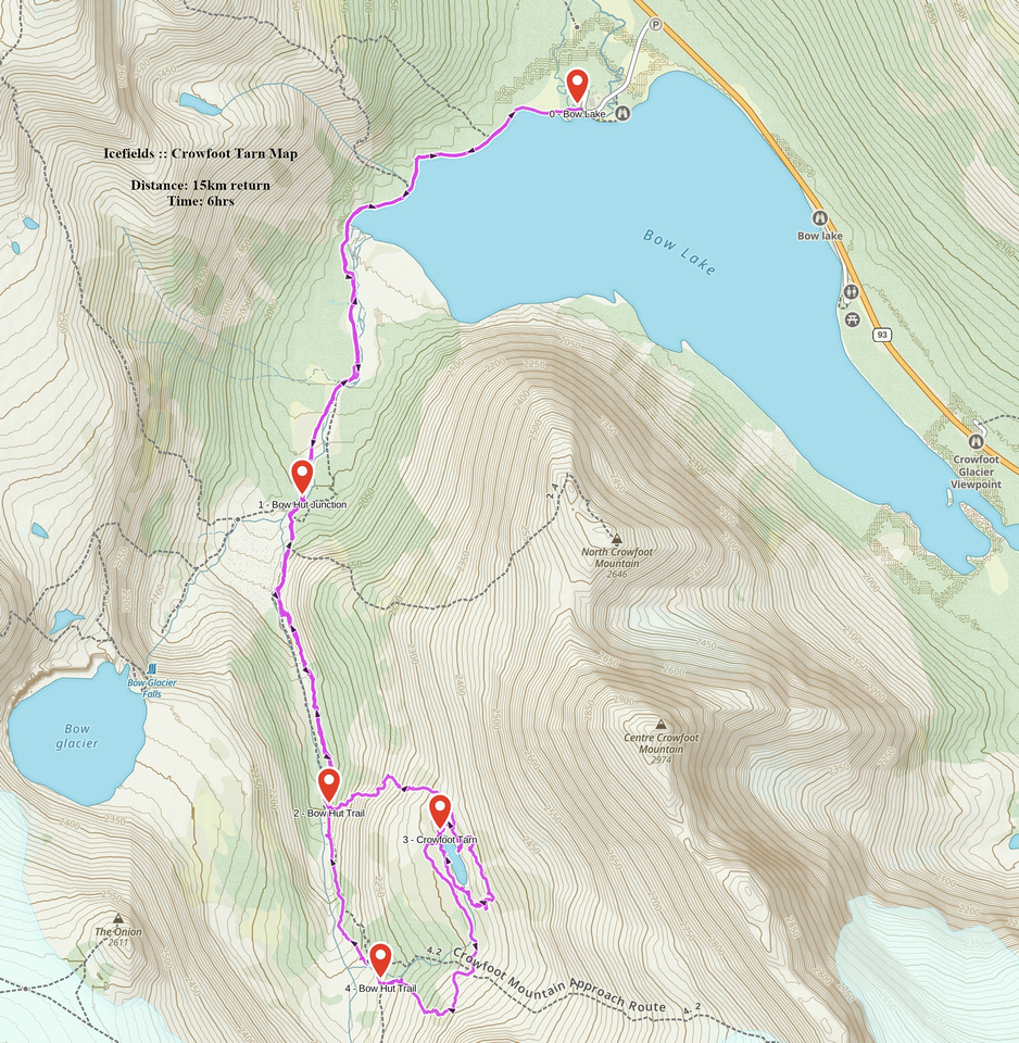
GPS Track |
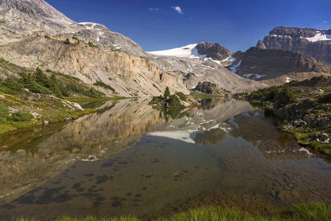 
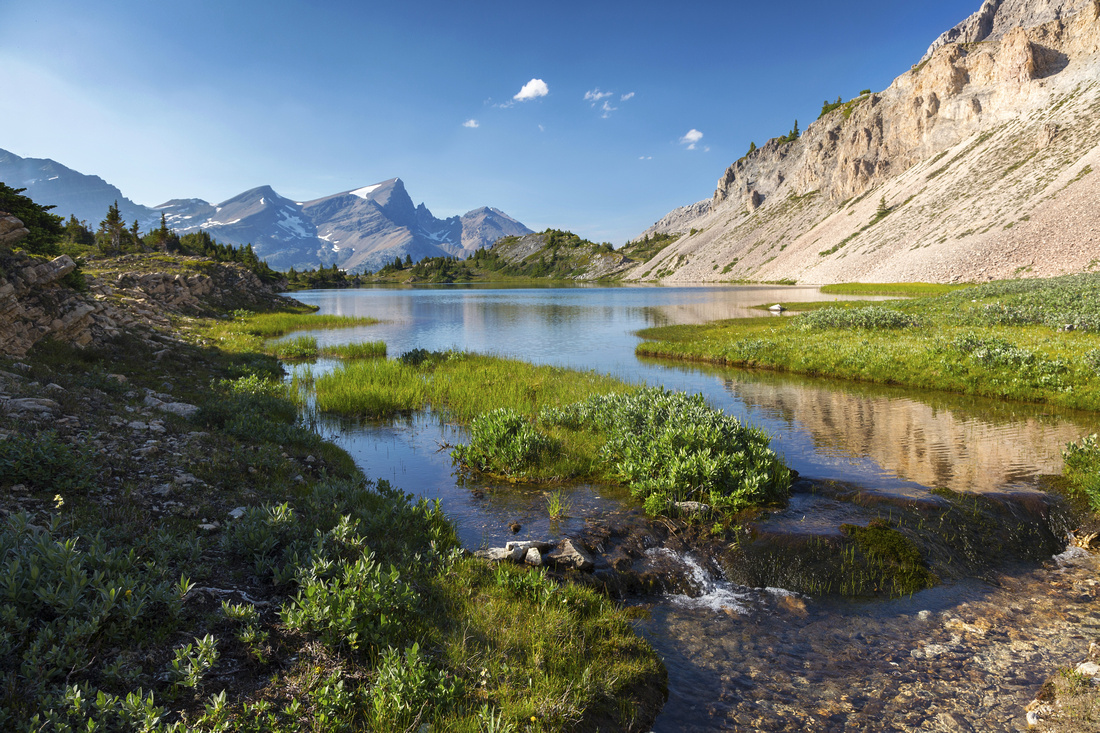
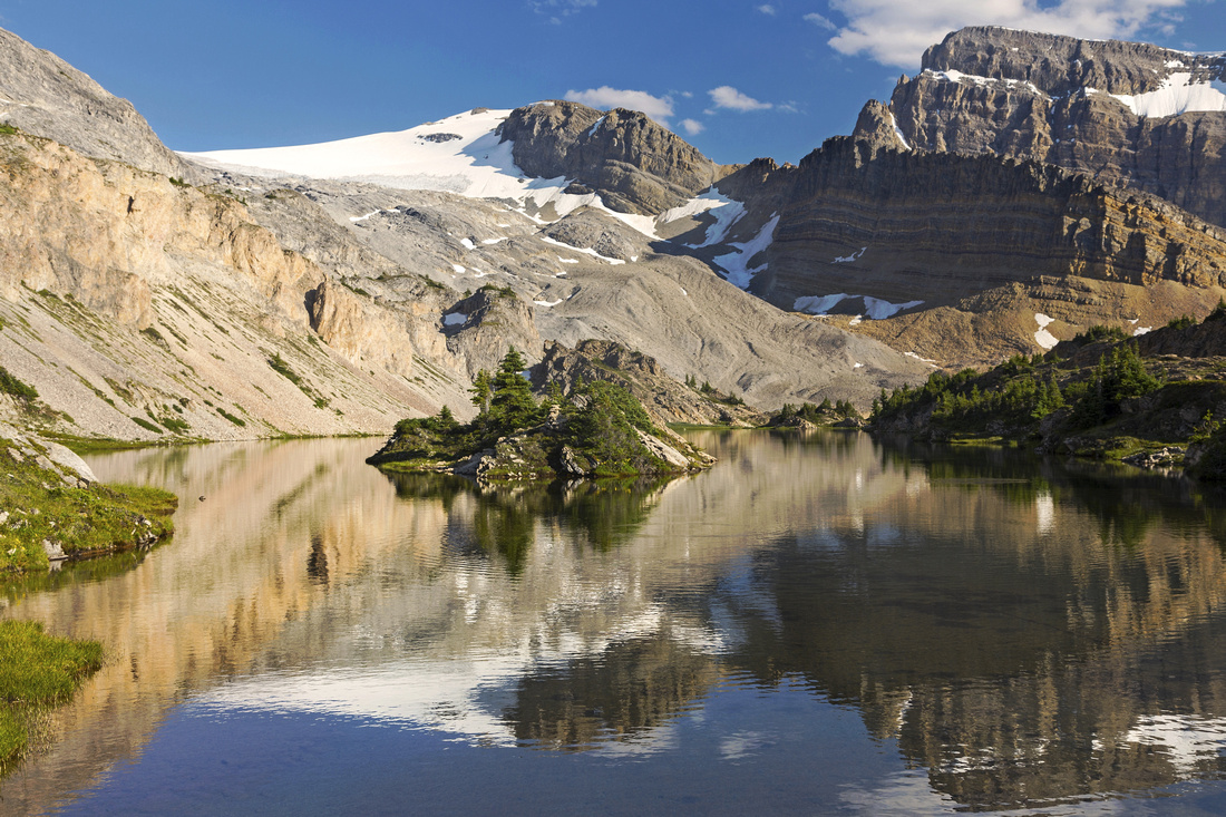
North end of "Crowfoot Tarn" looking towards glacial moraine below Crowfoot glacier |
|||
| Trip Summary | |||
July 26, 2017"Crowfoot Tarn" is unofficial name for glacial body of water west of Crowfoot Glacier. It is also known as "Mary Lake" or "Hotdog Lake" (due to its shape). Hidden from view, It stays mostly off-radar due to better known objectives. It can be seen from summit of mount Jimmy Simpson and presents fantastic day-hike objective. Scenery is nothing short of spectacular. Approach utilizes well-travelled ACC Bow Hut trail in grand Rockies environment. Couple of cairns on open slopes below the lake testify area sees the traffic. Loop return via glacial basin on north side draining Crowfoot Glaier is highly recommended.
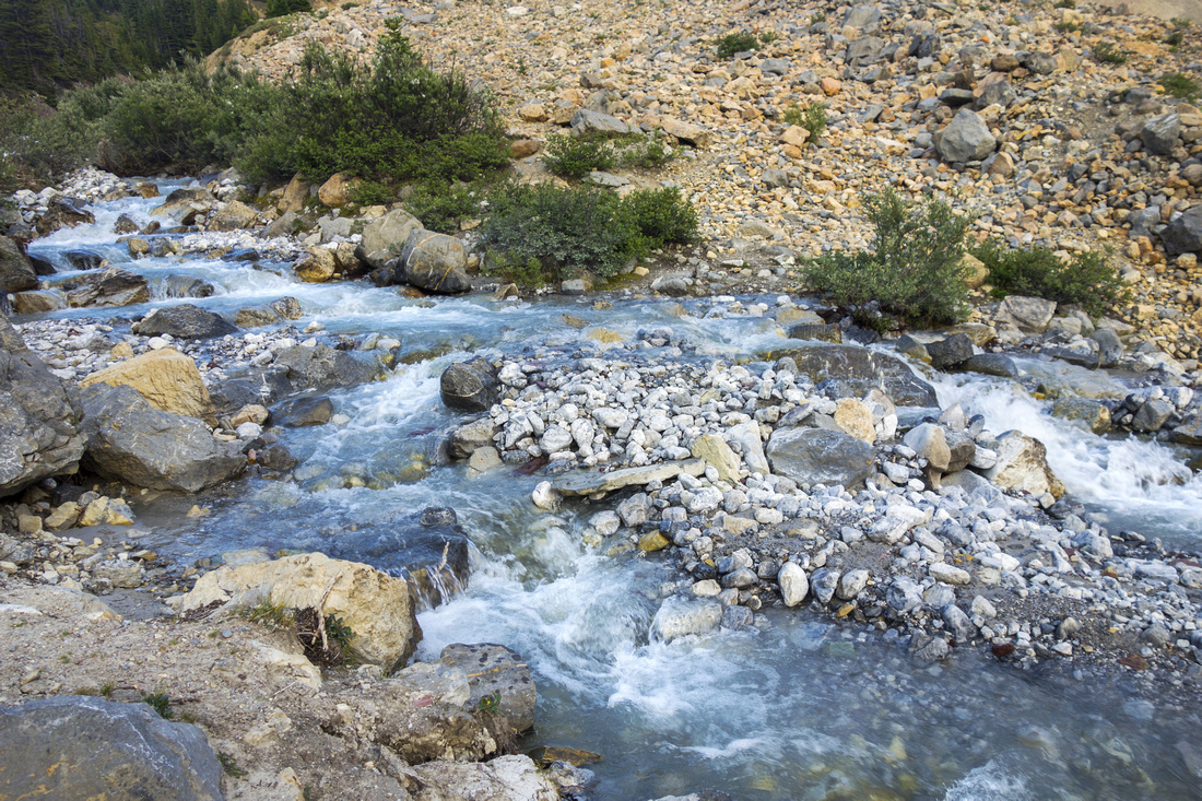
Trailhead is at Num-Ti-Jah lodge on Bow Lake, some 30 mins north from Lake Louise on Icefields Parkway. Follow tourist infested trail around the lake and continue towards Bow Falls. Some 40-45 mins from the parking trail ascends the canyon and reaches signed junction. Turn left and cross the canyon on wedged boulder -- technical crux of the day. This chockstone is wide and stable, but slip and fall would plunge you to your death so take care specially if there is bit of snow laying on rock. Initial step to gain the chockstone might feel a bit awkward for someone with short legs (low class 3). Past this obstacle follow well defined trail around the bend; Iceberg Lake access branches from here. In winter Bow Hut trail follows the canyon; summer trail stays above on east side and crosses couple of rock slides along the way. Some 30-40 minutes past the chockstone watch for open talus slopes on your left; this will be immediately after the trail crosses the creek (good water) and emerges out of forest -- see the photo in gallery. Leave the trail and head left and up. Couple of cairns provide assurance. Scree is stable and way is obvious. In winter under right conditions this slope has some avalanche potential. Midway up little meadow complete with man-made rock chairs are an excellent spot for the breather. Continue up and scramble bit of crumbling rock band then follow more cairns up the grass to north end of "Crowfoot Tarn".
The lake is extremely beautiful. Photographers will utilize mid to late afternoon sun for best lighting. Loop around the lake including little rock ridge on east side is suggested. Return the same way, or better from south end of the lake drop into glacial basin then after couple of easy rock-hops across the streams cross the boulder field aiming for grassy patch. Do NOT follow the drainage as it ends in deep canyon. From the grassy / treed patch then simply descend on good talus and intercept Bow Hut trail. Turn right and after re-crossing the drainage follow back to the parking.
Many possibilities for further exploration exist, including mountaineering ascent of Crowfoot Mountain and exploratory hike up the glacial basin below Balfour Hut / Vulture Glacier. |
|
Gallery |
|||
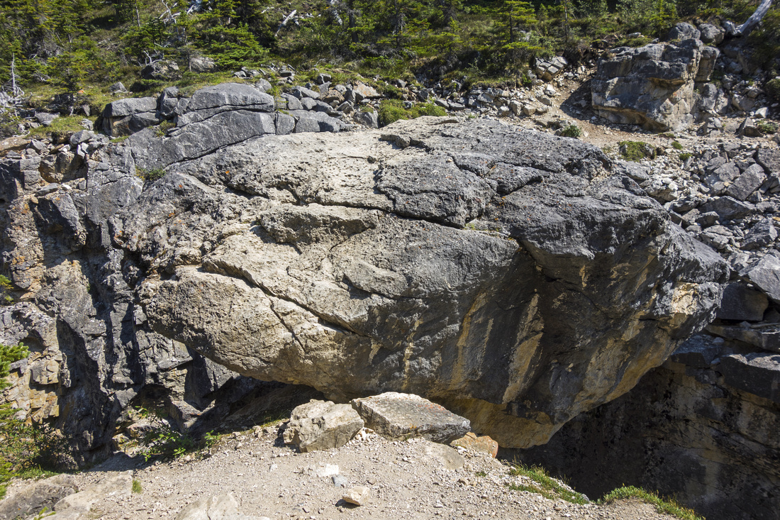 Wedged boulder on ACC Bow Hut junction
 |
|||
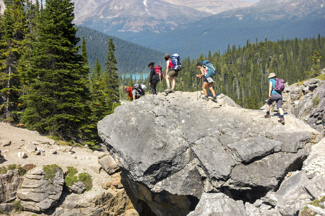 Looking back at Group of Hikers crossing the Boulder
 |
|||
 Summer trail crossing large rock slide above the canyon
 |
|||
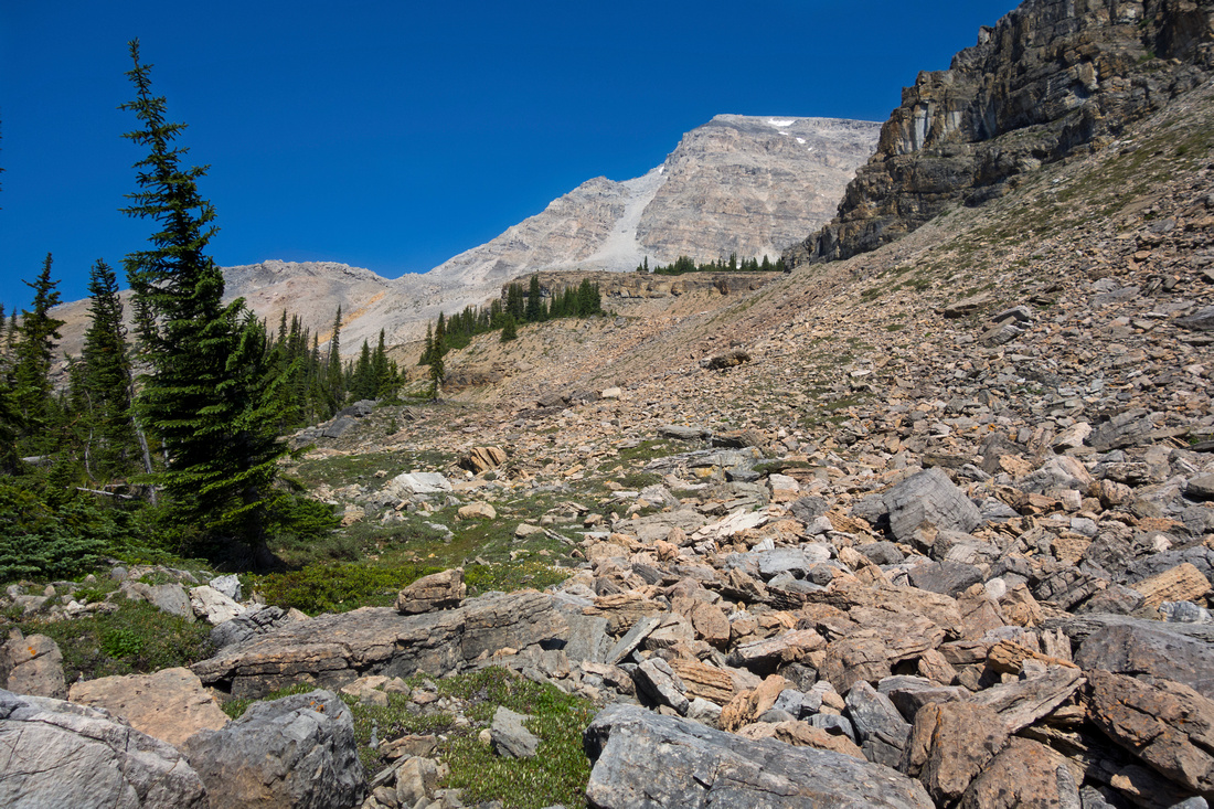 Leaving Bow Hut trail and heading up Talus
 |
|||
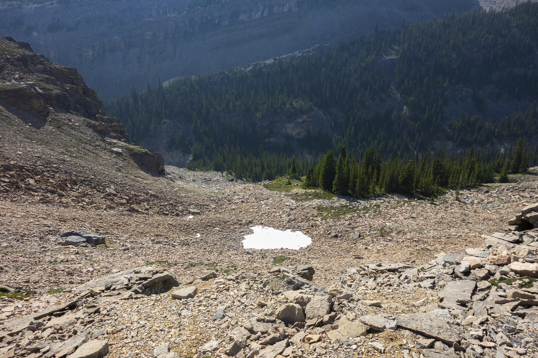 Looking down Talus slope above crumbling rock band
 |
|||
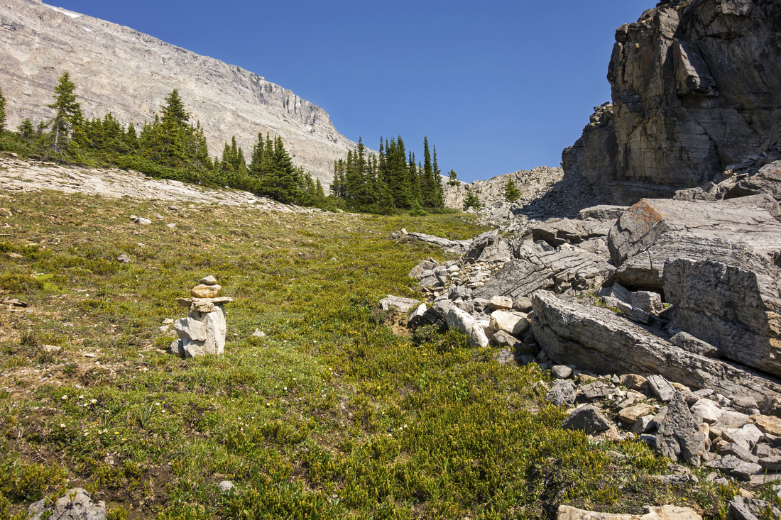 Following cairns on final grassy slope below the lake
 |
|||
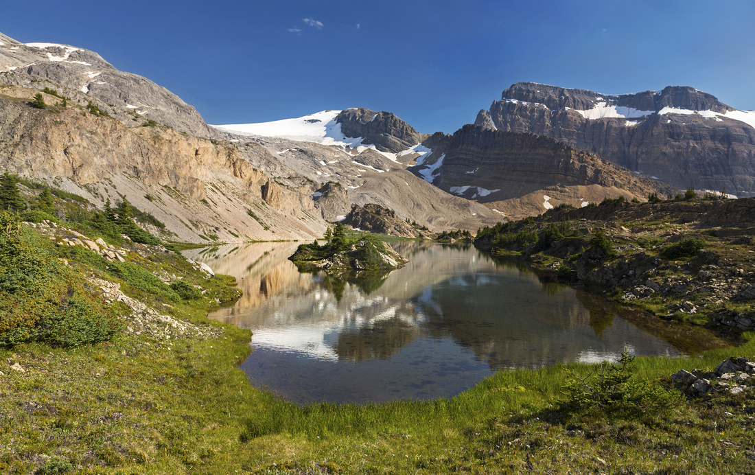 "Crowfoot Tarn" looking south to glacial moraine and Crowfoot glacier
 |
|||
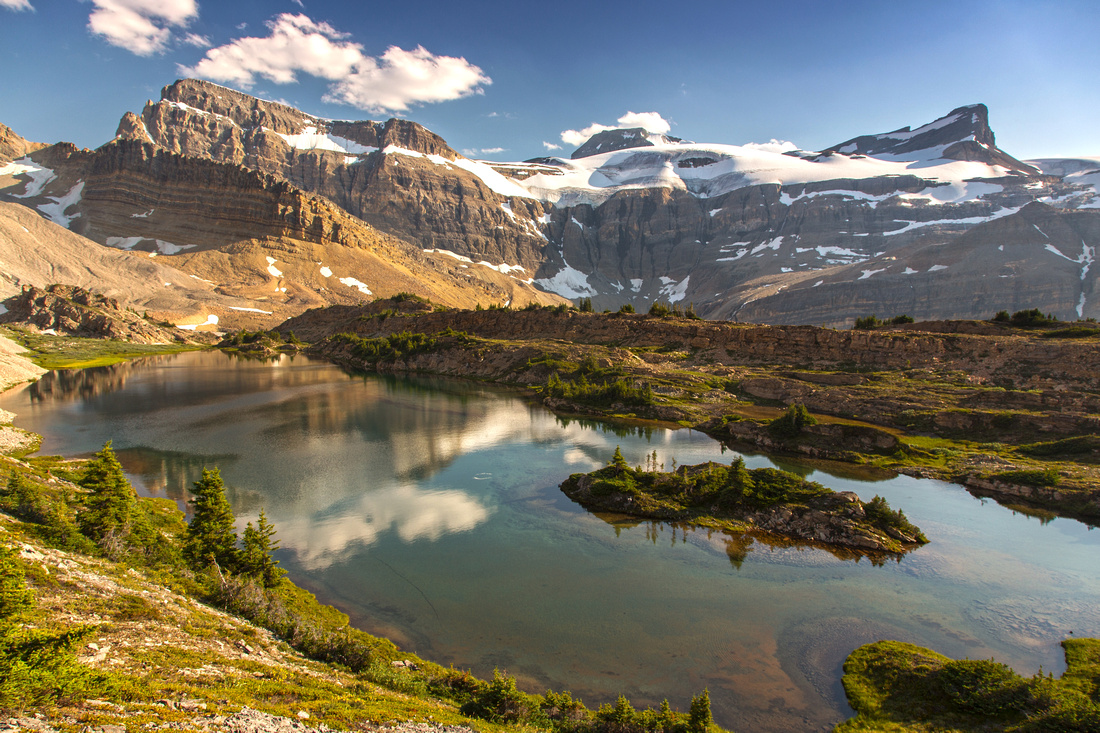
 View from south end of the lake; Jimmy Simpson center
 |
|||
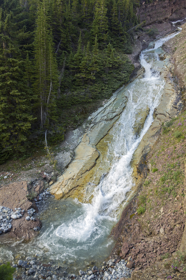
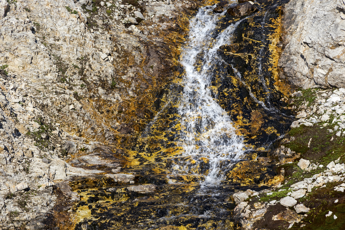 Lovely little waterfall draining into the lake on south end
 |
|||
 View north from start of little ridge above the waterfall
 |
|||
 Traversing the ridge above east side of "Crowfoot Tarn"
 |
|||
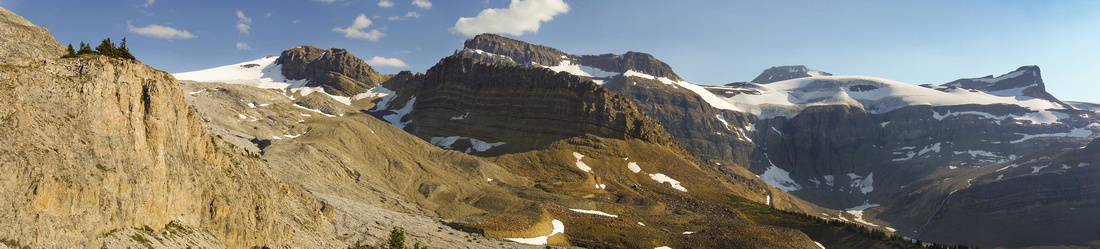 Panoramic view from ridge north end; St. Nick upper right
 |
|||
 Another view from ridge north end; Little Crowfoot left
 |
|||
 Beautiful views from north end of the lake, despite the haze
 |
|||
 Very peaceful and tranquil; overnight bivi would be fantastic
 |
|||
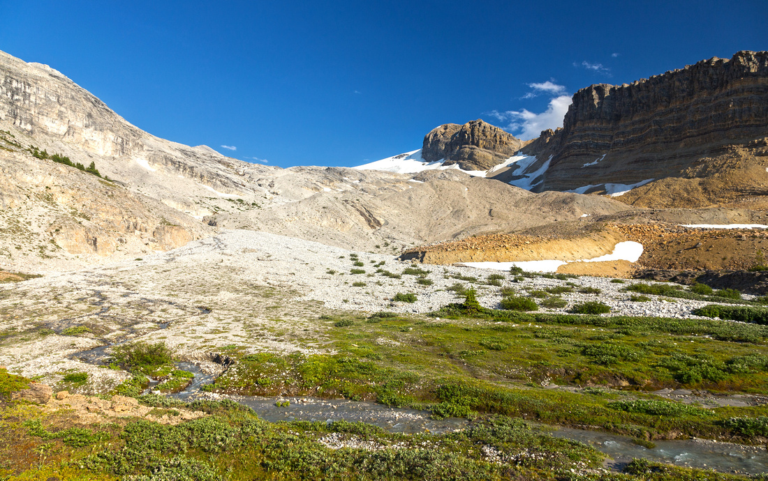
 Descending into glacial basin for loop return
 |
|||
 Traversing the basin with couple of easy rock hops over glacial streams
 |
|||
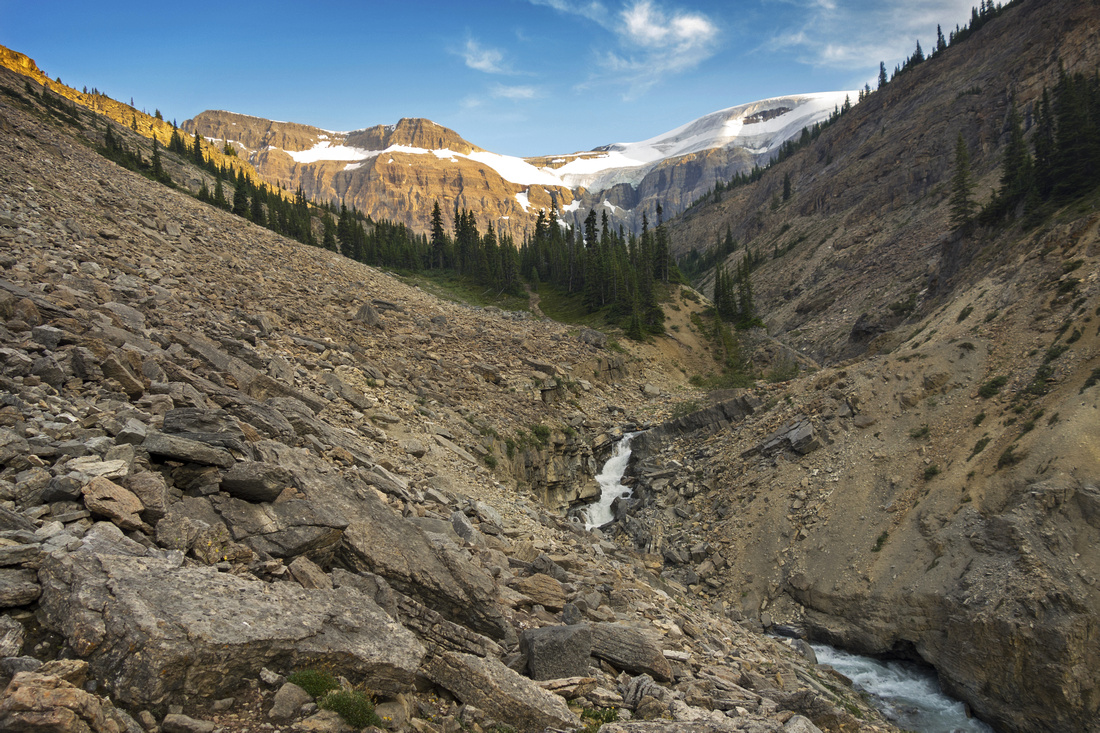
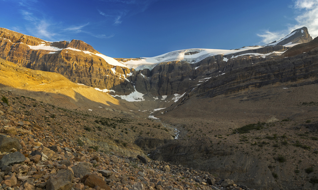
 Canyon draining the basin near Bow Hut Trail
 |
|||
 View of Wapta and St.Nick from moraine near Bow Hut Trail
 |
|||
 Crossing the drainage on return already on Bow Hut Trail
 |
Abstract
|
Overall Difficulty |
Off trail hiking with route-finding. Non-bridged glacial stream crossings. One brief class 3 step crossing the chockstone |
||||
|
Snow Factor |
Bow Hut trail well traveled in winter (ski). Moderate angled slope to the lake; stable snow conditions necessary. Recommended snowshoe trip |
||||
|
Scenery |
Spectacular hike around Bow Lake. Magnificent waterfall draining Iceberg Lake. Picturesque canyon draining Wapta Icefield. Beautiful glacial lake below Crowfoot Mountain. Several well known peaks including Jimmy Simpson, Olive/St. Nicholas, Portal Peak and Mount Thompson |
||||
|
Trail/Marking |
Very Good / None |
Marked and well-traveled trail to ACC Bow Hut followed by off-trail ascent to the lake. Occasional cairns and some route-finding but way is obvious |
|||
|
Suggested Time |
6 hr |
Loop return; less if coming down the same way |
|||
|
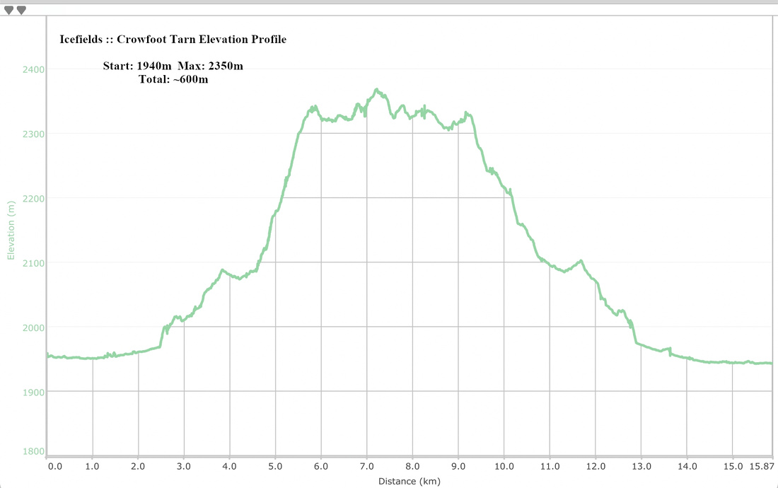
Elevation |
Start: 1940 m Max: 2350m Total: ~600m |
Round Trip: 15km (loop) | |||
|
Gear |
Full hiking boots preferred. Poles suggested. Old sandals could be helpful for creek crossing on return (loop), but not essential |
||||
|
Water |
Several glacial creeks. "Crowfoot Tarn" lake outlet. Carry no more than 1L |
||||
|
Dog Friendly |
Yes |
Standard back-country travel precautions |
|||
 Crowfoot Tarn GAIA Map
 Crowfoot Tarn Elevation Profile