Google Map |
Rockies :: Icefields :: Chephren and Cirque Lakes |
GPS Track |
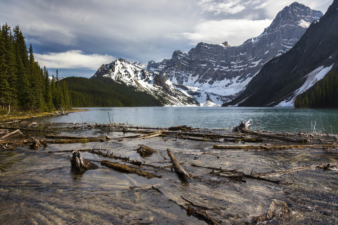 
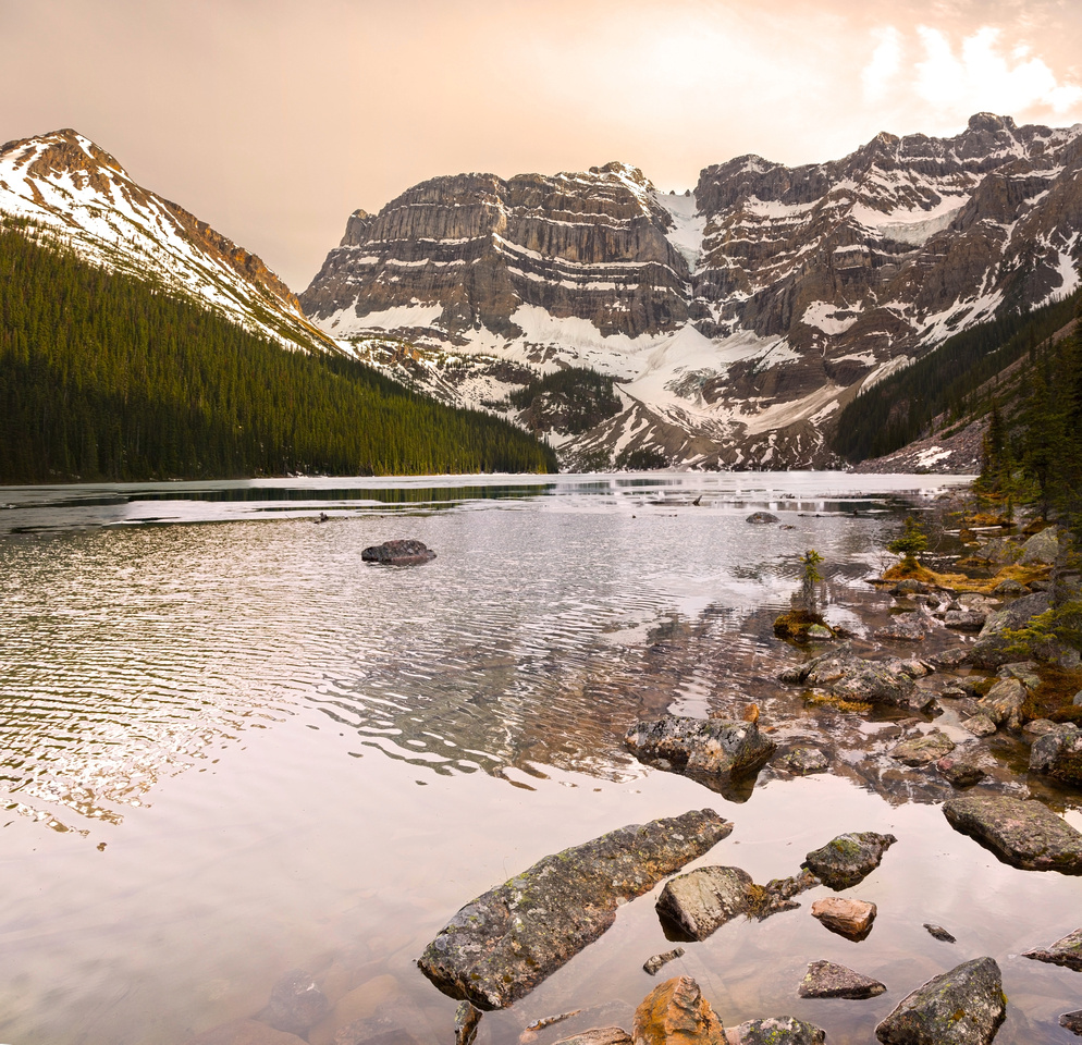
Classic View of Chephren Lake at end of official hiking trail |
|||
| Trip Summary | |||
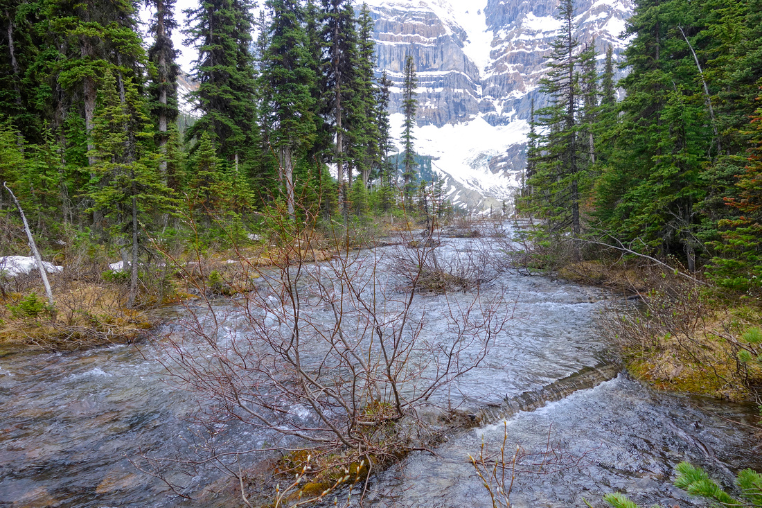
June 2, 2019Fairly undemanding hike on official Parks Canada trail starting below Waterfowl Lakes campground 25 km south of Saskatchwan River Crossing. Chephren Lake would be good family outing as trail is easy and mostly flat. Visit to both lakes is recommended. If doing so, suggested direction is Chephren first, Cirque second. Beautiful scenery with two classic Rockies back-country alpine lakes is superb reward for minimal effort. Drive on Icefields Parkway some 40 min north of Lake Louise and turn left into signed Waterfowl Lakes campground. Do not go to campground which might be closed; instead drive left for about 100m and park at road end. Follow trail descending to Mistaya River to info kiosk just before the bridge - this is the trailhead. Follow trail on the other side for about 15-20 minutes to signed junction (see gallery photo). Chephren Lake is reached in another 30 minutes of level trail with some muddy sections early in season. Return back to junction, then continue on Cirque Lake trail. It descends slightly for 10-15 mins, crosses some boggy meadows on boardwalks then starts ascent through beautiful forest on right side of creek draining Cirque Lake. There are some steep sections here. Final part just before Cirque Lake is rough and often still snowbound till June. Upon reaching the lake cross some boulders where official trail ends. Possible extensions that are much more challenging include hike on east end of Chephren Lake; it takes about an hour, and last bit crossing the slide is quite demanding. Terminal moraine is often used as bivi for Scramble access to Chephren Peak (difficult and beyond scope of this site). Examining Google Maps suggest that it might also be possible to link two lakes by scrambling over the dividing ridge at west end. I have not done this, but I'd probably try from Cirque side. Views on top of this dividing ridge are likely fantastic, specially early in the day. |
|
Gallery |
|||
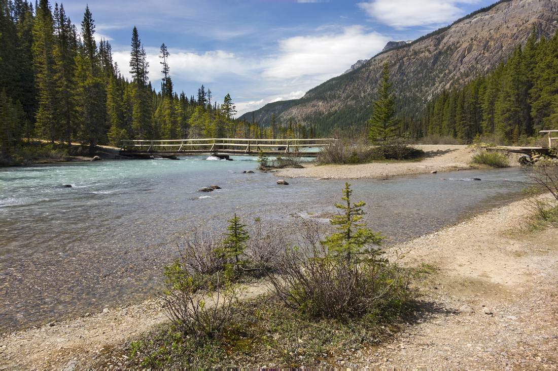 Mistaya River Bridge below Waterfowl Lakes campground
 |
|||
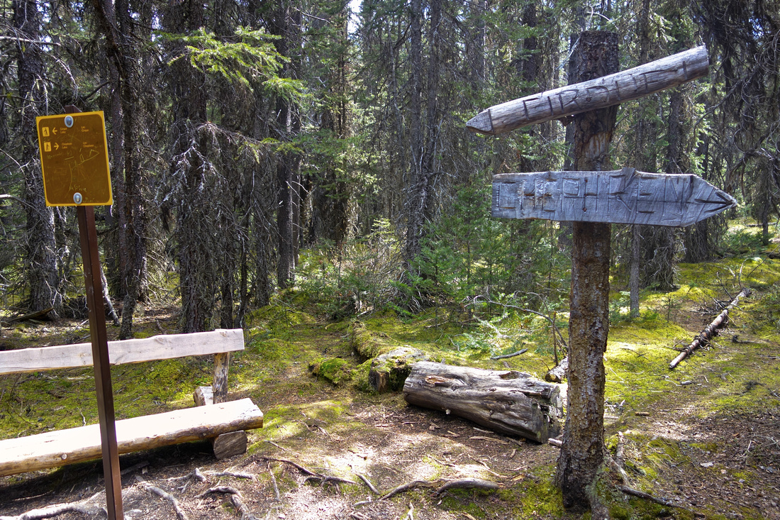 Signed Chephren / Cirque junction 15-20 minutes from trailhead
 |
|||
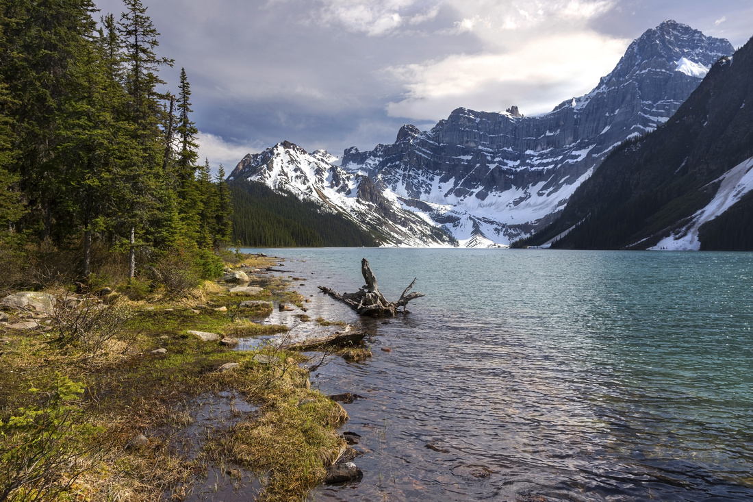 Chephren Lake north end; rough path continues on the left side and is used primarily as scramble approach for Chephren Peak. Howse Mountain towering upper right
 |
|||
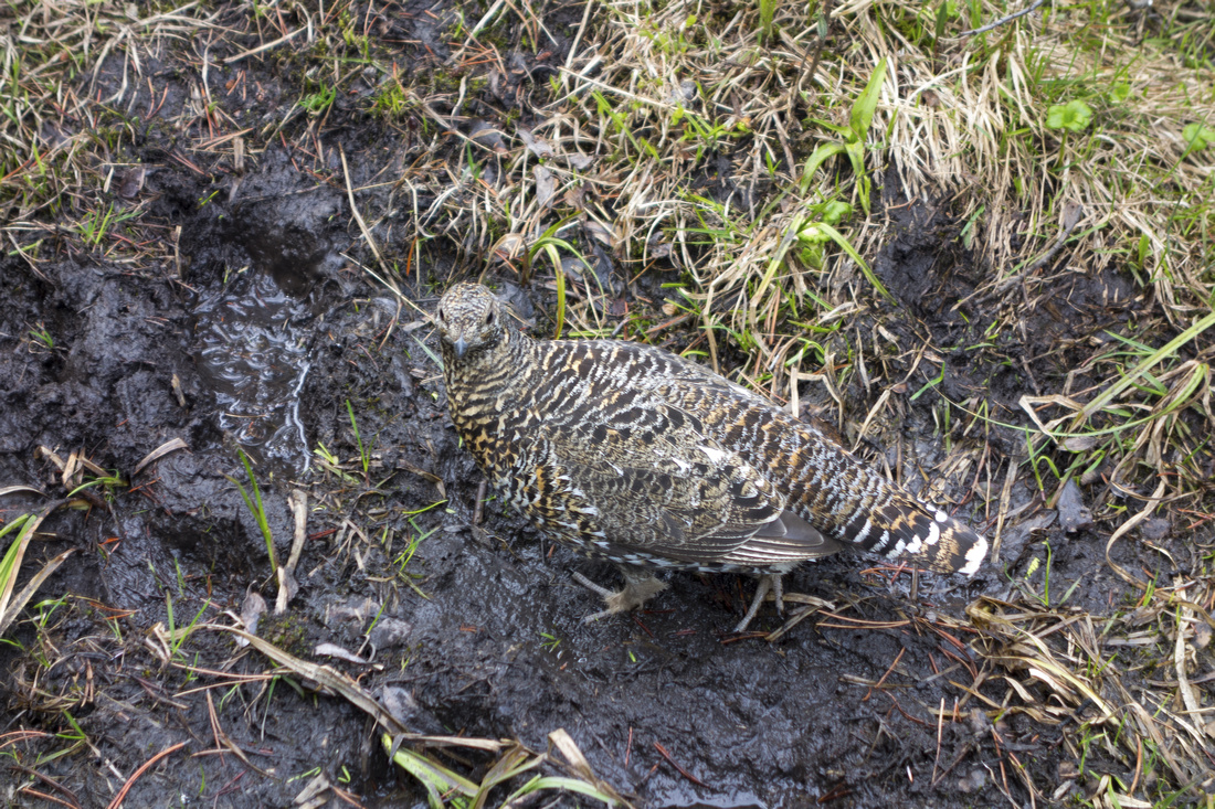 Ptarmigan at muddy section of Chephren Trail on return
 |
|||
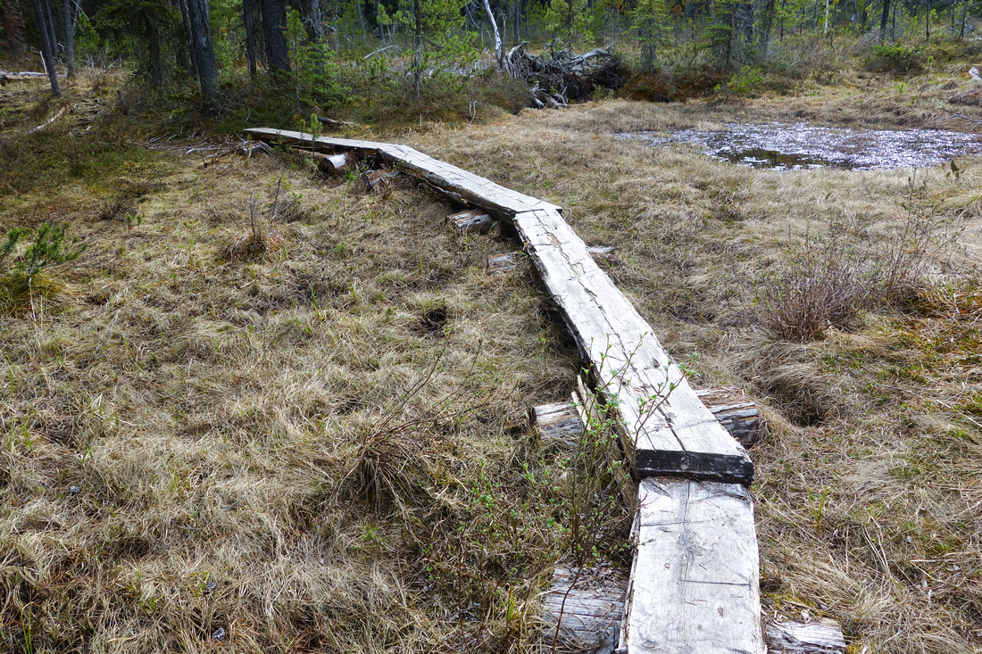 Marsh boardwalk on Cirque Trail before start of elevation gain
 |
|||
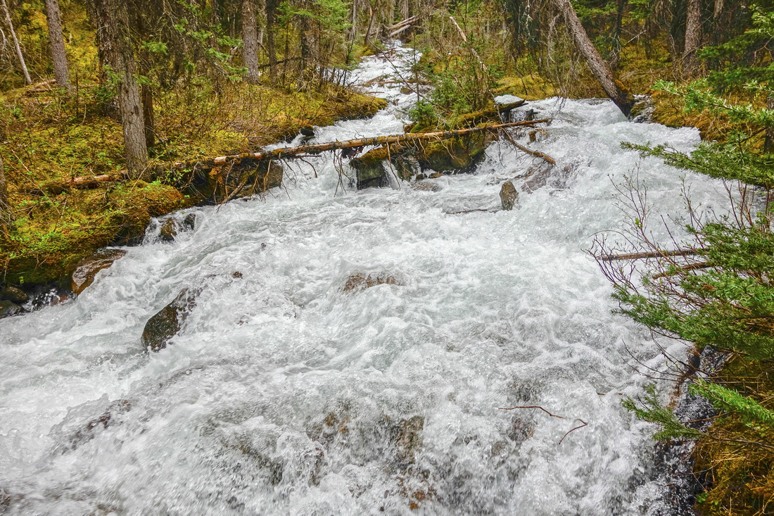 Ascending by swollen creek draining Cirque Lake
 |
|||
 Approaching Cirque Lake on rough path, snowbound and muddy in early season
 |
|||
 Fabulous late afternoon views across Cirque Lake. Trail ends here. It might be possible to trash along the right side, then scramble over dividing ridge to Chephren Lake south end
 |
|||
 View back east towards Icefields corridor from end of Cirque Lake Hiking Trail
 |
Abstract
| Overall Difficulty | D2/3 | Easy walk to Chephren Lake (D2), slightly more challenging for Cirque Lake with some rough sections | |||
| Snow Factor | S2 | No avalanche danger and good winter snowshoe trip | |||
| Scenery | Two picture perfect classic Rockies high-alpine lakes. Towering Mt. Chephren and Howse Mountain | ||||
| Trail/Marking | Very Good | Official parks trail with signed junction. Boggy section just before Cirque Lake | |||
| Suggested Time | 6 hr | Return time for both lakes; 2 - 2.5 hrs return if going just to Chephren Lake | |||
| Elevation | Start: 1680m Max: 1800m Total: ~400m (both lakes) | Round Trip: 15km (both lakes) | |||
| Gear | Light hikers will suffice most of the year; snowshoes or skis in winter | ||||
| Water | Chephren and CIrque Lake Outlet creeks. Carry no more than 1L | ||||
| Dog Friendly | Yes | Standard back-country travel precautions | |||
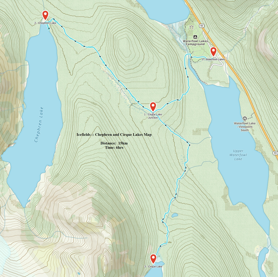 Chephren and Cirque Lakes GAIA Map
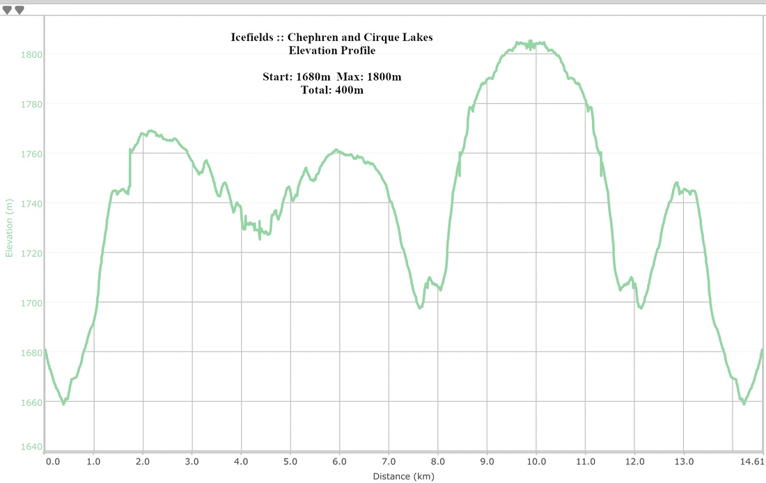 Chephren and Cirque Lakes Elevation