Google Map |
Rockies :: Canmore and Bow Valley ::Montane Traverse |
GPS Track |
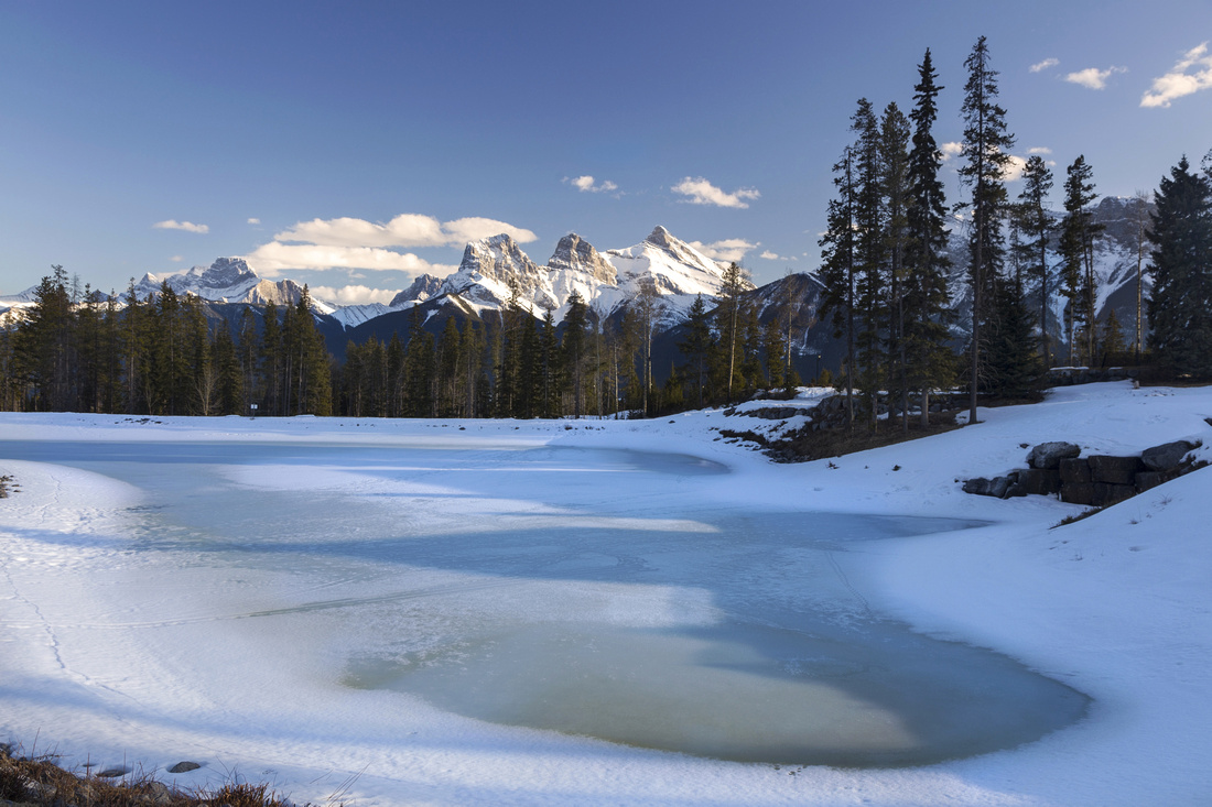 
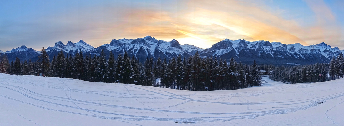
Frozen Pond at Silvertip Golf Course just below Montane Trail with view of Three Sisters |
|||
| Trip Summary | |||
December 2, 2020
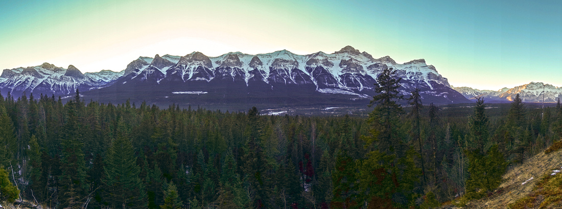
Montane Traverse is multi-use trail that contours lower slopes of Fairholme Range at north side of Bow Valley between Cougar Creek and Harvie Heights. Although primarily used by trail runners and mountain bikers, it is of interest to hikers - either on its own, or as approach to scrambling objectives such as Charles Stewart SE or Bald Eagle Peak (The Tit). Several nice loops can be made by hiking parts of Montane combined with one of Silvertip access trails or trail network in Harvie Heights on west end. Presented here is 1-way east-west traverse. Transportation must be pre-arranged for those that don't want to return on foot.
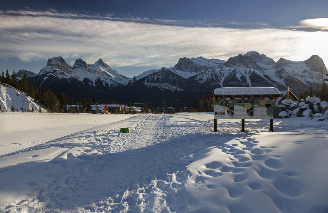
Park at Cougar Creek trailhead at top of Benchlands Drive at north side of Bow Valley above Canmore; this is the same as for Mt. Lady MacDonald. Canmore residents can probably walk from their doorstep, depending where they live. Follow wide pathway towards Cougar Canyon, then watch for Montane Trail branching left after almost a km from parking. (Cougar berm construction site is presently here at time of this writing but Montane trail was still open). Initial rise to Eagle Ridge is probably steepest part; after that trail meanders leisurely above residential houses initially then Silvertip Golf course. Stoneworks drainage is major junction reached after ~1.5 hours of casual pace from parking; if you don't wish to complete entire traverse, you can turn left here on Johnny's Trail then return via one of Silvertip trails. This drainage is also access for Charles Stewart SE (Buffalo Point) scramble. There are tables with maps here pointing in right direction. Beyond Stoneworks Montane becomes more confined but is still very enjoyable to hike. Eventually, after crossing couple of drainages below Bald Eagle Peak (The Tit) it ends at Tibitts Quarry. Alcove climber trail access branches upstream, while Montane turns south and descends to Harvie Heights. Recommended is extension at next junction -- turn right and walk beautiful open ridge with great views of Rundle range before dropping down and looping back to Harvie residential.
If hiking back to Cougar, quickest option is mind-numbing walk on 1A parallel to Trans-Canada. Otherwise it is possible to loop back via Ridge Traverse and Meander trails; this variation intersects Montane near Stoneworks junction. Total distance for this option is ~20 km and will be a solid day trip for most people. Unless you are a trail runner of course. |
|
Gallery |
|||
 Cougar Creek
Cougar creek trailhead with view back to south side of Bow Valley Cougar Creek
Cougar creek trailhead with view back to south side of Bow Valley |
|||
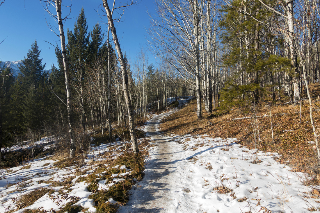 Aspen Path
Semi open part above Eagle Ridge Residential area on lower slopes of Mount Lady MacDonald Aspen Path
Semi open part above Eagle Ridge Residential area on lower slopes of Mount Lady MacDonald |
|||
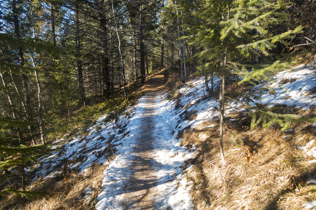 Montane Path
Forest transitions from Aspen to Pine as trail contours above golf course Montane Path
Forest transitions from Aspen to Pine as trail contours above golf course |
|||
|
|
|||
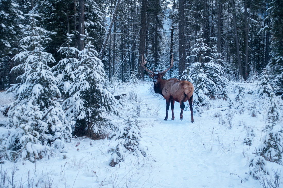 Wounded Deer
Harsh winter conditions for resident wildlife. This poor fellow had left hind leg broken, result of autumn rut probably, and will have a hard time surviving till spring Wounded Deer
Harsh winter conditions for resident wildlife. This poor fellow had left hind leg broken, result of autumn rut probably, and will have a hard time surviving till spring |
|||
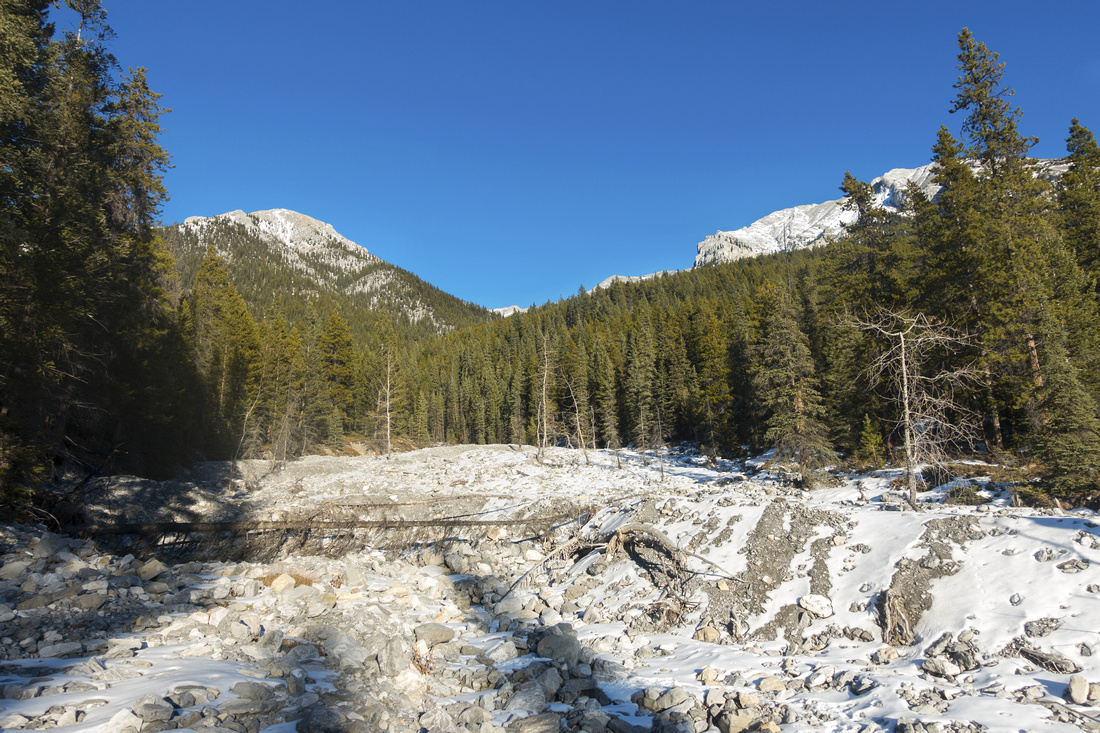 Stoneworks Drainage
Stoneworks Canyon drainage crossing between Lady Mac (R) and Bald Eagle Peak (L) Stoneworks Drainage
Stoneworks Canyon drainage crossing between Lady Mac (R) and Bald Eagle Peak (L) |
|||
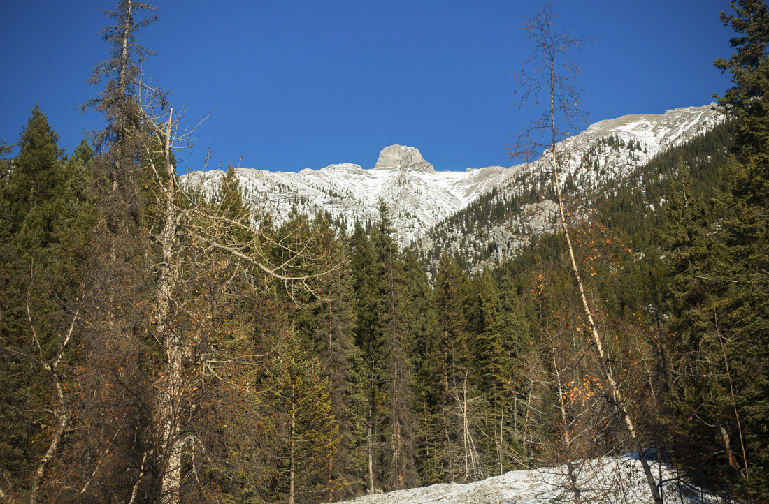 Bald Eagle Peak
Drainage directly below Bald Eagle Peak (formerly "The Tit"). Published scramble route ascends left skyline ridge, but it would be interesting to see if one could trash up right hand ridge from upper parts of this drainage Bald Eagle Peak
Drainage directly below Bald Eagle Peak (formerly "The Tit"). Published scramble route ascends left skyline ridge, but it would be interesting to see if one could trash up right hand ridge from upper parts of this drainage |
|||
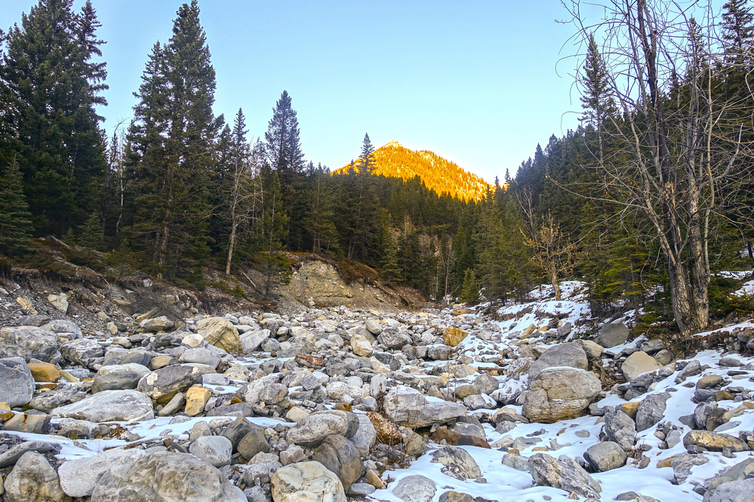 Tibitts Drainage
Tibitts Quarry looking up towards unofficially named Tibitts Ridge Tibitts Drainage
Tibitts Quarry looking up towards unofficially named Tibitts Ridge |
|||
|
|
Abstract
| Overall Difficulty | D2/3 | Gentle trail hiking with couple of mildly steep parts and rocky drainage crossings | |||
| Snow Factor | S2 | Dry and sunny north slopes harbor little snow and trail is usually well compacted. Possibility of icy sections. | |||
| Scenery | Bow Valley panorama with many well-known south side peaks from several vantage points. Some nice aspen forest that transitions into pine evergreen in western part. Silvertip Golf Course greens | ||||
| Trail/Marking | Very Good | Well defined throughout with several rocky drainage crossings. Several unmarked junctions / local trails throughout | |||
| Suggested Time | 3 hr | One way traverse Cougar Canyon to Harvie Heights with transport arranged; more if coming back on foot (see write-up for options) | |||
| Elevation | Start: 1410 m (Cougar) End: 1360m (Harvie) Total: (+285m) (-340m) | Distance: ~9 km (1-way) | |||
| Gear | Day hikers are enough. Icers recommended in winter | ||||
| Water | Seasonal water in late spring / early summer in drainage gullies, but can not be relied upon. Carry ~1L | ||||
| Dog Friendly | Yes | No on-leash restrictions but please be curteous to other trail users, including trail runners and mountain bikers | |||
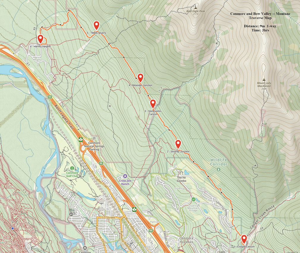 Montane Traverse GAIA Map
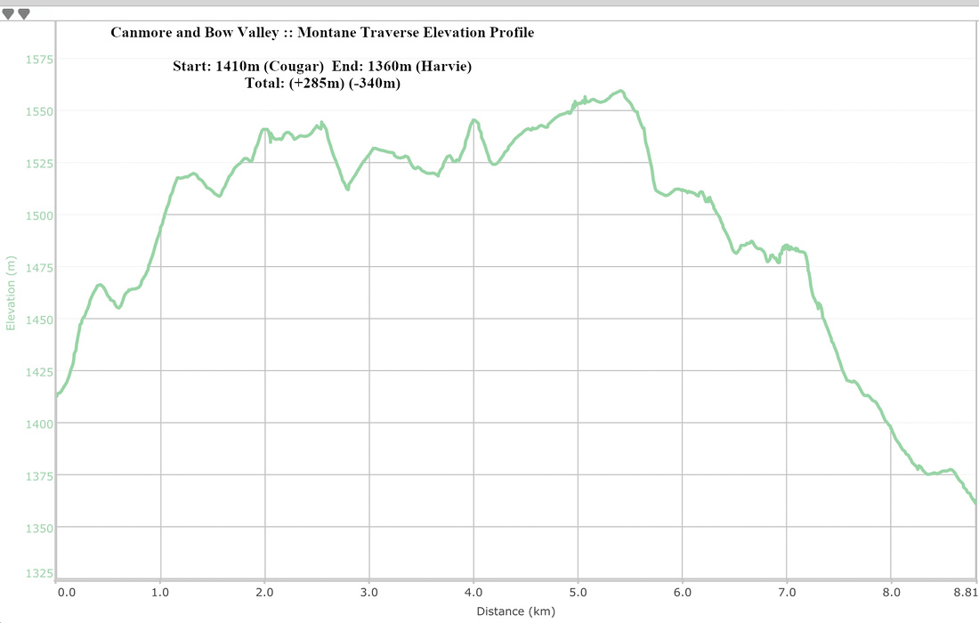 Montane Traverse Elevation Profile