Google Map |
Rockies :: Canmore and Bow Valley ::Exshaw Ridge |
GPS Track |
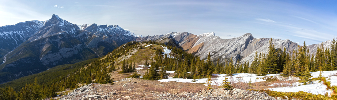 
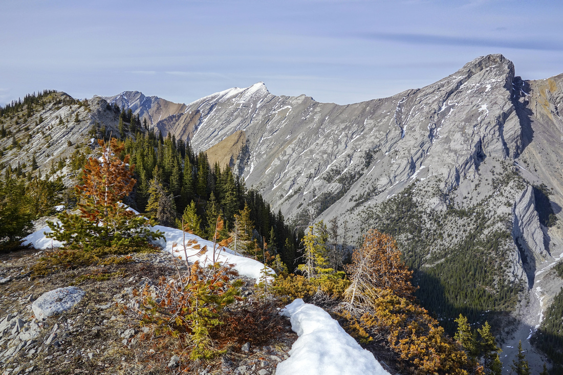
Panoramic View North from 4th bump as views open up. Mt. Fable upper left, Mythic Towers behind, Exshaw pass distance center. White Fang of Morrowmount center right, Hassel Castle and long ridge extending to Loder/Doorjam right |
|||
| Trip Summary | |||
April 25, 2019
This long ridge separating Exshaw and Jura creek drainages on north side of Bow Valley is great early-season trip. First bump directly above Town of Exshaw has been named “Exshaw Mountain”, but this is quite misleading as ridge gets higher further north. Purists wishing to traverse entire ridge go over “Exshaw Mountain” (bump 1) but this is not recommended -- “summit” is forest enclosed and viewless, and then one must lose almost half of elevation gained to deep saddle leading to bump 2. Better option is to start from bump 2 approaching via Prospector Biking trail and ascending via unofficial, but reasonably well defined trail. Bumps 2,3 are semi closed, but forest opens up at bump 4 and rest of ridgewalk is in the open with fantastic 360 views. Many more bumps follow with minor ups and downs (~40-50m each). The further one goes, the more rugged the ridge becomes ending with technical section that requires rope. At this point it is possible to trash down to Exshaw Creek and hike out via the drainage, but this is now quite difficult due to excessive deadfall past historic 2013 floods. Last portion of the creek (~2km before Town of Exshaw) as also closed by Cement Plant factory.
Parking is at “Exshaw Legion” - directly by 1A on east side of Town. Residential streets closer to the ridge have signs that hiker parking is not allowed, so use Legion parking to avoid potential fine although this adds ~1km of asphalt walking. Ascent steep hillside almost anywhere aiming to intercept Prospector Biking trail that contours “Exshaw Mountain”. Follow Prospector for 15 min or so to junction with overgrown logging road, then follow this road for another 5-10 min heading north. Look for side trail (cairn, but not marked otherwise as of April ’19) -- see GPS track. This trail is not well defined initially and crosses bit of deadfall - watch for flags - but becomes better as it rises through thinning forest. Over 500m vertical must be gained and it becomes quite steep as it reaches open talus slope below 2nd bump. From bump 2 drop down on forested north side, then cross over 3rd bump reaching open section of the ridge at bump 4. This is perfect spot for the break, and good turnaround point if pressed for time. Otherwise you can continue as far as you wish; it takes about an hour to reach bump 7 which was my turnaround point. Views are phenomenal on clear day; specially impressive is Morrowmount and Hassel Castle on north side. Exshaw Pass north is still far away, and although it offers hiking route into Ghost (as per Daffern K-country Guide Books) this long and arduous route not be recommended. Return the same way. |
|
Gallery |
|||
 Mt Fable drainage from semi-forested 2nd bump and start of Exshaw Ridge proper. You gain ~700m vertical to this point
 |
|||
 View back to shady/snowy north aspect of 2nd bump. Exshaw Plant upper center right
 |
|||
|
|
|||
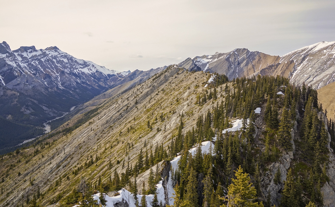
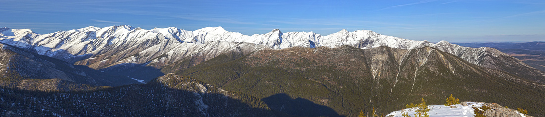
 Panoramic View back from north side of the ridge ascending the high-point; bumps 2,3 and 4 center right.
 |
|||
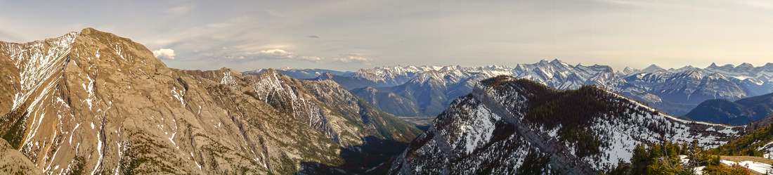
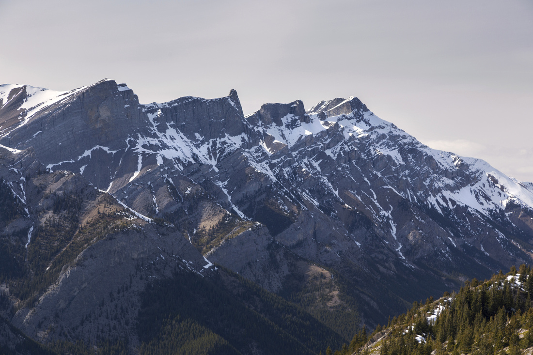
 Great Ridgewalk towards the high-point (upper left). Morrowmount and Hassel Castle ("The Hunchback") right
 |
|||
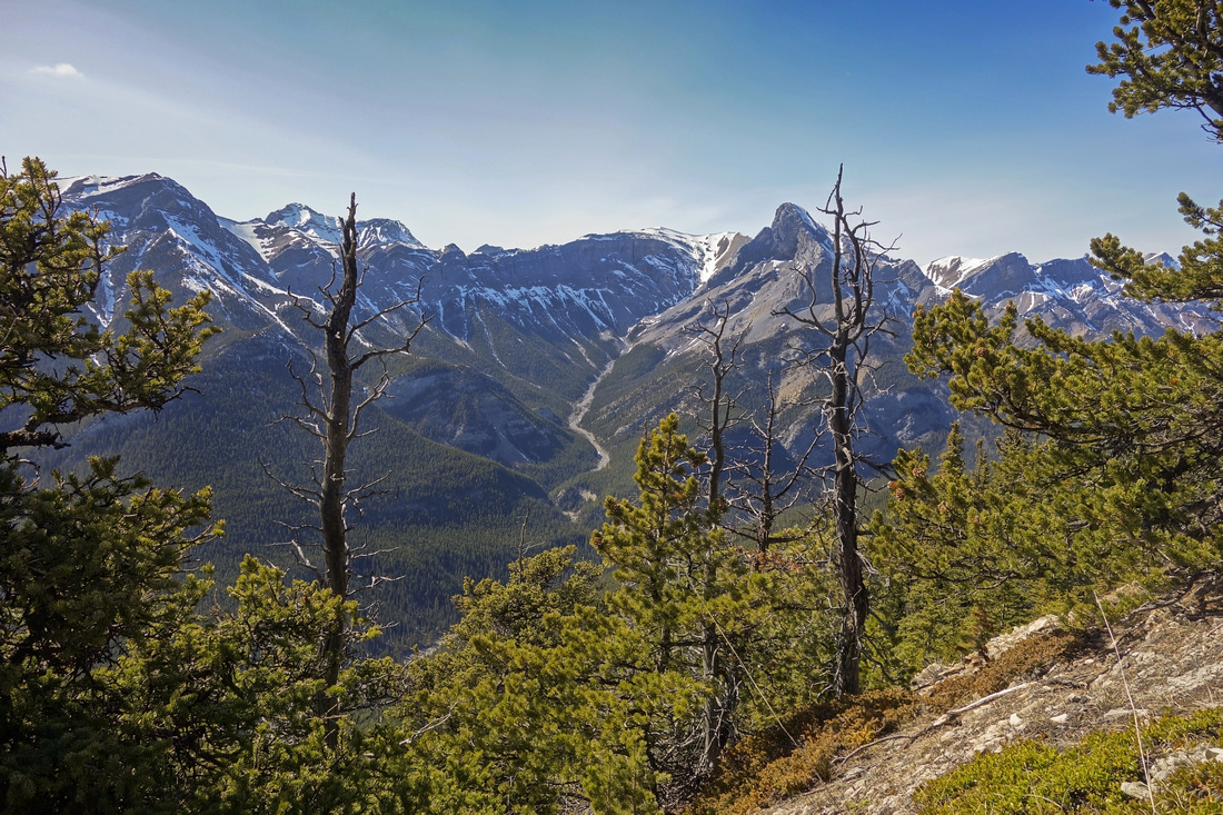
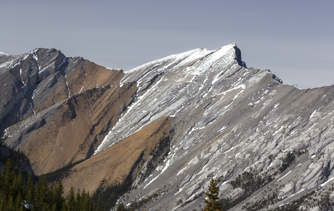 Closer look at White Fang of Mt. Morrowmount. Mostly easy scramble, if not for brutally long slog in Jura Creek
 |
|||
|
|
|||
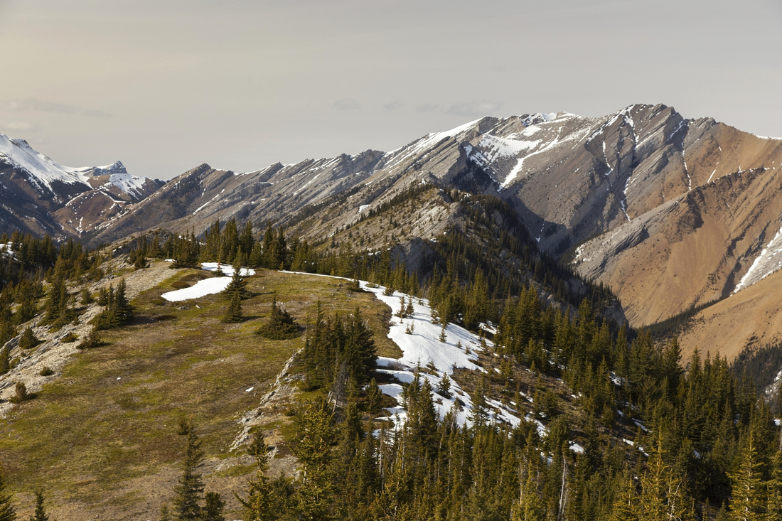
 High-point and turnaround spot. It is possible to continue to next bump (~20 min) then trash down left to Exshaw Creek, but return the same way is better option. Exshaw Pass distance center-left
 |
|||
|
|
Abstract
| Overall Difficulty | D4 | Steep talus slope to 2nd bump. Some bushwhacking and minor route-finding. Narrow ridge on descent from bump 3. Difficulties increase past high-point ending with technical rock in far north side. | |||
| Snow Factor | S2 | No avalanche danger, but deep snow lingering on shady east side between bumps 2-4 can prove problematic | |||
| Scenery | Front Ranges and Foothills. Fantastic view of long ridge east of Jura creek connecting Morrowmount, Hassel Castle with Loder/Doorjam. Mt. Fable, Mythic Towers and Exshaw Pass on west side. | ||||
| Trail/Marking | Poor | Maze of bike trails on approach. Faint trail to 2nd bump, none after. Some flags and cairns. Junctions are unmarked | |||
| Suggested Time | 7-8 hr | Depending on turnaround point; less if going just to clearing at 4th bump | |||
| Elevation | Start: 1290 m Max: 2110 m Total: (+1020m) (-210m) | Round Trip: ~17 km | |||
| Gear | Light hikers or full boots depending on season. Hiking poles recommended. | ||||
| Water | No water source above Exshaw creek. Carry 2-3L | ||||
| Dog Friendly | Yes | No on-leash restrictions, standard back-country precautions | |||
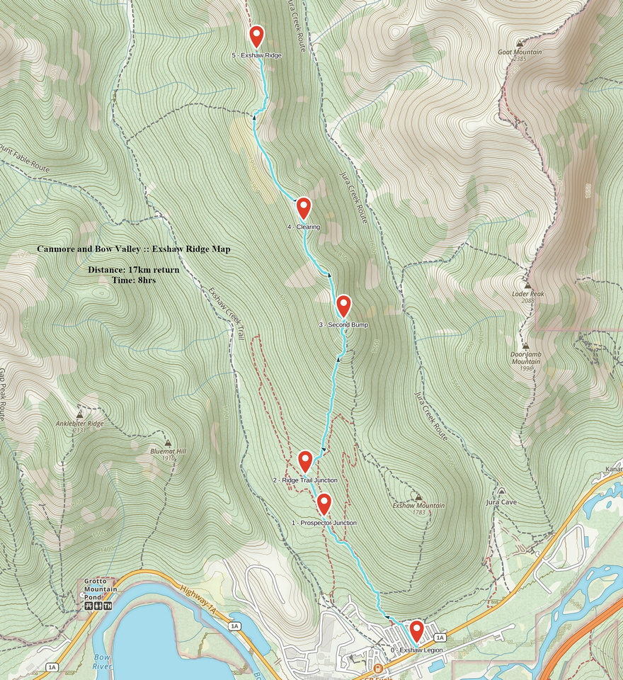 Exshaw Ridge GAIA Map
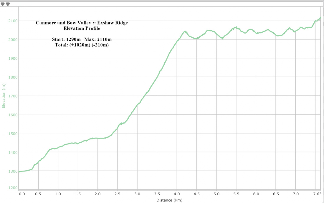 Exshaw Ridge Elevation Profile
|
|
Exshaw "Mountain" | ||
|
Bump 1 of Exshaw Ridge is best done as separate trip. From parking at Legion, follow residential streets to base of forested slopes. Several paths lead to the top but one can go most anywhere. There is about 450m vertical to be gained, so it is decent after-work leg stretcher. Takes about an hour to ascend. Unless embarking on full ridge traverse, return the same way. Descent will be much faster and whole trip will not take more than couple of hours, with return distance ~8km. Note that "summit", although it has cairn, is completely forest enclosed and viewless. Watch for ticks in early season. |
|||
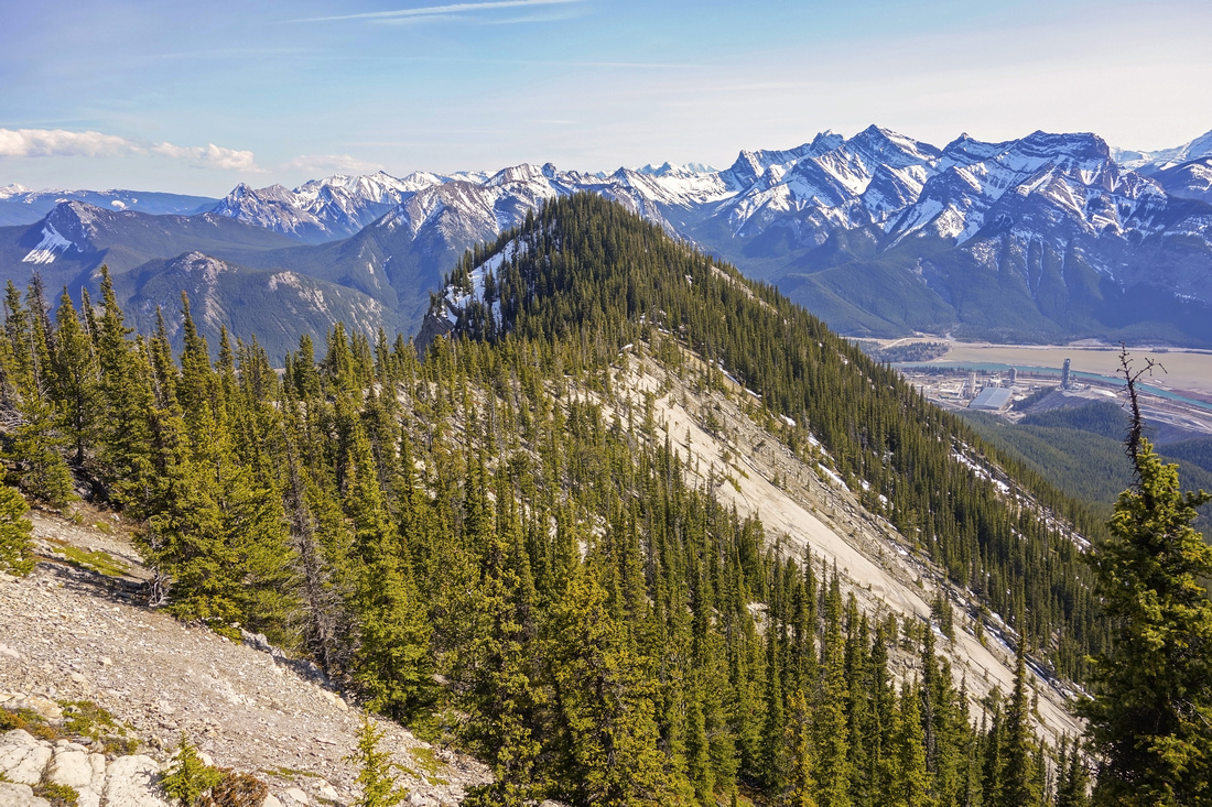
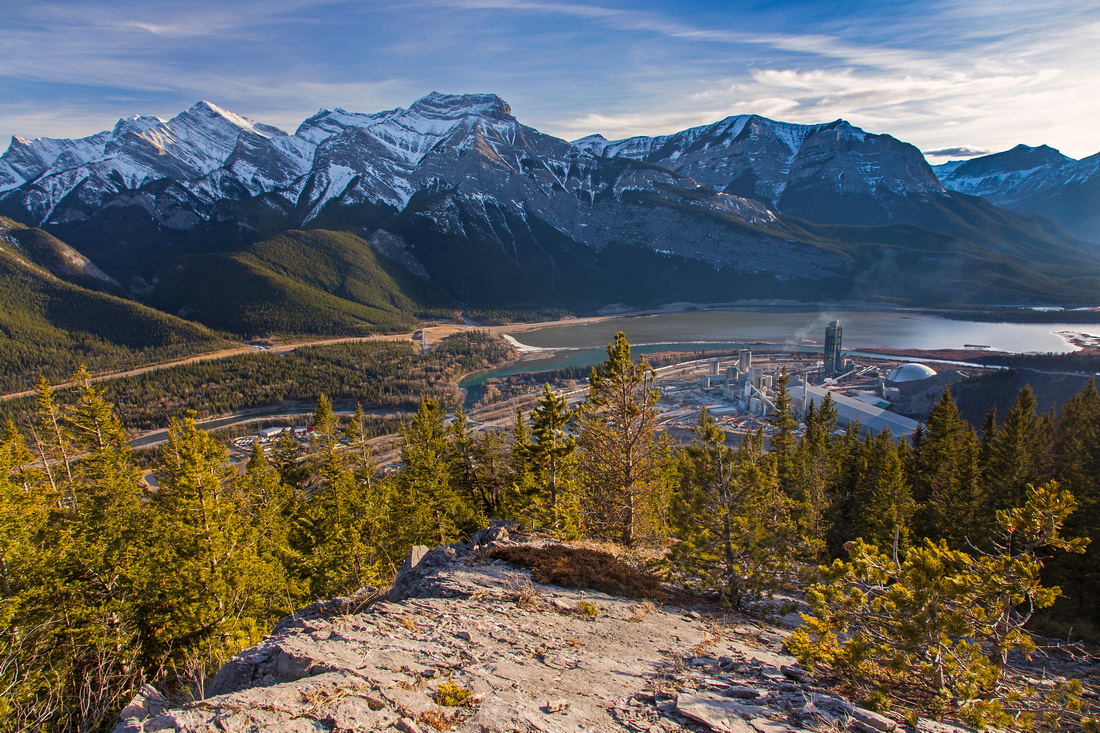 Exshaw Cement Plant and South Side of Bow Valley from clearing below "Exshaw Mountain" Summit
 |
|||