Google Map |
Rockies :: Canmore and Bow Valley ::Anklebiter Ridge |
GPS Track |
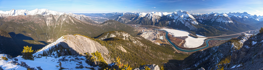 
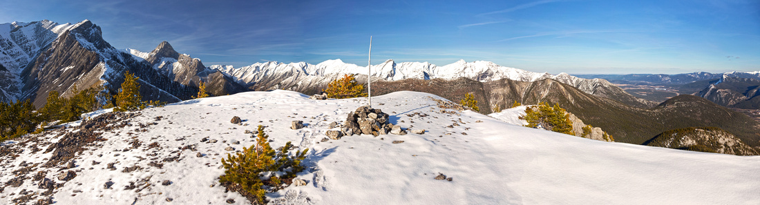
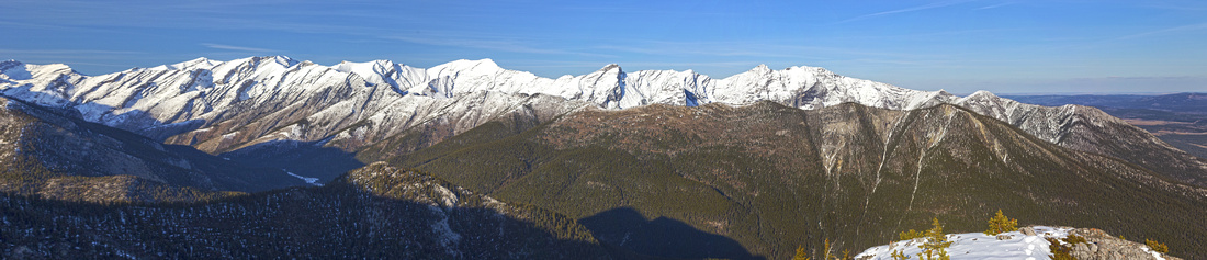
Panoramic View south from Anklebiter Summit. Ascent ridge far right; Horseshoe Descent via Bluemat Hill center left; Exshaw ridge further behind. Frozen Lac De Arcs with backdrop of Heart Mountain and Mt. McGillivray behind |
|||
| Trip Summary | |||
March 29, 2019
Anklebiter is great early season scramble. Sunny SE facing slopes lose snow early and offer good workout on dry rock. The name is unofficial; it is just a highpoint of long ridge extending further north and connecting to Gap Mountain above Grotto Canyon. Grade is steep right from the start with fairly sustained - but easy - scrambling. Upon topping on lower high-point (~700m elev. gain) flat and shady saddle can still be snowbound, but this part is short. Loop Horseshoe return via Bluemat Hill is possible, but wait till snow has completely melted as steep slopes must be negotiated directly below Anklebiter summit; in winter conditions, this part is mountaineering. Climbers sometimes ascend Gap Mountain via Anklebiter but this ridge is technical and requires roping.
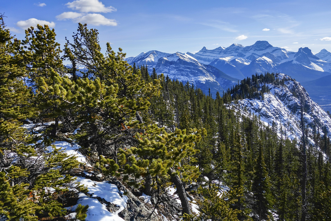
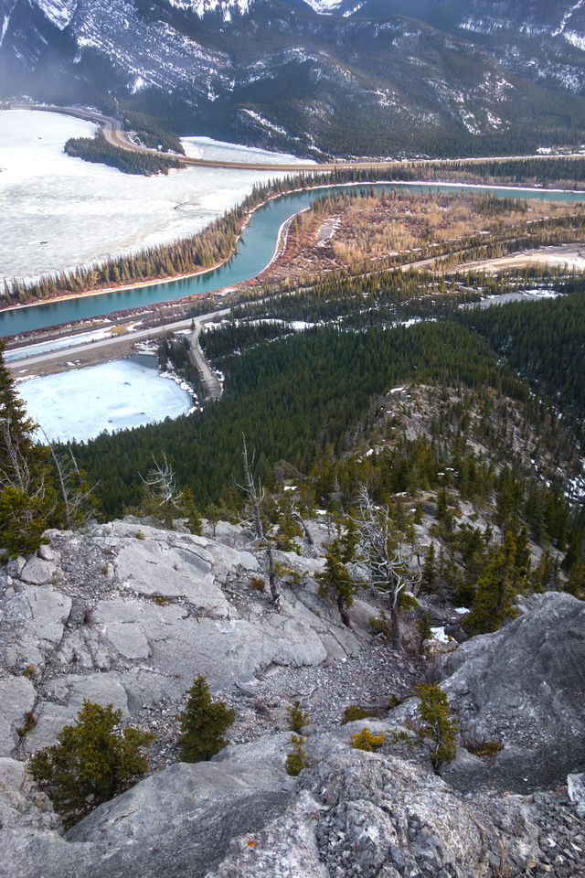
Parking is at Grotto Pond day-use, on Hwy 1A few km west of Exshaw. Anklebiter Ridge is directly above, but you can see only the lower part. It appears steep - and it is steep! Follow official Grotto Canyon Trail for few minutes, then diverge right upon reaching first drainage. If you miss this turnoff you can head up anywhere really through thinning forest -- or continue to Grotto Canyon, then ascend from there. Good trail rises through the forest and soon exits to treeline. First rock step is nearby; low class 3 and great fun tackled head on. Grade then eases, but soon resumes. Keep right scrambling on clean rock; talus slopes to the left are better used for descent. Several rises and flat portions alternate till you reach lower high-point; about 1hr 45min from parking. Ridge dips here, and if often snowbound in early season even if remainder is bone dry; gaiters can be helpful. Summit is visible across and despite appearance it is just a walk-up. Easily scrabble to wide summit plateau complete with wooden post and register. Great viewpoint offers opportunity to study several other trips on North Side of Bow Valley, including Exshaw Ridge, Gap Mountain and Mt. Fable.
Return the same way, keeping in mind descent will not be much faster. Alternatively, if snow has melted, drop east then angle left (north) to bypass steep cliffs. Return back to the ridge and follow bits of trail to Bluemat Hill; nice log cabin once stood here, but it was taken down in 2015. From Bluemat pick-up bits of trail dropping talus slopes below treeline to powerline and ultimately Hwy 1-A, about 1km east from Grotto Parking. |
|
Gallery |
|||
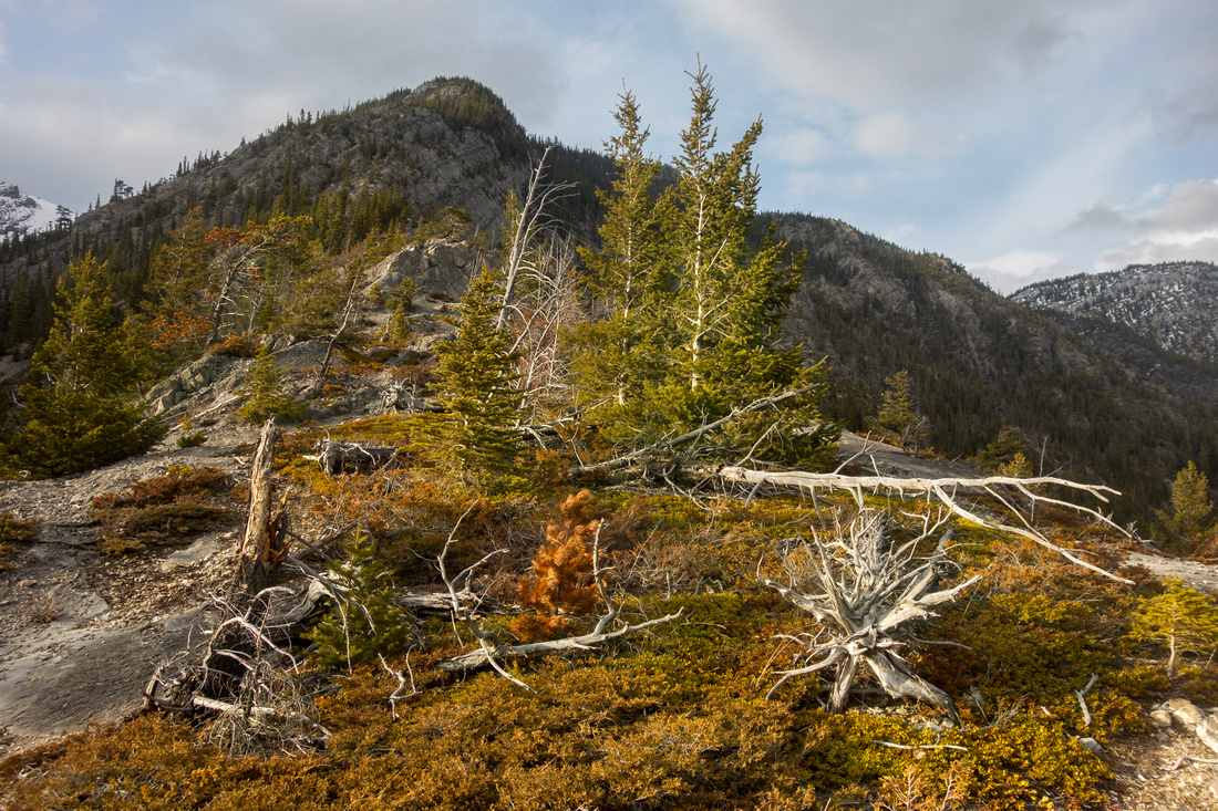 View of lower ridge just above treeline
 |
|||
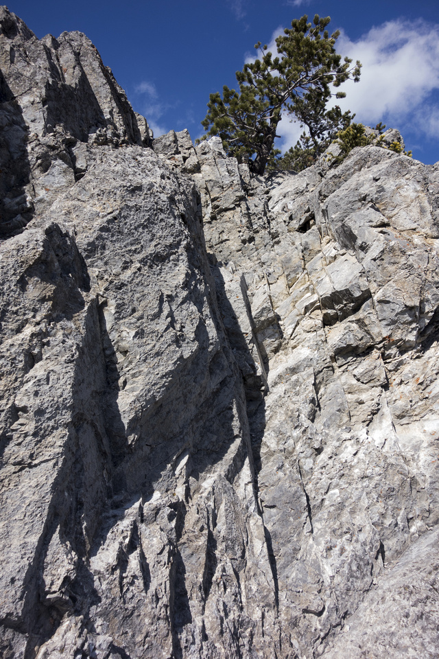 Lower crux step, right up the crack in the middle (low class 3). Easier than this photo might suggest - on return I downclimbed facing out.
 |
|||
|
|
|||
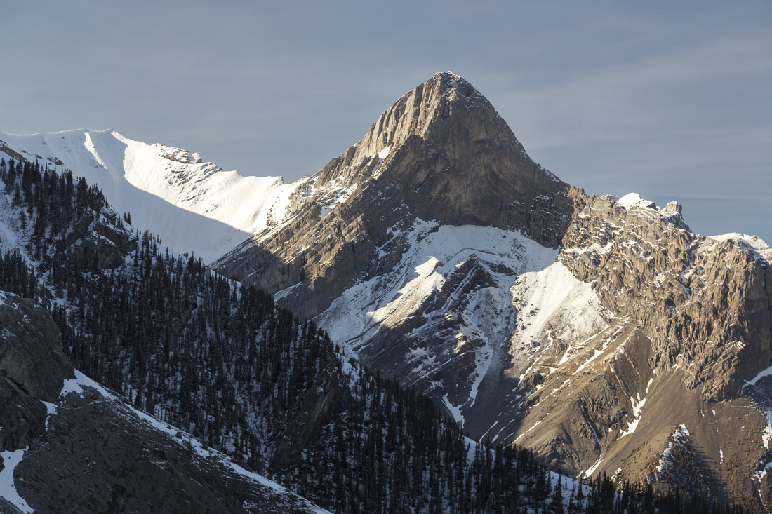
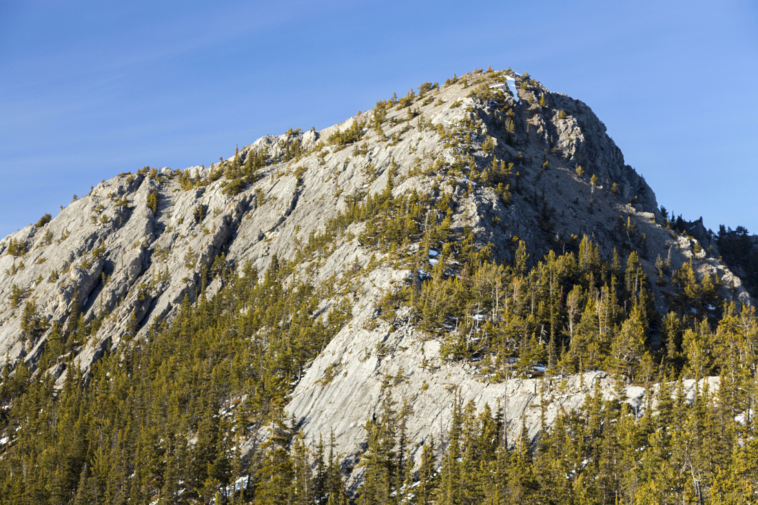 Summit block from lower highpoint; just a walk-up. Similar in nature to Mt. Harvey on Howe Sound Crest. About 700m elevation gain to this point
 |
|||
 Looking back from snowy saddle to lower highpoint. Deep snow lingers here quite late and makes this part unpleasant
 |
|||
 Wide Anklebiter summit plateau; ~2.5 hrs of moderate pace
 |
|||
|
|
|||
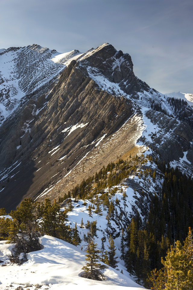 Connecting technical ridge to Gap Peak
 |
|||
|
|
|||
|
|
|||
|
|
|||
|
|

Abstract
| Overall Difficulty | D5 | Steep ascent on rubble and/or peeling cliffs. Several class 2/3 rock steps. Hard (but avoidable) rock step on optional return via Bluemat Hill. | |||
| Snow Factor | S3 | No avalanche danger, but deep snow lingering past first high-point can make early season attempts difficult. | |||
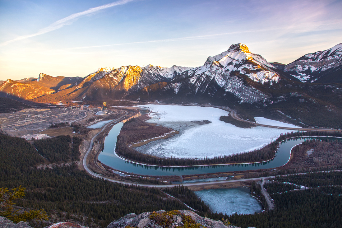
| Scenery | Front Ranges and Foothills. Great in-your-face view of connecting ridge with Gap Mountain. Mt. Fable and Exshaw Ridge | ||||
| Trail/Marking | Good | Well defined to treeline, occasional cairns and flags beyond. Way is obvious. Minor route-finding on Bluemat return. | |||
| Suggested Time | 5-6 hr | Moderate Pace, including summit break. | |||
| Elevation | Start: 1350 m Max: 2130 m Total: ~850 m | Round Trip: ~6.5 km | |||
| Gear | Light hikers or full boots. Hiking poles essential; Gaiters recommended | ||||
| Water | Entirely dry hike; carry 2-3 L, depending on season | ||||
| Dog Friendly | Yes | No on-leash restrictions, but be courteous to others as this is very popular area | |||
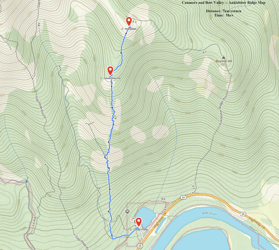 Anklebiter Ridge GAIA Map
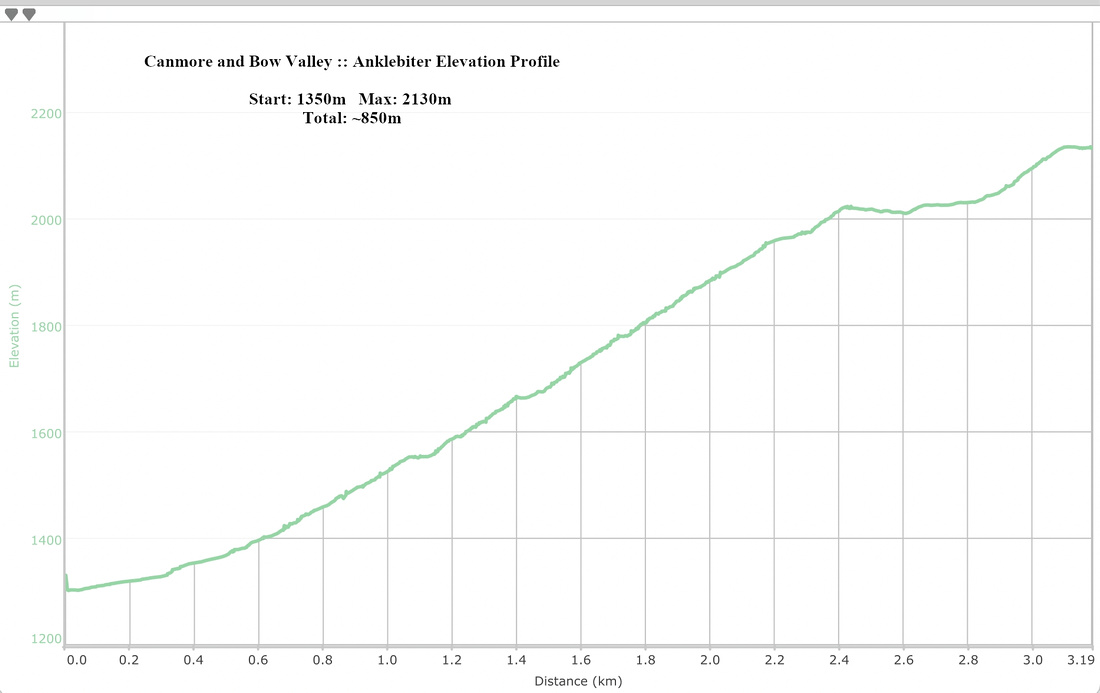 Anklebiter Elevation Profile