Google Map |
Rockies :: Banff-Louise :: Tilted Valley |
GPS Track |
|
Panoramic View of Heart Lake from top of small Headwall leading to upper Tilted Valley looking west to Skoki Core area |
|||
| Trip Summary | |||
September 13, 2021
There are many possible day hikes radiating from official Parks Canada back-country campground at Baker Lake (SK11) in Skoki -- ranging from several well documented Kane scrambles, to lesser known, but probably more scenic alpine destinations. One of these is off-trail visit to beautiful valley below Tilted Peak, east of long Sawback corridor below Baker Lake. This valley also serves as approach to infrequently ascended Mt. Lychnis (3124m - mountaineering, glacier crossings). Exploratory in nature, trip is also doable as long-day hike from Fish Creek parking at Lake Louise - but it is far better to backpack. This page presents only portion from Baker Lake, and stats in Abstract are given for that. (Fish Creek - Baker Lake is ~11km, 3.5hrs 1-way).
Just below Baker Lake on main Skoki trail is marked junction: straight for Cottongrass Pass and Red Deer Lakes, right for Sawback Trail. Descend and intersect valley trail in ~1km by old weathered Parks Table (as of Sep '21 - see gallery); turn right. Follow Sawback Trail for short distance only, rest of the trip is entirely off-trail. Cross alpine meadows aiming in general direction of Tilted Peak. Key landmark is canyon draining Heart Lake above, with obvious high-angle slab. There are probably several possible options; on my trip I simply trashed on climber right side of this feature. Initial rise is bit steep with moderate bushwhack, but short. On top of this slab which probably hosts impressive waterfall earlier in summer, canyon slowly disintegrates into gentle grassy draw. I followed this for ~10 minutes then headed left towards break in treeline. (Following draw to the end leads to very beautiful "Tilted Tarn", which likely sees no human visits). Inevitable part above treeline is ascent of short boulder field; if dry there are no issues except stability (poles). This bit would present avalanche danger in case of unlikely winter trip. At top is lower Tilted Valley with beautiful Heart Lake - name coming from unique shape. It is possible to walk around the lake on either side, but right although shorter is more rough - stay left. This is prime grizzly area - watch for signs in mud. I've heard of some people making bivouac at far end of Heart Lake, but if aiming for Mt. Lychnis it is far better to continue to upper Tilted valley few only a short distance away above small headwall. On my trip I just looped around the upper valley before turning back; if visiting as dayhike from Baker Lake "basecamp", there will be plenty of time for further exploration. Rough scree slope directly to the right provides scramble access to Tilted Peak - very lose and entirely not worth the effort. Route for Mt. Lychnis continues for another ~450m vertical to the col where glacier must be crossed for the summit ridge. Only decent report I could find on Internet of Lychnis ascent is here. |
|
Gallery |
|||
 Baker Panorama Baker Panorama Baker Lake Valley Panorama; Tilted Valley is just right of center with snowy Mt. Lychnis in the background
 |
|||
 |
|||
|
Weathered Parks Table at Junction with Sawback Trail ~1km below Baker Lake |
|||
 Alpine Meadow
Leaving Sawback Trail (extreme right) and heading across Alpine Meadow in general direction of Tilted Peak Alpine Meadow
Leaving Sawback Trail (extreme right) and heading across Alpine Meadow in general direction of Tilted Peak |
|||
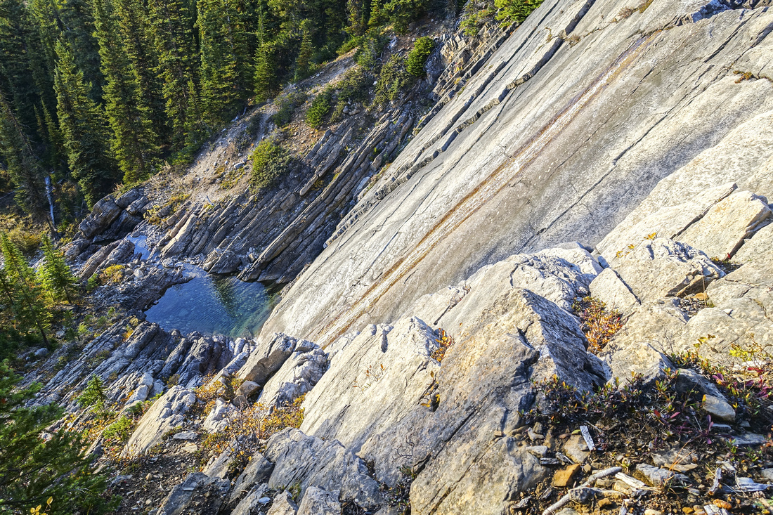 Heart Canyon
Very impressive high-angle slab in canyon draining Heart Lake. Easiest access from the meadow is on climber right, initially bit steep but with only moderate bushwhack Heart Canyon
Very impressive high-angle slab in canyon draining Heart Lake. Easiest access from the meadow is on climber right, initially bit steep but with only moderate bushwhack |
|||
 Tilted Tarn
Well worth brief diversion to beautiful body of water below Tilted Peak talus slopes Tilted Tarn
Well worth brief diversion to beautiful body of water below Tilted Peak talus slopes |
|||
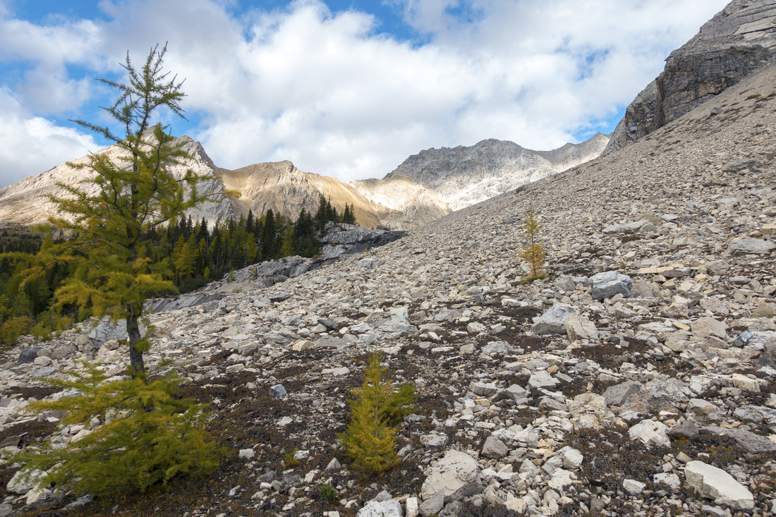 Talus Slope
Ascending unavoidable talus field to lip of Cirque containing Heart Lake Talus Slope
Ascending unavoidable talus field to lip of Cirque containing Heart Lake |
|||
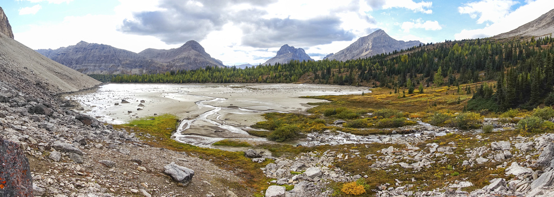
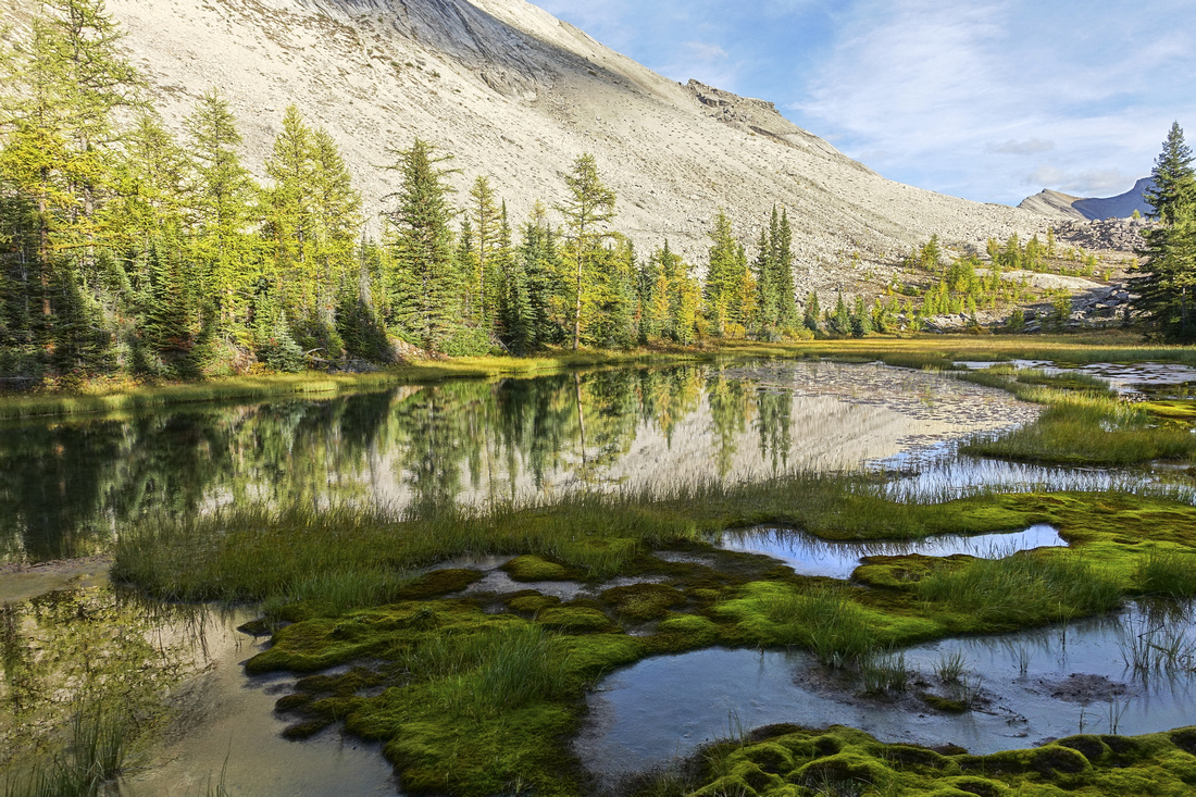
 Heart Lake
Very picturesque and rarely seen Heart Lake with water level very low in late summer. Tilted Valley is behind short headwall at far side of the lake. Although longer, it is much easier to walk around the lake on left side Heart Lake
Very picturesque and rarely seen Heart Lake with water level very low in late summer. Tilted Valley is behind short headwall at far side of the lake. Although longer, it is much easier to walk around the lake on left side |
|||
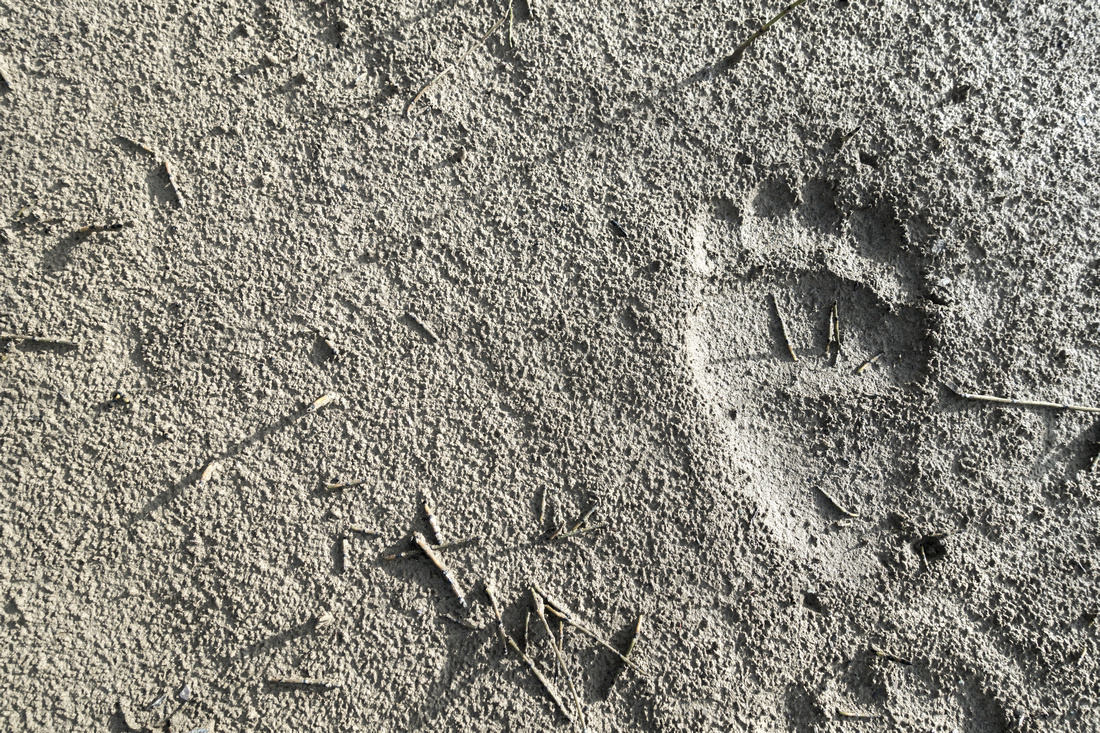 Sasquatch Footprint
Bear Prints in mud of of Heart Lake shore Sasquatch Footprint
Bear Prints in mud of of Heart Lake shore |
|||
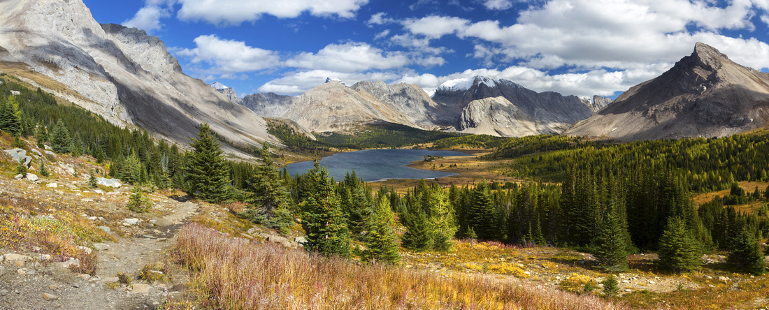
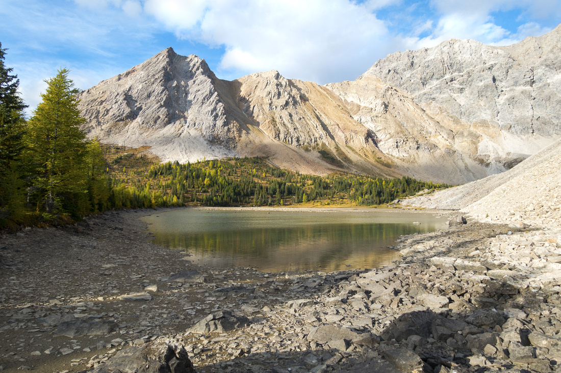
 Heart Lake Panorama
Tilted Peak rising above Heart Lake; upper Tilted valley and Mt. Lychnis to the left Heart Lake Panorama
Tilted Peak rising above Heart Lake; upper Tilted valley and Mt. Lychnis to the left |
|||
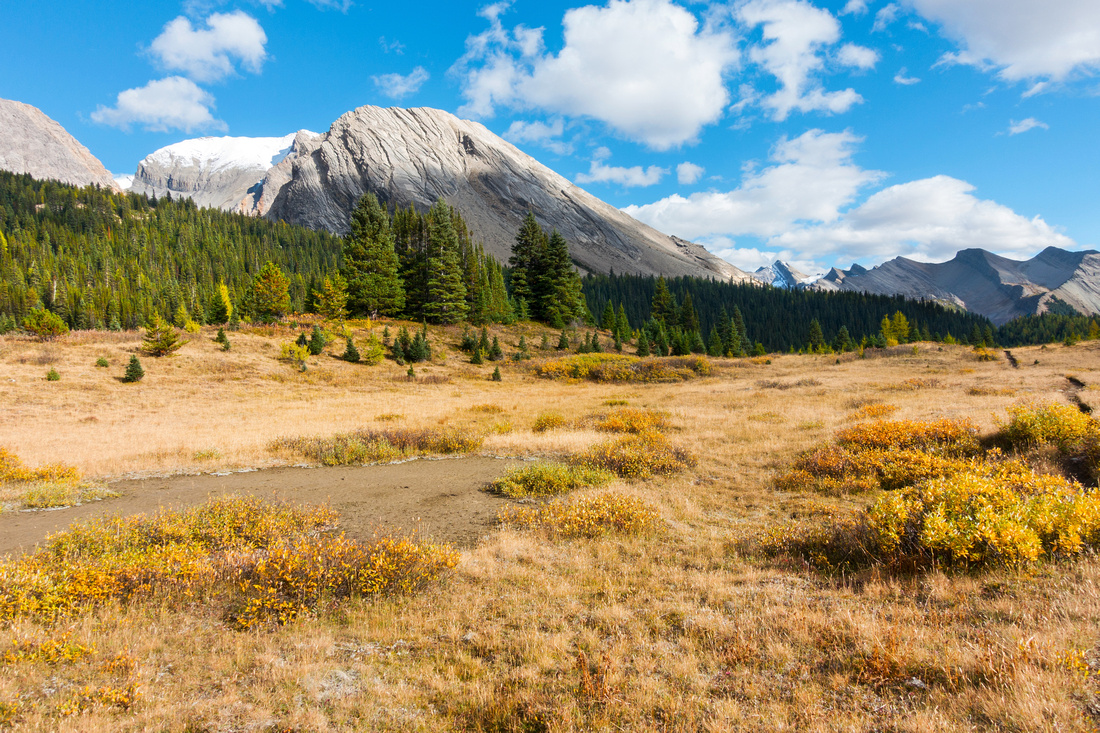
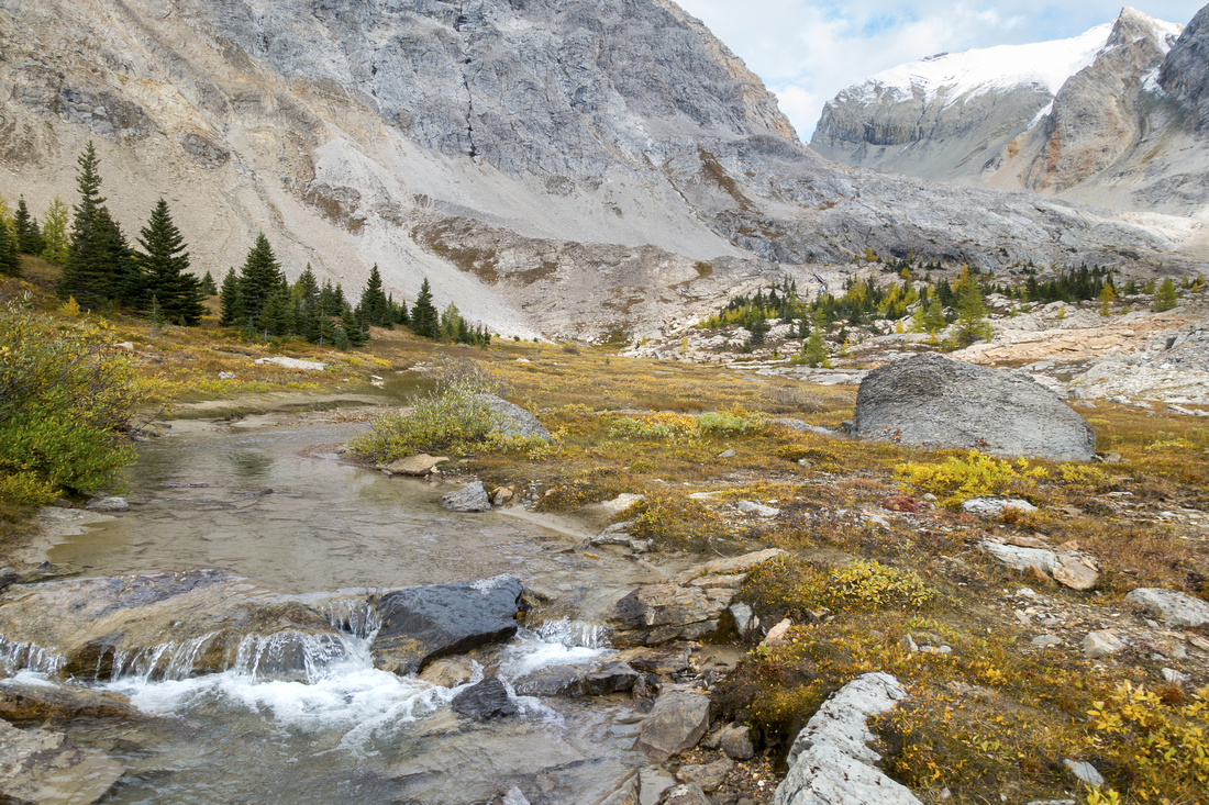 Tilted Valley
Secluded and very beautiful upper Tilted Valley; most years it sees no human visitors Tilted Valley
Secluded and very beautiful upper Tilted Valley; most years it sees no human visitors |
|||
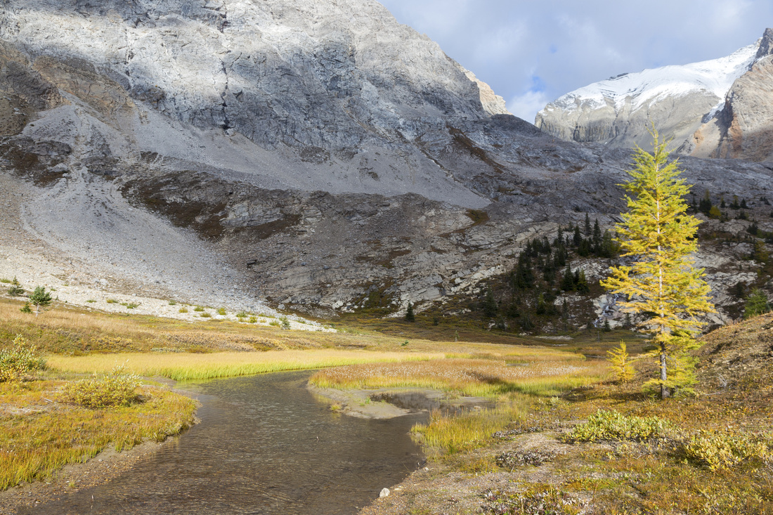 Tilted Valley
Approaching top of upper Tilted Valley - an awesome bivi site for assault on Mt. Lychnis upper right (glacier crossing, mountaineering) Tilted Valley
Approaching top of upper Tilted Valley - an awesome bivi site for assault on Mt. Lychnis upper right (glacier crossing, mountaineering) |
|||
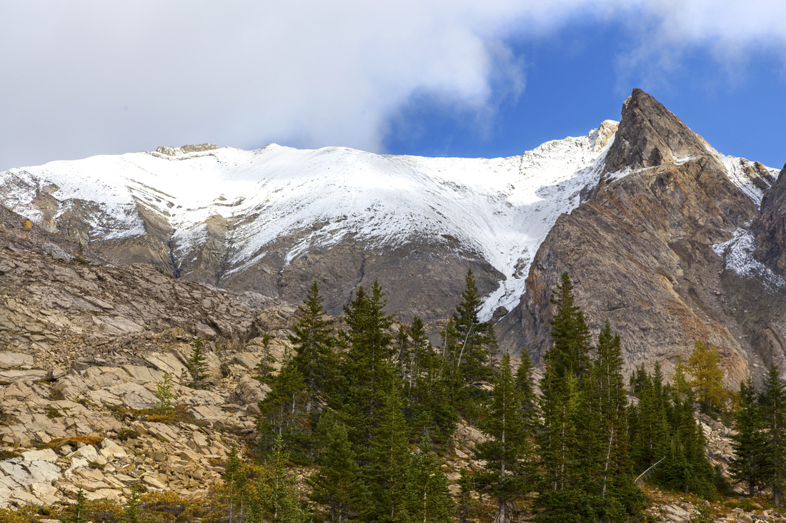 Lychnis Ridge
Snowy Ridge of Mt. Lychnis from top of upper Tilted Valley Lychnis Ridge
Snowy Ridge of Mt. Lychnis from top of upper Tilted Valley |
Abstract
(Baker Lake to upper Tilted Valley)
| Overall Difficulty | D3 | Off-trail hiking with moderate bushwhack and boulder field crossings; routefinding | |||
| Snow Factor | S3 | Crossing of boulder field at lip of Heart cirque moderate danger; Unlikely candidate for winter trip | |||
| Scenery | Baker Lake and essential Skoki. Alpine meadow of Sawback trail, Heart canyon and Lake; beautiful upper Tilted Valley | ||||
| Trail/Marking | Good/None | Official parks trail from Baker Lake to Sawback Junction; entirely off trail with no cairns/flags after | |||
| Suggested Time | 3hrs | Return time from Baker Lake. If dayhiking from Fish Creek trailhead add ~7hrs (return). Full day for ascents of Tilted Peak / Mt. Lychnis from Baker Lake "basecamp" | |||
| Elevation | Start: 2235m End: 2320m (+185 -105) (1-way from Baker Lake) | Distance: ~4km (1-way from Baker Lake) | |||
| Gear | Full hiking boots. Poles essential for Talus slope below Heart Lake cirque, Gaiters helpful. GPS suggested | ||||
| Water | Baker Lake outlet, Heart Lake outlet and streams in upper Tilted Valley. Carry ~0.5L maximum | ||||
| Dog Friendly | Yes | Standard back-country travel precautions. Grizzly bears frequent Tilted Valley | |||
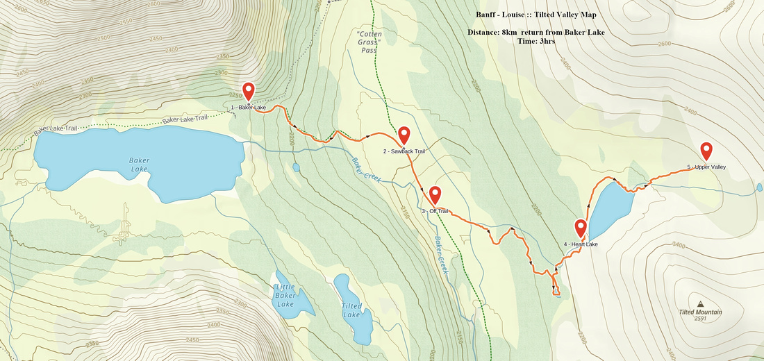 Tilted Valley GAIA Map
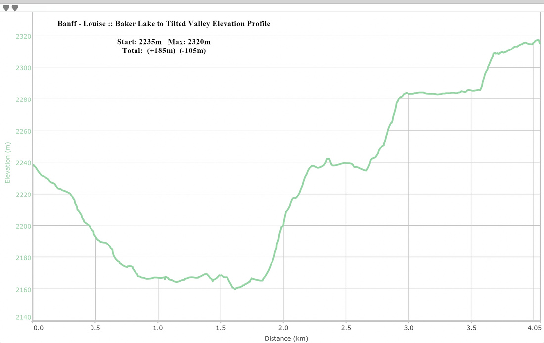 Baker Lake to Tilted Valley Elevation Profile