Google Map |
Rockies :: Banff-Louise ::Sunshine Meadows - Twin Cairns |
GPS Track |
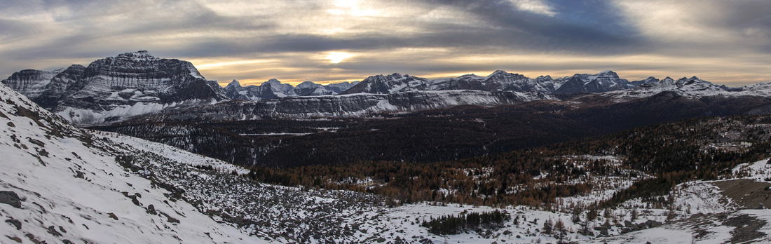 
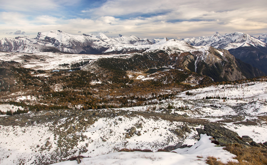
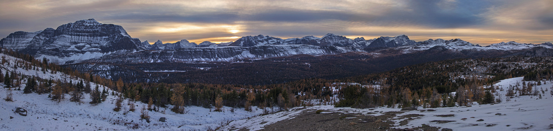
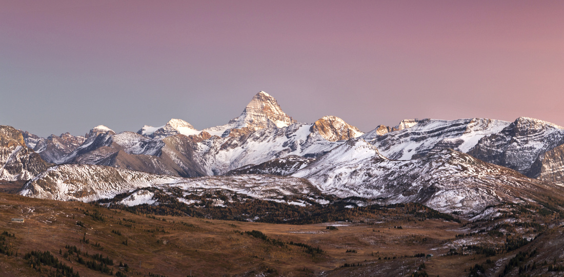
Panoramic view from Twin Cairns. Monarch far left, Monarch Ramparts extending to its right. Healy Pass environs right, Mt. Ball behind |
|||
| Trip Summary | |||
October 3, 2016
Twin Cairns is shapely ridge straddling the continental divide between Standish chair/Sunshine meadows and Monarch (Ramparts)/Simpson drainage west of Sunshine Village ski area. It is an awesome day trip with fabulous views throughout! The only drawback is 5 km (too) long access road, but it can easily be walked up in about an hour. (If you have deep pockets, check out shuttle schedule). Much variations for further exploration exists. Recommended extension is loop around Grizzly and Larix lakes - specially in fall season when many larches make entire area look spectacular! Loop return via the north end of the ridge has some easy scrambling on boulders that can be a bit tricky when covered with thin layer of snow.
Drive Sunshine access road from junction 10km west of Banff along Trans-Canada highway, then walk up to upper ski area (5km, ~500 vertical). Note Simpson Pass trailhead just before Trappers's Pub on the left side. This is where you will end up, if you decide to do the loop. Continue along the marked trail up to Continental Divide, then descend to Rock Isle lake. This is popular tourist spot and usually busy during the summer hiking season. Twin Cairns is shapely ridge rising to the west, still some distance away. Trail swings around Rock Isle lake and descends towards Grizzly and Larix Lakes. You can leave the trail anywhere now, but it would be a shame not to visit these 2 extremely pretty bodies of water first. This can also be very nice half-day family hike on its own. Note for photographers: Best views of Grizzly Lake is on the far (west) side; you will have to rock-hop the drainage just before the outlet/waterfall, but it is well worth. Larix lake is even more beautiful and best light conditions are mid-afternoon as soon moves west towards the Monarch. Leave trail at north end of the lake and head up the drainage, hoping across as necessary. It rises through stands of larch trees and meadows. As you gain elevation angle left and intersect ridge near its lowest point. Fabulous westerly views towards Monarch unfold. This ridge is easily hiked on grass initially then talus towards the first rise -- lower Cairn. Far (north) Cairn is higher, and although it might appear tempting to sidehill it is best to stay right on top, even if it means losing a bit of elevation on descent from lower Cairn. Final ascent is an easy scramble through boulders that calls for use of hands now and then. Summit views are as spectacular as you might expect. Length of Monarch Ramparts towards Healy Pass area is in front of you. Eohippus lake below Monarch is spellbinding. It appears feasible to head over from Twin Cairns as well, but it would mean fairly drastic loss (and regain) of elevation to bypass intervening Simpson river drainage. Easiest access is via established trail branching off Simpson Pass trail further north.
You can return the same way, but nicer option is to continue north and descend to the meadows on the far side. This is not as straightforward as you must traverse large boulder field that is fairly tricky specially under thin cover of snow -- caution needed. Just before the north bump ('third cairn') drop left, then descend on grass and talus to meadows below. Turn right and head back to north end of Standish ridge and chairlifts. It is not necessary to look for Simpson pass trail that is further north from where you dropped of Twin Cairns. Simply walk east towards top of Standish Chair, then drop down to Sunshine Village. Of course you will also have to walk the road back, and it will feel quite tedious at the end of the day - but it is relatively small price to pay for glorious alpine wondering behind you. |
|
Gallery |
|||
 Hiking around Rock Isle Lake
 |
|||
 Hiking around Rock Isle Lake
 |
|||
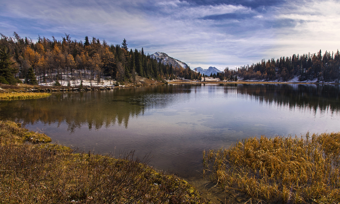
 Reflections in Rock Isle Lake
 |
|||
 Off-trail hike around Grizzly Lake
 |
|||
 Grizzly Lake meadows heading to Simpson River lookout
 |
|||
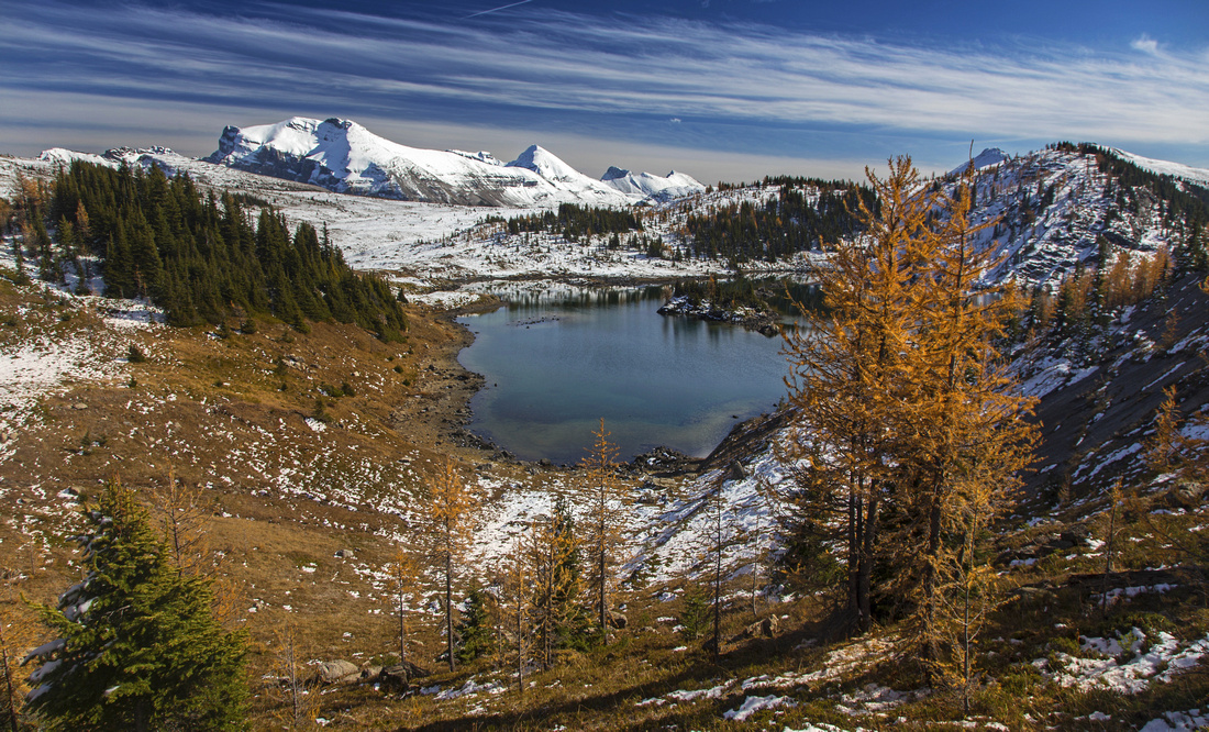
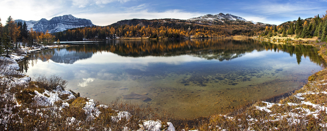 Larix Lake Panorama. Monarch upper left, Twin Cairns center right
 |
|||
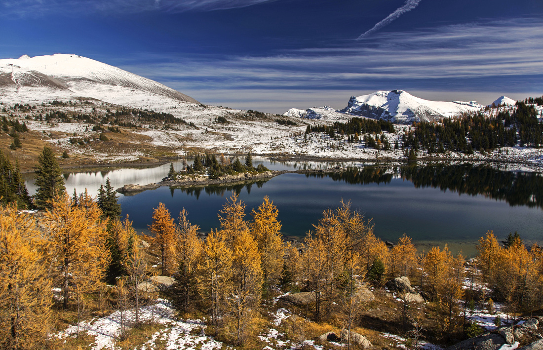
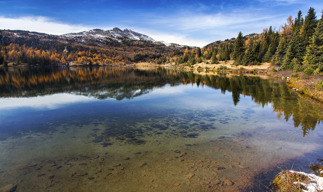 Hiking around Larix Lake. Twin Cairns left of center
 |
|||
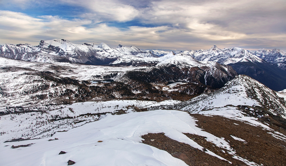
 View back from lower Twin Cairns ridge. Larix and Rock Isle Lakes below, distant Mt. Assiniboine upper center right
 |
|||
 Mt. Assiniboine Telephoto
 |
|||
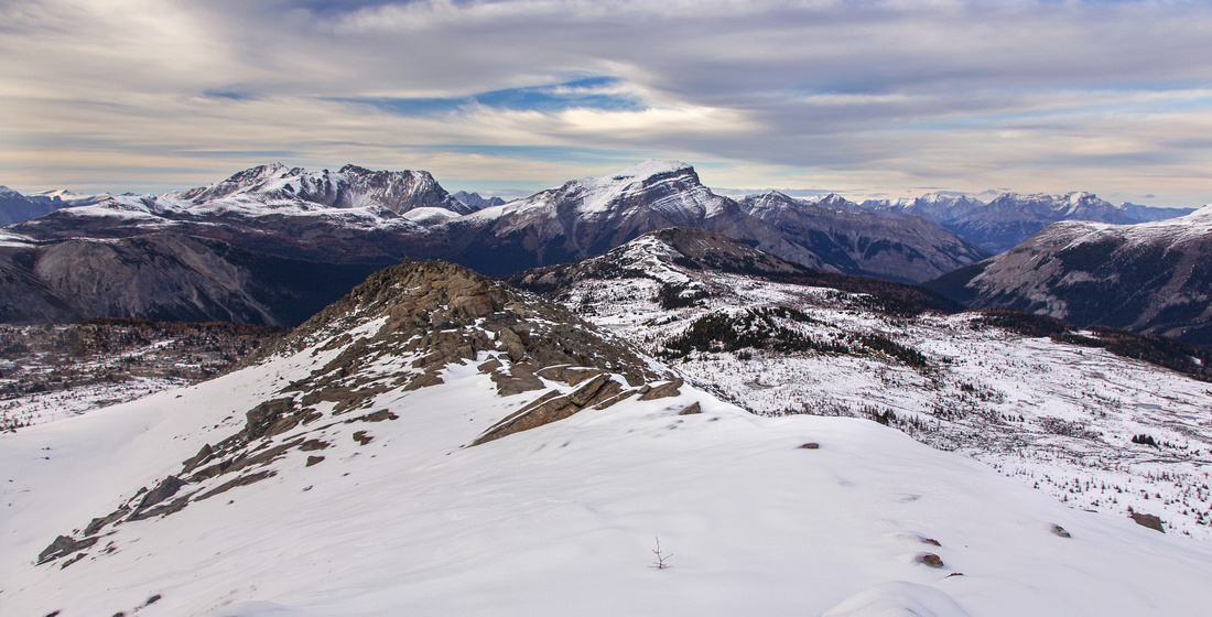
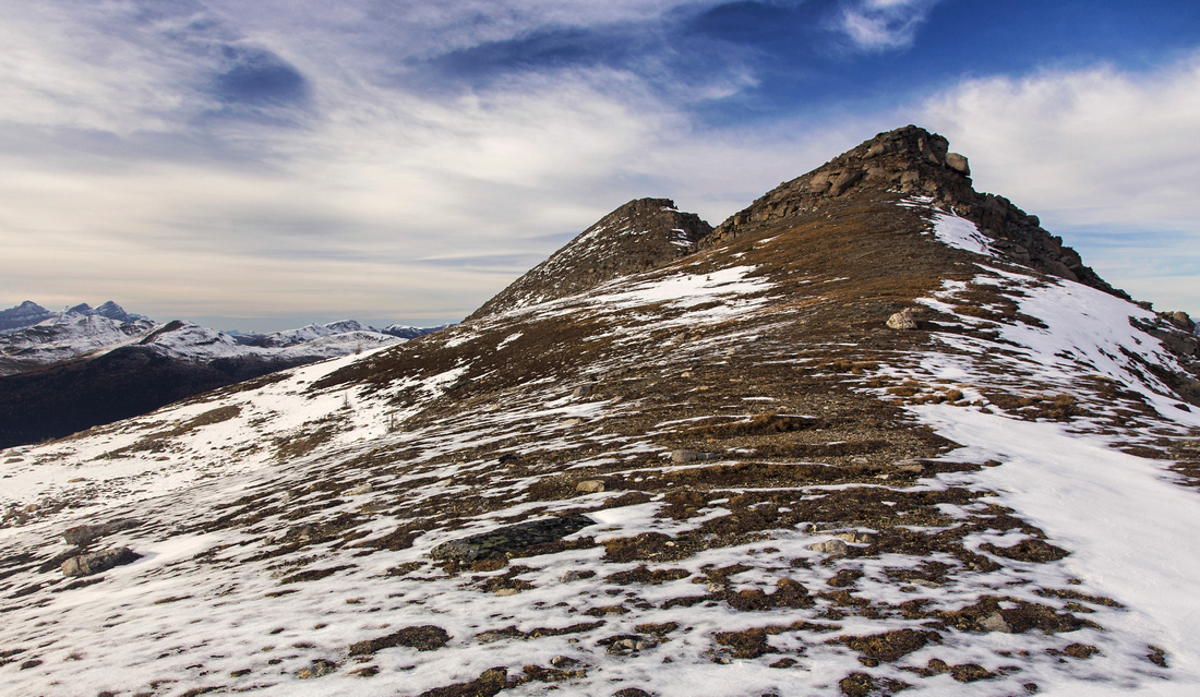 Twin Cairns. Far summit is higher. Easiest route goes directly over the lower (south) cairn
 |
|||
 View back to Continental Divide from higher Cairn
 |
|||
 Views north towards Mt. Bourgeau from higher Cairn
 |
|||
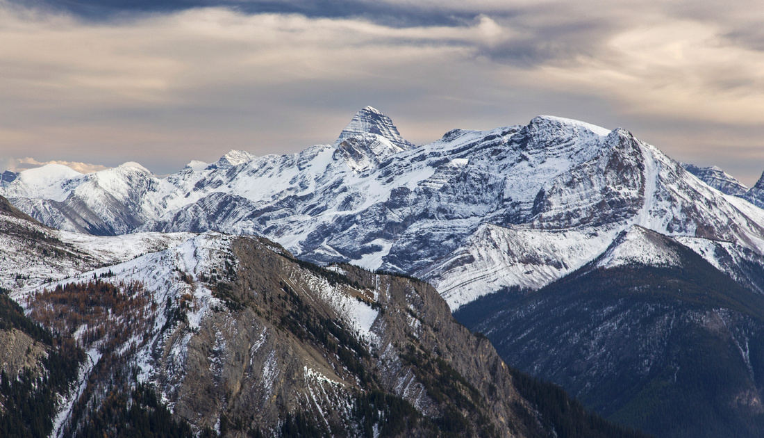
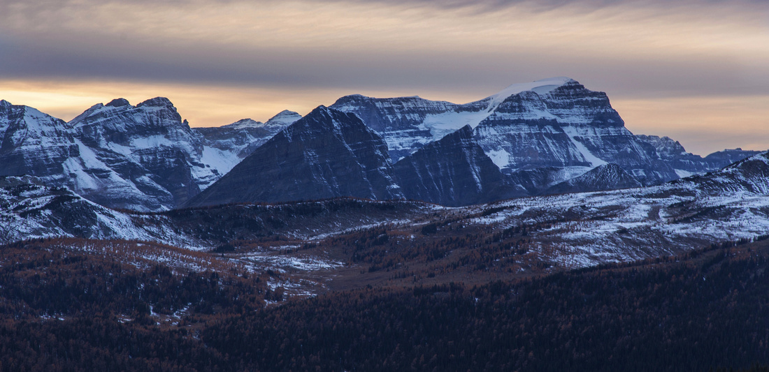
 Panoramic view to Monarch (Ramparts) area on descent from higher Cairn
 |
|||
 Zoom on Eohippus Lake below Monarch
 |
|||
 Healy Pass telephoto. Mt. Ball behind
 |
|||
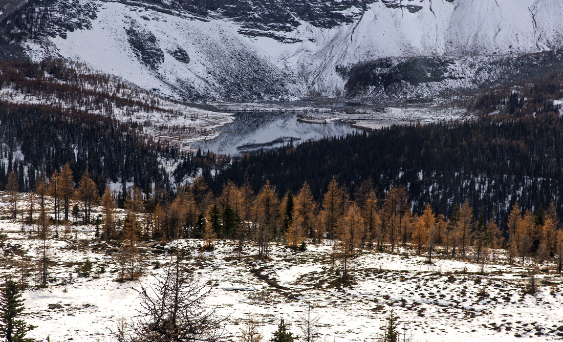
 Snowy tarns on descent from North Cairn
 |
Abstract
| Overall Difficulty | D4 | Off trail hiking with some easy route-finding. An easy scramble up boulders on the ridge | |||
| Snow Factor | S2 | Terrific snowshoe or x-country trip with no avalanche danger | |||
| Scenery | Wide reaching views in all directions. Expansive meadows, lakes and distant peaks. | ||||
| Trail/Marking | Excellent / None | Official parks trail to Rock Isle Lake, followed by off-trail meandering in open terrain | |||
| Suggested Time | 5-6 hr | Loop from Sunshine village including visit to Larix and Grizzly lakes. Add 1hr each way if walking Sunshine access road | |||
| Elevation | Start: 2180m Max: 2550 m Total: ~600 m (Sunshine Village) |
Round Trip: ~14 km (Sunshine Village) |
|||
| Gear | Full hiking boots recommended for stability on lose boulders on the ridge. Poles helpful | ||||
| Water | Several creeks in meadows above Grizzly lake. Carry 1L | ||||
| Dog Friendly | Yes | Standard back-country travel precautions. You will have to walk the road both ways | |||
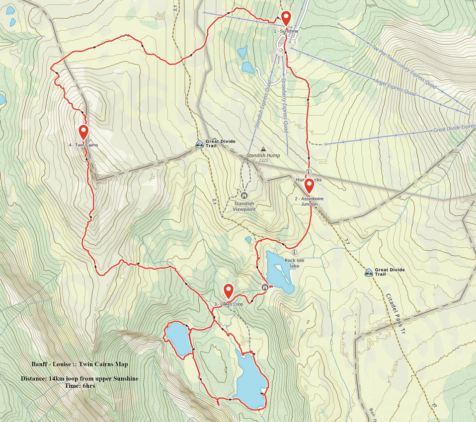 Twin Cairns GAIA Map
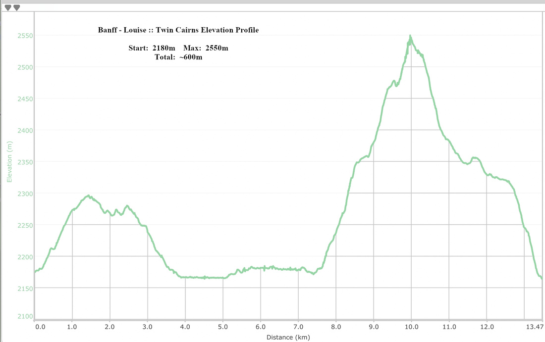 Twin Cairns Elevation Profile
Wawa Ridge
Wawa Ridge extends north from top of Standish Chair. It is often done as snowshoe / ski trip in winter, but also provides nice extension to above described "grand tour" of Sunshine alpine basin. Good trail splits from high point on Simpson Pass trail and heads right. Note that Parks Canada often (i.e. during autumn larch colors change) puts up signs that prohibit access. Trail rises gently for about 20-30 minutes to top of Wawa Ridge that has small meteorological station on top. Views are outstanding, in particular during sunset when whole valley can be set on fire in right conditions. Return the same way.
Mt. Assiniboine from top of Wawa Ridge