Google Map |
Rockies :: Banff-Louise :: Stewart Canyon |
GPS Track |
 
Large Ice Chunks scattered in Cascade River from Stewart Canyon Bridge |
|||
| Trip Summary | |||
Apr 10, 2025
Popular extension of tourist friendly walk to Cascade River bridge along Minnewanka shoreline trail. Past signed junction few minutes above the bridge Stewart Canyon trail splits by the sign (see Gallery). Note that seasonal group of 4 restriction does not apply for Stewart Canyon. Trail continues along semi-open east embankment with some nice views until it reaches rocky drainage below Mt. Astley - usual return point. When icy descent into drainage can be tricky. Rough trail does continue on the other side but fades away soon - not worth, although one could presumably reach Cascade River Bridge at km 6 of Cascade Fireroad this way. In summer couple of popular Rock Climbing areas in Astley drainage are worth checking out. |
|
Gallery |
|||
 Minnewanka Shoreline
View from Minnewanka Shoreline Trail heading towards Stewart Canyon. Mt. Astley rising above Minnewanka Shoreline
View from Minnewanka Shoreline Trail heading towards Stewart Canyon. Mt. Astley rising above |
|||
 Stewart Trailhead
Large Parks Canada Table at end of Paved (but closed for cars) road, and official Stewart Canyon Trailhad Stewart Trailhead
Large Parks Canada Table at end of Paved (but closed for cars) road, and official Stewart Canyon Trailhad |
|||
|
|
|||
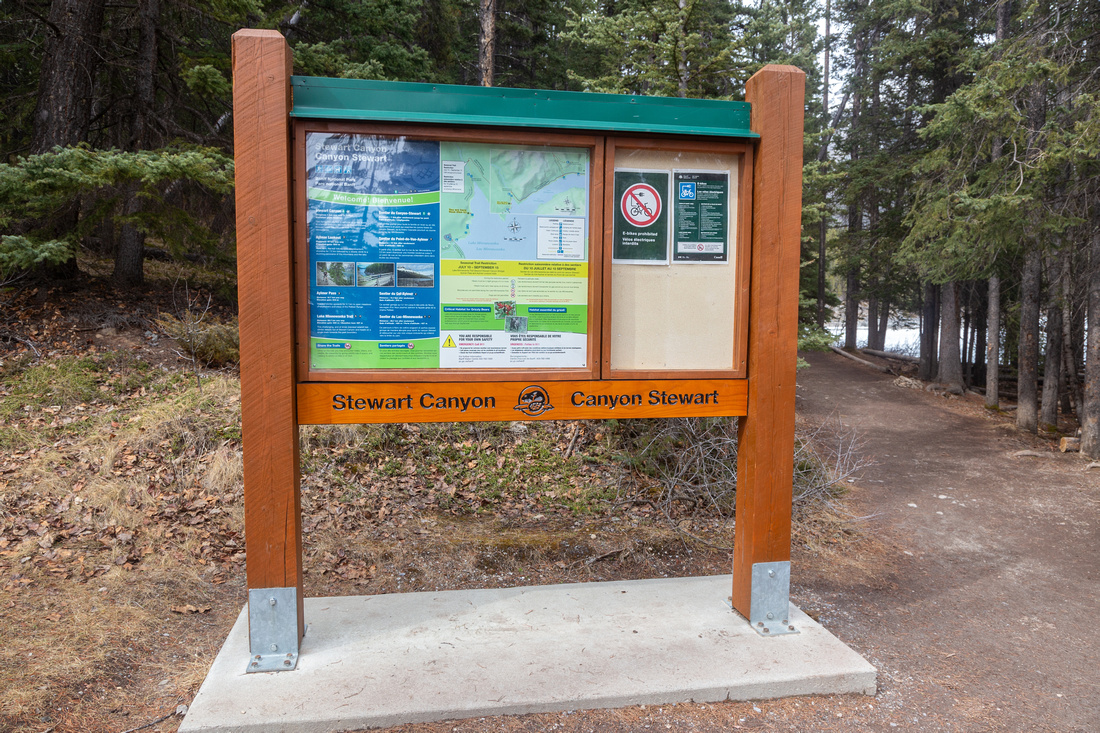
 Stewart Canyon Junction
Few minutes above Cascade River bridge trail splits: left for Stewart Canyon, right Minnewanka Shoreline (out of picture) Stewart Canyon Junction
Few minutes above Cascade River bridge trail splits: left for Stewart Canyon, right Minnewanka Shoreline (out of picture) |
|||
 Stewart Canyon
One of several open viewpoints as trail traverses Stewart Canyon east bank Stewart Canyon
One of several open viewpoints as trail traverses Stewart Canyon east bank |
|||
 Astley Drainage
Usual end of Stewart Canyon Trail above Astley drainage. Brief but steep descent into the drainage can be awkward when icy Astley Drainage
Usual end of Stewart Canyon Trail above Astley drainage. Brief but steep descent into the drainage can be awkward when icy |
|||
 Upper Steward Canyon
Rough trail does continue on the other side of Astley drainage, but eventually completely disintegrates - not worth the effort Upper Steward Canyon
Rough trail does continue on the other side of Astley drainage, but eventually completely disintegrates - not worth the effort |
|||
 Minnewanka Rainbow
Rainbow over Mt. Inglismaldie from Minnewanka shoreline on return Minnewanka Rainbow
Rainbow over Mt. Inglismaldie from Minnewanka shoreline on return |

Abstract
| Overall Difficulty | D1/2 | Generally easy trail walking with couple of moderately steep but short parts. Rough descent into Astley drainage (optional) | |||
| Snow Factor | S2 | Possible icy sections in shoulder season | |||
| Scenery | Lake Minnewanka, Cascade River and Stewart Canyon | ||||
| Trail/Marking | Excellent | Official Parks Canada Trail with signed junctions | |||
| Suggested Time | 2-3 hrs | Return time to Astley drainage with casual pace. Longer if exploring upper Stewart Canyon | |||
| Elevation |
Start: 1490m Max: 1520m Total: ~110m |
Round Trip: ~6km (Astley Drainage) |
|||
| Gear | Running shoes or day hikers. Hiking poles, Micro-spikes can be very helpful when trail is icy in shoulder season | ||||
| Water | Very short trip; water seasonably available in Astley drainage at end of trail. Carry 0.5L | ||||
| Dog Friendly | Yes | Busy trail - keep dogs on leash. | |||
 Stewart Canyon GAIA Map
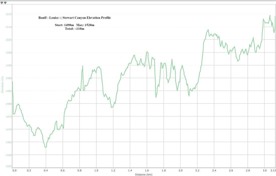 Stewart Canyon Elevation Profile