Google Map |
Rockies :: Banff-Louise :: Plain of Six Glaciers |
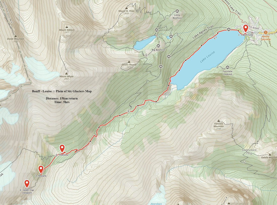
GPS Track |
|
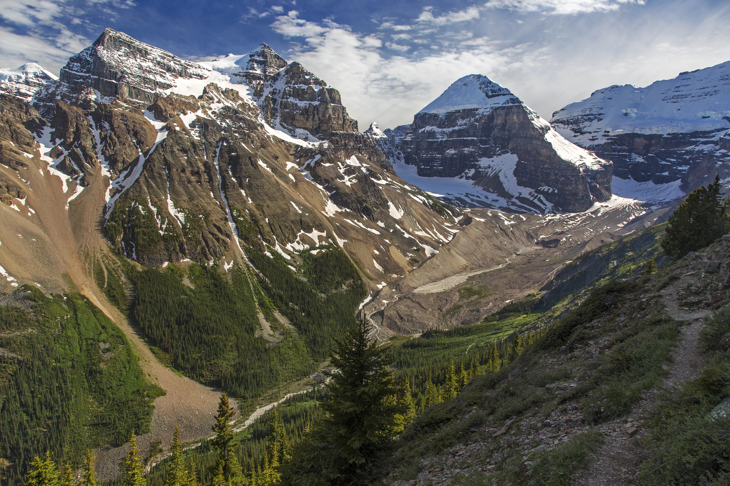
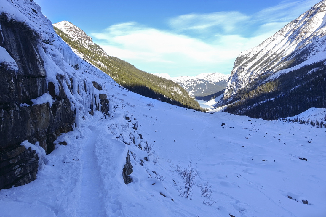
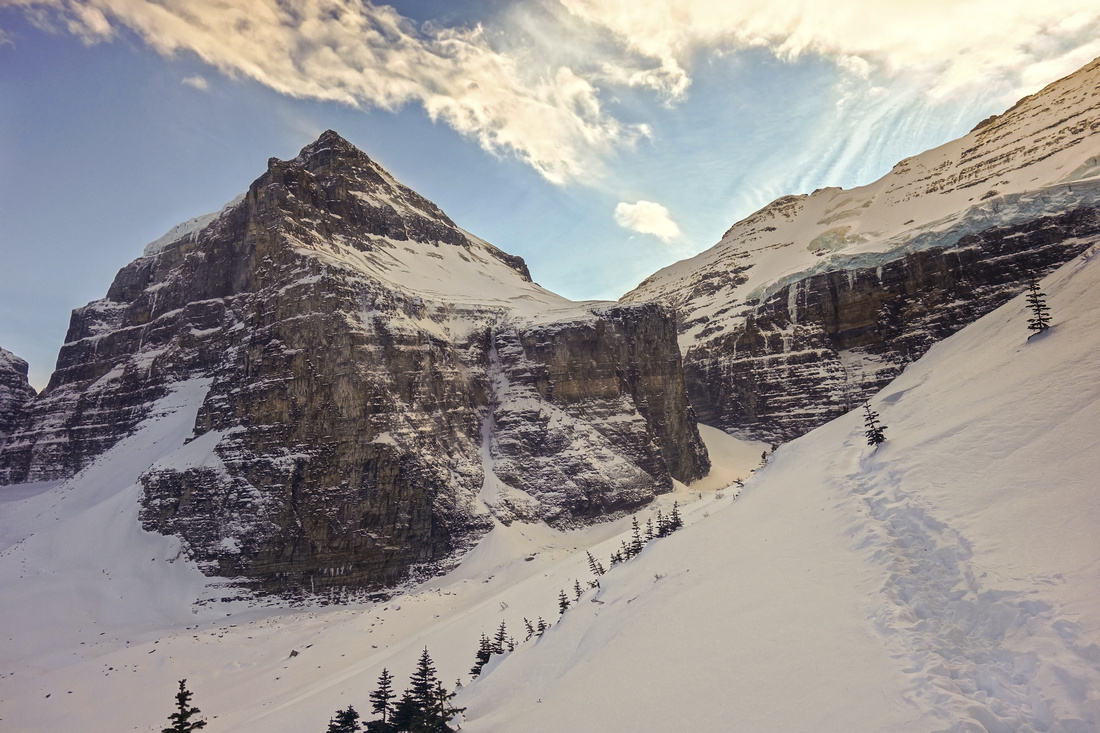
Plain of Six Glaciers from Devil's Thumb scramble route. Main trail follows valley bottom |
|||
| Trip Summary | |||
Multiple Dates, last Nov 11, 2022
Plain of Six Glaciers is prime Canadian Rockies hiking. Doable year-round it leads deep into awe inspiring glacial landscape below Mounts Lefroy and Victoria. Trail is also one of most popular, and in summer solitude is next to impossible to find. Ultra busy Lake Louise shoreline at start and commercial Teahouse at the end add to overall tourist feel. Lots of seasoned Rockies hikers dismiss it for these 2 reasons. Yet, I find this unfair. Scenery is simply spectacular, any time of the year. For newcomers to Canadian Rockies I highly recommend it. And for veterans advice: Pick the right time to go. I enjoy mountain solitude to extreme, and I've been finding it in Plain of Six Glaciers in off season regularly. Mid November is my favorite time to go. Lake Louise still not frozen, autumn snow does not present avalanche danger and you can usually have it to yourself, at least in mid-week.
Follow Lake Louise shoreline trail, past the climbing area at far end (~2km from start) then continue up gaining some elevation past couple of signed junctions that link with Beehive/Agnes highline trail. About 30 min before teahouse, as views fully open up, is the "crux" -- 45-50m ledge that is not particularly narrow, but can be tricky without proper footwear when icy. Beyond trail splits - horses left, humans right. Why horses? Because this is how they bring supplies to Teahouse! Seasonally opened till mid-September it is touristy, but quite rustic and I've been enjoying my lunch breaks at deserted verandah there regularly during November trips. Past Teahouse trail leads in ~10min to start of terminal moraine below Popes peak. This bit can be quite sketchy in winter and avalanche prone. Eventually you end up at superb viewpoint of Abbott Pass and infamous "Death Trap" -- glaciated gully with severe Icefall. Some mountaineers still travel that way, but normal route is via Fuhrmann Ledges and Mount Lefroy slopes. This is also one of best traverses in Rockies, that links Lake Louise in Banff National Park and Lake O'Hara in Yoho National Park, with usual overnight stop at ACC managed Abbott Pass Hut. (Note: As of Nov '20, Abbott Pass Hut is closed due to slope erosion & it is unclear when it will be reopened).
With enough time and energy, optional return via highline Beehive/Lake Agnes connector is recommended. Turn north and up at signed junction just past the "crux" ledges". This extension will add ~300m vertical gain to days tally. Alternate full day option for best experience of the area is to hike in via Agnes/Beehives, scramble Devil's Thumb, then descend to Plain of Six Glaciers. 8-9 hours for this one, moderate pace, summer only.
|
|
Gallery |
|||
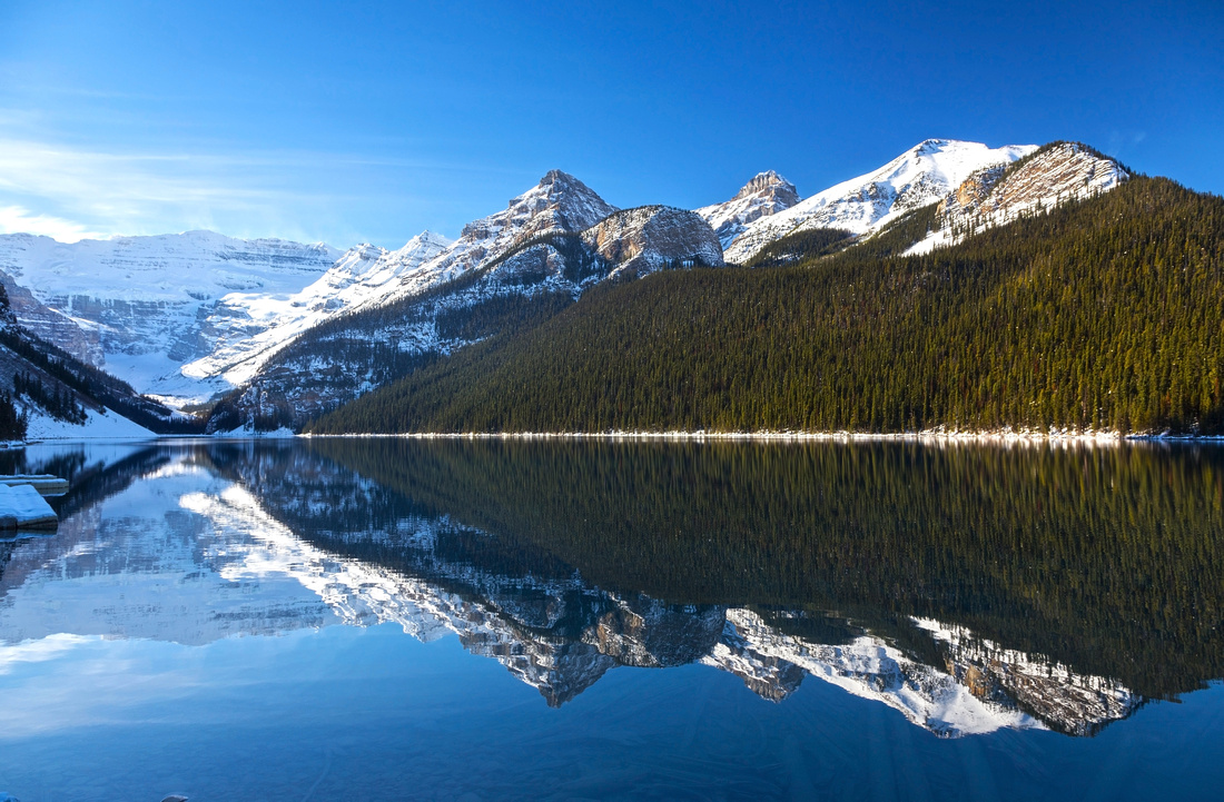 Lake Louise Panorama Lake Louise Panorama Panoramic view across Lake Louise in early November. Top of Plain of Six Glaciers beneath Mount Victoria far left
 |
|||
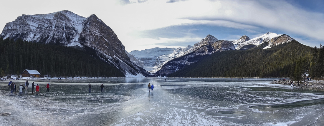 Lake Louise Ice Skating
Ice Skating on Lake Louise in November. There is about a week every year when you get this kind of conditions, and it is pretty magical: Transparent Frozen Lake with no snow Lake Louise Ice Skating
Ice Skating on Lake Louise in November. There is about a week every year when you get this kind of conditions, and it is pretty magical: Transparent Frozen Lake with no snow |
|||
 Mount Fairview
Towering Mount Fairview at south side of snow covered Lake Louise in late November Mount Fairview
Towering Mount Fairview at south side of snow covered Lake Louise in late November |
|||
|
|||
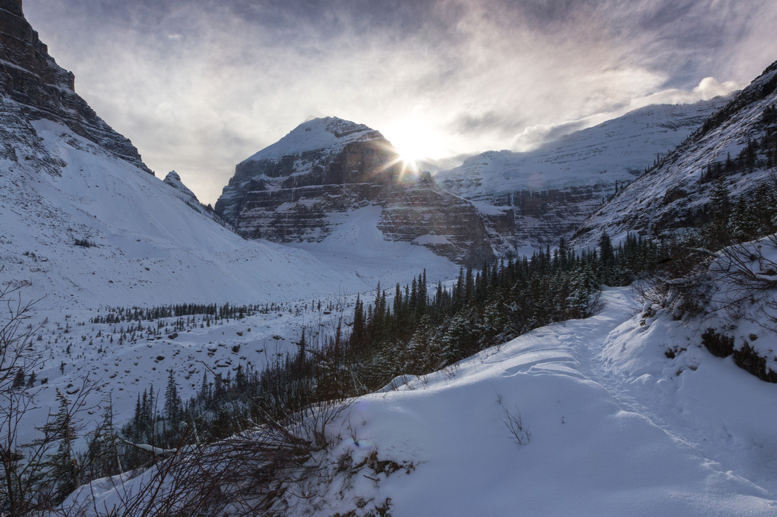 Plain of Six Glaciers Trail
Mid part of Plain of Six Glaciers trail with sun dropping behind Mount Lefroy Plain of Six Glaciers Trail
Mid part of Plain of Six Glaciers trail with sun dropping behind Mount Lefroy |
|||
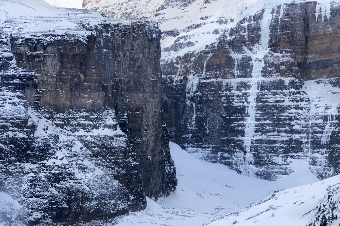
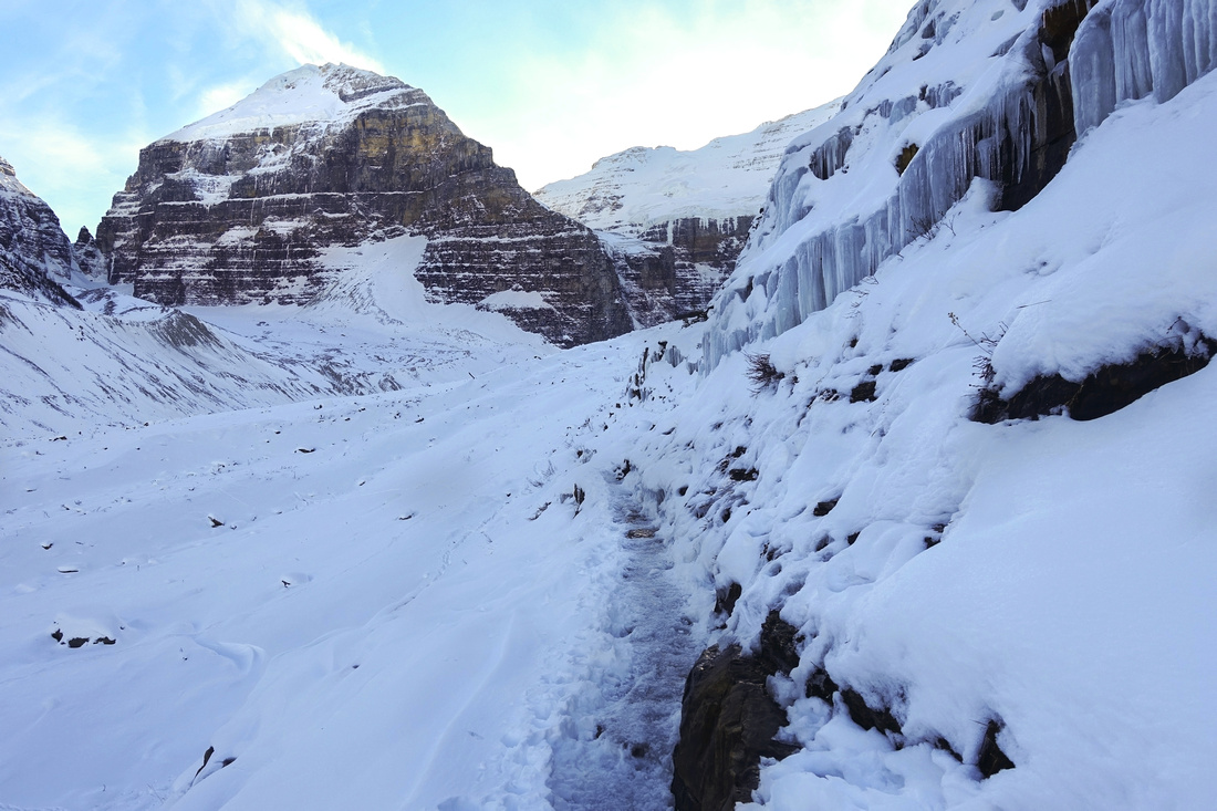 Icy Ledge
Icy and reasonably narrow ledge ~30 min before Teahouse on early November 2020 trip. I was forced to put micro-spikes here. In early spring this exposed slope has avalanche potential Icy Ledge
Icy and reasonably narrow ledge ~30 min before Teahouse on early November 2020 trip. I was forced to put micro-spikes here. In early spring this exposed slope has avalanche potential |
|||
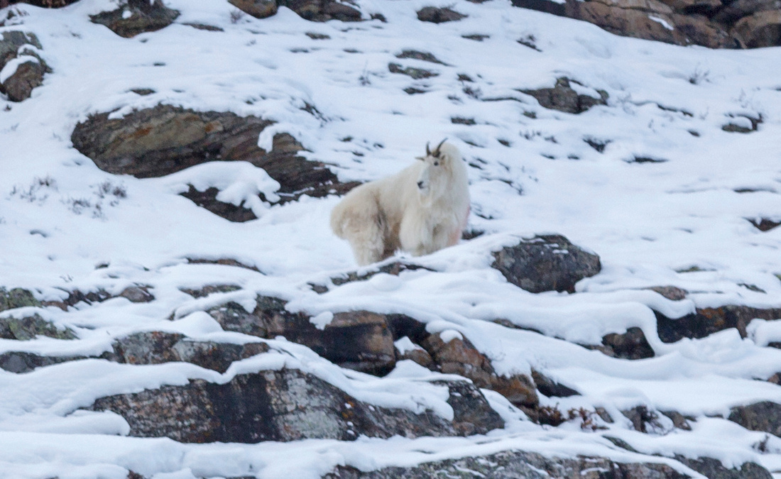 Billy Goat
White Mountain Goats frequent north side rocky slopes Billy Goat
White Mountain Goats frequent north side rocky slopes |
|||
 Icy Ledge
View back after crossing Icy Ledge, Crux in winter conditions, with Lake Louise just right of center Icy Ledge
View back after crossing Icy Ledge, Crux in winter conditions, with Lake Louise just right of center |
|||
|
|||
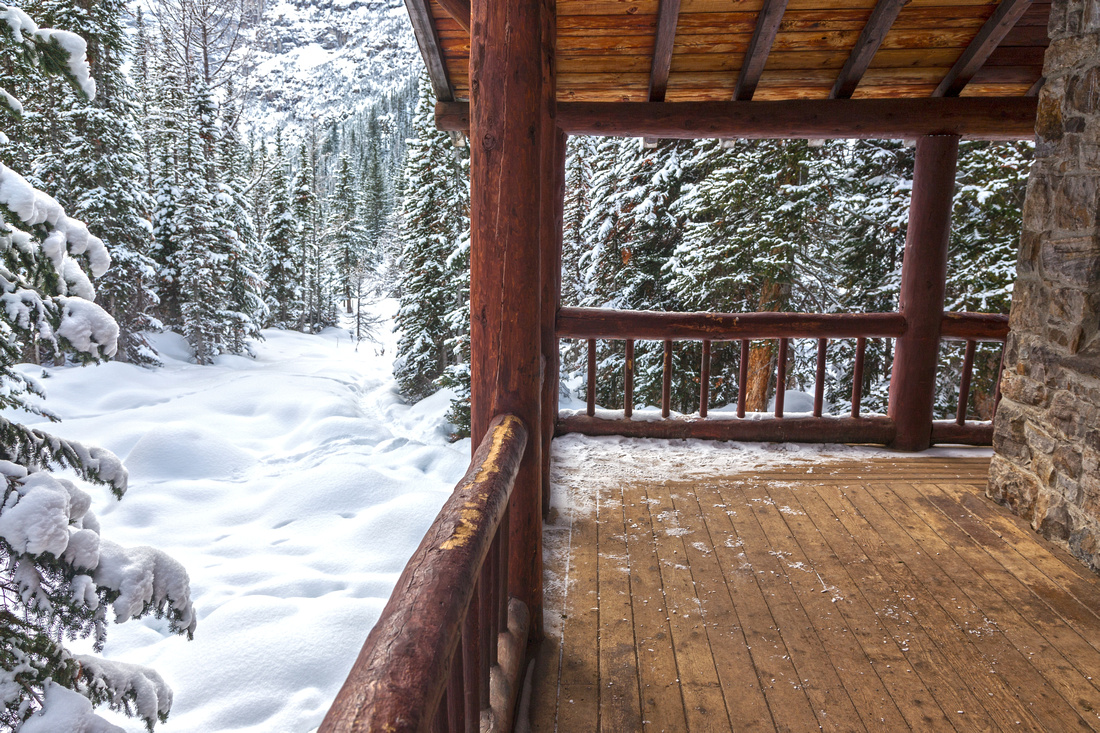 Teahouse Porch
Plain of Six Glaciers Teahouse Verandah deserted after mid-September closure Teahouse Porch
Plain of Six Glaciers Teahouse Verandah deserted after mid-September closure |
|||
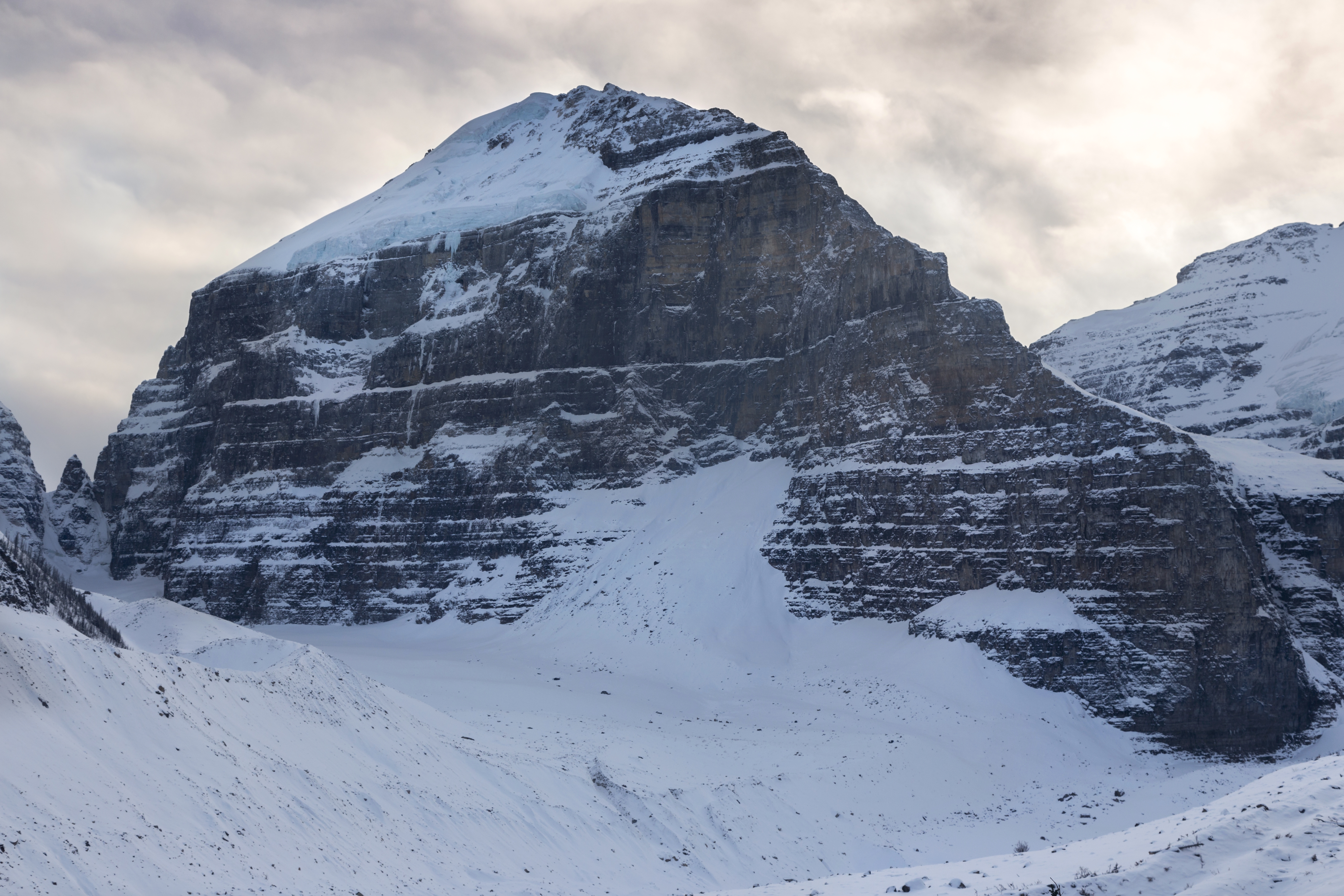
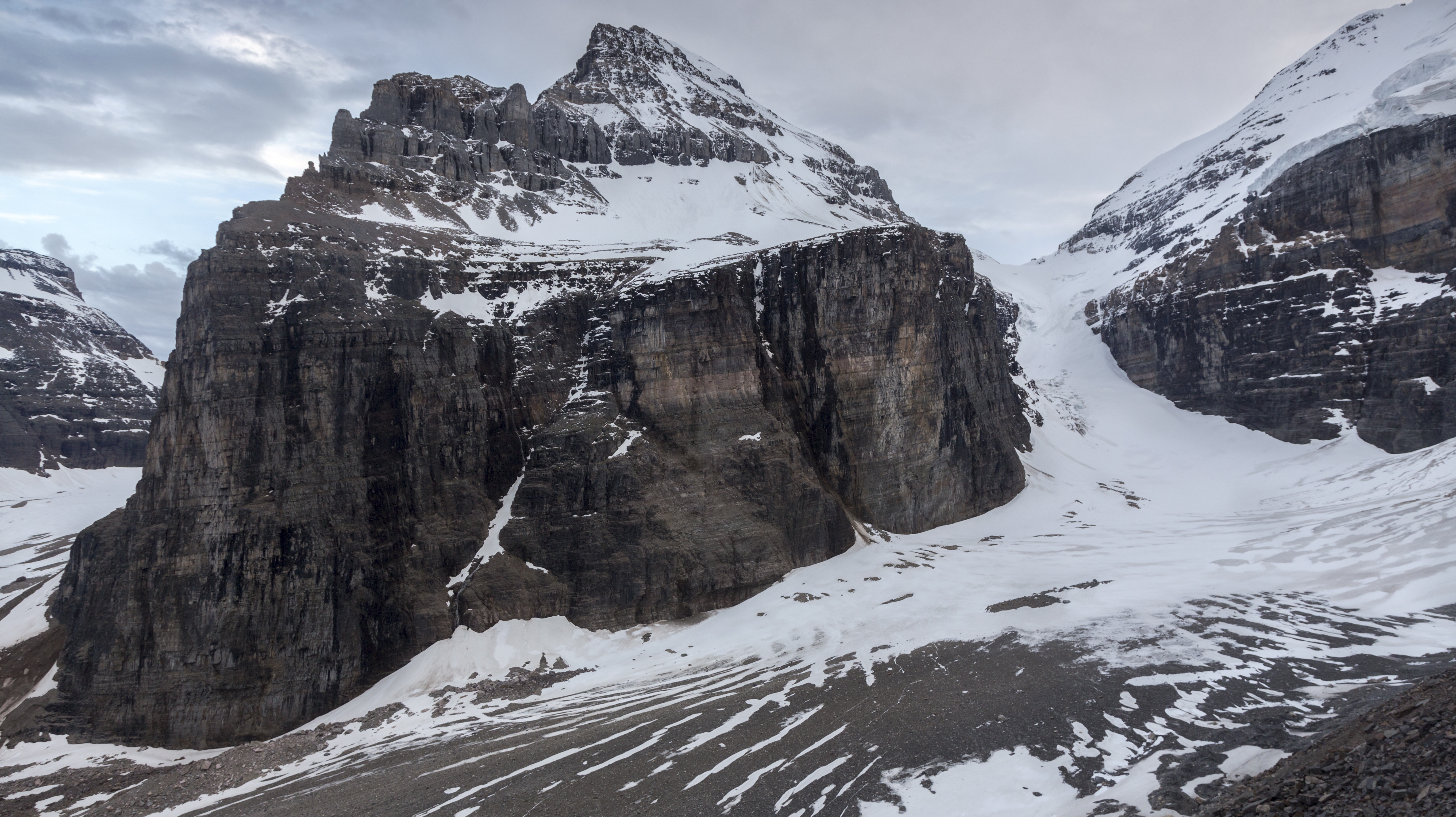
 Top of Plain of Six Glaciers Telephoto as trail reaches moraine ~1km past the Teahouses. It might not be safe to continue beyond here in winter conditions (avalanche danger)
 |
|||
 Breaking Trail in sketchy conditions -- not recommended without proper gear and experience
 |
|||
|
|||
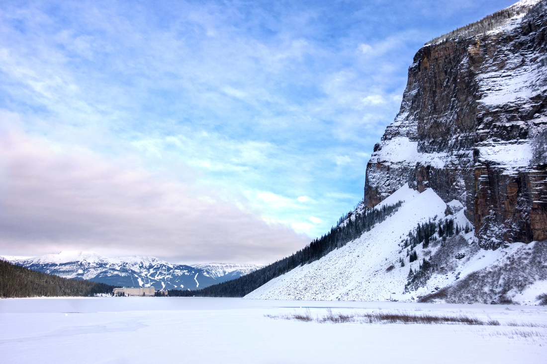
 Canoe rental cabin in almost surreal winter conditions on return back to Lake Louise
 |
Abstract
| Overall Difficulty | D3 | Established trail hiking with some moderately steep sections and one narrow, but brief ledge. Open talus slopes for Abbott Pass viewpoint past Teahouse (not safe in winter). Crux might be dodging all the tourists at Lake Louise shore | |||
| Snow Factor | S3 | Trail usually compact in winter & might not require snowshoes. Avalanche danger in spring from steep north side below Mt. Whyte. Continuing past Teahouse not recommended in winter for hikers | |||
| Scenery | Glaciers, Lakes and Mountains - Canadian Rockies at their best. Alternate, non-tourist perspective of Lake Louise. In-your-face Mount Lefroy, Mount Victoria and Death Trap/Abbot Pass | ||||
| Trail/Marking | Excellent | Wide tourist path around Lake Louise followed by maintained trail to Plain of Six Glaciers Teahouse with signed junctions. More difficult for Abbott Pass viewpoint, but still straightforward in summer conditions. | |||
| Suggested Time | 5 hr | Relaxed pace with photo breaks including Abbott Pass Viewpoint | |||
| Elevation | Start: 1770m Max: 2220 m Total: ~500 m |
Round Trip: ~15 km |
|||
| Gear | Day Hikers or Full Hiking boots in summer. Micro-spikes highly recommended in winter (slippery and/or icy conditions). Snowshoes usually not necessary. | ||||
| Water | Inflow at far end of Lake Louise and seasonal drainages below Mt. Whyte. Plain of Six Glaciers Teahouse (commercial). Carry 1L | ||||
| Dog Friendly | Yes | Please consider not bringing your dog in summer conditions as this is very popular and often quite congested area | |||
 Plain of Six Glaciers GAIA Map
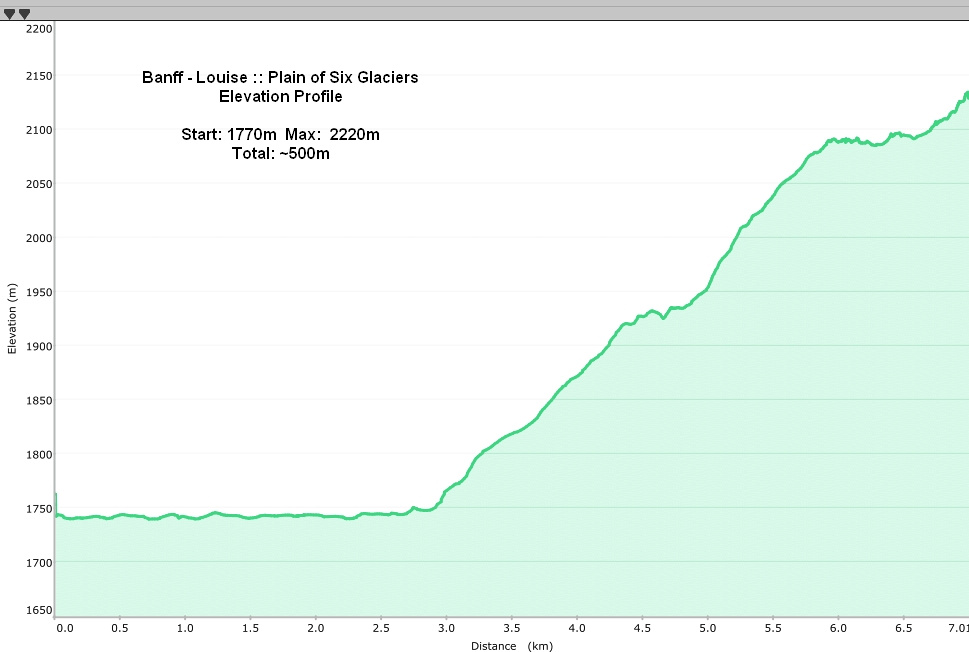 Plain of Six Glaciers Elevation Profile