Google Map |
Rockies :: Banff-Louise :: Devil's Thumb |
GPS Track |
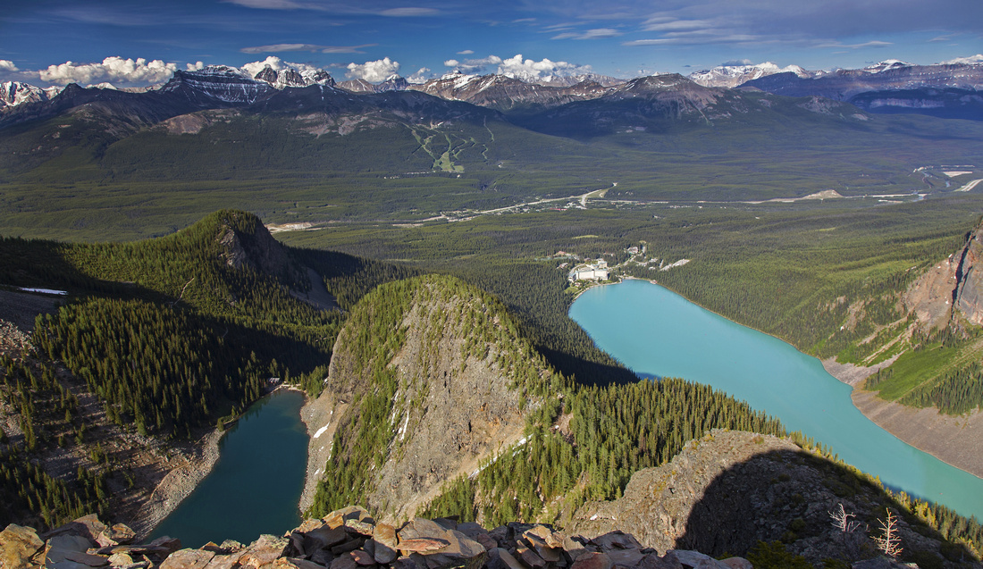 
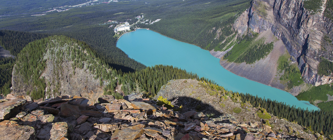
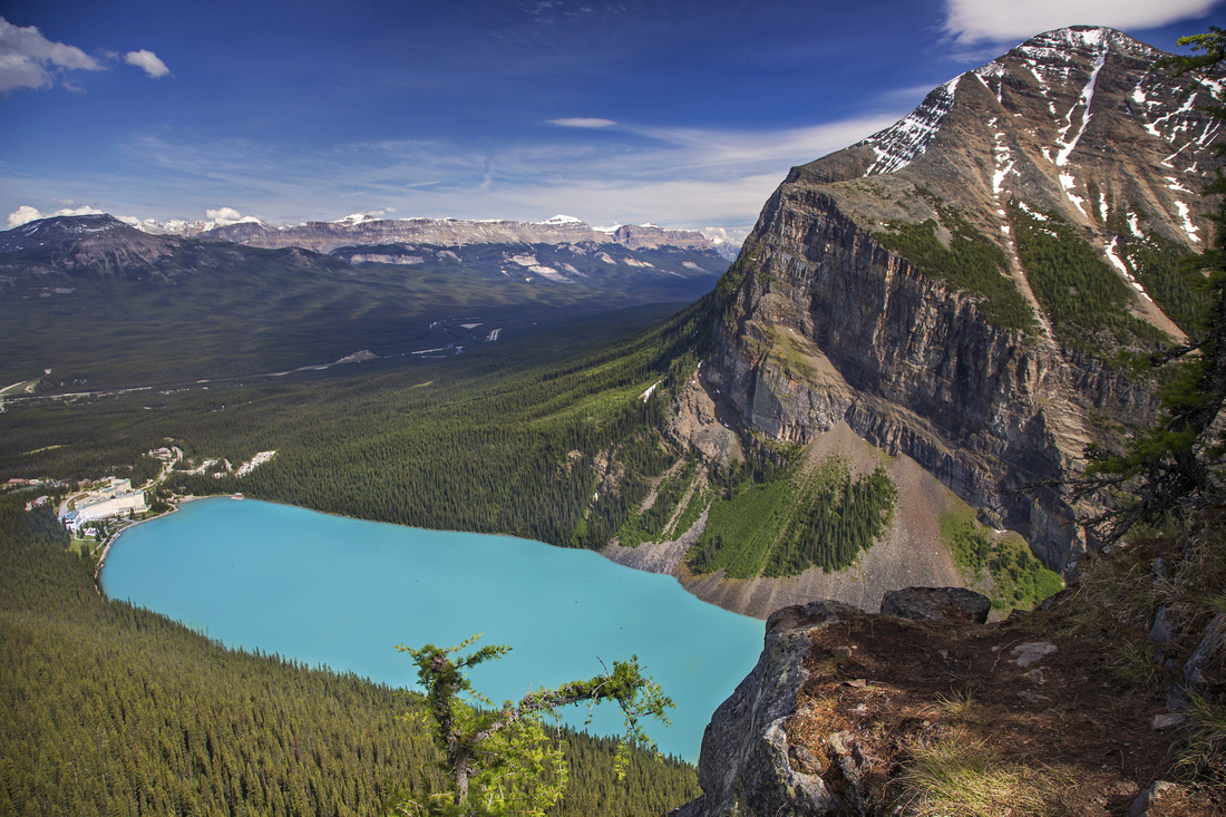
Devil's Thumb summit view. Lake Agnes left, Lake Louise right, big Beehive in between. Louise ski-area and peaks of Skoki group in the distance |
|||
| Trip Summary | |||
June 20, 2016
Devil's Thumb is possibly the most scenic trip in Lake Louise area. Summit is just a bump on Mt. Whyte east ridge, but it hosts one of most spectacular views found in Banff National Park. Pre-requisite is fighting for elbow space on ultra-busy tourist trail to Lake Agnes, but once past the teahouse crowds thin considerably while scenic part is just about to begin! Trail past Big Beehive junction is also sometimes used by climbers as access to Perren route on Mt. Whyte (5.6). This is prime fall season trip when larches start to shed their needles and form golden carpet in vicinity of Lake Agnes. Loop return by descending to Plain of Six Glaciers trail is recommended option; for energetic hikers these two trips can even be combined for a most rewarding day out in Louise area.
Hike signed Lake Agnes trail starting from Lake Louise just past the Chateau on north side, passing pretty Tower Lake along the way. Teahouse is reached in about 45 minutes of moderate pace. Trail circles around the lake on north side, then switchbacks to the junction at low col between Devils' Thumb and Big Beehive. Views towards Mt. Niblock (moderate Kane scramble) from this slope are phenomenal! Visit to Big Beehive is recommended and short extension; good trail leads to gazebo in about 10 minutes and hosts spectacular views of Lake Louise and Mt. Fairview across the valley. Back at the col continue to the other side towards Devil's Thumb. There is usually large log across the trail indicating this is the "wrong way" -- but this is for casual hikers bound for Plain of Six Glaciers. Crux is nearby -- couple of easy rock steps you might not even need your hands for. Trail then moves left and traverses south slopes below Devil's Thumb. Views of Plain of Six Glaciers are simply magnificent from here; you can also spot the official trail heading up the valley towards Victoria glacier. Steep avalanche slope is the ascended towards saddle between Mt. Whyte and Devil's Thumb. It is fairly steep and hiking poles are an asset, specially on descent. In winter it could be very dangerous; this is main reason why this is summer trip. At the saddle turn right and ascend broken ground towards the wide summit plateau, keeping right at one potentially problematic spot.
After enjoying summit views with most striking feature being contrast in color between Lake Agnes and Lake Louise, retrace your steps back to Big Beehive junction. Turn right for optional return via Plain of Six Glaciers. About half an hour of steady descent on forest enclosed switchbacks brings you to marked Tower Lake junction where you can turn left and reconnect with Lake Agnes trail. Keeping right is better option, as forest soon opens up and you have very enjoyable views towards Mt. Aberdeen and Mt. Lefroy. Upon exiting on Plain of Six Glaciers turn left and hike out (~5km and 1 hour to Louise Chateau) |
|
Gallery |
|||
 Devil's Thumb from trail on north side of Lake Agnes
 |
|||
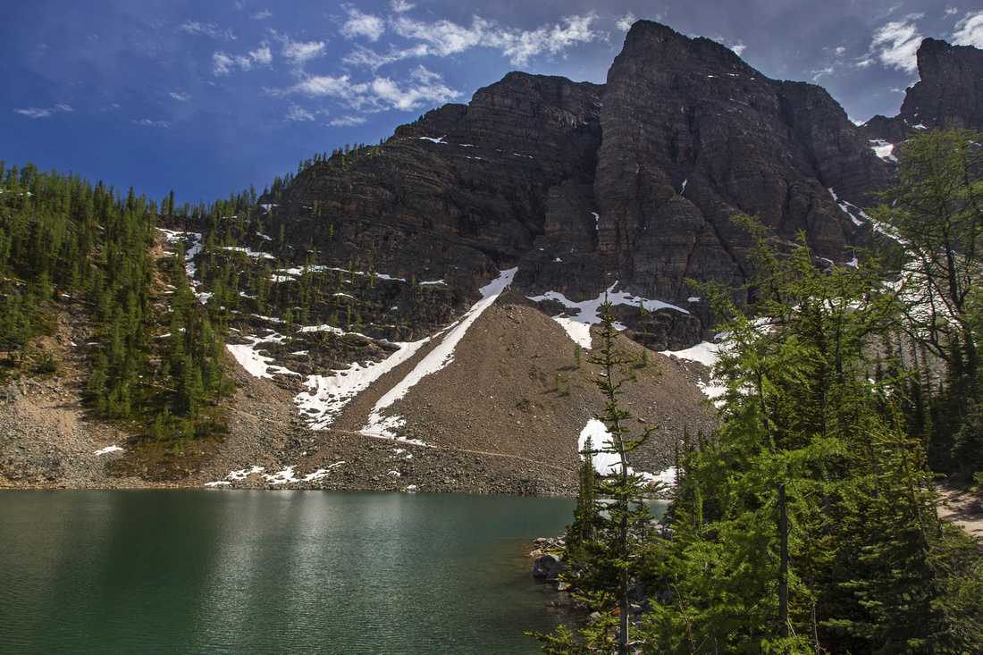
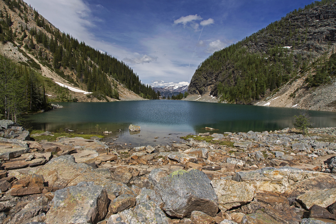 View back from west end of Lake Agnes
 |
|||
|
|
|||
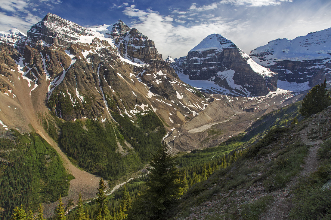 Plain of Six Glaciers from south slopes of Mt. Whyte
 |
|||
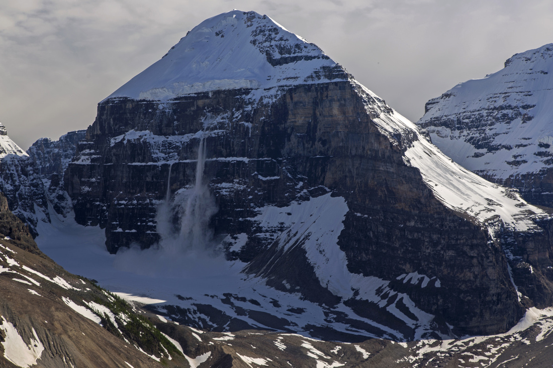 Avalanche on Mt. Lefroy. Fuhrmann Ledges center right
 |
|||
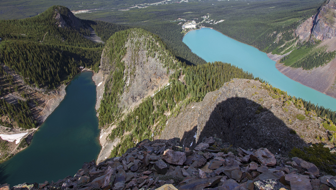 Classic summit view of Lake Agnes (L) and Lake Louise (R)
 |
|||
 Closer look at Lake Louise from the summit. Big Beehive left
 |
|||
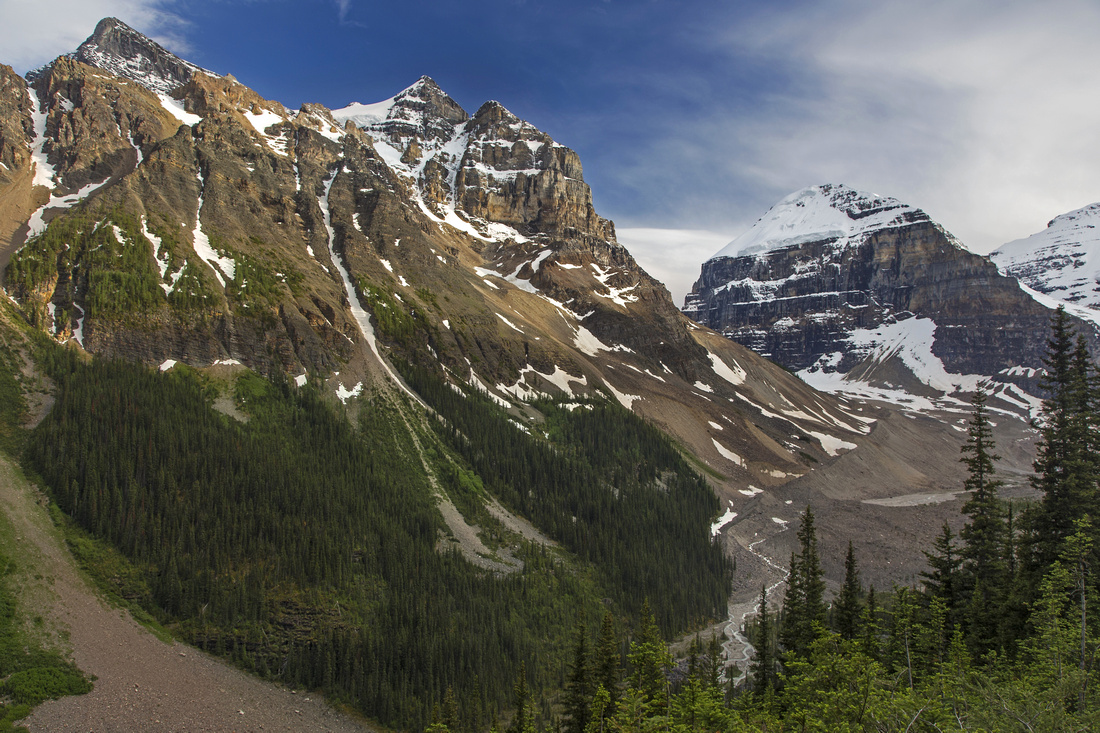 Mt. Aberdeen and Lefroy on descent to Plain of Six Glaciers
 |
Abstract
| Overall Difficulty | D4 | One brief class 2 rock step. Steep talus/dirt slope and some boulder hoping. Much trail hiking | |||
| Snow Factor | S5 | Steep avalanche slopes below Mt. Whyte; winter ascent is not recommended | |||
| Scenery | Outstanding views of many Louise giants. Bird-eye view of Plain of Six Glaciers. Very unique view of Lake Agnes and Lake Louise from the summit | ||||
| Trail/Marking | Very Good | Official Park trail with signposts to the col below Big Beehive followed by narrow, but distinct trail on south slopes of Mt. Whyte. | |||
| Suggested Time | 5-6 hr | Return time including visit to Big Beehive. Add ~1 hour if making a loop via Plain of Six Glaciers | |||
| Elevation | Start: 1740m Max: 2470 m Total: ~820 m | Round Trip: ~15 km (add couple of km's if returning via Plain of Six Glaciers) | |||
| Gear | Hiking poles helpful for stability on descent of steep talus slope below Devil's Thumb | ||||
| Water | Several streams in vicinity of Lake Agnes. Carry 1 - 1.5L | ||||
| Dog Friendly | Yes | Trail to Lake Agnes / Big Beehive is very busy -- please keep pet on leash and under control. | |||
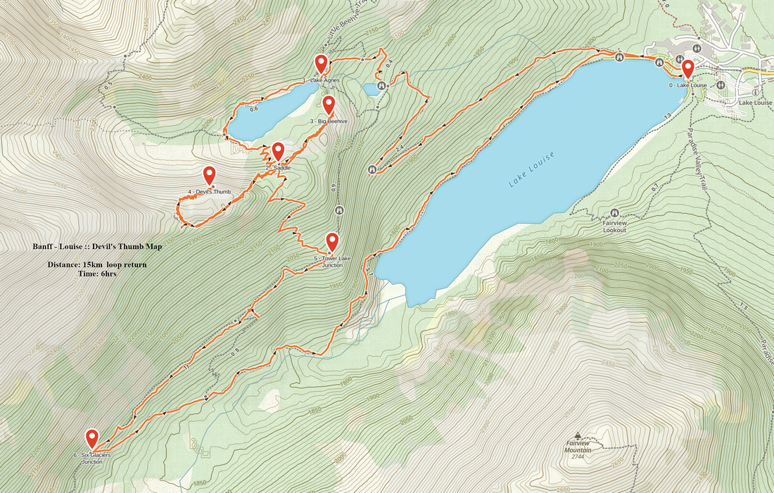 Devils Thumb GAIA Map
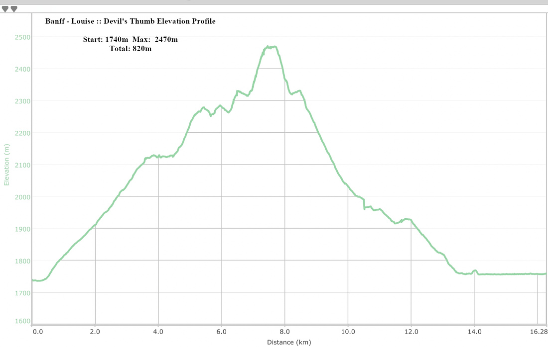 Devils Thumb Elevation Profile