Google Map |
Rockies :: Alberta Foothills :: Prairie Mountain |
GPS Track |
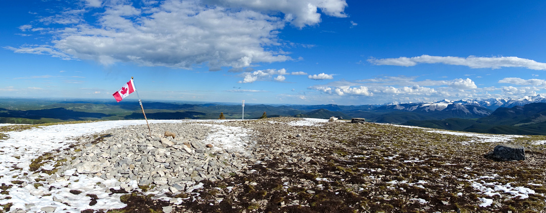 
Iconic Canadian Flag at 2210m rounded Prairie Mtn summit with view of distant Foothills and Snowy Elbow area Peaks |
|||
| Trip Summary | |||
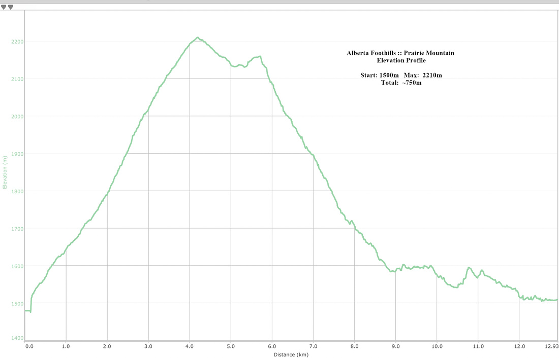
Jun 20, 2024Prairie Mountain is Calgary equivalent of Vancouver Grouse Grind. Accessible and as such always busy with popularity really taking off in Covid era and never letting off. Badly eroded normal trail caused Alberta Parks to close the area in summer '23 in order to perform upgrades. Result is wide and rather unappealing bulldozed track to treeline. Biggest appeal to most Prairie hikers is fitness exercise - 650m vertical over ~4km (slightly less compared to GG 840m over 2.4km). I've heard of people doing multiple laps any time of year. All this urban gong show might create an impression that Prairie Mtn should be avoided, but rounded 2210m summit area is still fantastic Foothills viewpoint and as such worth the effort - at least once. Real reward lies in Prairie North Ridge leading to north end above Canyon Creek, a fantastic Moose Mountain viewpoint. South side loop return via Prairie Creek as presented on this page offering much more solitude and real hiking feel is highly recommended.
Signed Trailhead is opposite Elbow Falls rec area on Hwy66 (first photo in Gallery). There are always many cars on shoulder here creating a jam -park at wide Elbow Falls lot instead and simply walk back. Hwy 66 is closed in winter, so leave car at seasonal gate and walk over. It will take ~1.5hrs of normal pace to Prairie summit cairn with iconic Canadian Flag. After quickly snapping few photos I continued down north ridge and enjoyed fantastic views in total solitude. South side descent junction is bit tricky to identify from the ridge - use GPS download Top of Page, Waypoint ("3, 5 - South Descent"), but good trail develops at Treeline and is easy to follow all the way down to Prairie Creek where you turn left. Hike out back to Elbow Trail feels a bit roundabout with some ups/downs, but is more scenic than likely expected. Expect ~5hrs RT for this recommended Prairie loop, best done in CCW direction. |
|
Gallery |
|||
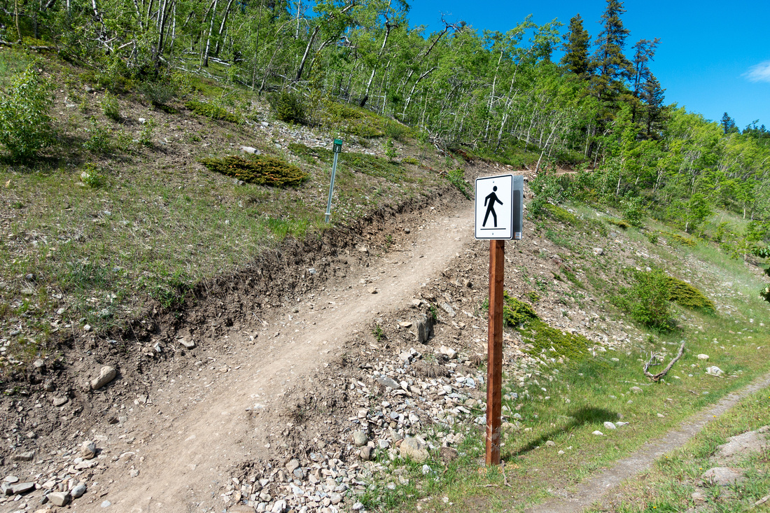 Elbow Trailhead Elbow Trailhead Signed Trailhead at west side of Elbow Trail, opposite Elbow Falls
 |
|||
 Bulldozed Track Bulldozed Track Wide, bulldozed track after Alberta Parks '23 trail upgrades ascending forested slopes
 |
|||
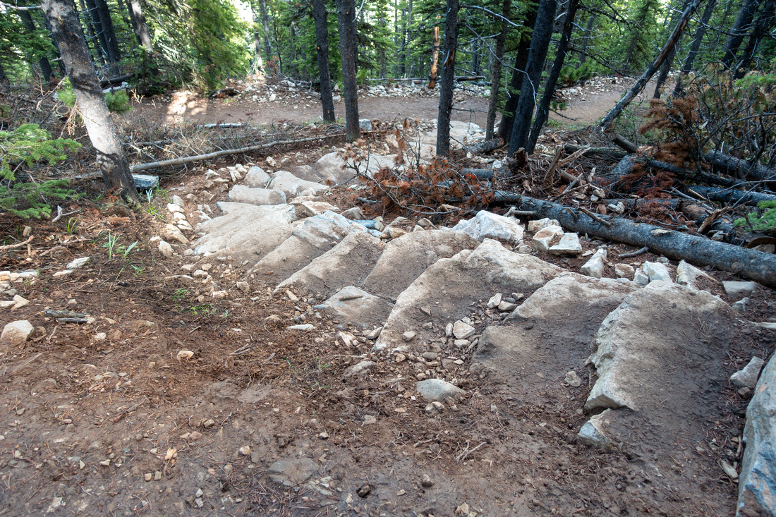 Stone Stairs Stone Stairs Lawrence Grassi style Stone stairs bridging eroded switchback shortcuts
 |
|||
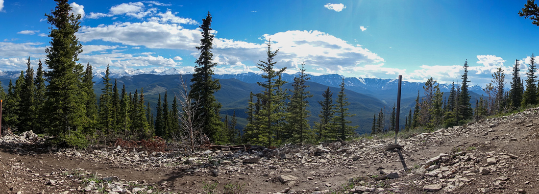 Elbow Panorama Elbow Panorama One of several clearings with rock chairs near treeline and panoramic views to Elbow area peaks
 |
|||
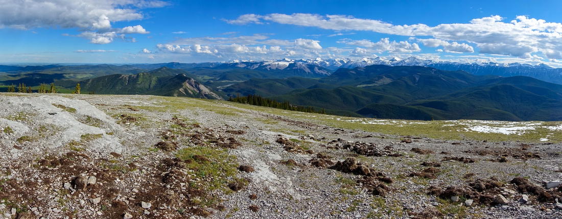
 Foothills Panorama Foothills Panorama View down summit ridge with green Prairies and Foothills Peaks
 |
|||
 Prairie Summit Prairie Summit Wide Prairie Mountain Summit with Trail Sign and Iconic Canadian Flag ~4km and ~650m vertical from Elbow Trailhead
 |
|||
 Bear Diggings Bear Diggings Many bear diggings on south side below Prairie summit in June '24 - despite ultra popularity you imagine would drive wildlife away
 |
|||
 |
|||
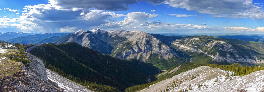 Moose Panorama Moose Panorama North side Panorama from Prairie summit. Snow covered Moose Mtn just left of center
 |
|||
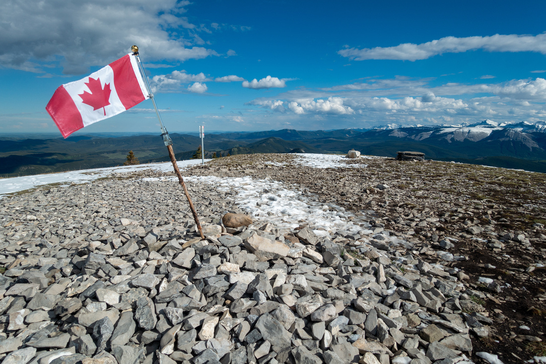 Prairie Flag Prairie Flag Canadian Flag, almost synonym with Prairie Mtn Summit - I believe it will always be here
 |
|||
 North Ridge North Ridge Terrific hiking descending beautiful north ridge to Moose Mtn viewpoint. Easily the most scenic part of entire trip, yet majority of urban social media hikers obsessed with selfies never see it
 |
|||
 North Ridge Viewpoint North Ridge Viewpoint North ridge turnaround point ~15-20min from Prairie summit. It is likely possible to drop to Canyon Creek this way, but no trail. Moose Mountain across
 |
|||
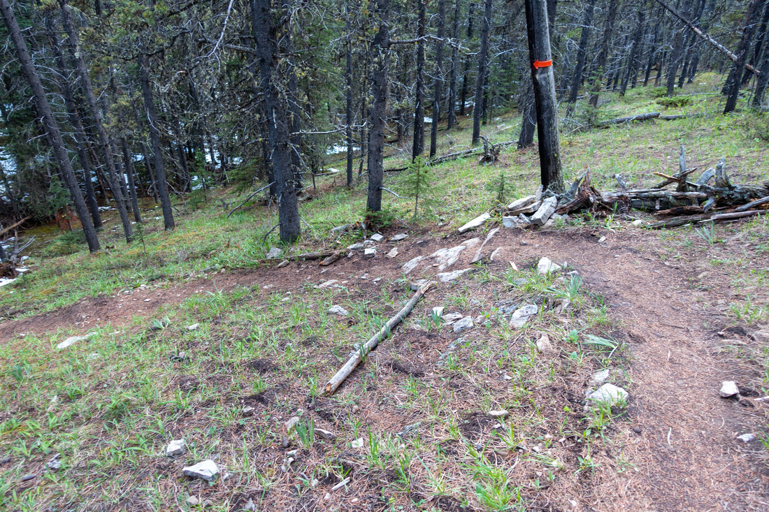 Canyon Creek Descent Canyon Creek Descent Well defined forest trail descending slopes to Prairie Creek. Note orange arrow
 |
|||
 Prairie Meadow Prairie Meadow South side descent crossing beautiful meadow just before Prairie Creek junction. Orange square marks point where trail enters the forest (out of picture)
 |
|||
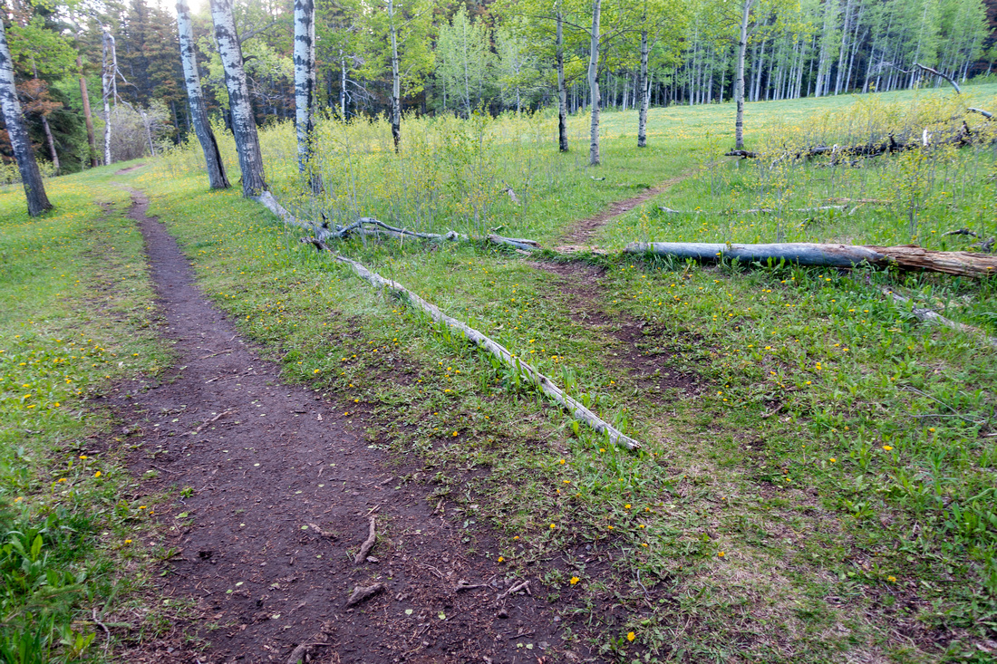 Prairie Creek Trail Prairie Creek Trail Prairie Creek junction looking back. If doing the loop clockwise this spot is not signed and easy to miss - use GPS download Top of Page (Waypoint "6 - Prairie Creek")
 |
|||
 White Buddha White Buddha Sunlit Vents Ridge while hiking back Prairie Creek back to Elbow Trail
 |
Abstract
| Overall Difficulty | D3 | Moderately steep but well graded switchbacks below treeline | |||
| Snow Factor | S2 | Compact trail throughout the winter. Possible icy sections. Summit ridge windblown with possible east side cornice. Postholing on Prairie Creek loop descent, but no avalanche danger | |||
| Scenery | Sweeping scenery of front ranges and foothills. Great view of Moose Mountain. Rather pretty Prairie Creek on alternate loop descent | ||||
| Trail/Marking | Very Good | Wide Alberta Parks maintained trail with signposts. South side loop descent well defined. Prairie Creek junction not signed | |||
| Suggested Time | 3-5 hrs | East side OnB 2-3 hrs return only; add 1-2 hrs for Prairie Ridge / Prairie Creek loop | |||
| Elevation | Start: 1500m Max: 2210m Total: ~750m (Prairie Creek loop) | Round Trip: ~13km (Prairie Ridge / Creek loop) | |||
| Gear | Full boots preferred to day hikers. Micro spikes in winter / shoulder season. Wind breaker essential | ||||
| Water | Prairie creek on loop return, none on normal route. Carry 1-1.5L depending on season | ||||
| Dog Friendly | Yes | Very busy area - please keep dogs on leash for courtesy to other hikers. Standard back-country precautions for loop return | |||


