Google Map |
Rockies :: Alberta Foothills :: Nihahi Ridge |
GPS Track |
 
Panoramic view down Little Elbow corridor from South Summit of Nihahi Ridge with sea of snow covered Foothills Peaks on Skyline |
|||
| Trip Summary | |||
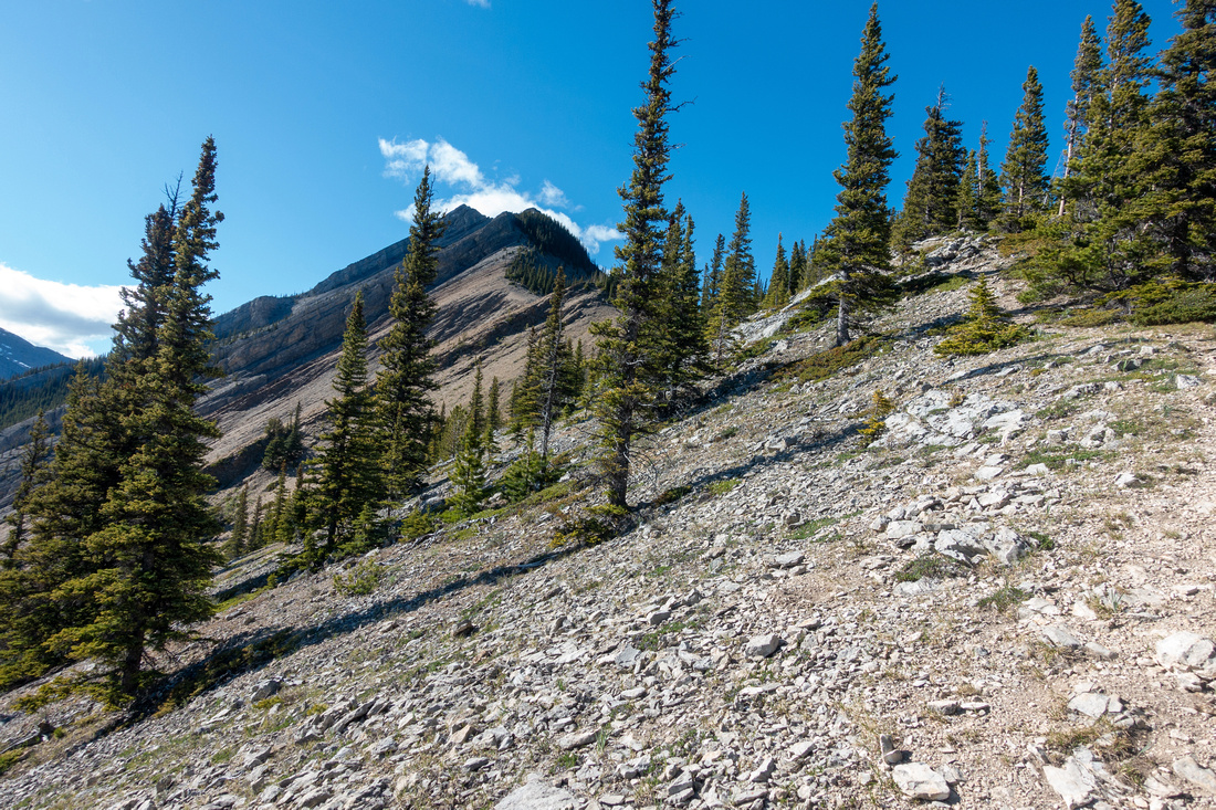
June 12, 2024Long, elegant ridge rising above Little Elbow Trail and stretching for several kilometers west of Powderface Trail Road. Traverse of entire ridge has been popularized by inclusion in Scrambles guidebook, but far better option is out-and-back trip to South Summit only. Regardless of target, this is fairly serious trip that should be attempted only by experienced hikers, comfortable with class 3 Rock and navigating narrow, exposed ridge crests. Good hiking trail that leads to talus bench below south shoulder is feasible year-round, but route above should be snow free. Fantastic views are more that adequate reward fo the effort. Bicycle, generally good idea for most trips in this area, reduces Nihahi Trailhead approach time. Note that Hwy66 (Elbow Trail) is seasonally closed Dec 1 - May 14 west of Elbow Falls, same as Powderface Trail Road.
Follow Little Elbow Trail starting from Large Hiker Parking Lot just past Forgetmenot Pond Recreation area. Without bicycle it is better to follow riverside trail instead of paved asphalt road passing through the Campground. From marked Nihahi Junction (see Gallery), well defined trail rises in moderately graded switchbacks, then traverses some open meadow before ascending lower ridge. If wind makes you uncomfortable here know it will get worse higher up & it might be good idea to return. Otherwise follow eroded, but well defined talus trails staying on right (east) side traversing cliffs below south shoulder. Crux is 5-6m low class 3 rock step up a gully; it is not too difficult, but should be snow free. After more traversing, Nihahi Ridge is gained by steep scramble to narrow and exposed South End. South Summit is within sight, but connecting part is fairly narrow and if windy can be dangerous. If that is the case, simply descend for break back to flat and sheltered South Shoulder above the crux before hiking out the same way.
Things to keep in mind if planning on traversing entire Ridge:
|
|
Gallery |
|||
 Elbow Trailhead
Little Elbow Recreation Area trailhead by large Parking lot Elbow Trailhead
Little Elbow Recreation Area trailhead by large Parking lot |
|||
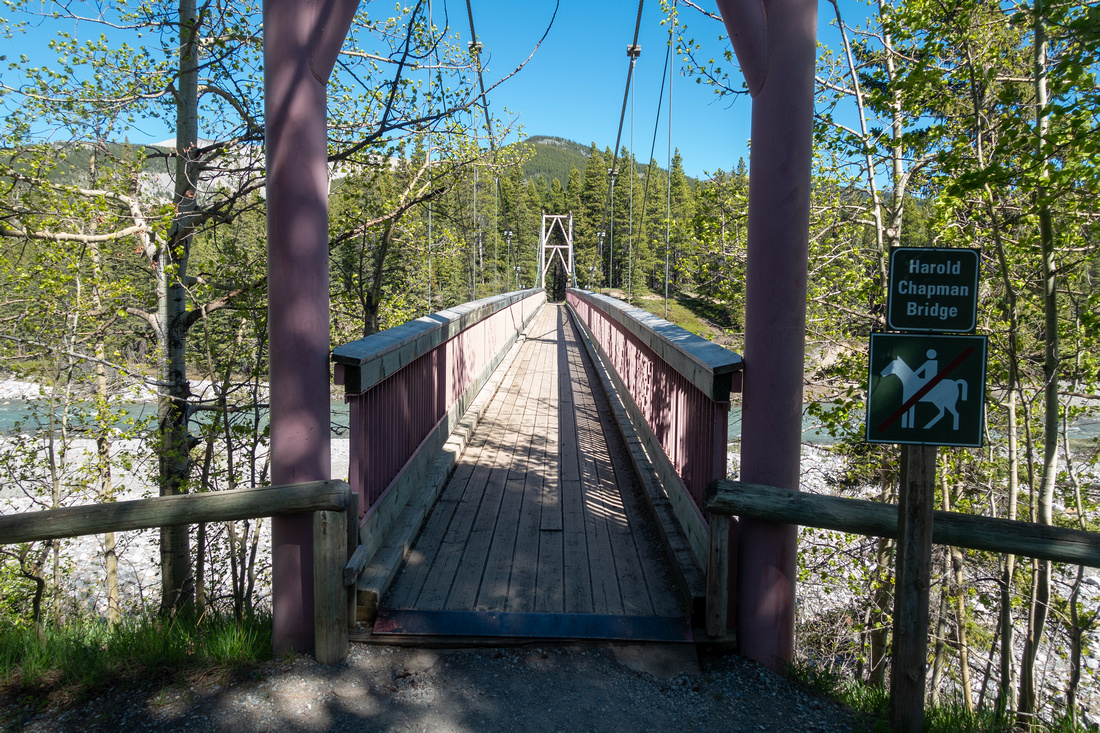 Elbow Bridge
Harold Chapman Suspension Bridge ~10min from the Parking. Big Elbow Trails across the bridge; for Nihahi stay on this side Elbow Bridge
Harold Chapman Suspension Bridge ~10min from the Parking. Big Elbow Trails across the bridge; for Nihahi stay on this side |
|||
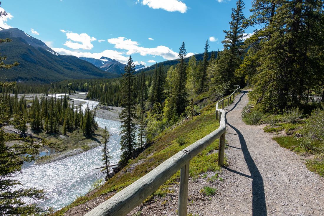 River Trail
Hiking pleasant Riverside Trail is better option than walking on Asphalt through the campground if you don't have bike River Trail
Hiking pleasant Riverside Trail is better option than walking on Asphalt through the campground if you don't have bike |
|||
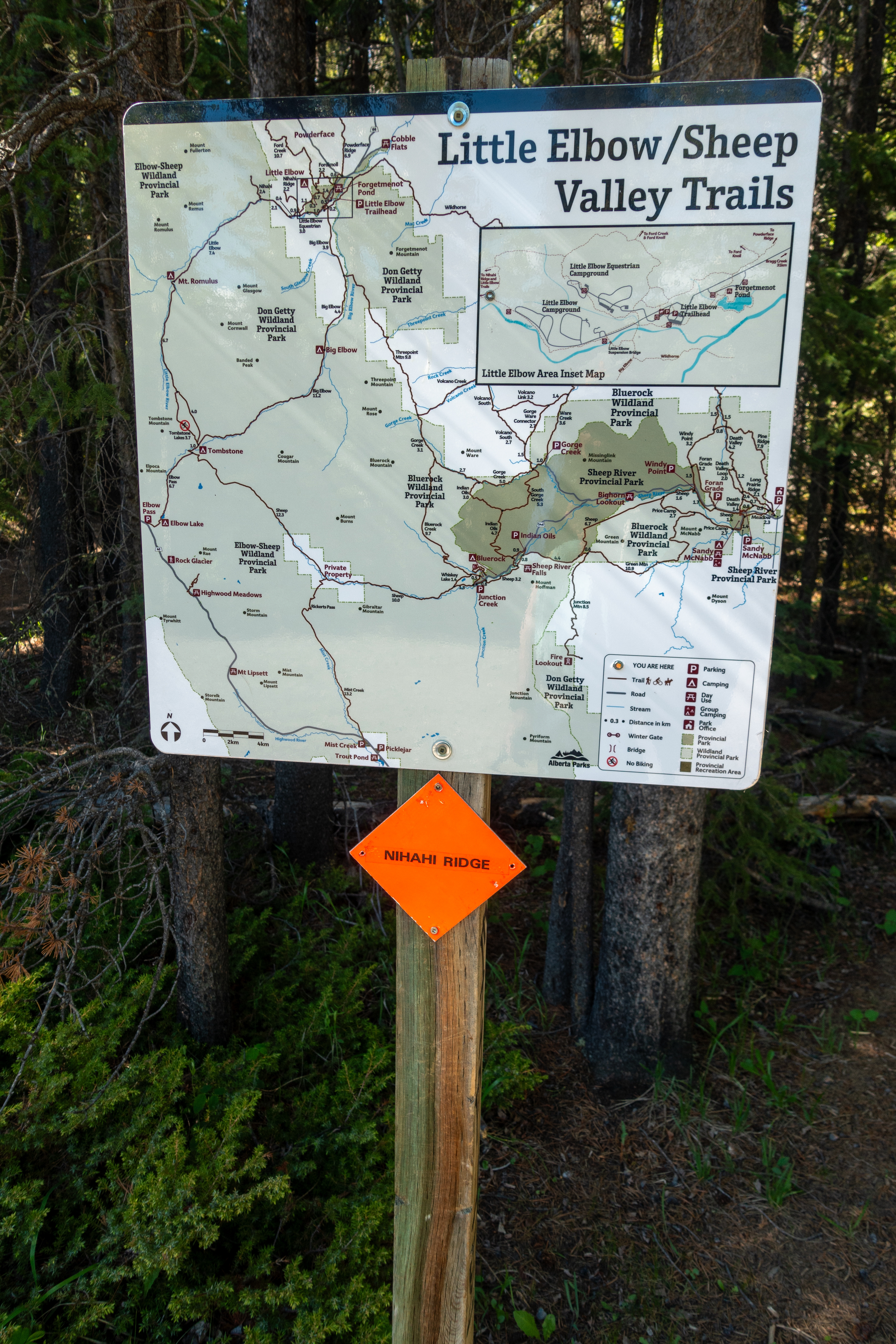
 Nihahi Junction
Marked Nihahi Ridge Junction on right side of Little Elbow Trail ~30min from Parking Nihahi Junction
Marked Nihahi Ridge Junction on right side of Little Elbow Trail ~30min from Parking |
|||
 |
|||
 Alpine Meadow
Very pleasant hiking across open meadow after initial forested rise Alpine Meadow
Very pleasant hiking across open meadow after initial forested rise |
|||
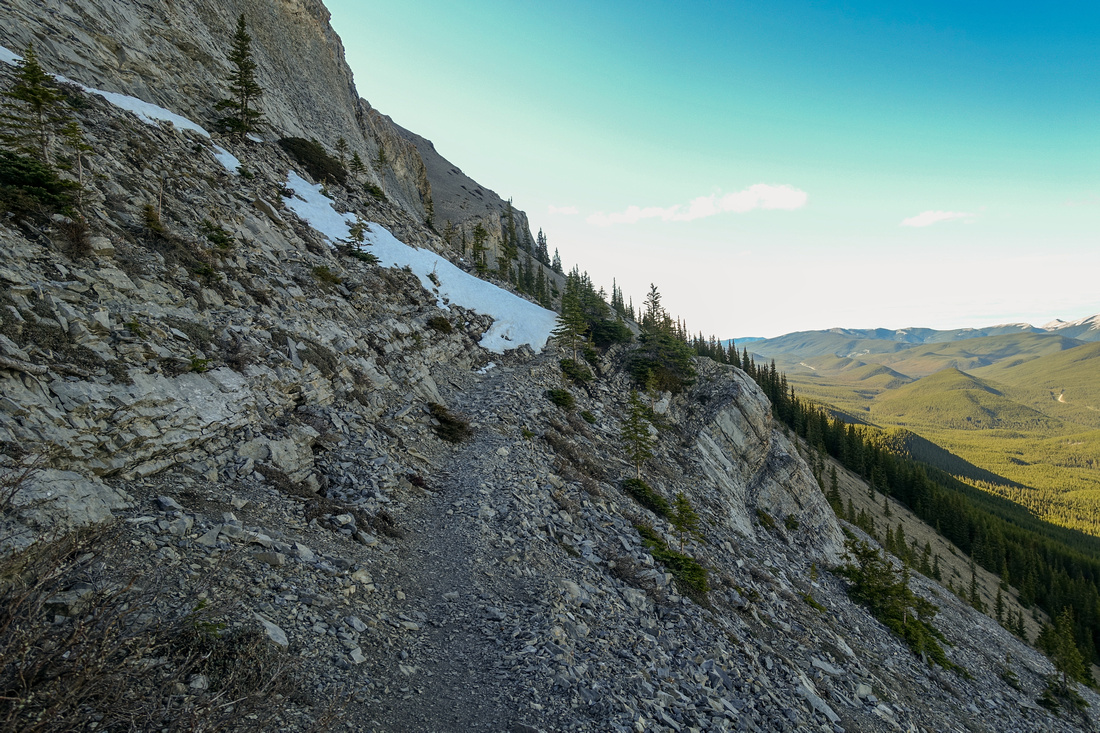
 Ridge Trail
Upper part of approach Trail following semi-open ridge crest. Nihahi Ridge South End upper center. Ridge Trail
Upper part of approach Trail following semi-open ridge crest. Nihahi Ridge South End upper center. |
|||
 Powderface Ridge
Great views east showing length of Powderface Ridge; Moose Mtn far left Powderface Ridge
Great views east showing length of Powderface Ridge; Moose Mtn far left |
|||
 Ledge Traverse
Good scree trail traversing ledge below Nihahi south shoulder Ledge Traverse
Good scree trail traversing ledge below Nihahi south shoulder |
|||
 Crux Up
Technical Crux - low class 3 scramble up 40-45 degree gully. Ascent line roughly follows demarcation of dark/wet and light rock. This bit is unavoidable Crux Up
Technical Crux - low class 3 scramble up 40-45 degree gully. Ascent line roughly follows demarcation of dark/wet and light rock. This bit is unavoidable |
|||
 Crux Down
Looking down after getting up the crux. On return it must be dowclimbed; no easier options exist Crux Down
Looking down after getting up the crux. On return it must be dowclimbed; no easier options exist |
|||
 South Shoulder
Looking back South Shoulder above the crux; note scree trail lower left. Forgetmenot Ridge across South Shoulder
Looking back South Shoulder above the crux; note scree trail lower left. Forgetmenot Ridge across |
|||
 South Shoulder
Trail continuing up scree bypassing rock buttress on the right side South Shoulder
Trail continuing up scree bypassing rock buttress on the right side |
|||
 Nihahi Ridge
Steep scramble leading to Nihahi South End; follow bits and pieces of trail on left side (out of photo) Nihahi Ridge
Steep scramble leading to Nihahi South End; follow bits and pieces of trail on left side (out of photo) |
|||
 Rock Cleft
Upper Crux: Stiff class 2 Rock Cleft, easier from what this photo suggests Rock Cleft
Upper Crux: Stiff class 2 Rock Cleft, easier from what this photo suggests |
|||
 Ridge Crest
Nihahi Ridge Crest from South End. Obvious bump upper center is South Summit and recommended turnaround point Ridge Crest
Nihahi Ridge Crest from South End. Obvious bump upper center is South Summit and recommended turnaround point |
|||
 Ridge Crest
Looking back from South Summit after traversing exposed crest. It takes 8-10min only, but strong wind can make this part awkward Ridge Crest
Looking back from South Summit after traversing exposed crest. It takes 8-10min only, but strong wind can make this part awkward |
|||
 |
|||
 |
|||
 Elbow Panorama
Little/Big Elbow Panorama on return from Nihahi South End Elbow Panorama
Little/Big Elbow Panorama on return from Nihahi South End |
Abstract
| Overall Difficulty | D6 | Steep parts of approach trail. Eroded sections. Class 3 Rock scramble step below South Shoulder. Exposed and narrow Summit Ridge; strong wind gusts / loss of balance | |||
| Snow Factor | S5 | Severe avalanche danger on east facing slopes, narrow corniced ridge; Mountaineering. Route needs to be snow free | |||
| Scenery | Sweeping scenery of front ranges and foothills. Very good view of Forgetmenot ridge and peaks along Big/Little Elbow | ||||
| Trail/Marking | Good / None | Signed Little Elbow / Nihahi Junction. Well defined trail to below south shoulder, route with sporadic cairns afterwards. | |||
| Suggested Time | 5 hrs | Return Time for South Summit OnB. Long Day (10hrs) if traversing entire ridge | |||
| Elevation | Start: 1620m Max: 2370m Total: ~780m | Distance:13 km (South Summit OnB) | |||
| Gear | Full boots preferred. Hiking poles essential. Gaiters recommended. Micro-spikes could be useful in shoulder season. Wind-breaker essential as ridge is wind-blown year round. | ||||
| Water | No reliable water source. Carry 1 - 1.5L, depending on season | ||||
| Dog Friendly | No | Dogs Ok if just hiking to end of trail below south shoulder | |||
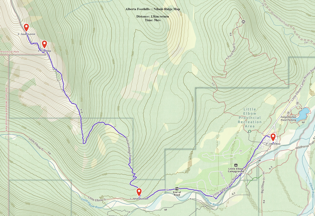 Nihahi Ridge GAIA Map
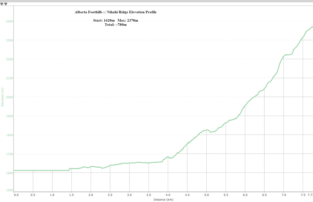 Nihahi Ridge Elevation Profile