Google Map |
Rockies :: Alberta Foothills :: Bastion Ridge |
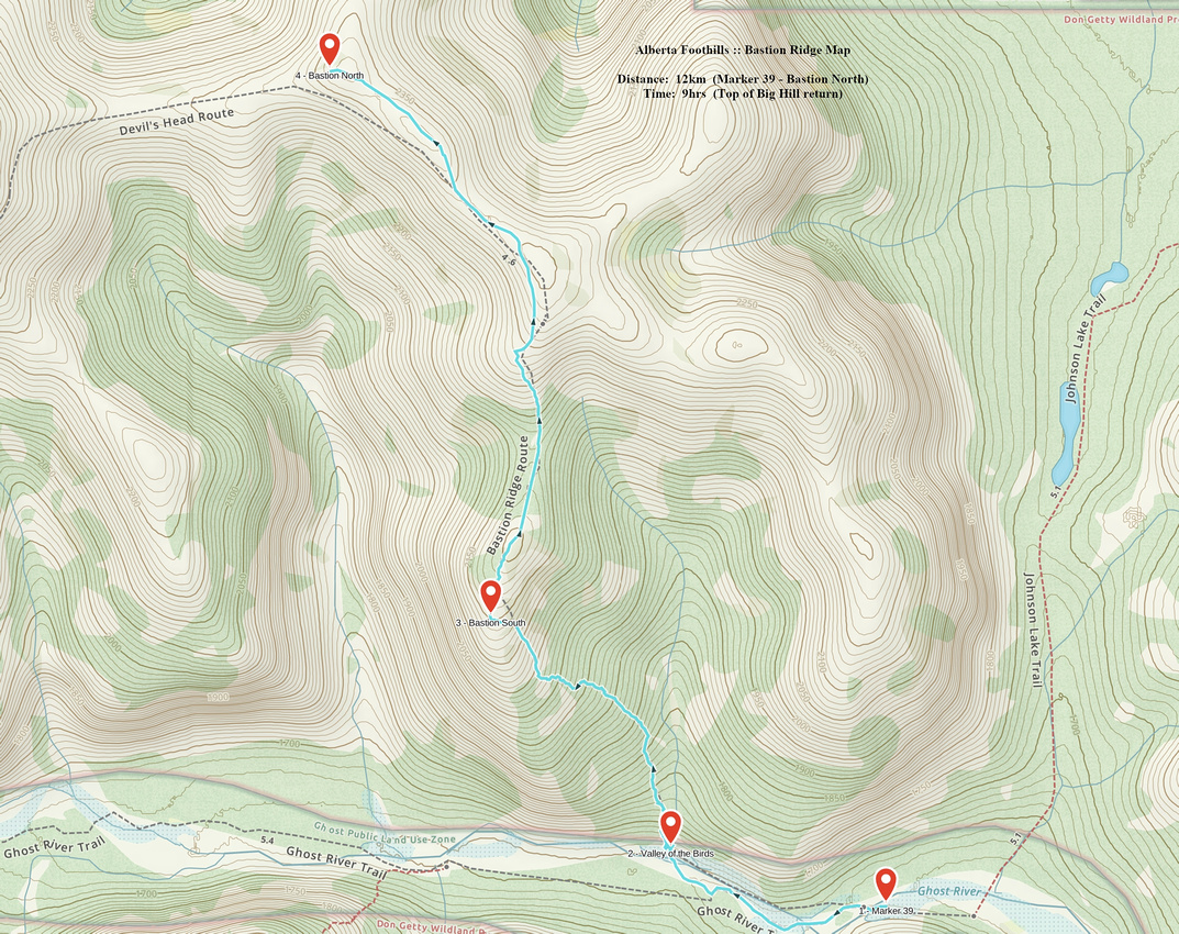
GPS Track |
|
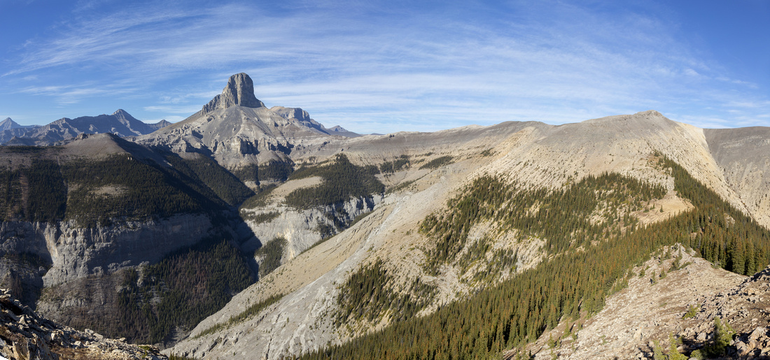
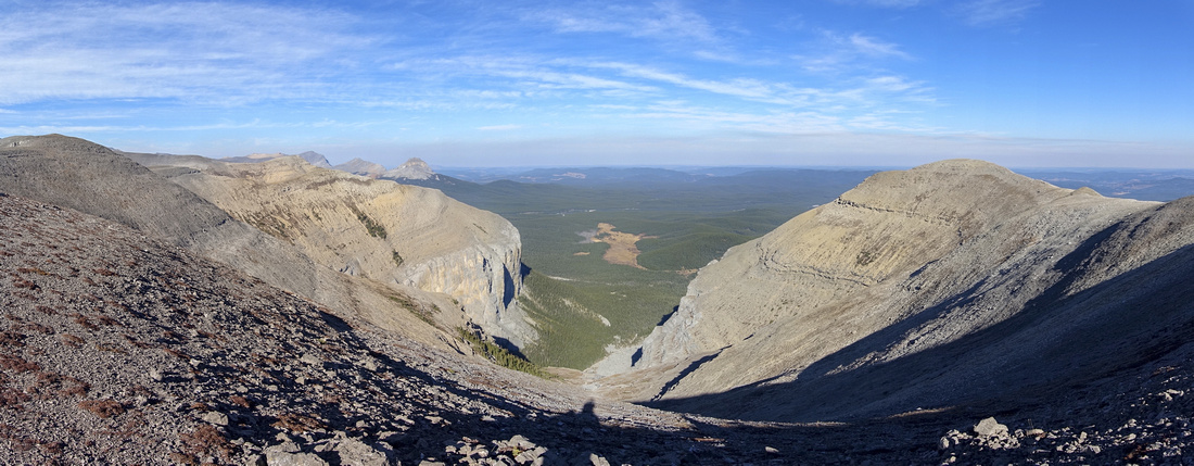
Panoramic view towards Devils Head from south end of Bastion Ridge |
|||
| Trip Summary | |||
Oct 19, 2022Bastion Ridge is one of most rewarding trips in Ghost. It provides in-your-face view of iconic Devils Head (or Devils Nose) - striking rock tower seen from many vantage points in NW Calgary. Just like everywhere else in Ghost, main difficulty is the access -- see lead article for more details. Described here is the hike from "Marker 39" in Ghost River Bed - roughly 1.5hrs of cycling from parking at "Top of Big Hill". With low water late in season high clearance 4x4 can drive up to here, but I don't recommend it as there is non-trivial chance of getting stuck in river bed. Continue up the River bed for about a km from Marker 39. If you drove all the way, bringing bicycle for this last part is probably not worth as distance is short. Valley of the Birds will be the next drainage on the right (north) side. It is not obvious and on my trip I cycled past it, realizing my mistake further up the road, which resulted at ~30min time loss. Use GPS track download from top of the page. River conditions change but there will be at least 1 more ford required (usually 3) to get to the trailhead. If on bicycle, leave it just before this last ford, then cross on foot and find trailhead on left (west) side just after crossing. Continuing up the drainage is not possible as sheer cliff soon bares the progress - see gallery.
It will take ~1.5 hr (4km, ~540m vertical) to reach South End of Bastion Ridge. Initial part above Valley of the Birds is brutally steep and eroded - hiking poles are great asset. If icy, micro-spikes on descent might not be enough. It is mercifully short and grade moderates ~100m vertical above. Trail criss-crossed with some deadfall climbs to charred area where it periodically disappears - I used some burned trees as landmark to be able to pick it up on return. Cairns then lead the way to Bastion South - one of these "ahhh" moments, as Devils Head majestically springs in your face. This is perfect spot for break, and it would be tempting to spend the day right here in absolute solitude, doing absolutely nothing but gawking at outstanding scenery.
Ridge continues north across couple of bumps then drops semi-forested area to low saddle, and climbs talus on the other side to the main portion. I suggest going at least up to here as views get better and better. Note that area is notoriously windy - with chinooks winds blowing, sheer force of Bastion gale might threated to blow you from the ridge! Usual turnaround is "Bastion North" - ridge highpoint, ~1.5 hrs at most from Bastion South. Several side ridges fork like octopus arms and legs and with enough time are well worth exploring (much more worthy effort than attempting Devils Head climb!). Return is the same way; make sure you left enough daylight in case you are cycling all the way back to Top of the Big Hill.
|
|
Gallery |
|||
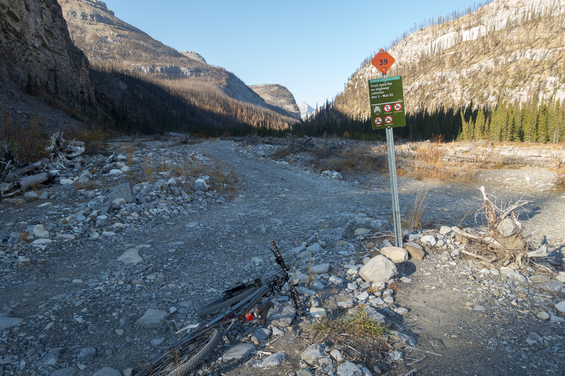 Marker 39 Marker 39 Marker 39 where further driving is prohibited. Roughly 1.5 hrs of cycling from Top of Big Hill parking. Valley of the Birds is ~1km on right side
 |
|||
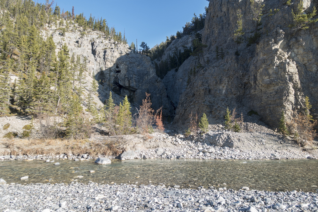 Valley of the Birds
"Valley of the Birds" - note one last, unavoidable ford. On my trip water level was very low, but during spring runoffs it might be entirely different story. Bastion Trailhead is in hammock of trees on left side Valley of the Birds
"Valley of the Birds" - note one last, unavoidable ford. On my trip water level was very low, but during spring runoffs it might be entirely different story. Bastion Trailhead is in hammock of trees on left side |
|||
|
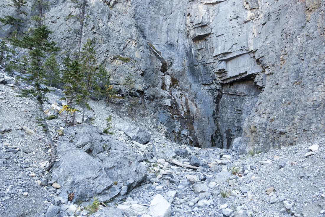
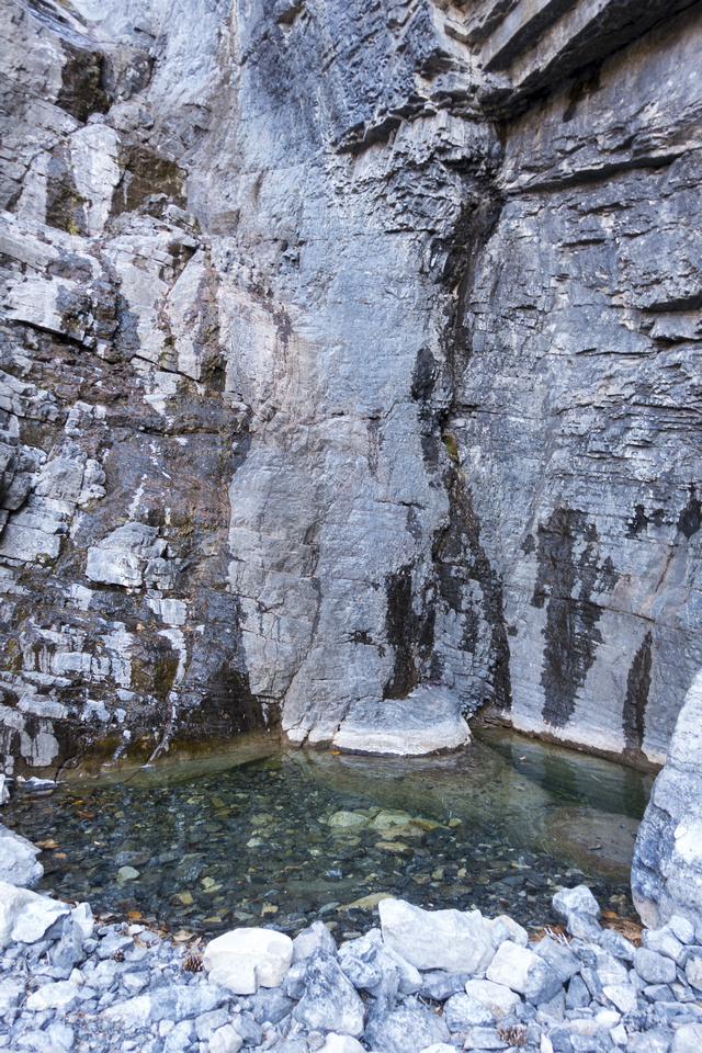
Cliff baring further progress up Valley of the Birds drainage. In winter this is popular ice climb; Just small pool of water remains in late season |
|||
 Bastion Trailhead
Umarked trail to the left just after Ghost ford - Bastion trailhead Bastion Trailhead
Umarked trail to the left just after Ghost ford - Bastion trailhead |
|||
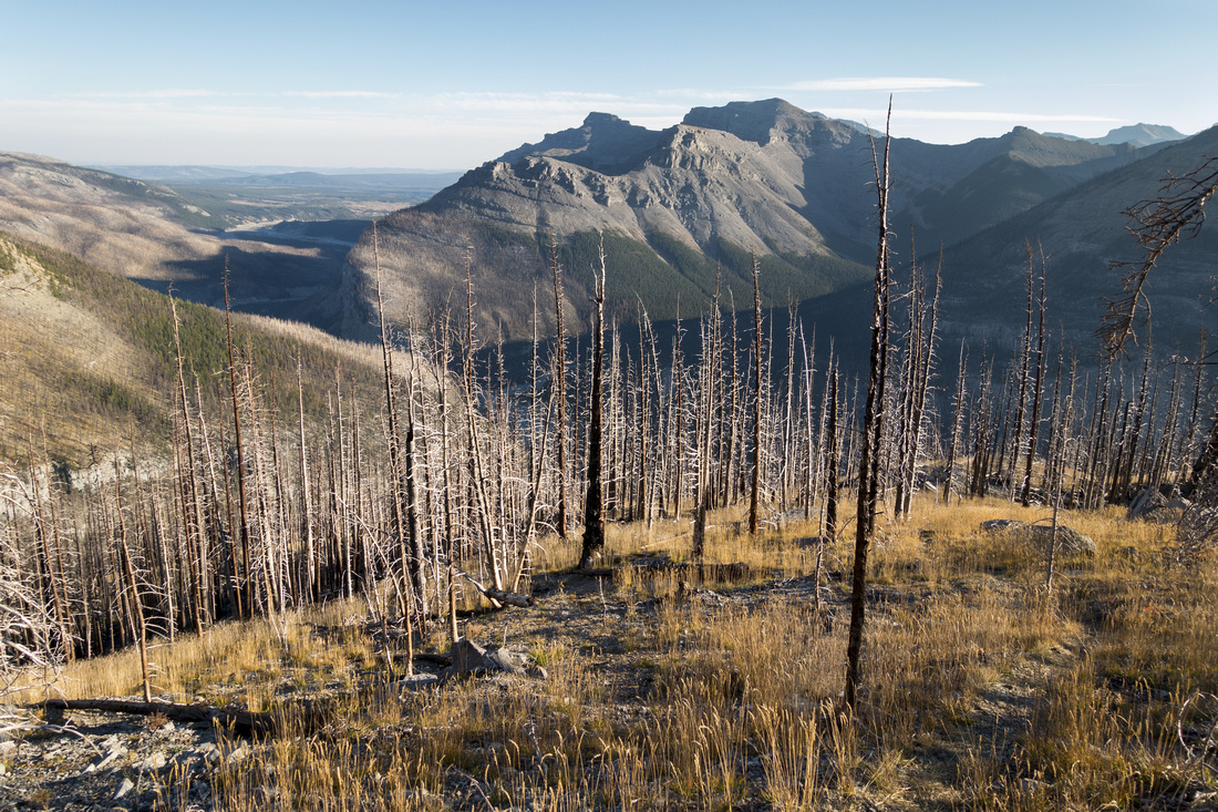 Old Burn
Looking down old burn as trail rises above Valley of the Birds. Phantom Crag and Orient Point at other side of Ghost River Old Burn
Looking down old burn as trail rises above Valley of the Birds. Phantom Crag and Orient Point at other side of Ghost River |
|||
|
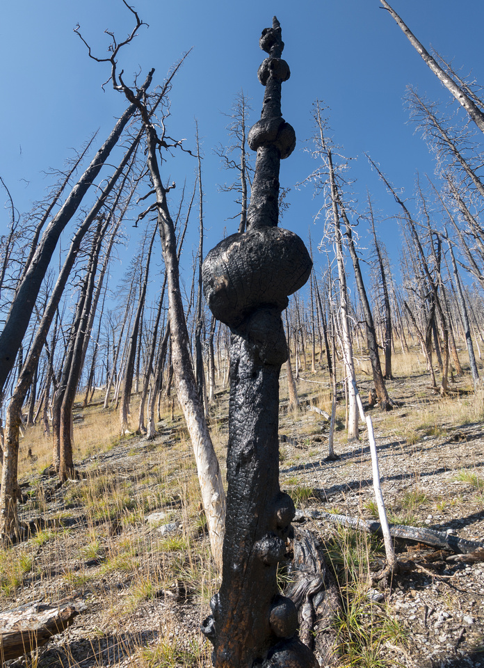
Trail becomes faint and occasionally disappears completely in this section; I used this fascinating burned tree as landmark on return |
|||
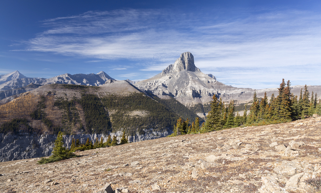 Bastion South
Real "ahhh" moment upon reaching South End of Bastion Ridge, ~1.5hrs of moderate pace from Valley of the Birds. Perfect spot for lunch break Bastion South
Real "ahhh" moment upon reaching South End of Bastion Ridge, ~1.5hrs of moderate pace from Valley of the Birds. Perfect spot for lunch break |
|||
 |
|||
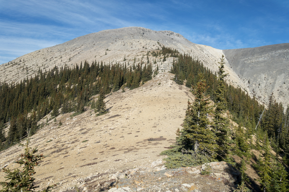 Ridge Dip
Intervening Dip between Bastion South and Main part of the ridge; faint trail exists most of the time Ridge Dip
Intervening Dip between Bastion South and Main part of the ridge; faint trail exists most of the time |
|||
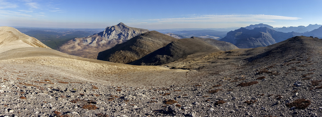 Bastion Ridge
 Panorama looking back - one of nicest ridgewalks in Front Ranges. Black Rock just left of center Bastion Ridge
Bastion Ridge Panorama looking back - one of nicest ridgewalks in Front Ranges. Black Rock just left of center |
|||
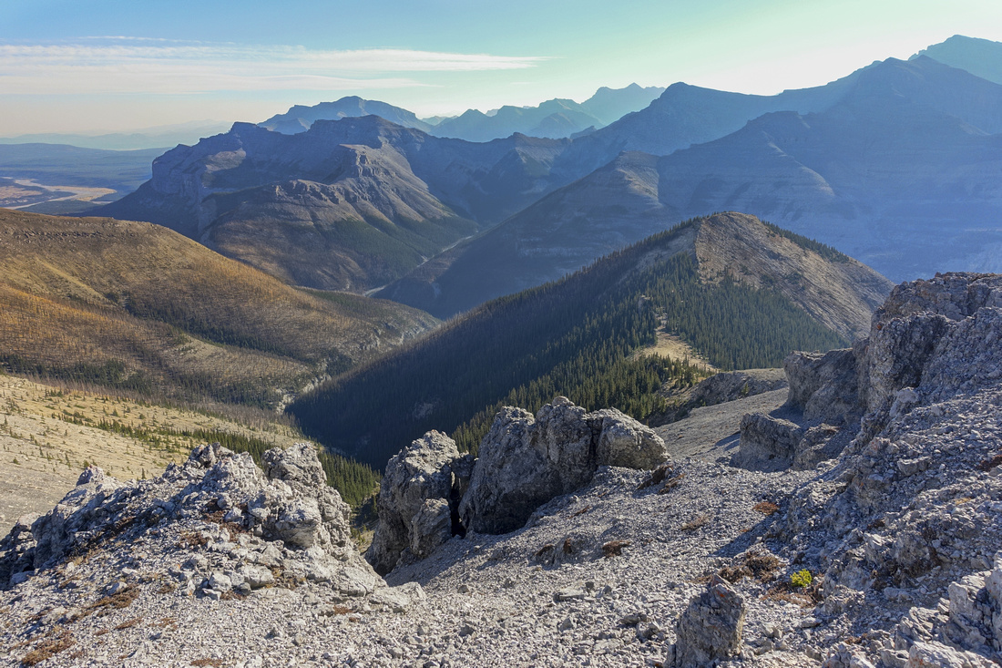
 Johnson Valley
/Canyon on NE side - accessed via Waiporous creek (4x4 required). It is possible to scramble Bastion North from here Johnson Valley
Johnson Valley/Canyon on NE side - accessed via Waiporous creek (4x4 required). It is possible to scramble Bastion North from here |
|||
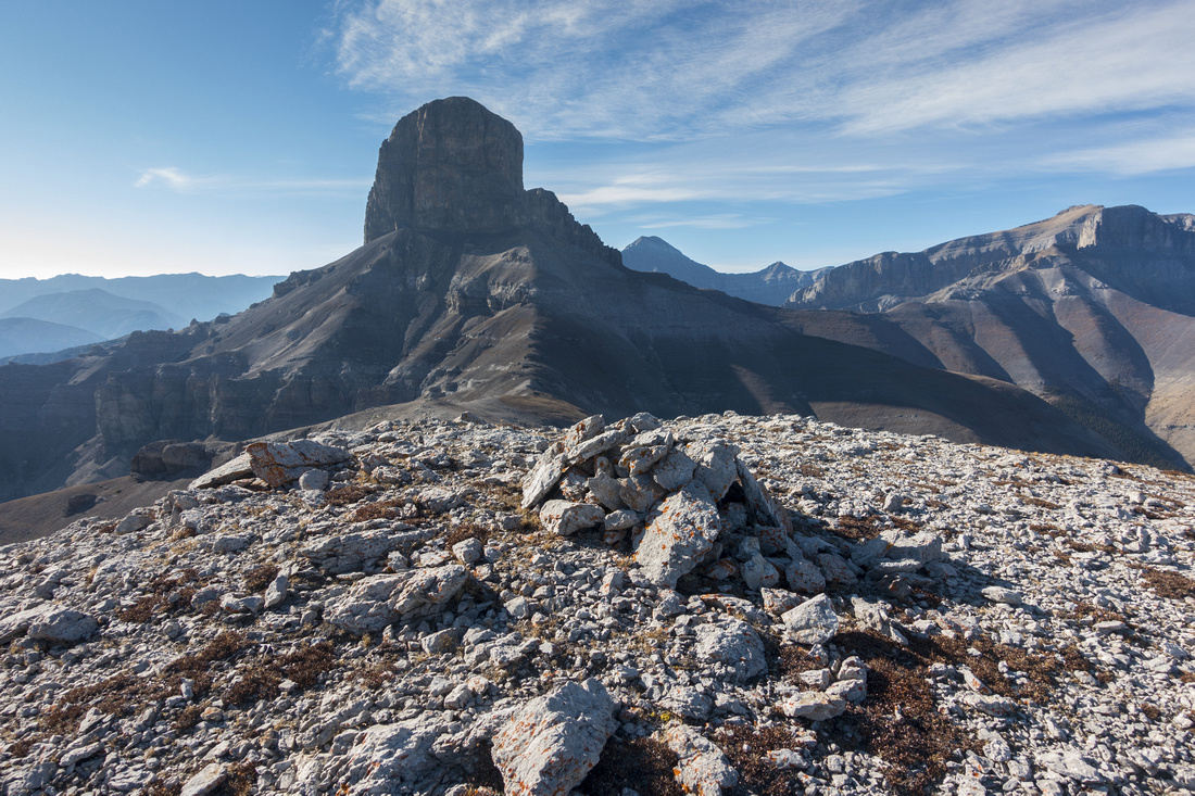 Bastion North
North end of Bastion Ridge, usual hiker turnaround point. Note small cairn. Faint trail continues across intervening dip then climbs to base of Devils Head. Astral Peak and Castle Rock, scrambled via Malamute Valley further up the Ghost behind Bastion North
North end of Bastion Ridge, usual hiker turnaround point. Note small cairn. Faint trail continues across intervening dip then climbs to base of Devils Head. Astral Peak and Castle Rock, scrambled via Malamute Valley further up the Ghost behind |
|||
 Bastion Ridge
View back to Bastion South on return from main portion of the ridge with advancing haze from BC smoke Bastion Ridge
View back to Bastion South on return from main portion of the ridge with advancing haze from BC smoke |
Abstract
|
Overall Difficulty |
Trip not technically too difficult, but logistics are fairly involved. Several fords of Ghost River, depending on season (min 3 past marker 39), always deeper on return. Very steep rise above Valley of the Birds |
||||
|
Snow Factor |
South facing slopes usually dry when everything else is still plastered in snow. Winter trip feasible, but logistics challenging due to limited daylight. Super steep rise above Valley of the Birds tricky with ice |
||||
|
Scenery |
Ghost Rock and Foothills with BNP Front Range Peaks. Remote wilderness feel. |
||||
|
Trail/Marking |
Poor/None |
Old Trans-Alta utility road in Ghost River Bed easy to follow. Valley of the Birds trailhead not marked. Trail to Bastion South periodically disappears in old burn; some cairns. |
|||
|
Suggested Time |
8-9 hrs |
Parking at top of Big Hill and cycling Ghost River; subtract ~2.5hrs if driving to Marker 39. Add 1-2 hrs if exploring side ridges |
|||
|
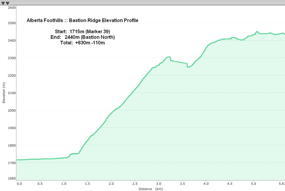
Elevation |
Start: 1715m Max: 2440m Total: +830m -110m (Marker 39 - Bastion North) |
Round Trip: ~12km (Marker 39 - Bastion North) | |||
|
Gear |
Bicycle for approach if unable to drive. GPS Helpful for locating correct ascent drainage. Day Hikers or Full Hiking boots. Poles super helpful on initial steep bit above Valley of the Birds. Micro-spikes might be required when icy in early or late season. Wind-breaker a must as ridge is notoriusly windy. |
||||
|
Water |
Ghost River on approach. Bastion Ridge is dry - carry min 1.5L past River Flats |
||||
|
Dog Friendly |
Yes |
Standard Back-country precautions |
|||
 Bastion Ridge GAIA Map
 Bastion Ridge Elevation Profile
Devils Head Climb
Despite various levels of misinformation found on Internet stating how Devils Head is just a scramble - it is not. It is dangerous technical rock climb with 5.4 YDS crux that at minimum requires rappel on descent. Most detailed and best by margin online resource is summitpost. This photo showing ascent line is taken from there:
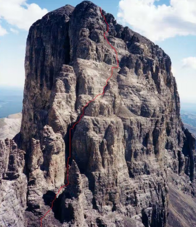
There are two possible approaches that merge at start of technical part. First and much more commonly used is Bastion Ridge, as described in detail in this report. From Bastion North ontinue on path descending to saddle below Devils Head, climb up talus and minor broken cliff band to the base then circle clockwise below the cliffs till only feasible gully appears; I estimate ~45min to an hour from Bastion North. Second approach is more difficult; it continues up Ghost River for ~1km past Valley of the Birds, then scrambles left (west) side of next drainage. It then follows craggy ridgeline till it reaches base of the tower where Bastion approach joins in. Both of these approaches are well described in summitpost.
First part of technical route is steep and lose climb up a gully; it is difficult scrambling. After topping up by some interesting rock features called "Devil's Horns" is the technical part; brief drop leading to chimney with overhang which is the crux. At some point there even used to be unsecured ladder here. Terrain above does not get much easier - according to summitpost at least one point is rated 5.3YDS. There are apparently enough cairns that facilitate routefinding. Descent, as almost always, will be more difficult. There is cell coverage in the area for emergency.
I have not climbed Devils Head, and never will. IMHO time is much better spent exploring awesome side ridges branching off Bastion spine, or even circling base of rock on scree path beneath the cliffs. I have included beta here for completeness as some folks reading this will undoubtedly be interested. If you do decide to go for it, you are doing it entirely at your own risk, and I advise you against. Information above can not be used as liability.