Google Map |
Vancouver Island :: Victoria :: Thetis Lake |
GPS Track |
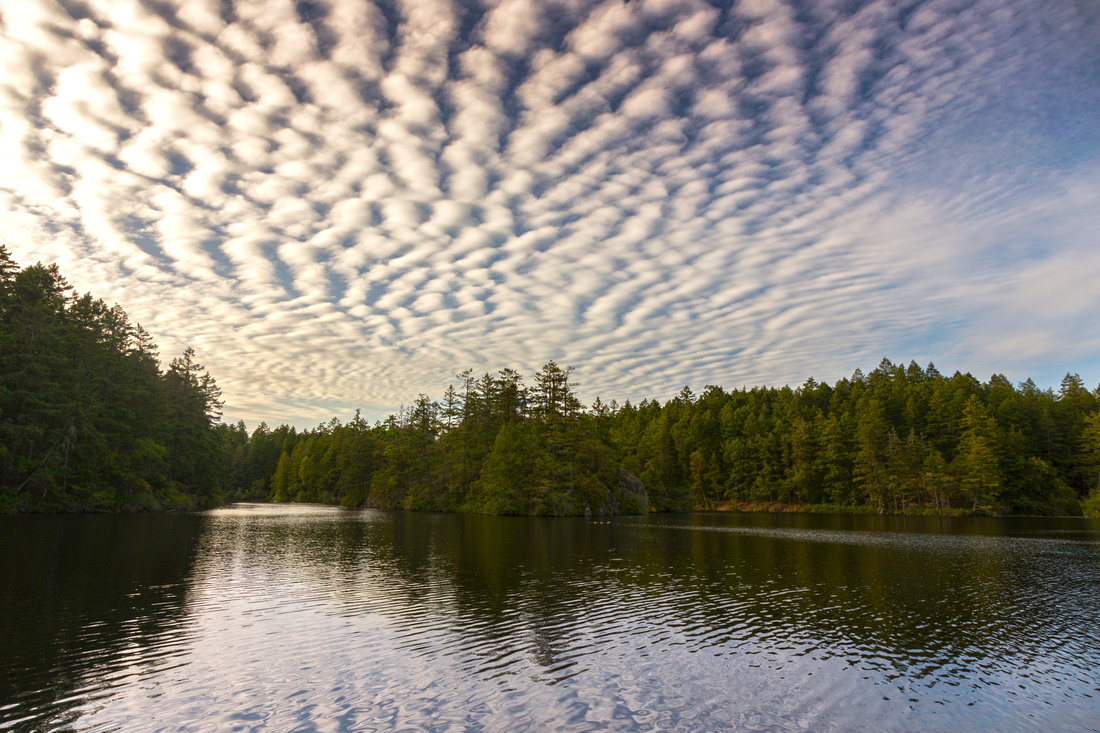 
Fabulous Skies over lower Thetis Lake from South Beach |
|||
| Trip Summary | |||
Multiple Dates, last October 22, 2021
There are several lakes in Victoria vicinity but Thetis is probably nicest. It is the Regional Park and one of most visited. No wonder - there are two lakes (lower and upper), network of hiking/walking/running trails, couple of beaches and in summer I've seen divers too. Take exit 10 coming from downtown Vic, then Island Highway and right onto Six Mile Road to Park Entrance (first gallery photo) and Main Parking which is free after Oct 1, but paid in summer season. There are also several smaller roads through the park where people sometime leave their cars.
This page presents most frequently done loop around both lakes in CCW direction, starting and ending at South Beach, including side trip up Seymour Hill - highest point in the park, rising on right (east) side of lower lake. Follow lower lake trail just for a short bit, then diverge right and up. Trail is bit steep but this is the only real elevation gain for entire hike. Soon it tops on open rocky bluffs ~100m above the lake with great views of wider Victoria region. On the other side trail descends over some Rocky outcrops (hands needed in one or two spots if slippery after rain), then loops back to lower Lake trail. Reaching junction lower lake trail turns left and loops back to South beach; follow right side trail for upper lake. Pleasant walk across several small forested raises and openings with views of wetland ensues. Eventually past several marked junctions trail reach junction lower lake junction near smaller west beach and continues back to south beach. Side trails lead to small peninsulas overlooking lower lake and are well worth short extension.
|
|
Gallery |
|||
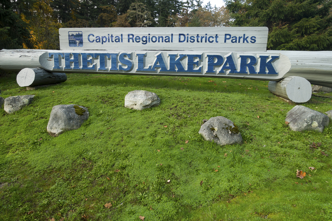 Thetis Park Entrance
Park Sign by South Parking lot and end of Six Mile Road Thetis Park Entrance
Park Sign by South Parking lot and end of Six Mile Road |
|||
 Lower Thetis Lake
 Panorama from South Beach Lower Thetis Lake
Lower Thetis Lake Panorama from South Beach |
|||
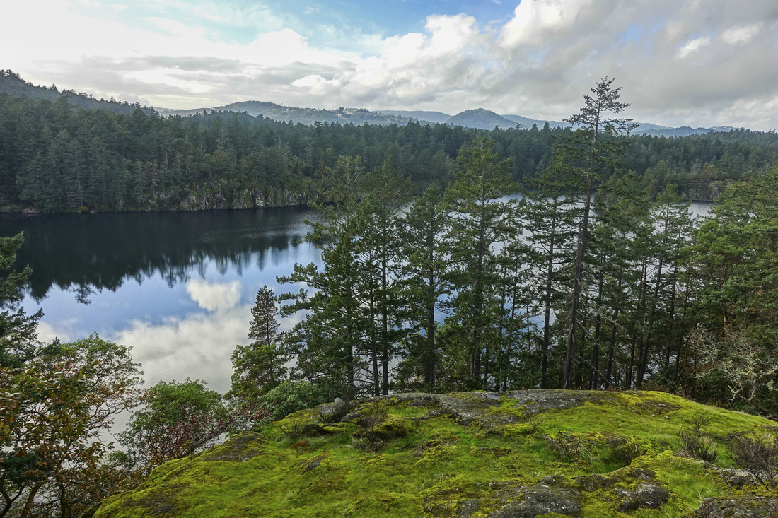 Seymour Hill
Lower Thetis Lake from Seymour Hill Seymour Hill
Lower Thetis Lake from Seymour Hill |
|||
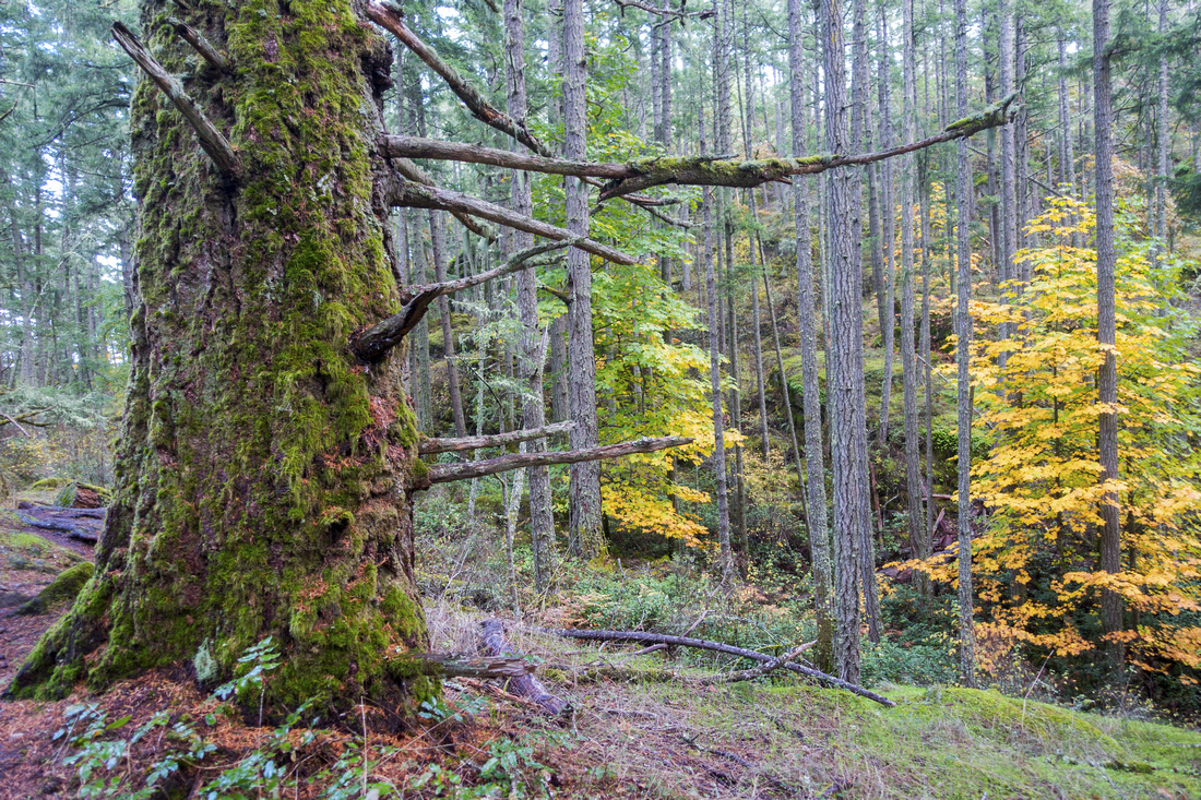 Spiky Forest
Plenty of nice forest walking on descent from Seymour Hill Spiky Forest
Plenty of nice forest walking on descent from Seymour Hill |
|||
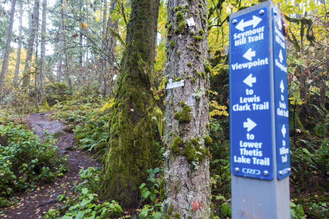 Marked Junction
Trail Junctions are well marked and it is easy to orient Marked Junction
Trail Junctions are well marked and it is easy to orient |
|||
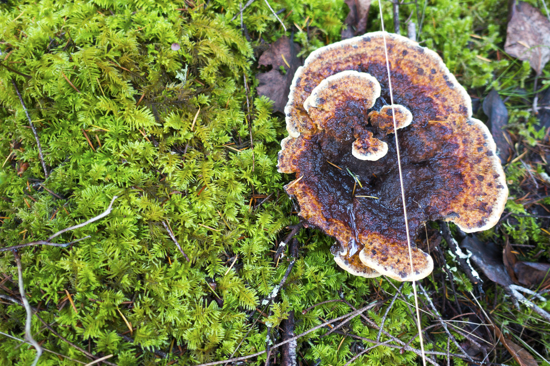 Mossy Fungus
Autumn Details along upper Lake trail Mossy Fungus
Autumn Details along upper Lake trail |
|||
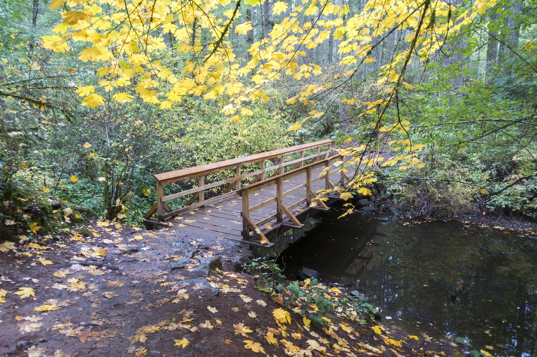 Autumn Foliage
Lovely Autumn colors while crossing one of several wood bridges at upper Lake trail Autumn Foliage
Lovely Autumn colors while crossing one of several wood bridges at upper Lake trail |
|||
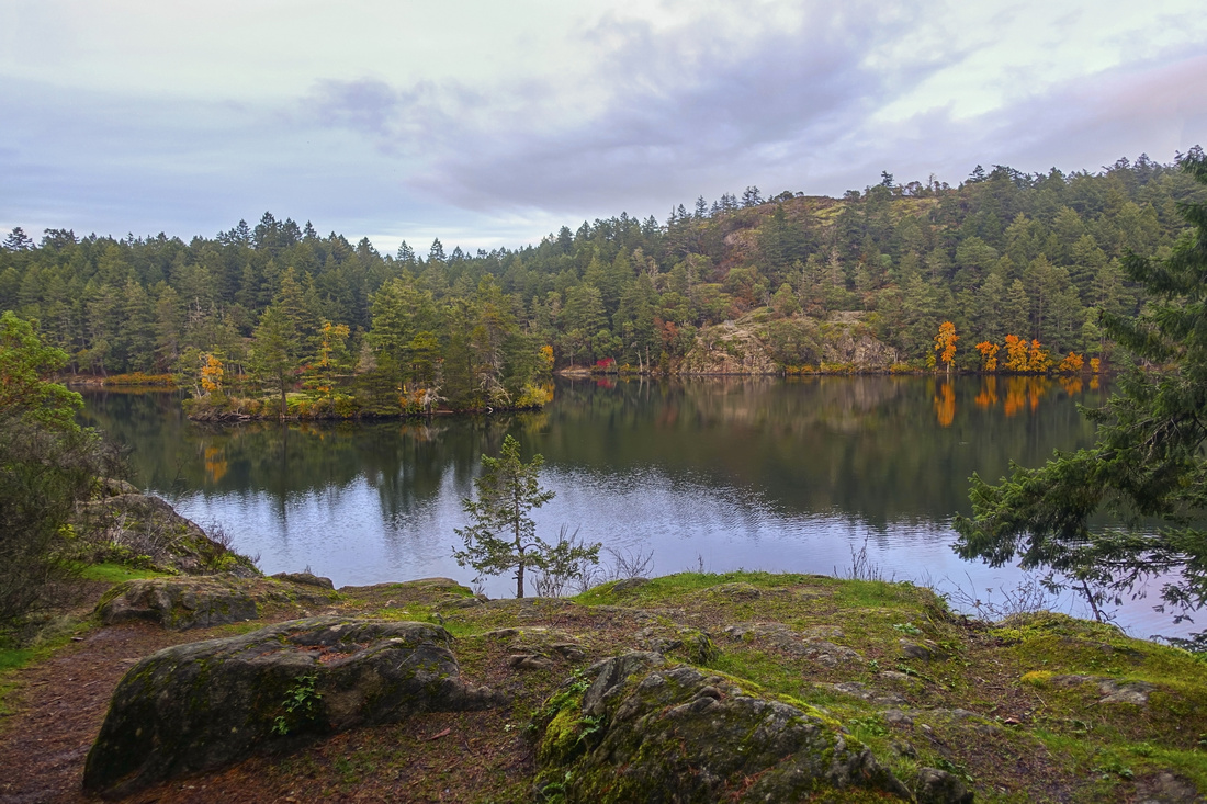
 Bluff Reflections
Calm water and perfect Autumn scenery Bluff Reflections
Calm water and perfect Autumn scenery |
|||
 Lower Viewpoint
View from small Peninsula near South beach with Seymour Hill across Lower Lake Lower Viewpoint
View from small Peninsula near South beach with Seymour Hill across Lower Lake |
Abstract
| Overall Difficulty | D2 | Some steep sections over bluffs for Seymour Hill side-trip. Just a Walk around the lake is D1 | |||
| Scenery | Two calm lakes, rock bluffs and forest with impressive foliage | ||||
| Trail/Marking | Excellent | Wide path with marked junctions. Several rest-stops with park benches | |||
| Suggested Time | 2-3hrs | Loop around both lakes with side trip up Seymour Hill. Just loop around both lakes could be done in ~1hr with fast pace | |||
| Elevation | +- 250m (incl. Seymour Hill. Just a loop is ~100m) | Round Trip: 8.5km (incl. side trips; just a loop is ~5km) | |||
| Gear | Day hikers sufficient | ||||
| Water | Several small creeks, but might need to treat water. Carry 0.5-1L in summer | ||||
| Dog Friendly | Yes | Dogs must be under control for consideration to other visitors as this is quite busy park | |||
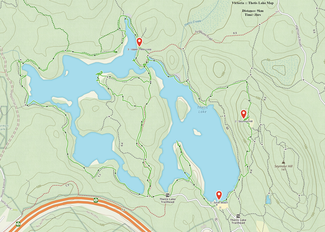 Thetis Lake GAIA Map
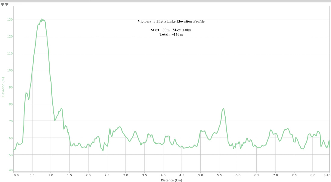 Thetis Lake Elevation