Google Map |
USA :: Prescott :: Granite Mountain |
GPS Track |
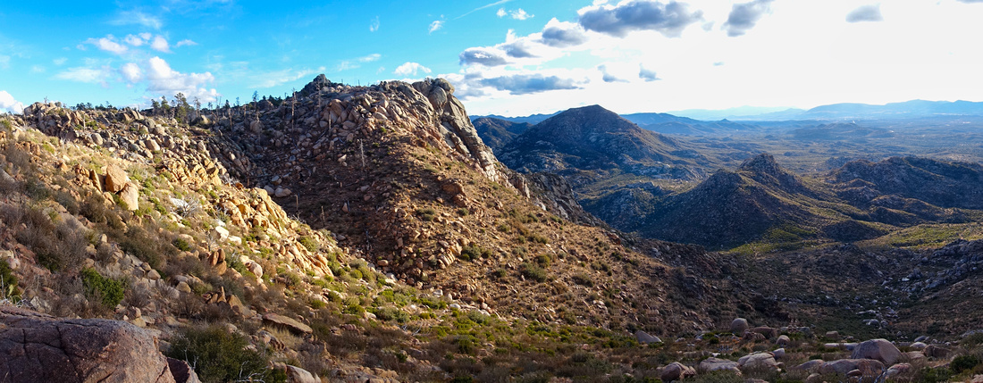 
Granite Basin looking SE near the End of Lookout Trail |
|||
| Trip Summary | |||
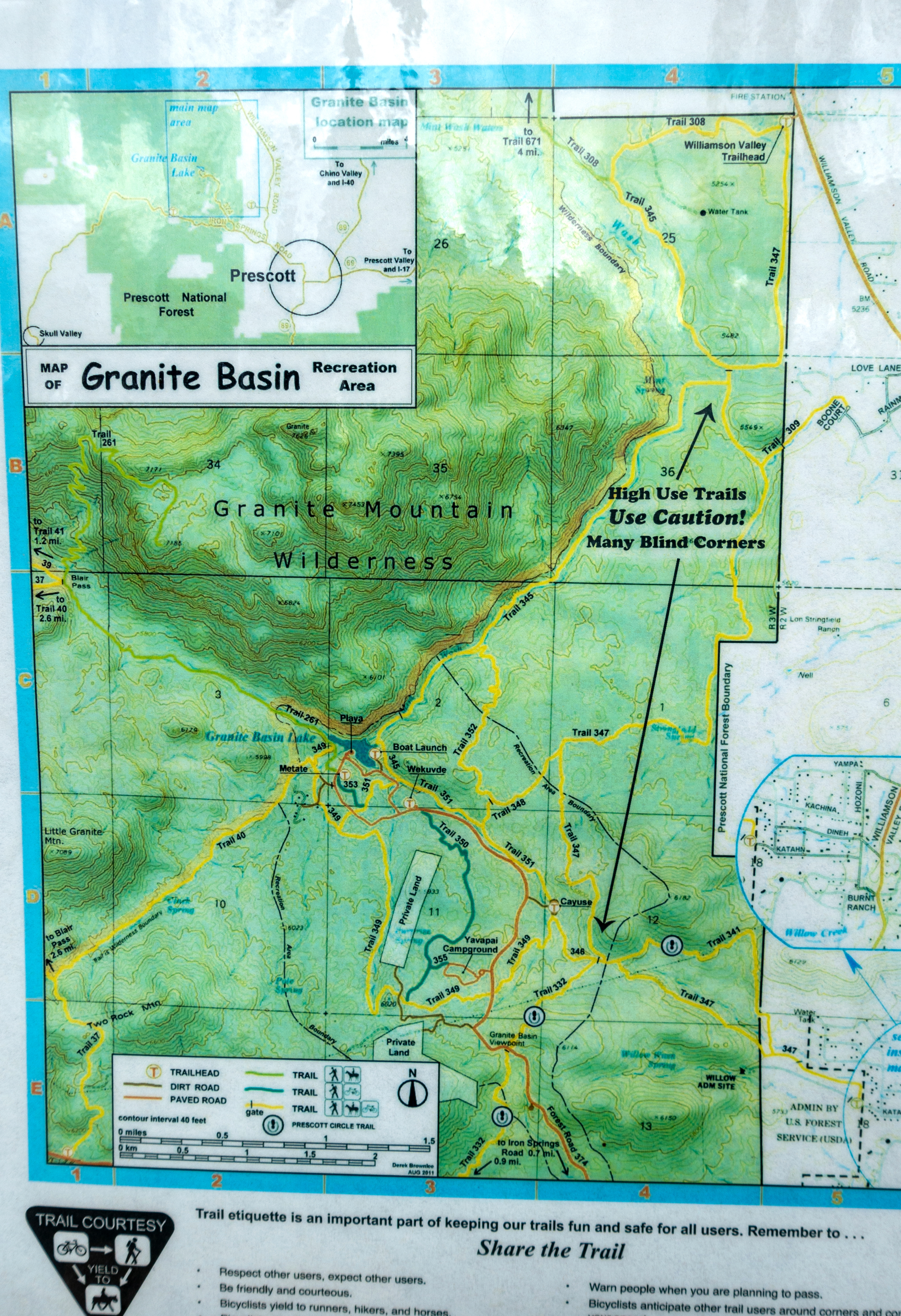
December 21, 2023Granite Mountain is the Highest Peak in Prescott area and Wilderness basin west of Prescott Valley contains well developed and extensive network of Hiking trails. Area is managed by USDA Forest Service and entry fee is required but America The Beautiful Pass is accepted. Access is via Iron Springs Road; turn right at Granite Basin Road 15-20min from downtown Prescott and drive to the End. As usual the case with overmanaged rec areas there are gates that close around sunset; 1-way exit usually remains open, but no guarantees. Granite Mountain trail starts at Playa Parking; it is worth checking out Lake viewpoint below (1st pic in the Gallery).
First part follows wide canyon to Blair Pass where Little Granite Mtn / Granite Lake trail splits off through the gate. Main elevation gain is ahead; switchbacks are well graded, but this part is entirely in the open offering no shade and likely quite hot in summer months. After cresting the saddle, trail contours some lovely terrain before ascending final part to the Lookout. Unsigned summit trail junction is some ~20min before end of Trail #261: Waypoint "3 - Summit Junction", GPS Track download top of Page. Remainder of the Hike is very scenic, ending on open slopes with impressive views over Granite Wilderness and distant central Arizona Plateau. Rock bluff above the Lookout can probably be scrambled, but it appears quite stiff and not really worth the effort. Return the same way.
I have not climbed Granite Mountain, but here is what to expect. From the junction bits of trail continue in general direction of the peak for some 15min, then disappears in maze of chaparral bush and granite boulders. Some flags aid the navigation to summit block which is then ascended via gully system on the west side. This extension is considerably more involved, mainly from micro-terrain routefinding skills - see here for more details. Number of technical rock climbing routes are also very popular. |
|
Gallery |
|||
 Granite Lake Granite Lake Granite Lake just below Playa Parking. Boat Launch on the other side
 |
|||
 |
|||
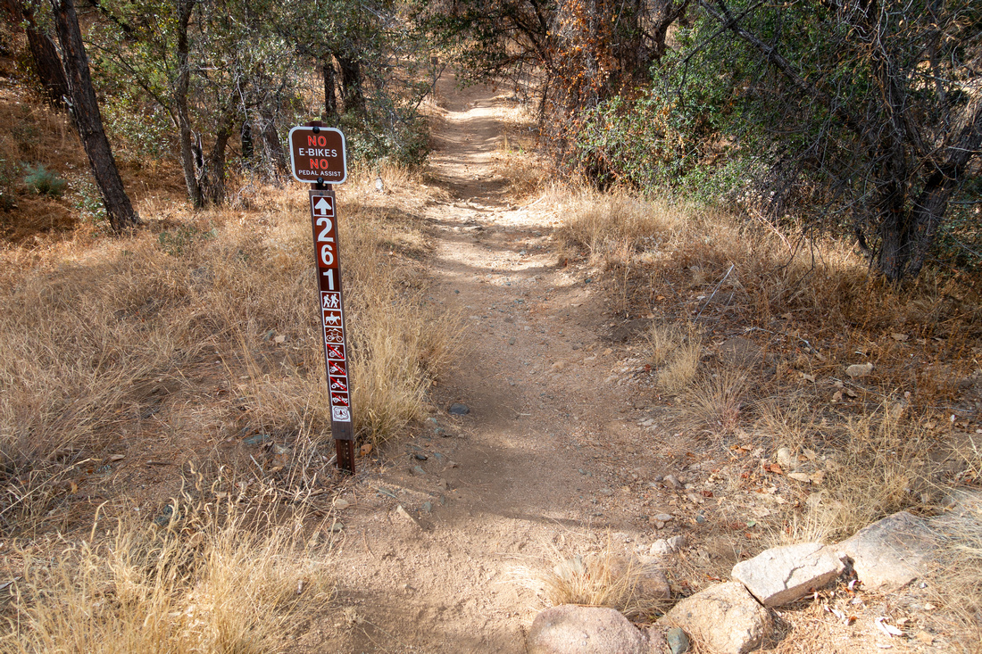 Granite Trailhead Granite Trailhead Granite Trail #261 start just below Playa Parking Lot
 |
|||
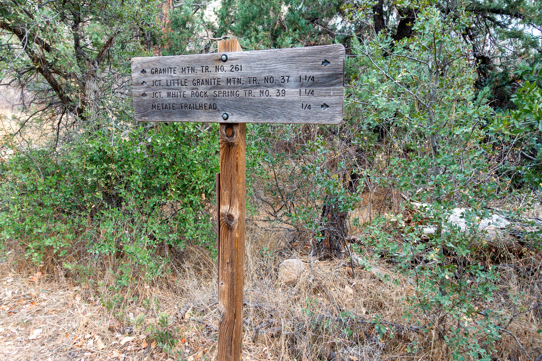 Metate Junction Metate Junction Signed Metate Trail junction ~10min into the Hike
 |
|||
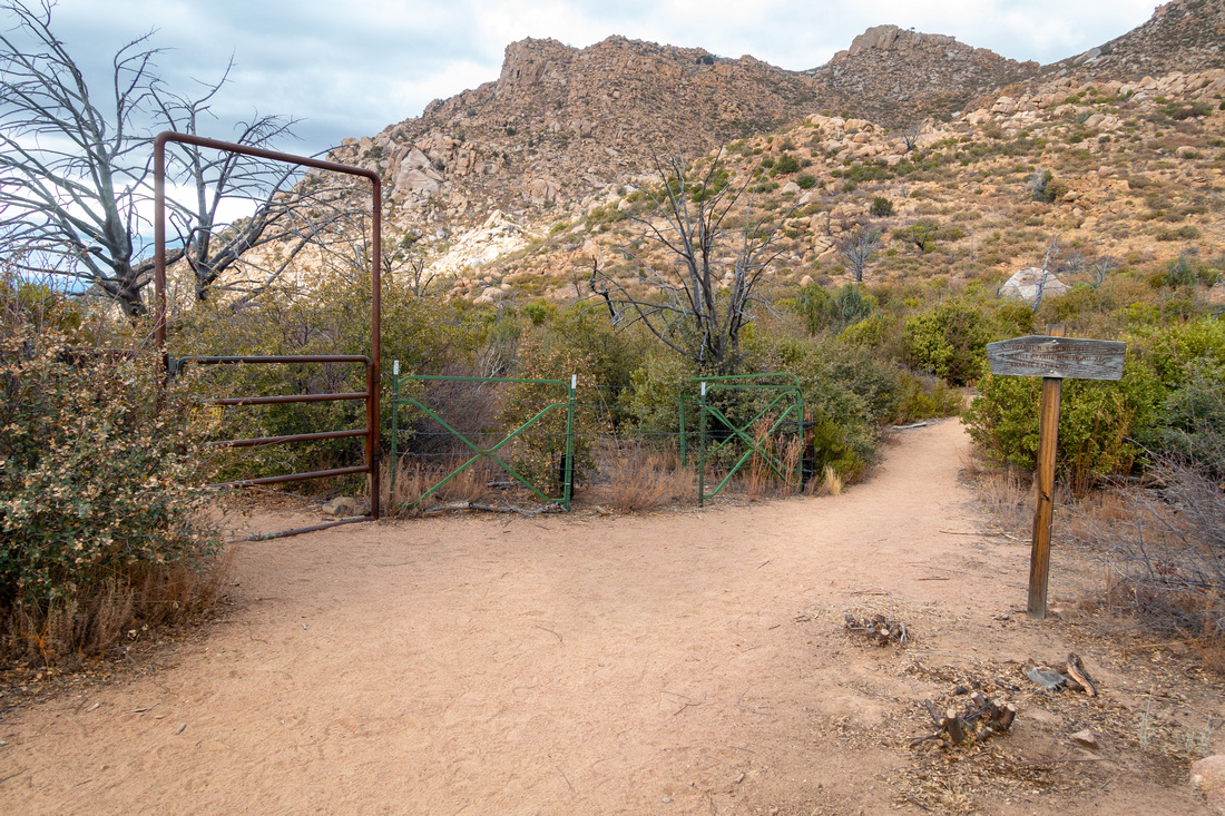 Blair Pass Blair Pass Blair Pass ~40-45min into the Hike; continue straight. Little Granite Mtn / Granite Lake turns left through the Gate
 |
|||
 Granite Panorama Granite Panorama Granite Basin Panorama as trail starts switchbacks to the saddle. Blair Pass below, Little Granite Mountain upper center
 |
|||
 Granite Trail Granite Trail Trail just below the Saddle. Most of Elevation gain is behind at this point
 |
|||
 Granite Saddle Granite Saddle Above the Saddle trail contours right towards the Overlook. Granite Mountain Main Peak center can be approached either from here (rough trail) or further along Lookout trail (next photo)
 |
|||
 Peak Junction Peak Junction Usual Main summit junction; it would also be a nice camping spot (no water). Lookout trail continues to the right
 |
|||
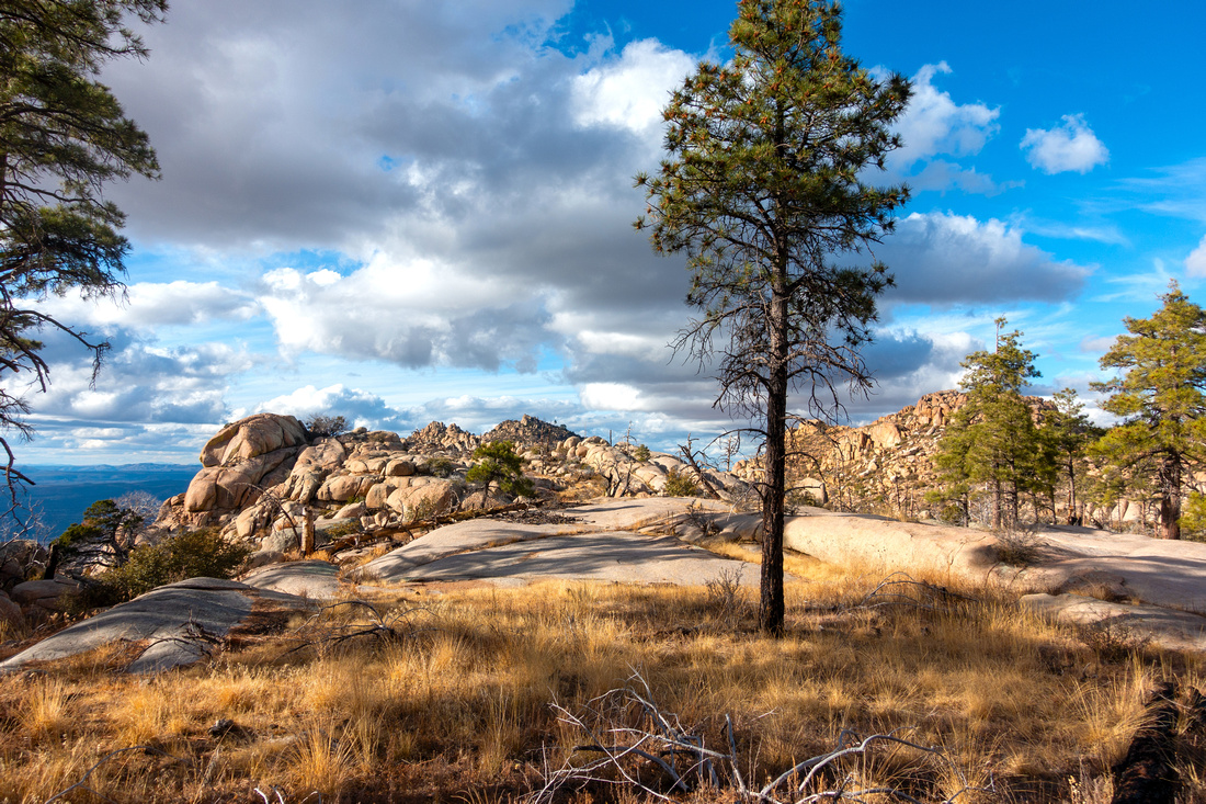 Granite Plateau Granite Plateau Very pleasant hiking through sparse forest in upper Plateau
 |
|||
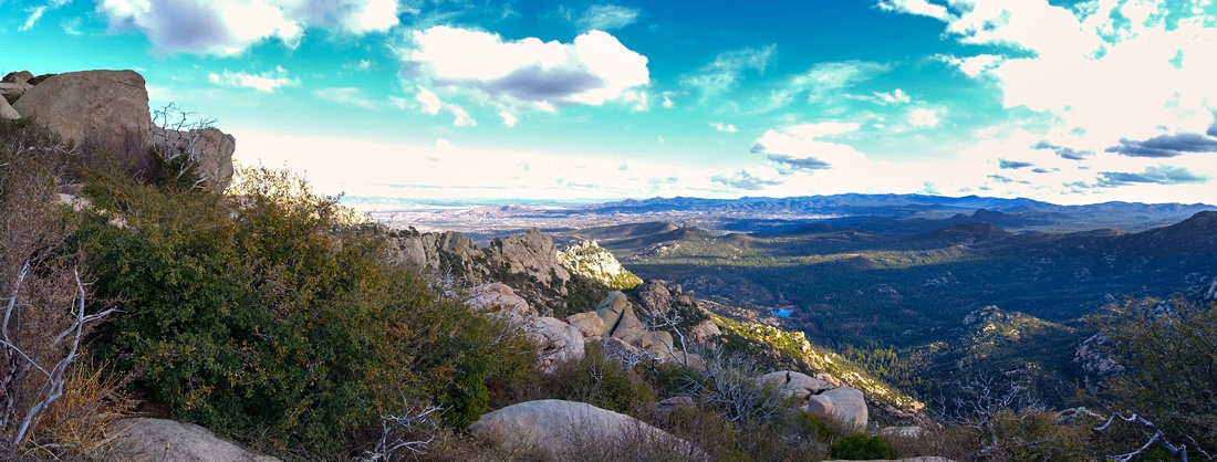 Granite Lookout Granite Lookout End of Trail #261 with nice Panoramic views east over Prescott Valley
 |
|||
 Bluff Scramble Bluff Scramble Bluff directly above the Lookout can probably be scrambled but it appears fairly difficult and not worth the effort
 |
Abstract
| Overall Difficulty | D3 | Moderately steep trail above Blair Pass with rocky trailbed. Continuing to Granite Mountain Summit considerably more difficult with bushwhack, micro-terrain route finding and class 2 rock scrambling (D5) | |||
| Scenery | Granite Lake rec area. Granite Mountain Wilderness with distant views across central Arizona plateau | ||||
| Trail/Marking | Very Good | Official trail #261 maintained by USDA Forest service with Trailhead Map and signed junctions | |||
| Suggested Time | 4hrs | Granite Lookout return, moderate pace. Add 2-3hrs for Granite Mountain summit | |||
| Elevation | Start: 1695m Max: 2160m Total: ~600m (Lookout only) | Round Trip: ~13 km (Lookout only) | |||
| Gear | Full hiking boots for ankle stability, hiking poles very helpful. Long pants/sleeves for bushwhack for Granite Summit | ||||
| Water | Water can be filled at Granite Lake Rec area, no reliable source after. Carry ~2L depending on season | ||||
| Dog Friendly | Yes | Dogs must be on leash at all times | |||
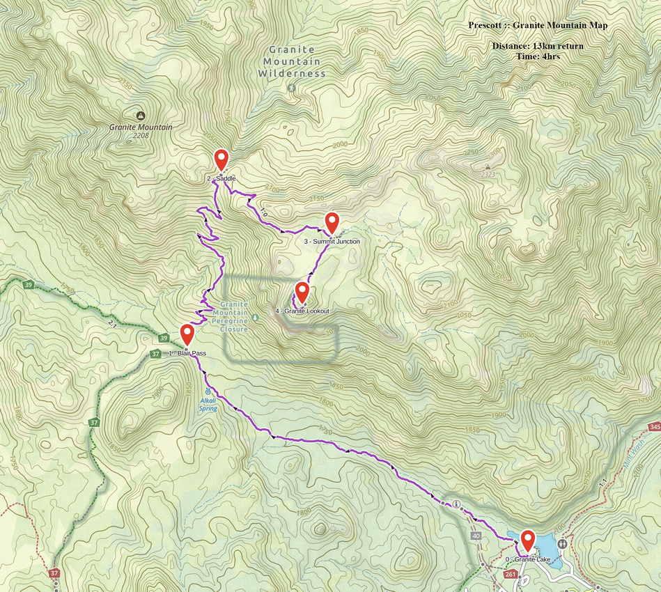 Granite Mountain GAIA Map
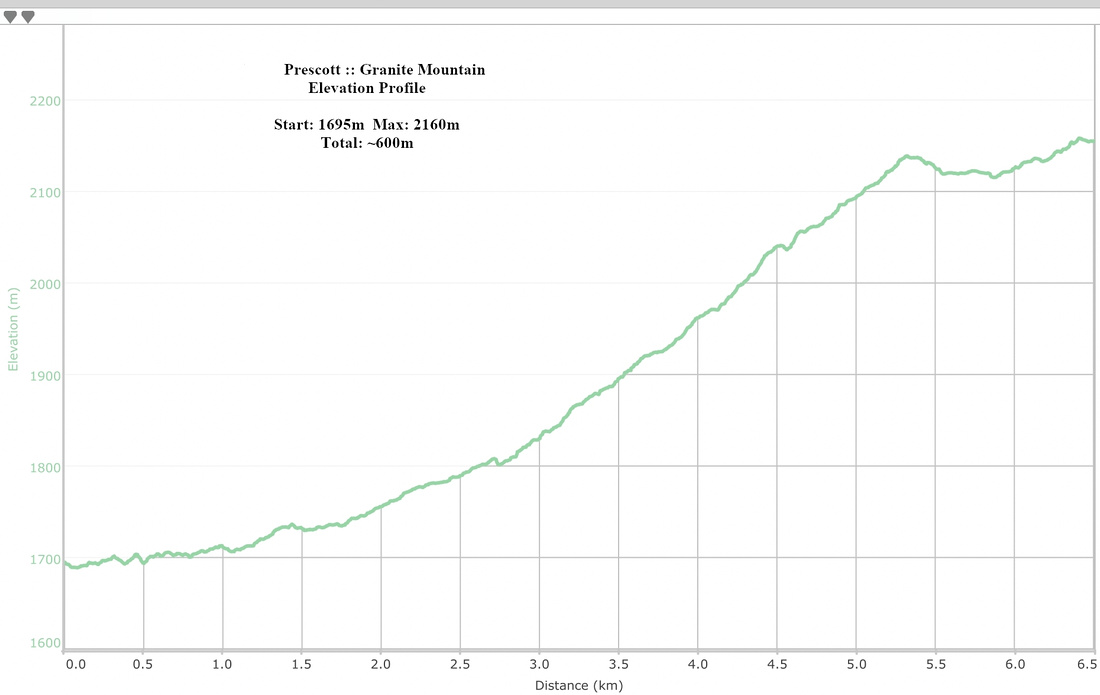 Granite Mountain Elevation Profile