USA :: Phoenix :: Camelback Mountain
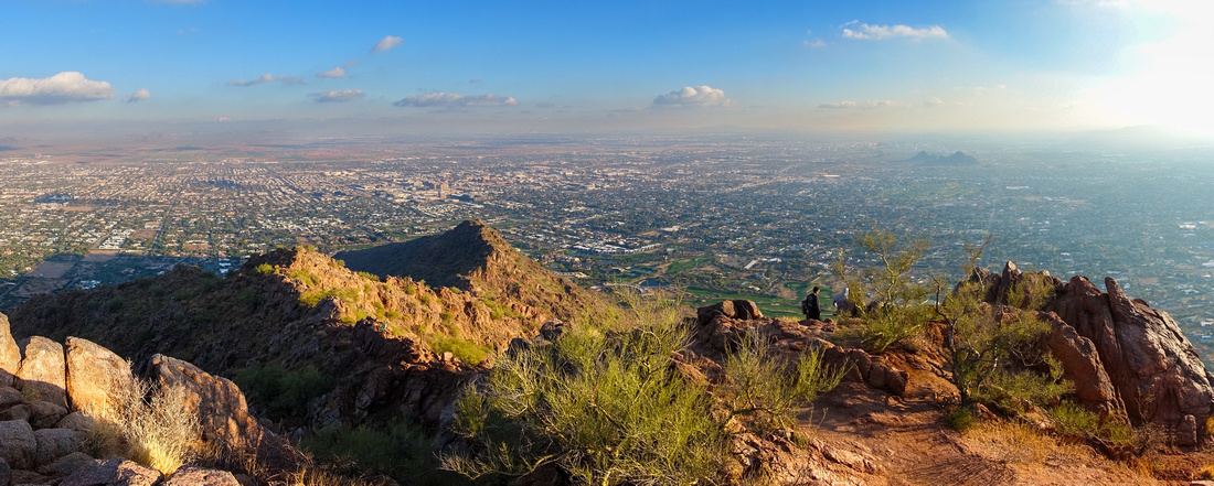 
Panormic view east across smog filled Scottsdale from Camelback Summit |
|||
| Camelback Mountain is signature Phoenix Landmark, visible from many Vantage points around Valley of the Sun. It is also incredibly busy - classic example of modern Urban Hiker Gong Show. But, just like Vancouver Grouse Grind, it is so iconic you have to do it. There are 2 ways up the Mountain - Cholla Trail from the East and Echo Canyon from the West. Finding parking space is ultimate Crux - in Dec '21 I simply gave up not being able to park at Echo Trailhead. Better prepared for such logistics in Dec '23 I decided to try Cholla side. It is less popular and parking can usually be found at Invergordon Street. Better yet - I left car at nearby Fashion Mall (many free parking garages) then simply walked urban streets for ~20min to Trailhead. From Hiking perspective, while not particularly difficult, it is also not walk in the park. Both sides classify as scrambles, Cholla as easy and Echo Canyon as lower moderate using Rockies/BC Coast criteria. Best way to experience the mountain is naturally 1-way traverse; but for that you likely need someone to drop you off (or pick-up) at Echo side. If you do that recommended direction is West to East (Echo up, Cholla down). Overall for outdoors minded Visitor it is still worth doing it - but just once. Just don't try during excessive summer heat months when daytime temps hit mid 40's Celsius - although locals probably still do it.
|
| Cholla Trail | GPS Track | |
| December 24, 2023
Regardless where you left the car, walk up Invergordon street and find Cholla Trail Gate - first photo in Gallery - noting posted "Gate Closed at Sunset". I can't tell if this is true or not, but jumping the fence wouldn't be huge problem; you wouldn't be only one either. Official Trailhead with Restroom and Water Fountain is nearby. Well defined trail that also has "Milepost" numbers (summit is 36 if I remember well), switchbacks lower slopes then bypasses first bump on climber right side. Upon reaching the saddle hike elevates to easy scramble. Way is always obvious but using hands now and then will be required, if nothing else then for stability. Equal - if not more difficult crux - is to dodge all urban hikers or find bathroom privacy should you need it (I used Saguaro Cactus!). Finally around 1hr mark of moderate pace you are on the summit which during my Dec '23 hike had small Christmas Tree. Having solitude on summit is literally impossible, but by dropping a bit on Echo side I was able to find somewhat secluded spot to enjoy break and aerial views of Scottsdale / Metro Phoenix area, before returning the same way. |
||
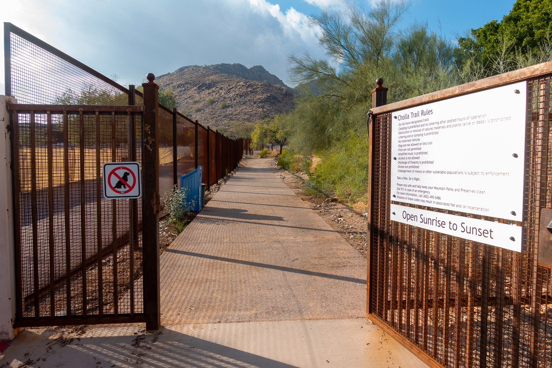 Cholla Gate
 by Invergordon Road. Note "Gate closed at Sunset". What does that mean? I am more than certain there are people inside past sunset. Do they jump the gate if locked out (wouldn't be huge problem)? Cholla Gate
Cholla Gate by Invergordon Road. Note "Gate closed at Sunset". What does that mean? I am more than certain there are people inside past sunset. Do they jump the gate if locked out (wouldn't be huge problem)? |
|||
 |
|||
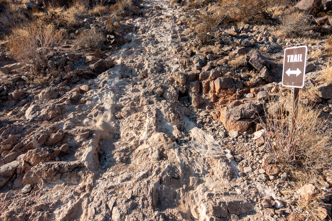 Rocky Trailbed
Rocky Section as lower Cholla Trail switchbacks lower slopes Rocky Trailbed
Rocky Section as lower Cholla Trail switchbacks lower slopes |
|||
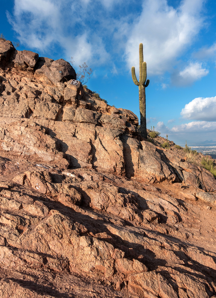 Saguaro Landscape
Classic Arizona Desert Scenery - polished rock and Saguaro Cactus Saguaro Landscape
Classic Arizona Desert Scenery - polished rock and Saguaro Cactus |
|||
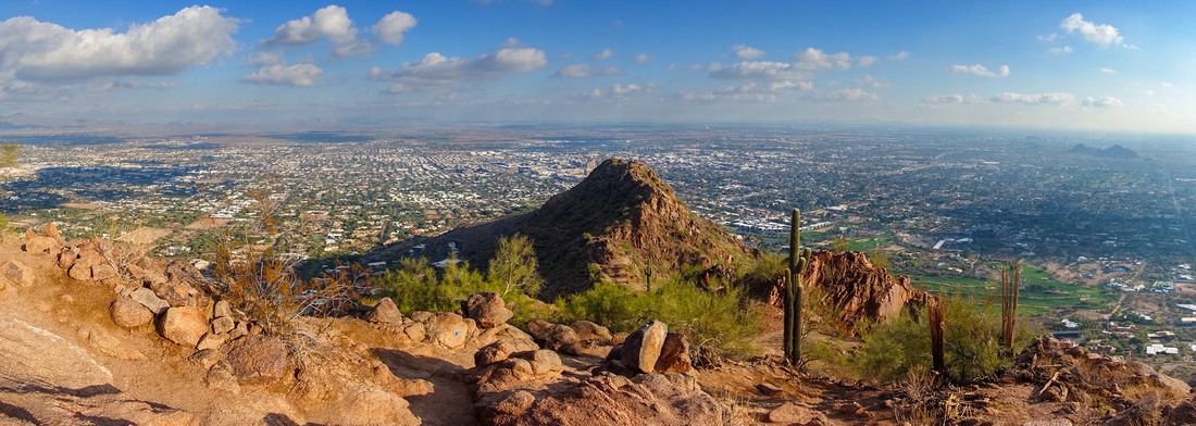 East Ridge Pano
Pano in upper part looking back, this is as scramble starts. Trail skirts that ridge below on climber right East Ridge Pano
Pano in upper part looking back, this is as scramble starts. Trail skirts that ridge below on climber right |
|||
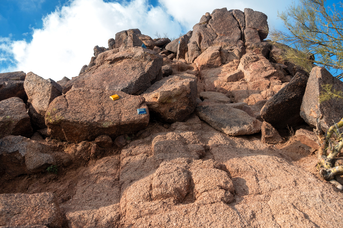 Class 2 Rock
Typical section of class 2 rock in upper part. Note Blue / Yellow Light Fluorescent Markers, testimony this Trail is frequently done in Dark Class 2 Rock
Typical section of class 2 rock in upper part. Note Blue / Yellow Light Fluorescent Markers, testimony this Trail is frequently done in Dark |
|||
 Class 2 Rock
Same spot as on previous photo looking back. Grippy Rock does not present problems when descending this way Class 2 Rock
Same spot as on previous photo looking back. Grippy Rock does not present problems when descending this way |
|||
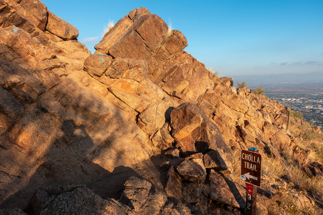 Cholla Crux
This is probably crux in technical terms: Note blue markers, route goes straight across that rock bulge in center. It is still only easy scrambling Cholla Crux
This is probably crux in technical terms: Note blue markers, route goes straight across that rock bulge in center. It is still only easy scrambling |
|||
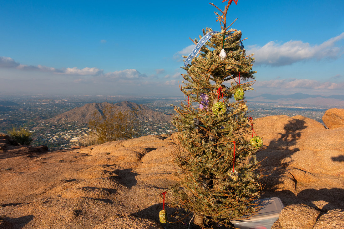 Camelback Christmas
Merry Christmas '23 at Camelback Mountain Summit! Camelback Christmas
Merry Christmas '23 at Camelback Mountain Summit! |
|||
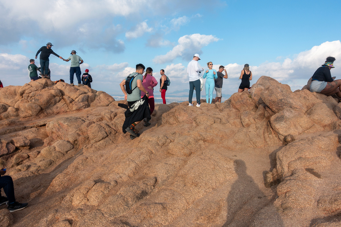 Human Zoo
Camelback summit congestion, illustrating how popular this Peak is Human Zoo
Camelback summit congestion, illustrating how popular this Peak is |
|||
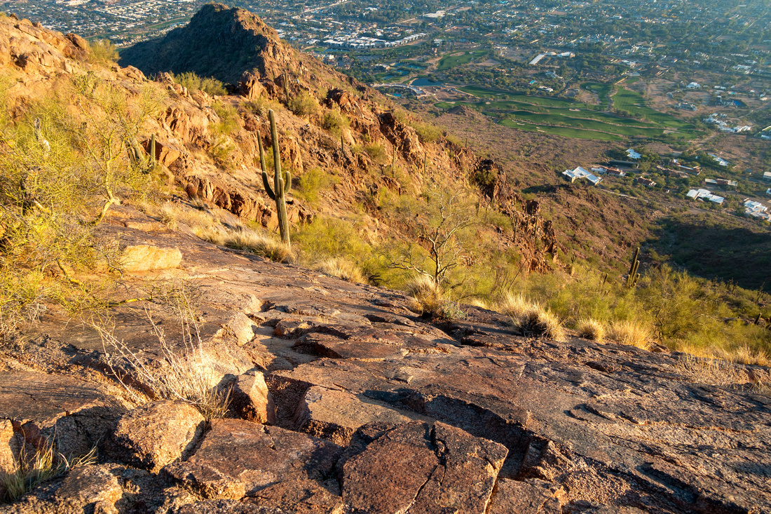
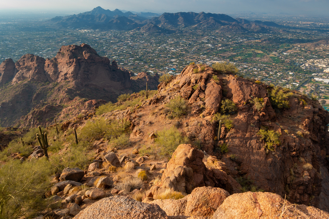 Echo Descent
View of shorter but steeper Echo Canyon side just below Camelback Summit. Piestewa Peak upper left Echo Descent
View of shorter but steeper Echo Canyon side just below Camelback Summit. Piestewa Peak upper left |
|||
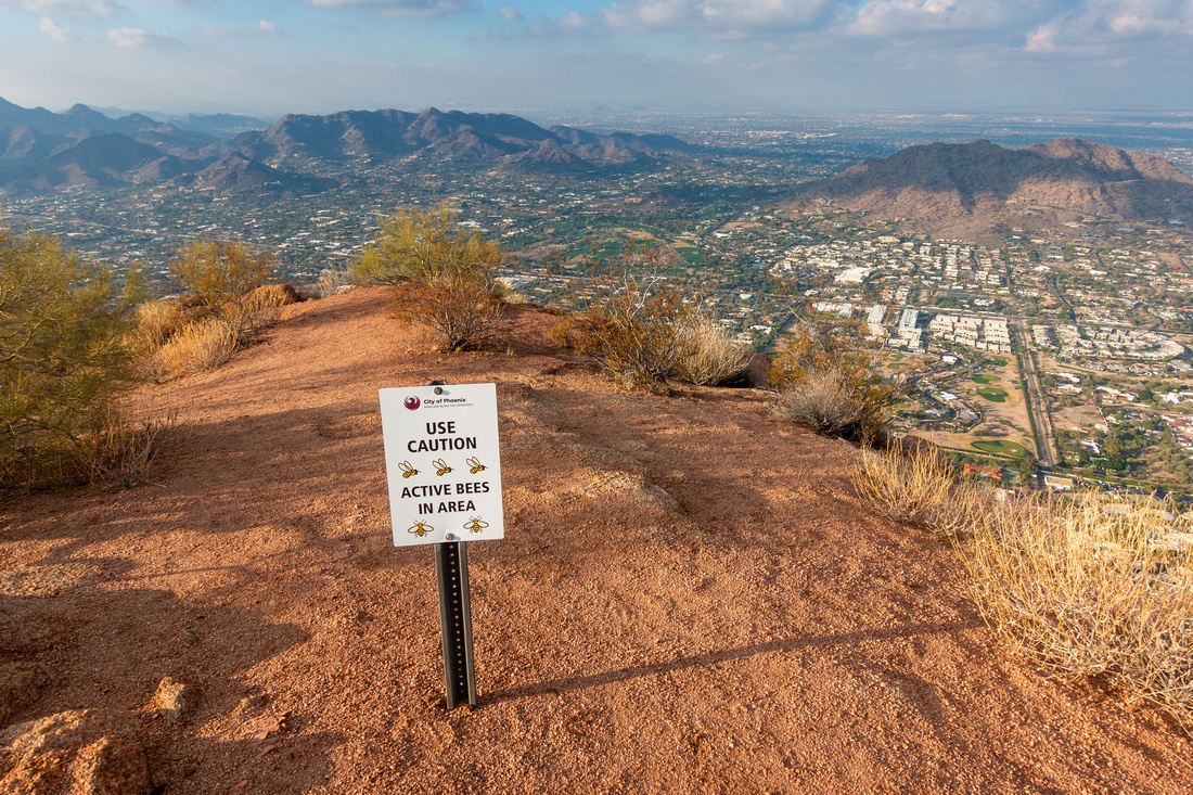 Bee Warning
There are presumably bee nests on Camelback Mountain Bee Warning
There are presumably bee nests on Camelback Mountain |
Abstract
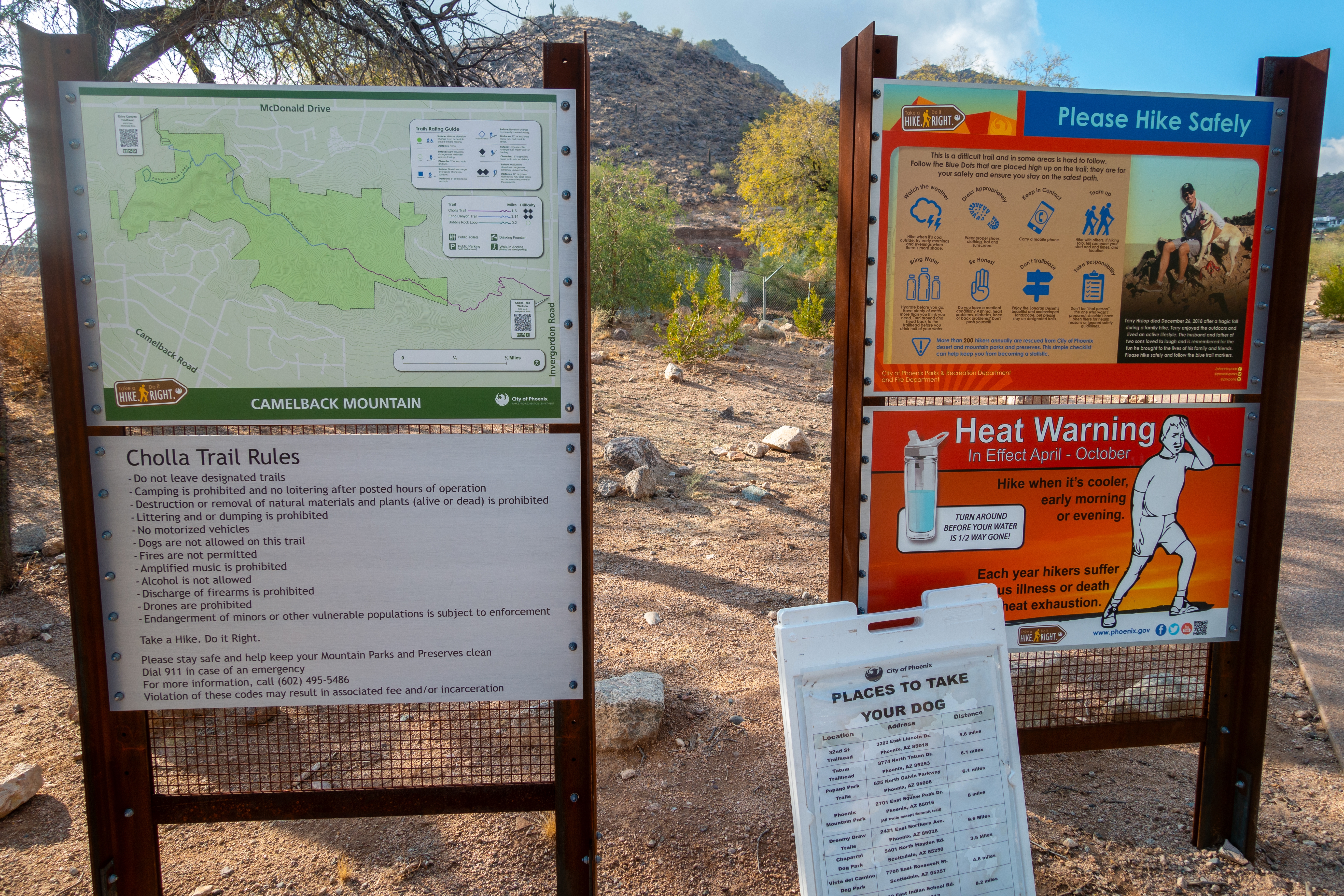
| Overall Difficulty | D4 | Moderately steep and occasionally rocky trail in lower part. Class 2 Rock scramble above | |||
| Scenery | 360 Panorama of Metro Phoenix Valley | ||||
| Trail/Marking | Excellent | Well defined trail in lower part, paint blazes and fluorescent lights on upper rocky ridge | |||
| Suggested Time | 2 hrs | Return time, regardless of descent route | |||
| Elevation |
Start: 415m Max: 825m Total: ~380m |
Distance: ~2.5km (1-way) | |||
| Gear | Light hikers probably sufficient, but full boots for ankle support won't be out of place. Poles helpful for stability on descent | ||||
| Water | Trailhead water fountain only. Carry 1-3L, depending on season | ||||
| Dog Friendly | No | Official trailhead sign officially prohibits canine traffic because of heavy human traffic | |||
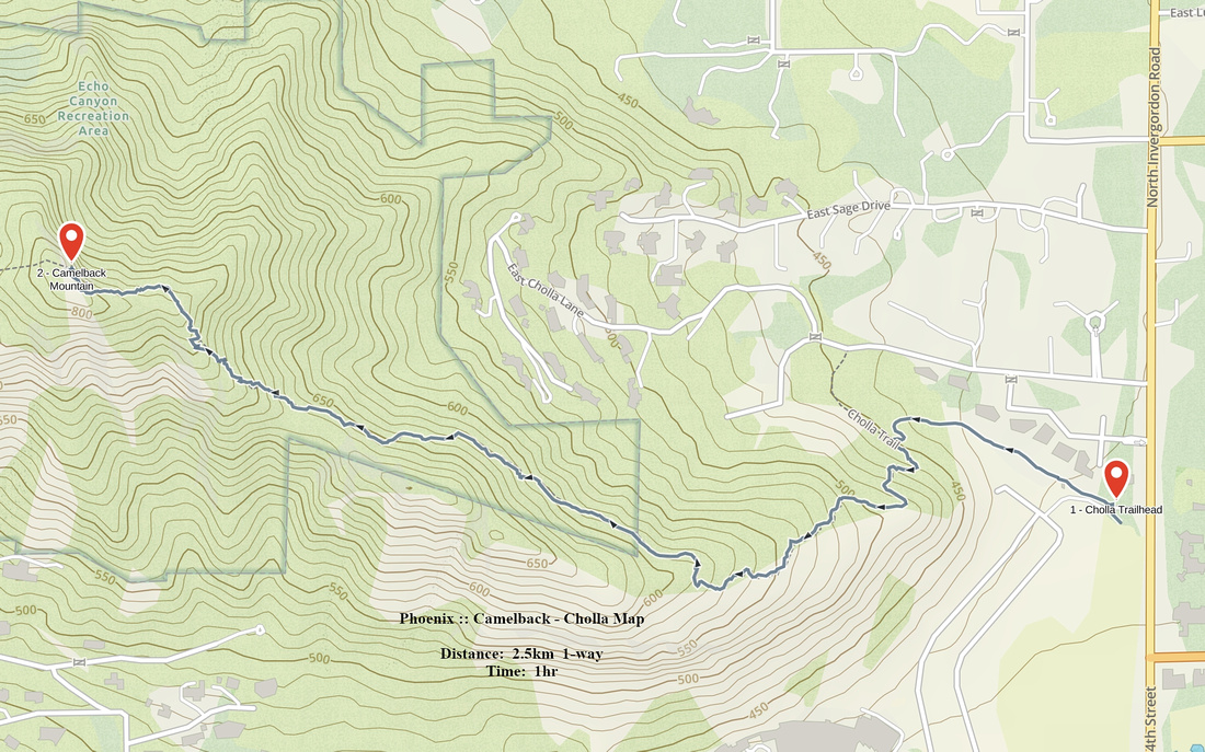 Camelback - Cholla GAIA Map
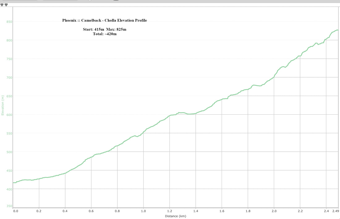 Camelback - Cholla Elevation Profile
| Echo Canyon | ||
|
TBA |
||