BC Coast :: North of Whistler :: Land of Tolkien |
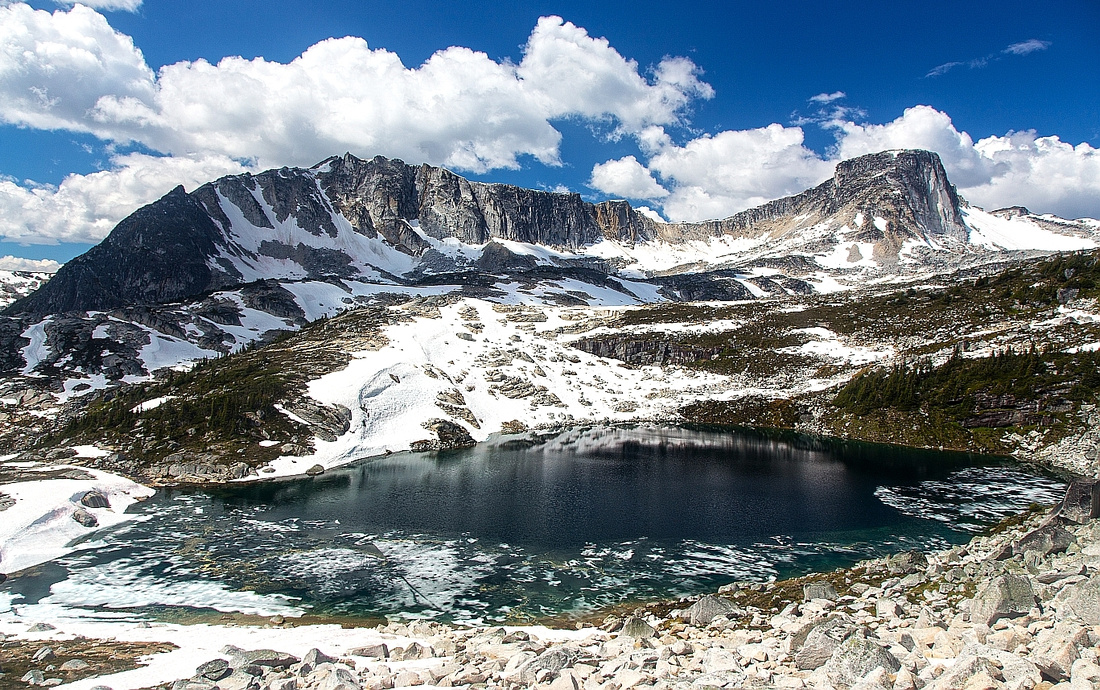 
Alpine basin above Long Lake from lower slopes of Mt. Shadowfax. Gandalf - Aragorn ridge behind |
|||
|
Just north of Birkenhead lake Provincial Park lies fantastic alpine area themed based on popular "Lord of the Rings" fantasy series. And for good reason too; it is very beautiful, mysterious at times and most of everything: It begs for exploration! Brian Waddington Hut at west side of Long Lake is an excellent base for multi-day visits (Day trips from metro-Van area, although done, are not feasible due to excessive driving time - over 3 hours one way). Phelix creek provides good access to the alpine, and high-clearance 4WD will cut approach time over an hour each way. With 2WD bringing a bicycle is excellent idea, and ride back will be quick and memorable! Above the Hut half a dozen peaks can be scrambled with minimal technical difficulty; each hosts fantastic views into not-so-frequently visited areas of BC Coast Mountains. Note that grizzly bears frequent areas around Long Lake; for that reason visits are discouraged in prime August-October season. If you go please treat this beautiful and fragile area with care, leave no trace and enjoy!
|
| Phelix Creek | GPS Track | |
|
Phelix Creek is standard approach to "Tolkien Base Camp" -- sub-alpine basin hosting Long Lake and Brian Waddington Hut. For relaxed visit most groups will spend their 1st day on drive, approach hike and settling in. Conditions on logging road above Birkenhead lake constantly change; check online Forums (such as Club Tread) for latest updates. Leaving the car parked overnight on this road is generally safe, but break-ins have been reported; do not leave anything of value inside your vehicle.
From Vancouver drive Sea-to-Sky (Hwy 99) to Whistler and continue to Mt. Currie few minutes past Pemberton. At T intersection just Hitching Post motel continue straight towards D'Arcy (right goes up to Duffey / Lilloet). Continue for ~35km and turn left into Blackwater Valley Road (gravel after initial 1.5km)) - following signs for Borkenhead Lake provincial park. Follow this road for about 1/2 hour. Phelix creek logging road is few minutes before Birkenhead Lake parking on the right (north) side. (If you have enough time and have never been to Birkenhead, it is worth short visit). Drive up Phelix logging road; it is manageable for 2WD for a short distance only till you encounter major washout. This is "2WD parking" on GPS map; with 4WD you might be able to continue, depending on conditions, clearance of your vehicle and your driving skills! If not walk or cycle the road; it is steep initially, but fairly soon after couple of switchbacks it levels -- if you haven't brought the bike, you'll wish you had! Road crosses the creek back and forth twice, then settles for gentle rise on the left (right) side. About 3.5km past the slide (2WD parking) is unbridged creek crossing. This is usual 4WD parking. Some drivers have continued past this obstacle, but it is not really worth as the end of the road is only 10-15 mins away. Cross the creek on somewhat narrow log (handline feels welcome here) and hike to the end of the road. Trail dips into the forest and descends slightly, then emerges at large avalanche slope you must cross. This slope is overgrown; follow trail as best as you can, but at times you won't be able to see your feet -- caution is needed. It will take about 1/2 hour to cross this part and is by far the least enjoyable part of journey into the Land of Tolkien. At far end watch for flags and pick-up the trail again. Trail now rises in series of switchbacks and long traverses towards the mouth of Long Lake basin; it will take about 1 hour. Upon reaching the basin views open up and everything becomes incredibly scenic! Long Lake is in front of you, and good eyes will be able to spot the hut on the far end. Trail crosses the outlet on seasonal bridge to the right (north) side; if the bridge is removed, you still might be able to hop on the logs. Otherwise continue on the left side, but only as last resort as hopping over boulders is fairly awkward. Trail contours the lake then just before the hut crosses boggy area where wood planks have been laid.
The Hut is wonderful! The view from the porch across Long Lake towards Mt. Taillefer at dusk is stunning, to say the least! Creek is nearby for fresh water (drinks can be cooled in too). Inside is quite spacey, with 2 floors and basic facilities -- kitchen, benches and desks and sleeping quarters upstairs. There is even small library! Behind the hut is outhouse as well as infamous alternative -- "pee tree"! Please familiarize yourself with Hut rules posted on the wall and leave cleaner than you found it. Payment for your visit can be deposited in the box on the wall just by the entrance. |
||
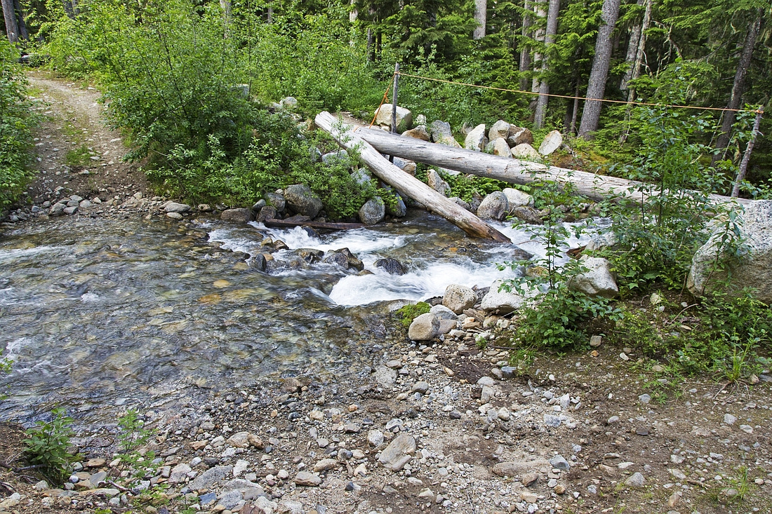  Phelix Creek crossing at usual 4WD parking. Trailhead is 10-15 mins away
 |
|||
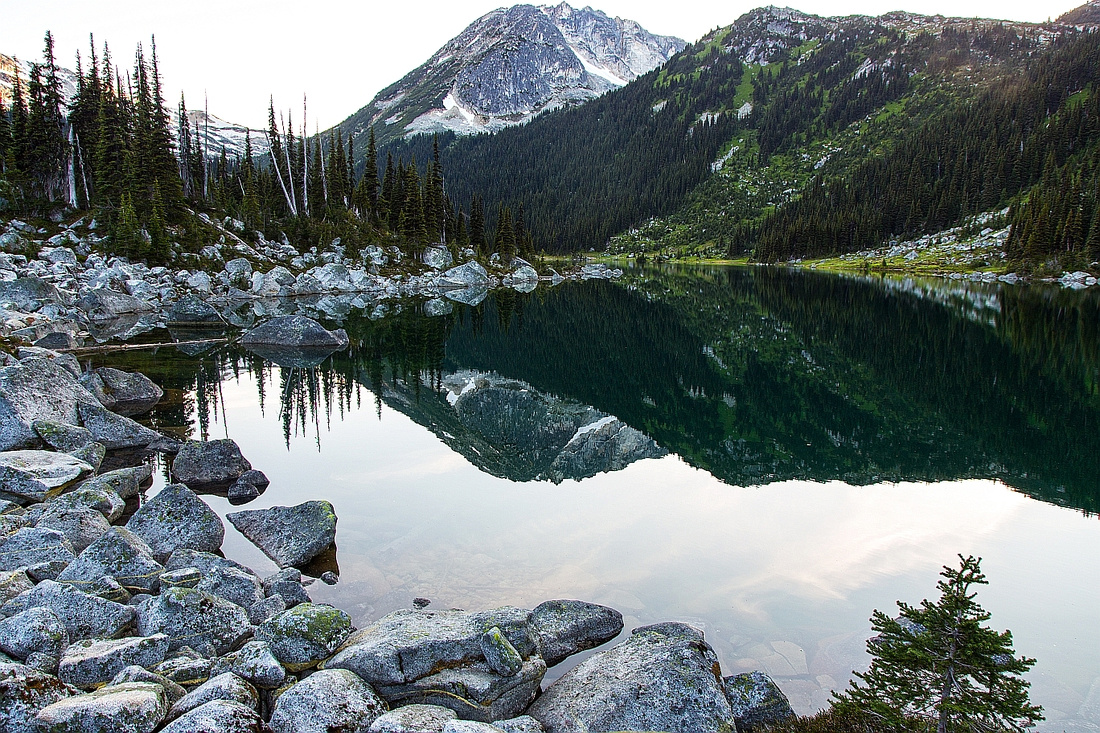  East End of Long Lake. Gandalf upper center
 |
|||
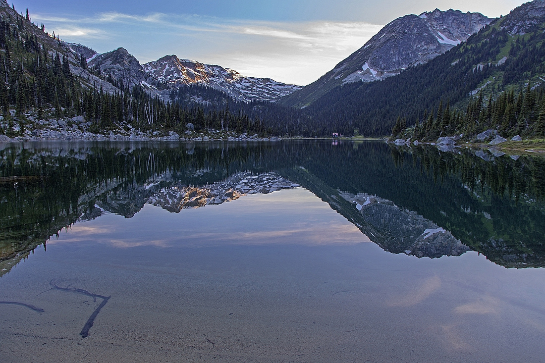  Hiking around Long Lake to the Hut on the far side
 |
|||
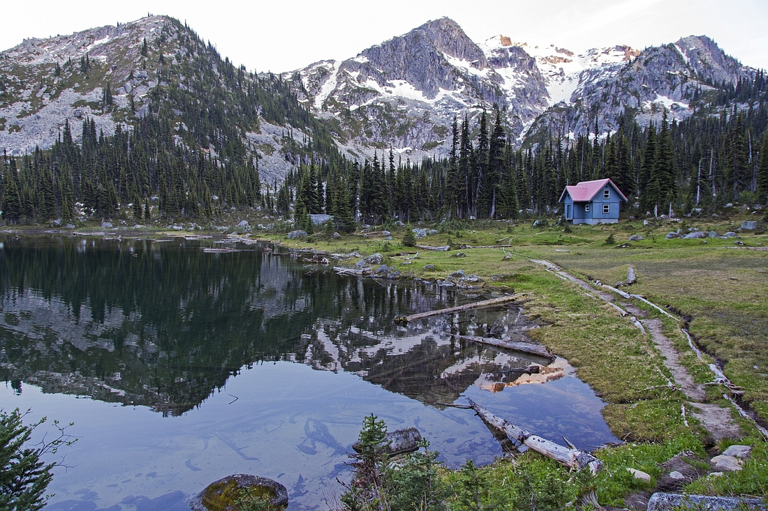  West End of the lake just before Brian Waddington Hut
 |
|||
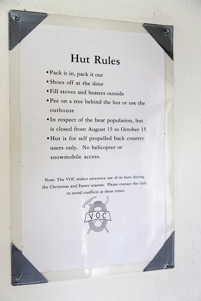  Brian Waddington Hut Rules
 |
|||
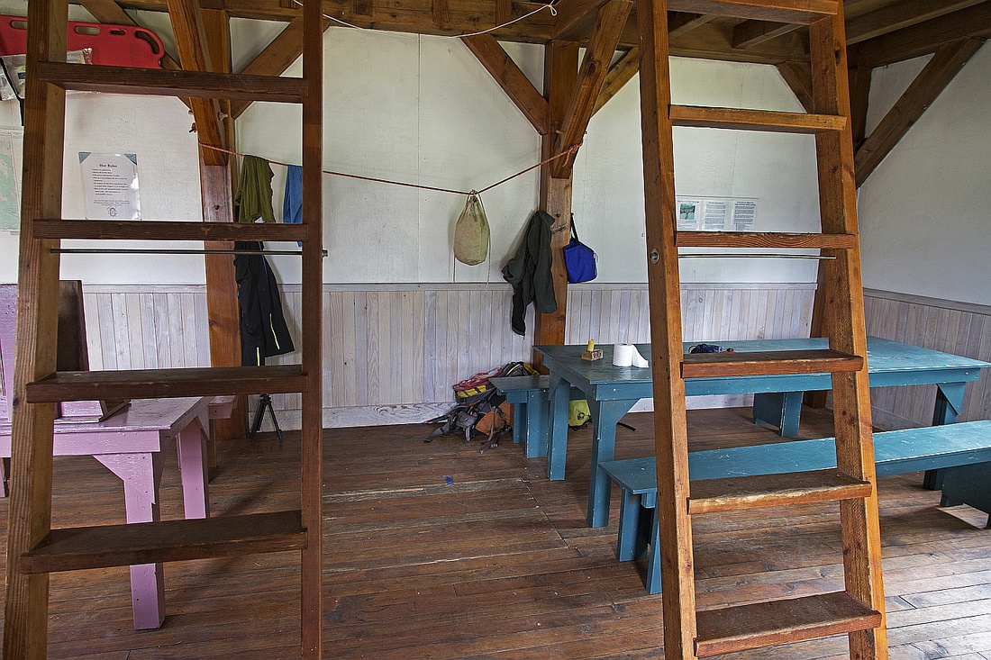  Main floor and sitting area
 |
|||
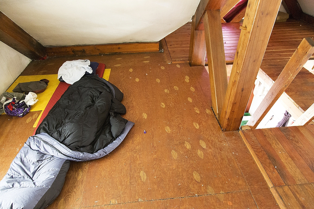  Upper floor and sleeping area
 |
|||
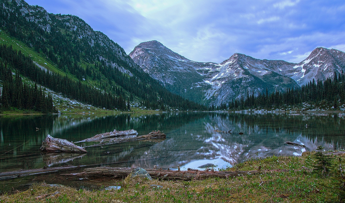 
Evening views across Long Lake |
Abstract
| Overall Difficulty | D3 | Logging road walk (4WD or bicycle). Overgrown avalanche slope. Moderately steep switchbacks. Potentially problematic (but avoidable) crossing of Long Lake outlet | |||
| Snow Factor | S3 | Trip is frequently done in winter on skis. Caution on avi slope just past the end of logging road. Ascent to Long Lake is in trees and does not pose avalanche danger | |||
| Scenery | Approach hike is not overly scenic, but this is necessary price to pay for riches that follow. Beautiful Long Lake | ||||
| Trail/Marking | Good | Caution not to lose trail on overgrown avi slope just past end of logging road; well defined and marked after that | |||
| Suggested Time | 2 hrs | 1-way to Brian Waddington Hut with 4WD from end of logging road. Add 1+ hr if walking, 45 min if cycling (faster on descent) | |||
| Elevation |
Start: 860m(2WD), 1200m(4WD) Max: ~1710m Total: 850m(2WD), 520m(4WD) |
Distance: 10 km (2WD), 6.5 km (4WD) | |||
| Gear | Full hiking boots. Gaiters and hiking poles suggested. Overnight gear (Hut has skimpy mats and some dishes; bring your own) | ||||
| Water | Phelix Creek (several crossings if walking/cycling logging road). Long Lake outlet. Carry 1L | ||||
| Dog Friendly | No | Dogs should not overnight in the Hut. If camping outside, be aware this is grizzly bear hotspot | |||
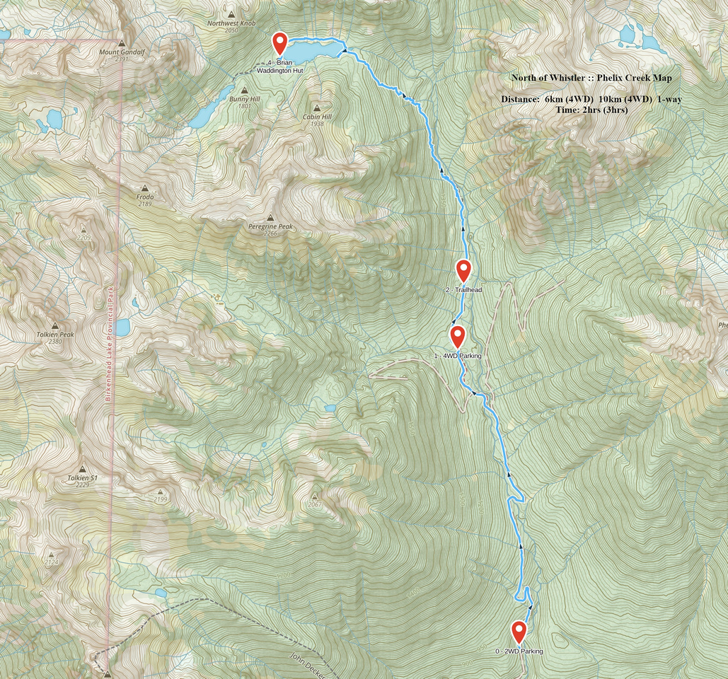 Phelix Creek GAIA Map
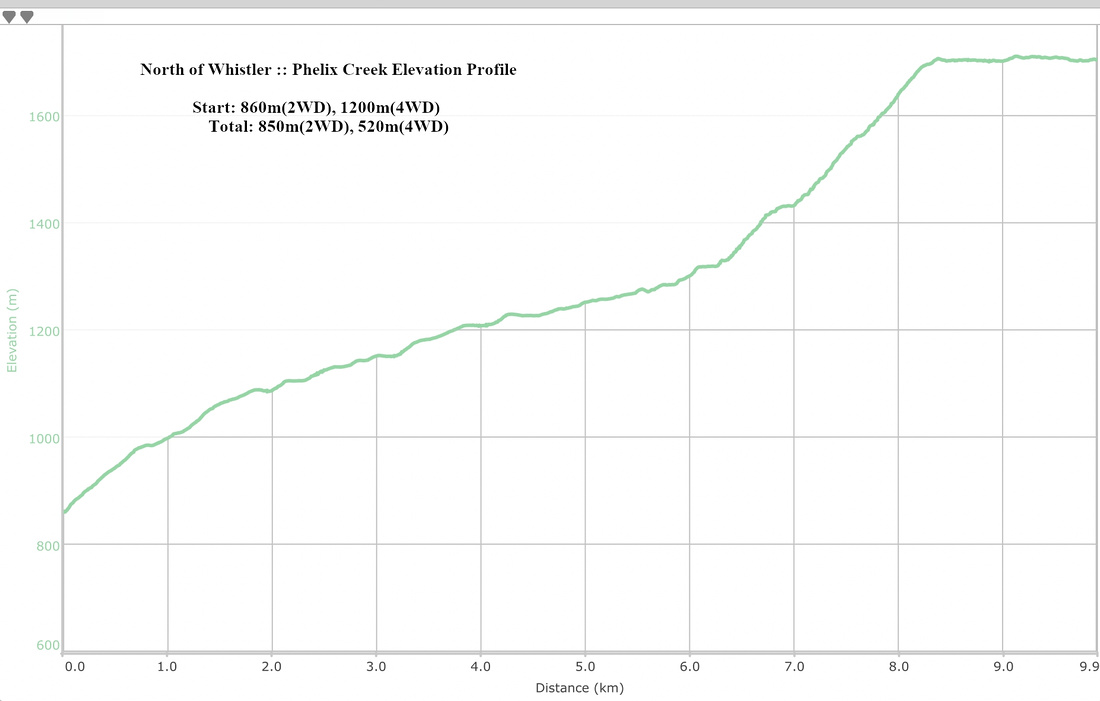 Phelix Creek Elevation Profile
| Gandalf | GPS Track | |
|
Gandalf is peak seen above west end of Long Lake while approaching Brian Waddington Hut. It is highly recommended ascent that poses little technical difficulties. Scenery is fantastic! Most groups continue over to Aragorn then return back to the Hut via alpine basin below Shadowfax.
From the Hut head towards upper lake following faint trail on the right side of the creek. If you lose it just stay near the creek; forest is open. You might stumble upon cairn and faint trail coming down on the right side; this is descent from the basin below Aragorn and where you will return if you do the loop. Upper lake is reached in about 20 minutes from the Hut. It is very beautiful, with Tolkien peak towering on the left side (to ascend Tolkien, you would head around the lake on the left side, then climb up grassy gully towards the col to the left of Tolkien). For Gandalf make your way around the lake on the right side, hopping across boulder field towards the end. The goal is to climb low col directly in front of you, then follow broken ridge to summit of Gandalf to the right. Terrain is easy with grassy terraces and sections of talus; any way will do. You gain about 300m vertical to the col. Fabulous views open up on the other side towards Sockeye drainage, while gentle ridge to the left side towards Tolkien peak looks equally inviting. After the break turn right and follow cairns up the slope above aiming to intersect Gandalf west ridge. Follow the ridge to the summit, with couple of brief detours to the right side - this is the only scrambling portion of the ascent. At the summit awaits famous "Gandalf flake" - rock fin and true summit. You will undoubtedly have fun trying to wiggle your way up, but beware if rock is wet. Fantastic 360 degree panorama will warrant extended summit visit; even the distant Joffre group can be spotted! Return the same way, or descend the north ridge towards Aragorn. |
||
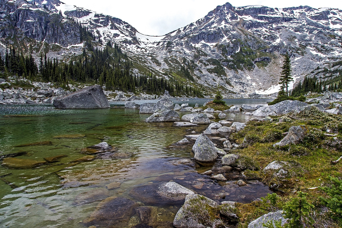  Hiking around upper lake. Tolkien peak just right of center
 |
|||
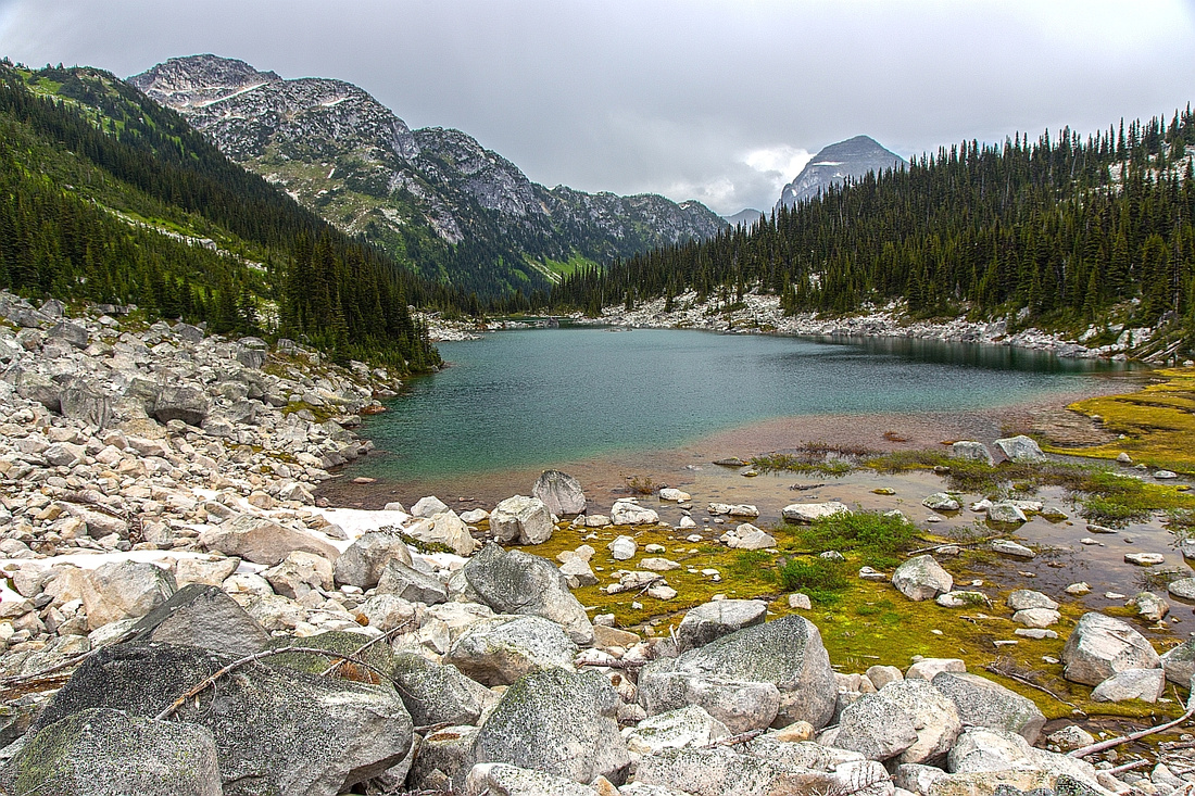  View back across upper lake. Shadowfax left, Taillefer right
 |
|||
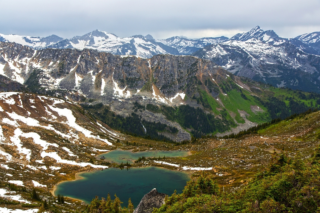  View west from Tolkien - Gandalf col to Sockeye drainage
 |
|||
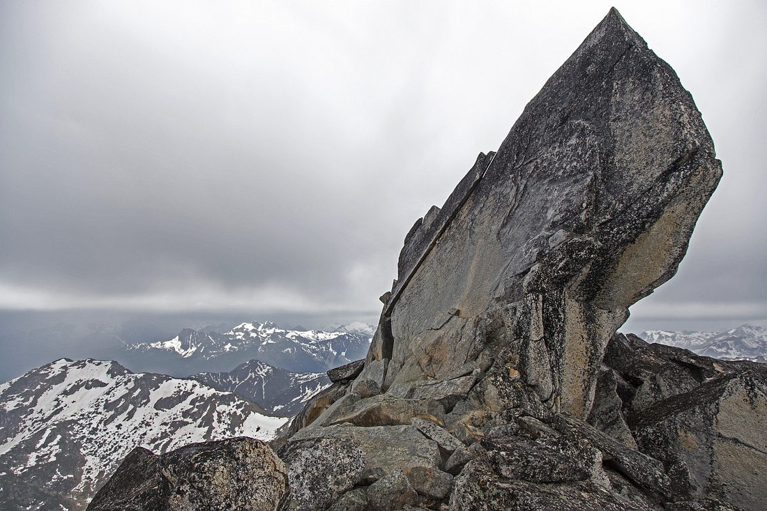  Gandalf summit flake
 |
Abstract
| Overall Difficulty | D4 | Mainly off-trail hiking with brief mild bushwhack. Moderately angled talus slope with boulder hoping in upper part. Optional difficult scramble up the flake on summit | |||
| Snow Factor | S3 | Frequently skied in winter; snowshoe ascent is feasible as well. Moderate avi risk | |||
| Scenery | Sparking upper lake in cirque below Tolkien Peak. Far reaching views from the col and summit | ||||
| Trail/Marking | None | Faint trail between two lakes, none afterwards. Sporadic cairns | |||
| Suggested Time | 2.5 hrs | One way from Long Lake to summit of Gandalf. Complete time depends from return option; see Aragorn. If coming back the same way to Long Lake descent should take less than 2 hours | |||
| Elevation | Start: 1710m Max: ~2390m Total: 720m (1-way from the Hut) | Distance: 5 km (1-way from the Hut) | |||
| Gear | Full hiking boots and poles / skis or snowshoes | ||||
| Water | Creek between two lakes. No water source above upper lake. Carry 1.5L | ||||
| Dog Friendly | No | Assuming overnight stay in Brian Waddington Hut. If dayhiking from Phelix Creek dogs are ok; beware of bears | |||
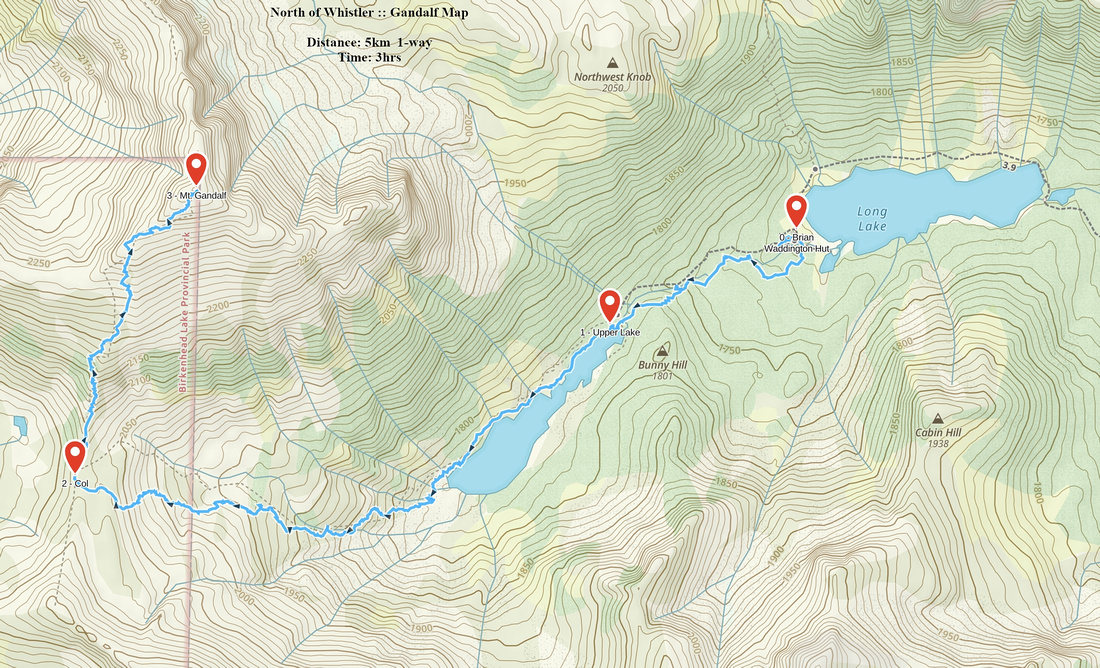 Gandalf GAIA Map
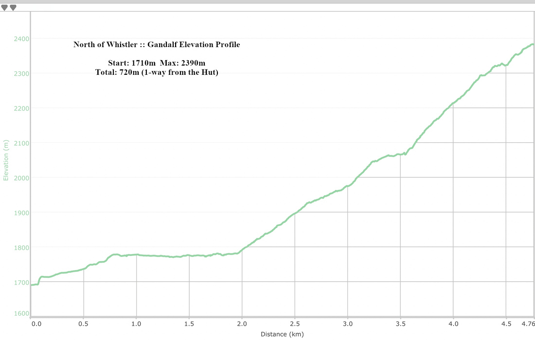 Gandalf Elevation Profile
| Aragorn | GPS Track | |
|
Mt. Aragorn is high-point of long ridge extending north from the summit of Mt. Gandalf. It is usually climbed as extension of Gandalf trip. Direct ascent from Long Lake is not recommended because of ultra steep and lose talus slope below Gandalf-Aragorn col which is much easier to descend.
From summit of Gandalf descend north ridge. Initially going is quite rough across large boulders and sloping rock platforms. Bits are mildly exposed and lose - use caution. Halfway down route eases up and you are back to grass. Delightful hiking leads to low col and your exit route. Summit of Aragorn is about 1/2 hour -- 1km and 250m vertical away. Going is equally easy and there are no difficulties reaching what is probably your 2nd summit of the day. Views do not disappoint and include northerly views towards rarely visited Bralorne Valley. Walk briefly down north ridge for bird-eye view of large tarn that remains frozen most of the year.
For descent goal is to reach large alpine basin to the east (towards Mt. Shadowfax). There are 2 ways to do it:
Regardless of the way you descended to the basin, make your way south across meadows and talus fields. You could also continue east and scramble Mt. Shadowfax from here for very satisfying, but long 3-peak day. Most people seem to have enough with 2 peaks though. Stay close to the skier left side of obvious drainage and watch for flags that indicate start of faint trail descending down to the valley. Eventually you emerge to trail between Long Lake and upper lake, about 10 minutes above the Hut. Turn left and hike back to Long Lake. |
||
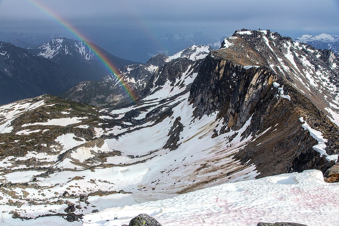  Gandalf descent ridge (R) from lower slopes of Aragorn
 |
|||
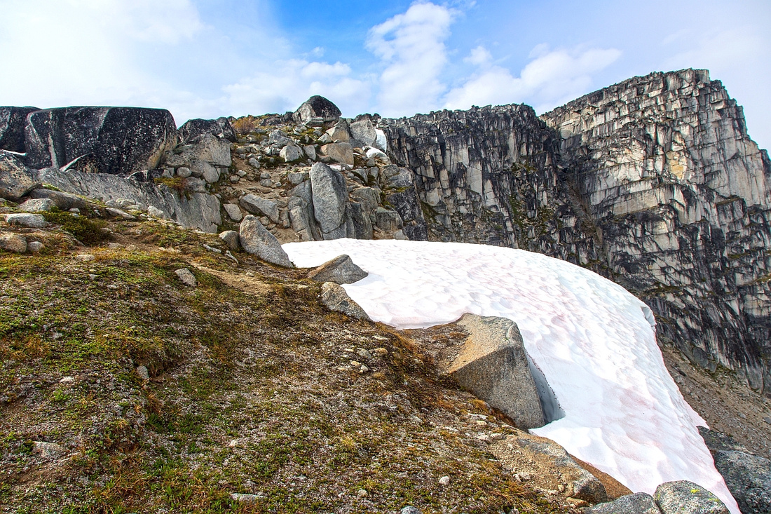  Final push to Aragorn summit -- just a walk
 |
|||
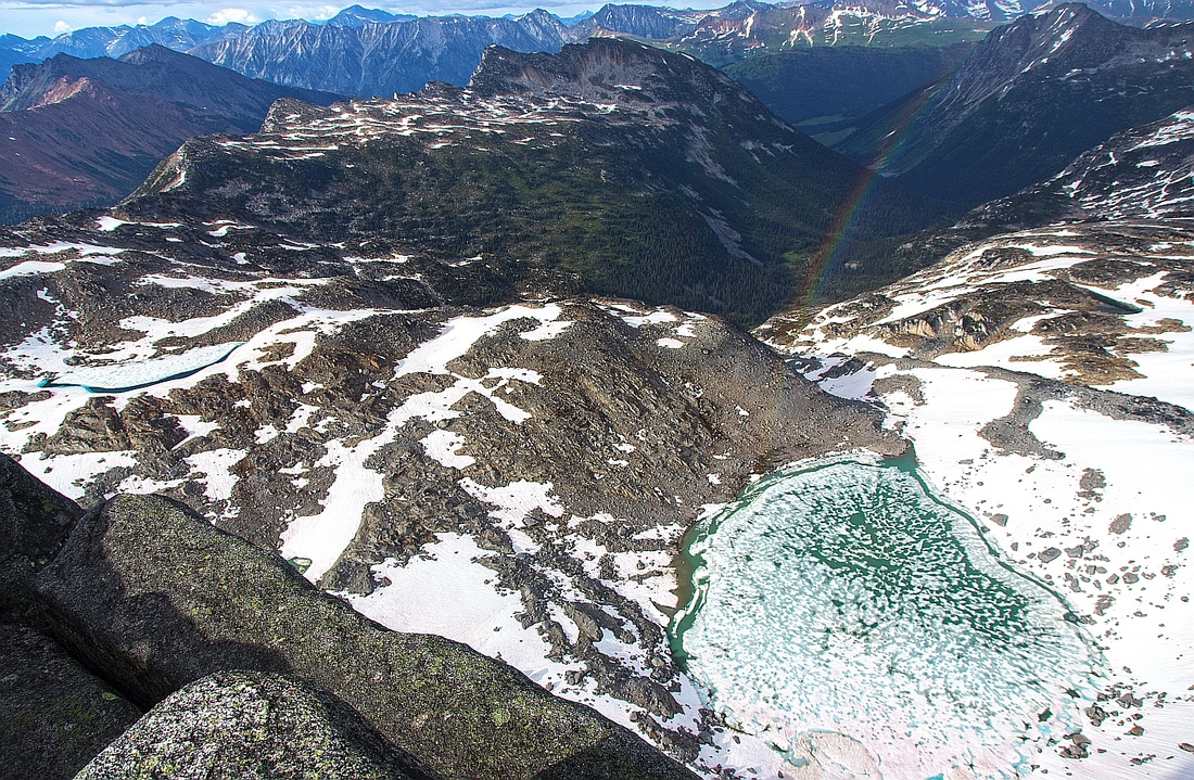  Views on Aragorn north side towards Bralorne valley
 |
|||
  Descent from Aragorn/Gandalf col via "Chute of Mordor"
 |
Abstract
| Overall Difficulty | D5 | Semi-exposed section directly below Gandalf. Awkward very lose descent from Gandalf-Aragorn col | |||
| Snow Factor | S4 | Steep east slopes below Gandalf on return with frequent releases - high avalanche danger | |||
| Scenery | Breathtaking views in the heart of Tolkien. Lovely alpine basin dotted with tarns between Aragorn and Shadowfax | ||||
| Trail/Marking | Poor | Occasional cairns on the ridge. Faint trail with flags on descent from basin to Long Lake | |||
| Suggested Time | 3-4 hrs | From summit of Gandalf to Aragorn and down to the Hut. Complete loop Hut - Gandalf - Aragorn - Hut: ~7 hrs | |||
| Elevation | Start: 2390m (Gandalf) Max: 2440m (Aragorn) Total from Gandalf: 190m (ascent), 850 (descent) | Distance: 6 km (Gandalf - Aragorn - Hut) | |||
| Gear | Full hiking boots and poles / skis or snowshoes. Ice-axe / crampons for alternate descent. Climbing helmet suggested | ||||
| Water | Ridge is dry. Occasional snow patches. Small creeks and tarns in the basin. Carry 1-2L | ||||
| Dog Friendly | No | Assuming overnight stay in Brian Waddington Hut. Day trip to Aragorn from Phelix creek is very long day | |||
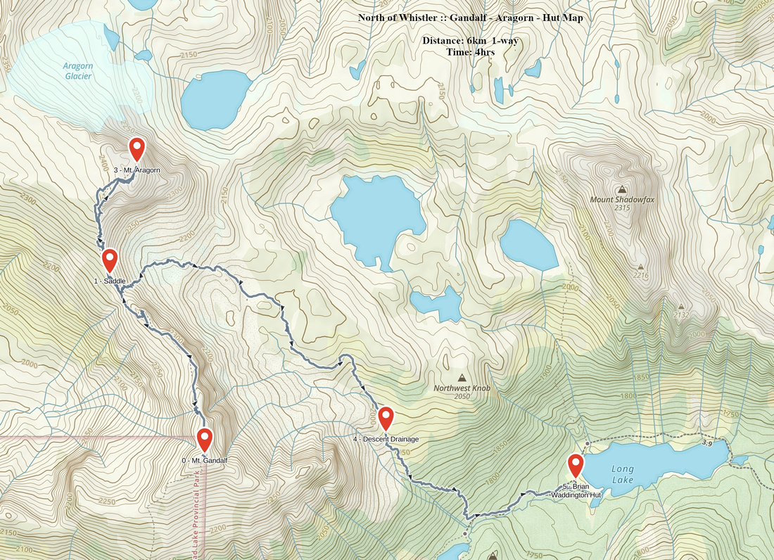 Shadowfax - Aragorn - Hut GAIA Map
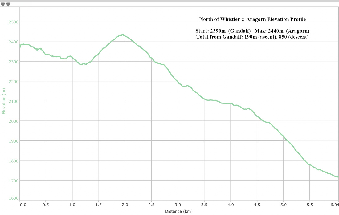 Aragorn Elevation Profile
| Shadowfax | GPS Track | |
|
Shadowfax is the most technical peak in immediate vicinity of Brian Waddington Hut. It sits directly above Long Lake on the north side. Distance is short and it is might be feasible as day trip from Phelix creek. Most parties that overnight at the Hut seem to leave Shadowfax for the last day before hiking out.
From the front of the Hut hike on the north side towards obvious bushy drainage coming down from alpine basin below Mt. Shadowfax. Leave the trail past the boggy section with planks and head up on left (west) side of the creek. Watch for flags at edge of bush; faint trail exists and is much easier than trashing up on your own. There are still couple of awkward sections and mild bushwhacking. It takes about 30 minutes to ascend this part. Eventually bush opens up , trail exits to alpine meadow and disappears. Note this spot to be able to pick up the trail on return. Cross the creek to the right side and ascend to gorgeous and large alpine tarn directly below your objective. This tarn (lead photo on top of this page) is very beautiful and remains frozen till mid-summer. Entire Gandalf-Aragorn ridge can also be readily studied from here. After the break hike around the right side of the tarn. Do not follow all the way around the lake although long grassy slope at far end seems promising. Correct way is to head up grassy gully about halfway around. This gully is fairly steep and main reason why ascent of Shadowfax can not be recommended in winter conditions. Towards the top of the gully watch for cairns leading across ledges towards south end of Shadowfax ridge. Bits of trail reappear here. Turn left and scramble ridge to the summit keeping mainly on the left side; there are couple of mild scrambling steps, but nothing too difficult in dry conditions.
Wide summit plateau offers breathtaking views. As this is likely your last peak before heading out stop for a moment and reflect to the beauty of Land of Tolkien in the heart of British Columbia Coast Mountains!
Descent is the same way and will be twice as fast as ascent. |
||
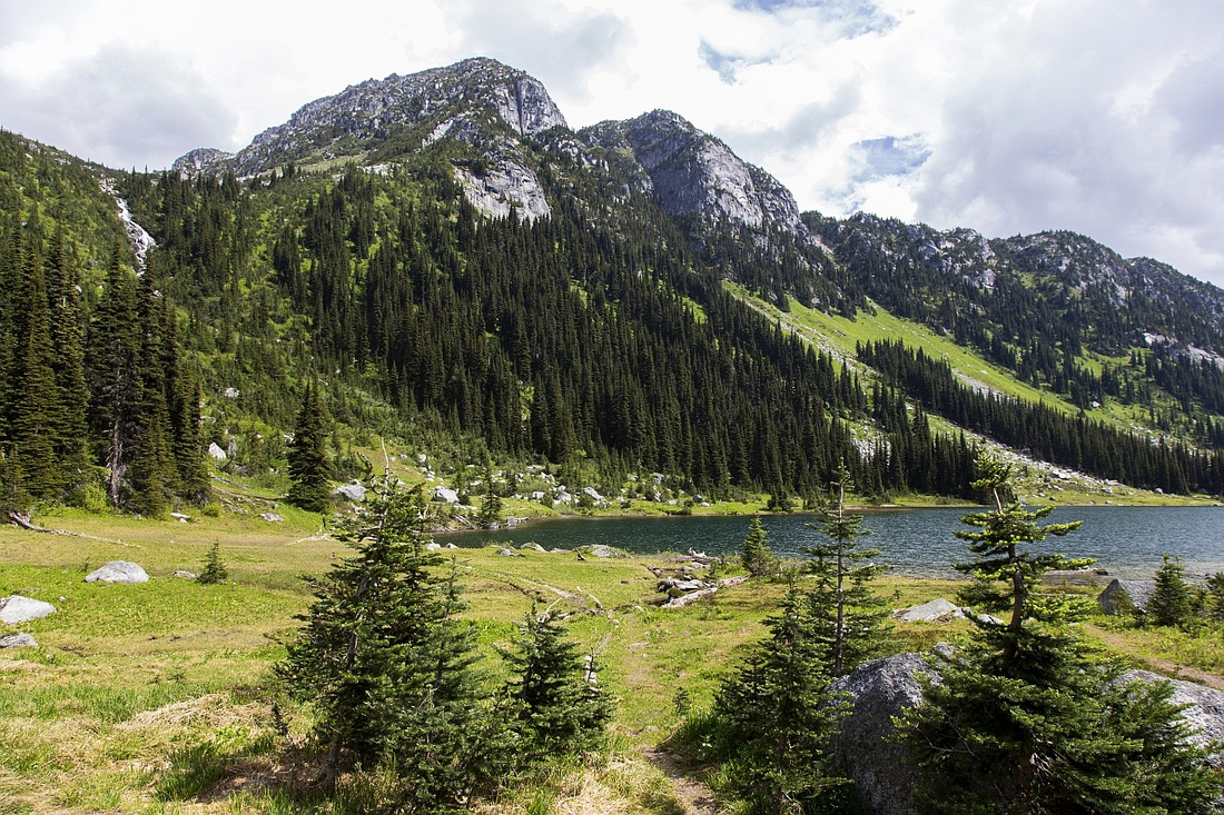  Shadowfax from Brian Waddington Hut. Access is via bushy drainage to the left
 |
|||
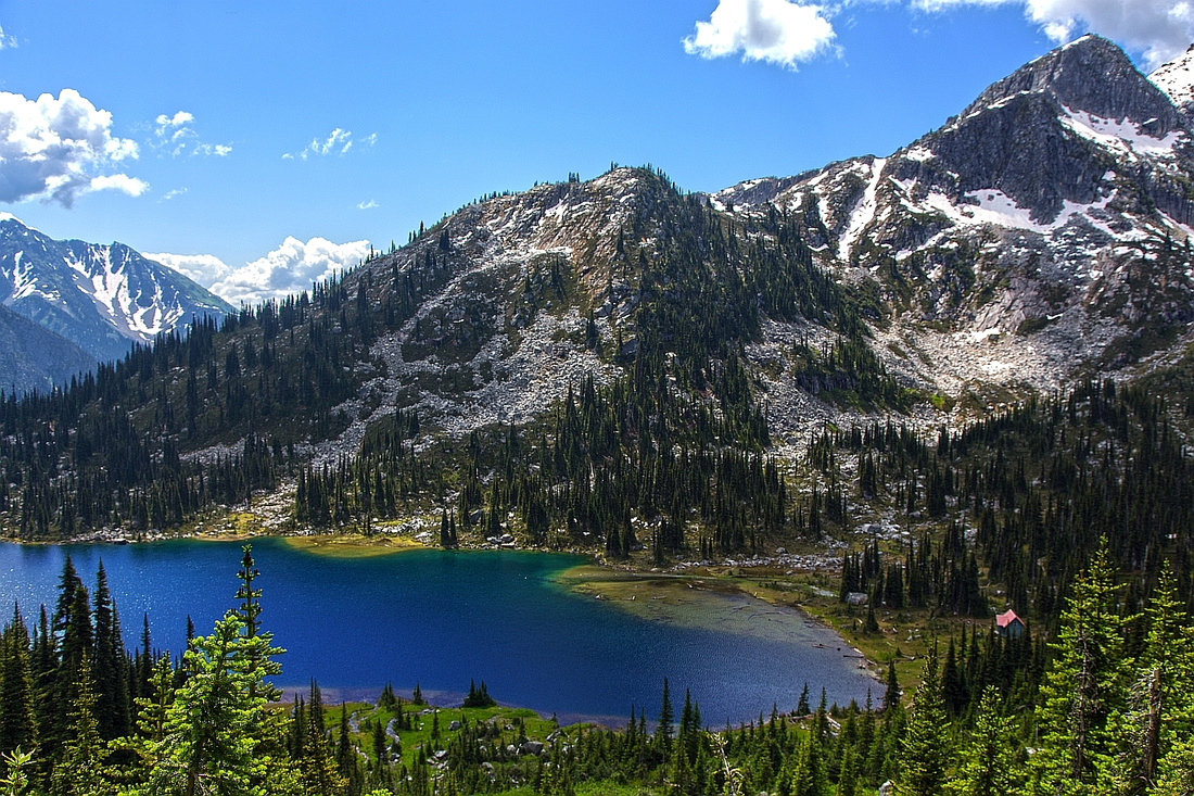  Long Lake and Peregrine Peak from ascent drainage
 |
|||
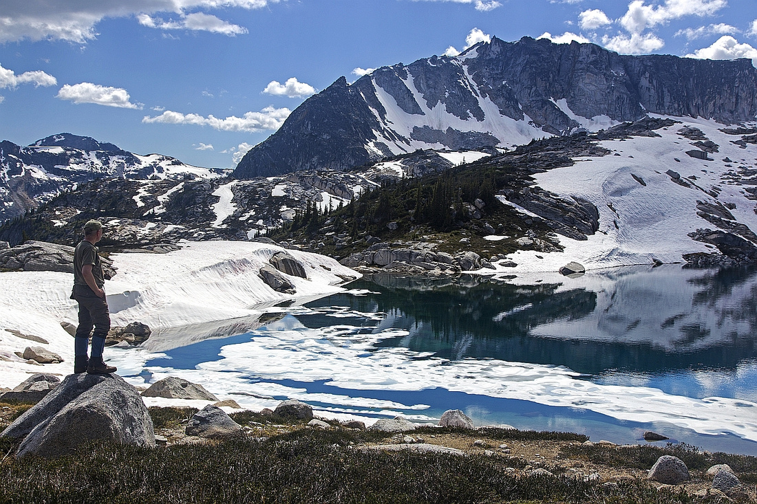  Gandalf from upper alpine basin dotted with tarns
 |
|||
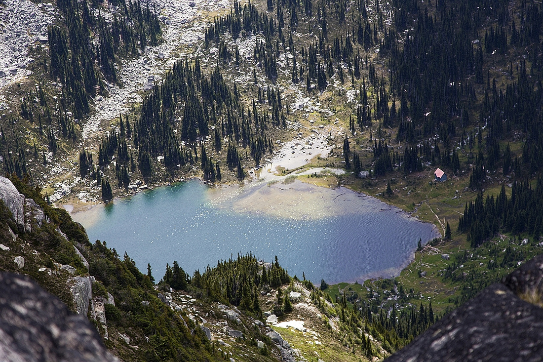  Bird-eye view of Long Lake from upper Shadowfax ridge
 |
|||
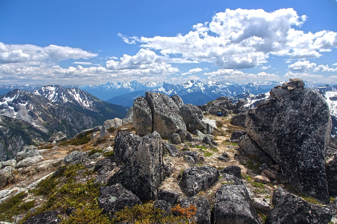  Shadowfax summit with views to the distant Joffre group
 |
|||
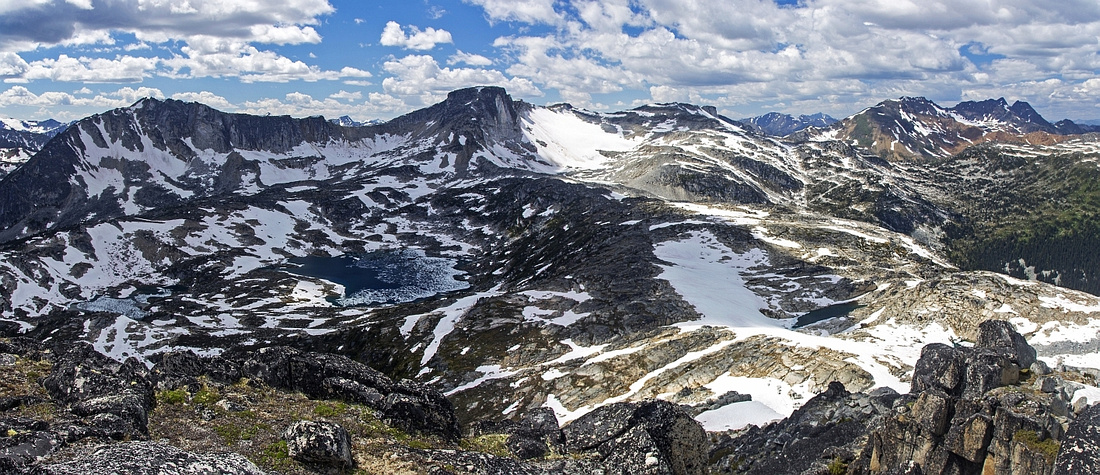  Summit pano looking west; Gandalf/Aragorn ridge left
 |
Abstract
| Overall Difficulty | D4 | Mainly off-trail hiking with brief mild bushwhack. Moderately angled talus slope with boulder hoping in upper part. Optional difficult scramble up the flake on summit | |||
| Snow Factor | S3 | Frequently skied in winter; snowshoe ascent is feasible as well. Moderate avi risk | |||
| Scenery | Sparking upper lake in cirque below Tolkien Peak. Far reaching views from the col and summit | ||||
| Trail/Marking | None | Faint trail between two lakes, none afterwards. Sporadic cairns | |||
| Suggested Time | 2.5 hrs | One way from Long Lake to summit of Gandalf. Complete time depends from return option; see Aragorn. If coming back the same way to Long Lake descent should take less than 2 hours | |||
| Elevation | Start: 1710m Max: ~2390m Total: 720m (1-way from the Hut) | Distance: 5 km (1-way from the Hut) | |||
| Gear | Full hiking boots and poles / skis or snowshoes | ||||
| Water | Creek between two lakes. No water source above upper lake. Carry 1.5L | ||||
| Dog Friendly | No | Assuming overnight stay in Brian Waddington Hut. If dayhiking from Phelix Creek dogs are ok; beware of bears | |||
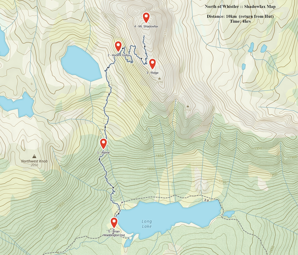 Shadowfax GAIA Map
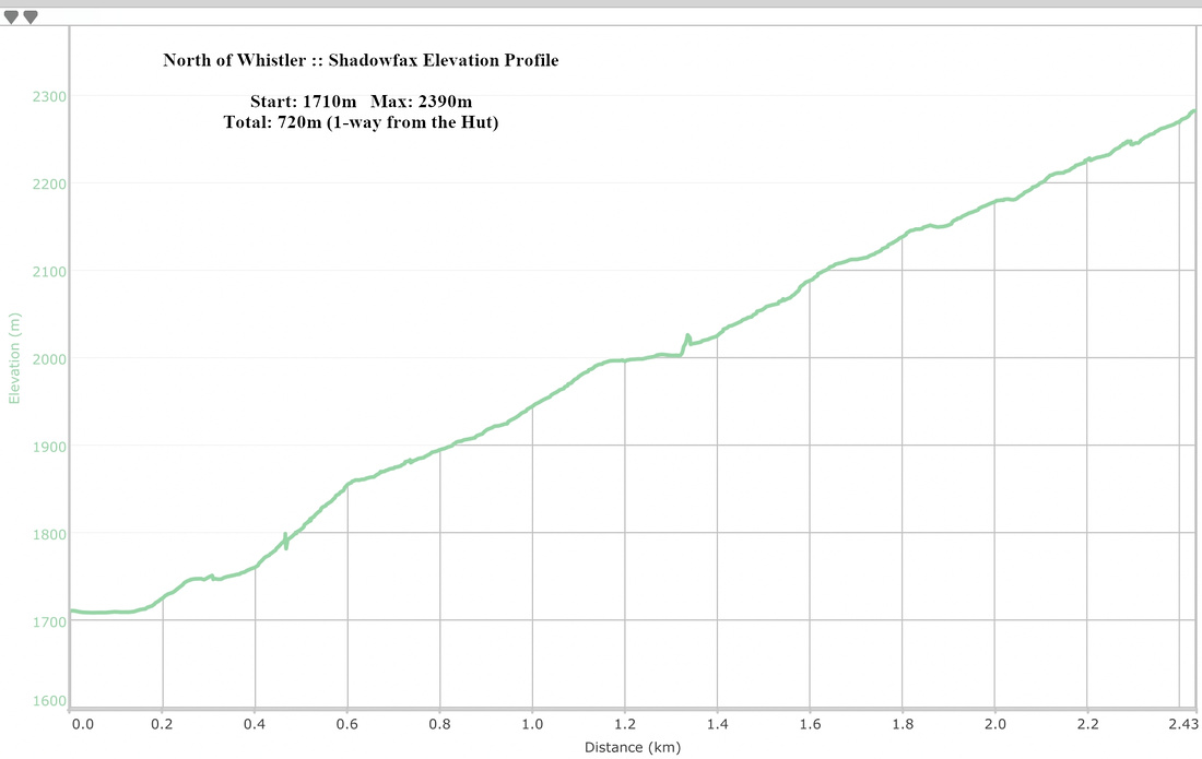 Shadowfax Elevation Profile