Google Map |
Rockies :: Canmore and Bow Valley ::Eyes of Bataan |
GPS Track |
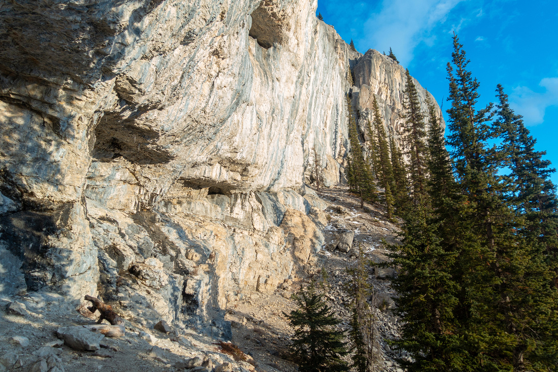 
"Swiss Cheese" Rock Wall, including Eyes of Bataan Climbing Route at end of Approach Trail |
|||
| Trip Summary | |||
Nov 15, 2024
South slopes of Grotto Mountain present hard technical climbing opportunities, famous in climber community around the World. East of Echo Canyon (or 'Big Gully') Limestone L-shaped cliff curls up with several well developed routes. Approach trail is well developed and totally off social media hiker radar with solitude and great rock wall views, including sizeable cave most permanent Bow Valley residents are totally unaware off. It is also good exercise as ~800m vertical is gained in just above 3km; with bit of luck added bonus is opportunity to watch climber Spider Men scaling up what likely appears impossible to ordinary mortals. Trip is feasible year-round, but in icy conditions upper steep parts could be very tricky (spikes).
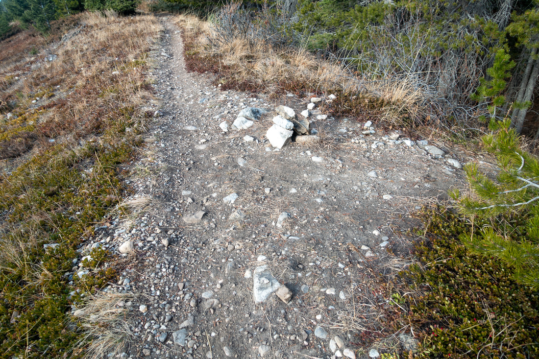
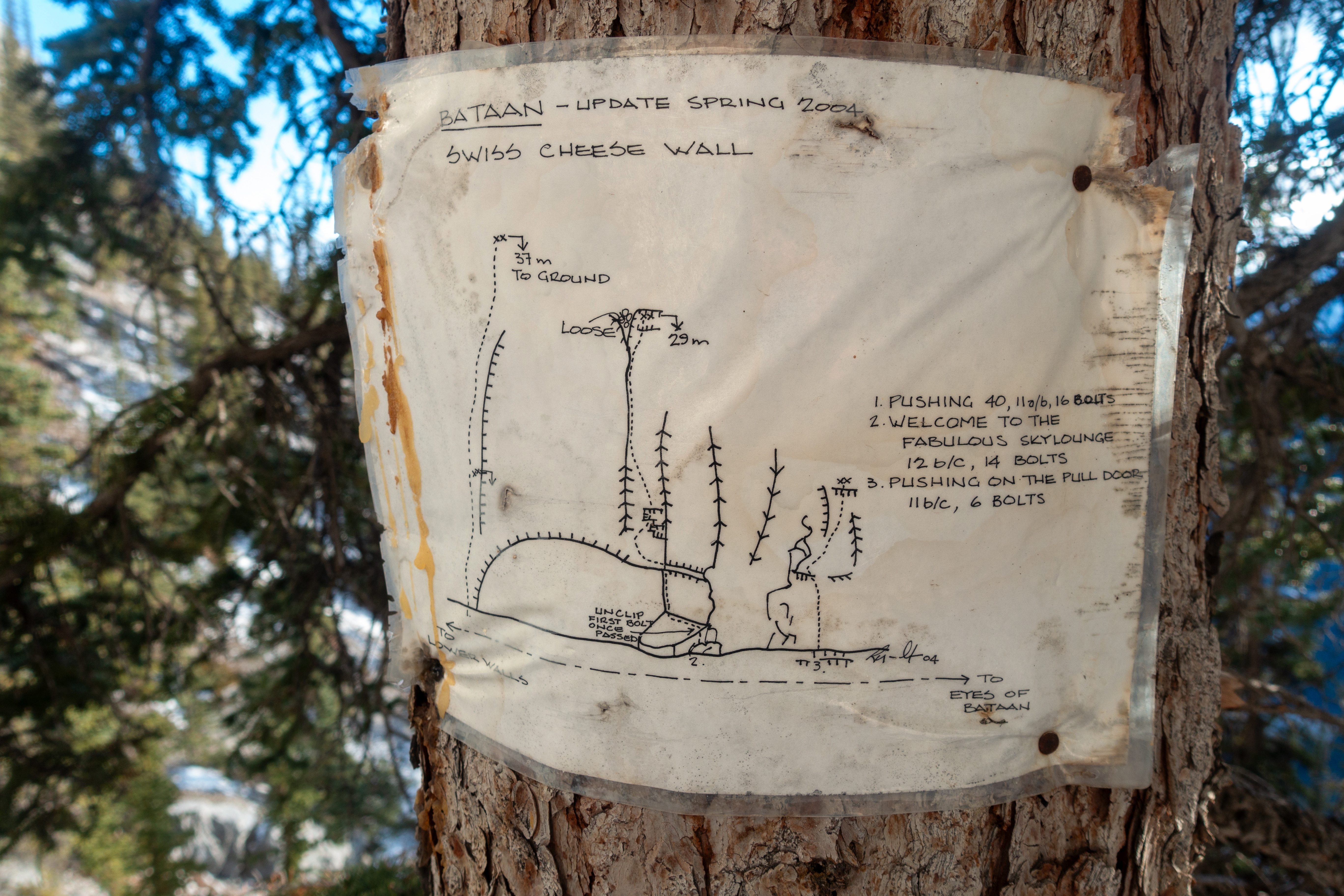
Parking is at unsigned pullout on south side of Bow Valley Parkway ~1km from ACC clubhouse (Waypoint '0 - Bow Valley 1A', GPS Download Top of Page). There are usually some vehicles parked as this is also alternate trailhead for Horse Meadows G8 Hiking / Equestrian trails. Follow trail up keeping straight or trending left at all junctions that are unsigned. Do not venture into Baymont Quarry despite trails as several warning Tables indicate - see Gallery. Bataan junction is reached in ~30-40min from parking on upper G8 Jawbone Loop. Well defined trail initially ascends gently lower forested slopes, but steepens up considerably after reaching lower end of Bataan Cliffs. Large cave shortly past first climbing routes is as awesome as unexpected. Be careful if venturing inside the cave as terrain is quite lose and eroded. Above the cave it is best to stick by edge of Rock Wall, although well defined trail switchbacks in the forest further climber right. End is at base of "Swiss Cheese" wall, about 30min from the cave and ~2hrs from the parking. Weathered Map nailed on tree provides climber route information, while variety of equipment paraphernalia is usually tucked at base of Rock wall.
It is possible to explore further around the base of "Swiss Cheese" wall. On my trip I followed faint trail for about 10minutes before turning back. Looking at Topo Maps later on it appears it might be possible to scramble rock wall further east just before next drainage gully, and continue to Grotto summit but I have not verified it was feasible as hiking/scrambling only; best is probably to return the same way.
Naming note: The Bataan Death March was the forcible transfer by the Imperial Japanese Army of 75,000 Second World War prisoners on the Bataan Peninsula in Philippines. The Eyes of Bataan are named for 2 large caves that resemble a set of eyes, visible from Bow Valley Parkway |
|
Gallery |
|||
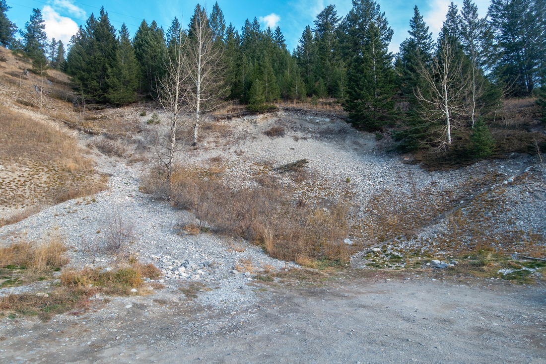 Parking Area Parking Area Unmarked parking area at North side of Bow Valley Parkway, ~1km East of ACC Clubhouse road
 |
|||
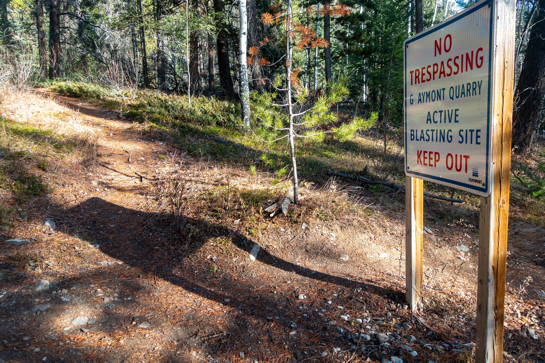 Baymont Table Baymont Table Baymont Quarry Blasting Site Warning Table; keep straight
 |
|||
 Jawbone Ridge Jawbone Ridge Hiking upper leg of Jawbone Loop on Horse Meadows G8 loop. L-shaped Bataan Wall on Skyline left of center
 |
|||
 Jawbone Loop Jawbone Loop Looking east from Jawbone G8 loop, note smoke from blasting in Baymont Quarry below. Be alert for mountain cyclists here
 |
|||
|
|
|||
 Bataan Trail Bataan Trail Bataan Trail steepens up after ascending lower forested slopes
 |
|||
 First Climbing Wall First Climbing Wall South end of Bataan Wall with first climbing routes
 |
|||
 First Cave First Cave Awesome and totally unexpected Cave. This is real cave, not just some shallow hole in the wall. Getting inside is more involved from what this photo might suggest as terrain is lose and eroded
 |
|||
 Cave Arch Cave Arch Nice photo ops inside the cave with views of distant Kananaskis Front Ranges
 |
|||
 Inside The Cave Inside The Cave Top of First Cave; I'd not be surprised if this was Bats home, but I saw none
 |
|||
 Bataan Wall Bataan Wall Above the Cave keeping close to the Wall is better option than following switchbacks further right. It is steep either way
 |
|||
 |
|||
 Climber Gear Climber Gear Assorted Climbing Gear tucked at the Base of "Swiss Cheese" Wall - note Grill!
 |
|||
 Eyes of Bataan Eyes of Bataan Eyes of Bataan Climbing Route starts at base of "Swiss Cheese" Wall
 |
|||
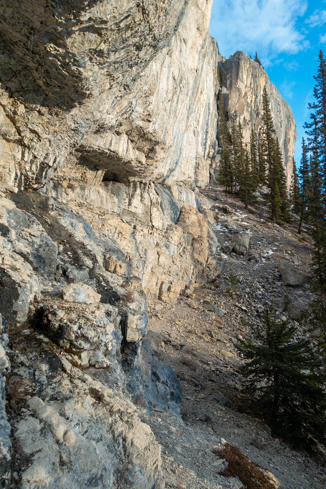 Bataan Wall Bataan Wall Following faint trail at east side of Bataan Wall
 |
|||
 Steep Gully Steep Gully Steep gully breaks east side of Bataan Wall; It is probably one of climber descent routes, and might be scrambled - but I can not guarantee. Know that gully does not end at top of skyline cleft as there is another wall above
 |
|||
 Bataan Wall Bataan Wall Faint trail continues along the base eventually reaching next large drainage in 10-15min. This is probably climber descent route
 |
|||
 Bow Valley Bow Valley Bow Valley Panorama with "Swiss Cheese" Wall and Eyes of Bataan center right on return
 |
Abstract
| Overall Difficulty | D4 | Steep ascent with rocky sections. Trail eroded and narrow in upper part. Some rockfall danger | |||
| Snow Factor | S2 | Forested south facing slope presents little avalanche danger. Snow / Ice can make trail very slippery | |||
| Scenery | Limestone rock cliffs, including awesome totally off-radar cave. Bow Valley Panorama | ||||
| Trail/Marking | Good/None | Trail reasonably well defined. Several confusing non-marked junctions in lower part | |||
| Suggested Time | 4 hr | Return time. Longer if planning on exploring past end of Climber approach trail | |||
| Elevation | Start: 1340 m Max: 2120m Total: ~800 m | Round Trip: ~6.5km | |||
| Gear | Full hikers much preferred for ankle stability on steep terrain, specially on descent. Poles mandatory. Micro-spikes in shoulder season | ||||
| Water | No reliable source of water. Carry 1-2L, depending on season | ||||
| Dog Friendly | Yes | Area frequented by cougars and bears | |||
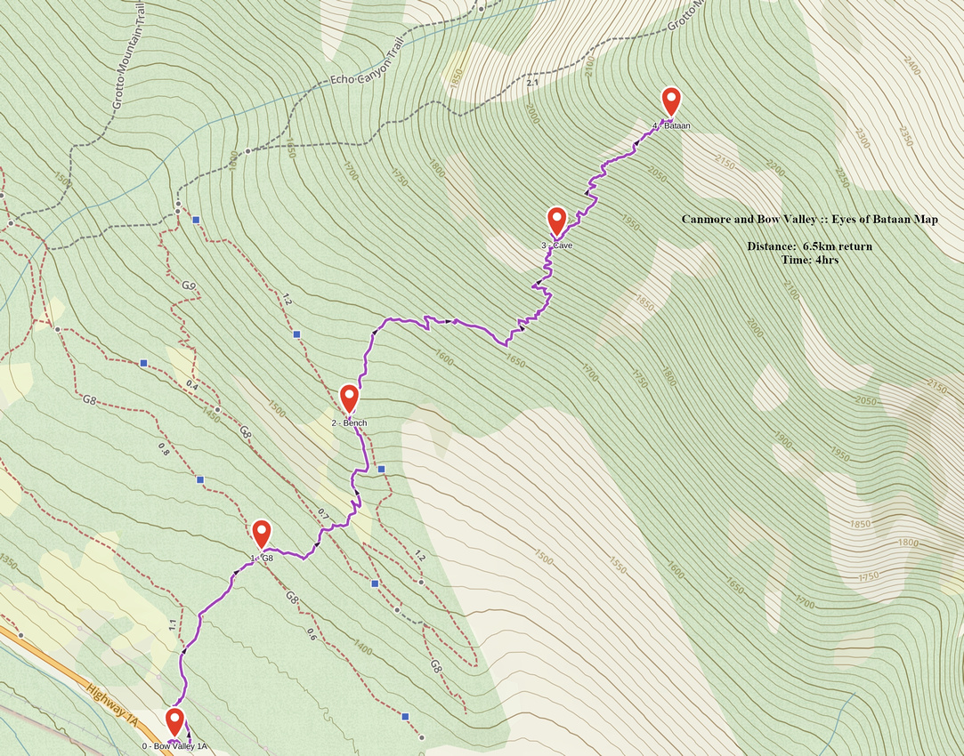 Eyes of Bataan GAIA Map
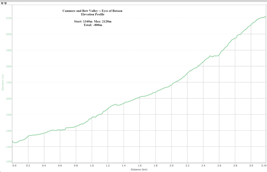 Eyes of Bataan Elevation Profile
