Google Map |
BC Coast :: North Shore ::Dog Mountain - Suicide Bluffs |
GPS Track |
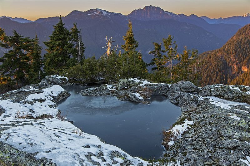 
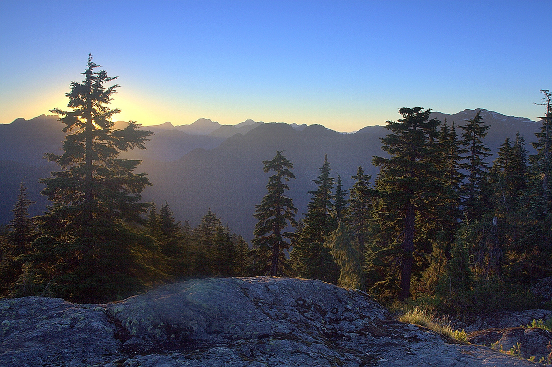
Semi-frozen tarn on Suicide Bluffs looking towards Coliseum group |
|||
| Trip Summary | |||
August 3, 2012
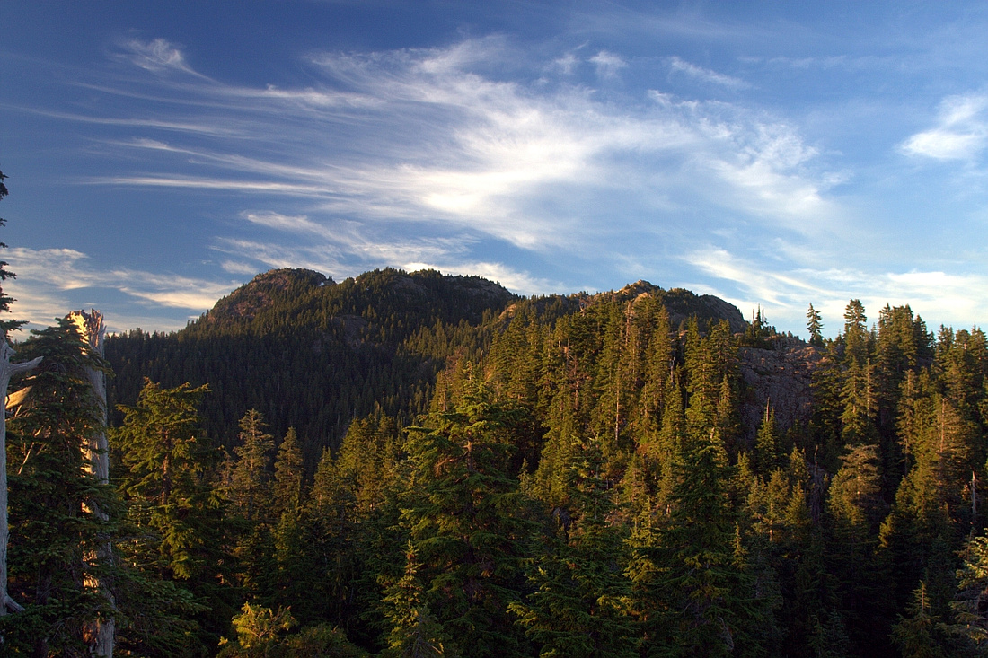
This is one of best half-day trips in mid-Seymour. First part to Dog Mountain is super popular year-round, but crowds can be dodged by picking up indistinct trail continuing north towards Suicide Bluffs, then looping back via main Mt. Seymour trail. Views from the bluffs are much better than from over-hyped (and overcrowded) Dog Mountain. Some parties are known to overnight on Suicide Bluffs in summer. There is some route finding and sections of trail are quite steep. Avalanche Danger sign is posted along main Seymour snowshoe artery to Brockton Point so do not venture off trail if you are have limited experience in off-trail back-country travel in winter conditions.
Dog mountain trail forks off on left (east) side of main Seymour trail few minutes past the parking. Follow this well trodden path towards picturesque First Lake, then continue to Dog Mountain - less that 1hr from trailhead. "Mountain" name is misleading - it is just a few rock bluffs that offer limited views (see gallery). Just before trail exits to Dog bluffs, note narrow trail continuing north. Immediately you leave crowds and trip becomes true North Shore wilderness experience. Trail has solid footbed and climbs steadily for next 30-40 minutes before reaching final steep climb to Suicide Bluffs. Fixed rope assists in most awkward part. Fabulous views unfold; this is also perfect place to watch the Sunset. Turn right and traverse the bluffs looking to pick up the trail heading east. There are some ups and downs and trail eventually intercepts main Seymour artery some 10-15 minutes before Brockton Point. Turn right and hike back to the parking lot. |
|
Gallery |
|||
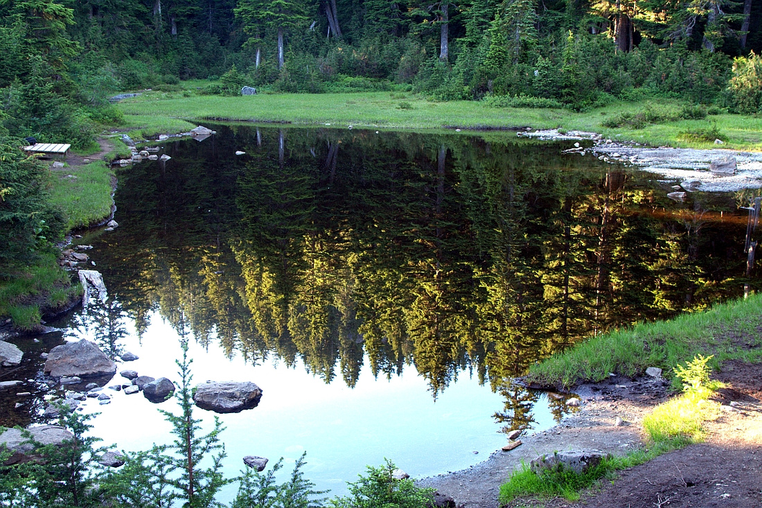 First Lake on Dog Mountain Trail
 |
|||
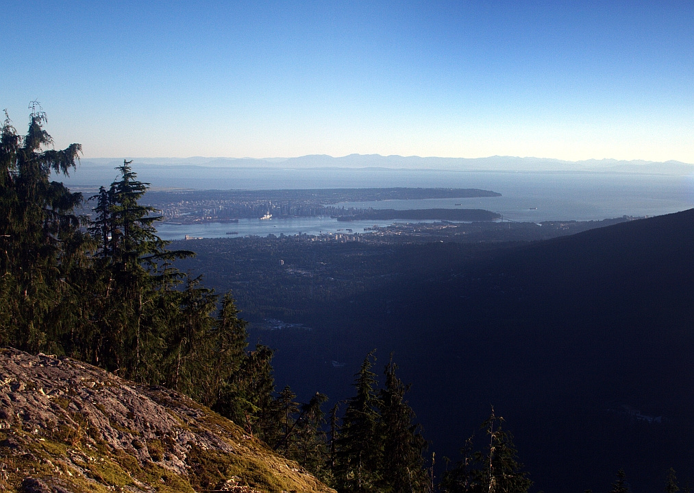 Burrard Inlet and metro Van from Dog Mountain
 |
|||
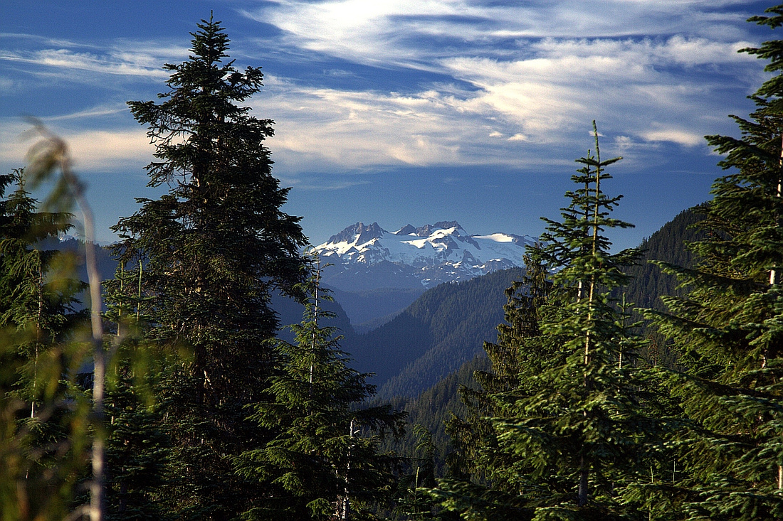 View north to Mamquam from Dog Mountain
 |
|||
 Three peaks of Mt. Seymour from Suicide Bluffs
 |
|||
 Suicide Bluffs Sunset
 |
Abstract
| Overall Difficulty | D3/4 | To Dog Mtn easy (D2) with some ups/downs and rooty sections. More challenging with couple of steep parts & rope assisted scrambles up bluffs. Some route-finding. Icy sections in shoulder season | |||
| Snow Factor | S3 | Dog Mountain is popular winter snowshoe trip (D1). Harder with likely trail breaking for Suicide Bluffs. Moderate avalanche danger | |||
| Scenery | Metro Van from Dog Mountain. Terrific view of Lynn ridge, Coliseum/Burwell/Cathedral from Suicide Bluffs. North Shore wilderness | ||||
| Trail/Marking | Good/Poor | Excellent trail to Dog Mountain, back-country route with occasional flags for Suicide Bluffs | |||
| Suggested Time | 3-4hrs | Return time for Suicide Bluffs and loop return. ~2 hrs or less for Dog Mtn only | |||
| Elevation | Start: 930m Max: 1160m Total: ~300m | Round Trip: ~6.5 km (Suicide Bluffs loop) | |||
| Gear | Day hikers or full boots. Snowshoes in winter. Micro-spikes often necessary in shoulder season | ||||
| Water | Seasonal tarns but no reliable source of water. Carry ~1.5L | ||||
| Dog Friendly | Yes | Please keep pets on leash in consideration for other hikers. Note that black bears frequent mid-Seymour in summer months | |||
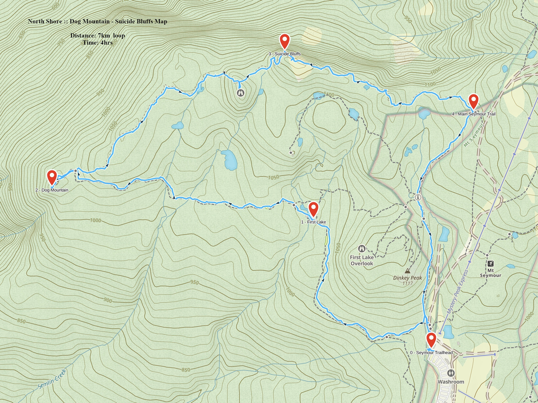 Dog Mountain - Suicide Bluffs GAIA Map
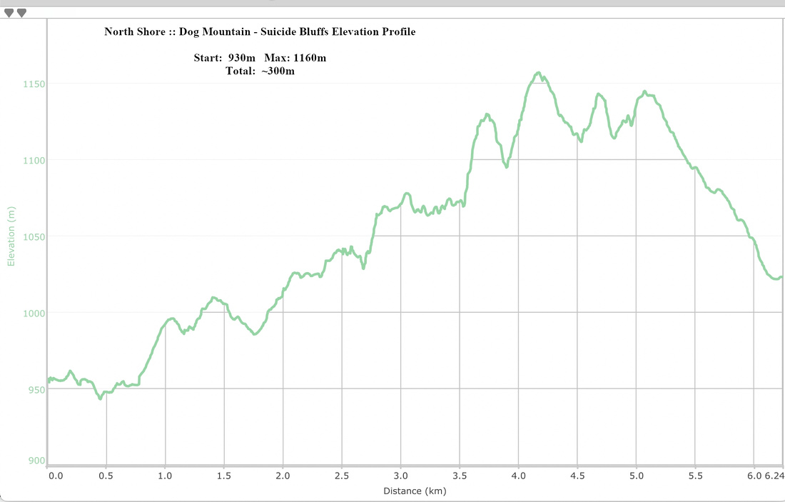 Dog Mountain - Suicide Bluffs Elevation Profile