Google Map |
Rockies :: Banff-Louise ::Paradise Valley - Horseshoe Lakes |
GPS Track |
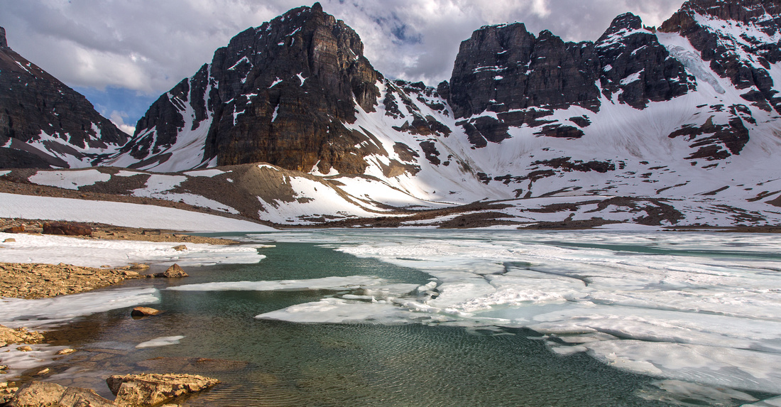 
South end of largest Horseshoe Lake looking towards Wastach Mountain |
|||
| Trip Summary | |||
June 11, 2015
Paradise Valley is one of most scenic areas in Banff National Park. Sitting between Mt. Temple on south side, Haddo/Aberteen/Lefroy on north and Mt. Hungabee/Ringrose Peak on west it offers fantastic view of these Rockies giants. Initial approach follows Paradise creek and mostly travels below treeline, however after climbing the rockslide above Annette lake far reaching views open up. There are many other scenic highlights -- cascading waterfalls of Paradise creek in upper valley (also called "Giant Steps") are one of most photographed motifs in Canadian Rockies. Feasible as day-hike, but overnight is also possible due to campground near Giant Steps - about 10km from trailhead at Moraine Lake road. Real rewards are in upper valley past Giant steps. Tucked under towering Mt. Hungabee are set of lakes glacially fed by receding Horseshoe glacier; this is the origin of unofficial "Horseshoe Lakes" name. Lakes are not frequently visited as there is no trail past Horseshoe Meadows and most hikers are not aware of their presence since they can be spotted only from higher elevation (i.e. Mt. Temple or Wastach Mountain). Note that groups of 4 are required in prime hiking season (July - October) due to grizzly bear activity; for more details see Parks Canada website. Popular extension with 2 cars is traverse to Valley of Ten Peaks via Wastach Pass and hike out via standard Wenchemna/Eiffel lake trail.
Trailhead is at left (west) side of Moraine Lake road few kilometers past junction with Lake Louise access road. Parking space will not be easy to find during sunny summer weekends. Follow well defined and wide trail to Lake Annette for about 6km (1 1/2 hours of moderate pace). All junctions are marked. There are couple of bridged crossings of Paradise creek; only steep section is last 15-20 minutes after final crossing to left (south) side. Scramblers heading for "Little Temple" will leave trail here and head up grassy slopes after circumventing the lake. Paradise hiking trail climbs up in westerly direction, then traverses open slopes beneath north aspect of Mt. Temple. In early season thundering avalanches can often be observed from here. This stretch is also dotted with larches that turn golden in late September. Trail stays level till junction with Sentinel Pass, then descends via series of switchbacks to Horseshoe meadows and Paradise campground next to Giant Steps.
To visit Horseshoe Lakes follow Paradise creek upstream. There is no trail, but travel is easy. Upper Horseshoe Meadows are reached about 15 minutes from Giant Steps. Make your way towards moraine bench under Mt. Hungabee at far end of the valley. Any direction will do; in early summer patches of snow can be utilized for better support. Circle the lakes to south end towards Wastach Mountain. Wastach Pass and crossover to Valley of Ten Peaks is easily reached from here; to return the same way descend talus to creek draining the lakes, then trash towards Horseshoe Meadows where standard Wastach trail can be joined; Turn left and follow back to main valley trail near Giant Steps.
Note there is alternate more direct trail that descends the valley on north side. This trail has been deactivated, and deadfall is accumulating. It is still relatively easy to follow, but lower down there are couple of crossings of Paradise creek that are not bridged anymore. In early to mid summer ford will be difficult if not impossible thus requiring unpleasant trash for several kilometers along the creek. It is better to return the same way via Lake Annette trail.
Note: As of summer '23 personal vehicles are not allowed on Moraine Lake Road. Best option is to simply walk couple of km to Paradise Valley Trailhead, Loop return via Moraine Lake now has significantly more logistic problems. |
|
Gallery |
|||
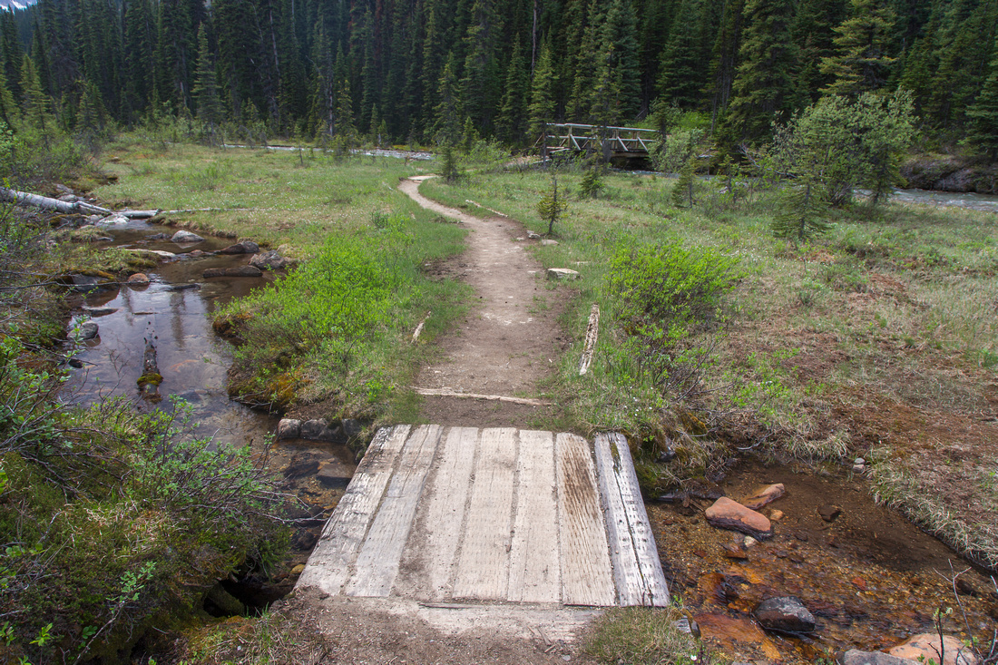 Crossing Paradise creek in lower valley couple of times
 |
|||
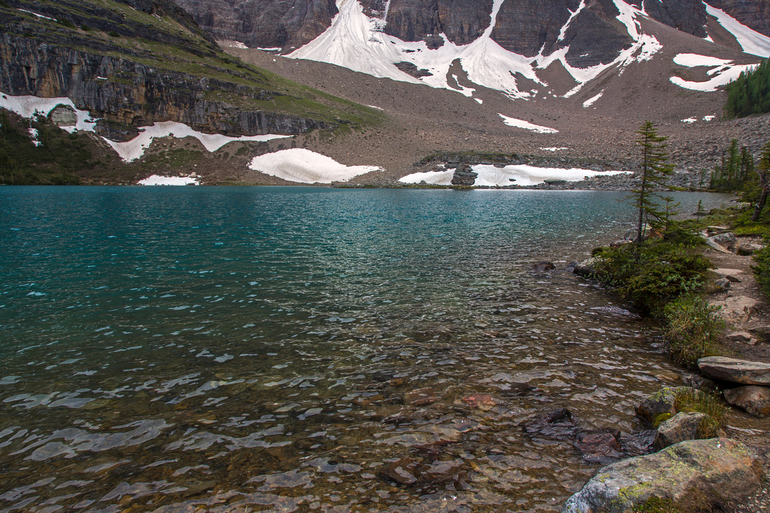 Lake Annette ~ 1.5 hours of fast pace from the parking
 |
|||
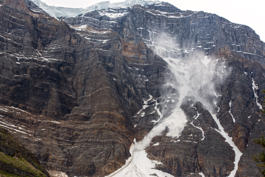 Avalanches coming down north side of Mt. Temple
 |
|||
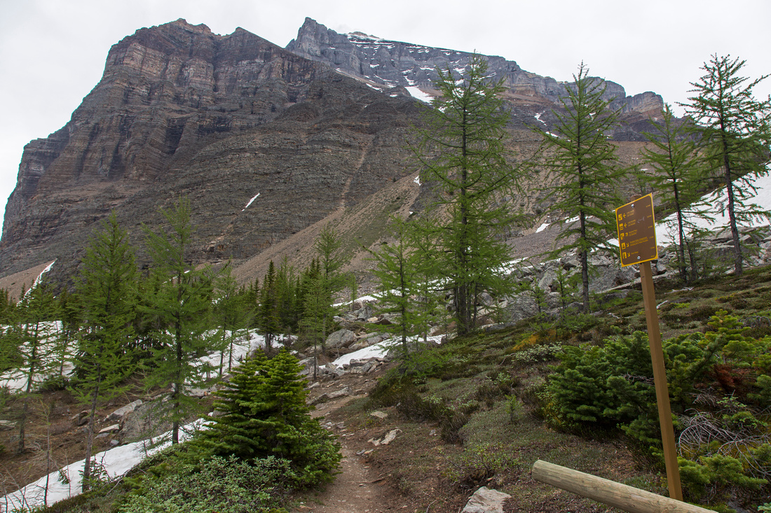 Sentinel Pass junction: Trail descends to Giant Steps
 |
|||
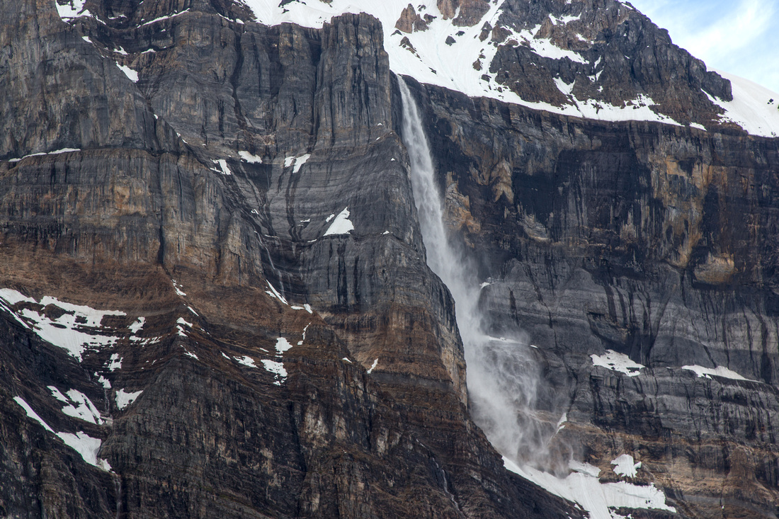
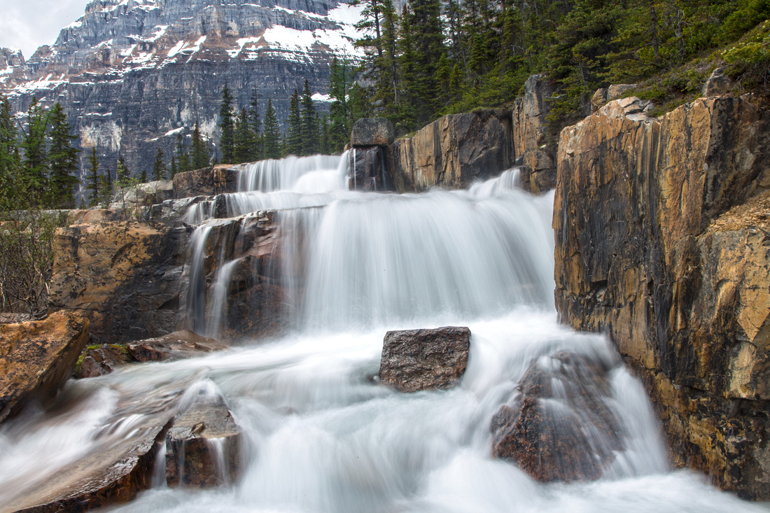 Giants Steps: Magnificent cascading waterfall
 |
|||
 Looking across Horseshoe Meadows towards Mt. Hungabee
 |
|||
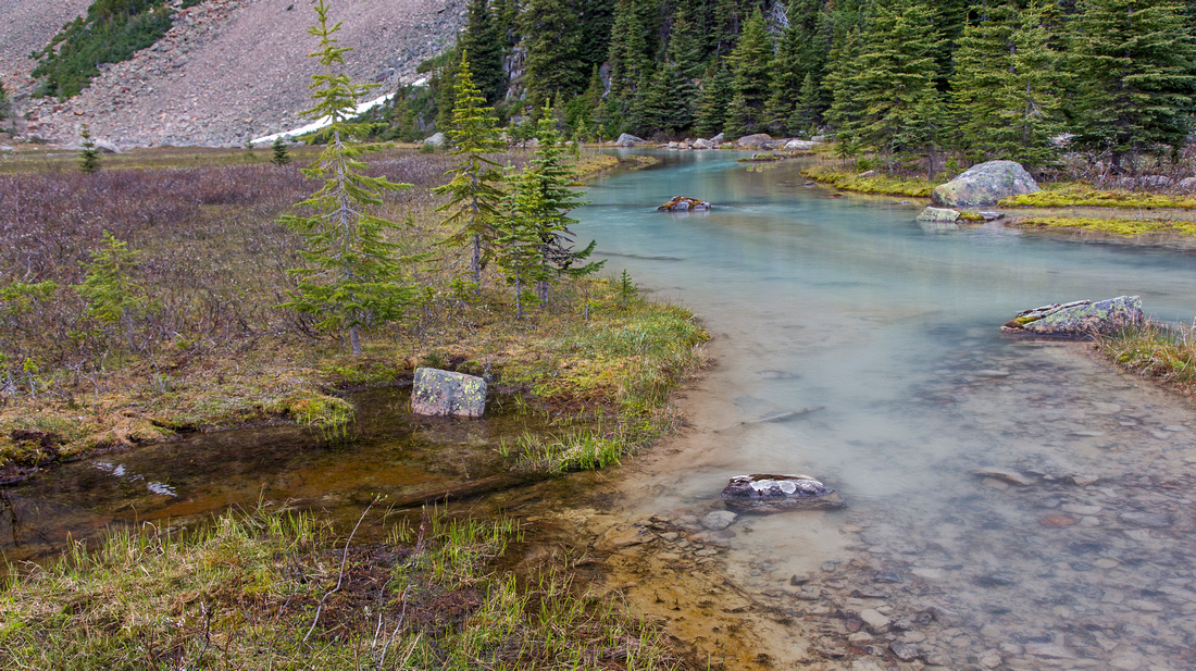 Silty Paradise creek upstream from Giant Steps
 |
|||
 Another thundering avalanche from Ringrose Peak
 |
|||
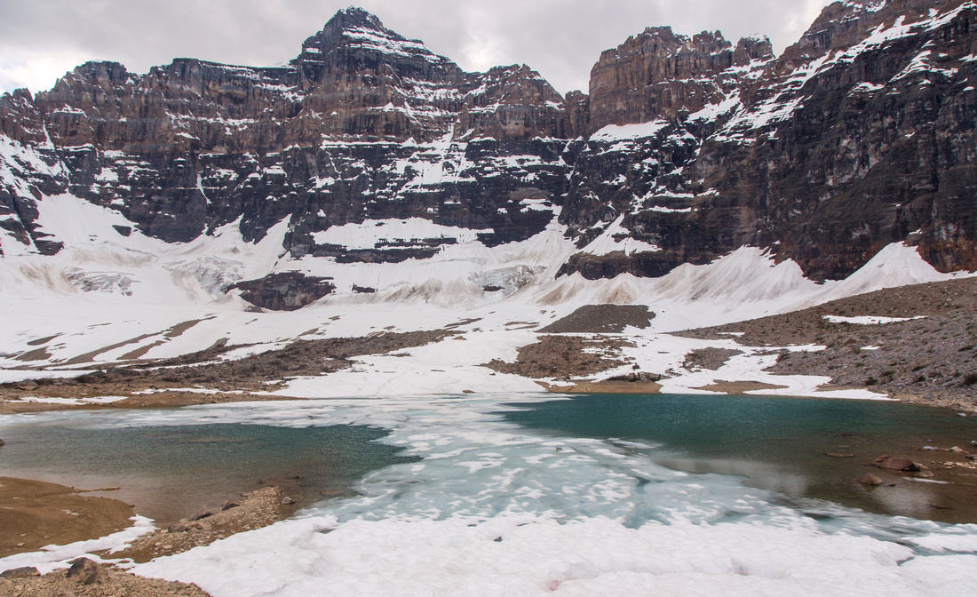 Horseshoe lakes in glacial cirque under Mt. Hungabee
 |
|||
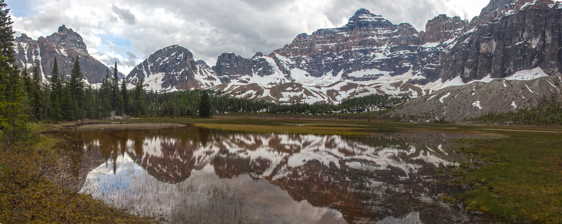
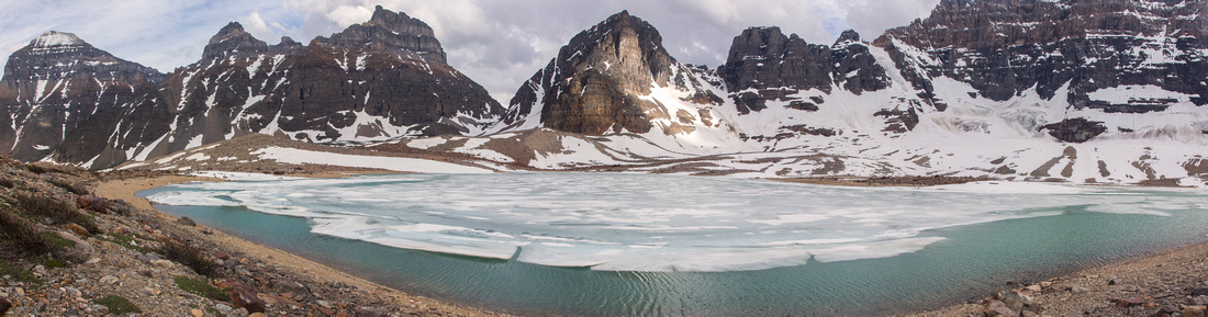 Panoramic view of upper valley under Horseshoe Glacier. Wastach Pass just left of center, Mt. Temple far left
 |
|||
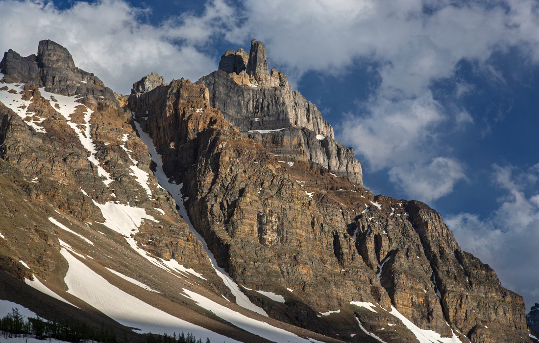 Hiking back with classic view of Mt. Eiffel Pinnacles
 |
|||
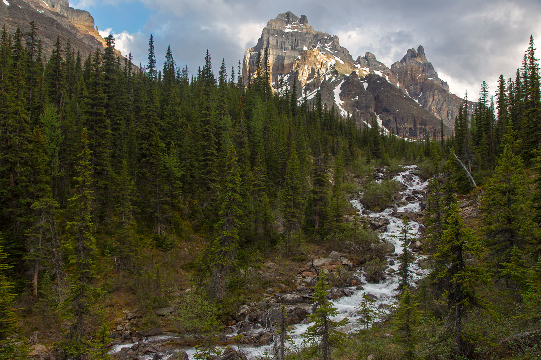 Return on North Side of the Valley by Paradise Creek along deactivated Park trail
 |
Abstract
| Overall Difficulty | D4 | Gentle graded park trails followed by off-trail hike in upper valley. Route-finding skills helpful. Some bushwhacking, possibility of steep talus moraine and/or creek crossings. Total length is considerable. | |||
| Snow Factor | S2 | Trail easily traveled on cross-country skis. Due to overall length it might not be feasible as snowshoe trip. Traverse under Mt. Temple between Lake Annette and Sentinel Pass junction is prime avalanche territory. | |||
| Scenery | One of most scenic areas in Lake Louise area. Glacial lakes, larches and waterfalls. Rockies at their prime! | ||||
| Trail/Marking | Excellent / None | Wide park maintained trail to Giant Steps. All junctions are signed. No trail or markings in upper valley. Trail on north side of Paradise creek is deactivated; bridges are missing, and creek might not be passable. | |||
| Suggested Time | 8-9 hr | Hiking time for full loop of upper valley and return the same way. Hiking just to Giant Steps and back is ~6 hours day. Continuing over Wastach Pass and exiting via Eiffel Lake trail is ~10 hour day. | |||
| Elevation | Start: 1730m Max: 2230m Total: ~780m | Round Trip: ~25km | |||
| Gear | Hiking boots and poles; Gaiters helpful when Horseshoe Meadows are wet and boggy. Old pair of sandals depending on water level | ||||
| Water | Paradise creek and tributaries most of the way. No need to carry more than ~1L at any time | ||||
| Dog Friendly | Yes | Standard griz country precautions | |||
 Paradise Valley - Horseshoe Lakes GAIA Map
 Paradise Valley - Horseshoe Lakes Elevation Profile