Google Map |
USA :: Sedona :: Oak Creek West Fork |
GPS Track |
|
Oak Creek Bend by the 'Mushroom' Rock, 30-40 min before The Subway |
|||
| Trip Summary | |||
Multiple Dates, last Nov 28, 2023
West Fork of Oak Creek is one of best known - and popular - Sedona area hikes. Situated in scenic Oak Creek Canyon it is also Arizona State Park - so Red Rock and America The Beautiful Passes are not valid; they charge outrageous $12USD for day parking. Humans like to partition nature in cells as money extortion scheme. That being said, Canyon is very beautiful and well worth time (and money). Usual turnaround is ~6km mark (more than posted 3.3 miles at trailhead) at "The Subway" - narrow part of the Canyon where wading is required to continue. Going is easy most of the way, but there are many non-bridged creek crossings. They are generally easy rock hop, but hiking pole is valuable for stability. It is worth noting that Canyon is quite deep and it will be in the shade most of the day. From photography standpoint that means high contrasts and low light conditions that require tripod for quality low ISO shots. This extra 'luggage' will pay off as there are many very scenic photo-ops along the way.
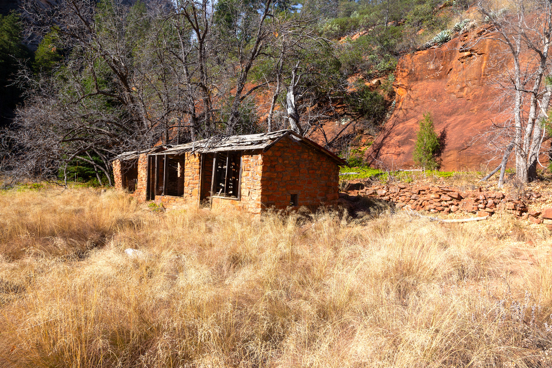
If you don't feel like going all the way, initial approach to Canyon Mouth is Family Friendly sunny Meadow walk leading to some old ruins. First ford is only 10 min away, so that would be optional turnaround point for shorter outing. On the other side, continuing past the "Subway" one can apparently reach back-country campground (posted 2.5miles one way from the "Subway") - but wading in shallow water is required. I always turned back here so I can't say how long wading is required or what the trail looks like beyond.
Despite ridiculous fee structure, this is very beautiful area and should be on the list of most Sedona visitors. |
|
Gallery |
|||
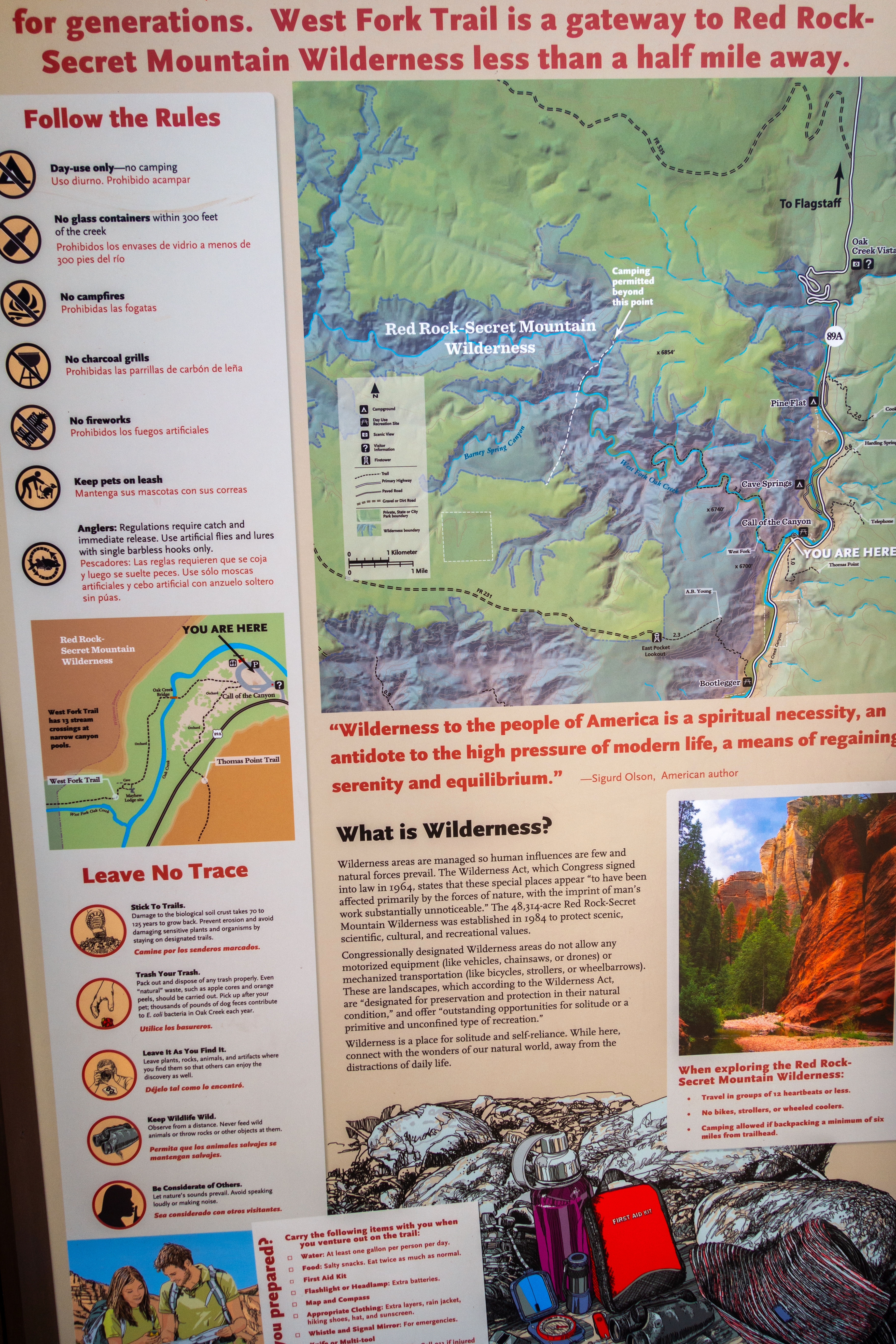
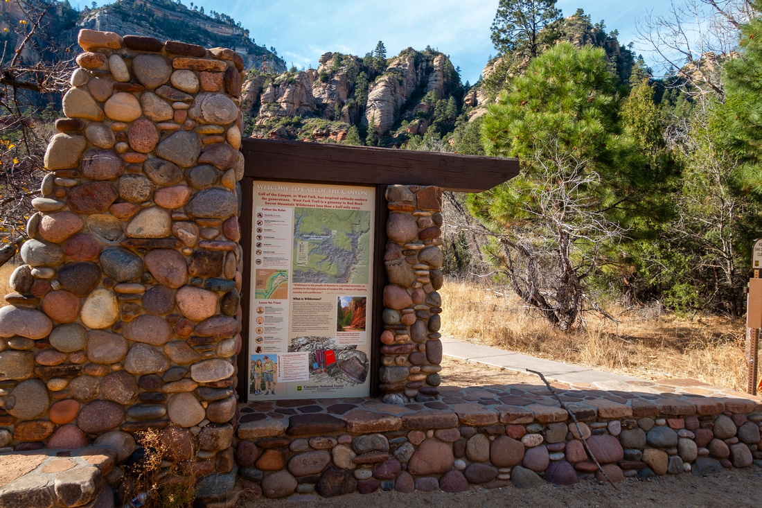 Trailhead Kiosk Trailhead Kiosk Trailhead Kiosk at the Parking Lot with Map. Initial part of the trail (lower center right of photo) is paved
 |
|||
 |
|||
|
|
|||
|
|
|||
 Creek Ford
Typical Creek Ford. Easy rock-hop, but rocks can be slippery. Creek Ford
Typical Creek Ford. Easy rock-hop, but rocks can be slippery. |
|||
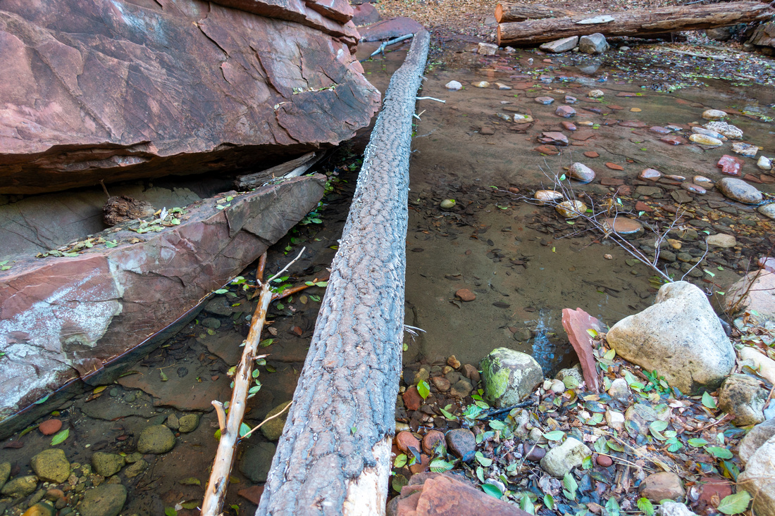 Creek Ford
Some creek fords are aided by logs. Hiking Pole is highly recommended for stability Creek Ford
Some creek fords are aided by logs. Hiking Pole is highly recommended for stability |
|||
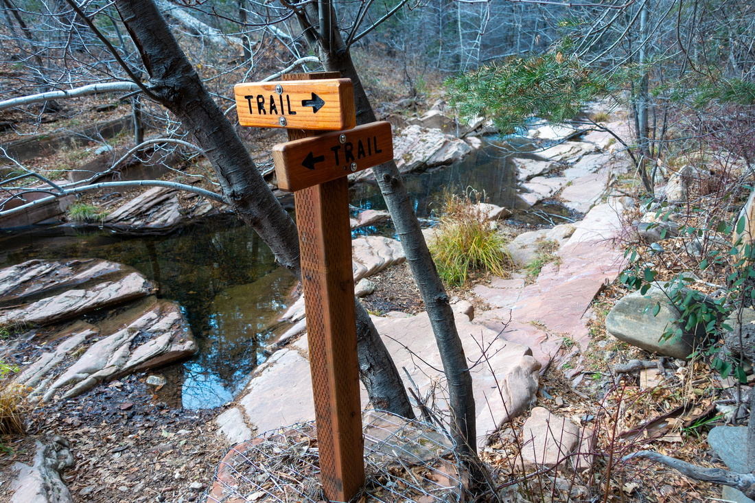 Trail Sign
Trail Direction Sign at potentially confusing spot around 5th crossing Trail Sign
Trail Direction Sign at potentially confusing spot around 5th crossing |
|||
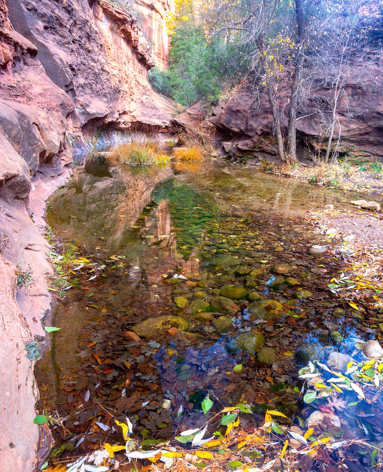
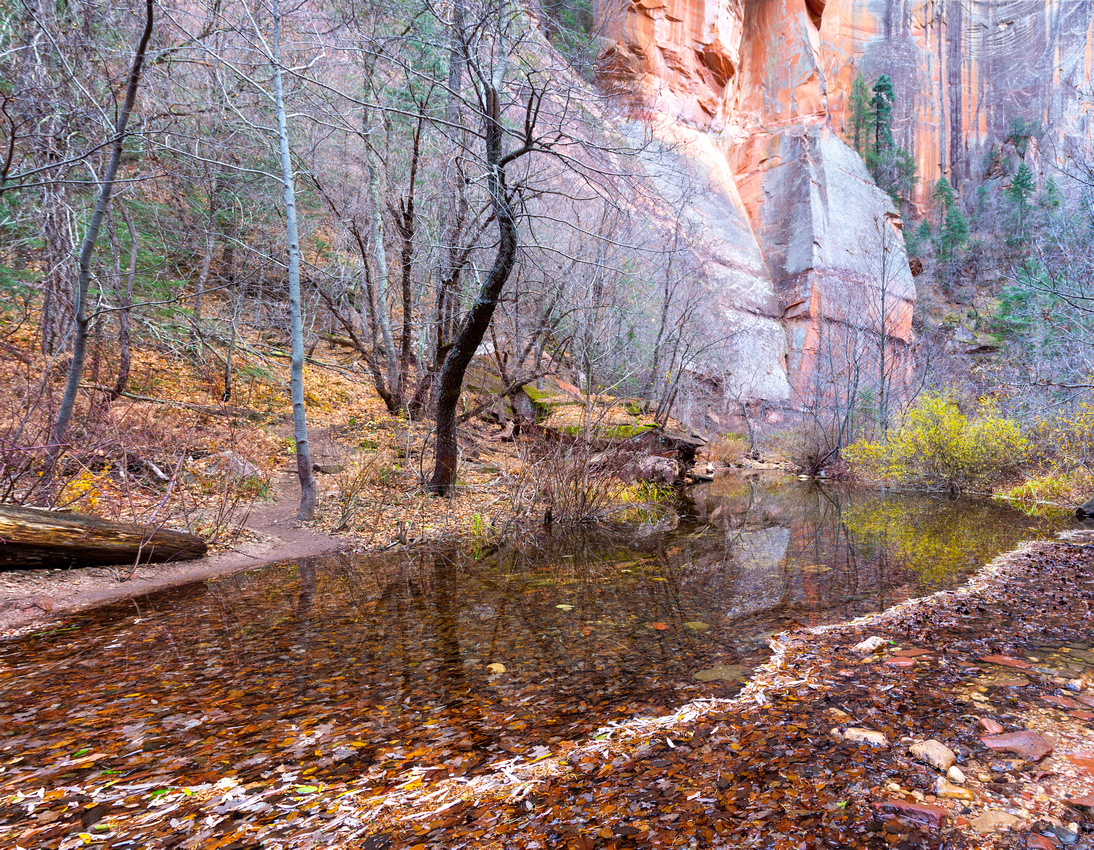 Creek Bend
There are many pristine and tranquil spots like this one along the way Creek Bend
There are many pristine and tranquil spots like this one along the way |
|||
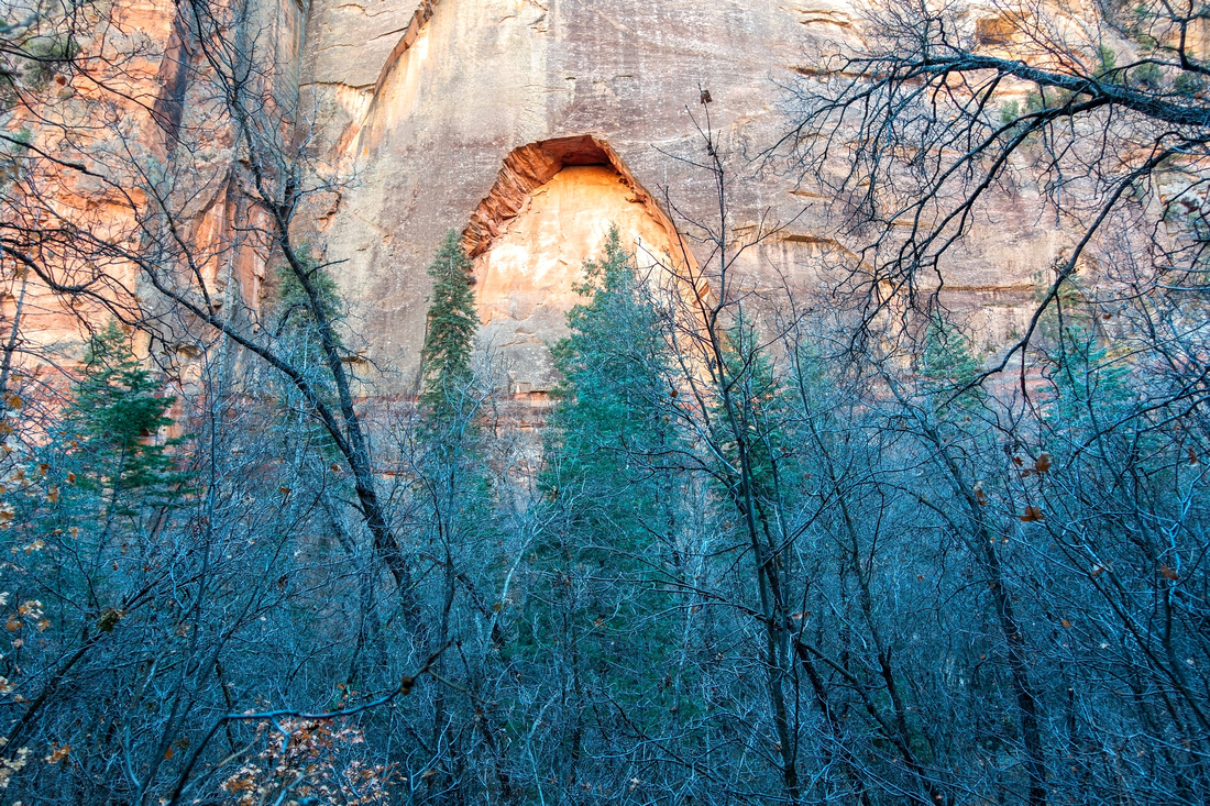 Forest Grotto
Canyon Rock Formation obscured by low Pines Forest Grotto
Canyon Rock Formation obscured by low Pines |
|||
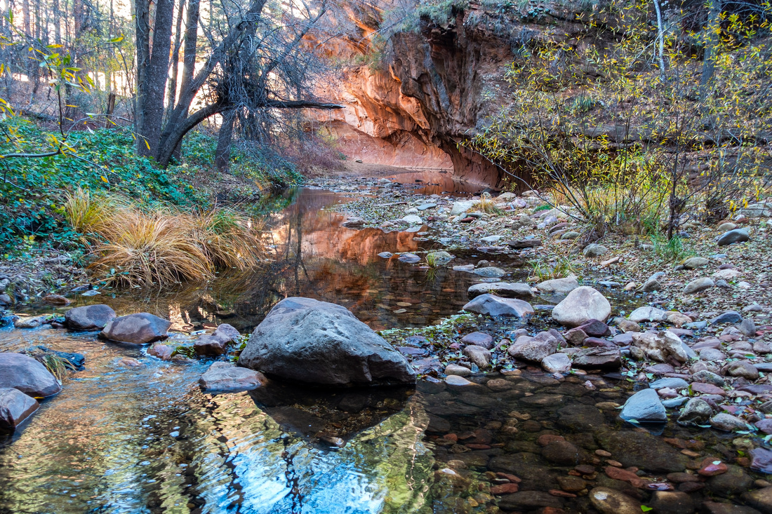
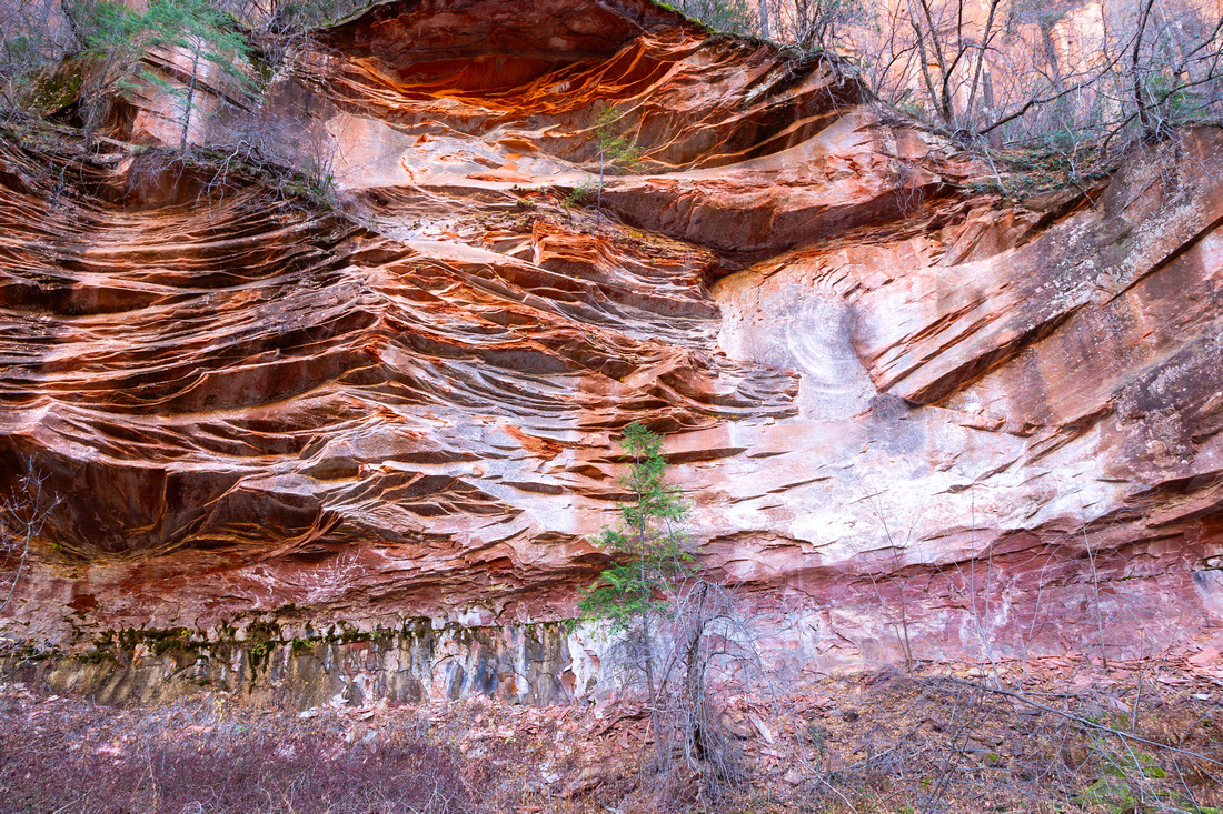 Rock Cliff
Textured Canyon Wall Rock Cliffs. Even with absence of sunlight colours are very vibrant Rock Cliff
Textured Canyon Wall Rock Cliffs. Even with absence of sunlight colours are very vibrant |
|||
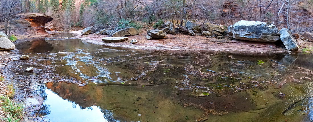
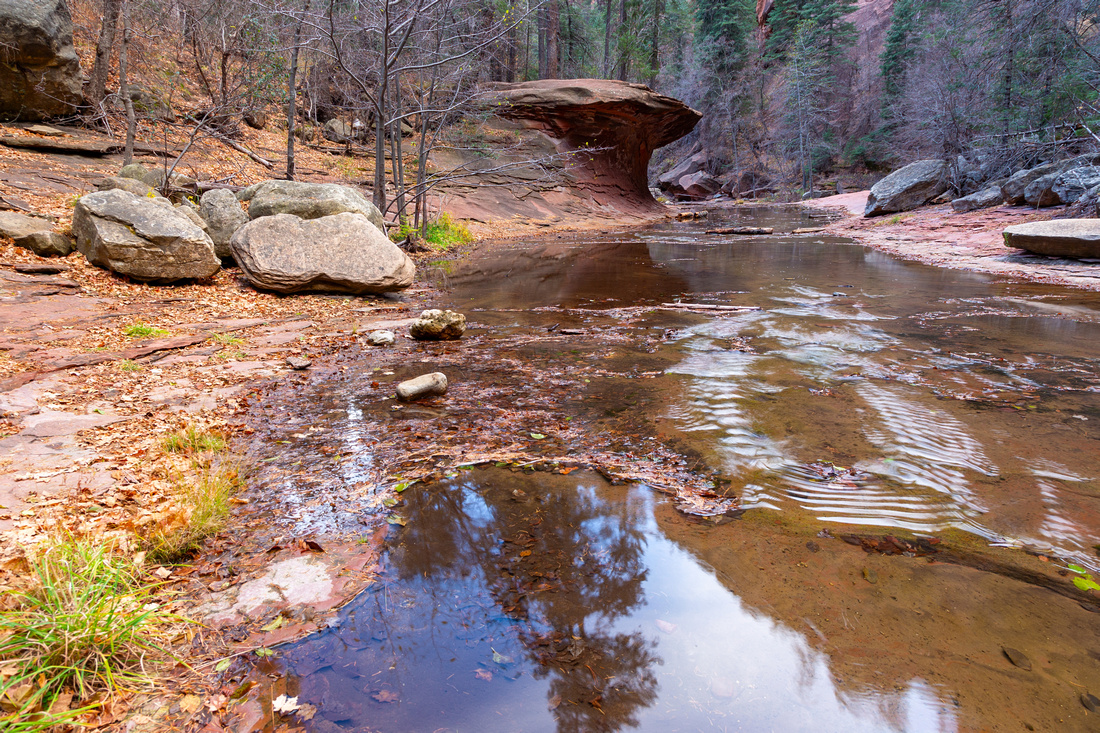 Mushroom Rock
Personal favourite spot ~2/3rd of the way inn. Leave trail and descend to rocky beach for this very photogenic view Mushroom Rock
Personal favourite spot ~2/3rd of the way inn. Leave trail and descend to rocky beach for this very photogenic view |
|||
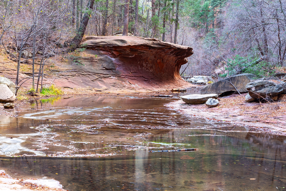 Mushroom Rock
Closer Look at "Mushroom Rock" (self coined phrase). Trail actually passes on top of it Mushroom Rock
Closer Look at "Mushroom Rock" (self coined phrase). Trail actually passes on top of it |
|||
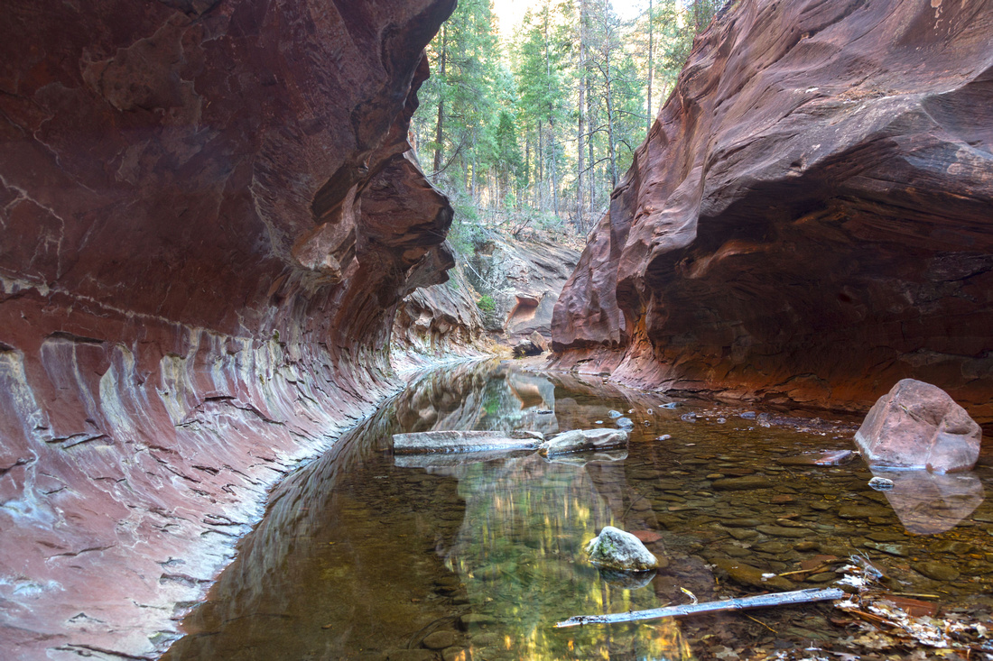
|
"The Subway" around 6km mark from Trailhead; wading is required to continue |
|||
|
|
Abstract
| Overall Difficulty | D2 | Minor ups and downs. Several creek fords (easy rock hop) | |||
| Scenery | Oak Creek Canyon and Scenic Rock Formations | ||||
| Trail/Marking | Very Good | Well defined trail with couple of potentially confusing parts at early crossings | |||
| Suggested Time | 4 hrs | Return time to the Subway. Continuing over to back-country campsite requires wading and overnight stay | |||
| Elevation | Start: 1630m Max: 1705m Total: ~200m | Round Trip: 12km | |||
| Gear | Light hikers are sufficient. Hiking poles essential for stability at creek crossings | ||||
| Water | Oak Creek throughout, but water needs to be treated. Carry 0.5-1L, depending on season | ||||
| Dog Friendly | Yes | Must be on leash. Please keep control of the pet for courtesy to other hikers | |||
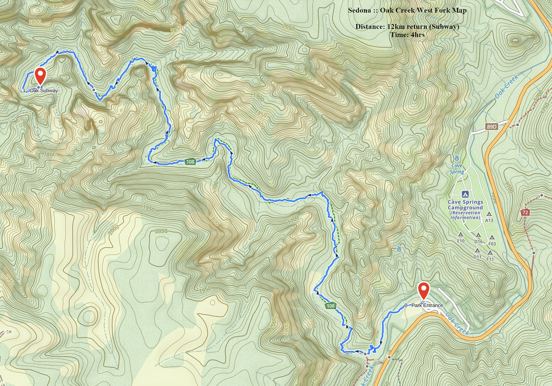 Oak Creek West Fork GAIA Map
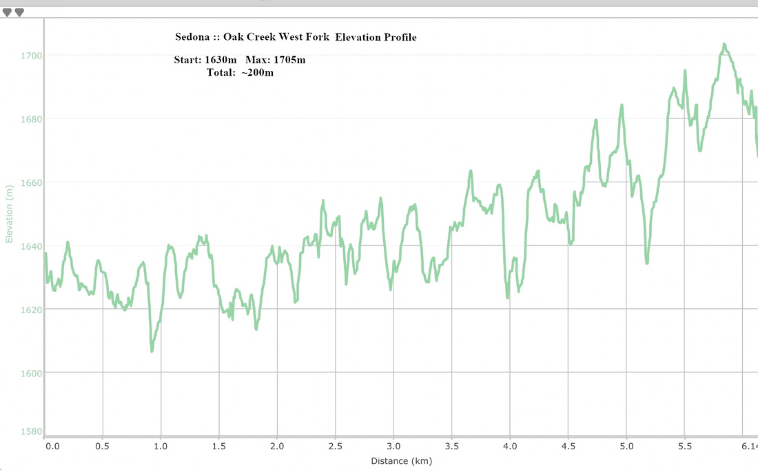 Oak Creek West Fork Elevation