Google Map |
USA :: Sedona :: Devil's Bridge |
GPS Track |
|
Devil's Bridge Rock Arch is very popular spot. Faint trail continues for another ~10min to Secret Wilderness viewpoint |
|||
| Trip Summary | |||
Multiple Dates, last Nov 21, 2023
Devil's Bridge is one of most popular Sedona Trails. Consequently solitude is near impossible to find. Yet, lack of privacy is compensated by very scenic hike and as such it should be at any Sedona Hiker's list. Usual start is at Dry Creek Road Parking, but with high clearance 4x4 it is possible to drive further to Devil's Trailhead which is only ~1.5km from the Arch. Parking Space is very difficult to find and you might have to circle around waiting for spot to open. Alternatively I've seen people leaving cars at Boynton Pass Road and walking up.
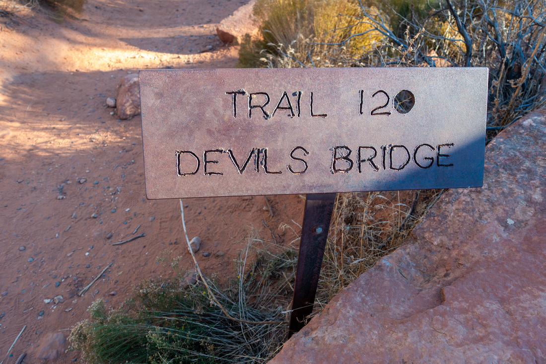
From Dry Creek Parking one can walk dusty road to Devil's Trailhead, but much better option is to use Chuckwagon Trail - it is very scenic and meanders lazily through semi open terrain with several great viewpoints (See Gallery). There are several trail junctions, but all are well signed and easily navigated even in dark. In about an hour Chuckwagon exits back to Dry Creek Road and Devil's Trailhead proper. There is room for ~10 jeeps here. The Arch is about 30min away, and last section is somewhat steep rock stairs ascent that requires bit of balance on descent. Traffic jams are likely. Bridge is very scenic but also ultra busy spot; more solitude can be found by continuing faint trail for ~10 minutes to nice open plateau that offers Secret Wilderness Panorama. Photography Note: Getting great shots will be difficult, both because of crowd factor and sun position that leaves area in shade by mid-afternoon. Early mornings might be preferred time for both reasons. |
|
Gallery |
|||
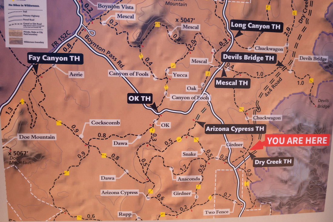 Trailhead Map Trailhead Map Trailhead Map at Dry Creek Parking Lot
 |
|||
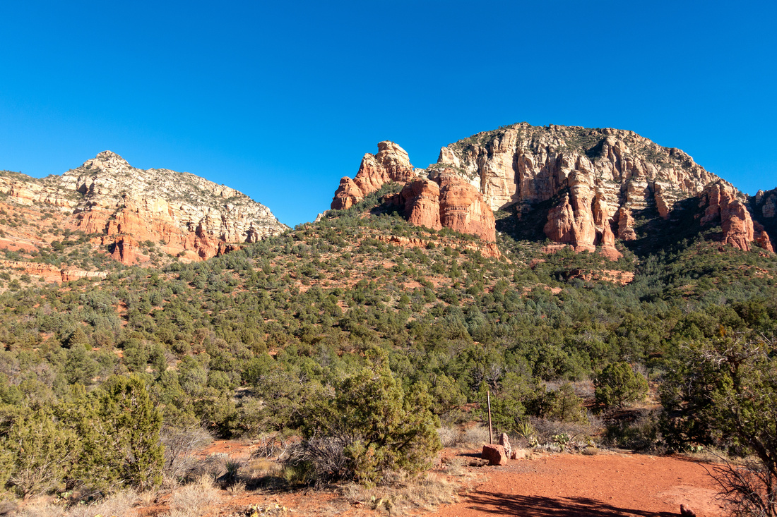 Dry Creek Vista
Classic Sedona Landscape Viewpoint near Dry Creek Parking Dry Creek Vista
Classic Sedona Landscape Viewpoint near Dry Creek Parking |
|||
|
|
|||
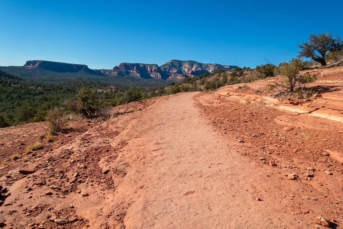
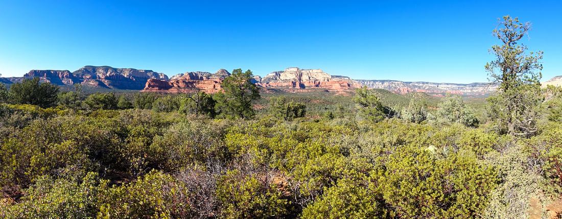 Chuckwagon Panorama
Beyond slickrock Chuckwagon trail gradually descends through low shrubs to Mescal Trail Junction Chuckwagon Panorama
Beyond slickrock Chuckwagon trail gradually descends through low shrubs to Mescal Trail Junction |
|||
 Maroon Mountain
View of Maroon Mountain near Mescal Trail Junction Maroon Mountain
View of Maroon Mountain near Mescal Trail Junction |
|||
 Trail Junction
All trail junctions are well signed Trail Junction
All trail junctions are well signed |
|||
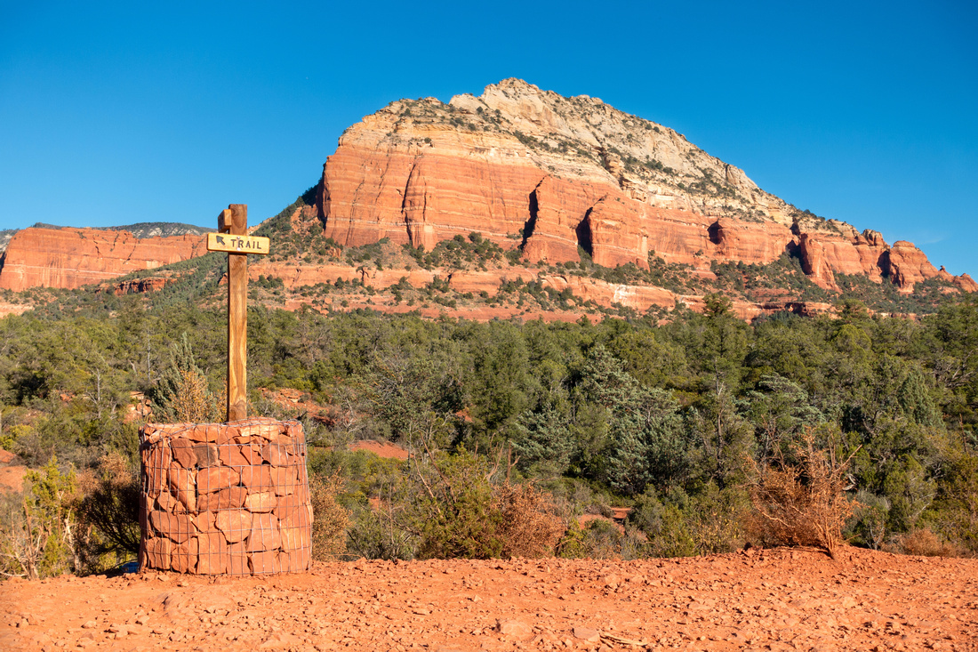
 Devil's Trailhead
Devil's Bridge is ~1.5km from Dry Creek Road 4x4 parking. Devil's Trailhead
Devil's Bridge is ~1.5km from Dry Creek Road 4x4 parking. |
|||
|
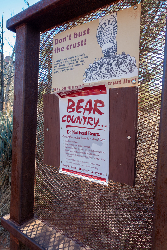
Apparently there are Bears in Sedona |
|||
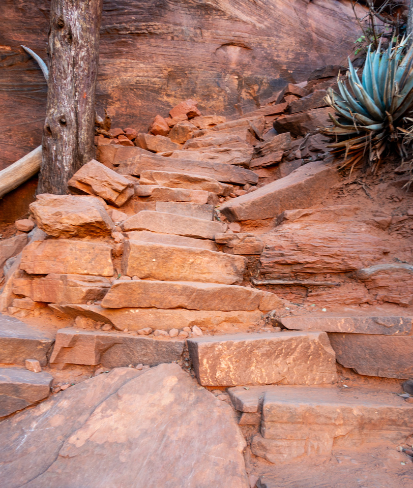
|
Final part before Devil's Bridge Trail ascends steeply up stone staircase. Good balance is required on descent |
|||
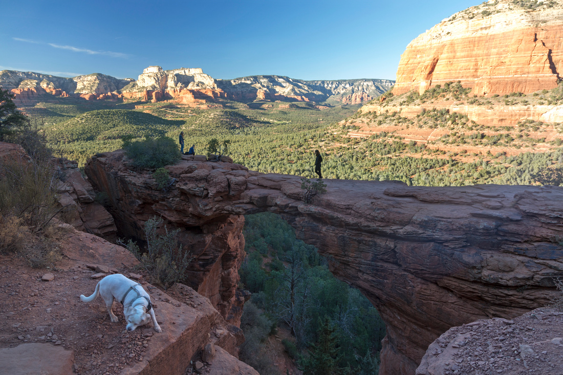
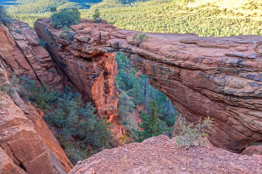
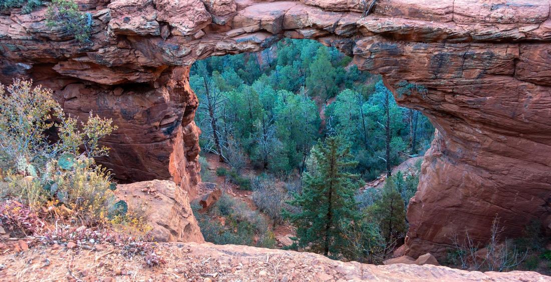 Devil's Bridge
 and End of Trail. This is ultra busy spot with people lining up for selfies on the bridge Devil's Bridge
Devil's Bridge and End of Trail. This is ultra busy spot with people lining up for selfies on the bridge |
|||
 Devil's Bridge
Another shot of Devil's Bridge from different angle quickly snapped during selfie taker change of guards Devil's Bridge
Another shot of Devil's Bridge from different angle quickly snapped during selfie taker change of guards |
|||
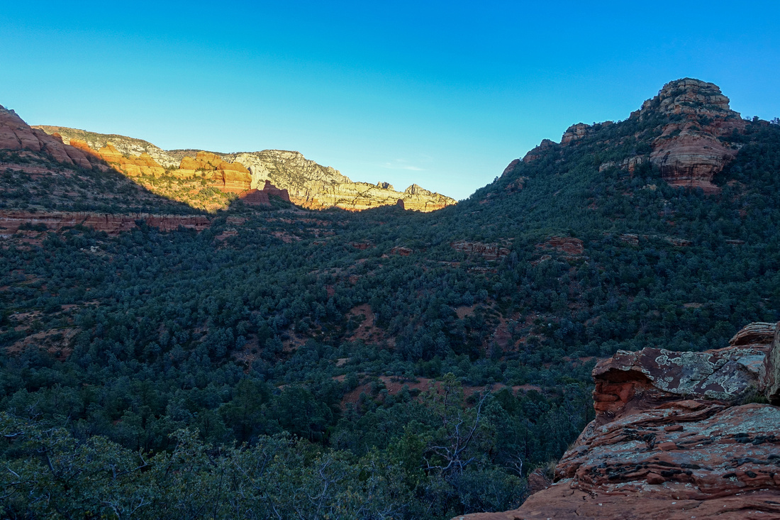 Secret Wilderness
Faint Trail past Devil's Bridge leads in ~10min to much more quiet, open Plateau with nice views of Secret Wilderness Secret Wilderness
Faint Trail past Devil's Bridge leads in ~10min to much more quiet, open Plateau with nice views of Secret Wilderness |
Abstract
| Overall Difficulty | D2/3 | Gentle rolling trail with brief stone staircase scramble near the end | |||
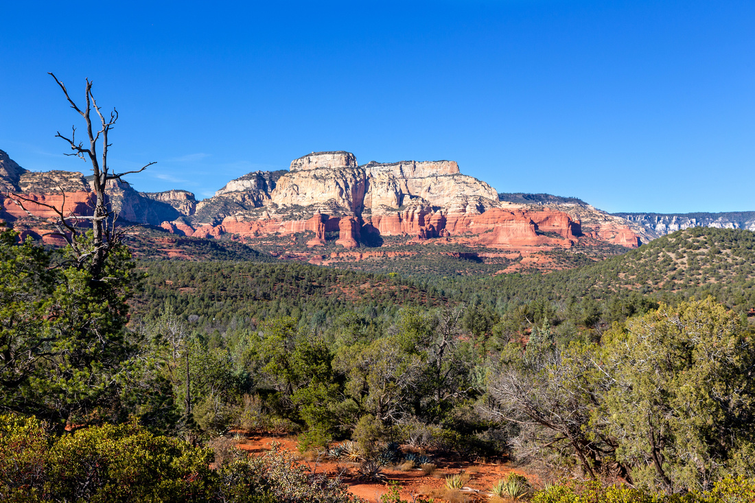
| Scenery | Delicate Rock Arch. Secret Wilderness. Distant views across valley floor to Boynton - Fay canyon area and Maroon Mountain | ||||
| Trail/Marking | Excellent | Well defined trail with marked junction and trail maps | |||
| Suggested Time | 4 hrs | If starting from Dry Creek Parking and approaching via Chuckwagon Trail, less by Dry Creek Road. 1-2hrs only if driving (4x4) to Devil's Trailhead | |||
| Elevation | Start: 1420m Max: 1525m Min: 1375m Total: +220m -120m | Round Trip: 11km (Chuckwagon Trail OnB) | |||
| Gear | Light hikers are sufficient | ||||
| Water | No reliable source. Carry 1L or more, depending on season | ||||
| Dog Friendly | Yes | Busy area - keep control of the pet for courtesy to other hikers | |||
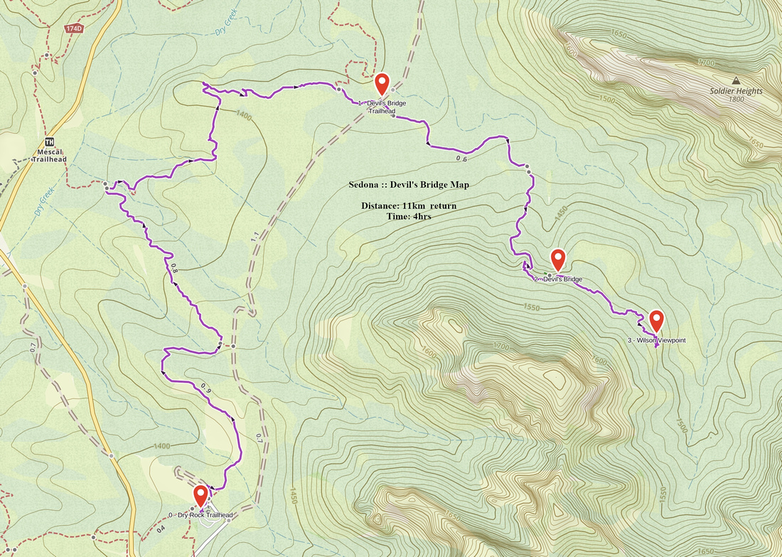 Devil's Bridge GAIA Map
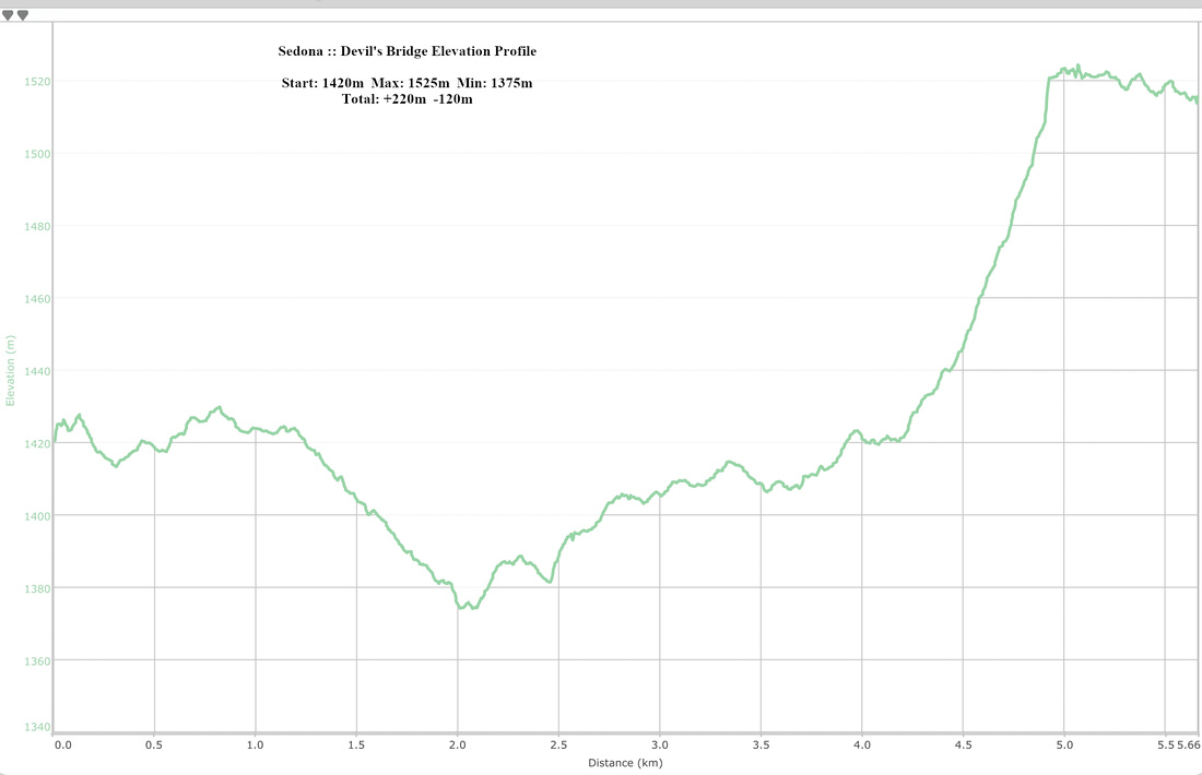 Devil's Bridge Elevation Profile