Google Map |
USA :: Sedona :: Bear Mountain |
GPS Track |
|
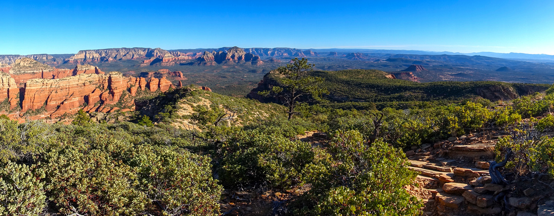
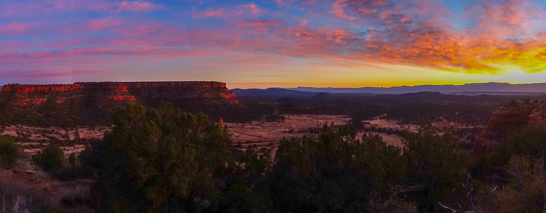
Panoramic View East from upper slopes of Bear Mountain |
|||
| Trip Summary | |||
Dec 8, 2023
Bear Mountain is most technical in official Sedona trail network. Although not long (4km 1-way only) terrain is rough with overall wilderness route feel. There is much clambering over rock outcrops with slickrock traverse and several short scramble steps. Focus is required most of the way and descent will not be much shorter than ascent. There have been rescues even resulting in death of paramedic who was apparently struck by helicopter blades. While this is probably extreme, ascent is best suited for experienced and fit hikers. There is much sun exposure and no water whatsoever, thus summer season trips are not recommended. I had ideal conditions in early December and was able to sustain myself with 1L, but during hot months even 4L might not be enough. Long sleeves - both up and down - are highly recommended as you are bound to brush against something prickly along the way. Rattlesnakes are probably abundant too in summer months.
Trailhead is at east side of Boynton Pass Road, less than a km from Fay Canyon parking. From signed parking area cross the road and find start of Bear Mountain trail by the gate. Obvious peak directly above is NOT the summit, just lower outlier - Bear Mountain is much further and higher behind and can't be seen from this point. Follow trail across couple of shallow drainages, then start ascent. Route can be divided in 3 parts:
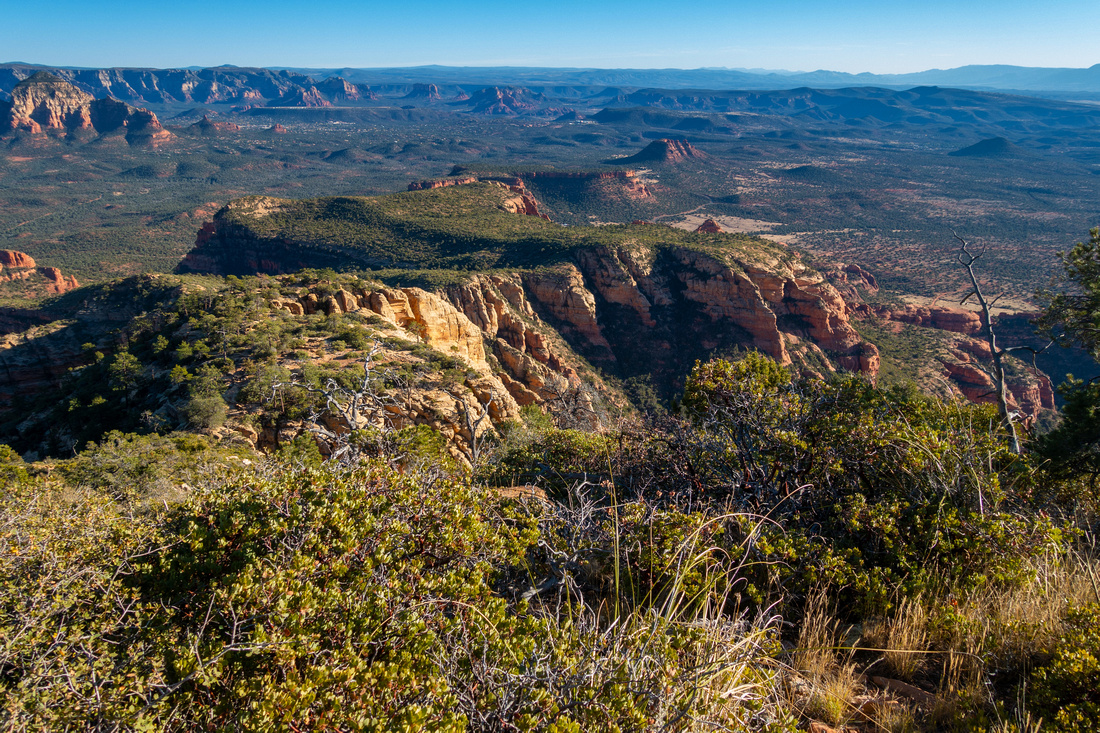
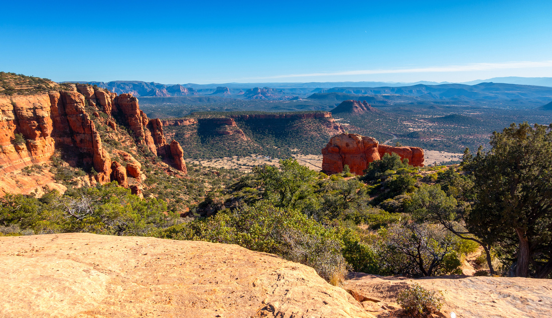
Trail is generally well defined, but drifts higher up; watch for white paint blazes on slickrock (apparently they don't do Rock Cairns in Sedona for some reason). Take a break after topping up at Mid-Plateau shoulder; it is only 1.7km from the start but it will take close to an hour from the Parking. This would also be good spot to turn back as summit is still quite far away, and roughest terrain is yet to come. Traversing the plateau is quite scenic though with 360 panoramic views. Aerial views of Red Rock Cliffs above Fay Canyon is particularly beautiful. Above the saddle scramble up Slickrock and low rock steps to final part contouring on south side to "Trail End" sign (see Gallery). This is Bear Summit and turnaround point; summit 'cairn' (without register on my visit) is nearby. North outlier, incorrectly named "Bear Mountain" on various maps is lower. Several faint trails continue in this direction but soon disintegrate in maze of low undergrowth - don't go there. Return is the same way and will not be much -if any- faster, but offer spectacular late afternoon views of Verde Valley to the south. |
|
Gallery |
|||
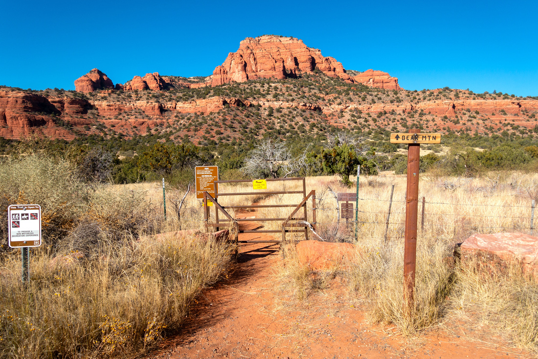 Trailhead Gate Trailhead Gate Trailhead Gate at west side of Boynton Pass Road. Red Peak upper center is just lower outlier; Bear Mountain is much further and higher behind
 |
|||
|
|
|||
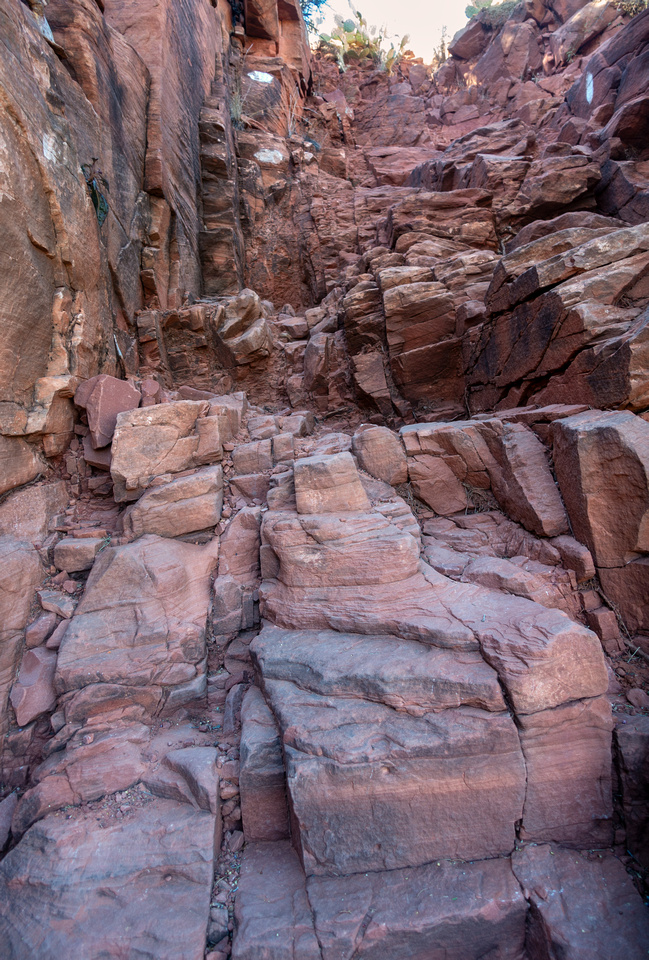
|
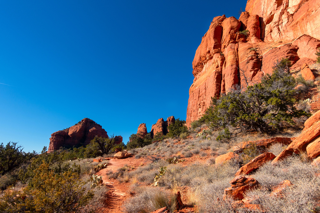
Initial Chimney Scramble with excellent Rock Steps |
|||
 Lower Bench
Pleasant Hiking on lower bench doesn't last long. Trail skirts Rock Cliff to the right followed by steep and rough switchbacks to mid-plateau Lower Bench
Pleasant Hiking on lower bench doesn't last long. Trail skirts Rock Cliff to the right followed by steep and rough switchbacks to mid-plateau |
|||
|
|
|||
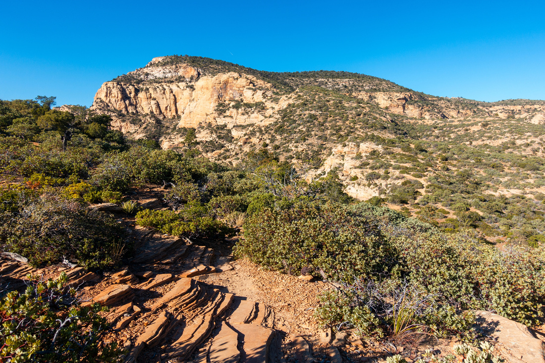
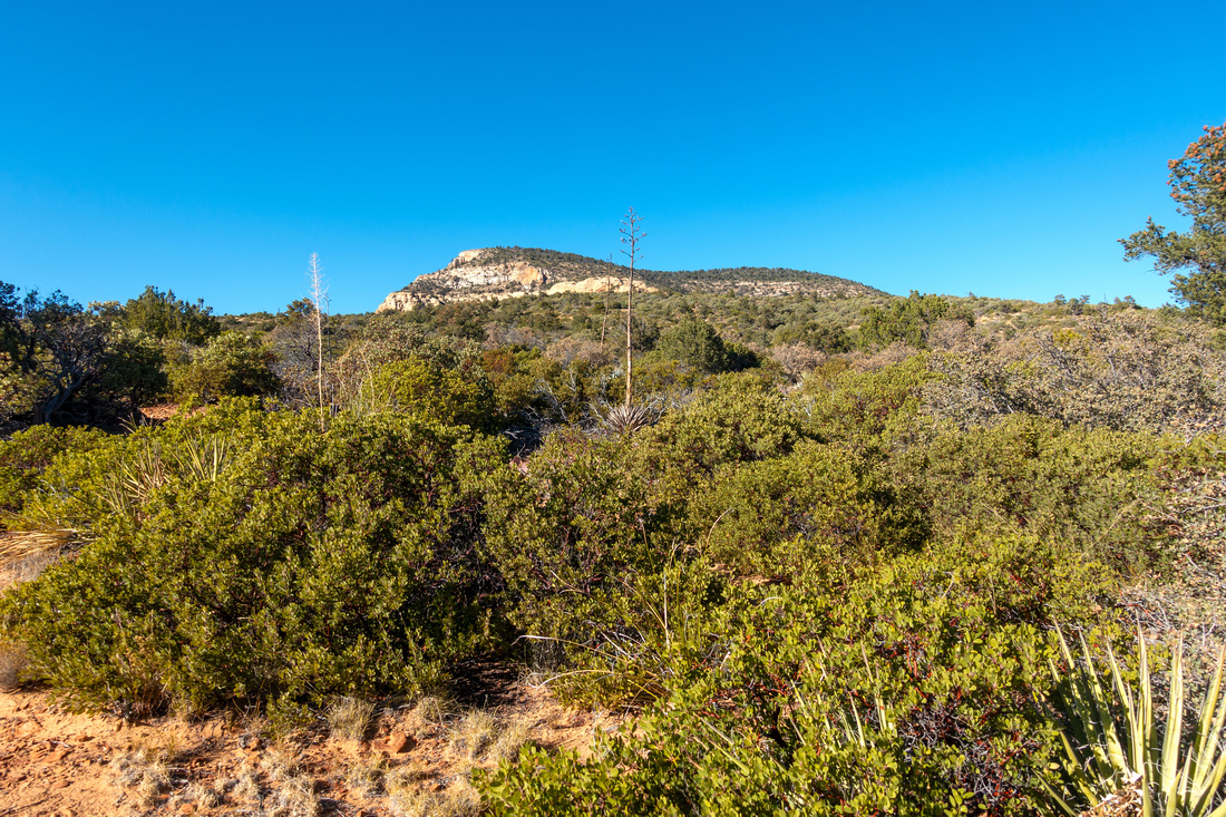 Mid Plateau
Traversing Mid Plateau through low shrubs. Bear Mountain upper center is further than it looks Mid Plateau
Traversing Mid Plateau through low shrubs. Bear Mountain upper center is further than it looks |
|||
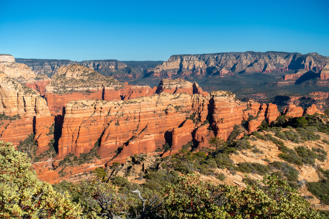 Fay Cliffs
View of Red Rock Cliffs above upper Fay Canyon Fay Cliffs
View of Red Rock Cliffs above upper Fay Canyon |
|||
 Bear Mountain
Descending to saddle below final ascent slope. Terrain gets increasingly rough and it will take ~40min from this point Bear Mountain
Descending to saddle below final ascent slope. Terrain gets increasingly rough and it will take ~40min from this point |
|||
 Crux Step
2.5m high cleft that is probably crux - low class 3. There are no good holds but rock is very grippy Crux Step
2.5m high cleft that is probably crux - low class 3. There are no good holds but rock is very grippy |
|||
 Upper Slopes
View back near Bear Mountain Summit. Length of mid Plateau traverse in mid-ground Upper Slopes
View back near Bear Mountain Summit. Length of mid Plateau traverse in mid-ground |
|||
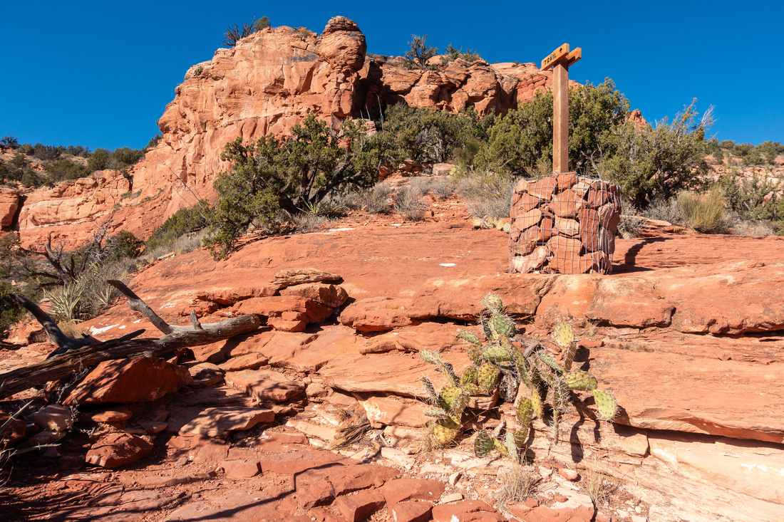
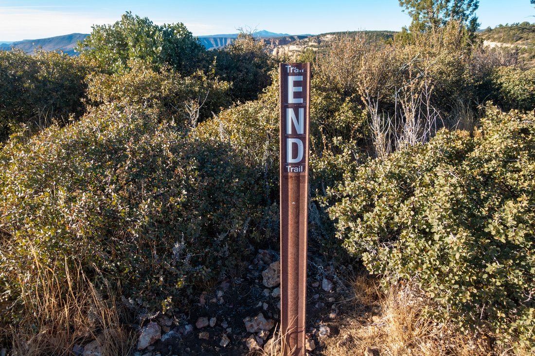 Trail End
Anticlimactic Sign at Bear Mountain summit. Faint trails continue further to the right but soon disintegrate in low bush Trail End
Anticlimactic Sign at Bear Mountain summit. Faint trails continue further to the right but soon disintegrate in low bush |
|||
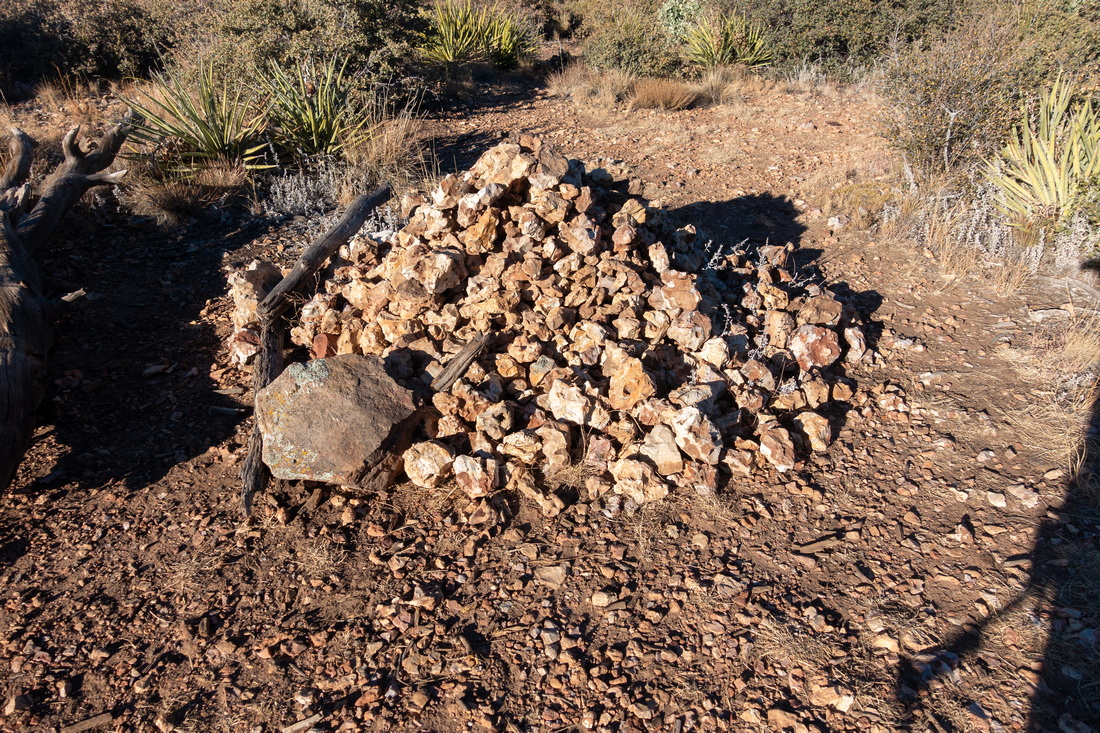 Summit Cairn
Large pile of rocks - supposedly summit cairn - near Trail End Sign Summit Cairn
Large pile of rocks - supposedly summit cairn - near Trail End Sign |
|||
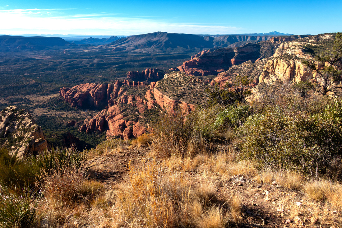 Summit West Panorama
Westerly views from Bear Mountain Summit West Panorama
Westerly views from Bear Mountain |
|||
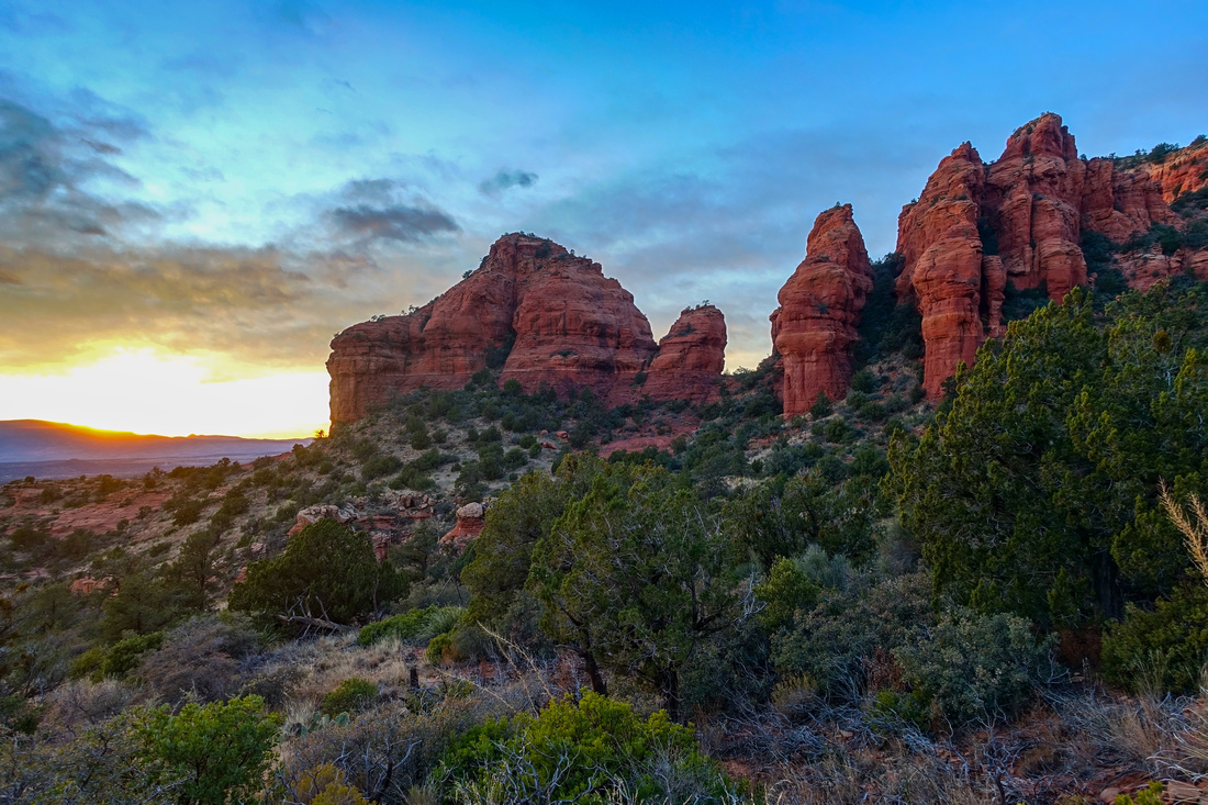 Sunset Colours
View of Sun just dropping behind Mingus range during descent Sunset Colours
View of Sun just dropping behind Mingus range during descent |
|||
 Sunset Panorama
Lovely Sunset Colours over Boynton Pass; Doe Mountain across Sunset Panorama
Lovely Sunset Colours over Boynton Pass; Doe Mountain across |
Abstract
| Overall Difficulty | D4 | Rough terrain with steep sections and several class 2/3 rock scramble steps | |||
| Scenery | Unobstructed views of Sedona Red Rock and Verde Valley. Aerial view of Fay Canyon Red Cliffs. Quintessential Northern Arizona | ||||
| Trail/Marking | Good | Trail well defined in lower half, more faint higher up. Watch for white paint blazes on slickrock | |||
| Suggested Time | 5 hrs | Return time to "Trail End" sign. Add an hour for Bushwhack to north summit | |||
| Elevation | Start: 1400m Max: 1980m Total: ~700m | Round Trip: 8km | |||
| Gear | Full hiking boots preferred for ankle support. Long pants and sleeves. Hiking poles essential | ||||
| Water | No water source. Carry min 1L in winter, 3-4L in hot summer months | ||||
| Dog Friendly | Yes | Be on alert for rattlesnakes in summer months | |||
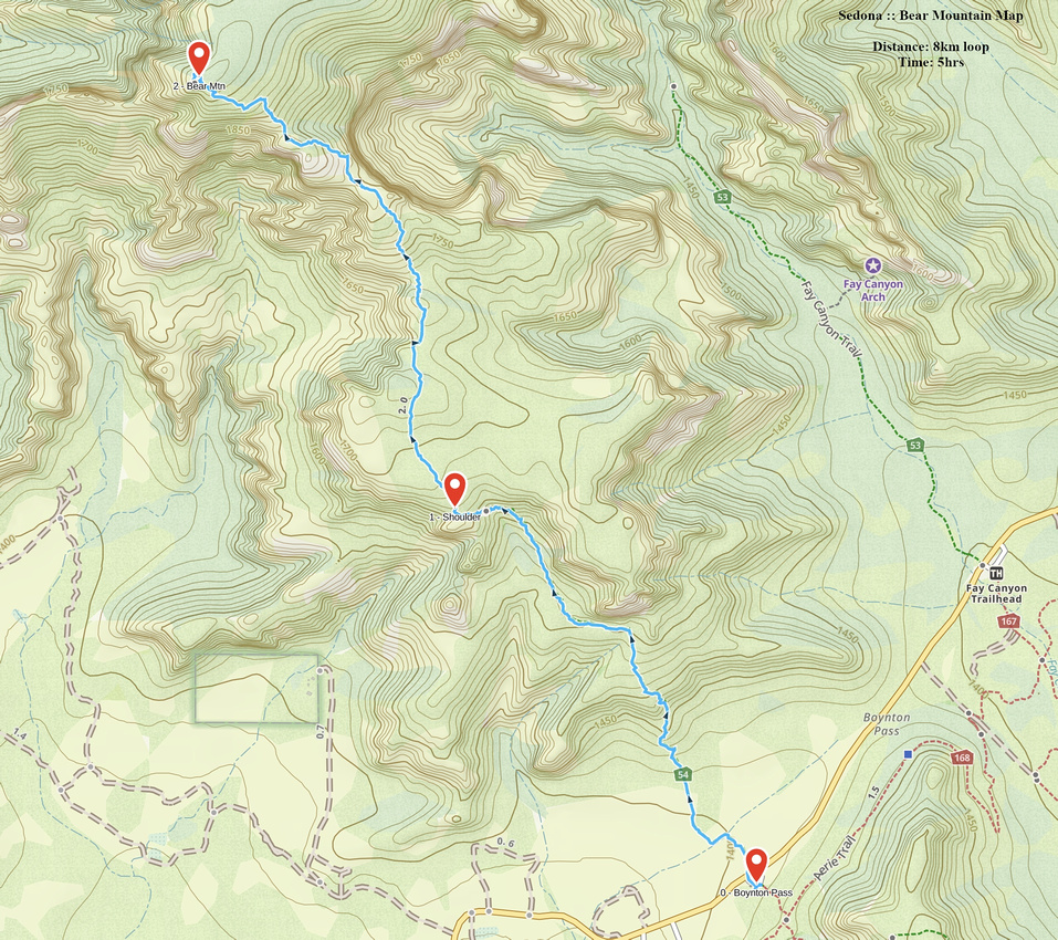 Bear Mountain GAIA Map
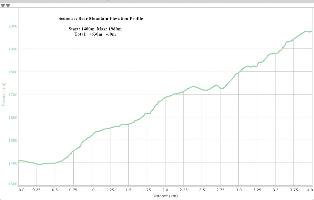 Bear Mountain Elevation Profile