USA :: San Diego :: Torrey Pines |
|
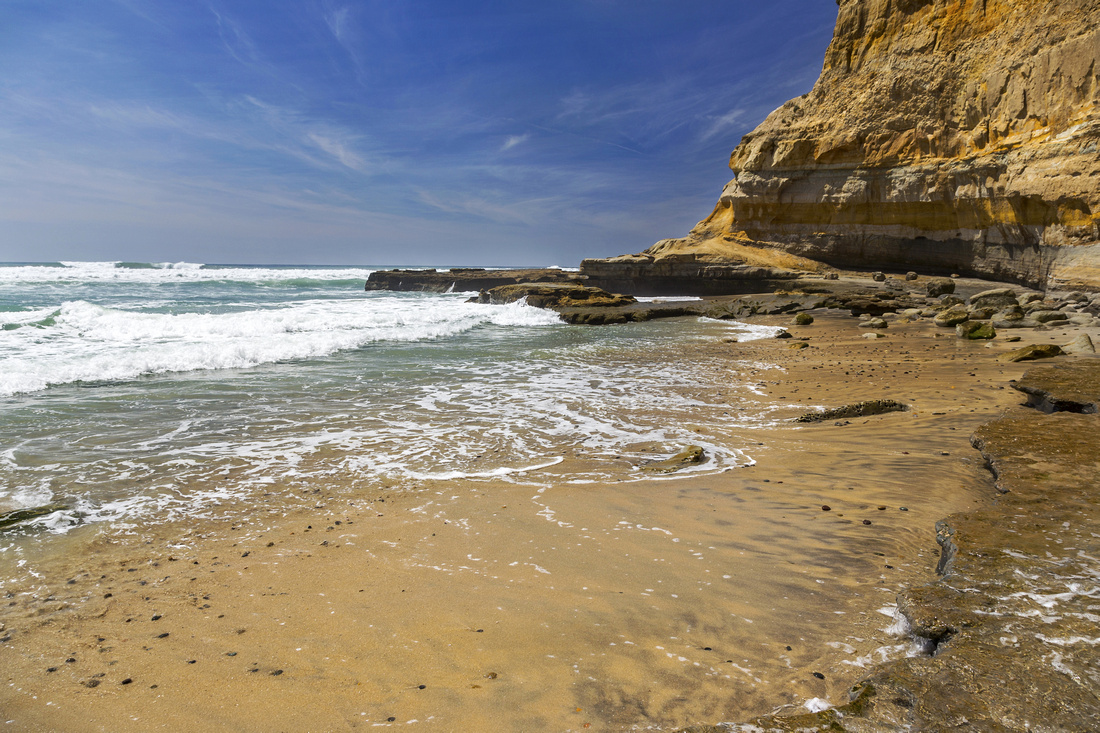
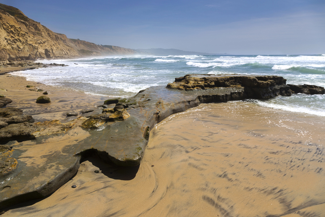
Flat Rock, unique Rock Formation carved by tidal waves in eroded Sandstone cliffs |
|||
| Trip Summary | |||
|
Torrey Pines state beach is for me the best ocean waterfront hike, anytime, anywhere. Stretch of occasionally rugged Pacific Coastline between La Jolla Shores and Del Mar is incredibly scenic. It can not even remotely be appreciated properly in single or even several visits. There is special spirit of mother nature at works here I was lucky to be able to gradually build during years I lived in San Diego when this was regular Sunday afternoon hike. There are many different options, from long 20km end-to-end stretch to shorter official trails at Torrey Pines state preserve park at north side.
I would often start and end at San Diego Gliderport below USCD. There is plenty of parking - but still tends to fill up on weekends. From Gliderport there are 2 paths down to the beach. South end is maintained and more commonly used. North end is steep and rough; it is very easy to slip or lose balance - I don't recommend it for descending. (In)famous 'Clothing Optional' Blacks Beach is below and one can chose direction - south towards La Jolla Shores, or north towards Del Mar. North end is the most scenic part with amazing rock formation called "Flat Rock" - see lead photo on this page. Washed out by tidal waves it is incredibly beautiful, and -if you are lucky to have it to yourself- place to sit in peace and reflect. Del Mar end is further 20-25 min north, and this stretch tends to be the busiest as it is entrance to State Preserve with parking lot. For return I'd either loop back to Flat Rock via "Beach Trail" starting up the road by Visitor Center - or simply speed hike on North Torrey Pines road back to Glideport.
South end to La Jolla Shores is shorter and might not always be passable during high tide just before Scripps Pier. Good turning point is "Mushroom Beach House" with concrete elevator shaft descending from luxury mansion on bluffs above. Alternate return I sometimes took would climb up access road to La Jolla Farms, then along North Torrey Pines road back to Gliderport. Options are endless and it would be difficult to describe them all. If you are lucky to be here devise your own path and enjoy; beach hikes don't get any better than this. |
|
Gallery |
|||
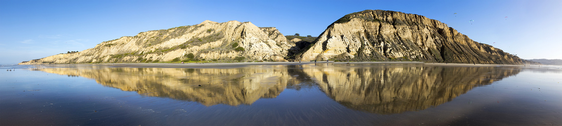
 Gliderport Panorama Gliderport Panorama Aerial View of Torrey Pines State beach from San Diego Gliderport. Rough path, one of several alternate access points, descends sandstone cliffs on the right side
 |
|||
 Sandstone Reflections
Sandstone Cliffs reflections in Surf. Ridge slanting right at mouth of canyon in center is rough descent path from Gliderport Sandstone Reflections
Sandstone Cliffs reflections in Surf. Ridge slanting right at mouth of canyon in center is rough descent path from Gliderport |
|||
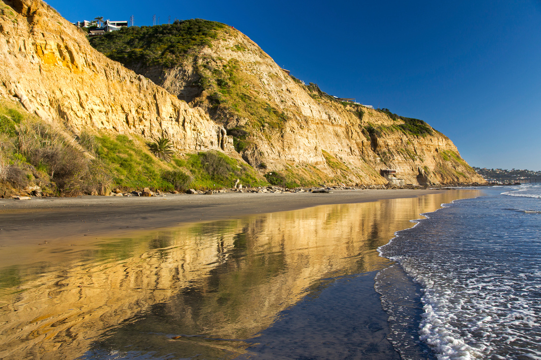
 Hiking the Surf
Luxury mansion at top of eroded sandstone cliffs, walking south towards La Jolla Shores Hiking the Surf
Luxury mansion at top of eroded sandstone cliffs, walking south towards La Jolla Shores |
|||
 La Jolla Farms Access
Alternate Access to Torrey Pines beach south of Gliderport via La Jolla Farms road (center left). Mushroom beach house further right with distant La Jolla Shore extreme right La Jolla Farms Access
Alternate Access to Torrey Pines beach south of Gliderport via La Jolla Farms road (center left). Mushroom beach house further right with distant La Jolla Shore extreme right |
|||
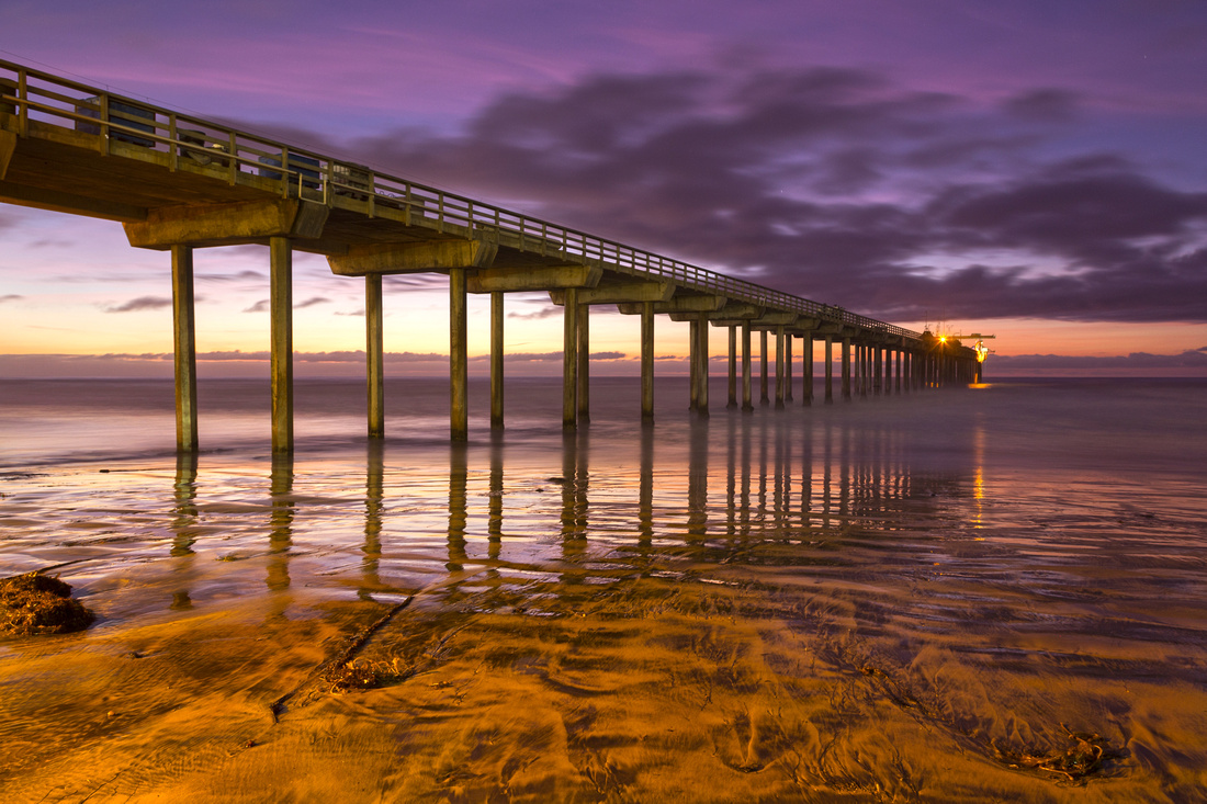 Scripps Sunset
Ellen Browning Scripps Memorial Pier at South end of Torrey Pines beach during sunset, one of well known photographer hotspots Scripps Sunset
Ellen Browning Scripps Memorial Pier at South end of Torrey Pines beach during sunset, one of well known photographer hotspots |
|||
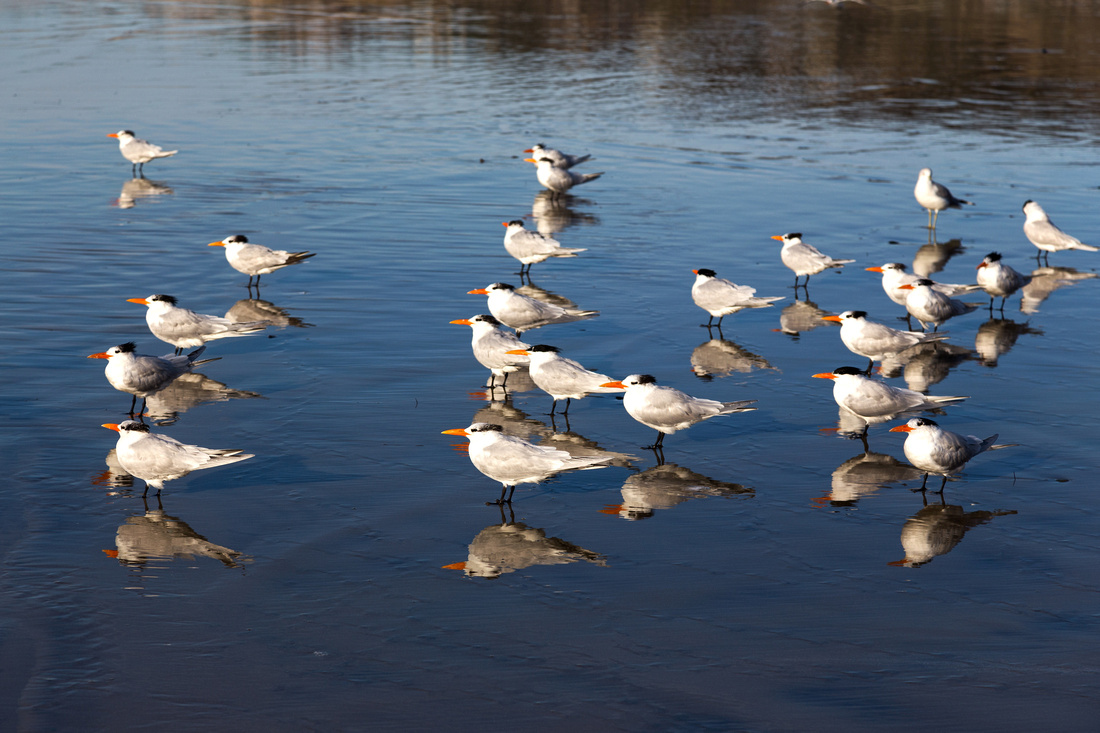 Dinner Time
Seabirds 'fishing' for supper in shallow pools at tideline Dinner Time
Seabirds 'fishing' for supper in shallow pools at tideline |
|||
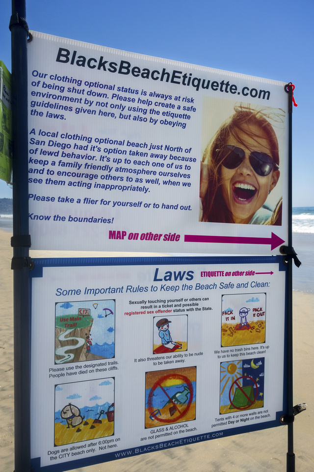 Clothing Optional
Blacks Beach Nude (or 'Clothing Optional') Beach Sign Clothing Optional
Blacks Beach Nude (or 'Clothing Optional') Beach Sign |
|||
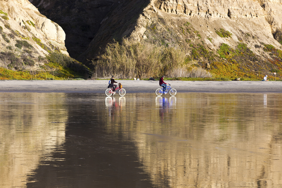 Surf Cycling
Walking, Jogging - even Cycling - are popular at Blacks Beach Surf Cycling
Walking, Jogging - even Cycling - are popular at Blacks Beach |
|||
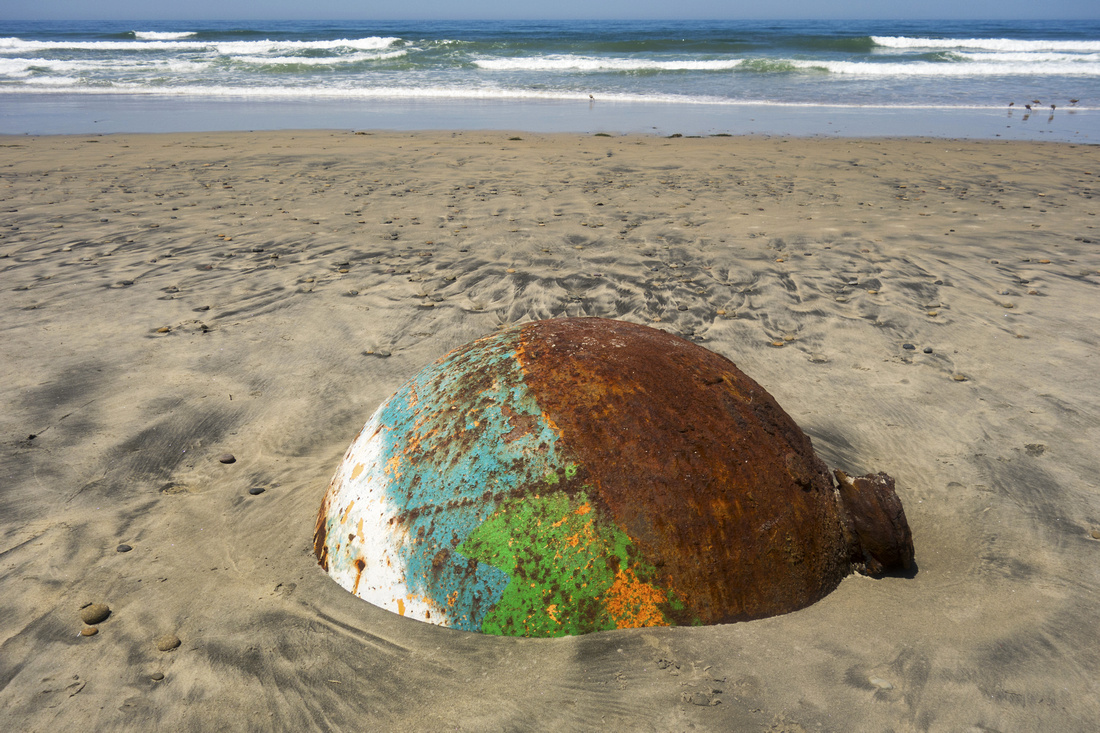 Old Buoy
Rusted Buoy washed out by the Tide Old Buoy
Rusted Buoy washed out by the Tide |
|||
 Dramatic Sky
 and Shallow Tide Pools past Blacks Beach going towards Flat Rock Dramatic Sky
Dramatic Sky and Shallow Tide Pools past Blacks Beach going towards Flat Rock |
|||
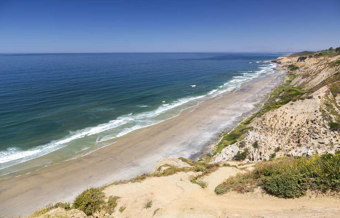
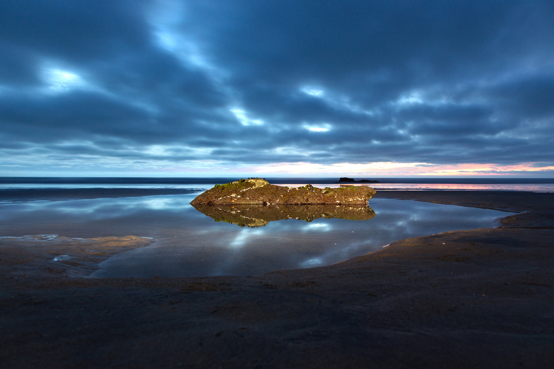
 Pacific Coastline
Looking back length of Torrey Pines beach from Flat Rock during high tide Pacific Coastline
Looking back length of Torrey Pines beach from Flat Rock during high tide |
|||
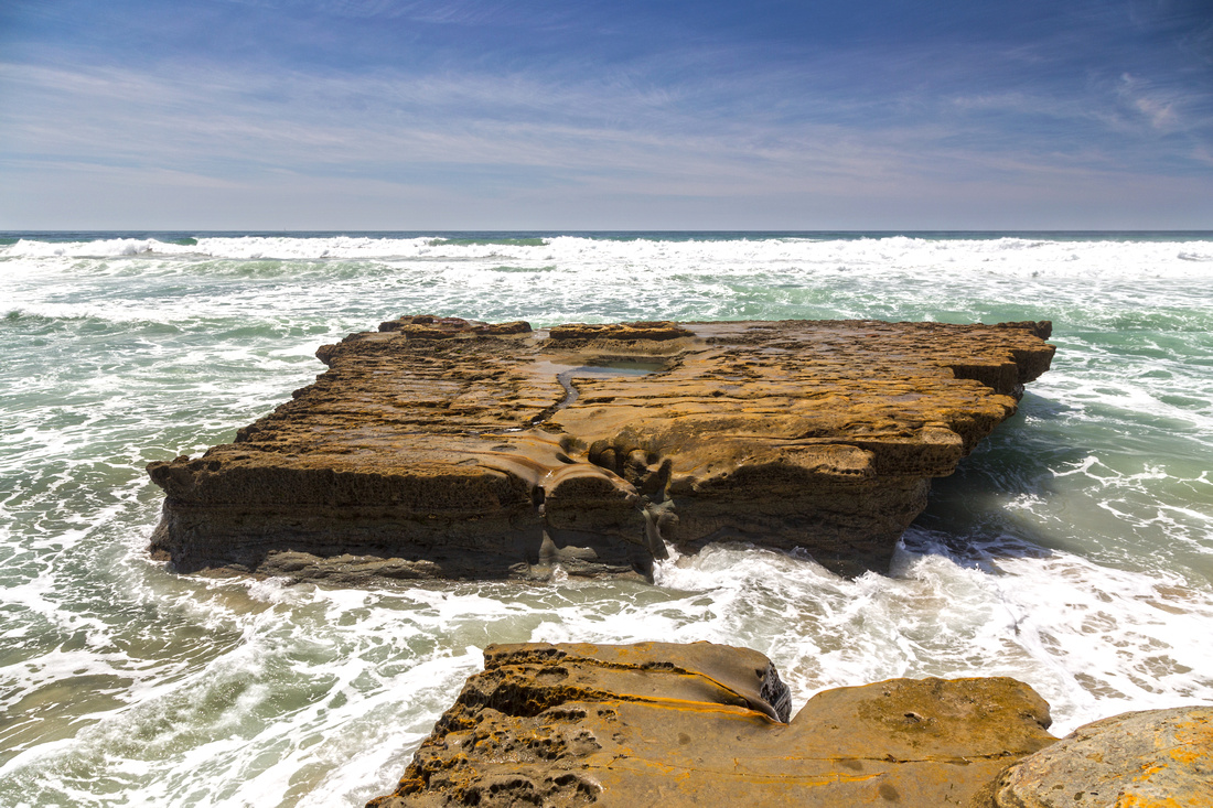 Flat Rock
Classic View of Flat Rock from narrow shelf that can be quite a traffic jam. During low tide it is possible to get across Flat Rock
Classic View of Flat Rock from narrow shelf that can be quite a traffic jam. During low tide it is possible to get across |
|||
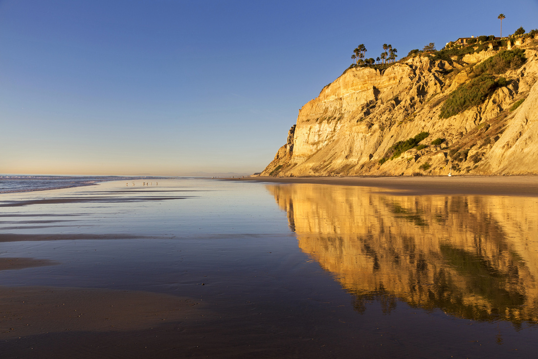
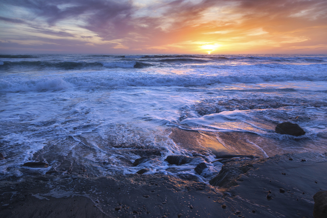 Beach Sunset
Crushing Waves and Dramatic Sunset Colors between Flat Rock and Del Mar beach Beach Sunset
Crushing Waves and Dramatic Sunset Colors between Flat Rock and Del Mar beach |
|||
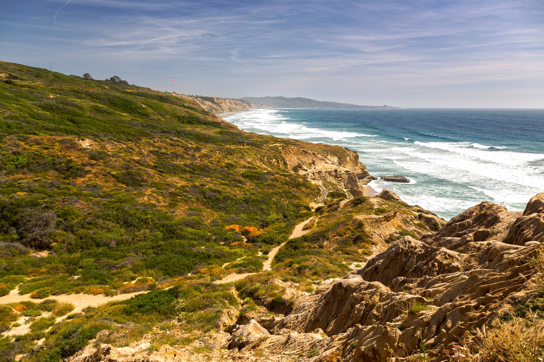 Beach Trail
"Beach Trail", starting at Torrey Pines State preserve visitor center and descending to Flat Rock (center right) Beach Trail
"Beach Trail", starting at Torrey Pines State preserve visitor center and descending to Flat Rock (center right) |
|||
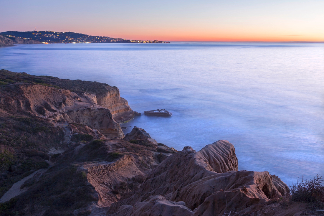 Silent Sea
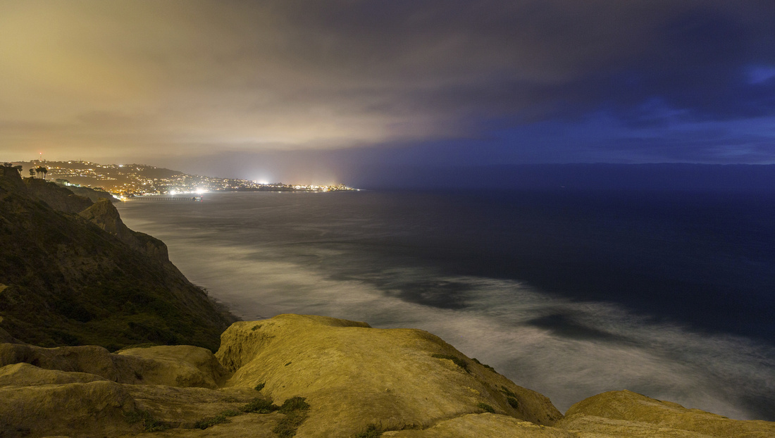
Long exposure shot after sunset from "Beach Trail"; Flat Rock just left of center, distant La Jolla in the background Silent Sea
Long exposure shot after sunset from "Beach Trail"; Flat Rock just left of center, distant La Jolla in the background |
|||
 Marine Layer
 advancing from Gliderport where most of my Torrey Pines hikes stared and ended Marine Layer
Marine Layer advancing from Gliderport where most of my Torrey Pines hikes stared and ended |
|||
Abstract
| Overall Difficulty | D2 | Sand / surf walk most of the way, with rugged access from Gliderport and narrow sandstone passage above Flat Rock | |||
| Scenery | Pacific Coastline, eroded Sandstone Bluffs, tidal pools and Flat Rock | ||||
| Trail/Marking | Good | Trails from Gliderport to the Beach are well defined. State Preserve Trails have marked trailheads and junctions | |||
| Suggested Time | 2-6 | Many different options with shortest Black Beach loop below Gliderport and longest full day end-to-end exploration | |||
| Elevation | Start: 100m Min: ~0m Total: ~100m (Gliderport to Del Mar OnB) | Round Trip: 10-20km (depending on option) | |||
| Gear | Beach sandals or light sneakers | ||||
| Water | No water source, carry 0.5-1L, depending on season | ||||
| Dog Friendly | No | Torrey Pines preserve prohibits dogs anywhere in preserve on on the beach | |||